Yvonne
I lava it!!!
- Joined
- Jan 19, 2012
- Messages
- 4,179
Testing the limits: A long day of hiking in Hawai’i Volcanoes NP
I love being on the move. For that reason, hiking is the most natural thing for me and I can keep going forever. My job as a lava tour guide luckily involves a lot of hiking and I often end up an average of 6-13 miles several times a week. Once in a while, we do have a pretty slow week. This usually happens when lava is not easily accessible or when other factors determine a less active week. When this happens, I still get out and explore, just to stay in shape. It also offers a lot of opportunities to explore parts of Hawai’i Island and Volcanoes NP that do not necessarily involve lava.
Today I had a day off again and I decided I wanted to do some hikes in Hawai’i Volcanoes NP. Many of the day hikes are pretty short and barely longer than 5 or 6 miles. While sitting over my national geographic map of the park to determine where I wanted to go today I found a nice but pretty long hike that combined several of the shorter hikes into an amazing day on the trail.
I wasn’t sure how many miles I would end up with, but I guessed it would be somewhere between 15 -20 miles.
I started pretty late due to some work-related issues. We had a big group tomorrow and couldn’t get all the guides we needed. Anyway, at one point my boss resolved the issue and I drove the 22 miles up the mountain to the park.
It was a pleasant day, sunny, but pretty hazy with a lot of volcanic VOG due to the shift of wind direction. I parked at the Jaggar Museum on the Crater Rim and got my stuff ready. I decided that I only wanted to bring my little Sony A6000 camera today. This little camera is a real gem and the pictures it creates are pretty decent.
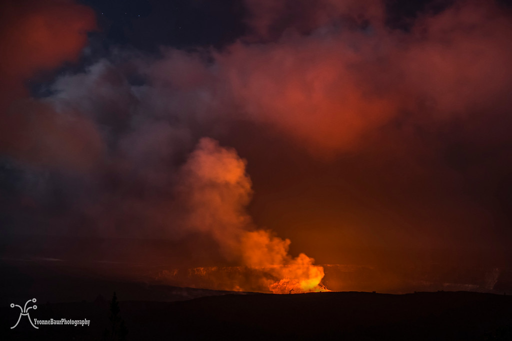
It was about 12:30 pm when I started my hike. Right next to the parking lot a paved trail started next to the HVO (Hawaiian Volcanic Observatory) and I followed it along the Crater Rim. Several spots allowed pretty nice views into Halema’uma’u Crater, a crater within Kilauea Crater. It was also the home of the world’s largest lava lake and its average size right now was about the size of the New Orleans Superdome. During the day you can barely see anything, but after dark, the lava lake will start to glow. And if the lake level is high enough you can see the lava spatter tossed in the air about 7 stories high.
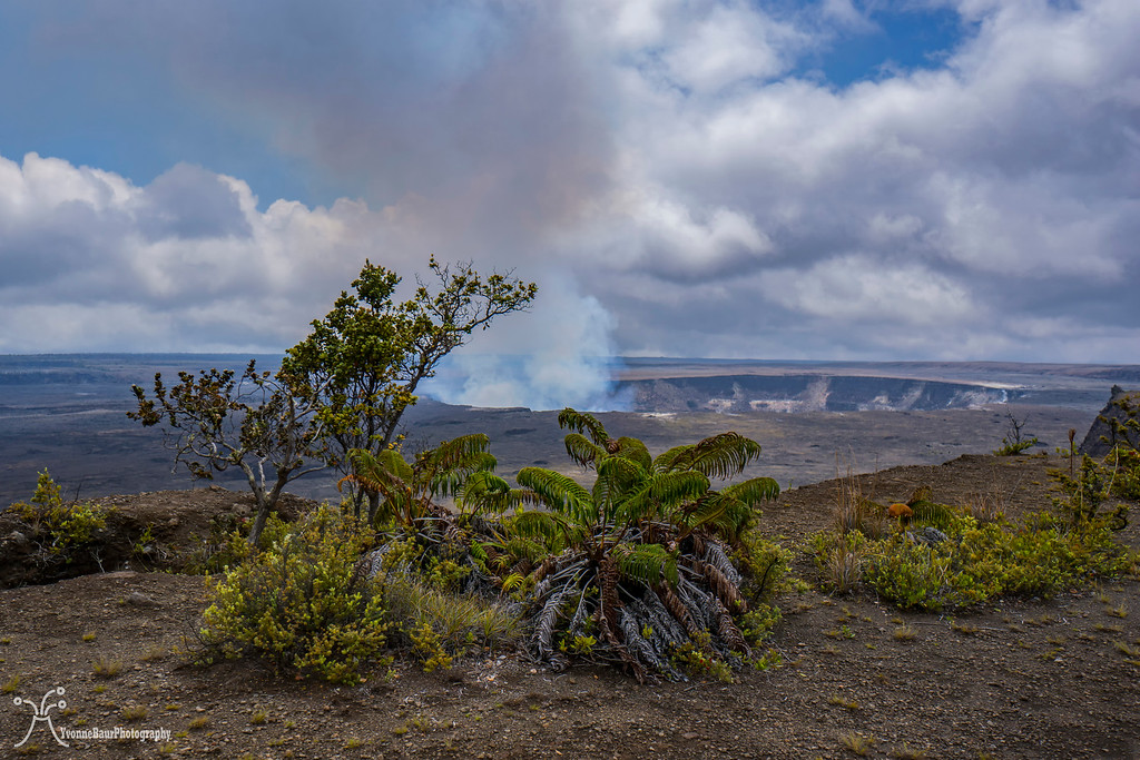
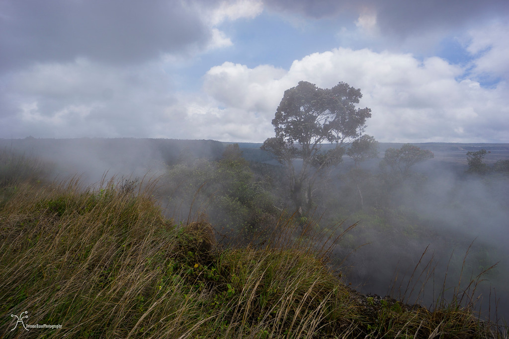
I followed the Rim Trail and enjoyed the views of the impressive Kilauea Caldera. After a while, I passed the area of Steam Vents, where several fumaroles released magmatic water vapor. It all then condensed into clouds and mist. It was always a pretty cool sight, especially when some of the trees were covered in the steam and the entire scene created an eerie landscape.
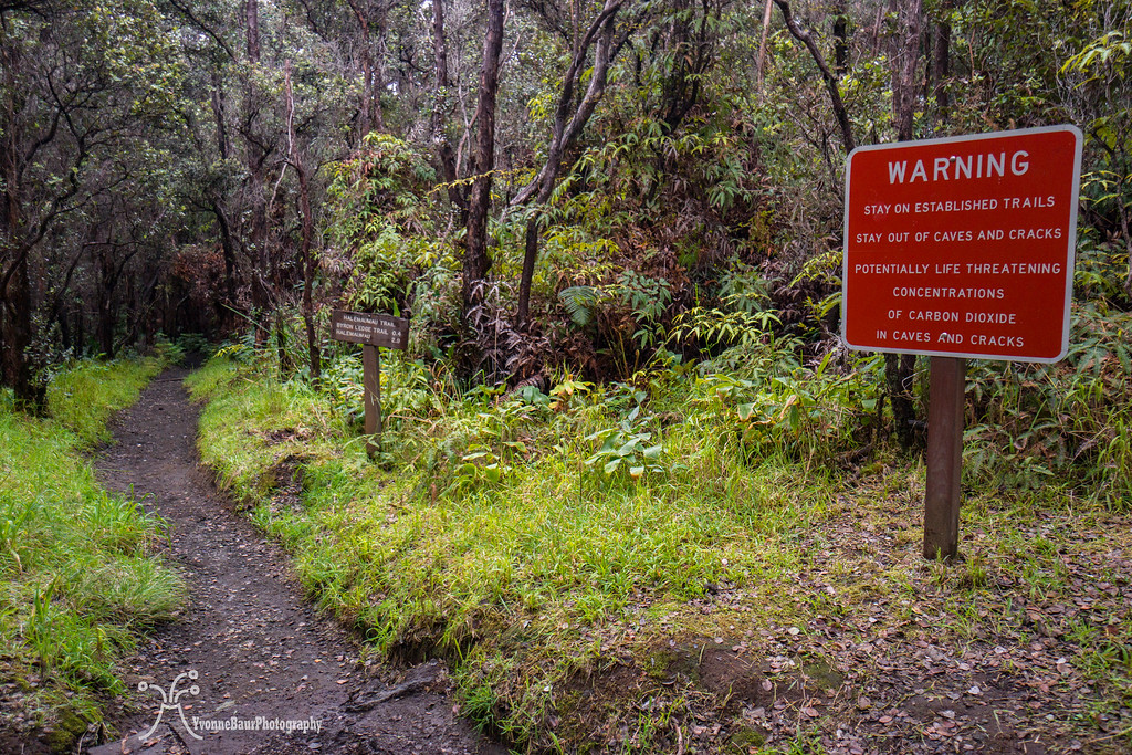
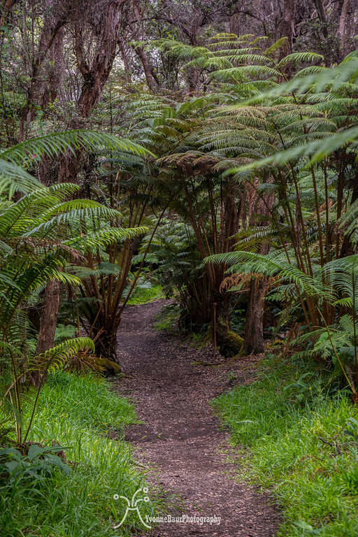
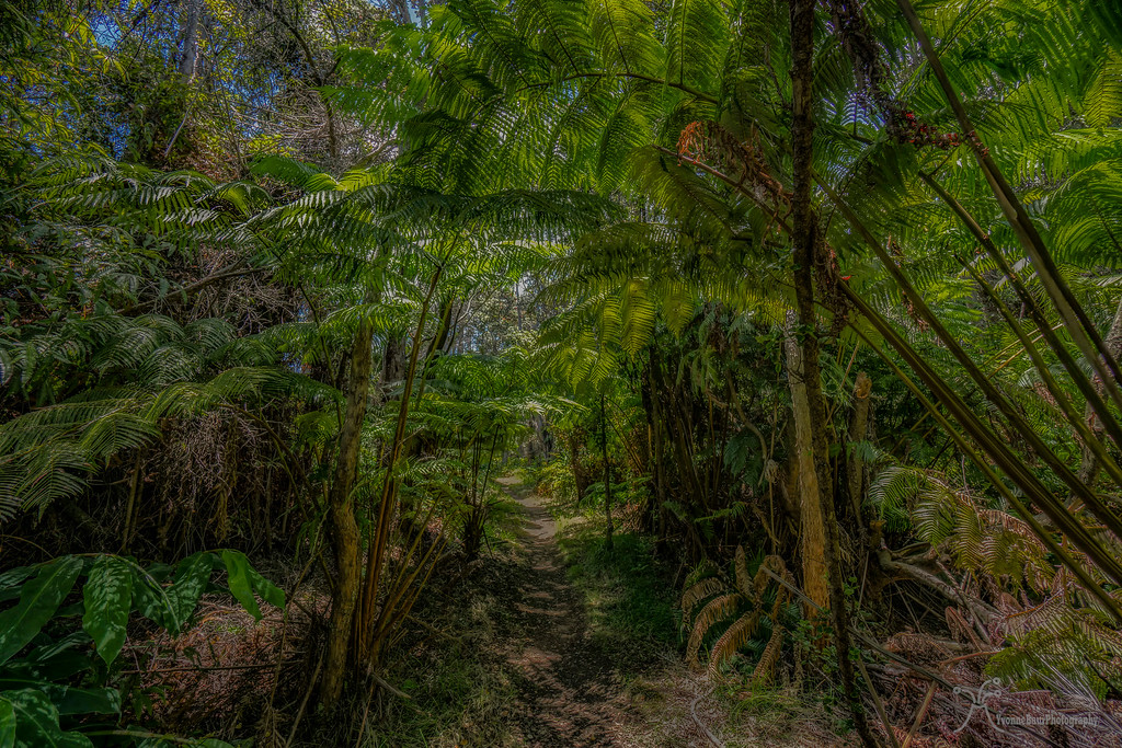
Shortly after the steam vents, I turned onto the Iliahi Trail, a short trail that went through some of the finest rainforests here on the Crater Rim, before dropping down the bottom of Kilauea Caldera. Iliahi is the Hawaiian name for Sandalwood and obviously, a lot of the tropical trees grew here along the trail. The vegetation was getting thicker, with many Ohia and Koa trees as well as a lot of tree ferns.
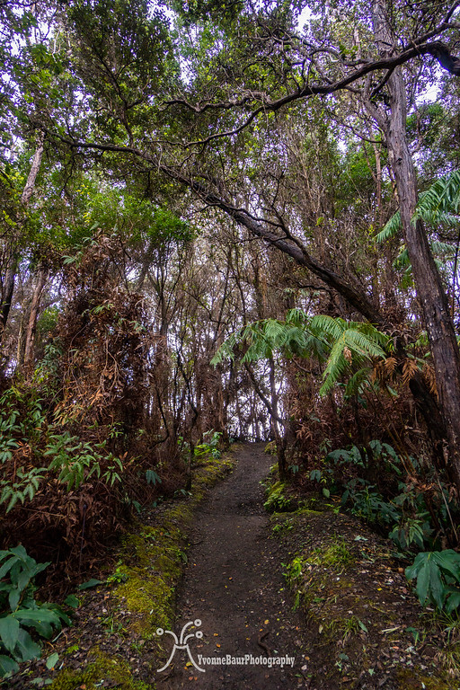
I followed the trail for about half a mile and then turned onto the Halemaumau trail which would drop to the bottom of the crater pretty soon. But before that, the trail went through a beautiful part of the wet rainforest. I really felt like I was placed into a scene of Jurassic Park.
Hapu'u Tree Fern along the trail
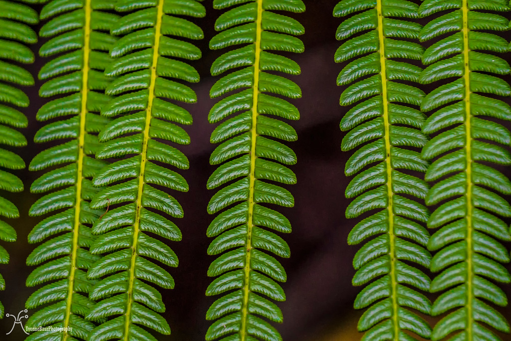
Back in these days when dinosaurs roamed the Earth it must have looked like that with all the impressive tree ferns of the Mesozoic area. And nowadays it still looked pretty prehistoric in some spots.
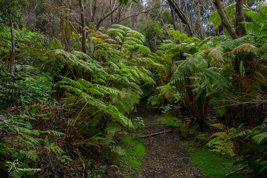
I really liked that part of the rainforest a lot. There was so much to see and to explore. I stopped a few times for pictures before I continued.
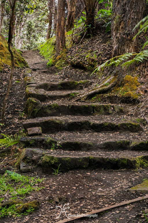
Moss covered boulders, some stairs, all in here in that lush and green forest.
The trail descended to the crater bottom and all of the sudden it was a whole different world.
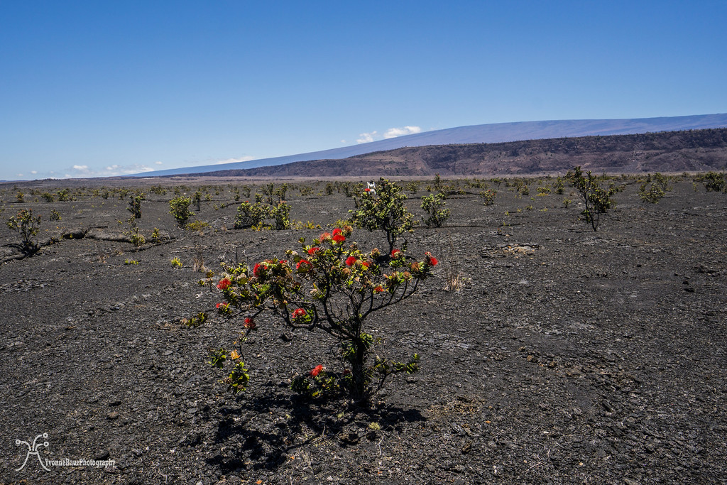
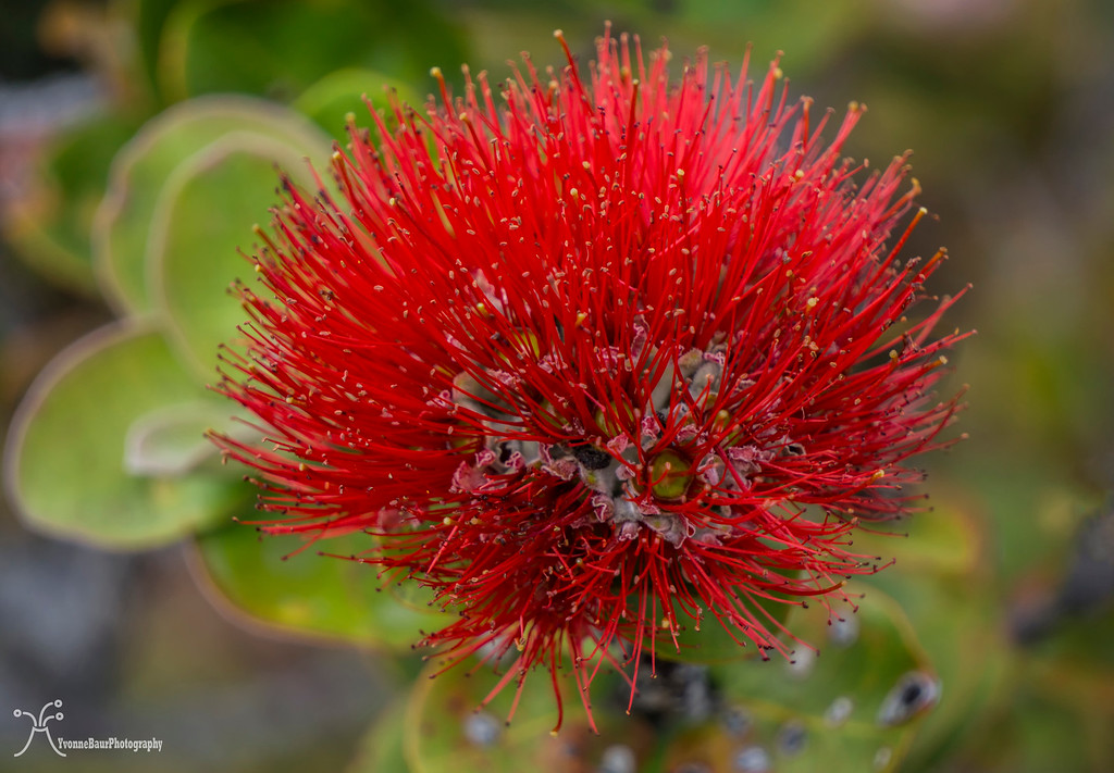
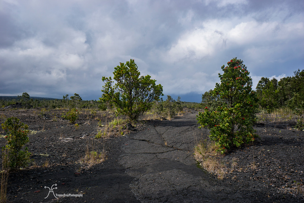
I stepped out of the forest and on to the lava covered floor of Kilauea Volcano. In the distance, I could see the steam plume of Halema’uma’u Crater in one direction, as well as the massive flank of Mauna Loa volcano. Several small Ohia trees grew on the bottom and their distinct bright red Lehua flowers were hard to miss.
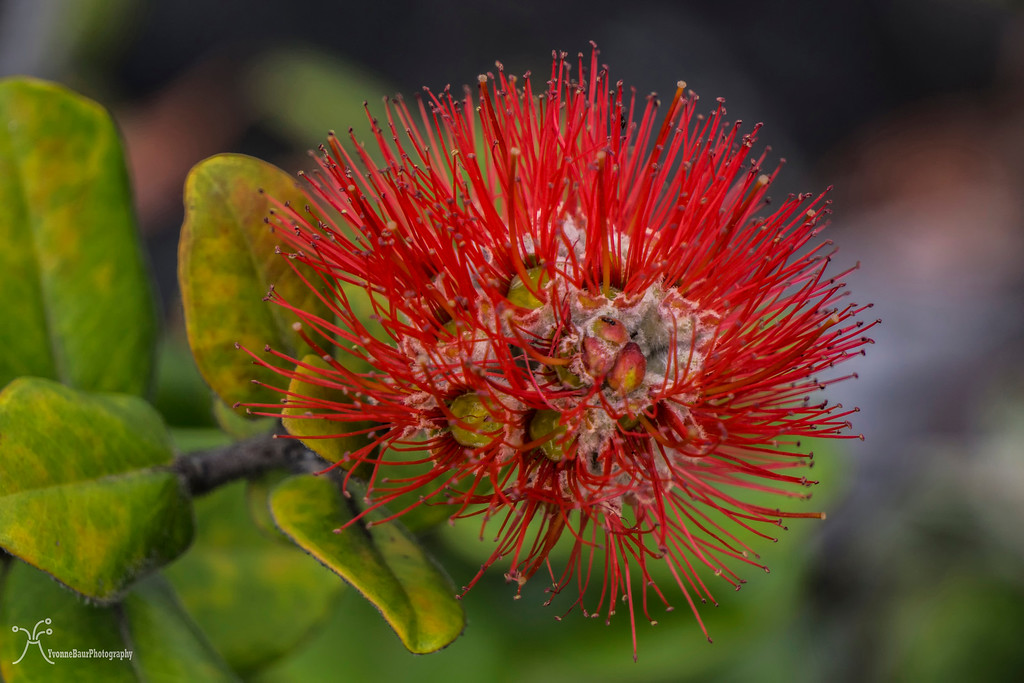
Ohia Lehua
I really love the flowers and when you shake them out in your hand you can lick the sweet nectar. The trail followed the crater bottom for a few hundred feet and then climbed back up to the rainforest. I followed it for a while until I came to the intersection with Kilauea Iki trail.
I left the rainforest again and descended down to the bottom of the former lava lake. Kilauea Iki erupted in 1959 and its bottom was filled with bubbling lava. Fountains of lava shot almost 1800ft. high in the air and created the Pu’u Pua’i cinder cone. The lava lake eventually solidified and I walked across the bottom on black slabs of lava which was the original lava lake back in these days. Even though it is almost 60 years since the lava lake was hot and active, it still has a lot of steam rising up from cracks after some good sized rain falls.
Pu'u Puai

Kilauea Iki Trail
After I crossed the lake I climbed back to the rainforest and to the crater rim. The trail followed quite a few switchbacks up to the rim and I gained again a lot of elevation.The sun was out and it was pretty warm. I was actually pretty happy to be up at the crater rim after a while.
The Kilauea Iki trail ended at the parking lot to the popular Thurston Lava Tube, one of the most popular sights here inside the park.
Because of the busy time of the day, I decided to walk through the lava tube on my way back and instead I continued past the tube and went on to the Escape Road, a 4.8 miles long stretch of hiking and biking road towards Mauna Ulu. It was originally build in the 1800s to bring supplies from the coast up to Kilauea, but later extended as an emergency road just in case if lava would block chain of craters road again.
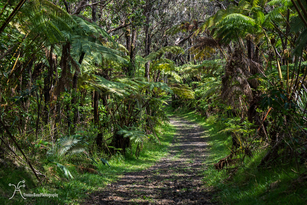
The road was pretty muddy because of all the rain we had the last few weeks and went through a lush rainforest. In most parts, the rainforest was so thick that there were no views to the surrounding area.
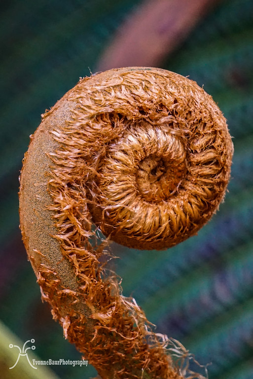
Young Hapu'u Tree Fern
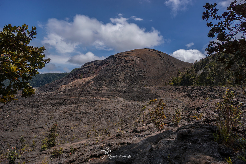
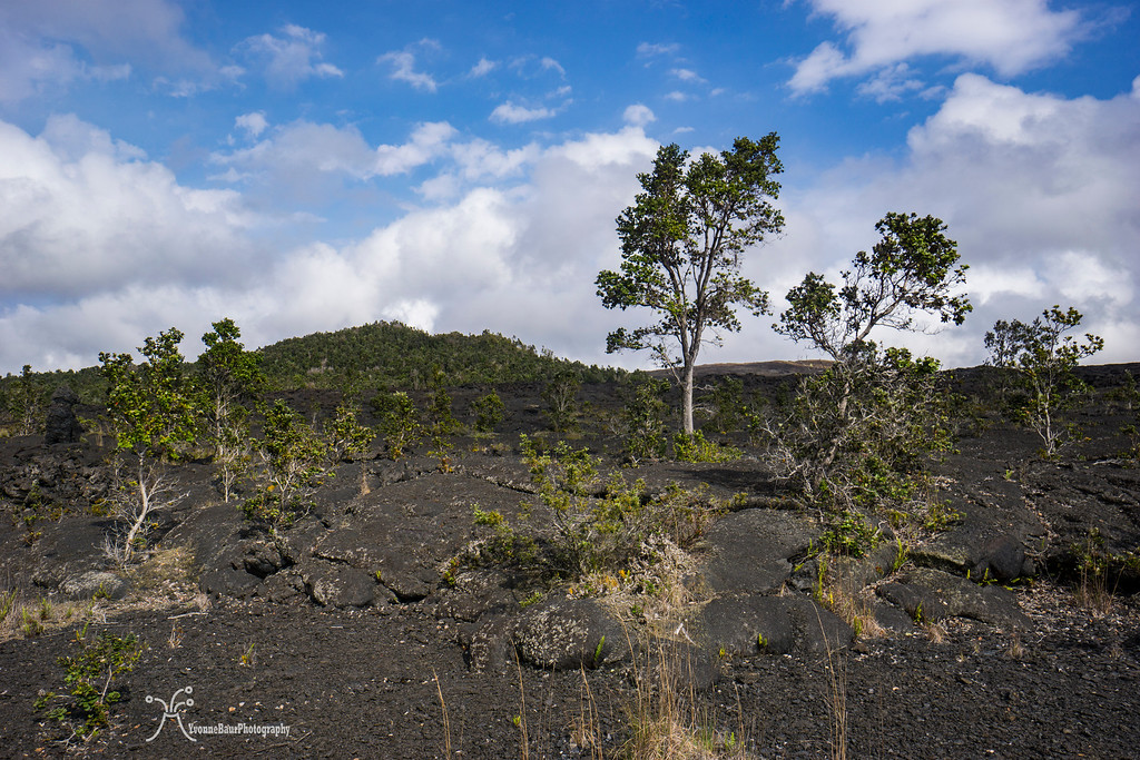
Despite the muddy parts I made good progress because I lost a good amount of elevation on my way to Mauna Ulu. It would be a good climb on my way back but at least it was all gradually and not only one short steep section. After a while of fast paced hiking the rainforest gave way to the impressive lava shield of Mauna Ulu. Cinder covered the entire are and Ohia trees and the invasive Faya trees were spread out over a wide area. Every now and then there were pretty awesome lava trees and tree molds which were created during the Mauna Ulu eruption.
Pu'u Huluhulu ahead
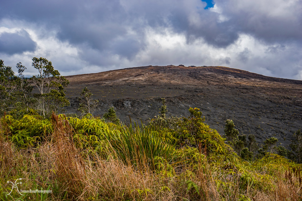
I really loved the entire area. The first views of Mauna Ulu und Pu’u Huluhulu came into sight, it would be my last stop before turning around and hike back out again. The trail followed across some old lava slabs of the Mauna Ulu eruption and then turned left up to a hill covered in rain forest vegetation. It was Pu’u Huluhulu which means hairy hill in Hawaiian. This cinder cone would be the end of my route.
Mauna Ulu Lavashield
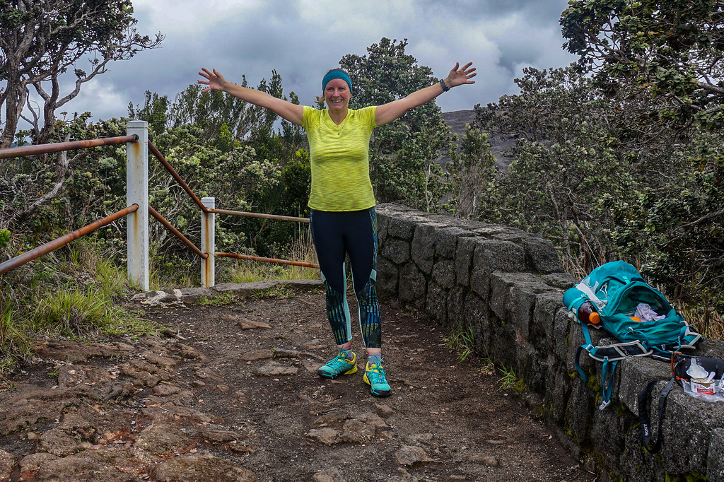
I ascended about 300 feet up to the top to the little viewing platform. From here you have a 360-degree view of the surrounding area on clear days. It wasn’t the case today but I could still see a steaming Pu’u O’o in the distance, the source where all the lava was coming from on our lava hikes.

Pu'u O'o
After a short snack break, I started to head back. It didn’t take long and it started to rain. The rain was okay but it made the trail even more slippery and muddy as it already was. And my hiking shoes were not really water proof.
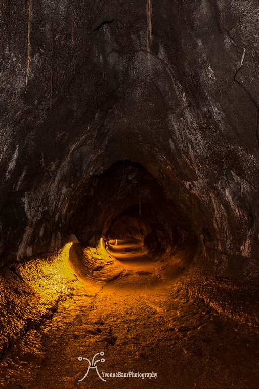
On the way back I stopped at the Thurston Lava Tube and walked the quarter of a mile loop through it. This lava tube was the most famous one in the park and was usually a zoo. But if you go late enough you often have all on your own.
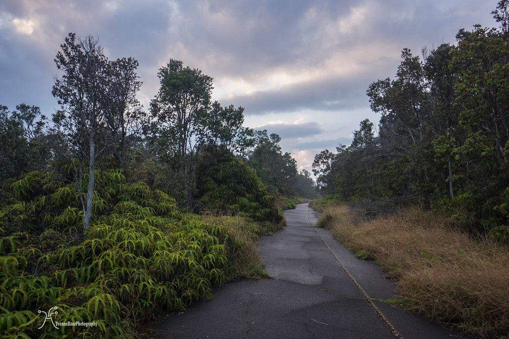
From there I followed the Crater Rim trail past the old park road. It partially collapsed during an earthquake in 1982 and is now only open to hikers. Most of the road was already overgrown, it’s amazing how fast nature can take over.
old park road on Waldron Ledge
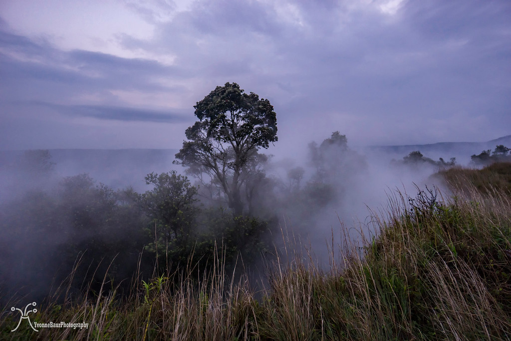
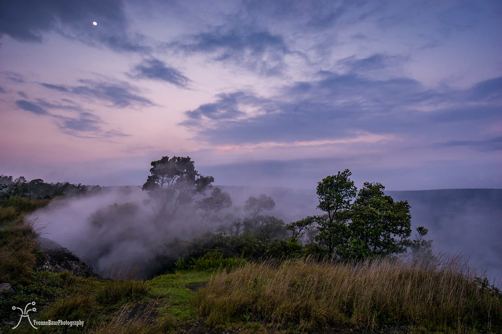
I hiked past the Visitor Center and back to the steam vents. It was around sunset and the colors were really nice right now. I definitely had to stop and enjoy the view. Even though it was pretty cloudy, it was a great view and the moon was also visible for a bit.
From the steam vents, I continued the last two miles back to the Jaggar Museum. With my wet shoes and socks, it wasn’t as comfortable as I wanted it to be and my feet started to hurt a bit. I definitely needed Gore Tex hiking shoes for future hikes, especially with having such a wet winter like this year. I finally reached the parking lot and my phone had recorded 20.4 miles. Not bad for a day hike.

As a reward, I went to the view point at the Jaggar Museum and enjoyed the glowing lava lake for a bit.
Tired, but happy I went back home and smiled. 20.4 miles was the longest day hikes for quite a while. Now I simply need to find an extension with 6 more miles, so I could hike a marathon next time.
I love being on the move. For that reason, hiking is the most natural thing for me and I can keep going forever. My job as a lava tour guide luckily involves a lot of hiking and I often end up an average of 6-13 miles several times a week. Once in a while, we do have a pretty slow week. This usually happens when lava is not easily accessible or when other factors determine a less active week. When this happens, I still get out and explore, just to stay in shape. It also offers a lot of opportunities to explore parts of Hawai’i Island and Volcanoes NP that do not necessarily involve lava.
Today I had a day off again and I decided I wanted to do some hikes in Hawai’i Volcanoes NP. Many of the day hikes are pretty short and barely longer than 5 or 6 miles. While sitting over my national geographic map of the park to determine where I wanted to go today I found a nice but pretty long hike that combined several of the shorter hikes into an amazing day on the trail.
I wasn’t sure how many miles I would end up with, but I guessed it would be somewhere between 15 -20 miles.
I started pretty late due to some work-related issues. We had a big group tomorrow and couldn’t get all the guides we needed. Anyway, at one point my boss resolved the issue and I drove the 22 miles up the mountain to the park.
It was a pleasant day, sunny, but pretty hazy with a lot of volcanic VOG due to the shift of wind direction. I parked at the Jaggar Museum on the Crater Rim and got my stuff ready. I decided that I only wanted to bring my little Sony A6000 camera today. This little camera is a real gem and the pictures it creates are pretty decent.
It was about 12:30 pm when I started my hike. Right next to the parking lot a paved trail started next to the HVO (Hawaiian Volcanic Observatory) and I followed it along the Crater Rim. Several spots allowed pretty nice views into Halema’uma’u Crater, a crater within Kilauea Crater. It was also the home of the world’s largest lava lake and its average size right now was about the size of the New Orleans Superdome. During the day you can barely see anything, but after dark, the lava lake will start to glow. And if the lake level is high enough you can see the lava spatter tossed in the air about 7 stories high.
I followed the Rim Trail and enjoyed the views of the impressive Kilauea Caldera. After a while, I passed the area of Steam Vents, where several fumaroles released magmatic water vapor. It all then condensed into clouds and mist. It was always a pretty cool sight, especially when some of the trees were covered in the steam and the entire scene created an eerie landscape.
Shortly after the steam vents, I turned onto the Iliahi Trail, a short trail that went through some of the finest rainforests here on the Crater Rim, before dropping down the bottom of Kilauea Caldera. Iliahi is the Hawaiian name for Sandalwood and obviously, a lot of the tropical trees grew here along the trail. The vegetation was getting thicker, with many Ohia and Koa trees as well as a lot of tree ferns.
I followed the trail for about half a mile and then turned onto the Halemaumau trail which would drop to the bottom of the crater pretty soon. But before that, the trail went through a beautiful part of the wet rainforest. I really felt like I was placed into a scene of Jurassic Park.
Hapu'u Tree Fern along the trail
Back in these days when dinosaurs roamed the Earth it must have looked like that with all the impressive tree ferns of the Mesozoic area. And nowadays it still looked pretty prehistoric in some spots.
I really liked that part of the rainforest a lot. There was so much to see and to explore. I stopped a few times for pictures before I continued.
Moss covered boulders, some stairs, all in here in that lush and green forest.
The trail descended to the crater bottom and all of the sudden it was a whole different world.
I stepped out of the forest and on to the lava covered floor of Kilauea Volcano. In the distance, I could see the steam plume of Halema’uma’u Crater in one direction, as well as the massive flank of Mauna Loa volcano. Several small Ohia trees grew on the bottom and their distinct bright red Lehua flowers were hard to miss.
Ohia Lehua
I really love the flowers and when you shake them out in your hand you can lick the sweet nectar. The trail followed the crater bottom for a few hundred feet and then climbed back up to the rainforest. I followed it for a while until I came to the intersection with Kilauea Iki trail.
I left the rainforest again and descended down to the bottom of the former lava lake. Kilauea Iki erupted in 1959 and its bottom was filled with bubbling lava. Fountains of lava shot almost 1800ft. high in the air and created the Pu’u Pua’i cinder cone. The lava lake eventually solidified and I walked across the bottom on black slabs of lava which was the original lava lake back in these days. Even though it is almost 60 years since the lava lake was hot and active, it still has a lot of steam rising up from cracks after some good sized rain falls.
Pu'u Puai
Kilauea Iki Trail
After I crossed the lake I climbed back to the rainforest and to the crater rim. The trail followed quite a few switchbacks up to the rim and I gained again a lot of elevation.The sun was out and it was pretty warm. I was actually pretty happy to be up at the crater rim after a while.
The Kilauea Iki trail ended at the parking lot to the popular Thurston Lava Tube, one of the most popular sights here inside the park.
Because of the busy time of the day, I decided to walk through the lava tube on my way back and instead I continued past the tube and went on to the Escape Road, a 4.8 miles long stretch of hiking and biking road towards Mauna Ulu. It was originally build in the 1800s to bring supplies from the coast up to Kilauea, but later extended as an emergency road just in case if lava would block chain of craters road again.
The road was pretty muddy because of all the rain we had the last few weeks and went through a lush rainforest. In most parts, the rainforest was so thick that there were no views to the surrounding area.
Young Hapu'u Tree Fern
Despite the muddy parts I made good progress because I lost a good amount of elevation on my way to Mauna Ulu. It would be a good climb on my way back but at least it was all gradually and not only one short steep section. After a while of fast paced hiking the rainforest gave way to the impressive lava shield of Mauna Ulu. Cinder covered the entire are and Ohia trees and the invasive Faya trees were spread out over a wide area. Every now and then there were pretty awesome lava trees and tree molds which were created during the Mauna Ulu eruption.
Pu'u Huluhulu ahead
I really loved the entire area. The first views of Mauna Ulu und Pu’u Huluhulu came into sight, it would be my last stop before turning around and hike back out again. The trail followed across some old lava slabs of the Mauna Ulu eruption and then turned left up to a hill covered in rain forest vegetation. It was Pu’u Huluhulu which means hairy hill in Hawaiian. This cinder cone would be the end of my route.
Mauna Ulu Lavashield
I ascended about 300 feet up to the top to the little viewing platform. From here you have a 360-degree view of the surrounding area on clear days. It wasn’t the case today but I could still see a steaming Pu’u O’o in the distance, the source where all the lava was coming from on our lava hikes.
Pu'u O'o
After a short snack break, I started to head back. It didn’t take long and it started to rain. The rain was okay but it made the trail even more slippery and muddy as it already was. And my hiking shoes were not really water proof.
On the way back I stopped at the Thurston Lava Tube and walked the quarter of a mile loop through it. This lava tube was the most famous one in the park and was usually a zoo. But if you go late enough you often have all on your own.
From there I followed the Crater Rim trail past the old park road. It partially collapsed during an earthquake in 1982 and is now only open to hikers. Most of the road was already overgrown, it’s amazing how fast nature can take over.
old park road on Waldron Ledge
I hiked past the Visitor Center and back to the steam vents. It was around sunset and the colors were really nice right now. I definitely had to stop and enjoy the view. Even though it was pretty cloudy, it was a great view and the moon was also visible for a bit.
From the steam vents, I continued the last two miles back to the Jaggar Museum. With my wet shoes and socks, it wasn’t as comfortable as I wanted it to be and my feet started to hurt a bit. I definitely needed Gore Tex hiking shoes for future hikes, especially with having such a wet winter like this year. I finally reached the parking lot and my phone had recorded 20.4 miles. Not bad for a day hike.
As a reward, I went to the view point at the Jaggar Museum and enjoyed the glowing lava lake for a bit.
Tired, but happy I went back home and smiled. 20.4 miles was the longest day hikes for quite a while. Now I simply need to find an extension with 6 more miles, so I could hike a marathon next time.