fossana
Member
- Joined
- Jan 11, 2018
- Messages
- 1,105
Intro
After reading the post from @Kullaberg63 on his Stevens East Benches route, I immediately put it on my to-do list. Allen's Stevens/Fold route ranks high among my all-time favorite routes, and I was anxious to try the variation. In March I did a spring warm-up trip to scout the Stevens Arch descent into Stevens Canyon and do the normal Stevens/Fold route. Thanks to @Jammer for the helpful Stevens Arch descent beta (to the extent it's possible to describe that).
Fast forward a few months to May. With a few days of cooler temps and possible rain predicted, I made a last-minute decision to try the E benches. Unfortunately, no rain came, as was the case for the prior 14+ days. I didn't get to the 40 Mile Tank (S Lobo) trailhead until noon, but didn't want to waste a cooler day. At the trailhead an older man peppered me with patronizing, unsolicited questions about my preparedness. I finally told him to stop. Thankfully, my next 4 days would be spent in solitude.
Day 1
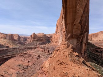
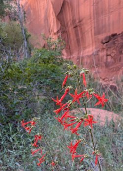
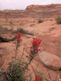
From the water tank I walked out to the 40 Mile trailhead and down Crack in the Wall. In contrast to my March trip, the wildflowers were in full bloom. From the rim I could see how low the Escalante River was. The USGS gauge measured ~0.18-0.21 CFS, far too close to the lowest flow rate recorded for the 69 years of daily mean data recorded, 0.16 CFS. Also climate-related is the insane amount of dry cheat grass this year.
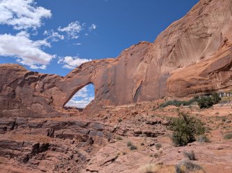
I crossed through Stevens Arch and found my previously reconned downclimbs. I was greeted with (avoidable) poison ivy in Stevens Canyon. There were still quite a few pools remaining thankfully. Due to my late start, I didn't make my mileage target, but instead camped closer to the exit ramp from the Stevens grotto.
Day 2
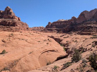
I awoke early and finished the familiar section of Stevens Canyon. The lower springs were still running, so I didn't have to do an out-and-back to the thrashy spring area to find water. I headed up the Baker Route to access the E benches. Interestingly, I encountered a single set of footprints that I would continue to see intermittently through out the entire E benches section. There was thankfully still some water in the major drainage potholes. I camped in a small alcove.
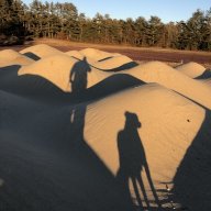
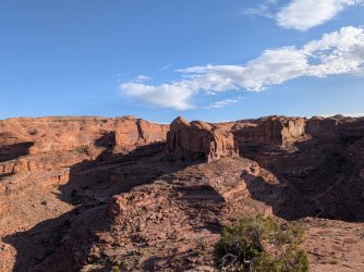
Mid-Stevens rim walking
Day 3
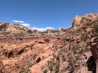
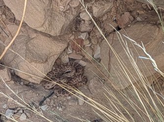
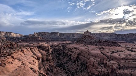
Having soon left the sandstone "sidewalks" behind, it was a long day of screen/talus tiptoeing and ramp traversing. Due to the steeper terrain, most of the canyons had to be fully headed rather than cutting through midway. Unlike the prior day, I was no longer finding usable water. At the hanging gardens, the seeps were barely running if at all. I also encountered my first rattlesnake in this region after hundreds of Glen Canyon backcountry miles. I had no option for giving the juvenile a wide berth, but it stayed put. I camped ~0.5 miles from Fold Pass.
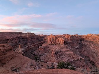
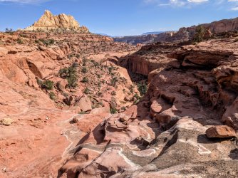
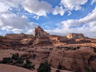
Looking ahead to the convoluted E Benches terrain
The little surprise I got when crossing a talus slope near one of the hanging gardens.
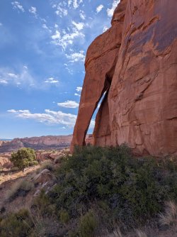
Below one of the hanging gardens fed by a seasonal seep
Day 4
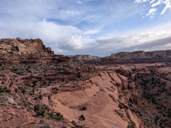
There was limited (and stagnant) pothole water in Fools. After spending the prior day with only one early water source and today's temps predicted in the upper 80s, I decided to exit Fold/Fools along on the standard drainages route instead of the overland route into Fools as the @Kullaberg63 party had done. The 3+ mile hike along the Escalante River was a welcome respite. Fools Canyon had some water, but it was mostly stagnant pools. I spent my last night tucked in one of the side drainages across from the start of the cattle trail.
Day 5
Along the long branch of Sleepy Hollow, I ran into large group being guided by an outfitter from Page. They were doing a Coyote Gulch > Fools > Escalante River > Coyote Gulch loop. Upper Coyote was quiet, but as usual, the area around Jacob Hamblin Arch felt like a carnival, with screaming kids and large groups who could have starred in a SAR PSA as they fumbled up and down the long 4th class slab. I scurried up the slab to minimize the chance of having to participate in a rescue, and got back to my car ~1:30. The temperature was already in the low 90s.
When I got home, I estimated my final route to be ~60 miles, not counting the zigzags required for route finding and avoiding cryptobiotic soil/hazards.
After reading the post from @Kullaberg63 on his Stevens East Benches route, I immediately put it on my to-do list. Allen's Stevens/Fold route ranks high among my all-time favorite routes, and I was anxious to try the variation. In March I did a spring warm-up trip to scout the Stevens Arch descent into Stevens Canyon and do the normal Stevens/Fold route. Thanks to @Jammer for the helpful Stevens Arch descent beta (to the extent it's possible to describe that).
Fast forward a few months to May. With a few days of cooler temps and possible rain predicted, I made a last-minute decision to try the E benches. Unfortunately, no rain came, as was the case for the prior 14+ days. I didn't get to the 40 Mile Tank (S Lobo) trailhead until noon, but didn't want to waste a cooler day. At the trailhead an older man peppered me with patronizing, unsolicited questions about my preparedness.
I finally told him to stop. Thankfully, my next 4 days would be spent in solitude.Day 1
From the water tank I walked out to the 40 Mile trailhead and down Crack in the Wall. In contrast to my March trip, the wildflowers were in full bloom. From the rim I could see how low the Escalante River was. The USGS gauge measured ~0.18-0.21 CFS, far too close to the lowest flow rate recorded for the 69 years of daily mean data recorded, 0.16 CFS. Also climate-related is the insane amount of dry cheat grass this year.
I crossed through Stevens Arch and found my previously reconned downclimbs. I was greeted with (avoidable) poison ivy in Stevens Canyon. There were still quite a few pools remaining thankfully. Due to my late start, I didn't make my mileage target, but instead camped closer to the exit ramp from the Stevens grotto.
Day 2
I awoke early and finished the familiar section of Stevens Canyon. The lower springs were still running, so I didn't have to do an out-and-back to the thrashy spring area to find water. I headed up the Baker Route to access the E benches. Interestingly, I encountered a single set of footprints that I would continue to see intermittently through out the entire E benches section. There was thankfully still some water in the major drainage potholes. I camped in a small alcove.
Mid-Stevens rim walking
Day 3
Having soon left the sandstone "sidewalks" behind, it was a long day of screen/talus tiptoeing and ramp traversing. Due to the steeper terrain, most of the canyons had to be fully headed rather than cutting through midway. Unlike the prior day, I was no longer finding usable water. At the hanging gardens, the seeps were barely running if at all. I also encountered my first rattlesnake in this region after hundreds of Glen Canyon backcountry miles. I had no option for giving the juvenile a wide berth, but it stayed put. I camped ~0.5 miles from Fold Pass.
Looking ahead to the convoluted E Benches terrain
The little surprise I got when crossing a talus slope near one of the hanging gardens.
Below one of the hanging gardens fed by a seasonal seep
Day 4
There was limited (and stagnant) pothole water in Fools. After spending the prior day with only one early water source and today's temps predicted in the upper 80s, I decided to exit Fold/Fools along on the standard drainages route instead of the overland route into Fools as the @Kullaberg63 party had done. The 3+ mile hike along the Escalante River was a welcome respite. Fools Canyon had some water, but it was mostly stagnant pools. I spent my last night tucked in one of the side drainages across from the start of the cattle trail.
Day 5
Along the long branch of Sleepy Hollow, I ran into large group being guided by an outfitter from Page. They were doing a Coyote Gulch > Fools > Escalante River > Coyote Gulch loop. Upper Coyote was quiet, but as usual, the area around Jacob Hamblin Arch felt like a carnival, with screaming kids and large groups who could have starred in a SAR PSA as they fumbled up and down the long 4th class slab. I scurried up the slab to minimize the chance of having to participate in a rescue, and got back to my car ~1:30. The temperature was already in the low 90s.
When I got home, I estimated my final route to be ~60 miles, not counting the zigzags required for route finding and avoiding cryptobiotic soil/hazards.