Offgrid
New Member
- Joined
- May 30, 2022
- Messages
- 2
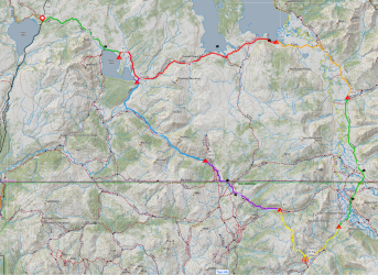
I had been planning a loop into Washakie and Teton wildernesses from the South Fork of the Shoshone River. Up the Shoshone to Marston Creek and over to the head waters of the Yellowstone then down to Hawks Rest. Exit via Thorofare Creek and Deer Creek Pass. Kudos to those folks who had great trip reports on this site for me to peruse for that area. Well, a few days before my trip I saw that the forest service reported that the South Fork trail was closed due to a nasty storm and mudslides! I wanting to get into the same nook of the Thorofare, so I perused options from the west instead. Thankfully, I managed to snag camps along a loop starting and ending at the Heart Lake Trailhead in Yellowstone National Park. Hadn't been into that area before so that was fine with me. Ended up being a 90+ mile loop which I tackled in 8 days. Calling it the "Cabin Loop" since I passed 7 patrol cabins along the route! East to Yellowstone Lake and then south through the Thorofare to Hawks Rest. Then up Atlantic Creek to hook up with the CDT northbound. Follow the Snake River and Heart River back to Heart Lake.
August 5 - Day 1 - Heart Lake Trailhead to Heart Lake camp 8J1. 9.5 miles
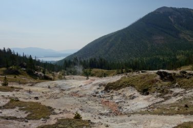
I departed about 9:15 and followed the flat route east for almost 5 miles where the trail emerges from the forest to an overlook of the Heart Lake Geyser Basin and the lake. There are some bubbling springs and fumaroles at the top.
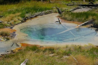
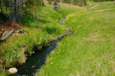
The trail then drops about 600 feet to Heart Lake. Towards the bottom, there are several large clear and pretty hot springs. There was also a creek that felt like it was hot tub 104 degrees.
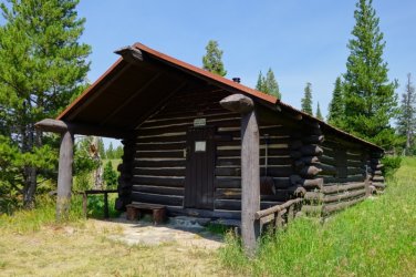
At 7.5 miles the first cabin of the trip made its appearance. Heart Lake Patrol Cabin. Nobody home. Which would be the case for all of them this trip.
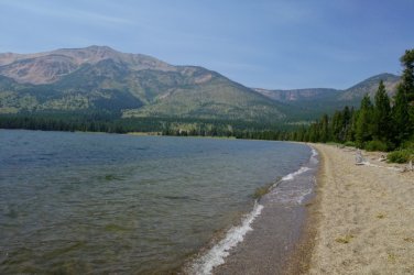
Then made it to the beach at Heart Lake. A couple who'd just passed me on the trail were already taking a break and the lady was in her skivvies taking a dip in the lake. I let them be and proceeded to hike along the gravel beach east for a half mile until the trail returned to dirt. The views of Mt Sheridan behind me were very nice.
At 9 miles I hit the turn off for my camp site 8J1 which was on a 0.4 mile side trail to the shore of the lake. Great view at camp.
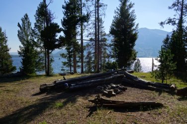
I'm from Colorado where a historic drought has the forests parched and a complete fire ban in effect. It was a pleasant surprise to find Yellowstone so green and no fire ban necessary. I took advantage to give myself a false sense of security while keeping the bears away with my little fire.
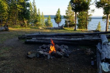
Day 2 - East to Yellowstone Lake Southeast Arm. 17.5 miles
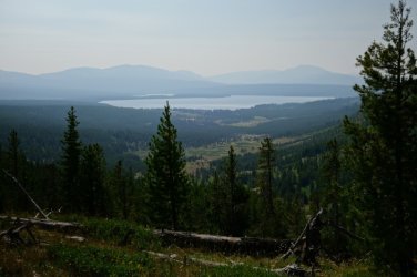
The next morning the views were rather impressive! I wouldn't mind climbing Sheridan someday.
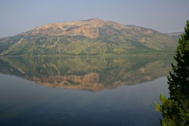
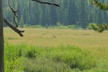
After a few miles comes the junction with the Trail Creek Trail which heads gradually up to the continental divide. There is a large meadow below Outlet Lake where a single heron was hunting grasshoppers(there were millions!). Previous August visits to YNP have been pretty light for me when spotting wildlife and this trip was no different. Besides pinecone bombing squirrels, animals avoid me like the plague. After practically petting ducks in my city park, here they scream bloody murder and fly off in utter terror if I get closer than 200 meters to them in the Yellowstone backcountry. Lol.
There had been nice flowers since beginning yesterday, but things ramped up closer to the divide.
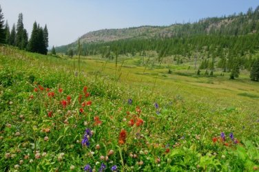
Outlet Lake
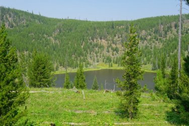
In due time, I made it to the South Arm of awesome Yellowstone Lake. Though you don't see it all that much from the trail. I did spot the Peale Island Patrol Cabin (#2).
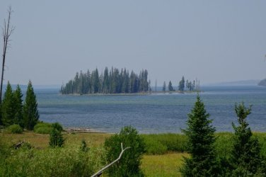
I am in pretty good shape but being 58 with a medium weight pack and a week of food on my back, I was getting pretty tired as the day wore on. But the gorgeous large meadows between the S and SE arms of the lake pulled me on. The northern terminus of the Two Ocean Plateau commanded the views. I also managed to veer off the faint trail at a small creek crossing and followed a horse track for a few hundred meters before realizing my mistake. Adding distance to the long day.
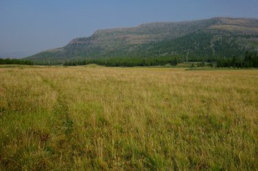
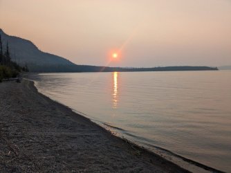
I passed the patrol cabin (#3) on the SE arm which signified me closing in on my camp at 6A4 and it was a most welcome arrival at 6pm. I got my chores and dinner done and was able to relax a bit on the beach of the serene lake as the sun set. Slept awesome that night.
Day 3 - Into the Thorofare to Mountain Creek. 10 miles
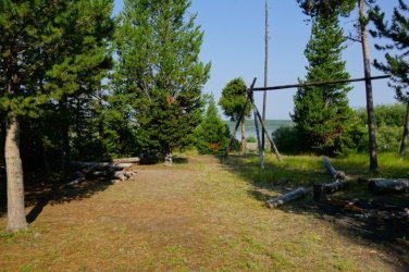
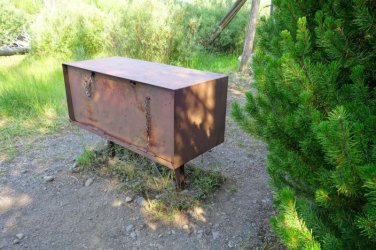
After sleeping in and no hurry this morning, I was on the trail about 10. Here are pics of the nice camp along with the bear locker.
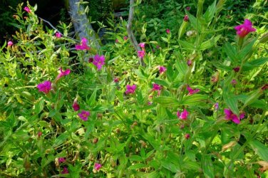
Pink monkey flower in the Trail Creek valley.
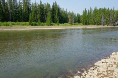
After 5 miles, I reached the Yellowstone River. The mosquitos where rather bad leading to the ford but a nice breeze and the empty shoreline alleviated that menace for the crossing. It ended up being crotch deep so had me tiptoeing a little bit. I could see that there was wet mud 1.5-2 feet above the current water level. Unsure if that was from high water or just sponge effect. But made me glad the river wasn't deeper today.
Along the Thorofare Trail, it's always great when the river bends into view. Most of the hike is in the forest and meadows with the river off to the west.
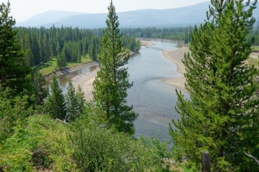
Trappers Creek was a simple ford and made for a nice lunch break with Colter Peak on the skyline.
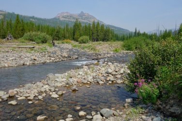
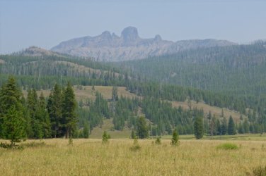
Turret Mountain flanks the south side of the Trappers valley.
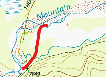
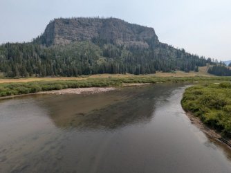
I got to Mountain Creek expecting a ford. But the creek bed was completely dry! I was a bit confused. Right after crossing the rocky stream bed there is a sign for site 6D3 but nothing for my site 6D2. Walked a bit further down the trail but didn't see anything so went back and took the trail to 6D3. And sure enough 6D2 was there. Not sure why they nixed the sign for it. And just beyond 6D2 is the creek to the east of it. It had re-routed itself sometime recently! After the trip I checked Google Satellite and it shows the old course too. So its a new happening. Here's the new route of the creek which is east of site 6D2 instead of north.
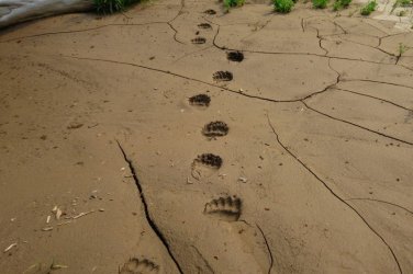
Looks like there are furry friends nearby. Since I saw no humans at all today and only one group yesterday, I knew I was finally "getting back in there".
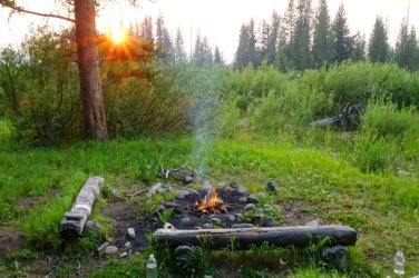
This prompted another evening campfire since that surely clears the whole area of any beasts that may come around in the dark of night. I could only wish. Just as I was dozing off to sleep, I heard a moose lope into the camp. Why was it running? From what? Ugh.
Day 4 - Deeper into the Thorofare and up Atlantic Creek in Teton Wilderness. 12.9 miles
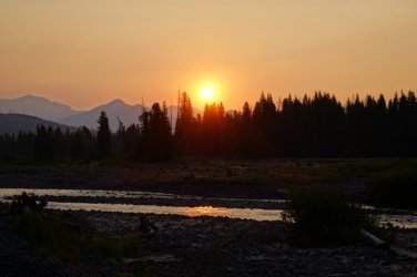
Low and behold, I was still breathing in the morning. And a nice sunrise greeted me for breakfast. At that moment I also stirred up the cow moose who had bedded down nearby. I guess that I provided a safe haven for her. With my fire last night. Ha!
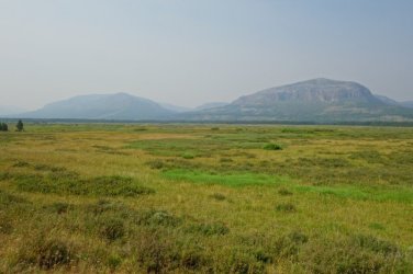
Mountain Creek was a chilly ford first thing in the morning. From there, most of the hike was through the expansive meadows of this region of the park. So beautiful. Still rather quiet with no animals to speak of. The grass showed no signs of disturbance from animals which you'd think would be the case in the "Serengeti of North America". No elk or bison and deer were oddly rare. All up on the plateaus staying as cool as possible under the August sun.
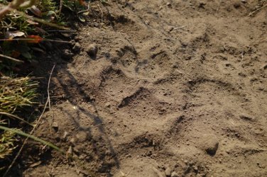
Bear and some wolf tracks on the trail were my main encounters with wildlife.
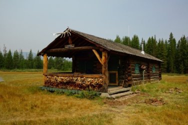
After 7 miles I made it to the Thorofare Ranger Station (#4). All buttoned up. I did sign the register at this epic spot of remoteness. There were a couple empty tents on site too.
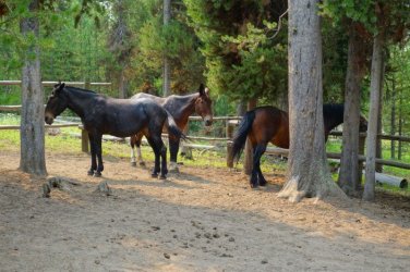
But there were a couple horses and a mule hanging in the corral. I tried to pet them, but they weren't interested in affection. I think they missed their friends who must have been out on patrol.
And this is a spot that resonates with a certain kind of folk, me included. It takes effort, appreciation of nature, and a curiousness about the world to make it to spots like this.
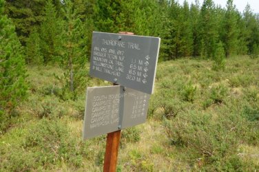
Going further south brings the trail to the ford of Thorofare Creek which was an easy crossing. After that the boundary of the park is reached as you enter Teton Wilderness.
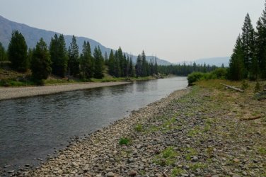
Bridger Lake. I had read that algae might be a problem here so avoided drawing any water. Great views though.
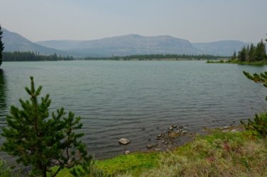
And finally, the Hawks Patrol Cabin (#5) is reached. I met a group of 3 French guys here who had their fly rods. They asked about why there were no animals. I told them I'd only seen 1 moose in 4 days so don't expect much. Not this time of year anyways.
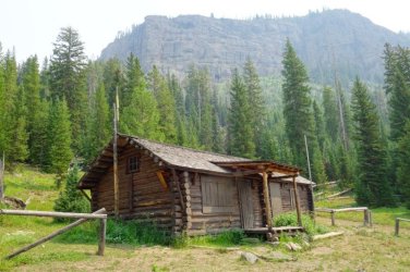
From Hawks Rest, I caught the Atlantic Creek Trail which crosses the Yellowstone on an enormous bridge!
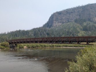
I crossed the vast Yellowstone plain and forded Atlantic Creek twice. I wanted to get past the 2nd one in the heat of day and glad I did since it was surprisingly a very long ford. I'm wimpy for cold rivers during the morning. I had hoped to find a camp just beyond it. But none were there besides an ancient spot someone had used. Better than nothing. I should have gone a couple miles further. But it would have been a climb towards the pass and I was ready to call it a day. At dinner, a friendly pine martin stopped by. So cute and I missed getting a pic of him.
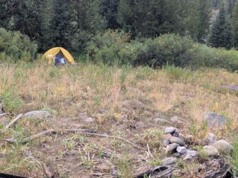
Day 5 - Two Ocean Pass and the Continental Divide Trail. 11.2 miles
I made quick work ascending to Two Ocean Pass. Once up there it was an immense flat area that bore no resemblance to the steep passes in Colorado.
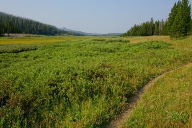
Funny, I didn't see much for berries along the trail. But the bears seem to know where to find them!
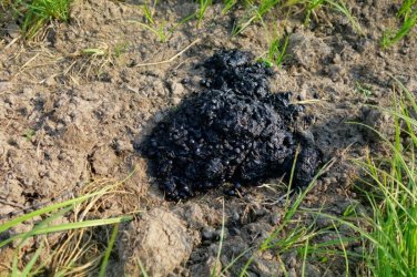
The CDT comes through and I hung a right and it'd be my companion for the next 40 miles to the trailhead.
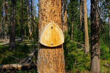
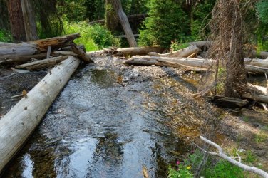
It didn't take long for me to reach a spot that had been on my consciousness for many years. The Parting of the Waters! Where Two Oceans Creek splits in two and becomes Atlantic Creek and Pacific Creek as they begin their journeys to distant oceans. 3488 and 1353 miles respectively. The photo is a bit non-dramatic due to the fallen timber that clutters the disjunction. But I enjoyed it.
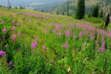
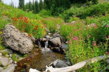
Whew. Thus begun the first and only serious climb of the trek. 2000ft up and over a portion of the Two Ocean Plateau. My goodness the flowers erupted here!
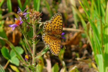
It was a bit of a grind going up, but the other side was rather mellow with a gradual and shorter descent. The fire smog was rather thick, and I don't have much for photos in that stretch. But the macro world was pretty with butterflies. I camped along Mink Creek about a quarter mile up from where the CDT crosses the creek. Due to the timing, there were both north and south bounders converging on YNP. I did only see 3 CDTers today. But from experience, they often amble into camp late, even after dark. So I skipped the convenient camp on the trail and found the more private spot.
Day 6 - Fox Park and onto the Snake River. 9 miles
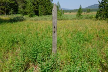
This would be my easiest day but still had nice views to be had. After about 3 miles, I crossed a little creek which happened to be the headwaters of the Snake River. Then reached Fox Park. I saw the Fox Park Patrol Cabin(#6) off the trail a bit. While in Teton Wilderness, the post in this pic is the extent of trail signage I saw the entire 3 days! There was at least an old post here. Most intersections had nothing. Just gotta have your maps.
Fox Park was really nice. And good to have the smog receded too.
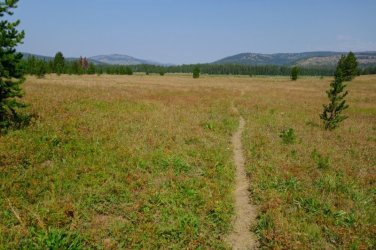
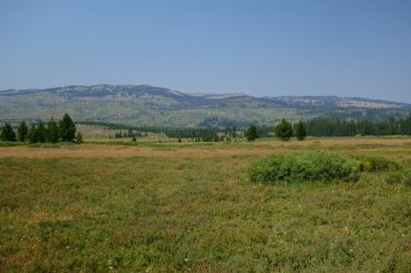
Big Game Ridge off to the west.
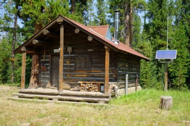
At the north end of Fox Park you ford Plateau Creek and then cross back into YNP where the Fox Creek Patrol Cabin (#7) sits. Had a nice lunch stop here and then joined the South Boundary Trail.
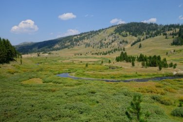
A couple creek fords gets you to the Snake River Canyon Trail. Followed it a couple miles to my camp
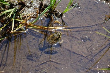
Amphibians were enjoying their short summer of fun before the long cold season came back.
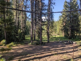
Site 8C9 is a huge horse camp. There are multiple places to pitch the tent. A nice creek and the Snake River to draw water from. And a meadow to graze the horses. But didn't seem like many had been through here this summer. And this camp is rather separate from other camps in distance. It was a nice spot to hang and relax for me.
Day 7 - Down the Snake to the Heart River. 11.6 Miles
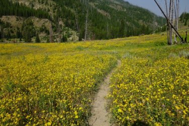
Today surprised me. Figured going down river would be easy hiking. There were numerous steep uphills to deal with. But they did go up to nice viewpoints of the river canyon and some spots were filled with wildflowers.
In route, there were 4 river fords to break up the day and cool off. Snake R, Heart R, Heart R and Surprise Cr, It was pretty warm and not a cloud in sight. I haven't mentioned the weather. Usually that means things are going well and "boring". This is the 7th day of great weather! Pretty much cloudless the whole time. Some smog. There was one afternoon where a few dark clouds floated by. But nothing happened.
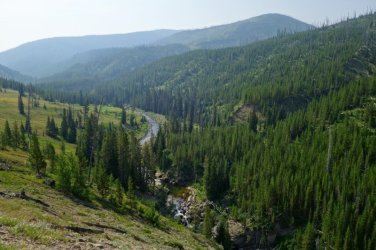
Of note, when planning the trip, I had wanted to go up the west side of Heart Lake. It would have been a little bit longer but wouldn't have as much repeated trail. Unfortunately, all of those camps were booked. So my route goes along the east end of the lake which I did on the way in.
I reached camp 8J4 on the banks of the Heart River. It was lovely. The water was warm due to all the hot springs around the lake which was only a quarter mile upstream. There was a lot of moss in the river. I drew my water from Surprise Creek which was adjacent to camp as well. Another moose ventured by. Well, I didn't see it, but heard it splash across the river when I wasn't looking. At least it was a moose in my head. There was a wildlife trail running through camp that had me a little worried for an eventful night so set my tent a bit away from it.
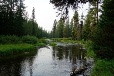
Day 8 - Back to Heart Lake and the trailhead. 12.5 miles.
After a week in the back country and my pack being significantly lightened, my legs were ready to haul back out. Today broke with cloudy skies and some mist falling at times. Perfect for putting it into the big gear and cranking some miles. The 5 miles back to the beach on Heart Lake went by quick.
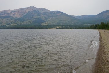
Getting back up to the top of the Heart Lake Geyser Basin (600 ft) was the only challenge of the day and it was pretty easy. The flat last 5 miles was at a quick clip.
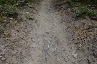
One thing I noticed on the way in and took a pic this time. There is a mystery cable running along the trail. Anyone know what it is? My guess is that is a fiber line to the data center going in on the shores of the lake. You know, those geysers provide cheap geothermal energy. That will surely add to the area. JK
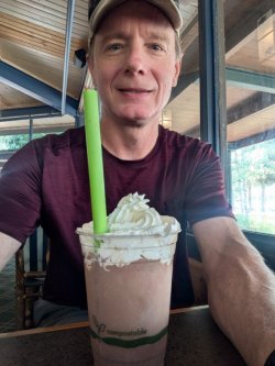
Milk shake award at Colter Bay. Damn it was good!
MAP
August 5 - Day 1 - Heart Lake Trailhead to Heart Lake camp 8J1. 9.5 miles
I departed about 9:15 and followed the flat route east for almost 5 miles where the trail emerges from the forest to an overlook of the Heart Lake Geyser Basin and the lake. There are some bubbling springs and fumaroles at the top.
The trail then drops about 600 feet to Heart Lake. Towards the bottom, there are several large clear and pretty hot springs. There was also a creek that felt like it was hot tub 104 degrees.
At 7.5 miles the first cabin of the trip made its appearance. Heart Lake Patrol Cabin. Nobody home. Which would be the case for all of them this trip.
Then made it to the beach at Heart Lake. A couple who'd just passed me on the trail were already taking a break and the lady was in her skivvies taking a dip in the lake. I let them be and proceeded to hike along the gravel beach east for a half mile until the trail returned to dirt. The views of Mt Sheridan behind me were very nice.
At 9 miles I hit the turn off for my camp site 8J1 which was on a 0.4 mile side trail to the shore of the lake. Great view at camp.
I'm from Colorado where a historic drought has the forests parched and a complete fire ban in effect. It was a pleasant surprise to find Yellowstone so green and no fire ban necessary. I took advantage to give myself a false sense of security while keeping the bears away with my little fire.
Day 2 - East to Yellowstone Lake Southeast Arm. 17.5 miles
The next morning the views were rather impressive! I wouldn't mind climbing Sheridan someday.
After a few miles comes the junction with the Trail Creek Trail which heads gradually up to the continental divide. There is a large meadow below Outlet Lake where a single heron was hunting grasshoppers(there were millions!). Previous August visits to YNP have been pretty light for me when spotting wildlife and this trip was no different. Besides pinecone bombing squirrels, animals avoid me like the plague. After practically petting ducks in my city park, here they scream bloody murder and fly off in utter terror if I get closer than 200 meters to them in the Yellowstone backcountry. Lol.
There had been nice flowers since beginning yesterday, but things ramped up closer to the divide.
Outlet Lake
In due time, I made it to the South Arm of awesome Yellowstone Lake. Though you don't see it all that much from the trail. I did spot the Peale Island Patrol Cabin (#2).
I am in pretty good shape but being 58 with a medium weight pack and a week of food on my back, I was getting pretty tired as the day wore on. But the gorgeous large meadows between the S and SE arms of the lake pulled me on. The northern terminus of the Two Ocean Plateau commanded the views. I also managed to veer off the faint trail at a small creek crossing and followed a horse track for a few hundred meters before realizing my mistake. Adding distance to the long day.
I passed the patrol cabin (#3) on the SE arm which signified me closing in on my camp at 6A4 and it was a most welcome arrival at 6pm. I got my chores and dinner done and was able to relax a bit on the beach of the serene lake as the sun set. Slept awesome that night.
Day 3 - Into the Thorofare to Mountain Creek. 10 miles
After sleeping in and no hurry this morning, I was on the trail about 10. Here are pics of the nice camp along with the bear locker.
Pink monkey flower in the Trail Creek valley.
After 5 miles, I reached the Yellowstone River. The mosquitos where rather bad leading to the ford but a nice breeze and the empty shoreline alleviated that menace for the crossing. It ended up being crotch deep so had me tiptoeing a little bit. I could see that there was wet mud 1.5-2 feet above the current water level. Unsure if that was from high water or just sponge effect. But made me glad the river wasn't deeper today.
Along the Thorofare Trail, it's always great when the river bends into view. Most of the hike is in the forest and meadows with the river off to the west.
Trappers Creek was a simple ford and made for a nice lunch break with Colter Peak on the skyline.
Turret Mountain flanks the south side of the Trappers valley.
I got to Mountain Creek expecting a ford. But the creek bed was completely dry! I was a bit confused. Right after crossing the rocky stream bed there is a sign for site 6D3 but nothing for my site 6D2. Walked a bit further down the trail but didn't see anything so went back and took the trail to 6D3. And sure enough 6D2 was there. Not sure why they nixed the sign for it. And just beyond 6D2 is the creek to the east of it. It had re-routed itself sometime recently! After the trip I checked Google Satellite and it shows the old course too. So its a new happening. Here's the new route of the creek which is east of site 6D2 instead of north.
Looks like there are furry friends nearby. Since I saw no humans at all today and only one group yesterday, I knew I was finally "getting back in there".
This prompted another evening campfire since that surely clears the whole area of any beasts that may come around in the dark of night. I could only wish. Just as I was dozing off to sleep, I heard a moose lope into the camp. Why was it running? From what? Ugh.
Day 4 - Deeper into the Thorofare and up Atlantic Creek in Teton Wilderness. 12.9 miles
Low and behold, I was still breathing in the morning. And a nice sunrise greeted me for breakfast. At that moment I also stirred up the cow moose who had bedded down nearby. I guess that I provided a safe haven for her. With my fire last night. Ha!
Mountain Creek was a chilly ford first thing in the morning. From there, most of the hike was through the expansive meadows of this region of the park. So beautiful. Still rather quiet with no animals to speak of. The grass showed no signs of disturbance from animals which you'd think would be the case in the "Serengeti of North America". No elk or bison and deer were oddly rare. All up on the plateaus staying as cool as possible under the August sun.
Bear and some wolf tracks on the trail were my main encounters with wildlife.
After 7 miles I made it to the Thorofare Ranger Station (#4). All buttoned up. I did sign the register at this epic spot of remoteness. There were a couple empty tents on site too.
But there were a couple horses and a mule hanging in the corral. I tried to pet them, but they weren't interested in affection. I think they missed their friends who must have been out on patrol.
And this is a spot that resonates with a certain kind of folk, me included. It takes effort, appreciation of nature, and a curiousness about the world to make it to spots like this.
Going further south brings the trail to the ford of Thorofare Creek which was an easy crossing. After that the boundary of the park is reached as you enter Teton Wilderness.
Bridger Lake. I had read that algae might be a problem here so avoided drawing any water. Great views though.
And finally, the Hawks Patrol Cabin (#5) is reached. I met a group of 3 French guys here who had their fly rods. They asked about why there were no animals. I told them I'd only seen 1 moose in 4 days so don't expect much. Not this time of year anyways.
From Hawks Rest, I caught the Atlantic Creek Trail which crosses the Yellowstone on an enormous bridge!
I crossed the vast Yellowstone plain and forded Atlantic Creek twice. I wanted to get past the 2nd one in the heat of day and glad I did since it was surprisingly a very long ford. I'm wimpy for cold rivers during the morning. I had hoped to find a camp just beyond it. But none were there besides an ancient spot someone had used. Better than nothing. I should have gone a couple miles further. But it would have been a climb towards the pass and I was ready to call it a day. At dinner, a friendly pine martin stopped by. So cute and I missed getting a pic of him.
Day 5 - Two Ocean Pass and the Continental Divide Trail. 11.2 miles
I made quick work ascending to Two Ocean Pass. Once up there it was an immense flat area that bore no resemblance to the steep passes in Colorado.
Funny, I didn't see much for berries along the trail. But the bears seem to know where to find them!
The CDT comes through and I hung a right and it'd be my companion for the next 40 miles to the trailhead.
It didn't take long for me to reach a spot that had been on my consciousness for many years. The Parting of the Waters! Where Two Oceans Creek splits in two and becomes Atlantic Creek and Pacific Creek as they begin their journeys to distant oceans. 3488 and 1353 miles respectively. The photo is a bit non-dramatic due to the fallen timber that clutters the disjunction. But I enjoyed it.
Whew. Thus begun the first and only serious climb of the trek. 2000ft up and over a portion of the Two Ocean Plateau. My goodness the flowers erupted here!
It was a bit of a grind going up, but the other side was rather mellow with a gradual and shorter descent. The fire smog was rather thick, and I don't have much for photos in that stretch. But the macro world was pretty with butterflies. I camped along Mink Creek about a quarter mile up from where the CDT crosses the creek. Due to the timing, there were both north and south bounders converging on YNP. I did only see 3 CDTers today. But from experience, they often amble into camp late, even after dark. So I skipped the convenient camp on the trail and found the more private spot.
Day 6 - Fox Park and onto the Snake River. 9 miles
This would be my easiest day but still had nice views to be had. After about 3 miles, I crossed a little creek which happened to be the headwaters of the Snake River. Then reached Fox Park. I saw the Fox Park Patrol Cabin(#6) off the trail a bit. While in Teton Wilderness, the post in this pic is the extent of trail signage I saw the entire 3 days! There was at least an old post here. Most intersections had nothing. Just gotta have your maps.
Fox Park was really nice. And good to have the smog receded too.
Big Game Ridge off to the west.
At the north end of Fox Park you ford Plateau Creek and then cross back into YNP where the Fox Creek Patrol Cabin (#7) sits. Had a nice lunch stop here and then joined the South Boundary Trail.
A couple creek fords gets you to the Snake River Canyon Trail. Followed it a couple miles to my camp
Amphibians were enjoying their short summer of fun before the long cold season came back.
Site 8C9 is a huge horse camp. There are multiple places to pitch the tent. A nice creek and the Snake River to draw water from. And a meadow to graze the horses. But didn't seem like many had been through here this summer. And this camp is rather separate from other camps in distance. It was a nice spot to hang and relax for me.
Day 7 - Down the Snake to the Heart River. 11.6 Miles
Today surprised me. Figured going down river would be easy hiking. There were numerous steep uphills to deal with. But they did go up to nice viewpoints of the river canyon and some spots were filled with wildflowers.
In route, there were 4 river fords to break up the day and cool off. Snake R, Heart R, Heart R and Surprise Cr, It was pretty warm and not a cloud in sight. I haven't mentioned the weather. Usually that means things are going well and "boring". This is the 7th day of great weather! Pretty much cloudless the whole time. Some smog. There was one afternoon where a few dark clouds floated by. But nothing happened.
Of note, when planning the trip, I had wanted to go up the west side of Heart Lake. It would have been a little bit longer but wouldn't have as much repeated trail. Unfortunately, all of those camps were booked. So my route goes along the east end of the lake which I did on the way in.
I reached camp 8J4 on the banks of the Heart River. It was lovely. The water was warm due to all the hot springs around the lake which was only a quarter mile upstream. There was a lot of moss in the river. I drew my water from Surprise Creek which was adjacent to camp as well. Another moose ventured by. Well, I didn't see it, but heard it splash across the river when I wasn't looking. At least it was a moose in my head. There was a wildlife trail running through camp that had me a little worried for an eventful night so set my tent a bit away from it.
Day 8 - Back to Heart Lake and the trailhead. 12.5 miles.
After a week in the back country and my pack being significantly lightened, my legs were ready to haul back out. Today broke with cloudy skies and some mist falling at times. Perfect for putting it into the big gear and cranking some miles. The 5 miles back to the beach on Heart Lake went by quick.
Getting back up to the top of the Heart Lake Geyser Basin (600 ft) was the only challenge of the day and it was pretty easy. The flat last 5 miles was at a quick clip.
One thing I noticed on the way in and took a pic this time. There is a mystery cable running along the trail. Anyone know what it is? My guess is that is a fiber line to the data center going in on the shores of the lake. You know, those geysers provide cheap geothermal energy. That will surely add to the area. JK
Milk shake award at Colter Bay. Damn it was good!
MAP
Attachments
Last edited: