- Joined
- Aug 23, 2016
- Messages
- 138
After our 2022 trip, which started in Yellowstone and ended in the Teton Wilderness (report here), Stacy said she'll be sticking to trails built and maintained by the park service from now on. No more Teton Wilderness horse trails. I can't say I blame her. For this trip we started and ended at the South Entrance and did sort of a lollipop with an extra stick. Saw a lot of the Snake River and spent two nights on Heart Lake.
Click here to view on CalTopo
DAY 1: South entrance to 8C6. Our original plan was to stay in Dubois the night before and drive over Togwotee pass to the South Entrance the morning of our trip. But the road had been closed because of the Fish Creek Fire so we instead went around to the south and drove in from Pinedale in the morning (we were coming in from Nebraska the night before). We got our permit in no time and were on our way.
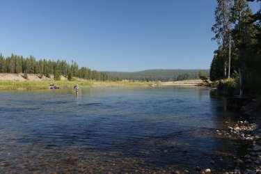
Always need a picture of the initial ford of the Snake. You walk down from the parking lot and immediately cross the river.
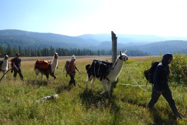
Just past the river we met a llama trekking group. They seemed like a happy bunch. Hopefully because they were having such a good time and not because the trip was almost over.
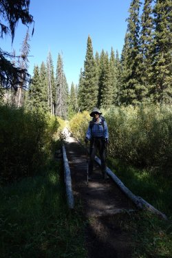
Ahhhh. NPS trails!
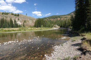
Snake River from 8C6. We'll have to ford the river first thing tomorrow morning. A common theme on this trip.
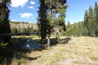
One of the many tenting areas at this campsite. Three things 1) That snag is not hanging right over the tent, 2) it is super solid and not going anywhere anyway, and 3) yes, we both hit our heads on it multiple times.
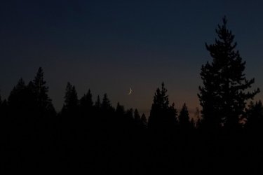
We were able to watch the sliver of moon set on a few nights. Had good stars maybe half of the nights. We were worried that the Fish Creek Fire would make for a really smoky trip but it was ok, some days better than others.
DAY 2: 8C6 to 8B1. A nice, mellow day of creeks and meadows.
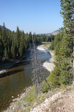
We've just crossed the river and are heading up toward Basin Creek. 8C6 is just where the river goes out of view.
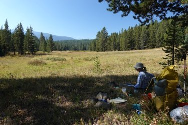
We packed right up in the morning and stopped a little way up the trail for breakfast. This meadow is along Red Creek.
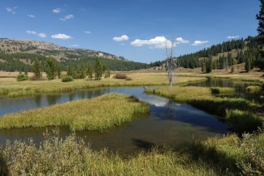
Another big meadow on Red Creek.
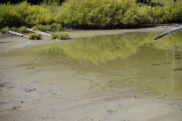
Trails of something in the mud of small pond near Basin Creek Lake
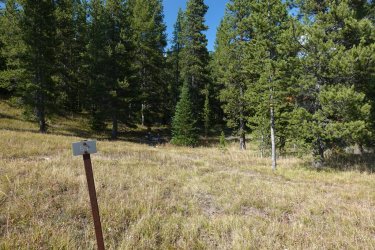
We really liked site 8B1. It's right on the edge of a huge meadow with great views.
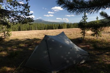
It looks like a cloud on the horizon but that's the Fish Creek Fire.

Panorama from camp.
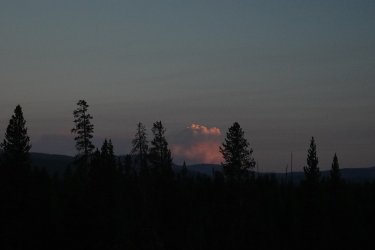
Another view of the Fish Creek Fire
DAY 3: 8B1 to 8J6.
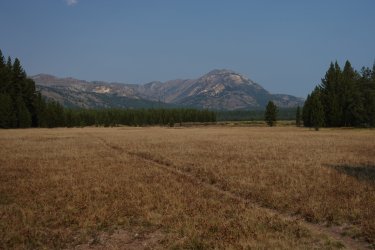
More creeks and meadows today. This is along Basin Creek
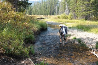
We had eight stream crossings today. Neither of us can stand wet hiking boots so we changed into water shoes for each crossing.
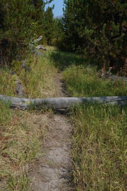
This was so unusual I had to take a picture of it. It was the only log we had to step over on the entire trip. Quite a change from the Teton Wilderness.
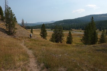
Headed down toward the Snake River again. Site 8C5 is up ahead on the other side of the river. We didn't stay there, however. We continued up to Heart Lake.
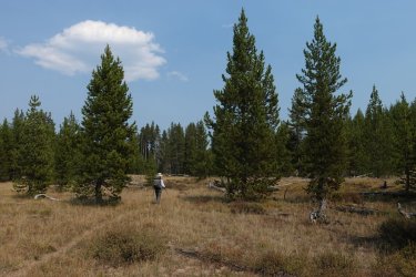
Between the Snake River and Heart River there is an area of very open pine forest. Along here we saw a mother moose and calf and a big mule deer. No time to get photos, unfortunately.
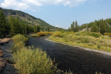
This is the Heart River not too far above the Snake River floodplain. I really liked the fall color through here. Heart Lake is a couple of miles upstream.
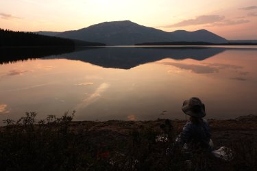
Finishing dinner at 8J6 on Heart Lake. We really liked this campsite. Since it was warm when we arrived we thought we'd go for a swim in the lake. It was difficult, however, because the water was so shallow so far out. A couple hundred feet from shore it was still only knee deep. I eventually got out to thigh deep and had my swim. We stayed on the beach until after dark and saw a bat skimming out over the water and then an owl flew right past us several times. You always read how owls can fly very quietly. Well, it's true. There was a strange disconnect between our ears, which did not hear ANYTHING, and our eyes that led us to expect the usual fluttery bird sounds.
DAY 4: Day hike from Heart Lake
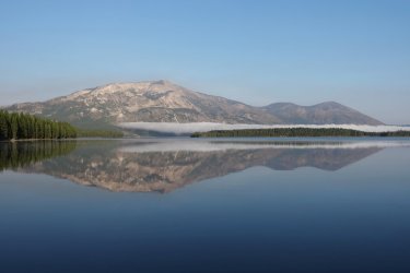
In the morning there was a fog bank on the far side of the lake. There are thermal features over there--maybe the fog comes from those? Over the two nights we were here we saw a lot of kingfishers, a couple of bald eagles and some sort of hawk or falcon. Also ducks, canada geese and pelicans. Oh--and we heard loons. Seems like this was the only place we did not hear sandhill cranes.
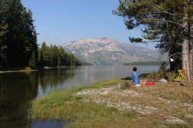
We stayed here two nights and took an easy day-hike. It was cold in the morning but we were able to find a sunny spot for breakfast.
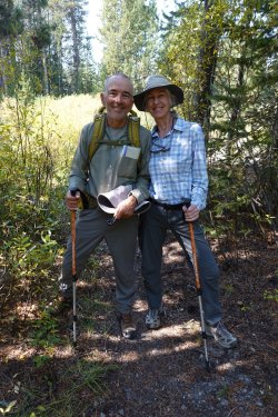
We hiked up a little way toward Outlet Lake. We were feeling pretty lazy and it was a hot day so we did not go far. We met a group who were doing a long circuit from Yellowstone Lake to--well, now I can't remember--either the Heart Lake or South Boundary trailhead. We took each other's pictures. Now I wish I had taken a photo of them with our camera. They were looking pretty rough but very, very happy.
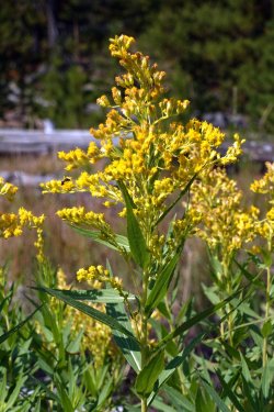
There were not many flowers this time of year but a fair amount of this yellow flower.
DAY 5: 8J6 to 8C4: This was a strange day. Decades ago, I used to get migraine headaches but haven't had one since I don't know when. But this morning I woke up with telltale precursors, which has never happened before--it was always late in the day. Anyway, I took some ibuprofin and carried on. Luckily it never got bad but I just felt wrung out and useless all day. Luckily there was no complicated routefinding!
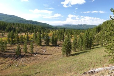
Headed down Heart River. The Snake River is in the valley in the distance.
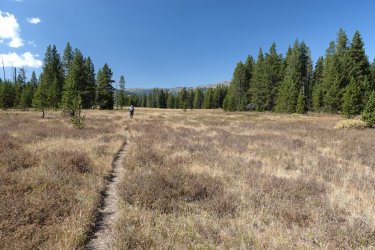
Very dry meadows in the Heart River/Snake River area
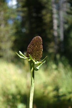
Still some of these flowers to be seen (I don't know what they're called).
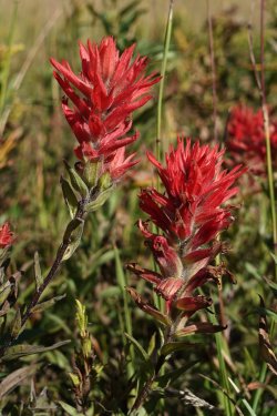
And some paintbrush here and there
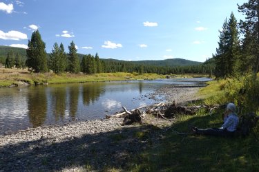
It was pretty hot when we got to 8C4 so we hung out down at the river in the shade. We really like this campsite. Nice views, good swimming, good tent sites and some nice off-trail hiking opportunities, although you have to cross the river to get to those. We were sitting by the river as it was getting dark and could hear some sandhill cranes. We finally spotted four of them way up high. Then, as we watched them, they sort of parachuted down to the river. They didn't really glide--they made no forward progress--they just used their wings like parachutes and sunk right on down. They are strange birds.
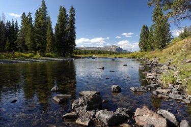
View upstream from 8C4 (actually across the river from 8C4).
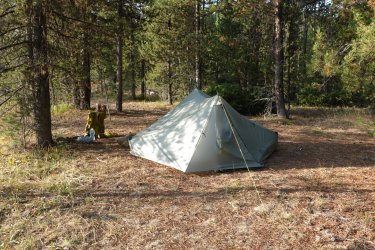
Our tent site
Day 6: 8C4 to 8C2: Today was the biggest climb of the trip but only some hundreds of feet and all on very nice trails.
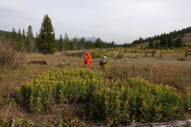
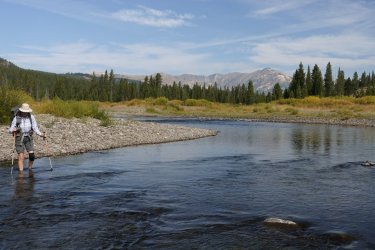
We started with another stream crossing. It was maybe a quarter mile down the trail. Since we thought we'd catch some sun there we packed up camp and had breakfast at the ford. While we were eating breakfast we saw what we assumed were the same four sandhill cranes from the night before. They headed on up the river.
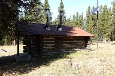
I guess I didn't take any pictures on the way up to the South Boundary Trail at Harebell Cabin. We saw a black bear on the trail. Well, at least the rear end of a black bear as it ran off.
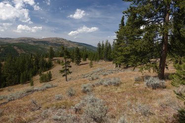
This is looking roughly west from the South Boundary Trail as it heads back down toward the Snake River. The valley ahead is Coulter Creek going off to the left and the Snake River to the right.
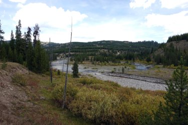
Confluence of Coulter Creek and the Snake. Harebell Creek joins Coulter just up from here and Wolverine Creek just above that.
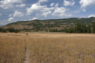
Approaching our last camp, 8C2. It's on the river in the clump of trees just right of the center of the picture. We called it "Dookie Camp" because there was horse manure EVERYWHERE. Almost like they made a conscience effort to spread it through the whole campsite.
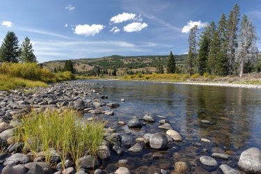
View from camp. You can see we are downstream from where the Snake flows through the Harebell Formation. Those smooth grapefruit to bowling ball size cobbles are a dead givaway. They are sort of interesting looking but make for terrible walking or sitting.
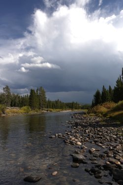
Some storms blew through after we got to camp. We heard thunder but only got a few drops of rain. Later in the evening the wind came up and the valley filled with smoke--not just smoky haze but sitting-next-to-a-campfire-smoke. We worried that the lightning we heard had started a new fire and the wind was blowing it our way. Turned out there was no new fire. Must have been smoke blowing in from the Fish Creek Fire.
DAY 7: 8C2 to South Entrance. This was our longest day at 9 miles, but on a well-maintained, nearly flat trail. It sprinkled on and off through the night and continued throughout the day. It didn't get particularly cold over night but also did not warm up much at all during the day. We were happy to be headed out.
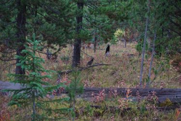
We saw a family of grouse just beside the trail. I barely managed to get a picture of mama grouse. This encounter was not nearly as terrifying as our previous grouse encounter here.
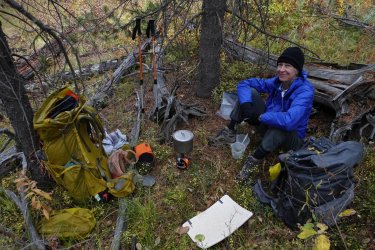
We ducked in under some trees for breakfast. We really needed bigger trees but at least some of the rain got blocked.
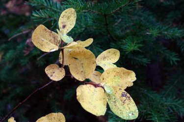
The water really beaded up on these leaves. There were a lot of these shrubs. The twigs were red and the leaves were thick and leathery.
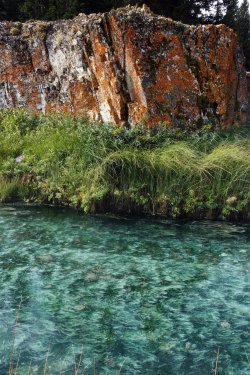
This is one of the hot springs near campsite 8C1. The colors seemed extra vivid in the low light today
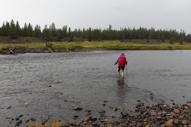
And here is the last (19th) stream crossing. It never really warmed up today and stayed cold and rainy for the next couple of days. We were happy to be heading out!
Despite a couple of backpacking trips to YNP we never took time to see the sights. So this year, armed with recommendations from @TractorDoc, we took a few days to tour the park. Since I waited until the last minute we could not get accommodations in the park. But we did ok with a couple of nights in West Yellowstone and one night in Gardiner.
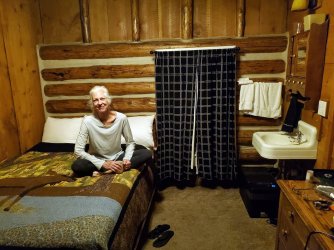
This is our room at the Historic Madison Hotel in W Yellowstone. It is upstairs from the gift shop; bathroom and shower is down the hall. By this time it was really cold and rainy outside so we were very happy to have our cozy little room!
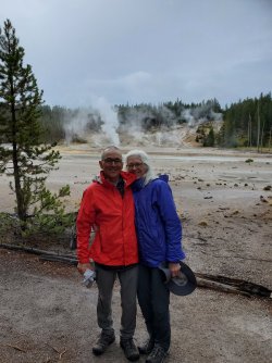
We made a conscious decision to not take photos of everything and try to enjoy it all in the moment but we did exchange photos with the other tourists. Here you can see I am so happy to be at Yellowstone National Park I have steam coming out of my head! We saw Norris Geyser Basin, Grand Canyon of the Yellowstone, Hayden Valley, Lamar Valley and...
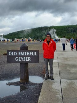
Old Faithful, of course!
And we managed to meet up with Mr. and Mrs. Tractordoc one afternoon. On the way home we drove through the Nebraska Sandhills on hwy 2, which I highly recommend. Nebraska does not get nearly the respect it deserves, if you ask me.
So that's the trip report. Time to start planning the next trip!
Click here to view on CalTopo
DAY 1: South entrance to 8C6. Our original plan was to stay in Dubois the night before and drive over Togwotee pass to the South Entrance the morning of our trip. But the road had been closed because of the Fish Creek Fire so we instead went around to the south and drove in from Pinedale in the morning (we were coming in from Nebraska the night before). We got our permit in no time and were on our way.

Always need a picture of the initial ford of the Snake. You walk down from the parking lot and immediately cross the river.

Just past the river we met a llama trekking group. They seemed like a happy bunch. Hopefully because they were having such a good time and not because the trip was almost over.

Ahhhh. NPS trails!

Snake River from 8C6. We'll have to ford the river first thing tomorrow morning. A common theme on this trip.

One of the many tenting areas at this campsite. Three things 1) That snag is not hanging right over the tent, 2) it is super solid and not going anywhere anyway, and 3) yes, we both hit our heads on it multiple times.

We were able to watch the sliver of moon set on a few nights. Had good stars maybe half of the nights. We were worried that the Fish Creek Fire would make for a really smoky trip but it was ok, some days better than others.
DAY 2: 8C6 to 8B1. A nice, mellow day of creeks and meadows.

We've just crossed the river and are heading up toward Basin Creek. 8C6 is just where the river goes out of view.

We packed right up in the morning and stopped a little way up the trail for breakfast. This meadow is along Red Creek.

Another big meadow on Red Creek.

Trails of something in the mud of small pond near Basin Creek Lake

We really liked site 8B1. It's right on the edge of a huge meadow with great views.

It looks like a cloud on the horizon but that's the Fish Creek Fire.

Panorama from camp.

Another view of the Fish Creek Fire
DAY 3: 8B1 to 8J6.

More creeks and meadows today. This is along Basin Creek

We had eight stream crossings today. Neither of us can stand wet hiking boots so we changed into water shoes for each crossing.

This was so unusual I had to take a picture of it. It was the only log we had to step over on the entire trip. Quite a change from the Teton Wilderness.

Headed down toward the Snake River again. Site 8C5 is up ahead on the other side of the river. We didn't stay there, however. We continued up to Heart Lake.

Between the Snake River and Heart River there is an area of very open pine forest. Along here we saw a mother moose and calf and a big mule deer. No time to get photos, unfortunately.

This is the Heart River not too far above the Snake River floodplain. I really liked the fall color through here. Heart Lake is a couple of miles upstream.

Finishing dinner at 8J6 on Heart Lake. We really liked this campsite. Since it was warm when we arrived we thought we'd go for a swim in the lake. It was difficult, however, because the water was so shallow so far out. A couple hundred feet from shore it was still only knee deep. I eventually got out to thigh deep and had my swim. We stayed on the beach until after dark and saw a bat skimming out over the water and then an owl flew right past us several times. You always read how owls can fly very quietly. Well, it's true. There was a strange disconnect between our ears, which did not hear ANYTHING, and our eyes that led us to expect the usual fluttery bird sounds.
DAY 4: Day hike from Heart Lake

In the morning there was a fog bank on the far side of the lake. There are thermal features over there--maybe the fog comes from those? Over the two nights we were here we saw a lot of kingfishers, a couple of bald eagles and some sort of hawk or falcon. Also ducks, canada geese and pelicans. Oh--and we heard loons. Seems like this was the only place we did not hear sandhill cranes.

We stayed here two nights and took an easy day-hike. It was cold in the morning but we were able to find a sunny spot for breakfast.

We hiked up a little way toward Outlet Lake. We were feeling pretty lazy and it was a hot day so we did not go far. We met a group who were doing a long circuit from Yellowstone Lake to--well, now I can't remember--either the Heart Lake or South Boundary trailhead. We took each other's pictures. Now I wish I had taken a photo of them with our camera. They were looking pretty rough but very, very happy.

There were not many flowers this time of year but a fair amount of this yellow flower.
DAY 5: 8J6 to 8C4: This was a strange day. Decades ago, I used to get migraine headaches but haven't had one since I don't know when. But this morning I woke up with telltale precursors, which has never happened before--it was always late in the day. Anyway, I took some ibuprofin and carried on. Luckily it never got bad but I just felt wrung out and useless all day. Luckily there was no complicated routefinding!

Headed down Heart River. The Snake River is in the valley in the distance.

Very dry meadows in the Heart River/Snake River area

Still some of these flowers to be seen (I don't know what they're called).

And some paintbrush here and there

It was pretty hot when we got to 8C4 so we hung out down at the river in the shade. We really like this campsite. Nice views, good swimming, good tent sites and some nice off-trail hiking opportunities, although you have to cross the river to get to those. We were sitting by the river as it was getting dark and could hear some sandhill cranes. We finally spotted four of them way up high. Then, as we watched them, they sort of parachuted down to the river. They didn't really glide--they made no forward progress--they just used their wings like parachutes and sunk right on down. They are strange birds.

View upstream from 8C4 (actually across the river from 8C4).

Our tent site
Day 6: 8C4 to 8C2: Today was the biggest climb of the trip but only some hundreds of feet and all on very nice trails.


We started with another stream crossing. It was maybe a quarter mile down the trail. Since we thought we'd catch some sun there we packed up camp and had breakfast at the ford. While we were eating breakfast we saw what we assumed were the same four sandhill cranes from the night before. They headed on up the river.

I guess I didn't take any pictures on the way up to the South Boundary Trail at Harebell Cabin. We saw a black bear on the trail. Well, at least the rear end of a black bear as it ran off.

This is looking roughly west from the South Boundary Trail as it heads back down toward the Snake River. The valley ahead is Coulter Creek going off to the left and the Snake River to the right.

Confluence of Coulter Creek and the Snake. Harebell Creek joins Coulter just up from here and Wolverine Creek just above that.

Approaching our last camp, 8C2. It's on the river in the clump of trees just right of the center of the picture. We called it "Dookie Camp" because there was horse manure EVERYWHERE. Almost like they made a conscience effort to spread it through the whole campsite.

View from camp. You can see we are downstream from where the Snake flows through the Harebell Formation. Those smooth grapefruit to bowling ball size cobbles are a dead givaway. They are sort of interesting looking but make for terrible walking or sitting.

Some storms blew through after we got to camp. We heard thunder but only got a few drops of rain. Later in the evening the wind came up and the valley filled with smoke--not just smoky haze but sitting-next-to-a-campfire-smoke. We worried that the lightning we heard had started a new fire and the wind was blowing it our way. Turned out there was no new fire. Must have been smoke blowing in from the Fish Creek Fire.
DAY 7: 8C2 to South Entrance. This was our longest day at 9 miles, but on a well-maintained, nearly flat trail. It sprinkled on and off through the night and continued throughout the day. It didn't get particularly cold over night but also did not warm up much at all during the day. We were happy to be headed out.

We saw a family of grouse just beside the trail. I barely managed to get a picture of mama grouse. This encounter was not nearly as terrifying as our previous grouse encounter here.

We ducked in under some trees for breakfast. We really needed bigger trees but at least some of the rain got blocked.

The water really beaded up on these leaves. There were a lot of these shrubs. The twigs were red and the leaves were thick and leathery.

This is one of the hot springs near campsite 8C1. The colors seemed extra vivid in the low light today

And here is the last (19th) stream crossing. It never really warmed up today and stayed cold and rainy for the next couple of days. We were happy to be heading out!
Despite a couple of backpacking trips to YNP we never took time to see the sights. So this year, armed with recommendations from @TractorDoc, we took a few days to tour the park. Since I waited until the last minute we could not get accommodations in the park. But we did ok with a couple of nights in West Yellowstone and one night in Gardiner.

This is our room at the Historic Madison Hotel in W Yellowstone. It is upstairs from the gift shop; bathroom and shower is down the hall. By this time it was really cold and rainy outside so we were very happy to have our cozy little room!

We made a conscious decision to not take photos of everything and try to enjoy it all in the moment but we did exchange photos with the other tourists. Here you can see I am so happy to be at Yellowstone National Park I have steam coming out of my head! We saw Norris Geyser Basin, Grand Canyon of the Yellowstone, Hayden Valley, Lamar Valley and...

Old Faithful, of course!
And we managed to meet up with Mr. and Mrs. Tractordoc one afternoon. On the way home we drove through the Nebraska Sandhills on hwy 2, which I highly recommend. Nebraska does not get nearly the respect it deserves, if you ask me.
So that's the trip report. Time to start planning the next trip!
Last edited:
