- Joined
- Feb 15, 2020
- Messages
- 598
Another great trip! And I may have finally not been lying to my brother when I said, "This one will be more relaxed than last year." Only about 52 miles and 7.9k' gain over 5 days on this one, but the scenery and weather were near perfect for a September hike through the GYE. I've wanted to do a backpacking trip out of the Slough Creek TH for a long time, but nothing had ever quite 'spoken' to me. So I decided to just draw one up and go - and I'm glad I did!
I was kind of 'winging it' on the permit front for this one - I figured if we couldn't grab a spot in the park we'd just hike all the way past the boundary on our first day and this did end up being the case. But I also knew I wanted to leave my truck at the Slough Creek TH, so I needed some kind of permit. That ended up being a bit of an ordeal... first we showed up at the Roosevelt Backcountry Office (on the last day it was open). But the ranger there couldn't get his computer working and told us to go to Mammoth - which we did. Then in Mammoth the ranger there wasn't really a backcountry ranger and was having a hard time making our trip fit in 'the system'. This was reminiscent of a few years ago when we almost got our permit rejected at the South Entrance, so my brother took to teasing me about it. (But this time it was much easier to get in touch with an actual backcountry ranger, so there was no such concern.) With permits finally in hand a couple hours later than planned and now knowing for certain we'd need to hike all the way out of the park, we were finally on our way...
Day 1: Slough Creek TH to Silver Tip Ranch [12.31 mi; +1,259'/-747']
Our first day was wonderful - even with the permitting delays. I'd hiked Slough Creek to the park border in the past as a day hike, but was very excited to continue on past the boundary. This was also our best wildlife day - though still fairly sparse - but seeing a grizzly on an active carcass while on foot is all I need to find 'Cloud Nine'.
Starting up to Slough Creek. Incredibly popular section of trail - so passed quite a few folks through here.
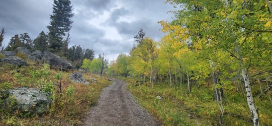
Looking back.
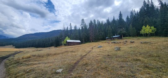
Slough Creek Patrol Cabin.
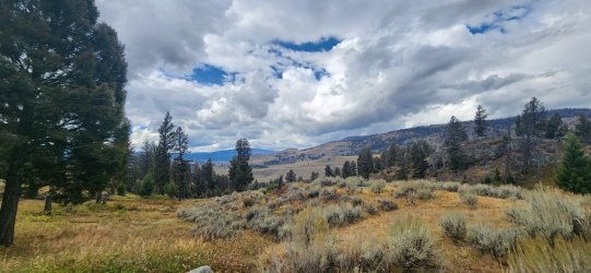
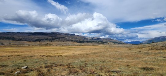
Love those wide open spaces.
Very near backcountry site 2S3 I saw a bison way in the distance that just didn't look right - probably because it was actually a grizzly bear. It was a long way off - probably almost half a mile, but it became clear after a while that it was eagerly feasting on a dead ungulate. My guess was - and still is - an elk, but it was hard to tell for certain. The bear was trying to drag it away - presumably somewhere 'safer' - but wasn't having much luck. We observed the bear eating and dragging around the carcass for a long time, before the bear wandered off - hopefully for a nice nap. Near impossible to get a good picture w/ only a phone and monocular, but I did my best. The pictures aren't great, but the moment was incredible. I'm very OK with that.
Can you spot the bear?
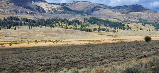
Holding the monocular up against the phone.
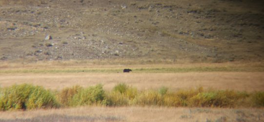
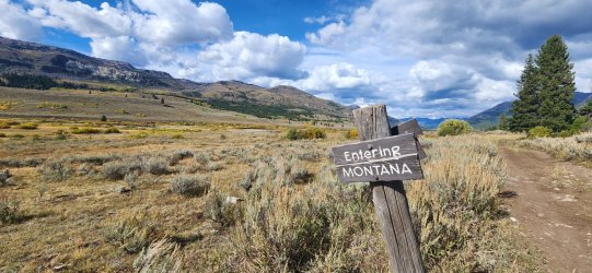
Always cool to walk from one state to another - something that was actually pretty common for me this year.
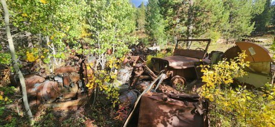
The Silver Tip Ranch. Looks pretty swanky... not a huge fan of all the garbage they have dumped just outside the national park though.
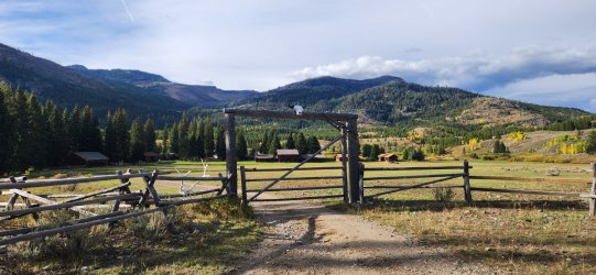
But I will begrudgingly admit that some of the old vehicles and machinery were kinda cool.
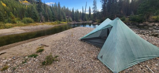
Camping options were a little more limited than I expected, but we found a really cool spot on an 'island' of Slough Creek. Little did we know though that this was very close to an active beaver lodge. In fact, I'd have never camped here if I'd noticed it before nightfall. After the sun set we could hear - and barely see - the little guys moving through the water and on the opposite shoreline. I slept straight through the night, but my brother reported hearing loud slapping sounds against the water throughout the night. In the brighter light of morning, the fuzzy critters were out of sight but we noticed very large amounts of scat and tracks that probably should've clued us in the night before. Pretty cool experience.
Day 2: Silver Tip Ranch to Frenchy's Meadow [3.83 mi; +216'/-79']
Owing to our longer Day 1, our plan for Day 2 was exceptionally short. I just wanted to get to the north side of Frenchy's Meadow and explore a bit - and that's exactly what we did. The weather was a bit moody, but only small amounts of actual rain.
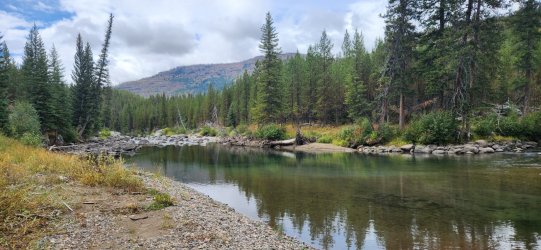
You can see the small-ish beaver lodge up against the opposite bank here. No noticeable damming of the creek, but in retrospect the conditions here were pretty naturally beaver-friendly.
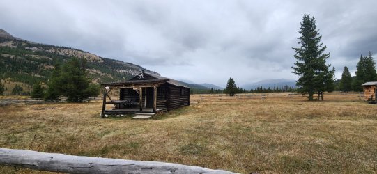
Forest Service cabin.
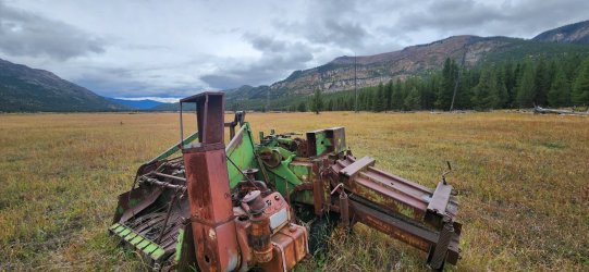
A fair bit of 'historical trash' in Frenchy's Meadow.
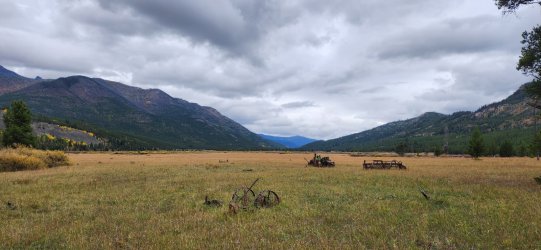
My brother was more fascinated by these things than I was, but I couldn't help snapping a few pictures.
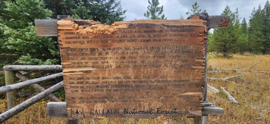
The 'interpretive sign' at Frenchy's Grave has seen better days. Interesting spot to visit.
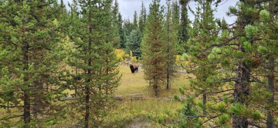
The bison this far into Montana might not be long for this world...
There were a couple outfitter camps with people/horses in the area, so we tucked ourselves away up on a hillside. Really nice spot for dinner though.
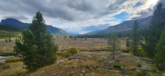
Day 3: Frenchy's Meadow to Buffalo Creek [9.22 mi; +2,377'/-1,551']
Pretty uneventful day - but the weather was wonderful and cool. Nothing wrong with a pleasant stroll through the forest. Slow and steady climb out of Frenchy's Meadow along South Fork Bull Creek. If I did it again I'd probably go over Lookout Mountain, but I was happy that we didn't see any other humans on this day - with one small exception at the very end.
Beautiful morning.
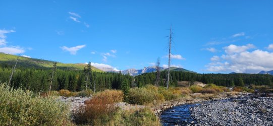
Pretty typical view for the entire climb.
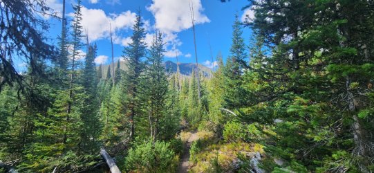
On the east side views opened up more and I really enjoyed it - this side was a much quicker drop back to the drainage though.
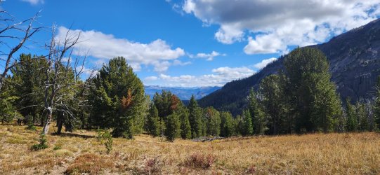
Looking back at the Beartooths.
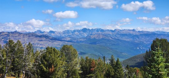
And ahead towards Buffalo Creek.
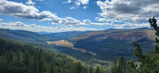
We stopped and chatted briefly with some Montana FWP folks that were staying at the Forest Service cabin on Buffalo Creek before setting up camp in a clearing nearby for the evening.
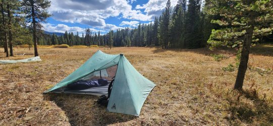
Day 4: Buffalo Creek to Buffalo Plateau [12.44 mi; +2,598'/-1,906']
I was anticipating that this would be my favorite day - and I don't think I was wrong. But it was fairly uneventful - almost completely devoid of animal life other than the occasional bird. Not even much sign that appeared to be less than weeks old.
The first part of the morning was a gentle uphill through fairly dense forest.
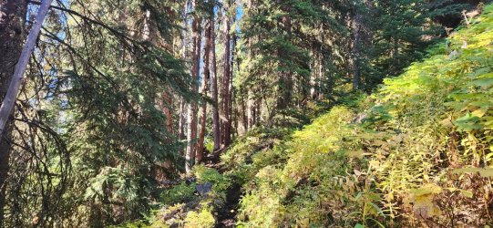
But it quickly began to open up.
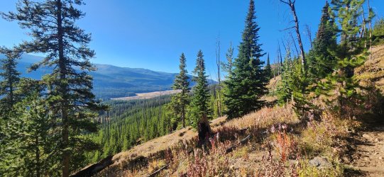
The very dry open meadows reminded me a lot of Pitchstone Plateau on the opposite side of the park.
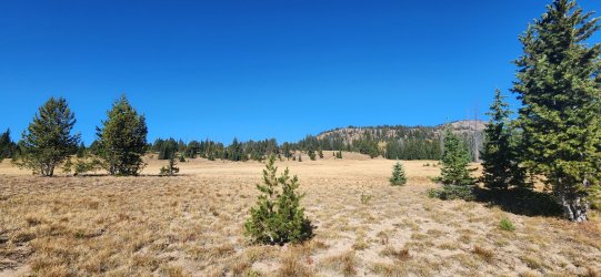
The high point of our route.
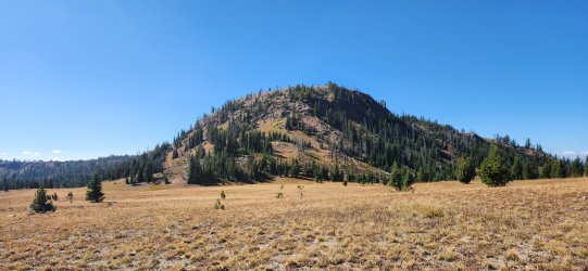
At the top! It was a little more scramble-y than expected, but nothing particularly difficult.
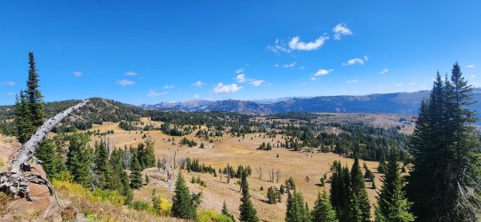
More wide open flat (and dry) walking.
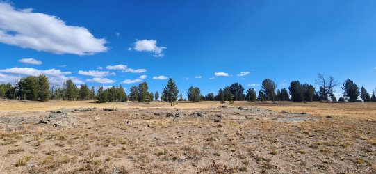
One of the only water sources of the day. It was cool enough that we still only ever carried a couple liters.
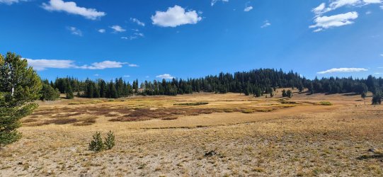
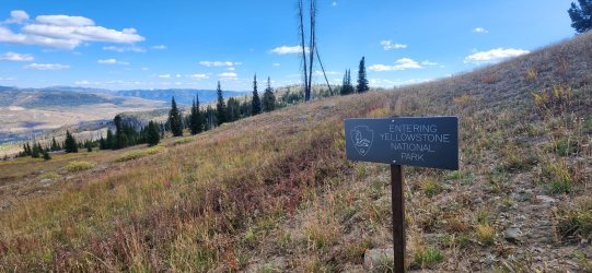
Dipping back into the park for the evening.
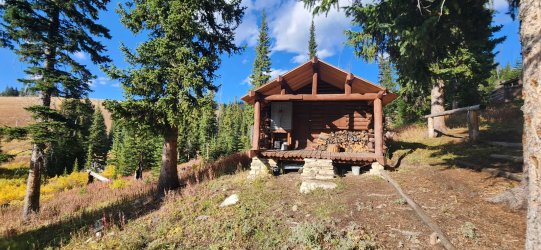
Buffalo Plateau Patrol Cabin. Nobody home.
Our only NP site of the trip was 2B1 Buffalo Plateau (not pictured). It was a nice enough spot, but I think I'd only stay there much earlier in the year if I visit again - the water situation was not great, but it was there. Also, my brother started coming down with something and was really feeling miserable. (I think I can safely say it wasn't my fault or even related to the trip specifically this time.) Still a pleasant evening and a wonderful night's sleep.
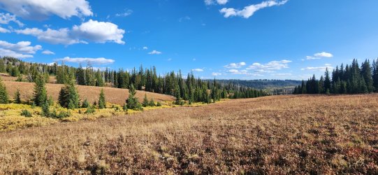
Day 5: Buffalo Plateau to Slough Creek TH [14.69 mi; +1,435'/-3,601']
The final day of our trip - and definitely a 'mixed bag'. My brother wasn't feeling any better than the night before, but staying still wasn't really an option. We'd originally planned on one more night out, but thought it might be best to get him back to civilization so we set out with the intention of making our way all the way back to Slough Creek. Conditions were great and the walking was fairly good even on the off-trail, but he was moving very slow. I try not to be one to worry about speed - at least not when I'm with other people - but this particular speed was gonna be a problem. After a quick break, I decided to strap his pack to mine and see if that got us moving a bit better - and thankfully it did. He still wasn't feeling great, but I do think it salvaged what could have otherwise been pretty rough. (Fair warning to future hiking partners: he is my younger brother, which puts him on a very short list of people I'd do this for - do not expect similar treatment. )
)
Like I said, the terrain was nice and easy and the conditions could hardly be beat!
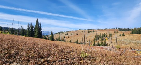
I really enjoyed this section on the edge of Buffalo Plateau. We found an old trail intermittently through here, but I know nothing of its history and it is not on any map I've seen.
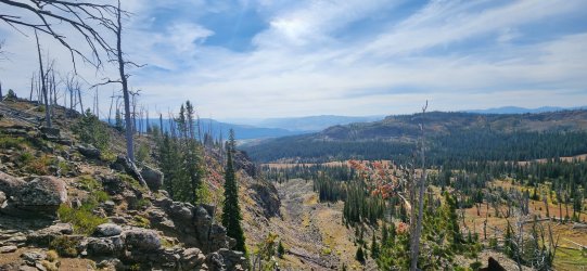
Fair bit of downfall, but easy enough to navigate.
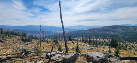
Back outside of the park and back onto the 'Poacher Trail'.
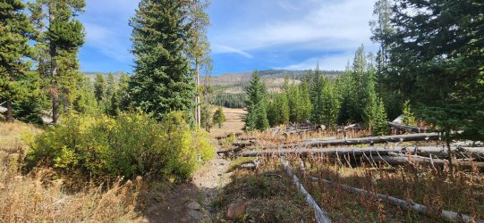
This section of Buffalo Creek was wonderful. We originally considered camping here and I'd certainly relish doing so in the future.
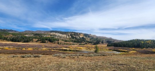
Nice little dam on Buffalo Creek.
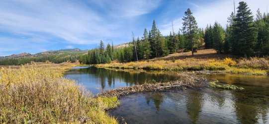
And back into the park!
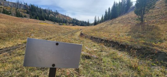
Our final stretch south along Buffalo Creek was pleasant and the fall colors were really starting to 'pop'.
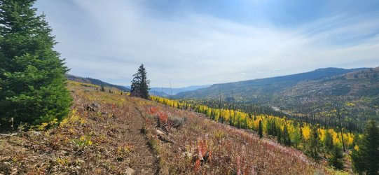
These little guys love to jump out and scare me... cute though.
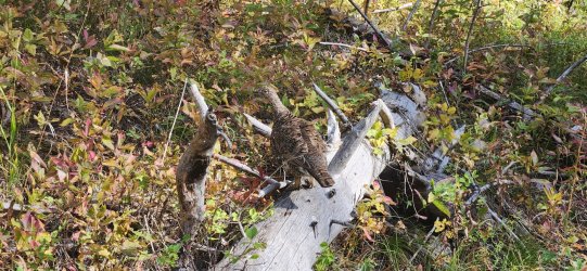
Baby aspens.
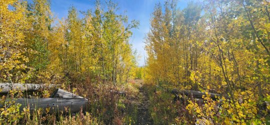
This section was short, but I loved the trees through here.
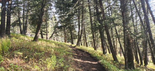
Getting back into the Slough Creek drainage.
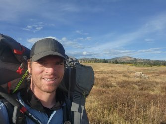
Yours truly - my brother's pack strapped to the top of mine.
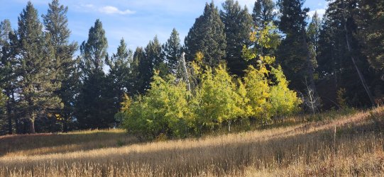
I dubbed this one the 'Upside Down Aspen'.
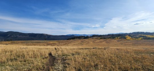
A new angle on Slough Creek.
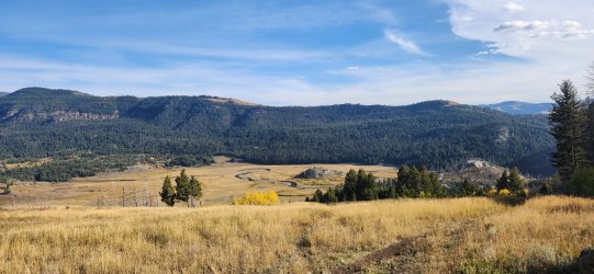
I enjoyed the cliffs along the Soldier's Trail down to the Slough Creek CG, but my phone died around here (only a couple miles left) and I didn't feel like pulling out my power bank. So that's the end...
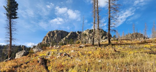
All-in-all it was a wonderful trip - the bear sighting on the first day was probably the highlight, but I'd also love to do the route again earlier in the year (or at the same time of year). Pretty easy route, but a nice taste of the GYE backcountry with very few other people outside of the Slough Creek drainage.
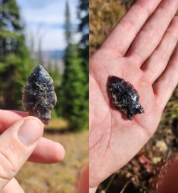
And one last little highlight - I didn't want to put this in context, because I'd rather not draw any attention to the actual location. We found this cool little arrowhead pretty far off the 'beaten path'. I suspect there might be more in the area, but we just enjoyed this little one and moved on.
I was kind of 'winging it' on the permit front for this one - I figured if we couldn't grab a spot in the park we'd just hike all the way past the boundary on our first day and this did end up being the case. But I also knew I wanted to leave my truck at the Slough Creek TH, so I needed some kind of permit. That ended up being a bit of an ordeal... first we showed up at the Roosevelt Backcountry Office (on the last day it was open). But the ranger there couldn't get his computer working and told us to go to Mammoth - which we did. Then in Mammoth the ranger there wasn't really a backcountry ranger and was having a hard time making our trip fit in 'the system'. This was reminiscent of a few years ago when we almost got our permit rejected at the South Entrance, so my brother took to teasing me about it. (But this time it was much easier to get in touch with an actual backcountry ranger, so there was no such concern.) With permits finally in hand a couple hours later than planned and now knowing for certain we'd need to hike all the way out of the park, we were finally on our way...
Day 1: Slough Creek TH to Silver Tip Ranch [12.31 mi; +1,259'/-747']
Our first day was wonderful - even with the permitting delays. I'd hiked Slough Creek to the park border in the past as a day hike, but was very excited to continue on past the boundary. This was also our best wildlife day - though still fairly sparse - but seeing a grizzly on an active carcass while on foot is all I need to find 'Cloud Nine'.
Starting up to Slough Creek. Incredibly popular section of trail - so passed quite a few folks through here.

Looking back.

Slough Creek Patrol Cabin.

Love those wide open spaces.

Very near backcountry site 2S3 I saw a bison way in the distance that just didn't look right - probably because it was actually a grizzly bear. It was a long way off - probably almost half a mile, but it became clear after a while that it was eagerly feasting on a dead ungulate. My guess was - and still is - an elk, but it was hard to tell for certain. The bear was trying to drag it away - presumably somewhere 'safer' - but wasn't having much luck. We observed the bear eating and dragging around the carcass for a long time, before the bear wandered off - hopefully for a nice nap. Near impossible to get a good picture w/ only a phone and monocular, but I did my best.
Can you spot the bear?

Holding the monocular up against the phone.

Always cool to walk from one state to another - something that was actually pretty common for me this year.

The Silver Tip Ranch. Looks pretty swanky... not a huge fan of all the garbage they have dumped just outside the national park though.

But I will begrudgingly admit that some of the old vehicles and machinery were kinda cool.

Camping options were a little more limited than I expected, but we found a really cool spot on an 'island' of Slough Creek. Little did we know though that this was very close to an active beaver lodge. In fact, I'd have never camped here if I'd noticed it before nightfall. After the sun set we could hear - and barely see - the little guys moving through the water and on the opposite shoreline. I slept straight through the night, but my brother reported hearing loud slapping sounds against the water throughout the night. In the brighter light of morning, the fuzzy critters were out of sight but we noticed very large amounts of scat and tracks that probably should've clued us in the night before. Pretty cool experience.

Day 2: Silver Tip Ranch to Frenchy's Meadow [3.83 mi; +216'/-79']
Owing to our longer Day 1, our plan for Day 2 was exceptionally short. I just wanted to get to the north side of Frenchy's Meadow and explore a bit - and that's exactly what we did. The weather was a bit moody, but only small amounts of actual rain.
You can see the small-ish beaver lodge up against the opposite bank here. No noticeable damming of the creek, but in retrospect the conditions here were pretty naturally beaver-friendly.

Forest Service cabin.

A fair bit of 'historical trash' in Frenchy's Meadow.

My brother was more fascinated by these things than I was, but I couldn't help snapping a few pictures.

The 'interpretive sign' at Frenchy's Grave has seen better days. Interesting spot to visit.

The bison this far into Montana might not be long for this world...

There were a couple outfitter camps with people/horses in the area, so we tucked ourselves away up on a hillside. Really nice spot for dinner though.

Day 3: Frenchy's Meadow to Buffalo Creek [9.22 mi; +2,377'/-1,551']
Pretty uneventful day - but the weather was wonderful and cool. Nothing wrong with a pleasant stroll through the forest. Slow and steady climb out of Frenchy's Meadow along South Fork Bull Creek. If I did it again I'd probably go over Lookout Mountain, but I was happy that we didn't see any other humans on this day - with one small exception at the very end.
Beautiful morning.

Pretty typical view for the entire climb.

On the east side views opened up more and I really enjoyed it - this side was a much quicker drop back to the drainage though.

Looking back at the Beartooths.

And ahead towards Buffalo Creek.

We stopped and chatted briefly with some Montana FWP folks that were staying at the Forest Service cabin on Buffalo Creek before setting up camp in a clearing nearby for the evening.

Day 4: Buffalo Creek to Buffalo Plateau [12.44 mi; +2,598'/-1,906']
I was anticipating that this would be my favorite day - and I don't think I was wrong. But it was fairly uneventful - almost completely devoid of animal life other than the occasional bird. Not even much sign that appeared to be less than weeks old.
The first part of the morning was a gentle uphill through fairly dense forest.

But it quickly began to open up.

The very dry open meadows reminded me a lot of Pitchstone Plateau on the opposite side of the park.

The high point of our route.

At the top! It was a little more scramble-y than expected, but nothing particularly difficult.

More wide open flat (and dry) walking.

One of the only water sources of the day. It was cool enough that we still only ever carried a couple liters.

Dipping back into the park for the evening.

Buffalo Plateau Patrol Cabin. Nobody home.

Our only NP site of the trip was 2B1 Buffalo Plateau (not pictured). It was a nice enough spot, but I think I'd only stay there much earlier in the year if I visit again - the water situation was not great, but it was there. Also, my brother started coming down with something and was really feeling miserable. (I think I can safely say it wasn't my fault or even related to the trip specifically this time.) Still a pleasant evening and a wonderful night's sleep.

Day 5: Buffalo Plateau to Slough Creek TH [14.69 mi; +1,435'/-3,601']
The final day of our trip - and definitely a 'mixed bag'. My brother wasn't feeling any better than the night before, but staying still wasn't really an option. We'd originally planned on one more night out, but thought it might be best to get him back to civilization so we set out with the intention of making our way all the way back to Slough Creek. Conditions were great and the walking was fairly good even on the off-trail, but he was moving very slow. I try not to be one to worry about speed - at least not when I'm with other people - but this particular speed was gonna be a problem. After a quick break, I decided to strap his pack to mine and see if that got us moving a bit better - and thankfully it did. He still wasn't feeling great, but I do think it salvaged what could have otherwise been pretty rough. (Fair warning to future hiking partners: he is my younger brother, which puts him on a very short list of people I'd do this for - do not expect similar treatment.
Like I said, the terrain was nice and easy and the conditions could hardly be beat!

I really enjoyed this section on the edge of Buffalo Plateau. We found an old trail intermittently through here, but I know nothing of its history and it is not on any map I've seen.

Fair bit of downfall, but easy enough to navigate.

Back outside of the park and back onto the 'Poacher Trail'.

This section of Buffalo Creek was wonderful. We originally considered camping here and I'd certainly relish doing so in the future.

Nice little dam on Buffalo Creek.

And back into the park!

Our final stretch south along Buffalo Creek was pleasant and the fall colors were really starting to 'pop'.

These little guys love to jump out and scare me... cute though.

Baby aspens.

This section was short, but I loved the trees through here.

Getting back into the Slough Creek drainage.

Yours truly - my brother's pack strapped to the top of mine.

I dubbed this one the 'Upside Down Aspen'.

A new angle on Slough Creek.

I enjoyed the cliffs along the Soldier's Trail down to the Slough Creek CG, but my phone died around here (only a couple miles left) and I didn't feel like pulling out my power bank. So that's the end...


All-in-all it was a wonderful trip - the bear sighting on the first day was probably the highlight, but I'd also love to do the route again earlier in the year (or at the same time of year). Pretty easy route, but a nice taste of the GYE backcountry with very few other people outside of the Slough Creek drainage.
And one last little highlight - I didn't want to put this in context, because I'd rather not draw any attention to the actual location. We found this cool little arrowhead pretty far off the 'beaten path'. I suspect there might be more in the area, but we just enjoyed this little one and moved on.

