IntrepidXJ
ADVENTR
- Joined
- Jan 17, 2012
- Messages
- 3,487
The Maze and the Mesa | Day 5
Wednesday, April 13, 2011
We were up before sunrise on Wednesday for a quick breakfast so that we could squeeze in a quick hike down into Sheiks Canyon before Dave would have to head back home. First up in Sheiks Canyon was the Yellow House Ruin. The roof beams over part of this ruin still have the yucca lashings with knots tied to the roof beams. It’s a pretty amazing site.
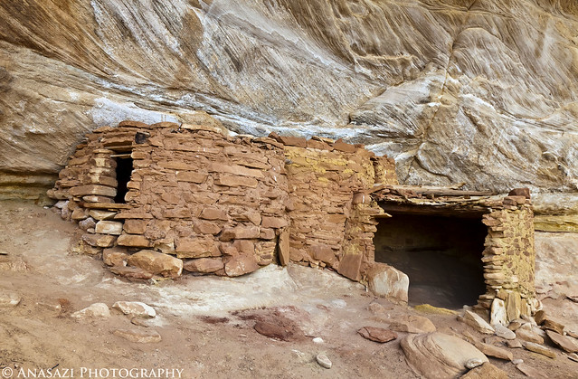
Yellow House by IntrepidXJ, on Flickr
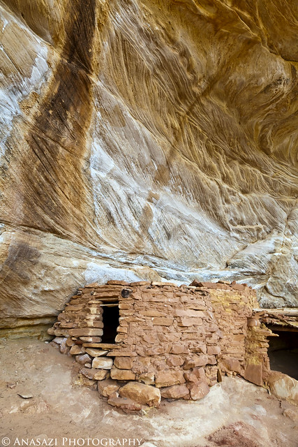
Yellow House Alcove by IntrepidXJ, on Flickr
A good look at the very cool roof structure still intact.
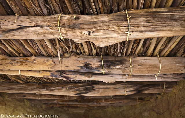
Yellow House Roof by IntrepidXJ, on Flickr
Jared takes a photo into the Yellow House.
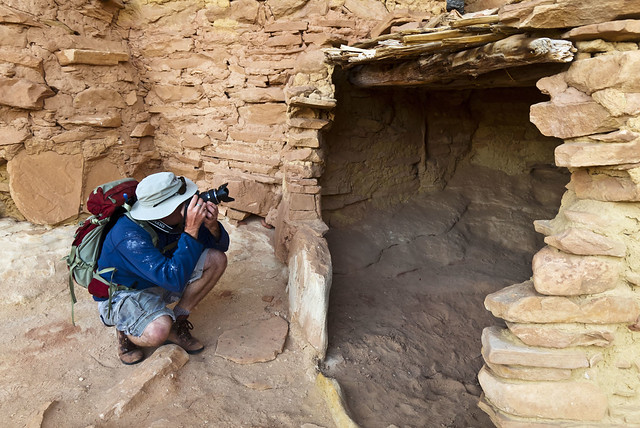
Jared and the Yellow House by IntrepidXJ, on Flickr
A little further down the canyon we came across another small ruin.
This small structure has a unique step right in front of the doorway.
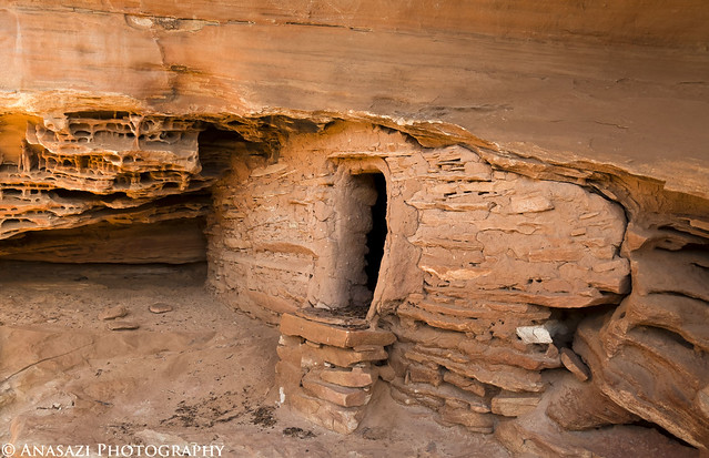
Welcome Mat by IntrepidXJ, on Flickr
It also has some faint white pictographs located just above, than you can see in this photo.
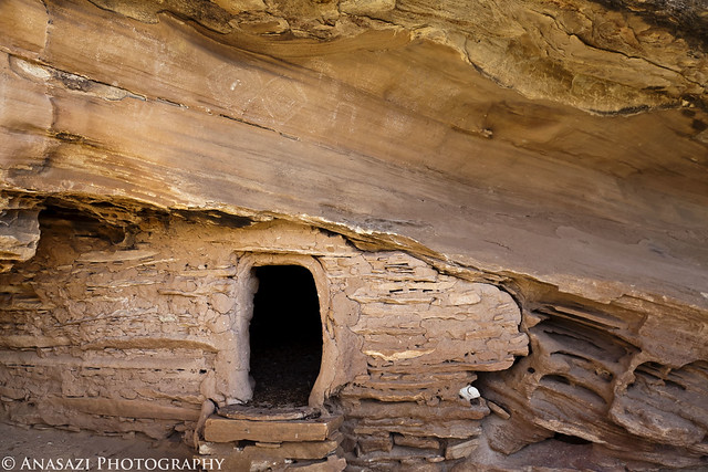
Ruin & Faint Pictographs by IntrepidXJ, on Flickr
As we continued down Sheiks Canyon there were a couple of steep talus slopes we needed to descend to get around some big pour-overs which slowed our hike down a little since we had to search for the way down a few times.
A view into Sheiks Canyon as we neared Grand Gulch.
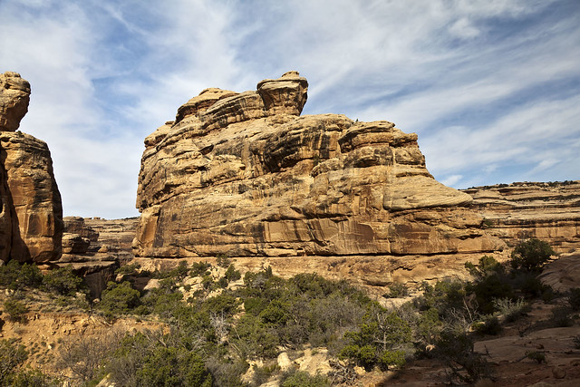
Sheiks Canyon by IntrepidXJ, on Flickr
Dave looking down into Grand Gulch from a viewpoint along our hike.
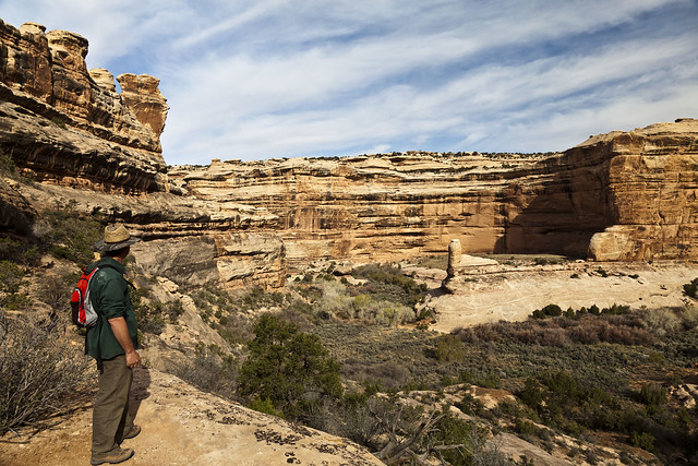
Dave and the Gulch by IntrepidXJ, on Flickr
A small granary we passed by on our way to The Green Mask alcove.
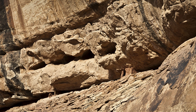
Tucked-Away Granary by IntrepidXJ, on Flickr
Once we got near the confluence with Grand Gulch we spotted the Green Mask alcove. It was easily spotted since it’s ceiling was covered with pictographs.
There were a lot of pictographs located near the ceiling of this alcove and out of reach.
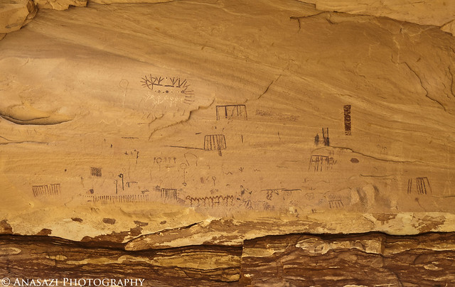
Ceiling Panels by IntrepidXJ, on Flickr
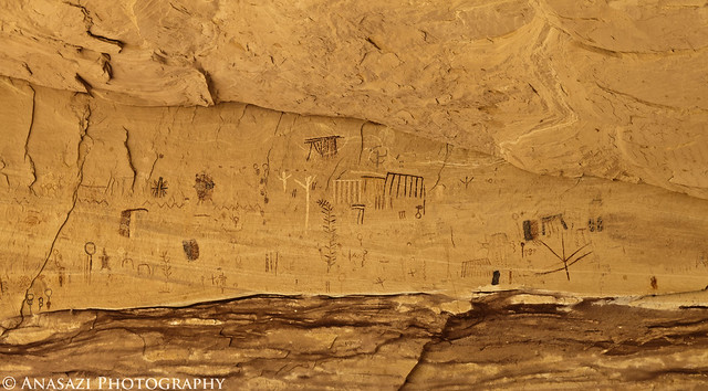
Ceiling Panels 2 by IntrepidXJ, on Flickr
Here’s a closeup of one of the more interesting and unique pictographs located above us.
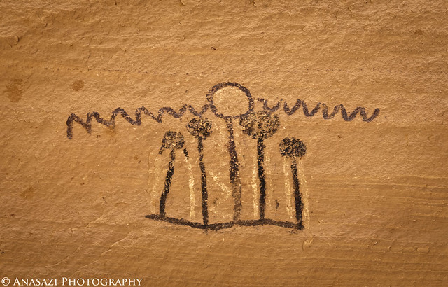
Alcove Pictograph by IntrepidXJ, on Flickr
There were plenty of ruins and rock art in the alcove to explore. We spent a good amount of time here.
This area had a bunch of pictographs and handprints, including the Breech Birth Panel.
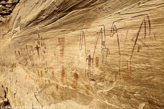
Headless Torso Wall by IntrepidXJ, on Flickr
A closer look at the left side.
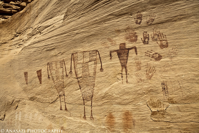
Handprints & Torsos by IntrepidXJ, on Flickr
This section is called the Breech Birth Panel. Apparently, some people believe this scene represents a C-section birth.
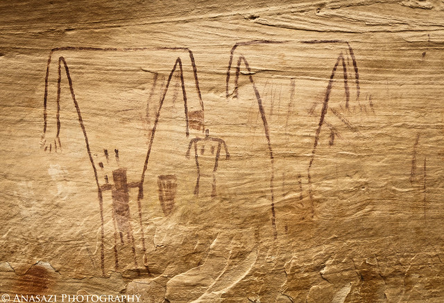
Breech Birth Panel by IntrepidXJ, on Flickr
Jared takes a photo of some rock art.
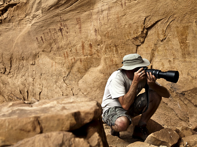
Shooting Rock Art by IntrepidXJ, on Flickr
The back of this ruin appears to have been painted.
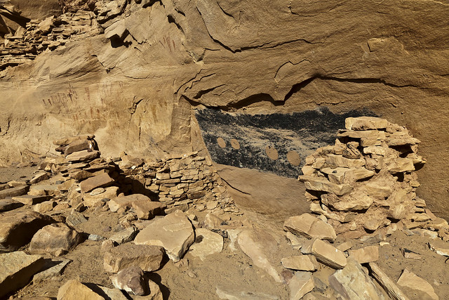
Painted Walls by IntrepidXJ, on Flickr
A closer look reveals that mud circles were applied to the back wall inside this ruin and then spirals were created. This is the first time I have come across this, and it was pretty cool.
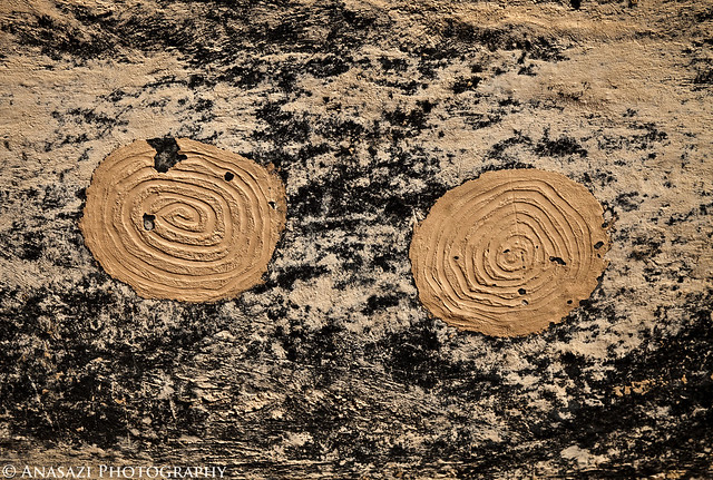
Mud Spirals by IntrepidXJ, on Flickr
The entrance to a small room or granary located along the back of the alcove.
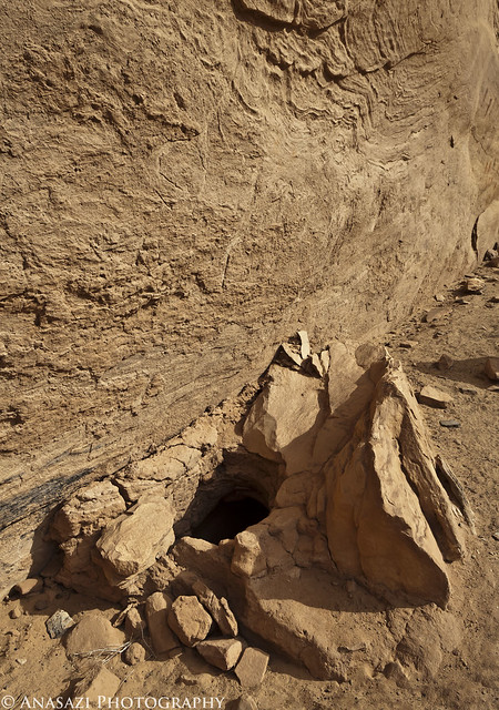
Hidden Room by IntrepidXJ, on Flickr
I was unable to climb up to these anthropomorphic pictographs located in a ruin on a ledge above us, so this is the best shot I was able to get.
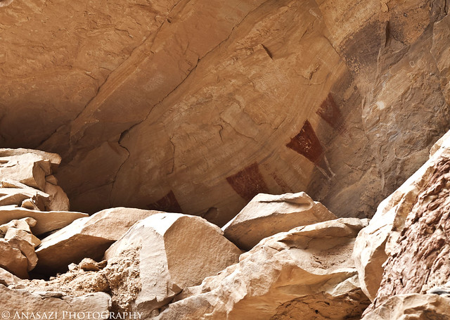
Upper Panel by IntrepidXJ, on Flickr
More faint white pictographs. The lower bird-like figure in white reminds me of a turkey.
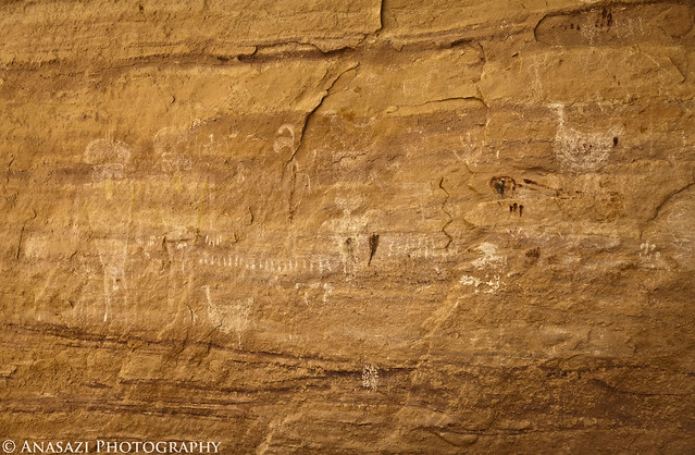
White Turkey Panel by IntrepidXJ, on Flickr
Two faint anthropomorphic figures with headdress-like designs where their heads should be.
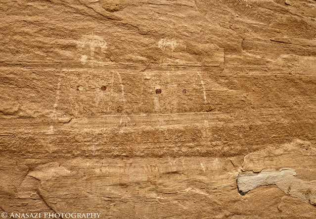
Faint Headress Figures by IntrepidXJ, on Flickr
Of course, I had to get a photo of The Green Mask before we left. I wish I had dragged my 100-400mm lens along on this hike so I could have got a better shot of this, but here’s a cropped shot of The Green Mask.
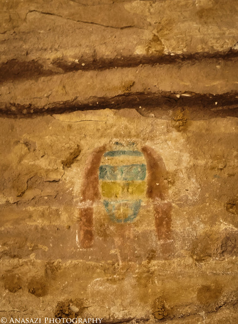
The Green Mask by IntrepidXJ, on Flickr
We spent plenty of time exploring and taking photos before turning around and heading back up canyon. When we reached camp, Dave made Jared and I some awesome breakfast burritos before he left us to head home. They were very delicious!
After Dave left, Jared and I headed to the Kane Gulch Ranger Station so I could pickup my annual Cedar Mesa hiking permit for the season. From there we drove over to the Lime Creek Towers, which are situated on top of a knoll near the head of Lime Creek Canyon.
Ruins of one of the towers at the head of Lime Creek Canyon.
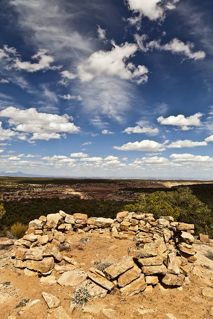
Lime Creek Tower Ruins by IntrepidXJ, on Flickr
Jared photographs the ruins of the towers.
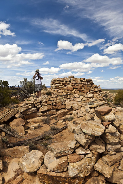
Photographing the Lime Creek Towers by IntrepidXJ, on Flickr
When we finished exploring those ruins we continued on down the road, unsure of where it would take us. After follwoing it for a few miles we reached a nice overlook of the Valley of the Gods.
A nice overlook of Valley of the Gods.
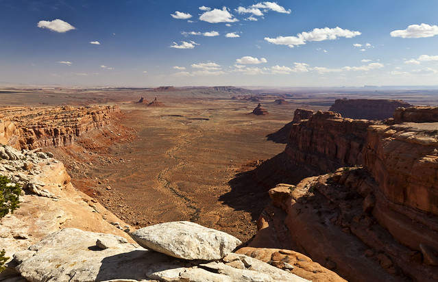
Valley of the Gods Overlook by IntrepidXJ, on Flickr
While at the overlook I finally got cell phone signal for the first time since Saturday and was able to call Amanda, which was nice. I finished up my phone call and then we headed back to the highway and over to Muley Point for a quick stop.
A view from Muley Point in black and white with Monument Valley in the background.
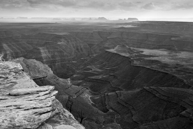
Muley Point View by IntrepidXJ, on Flickr
Is it ever not windy up here? Jared battles the wind to get a shot.
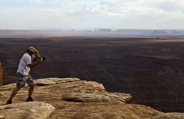
Windy by IntrepidXJ, on Flickr
Then it was down the Moki Dugway and into Mexican Hat for some burgers at the Olde Bridge Grille and fuel for the Jeep. Before heading back to camp we stopped at Mexican Hat Rock to see if there would be a break in the clouds during sunset for some photos, but there never was. We returned to camp up on Cedar Mesa...and so did the strong winds!
>> Sheiks Canyon & The Green Mask Photo Gallery
Wednesday, April 13, 2011
We were up before sunrise on Wednesday for a quick breakfast so that we could squeeze in a quick hike down into Sheiks Canyon before Dave would have to head back home. First up in Sheiks Canyon was the Yellow House Ruin. The roof beams over part of this ruin still have the yucca lashings with knots tied to the roof beams. It’s a pretty amazing site.

Yellow House by IntrepidXJ, on Flickr

Yellow House Alcove by IntrepidXJ, on Flickr
A good look at the very cool roof structure still intact.

Yellow House Roof by IntrepidXJ, on Flickr
Jared takes a photo into the Yellow House.

Jared and the Yellow House by IntrepidXJ, on Flickr
A little further down the canyon we came across another small ruin.
This small structure has a unique step right in front of the doorway.

Welcome Mat by IntrepidXJ, on Flickr
It also has some faint white pictographs located just above, than you can see in this photo.

Ruin & Faint Pictographs by IntrepidXJ, on Flickr
As we continued down Sheiks Canyon there were a couple of steep talus slopes we needed to descend to get around some big pour-overs which slowed our hike down a little since we had to search for the way down a few times.
A view into Sheiks Canyon as we neared Grand Gulch.

Sheiks Canyon by IntrepidXJ, on Flickr
Dave looking down into Grand Gulch from a viewpoint along our hike.

Dave and the Gulch by IntrepidXJ, on Flickr
A small granary we passed by on our way to The Green Mask alcove.

Tucked-Away Granary by IntrepidXJ, on Flickr
Once we got near the confluence with Grand Gulch we spotted the Green Mask alcove. It was easily spotted since it’s ceiling was covered with pictographs.
There were a lot of pictographs located near the ceiling of this alcove and out of reach.

Ceiling Panels by IntrepidXJ, on Flickr

Ceiling Panels 2 by IntrepidXJ, on Flickr
Here’s a closeup of one of the more interesting and unique pictographs located above us.

Alcove Pictograph by IntrepidXJ, on Flickr
There were plenty of ruins and rock art in the alcove to explore. We spent a good amount of time here.
This area had a bunch of pictographs and handprints, including the Breech Birth Panel.

Headless Torso Wall by IntrepidXJ, on Flickr
A closer look at the left side.

Handprints & Torsos by IntrepidXJ, on Flickr
This section is called the Breech Birth Panel. Apparently, some people believe this scene represents a C-section birth.

Breech Birth Panel by IntrepidXJ, on Flickr
Jared takes a photo of some rock art.

Shooting Rock Art by IntrepidXJ, on Flickr
The back of this ruin appears to have been painted.

Painted Walls by IntrepidXJ, on Flickr
A closer look reveals that mud circles were applied to the back wall inside this ruin and then spirals were created. This is the first time I have come across this, and it was pretty cool.

Mud Spirals by IntrepidXJ, on Flickr
The entrance to a small room or granary located along the back of the alcove.

Hidden Room by IntrepidXJ, on Flickr
I was unable to climb up to these anthropomorphic pictographs located in a ruin on a ledge above us, so this is the best shot I was able to get.

Upper Panel by IntrepidXJ, on Flickr
More faint white pictographs. The lower bird-like figure in white reminds me of a turkey.

White Turkey Panel by IntrepidXJ, on Flickr
Two faint anthropomorphic figures with headdress-like designs where their heads should be.

Faint Headress Figures by IntrepidXJ, on Flickr
Of course, I had to get a photo of The Green Mask before we left. I wish I had dragged my 100-400mm lens along on this hike so I could have got a better shot of this, but here’s a cropped shot of The Green Mask.

The Green Mask by IntrepidXJ, on Flickr
We spent plenty of time exploring and taking photos before turning around and heading back up canyon. When we reached camp, Dave made Jared and I some awesome breakfast burritos before he left us to head home. They were very delicious!
After Dave left, Jared and I headed to the Kane Gulch Ranger Station so I could pickup my annual Cedar Mesa hiking permit for the season. From there we drove over to the Lime Creek Towers, which are situated on top of a knoll near the head of Lime Creek Canyon.
Ruins of one of the towers at the head of Lime Creek Canyon.

Lime Creek Tower Ruins by IntrepidXJ, on Flickr
Jared photographs the ruins of the towers.

Photographing the Lime Creek Towers by IntrepidXJ, on Flickr
When we finished exploring those ruins we continued on down the road, unsure of where it would take us. After follwoing it for a few miles we reached a nice overlook of the Valley of the Gods.
A nice overlook of Valley of the Gods.

Valley of the Gods Overlook by IntrepidXJ, on Flickr
While at the overlook I finally got cell phone signal for the first time since Saturday and was able to call Amanda, which was nice. I finished up my phone call and then we headed back to the highway and over to Muley Point for a quick stop.
A view from Muley Point in black and white with Monument Valley in the background.

Muley Point View by IntrepidXJ, on Flickr
Is it ever not windy up here? Jared battles the wind to get a shot.

Windy by IntrepidXJ, on Flickr
Then it was down the Moki Dugway and into Mexican Hat for some burgers at the Olde Bridge Grille and fuel for the Jeep. Before heading back to camp we stopped at Mexican Hat Rock to see if there would be a break in the clouds during sunset for some photos, but there never was. We returned to camp up on Cedar Mesa...and so did the strong winds!
>> Sheiks Canyon & The Green Mask Photo Gallery
