Udink
Still right here.
- Joined
- Jan 17, 2012
- Messages
- 1,748
On April 17th I drove down early for the semi-annual San Rafael geocaching event. I got off work that day at 1:00PM and got a few last-minute things ready just as Dave showed up so we could convoy to our campsite. I'd been having problems with the engine in the truck momentarily cutting out in the weeks before the event, but it always went away when the engine warmed up. During the drive south it cut out often and jerked violently each time due to the added drag from the camp trailer, but other than that it was an uneventful drive. We arrived at the planned campsite near the Temple Mountain Road/Goblin Valley Road junction, but there were three trailers already set up there. We parked our vehicles and walked over to the camp and spoke with the occupants for a while. They were "full-timers" from out of state who had been camped there for a week and said they'd be camped there for another week or more. I asked them if they'd send any geocacher traffic over the hill, then Dave and I drove west a short distance on the Temple Mountain Road to the large BLM campground, or, as it's affectionately known, the "people pasture." After we each set up camp, we went for an ATV ride to Taylor Flat to find a geocache whose coordinates were more than 20 miles off due to an error by the cache hider. I'd figured out roughly the correct coordinates and Dave and I found the cache pretty easily. We then returned to camp for dinner and turned in a bit early.
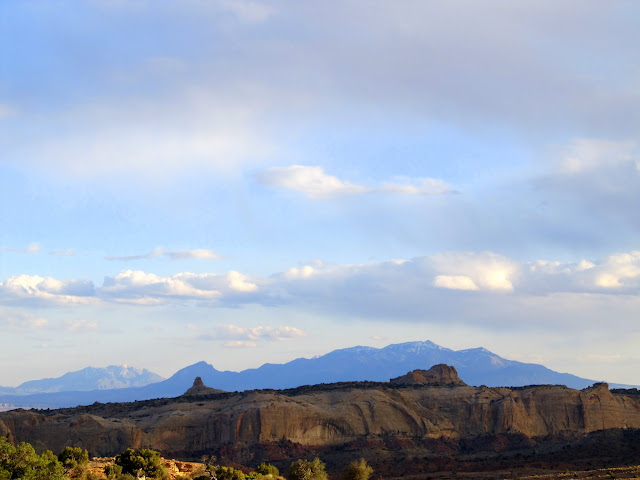
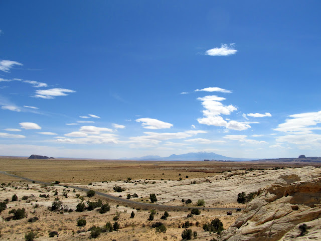
San Rafael Reef highlighted by the Henry Mountains in the background
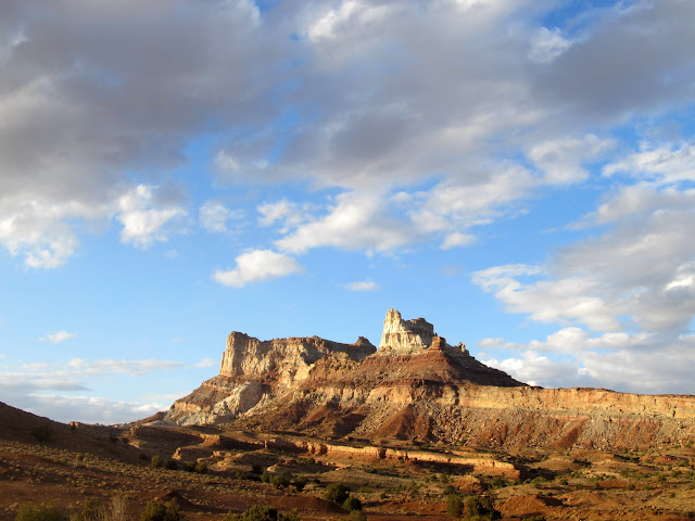
Temple Mountain
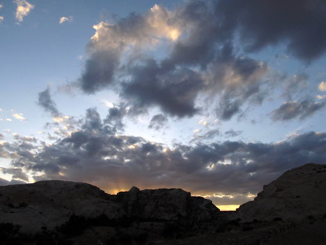
Sunset at camp
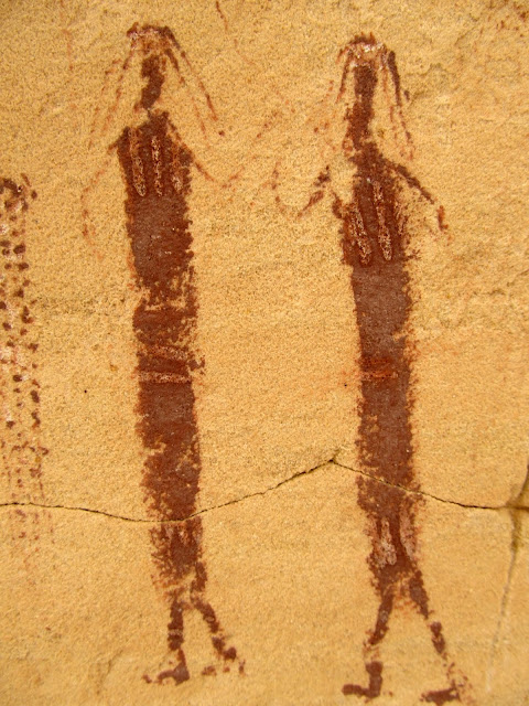
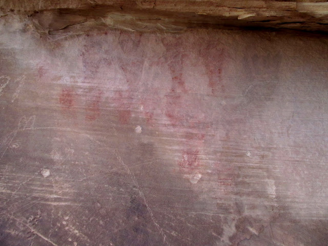
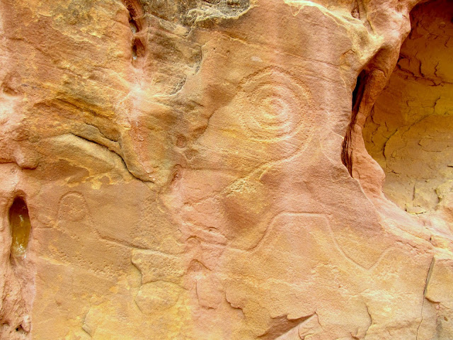
Dave drove in to Green River on Wednesday to find some oil because his ATV needed an oil change. I went for a hike up Wild Horse Creek to find some pictographs that I'd seen photos of online. I was planning a group hike up Wild Horse Creek on Saturday, but I wanted to find the rock art before the hike so I wasn't fumbling around for it with a large group. The coordinates I'd estimated from looking at photos turned out to be dead-on. I had walked right past the rock art alcove five years ago without knowing it was there. The pictographs there were absolutely amazing. There were some large figures with interesting shapes and small figures with very fine details. I spent about half an hour there enjoying the rock art, then rode my ATV back to camp. Dave still hadn't returned, so I hiked up and back down a small canyon near camp.
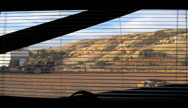
Morning view out of the trailer
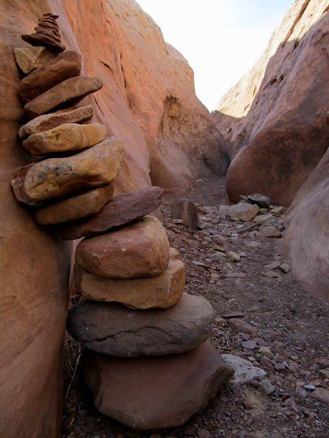
Cairn in Wild Horse Creek
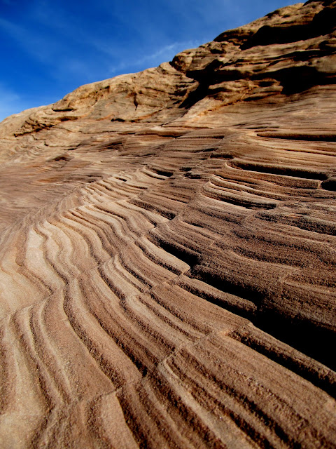
Sandstone layers in Wild Horse Creek
Wild Horse Creek pictographs
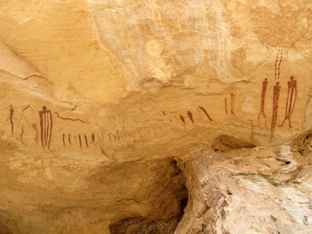
Wild Horse Creek pictographs
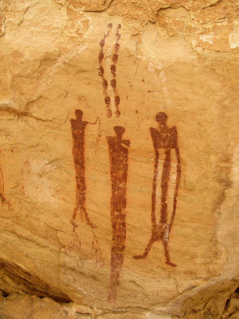
Wild Horse Creek pictographs
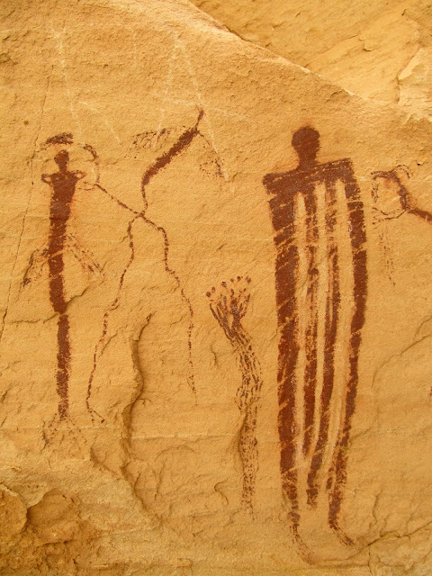
Wild Horse Creek pictographs
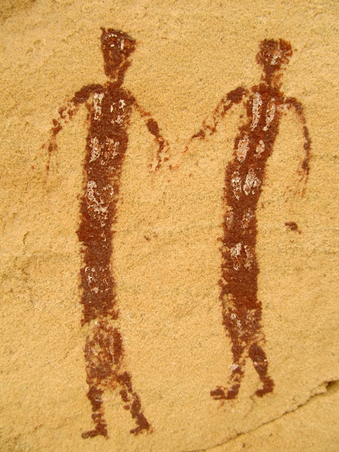
Wild Horse Creek pictographs
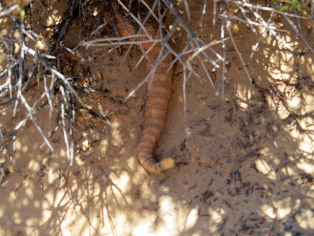
Dave was at camp when I returned from my short hike and I helped him a little bit with his oil change. We went for a ride to check out some pictographs I'd discovered a year and a half ago. Lighting conditions weren't ideal for photographing the pictographs, and Dave and I split up to do a little hiking around the sandstone hills. Not long after we split up, I heard the sound of a snake rattling behind me. I swore under my breath. I was no more than a couple hundred feet from the place where I'd seen a rattlesnake a year and a half before, and Torrey was running loose this time as well. I called Torrey over to me and put her leash on, then walked about 20 feet to where I'd heard the snake. It was starting to crawl under a bush, and I got a single out-of-focus photo of it before it disappeared into the brush.
Rattlesnake
View into the San Rafael Desert
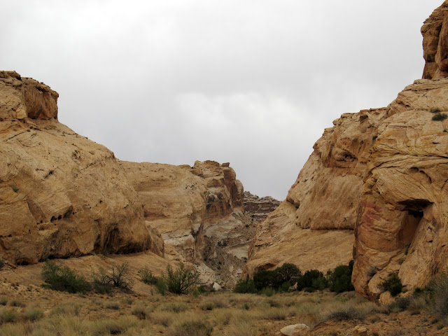
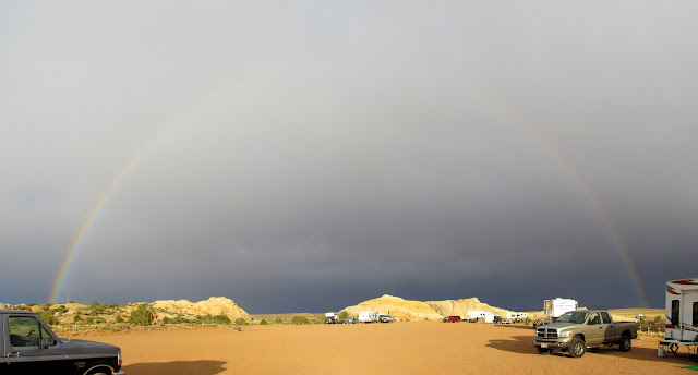
Late that afternoon I rode my ATV to Iron Wash and hiked up the canyon to look for some pictographs that I'd heard of from a couple of different people. It had become overcast and I could hear the wind roaring over the top of the canyon, but I was fairly well protected from it in the canyon's bottom. I scrambled up to an alcove to check it out, but found nothing interesting there. A large group of dirt bikes passed by going down the canyon. I expected to see them again after they reached the fence at the WSA boundary because when I parked my ATV there I didn't see a way around the fence. I found the pictographs just about where I thought they would be and spent only a few minutes there taking photos. I returned back down the canyon but never saw the motorcyclists, so when I got to the fence I looked for their tracks. Curiously enough, the tire tracks went right through the fence in the center of the drainage. I lifted the fence and realized that, even though it was freestanding, it could be lifted up about five feet--plenty to allow an ATV or motorcycle to pass under. On the ride back to camp I got hammered by cold, stinging, wind-blown rain. The short-lived storm was nearly gone when I got back to camp, though, and I was treated to a more sunny evening and a nice rainbow to the east. I returned to the pictographs where I'd seen the rattlesnake and got some photos with better lighting, then retired back to camp for the night.
Iron Wash
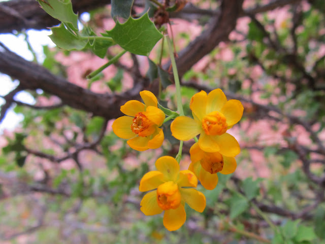
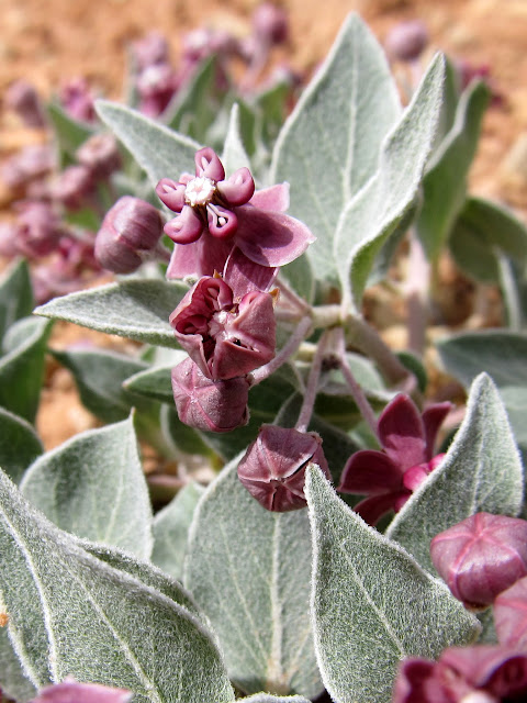
Fremont's Mahonia blossoms
Iron Wash pictographs
Rainbow at camp
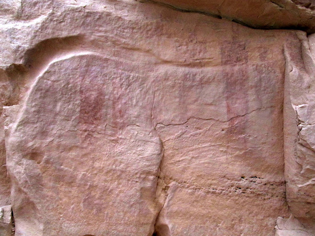
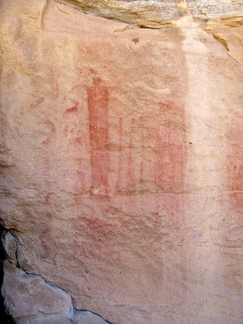
South Temple Wash pictographs
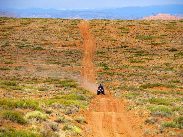
Thursday was an awesome day. I wanted to ride my ATV and cross over to the east side of Highway 24 to look for some rock art near Crow's Nest Spring and Cottonwood Wash. Getting there wasn't easy. The official travel map shows a legal route through Temple Wash starting at a gravel pit near the Temple Mountain/Goblin Valley junction and going east to UT-24. From there there's a short jog along the highway to a dirt road on the east side that would eventually lead us along the rim of Cottonwood Wash and to Crow's Nest Spring. As Dave and I rode east through Temple Wash we came upon a fence at some private property. Frustrated by the BLM's map issues, we rode cross-country to reach the paved Temple Mountain Road and continued east to Highway 24. After a short ride south, we turned east and finally made it to the other side of the highway. Since we'd had to alter our route, it took a long, roundabout route to the south, then east, north, and finally back to the west to reach Cottonwood Wash. The terrain along the way was mostly flat and uninteresting, but we did stop at Rattlesnake Butte and found some names carved into the sandstone from the early 1900s.
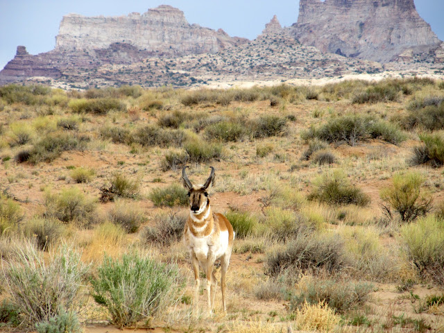
Pronghorn and Temple Mountain
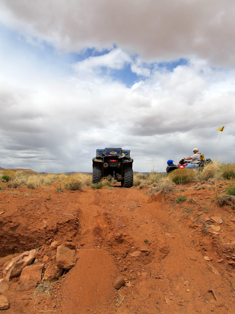
Dave riding in the San Rafael Desert
Wildflowers near Cottonwood Wash
After a steep climb out of a wash
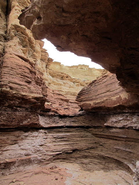
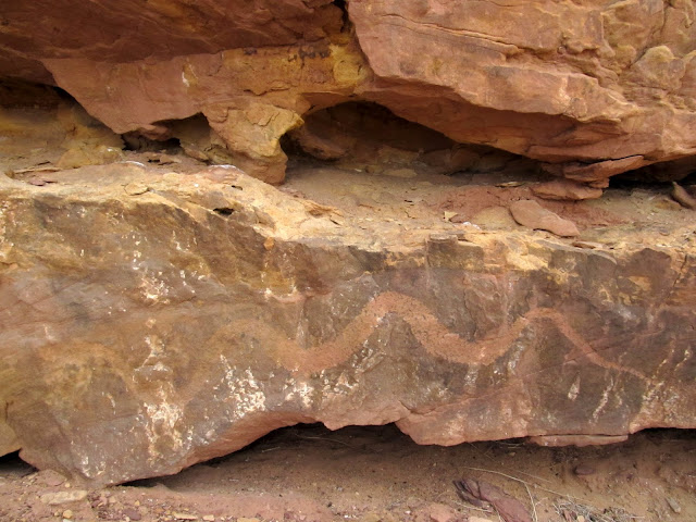
We reached Cottonwood Wash but since I didn't know where to even start looking for the rumored rock art, we just checked out the spring and an old corral, then moved along to Crow's Nest Spring. We parked the ATVs below the spring near the lone Cottonwood tree and hiked up to look into the three small canyons that merge just above the spring. I assumed the rock art would be in one of those three canyons because I couldn't see any after a cursory look near the spring. We hiked up the more easily accessed left fork first. It was shallow and narrow and quite interesting, but there was no rock art. We reached the top of the canyon where Dave turned around and returned to the spring while I crossed over into the middle fork. I had to walk the rim up-canyon for a while before I found a spot to drop into the canyon, then I followed it back to the spring. The middle fork was longer and more interesting than the left, and a light rain fell as I walked along the easy bottom. I got back to the confluence of the three canyons and found Dave at the top of a slope looking at a cliff--he'd found the rock art! There were several small petroglyph snakes that appeared to be emerging from natural holes in the cliff, one large snake petroglyph, a few interesting pinkish-orange pictograph figures, and a rake figure that was lightly scratched into the rock. After a pretty thorough check of the cliffs to make sure I wasn't missing any rock art, we took a much shorter and direct (though still not completely legal) route back to camp. We returned to find a few people had joined us at camp, and spent a nice evening around the fire with some old and new friends.
Canyon near Crow's Nest Spring
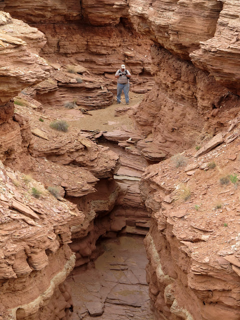
Canyon near Crow's Nest Spring
Snake petroglyphs
Large snake petroglyph
Faint pictographs
Faint lines scratched in a rake pattern

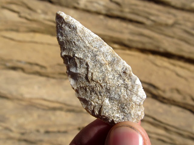
On Friday morning I went for a short two-mile hike just north of our camp. I was just wandering around hoping to find some rock art or anything else of interest. There were chert flakes littering the ground all along the sandy bottoms of the cliffs in the area, so I spent much of the time with my eyes on the ground. I saw one flint flake half-buried in the sand and flicked it with my finger, and it turned out to be a nice arrowhead! I normally like to take an in-situ photo of arrowheads before I pick them up, but I had to move this one to even realize what it was. What's surprising is that there were plenty of footprints in the wash--many people had walked right past it without realizing it was there. I turned around when I reached an impassible canyon just south of Temple Wash, but it looked interesting enough that I made a mental note to return another day and hike up the canyon from the east. I got back to camp and found Dave and his wife getting ready for an ATV ride. They invited me along, and Dave's wife borrowed Traci's ATV and we rode up North Temple Wash. We went as far as the old cabin on the east side of Temple Mountain, then returned to camp the same way we'd come in. On the way I was very surprised to spot some pictographs in North Temple. I'd been past that spot a few times without noticing it. We got back to camp and found even more people there. Traci showed up with the kids that afternoon, and slowly the rest of the group trickled in that night until quite late. I spun some steel wool on the Temple Mountain Road after sunset, had some drinks, and hung out around the fire until well into the morning.
Arrowhead found near South Temple Wash
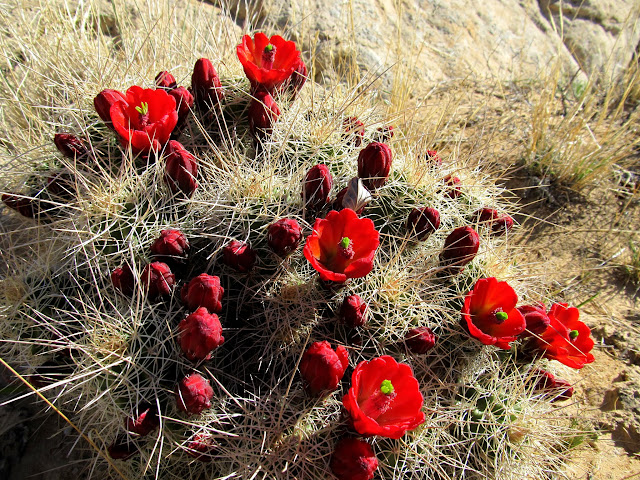
Claret Cup cactus blooms
North Temple Wash pictographs
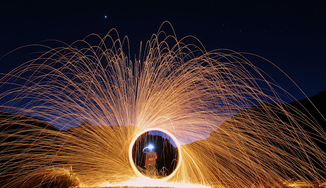
Spinning wool on Temple Mountain Road
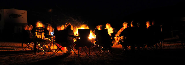
The group around the campfire
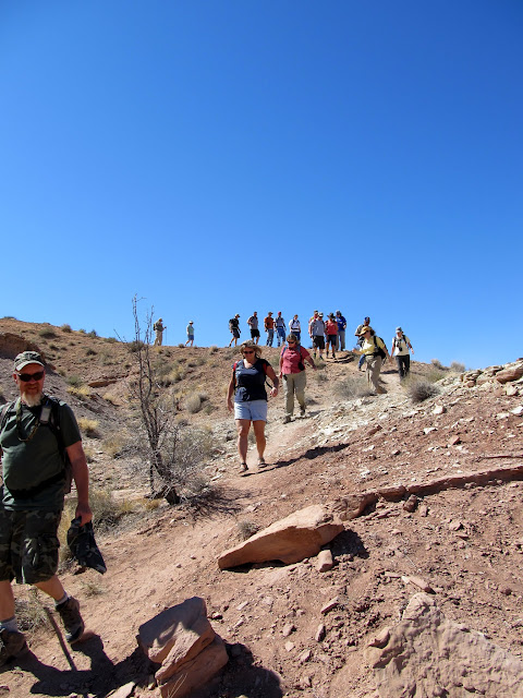
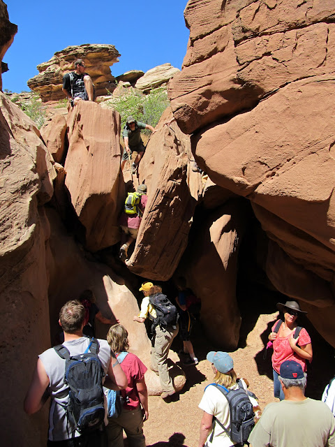
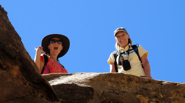
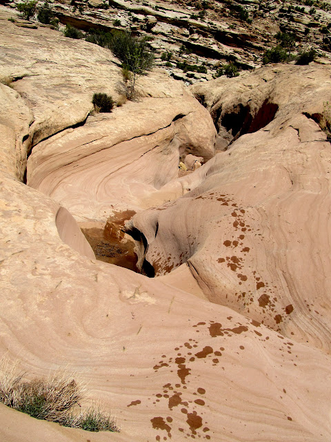
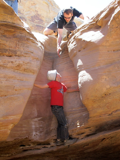
It took everyone a while to get going the next morning, but several of us set up a vehicle shuttle for the hike up Wild Horse Creek, then a large group of more than 20 of us started up the canyon. There were all different ages and hiking abilities represented in the group, so naturally we were strung out all along the canyon. I stayed somewhere around the middle most of the time, trying to keep an eye on my kids ahead of me while making sure nobody fell too far behind. There were three somewhat technical sections along the way that were easily bypassed, but several people chose the challenge of climbing up them. The first two weren't too difficult--I was able to lift Torrey up each of them and then haul myself up. The third was the most difficult. Traci took Torrey around, and I think Chris and I were the only ones to climb it ourselves, though Chris helped a few of the kids up it. Torrey was also happy to find a couple of water-filled potholes in the canyon. We reached the top of the canyon after about three and a half hours. After making sure everybody was accounted for, we drove back to camp.
The group hiking into Wild Horse Creek
The group surmounting one of the obstacles
Carrie and Jan hiking the rim around an obstacle
Pothole after Torrey took a dip
Chris helping Bradley up an obstacle
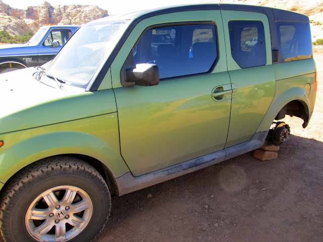
That afternoon Chris found a wheel missing from his Element with a note attached to one of the lugnuts. Jeremy had taken the wheel and hidden it, leaving GPS coordinates in its place. Chris and I rode ATVs over to the coordinates and found nothing but some reflective tacks in a wooden fencepost. Well played, Jeremy. We had to return at night with flashlights to follow a series of reflectors until we found more coordinates written on a fencepost, and those led us to the tire. We retired around the campfire, but most everyone turned in relatively early (meaning, after midnight).")
Honda Element minus one of its BFG All-Terrains
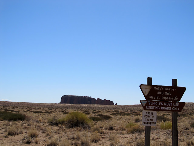
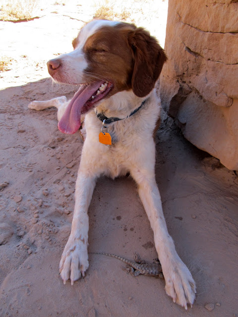
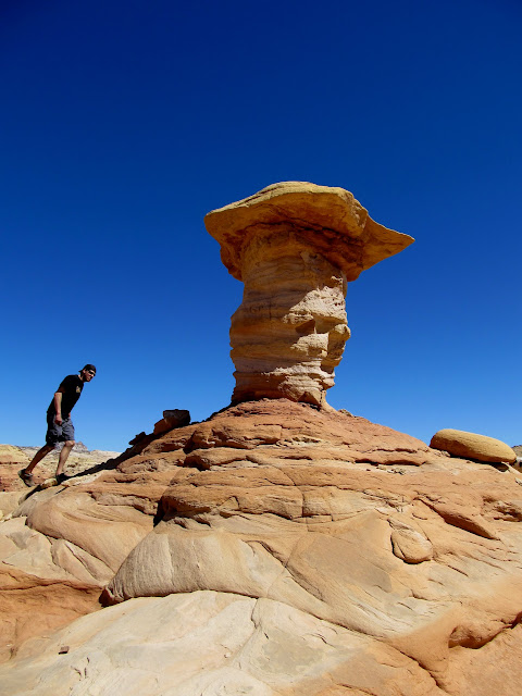
Most people had a longer drive home and pulled out of camp on Sunday morning. Chris and I went for a quick ATV ride toward Goblin Valley to check out Molly's Castle. I'd never been there and wanted to see what it was like, but it turns out I wasn't missing much. I was hoping to see a way to scramble to the top of the formation, but the cliffs looked pretty vertical around the top. We hiked around the base of the main formation for a while, and Torrey managed to catch a lizard. We rode back to camp and Chris headed home while Traci and I got the trailer packed up. She followed me home just in case I had any major problems with the truck, though besides the occasional sputtering it never completely died on me.
Road to Molly's Castle
Torrey and her hard-earned lizard
Chris at a formation outside of Goblin Valley
Full photo gallery here:
https://picasaweb.google.com/Dennis.Udink/SanRafaelSpring2012
GPS tracklog with photo waypoints (Google Earth .KMZ Format)
http://udink.org/geo/SanRafaelSpring2012.kmz
GPS tracklog with photo waypoints (Google Maps)
http://maps.google.com/maps?q=http://udink.org/geo/SanRafaelSpring2012.kmz&hl=en&sll=37.0625,-95.677068&sspn=40.545434,86.572266&t=h&z=11
Featured image for slideshow:

San Rafael Reef highlighted by the Henry Mountains in the background
Temple Mountain
Sunset at camp
Dave drove in to Green River on Wednesday to find some oil because his ATV needed an oil change. I went for a hike up Wild Horse Creek to find some pictographs that I'd seen photos of online. I was planning a group hike up Wild Horse Creek on Saturday, but I wanted to find the rock art before the hike so I wasn't fumbling around for it with a large group. The coordinates I'd estimated from looking at photos turned out to be dead-on. I had walked right past the rock art alcove five years ago without knowing it was there. The pictographs there were absolutely amazing. There were some large figures with interesting shapes and small figures with very fine details. I spent about half an hour there enjoying the rock art, then rode my ATV back to camp. Dave still hadn't returned, so I hiked up and back down a small canyon near camp.
Morning view out of the trailer
Cairn in Wild Horse Creek
Sandstone layers in Wild Horse Creek
Wild Horse Creek pictographs
Wild Horse Creek pictographs
Wild Horse Creek pictographs
Wild Horse Creek pictographs
Wild Horse Creek pictographs
Dave was at camp when I returned from my short hike and I helped him a little bit with his oil change. We went for a ride to check out some pictographs I'd discovered a year and a half ago. Lighting conditions weren't ideal for photographing the pictographs, and Dave and I split up to do a little hiking around the sandstone hills. Not long after we split up, I heard the sound of a snake rattling behind me. I swore under my breath. I was no more than a couple hundred feet from the place where I'd seen a rattlesnake a year and a half before, and Torrey was running loose this time as well. I called Torrey over to me and put her leash on, then walked about 20 feet to where I'd heard the snake. It was starting to crawl under a bush, and I got a single out-of-focus photo of it before it disappeared into the brush.
Rattlesnake
View into the San Rafael Desert
Late that afternoon I rode my ATV to Iron Wash and hiked up the canyon to look for some pictographs that I'd heard of from a couple of different people. It had become overcast and I could hear the wind roaring over the top of the canyon, but I was fairly well protected from it in the canyon's bottom. I scrambled up to an alcove to check it out, but found nothing interesting there. A large group of dirt bikes passed by going down the canyon. I expected to see them again after they reached the fence at the WSA boundary because when I parked my ATV there I didn't see a way around the fence. I found the pictographs just about where I thought they would be and spent only a few minutes there taking photos. I returned back down the canyon but never saw the motorcyclists, so when I got to the fence I looked for their tracks. Curiously enough, the tire tracks went right through the fence in the center of the drainage. I lifted the fence and realized that, even though it was freestanding, it could be lifted up about five feet--plenty to allow an ATV or motorcycle to pass under. On the ride back to camp I got hammered by cold, stinging, wind-blown rain. The short-lived storm was nearly gone when I got back to camp, though, and I was treated to a more sunny evening and a nice rainbow to the east. I returned to the pictographs where I'd seen the rattlesnake and got some photos with better lighting, then retired back to camp for the night.
Iron Wash
Fremont's Mahonia blossoms
Iron Wash pictographs
Rainbow at camp
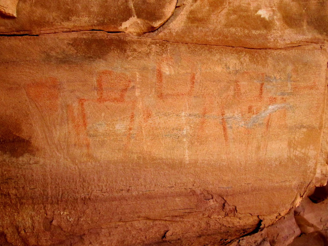
South Temple Wash pictographs
Thursday was an awesome day. I wanted to ride my ATV and cross over to the east side of Highway 24 to look for some rock art near Crow's Nest Spring and Cottonwood Wash. Getting there wasn't easy. The official travel map shows a legal route through Temple Wash starting at a gravel pit near the Temple Mountain/Goblin Valley junction and going east to UT-24. From there there's a short jog along the highway to a dirt road on the east side that would eventually lead us along the rim of Cottonwood Wash and to Crow's Nest Spring. As Dave and I rode east through Temple Wash we came upon a fence at some private property. Frustrated by the BLM's map issues, we rode cross-country to reach the paved Temple Mountain Road and continued east to Highway 24. After a short ride south, we turned east and finally made it to the other side of the highway. Since we'd had to alter our route, it took a long, roundabout route to the south, then east, north, and finally back to the west to reach Cottonwood Wash. The terrain along the way was mostly flat and uninteresting, but we did stop at Rattlesnake Butte and found some names carved into the sandstone from the early 1900s.
Pronghorn and Temple Mountain
Dave riding in the San Rafael Desert
Wildflowers near Cottonwood Wash
After a steep climb out of a wash
We reached Cottonwood Wash but since I didn't know where to even start looking for the rumored rock art, we just checked out the spring and an old corral, then moved along to Crow's Nest Spring. We parked the ATVs below the spring near the lone Cottonwood tree and hiked up to look into the three small canyons that merge just above the spring. I assumed the rock art would be in one of those three canyons because I couldn't see any after a cursory look near the spring. We hiked up the more easily accessed left fork first. It was shallow and narrow and quite interesting, but there was no rock art. We reached the top of the canyon where Dave turned around and returned to the spring while I crossed over into the middle fork. I had to walk the rim up-canyon for a while before I found a spot to drop into the canyon, then I followed it back to the spring. The middle fork was longer and more interesting than the left, and a light rain fell as I walked along the easy bottom. I got back to the confluence of the three canyons and found Dave at the top of a slope looking at a cliff--he'd found the rock art! There were several small petroglyph snakes that appeared to be emerging from natural holes in the cliff, one large snake petroglyph, a few interesting pinkish-orange pictograph figures, and a rake figure that was lightly scratched into the rock. After a pretty thorough check of the cliffs to make sure I wasn't missing any rock art, we took a much shorter and direct (though still not completely legal) route back to camp. We returned to find a few people had joined us at camp, and spent a nice evening around the fire with some old and new friends.
Canyon near Crow's Nest Spring
Canyon near Crow's Nest Spring
Snake petroglyphs
Large snake petroglyph
Faint pictographs
Faint lines scratched in a rake pattern
On Friday morning I went for a short two-mile hike just north of our camp. I was just wandering around hoping to find some rock art or anything else of interest. There were chert flakes littering the ground all along the sandy bottoms of the cliffs in the area, so I spent much of the time with my eyes on the ground. I saw one flint flake half-buried in the sand and flicked it with my finger, and it turned out to be a nice arrowhead! I normally like to take an in-situ photo of arrowheads before I pick them up, but I had to move this one to even realize what it was. What's surprising is that there were plenty of footprints in the wash--many people had walked right past it without realizing it was there. I turned around when I reached an impassible canyon just south of Temple Wash, but it looked interesting enough that I made a mental note to return another day and hike up the canyon from the east. I got back to camp and found Dave and his wife getting ready for an ATV ride. They invited me along, and Dave's wife borrowed Traci's ATV and we rode up North Temple Wash. We went as far as the old cabin on the east side of Temple Mountain, then returned to camp the same way we'd come in. On the way I was very surprised to spot some pictographs in North Temple. I'd been past that spot a few times without noticing it. We got back to camp and found even more people there. Traci showed up with the kids that afternoon, and slowly the rest of the group trickled in that night until quite late. I spun some steel wool on the Temple Mountain Road after sunset, had some drinks, and hung out around the fire until well into the morning.
Arrowhead found near South Temple Wash
Claret Cup cactus blooms
North Temple Wash pictographs
Spinning wool on Temple Mountain Road
The group around the campfire
It took everyone a while to get going the next morning, but several of us set up a vehicle shuttle for the hike up Wild Horse Creek, then a large group of more than 20 of us started up the canyon. There were all different ages and hiking abilities represented in the group, so naturally we were strung out all along the canyon. I stayed somewhere around the middle most of the time, trying to keep an eye on my kids ahead of me while making sure nobody fell too far behind. There were three somewhat technical sections along the way that were easily bypassed, but several people chose the challenge of climbing up them. The first two weren't too difficult--I was able to lift Torrey up each of them and then haul myself up. The third was the most difficult. Traci took Torrey around, and I think Chris and I were the only ones to climb it ourselves, though Chris helped a few of the kids up it. Torrey was also happy to find a couple of water-filled potholes in the canyon. We reached the top of the canyon after about three and a half hours. After making sure everybody was accounted for, we drove back to camp.
The group hiking into Wild Horse Creek
The group surmounting one of the obstacles
Carrie and Jan hiking the rim around an obstacle
Pothole after Torrey took a dip
Chris helping Bradley up an obstacle
That afternoon Chris found a wheel missing from his Element with a note attached to one of the lugnuts. Jeremy had taken the wheel and hidden it, leaving GPS coordinates in its place. Chris and I rode ATVs over to the coordinates and found nothing but some reflective tacks in a wooden fencepost. Well played, Jeremy. We had to return at night with flashlights to follow a series of reflectors until we found more coordinates written on a fencepost, and those led us to the tire. We retired around the campfire, but most everyone turned in relatively early (meaning, after midnight).
Honda Element minus one of its BFG All-Terrains
Most people had a longer drive home and pulled out of camp on Sunday morning. Chris and I went for a quick ATV ride toward Goblin Valley to check out Molly's Castle. I'd never been there and wanted to see what it was like, but it turns out I wasn't missing much. I was hoping to see a way to scramble to the top of the formation, but the cliffs looked pretty vertical around the top. We hiked around the base of the main formation for a while, and Torrey managed to catch a lizard. We rode back to camp and Chris headed home while Traci and I got the trailer packed up. She followed me home just in case I had any major problems with the truck, though besides the occasional sputtering it never completely died on me.
Road to Molly's Castle
Torrey and her hard-earned lizard
Chris at a formation outside of Goblin Valley
Full photo gallery here:
https://picasaweb.google.com/Dennis.Udink/SanRafaelSpring2012
GPS tracklog with photo waypoints (Google Earth .KMZ Format)
http://udink.org/geo/SanRafaelSpring2012.kmz
GPS tracklog with photo waypoints (Google Maps)
http://maps.google.com/maps?q=http://udink.org/geo/SanRafaelSpring2012.kmz&hl=en&sll=37.0625,-95.677068&sspn=40.545434,86.572266&t=h&z=11
Featured image for slideshow: