
A month and a half ago, or so, I did this hike with Mary and Alex. It was on Kevin's permit, but he had a family emergency and couldn't do the hike. Kevin came back about a week ago, and after a hike up the Lamar River a little ways (there's a trip report about it), we found we could get reservations for the same trip. We started at Delacy Creek Trailhead, in the upper right corner, went down along the west side of Shoshone Lake, then up to Lone Star Trailhead. It was a little over 20 miles.
We got our vehicles set, and off we went.
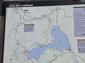
When I did it earlier this year, it was high summer. It was warm, if not downright hot. Now, it was cool to crisp in the morning, and the seasonal colors were out. Honestly, I loved both trips, but they were different.
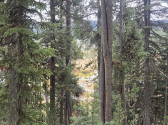
The trip down Delacy Creek has hiking through Lodgepole forests, and beside Delacy Creek in the woods and beside gorgeous meadows.
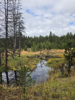
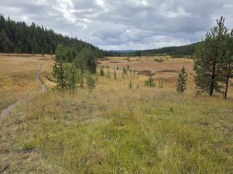
Maybe a mile or a mile and a half in, you start seeing the foot of the lake. It reminds me a little of getting to the big open area as you hike to Heart Lake.
Maybe I should be quiet for a while, and just look.
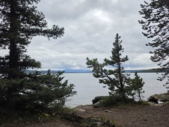
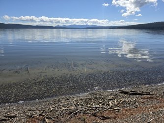
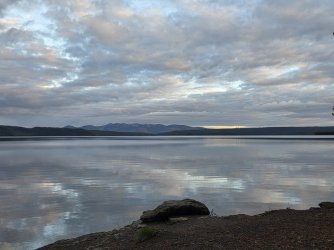
We got to our site with plenty of time to set up camp, and just look around. The lake was about 15 feet in front of the food pole, and we could see the notch where the Lewis Outlet is. In the distance, we could see the Red Range, and lots and lots of clouds.
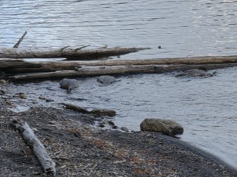
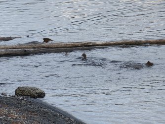
We sat in our chairs, and drank coffee, and watched a group of Merganzers. We had been told by the hikers who had spent the night before at the site, that at the outlet of the creek, there were lots of minnows. Indeed, there were a lot. When the merganzers went by, they made a bit of a loop, then a b-line to the center of minnow population. They had a great big lunch, then swam along the shore, continuing their slower fishing habit. It was interesting watching them.
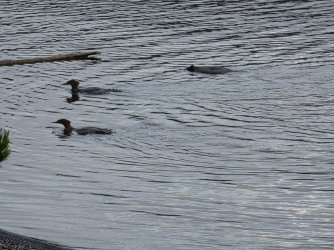
MINNOWS!!!!
When we got up, the fog was thick on the lake. We were both happy, though, that inside our tents, things were dry.
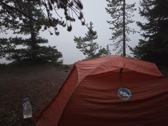
We ate and had coffee and hoped that the sun would come out and warm things up and burn off the fog.
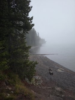
The sun came out a few times. In fact, once we thought it was the moon. We must have insulted it, because it went and hid again.
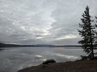
The merganzers came and went. They always stopped at Minnow Hollow.
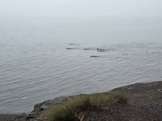
It was a little chilly, but the experience was worth any discomfort.
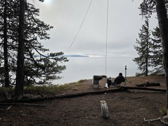
The area around camp had turned beautiful fall colors.
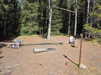
One last look at the camp kitchen area. It looks so stark without camp chairs and a camp stove and someone drinking coffee.
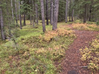
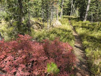
The trail followed the shore for a ways. It was cool and damp and felt every bit like fall. It smelled like fall, too.
I knew there was a trail that led to Pocket Lake. I'd seen it on the map. On my earlier hike, I'd looked for the turn off, but not noticed it. I asked the backcountry office folks about it, and they said it was no longer maintained. Since we were going right by it, we looked more closely. Kevin found the markings for the old trail. As they had said, it wasn't maintained, but it looked like a good enough trail. We were going our own way, though, and so walked on by.
The trail led back to the shore of the lake.
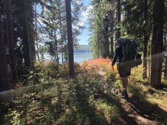
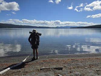
Hmmm, Kevin in a streaming glory.
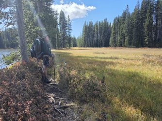
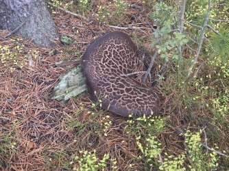
We came across a lot of mushrooms. I called this one a Tractor Seat mushroom. That might not be it's official name, though.
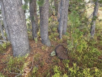
Closeup of the Tractor Seat mushroom.
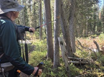
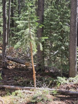
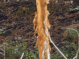
Kevin began seeing trees where elk had rubbed the velvet off their antlers.
Oddly, I didn't get any pictures of the next campsite. At this site, the food pole was separated from the lake by a little row of trees and brush. So we would move away from the food pole to eat, and look at the lake. The view from here was different from the previous site. Previously, we were south of the narrows, and saw the Lewis Outlet, and the Red Range. Here, we saw the east shore of the lake, and a number of little bends in the shore, and the peninsula that juts out to create the narrows. Whatever the details, this was the view, and it was nice.
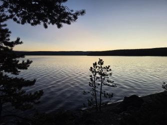
The moon came out.
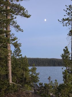
The tent area was up the hill, in trees. As dusk started, and we wandered up to our tents, IN the woods it was a good deal darker than it had been down by the water.
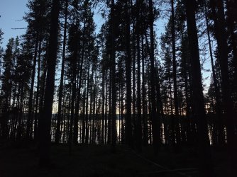
In the morning, it was foggy, but not as foggy as it had been the day before.
On this day, we were to hike to/through/by the Shoshone Geyser Basin. Kevin had wanted to go to the geyser basin for many years. I've been three times, and while I have treasured every trip, I figured that for me, taking the extra time and energy to hike in and poke around (on the trail), it wouldn't be best for me to do the side trip, so I planned to look at what I could from the main trail.
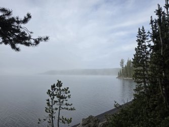
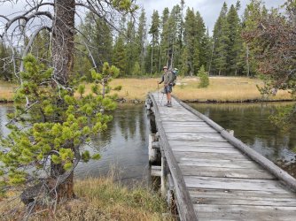
The bridge might need a little upkeep.
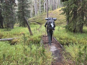
It was quiet. That quiet when there's fog and things are damp, and have that smell.
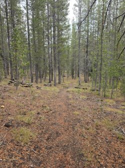
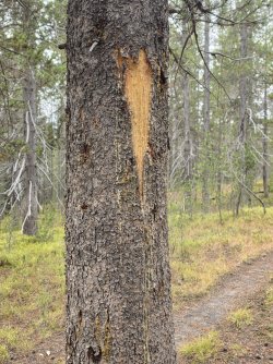
Kevin kept spotting trees that had been rubbed by elk. I remembered that Mary had pointed out many trees that had been scratched by bear. So, we found a few. Here's a bear tree.
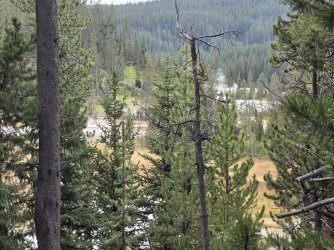
Kevin took the side trail to the Shoshone Geyser Basin. I poked along, looking that way. I saw things that steamed and squirted, mostly steamed, and then followed the trail away from the area.
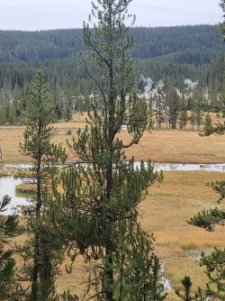
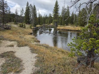
I had around two miles to go, along this nice stream.
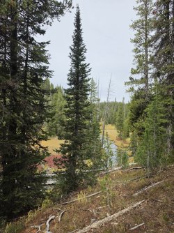
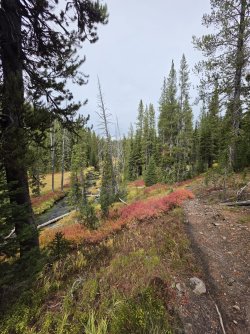
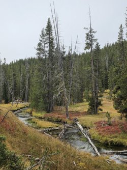
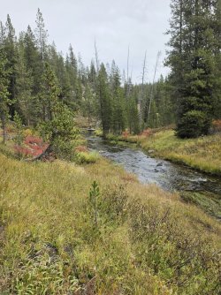
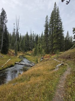
The map indicates that there is a horse trail that should go off to the left, cross the stream, and then bypass the geyser basin. I've been by here five times, and not seen it. I asked the backcountry office before the trip, and they said that trail was no longer a trail. I played with All Trails a bit, to see if I could see where the trail had been. All Trails kept indicating it was ahead, until all of a sudden it was behind. I had missed it again. I figured I'd see some branches and logs crossing the path, and an old rut, but nope.
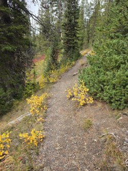
Thus far on the trip, my feet had remained dry. I knew that on this day, there were two places that I was going to have to cross a stream. It was chilly enough, that I didn't want wet feet, or eternally wet shoes. Still, I don't like balancing across trees because if you fall, you fall not just your height, but the height the log is over the water, and you get all wet and... . I balanced my way across and all was well with the world.
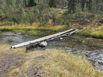
Kevin said later, that he balanced across the logs, but he looked for a few seconds and wondered what I had done. He decided I would take my chances with the rocks.
He was right.
I stayed dry, too!
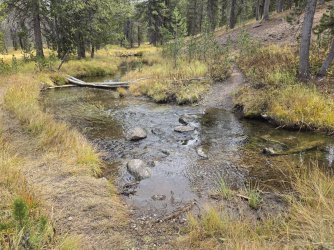
I wonder how many people have hiked down this path. (I wonder how many have gotten lost, too.)
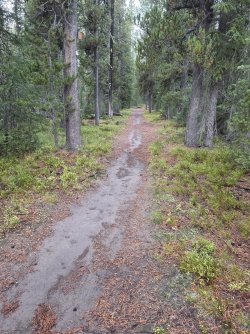
I wasn't sure if there was a type of mold growing on this, or if the moisture caused the little filaments to be visible.
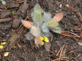
Hmmm. This is the second night in a row that I didn't get a picture of camp. Oh well. It looked like camp. There was a bear pole, and a little meadow with a stream for water, and a few flat spots in the trees for tents.
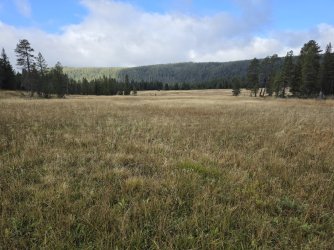
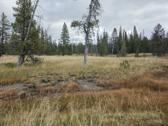
Our day started with climbing a big hill. It wasn't a mountain, it was a hill, and the stupid trail went up for quite a while. Then it was mostly flat for a while, and then it slam dunked us down into this nice meadow.
I hoped we'd see some elk. Even this summer, I saw a bull elk out here. Nope. No elk. No bison. Nothing. Well, it was pretty, but not animal-y.
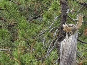
Kevin found a chippy to take a picture of. I decided that was a good idea. Just as I poked the button, chippy tossed his lunch treat, and headed off. Other than the merganzers, this was the wildlife on the trip.
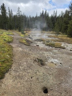
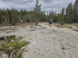
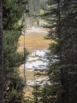
We began to pass thermal features at the edge of the trail. I don't think any of these are amazingly beautiful, like other areas of the park, but it's always nice to walk down a trail, and see the thermals, one of the things that make the park special.
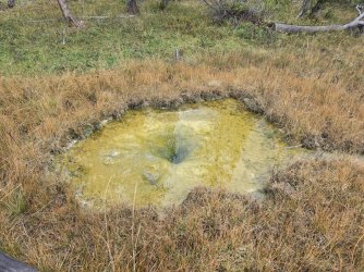
Everytime I walk along here, I am startled by at least one fumerole belching.
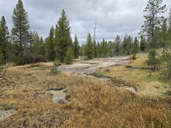
When you wear a pack, the park service trusts you to not fall in.
Or, they figure they can't put up enough fences to keep you out. Yeah. lets go with that.
Our campsite was just ahead, but since our tents were soaked, we had decided to hike on out. Now that I remember that, I think that's why there were no pictures of the previous night's camp. We had started preparing supper when the rain had decided to start to sprinkle. After an hour puttering in our tents, out of the rain, we were back fixing food, but being expeditious, as the rain could have returned. Maybe he has some pictures. I don't.
We got to Lone Star while the stump was steaming. We waited with about 8 other people. One man told a lady who had started talking with him that this was the best geyser in the park, maybe in the world. Well, ok. Wherever it is on that spectrum, we waited about an hour and watched the major eruption go off.
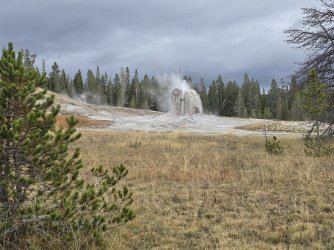
It started with some splashes.
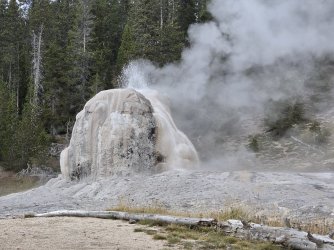
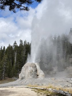
Then it did it's full show. It may not be the best I've ever seen it, but it was fair.
We hiked to the cars, and headed to Grant to the gas station for some hot coffee, but were surprised to find that it had closed for the season. Well pooh. It had been open four days before. Oh well.
We drove to Pahaska Teepee, and ate there.
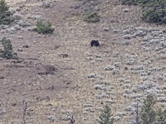
Kevin had already headed off to Cody. I backed out of my parking place, and looked up at the side of a mountain, and saw a nice grizzly, just minding it's business and eating. Yay!
We got our vehicles set, and off we went.
When I did it earlier this year, it was high summer. It was warm, if not downright hot. Now, it was cool to crisp in the morning, and the seasonal colors were out. Honestly, I loved both trips, but they were different.
The trip down Delacy Creek has hiking through Lodgepole forests, and beside Delacy Creek in the woods and beside gorgeous meadows.
Maybe a mile or a mile and a half in, you start seeing the foot of the lake. It reminds me a little of getting to the big open area as you hike to Heart Lake.
Maybe I should be quiet for a while, and just look.
We got to our site with plenty of time to set up camp, and just look around. The lake was about 15 feet in front of the food pole, and we could see the notch where the Lewis Outlet is. In the distance, we could see the Red Range, and lots and lots of clouds.
We sat in our chairs, and drank coffee, and watched a group of Merganzers. We had been told by the hikers who had spent the night before at the site, that at the outlet of the creek, there were lots of minnows. Indeed, there were a lot. When the merganzers went by, they made a bit of a loop, then a b-line to the center of minnow population. They had a great big lunch, then swam along the shore, continuing their slower fishing habit. It was interesting watching them.
MINNOWS!!!!
When we got up, the fog was thick on the lake. We were both happy, though, that inside our tents, things were dry.
We ate and had coffee and hoped that the sun would come out and warm things up and burn off the fog.
The sun came out a few times. In fact, once we thought it was the moon. We must have insulted it, because it went and hid again.
The merganzers came and went. They always stopped at Minnow Hollow.
It was a little chilly, but the experience was worth any discomfort.
The area around camp had turned beautiful fall colors.
One last look at the camp kitchen area. It looks so stark without camp chairs and a camp stove and someone drinking coffee.
The trail followed the shore for a ways. It was cool and damp and felt every bit like fall. It smelled like fall, too.
I knew there was a trail that led to Pocket Lake. I'd seen it on the map. On my earlier hike, I'd looked for the turn off, but not noticed it. I asked the backcountry office folks about it, and they said it was no longer maintained. Since we were going right by it, we looked more closely. Kevin found the markings for the old trail. As they had said, it wasn't maintained, but it looked like a good enough trail. We were going our own way, though, and so walked on by.
The trail led back to the shore of the lake.
Hmmm, Kevin in a streaming glory.
We came across a lot of mushrooms. I called this one a Tractor Seat mushroom. That might not be it's official name, though.
Closeup of the Tractor Seat mushroom.
Kevin began seeing trees where elk had rubbed the velvet off their antlers.
Oddly, I didn't get any pictures of the next campsite. At this site, the food pole was separated from the lake by a little row of trees and brush. So we would move away from the food pole to eat, and look at the lake. The view from here was different from the previous site. Previously, we were south of the narrows, and saw the Lewis Outlet, and the Red Range. Here, we saw the east shore of the lake, and a number of little bends in the shore, and the peninsula that juts out to create the narrows. Whatever the details, this was the view, and it was nice.
The moon came out.
The tent area was up the hill, in trees. As dusk started, and we wandered up to our tents, IN the woods it was a good deal darker than it had been down by the water.
In the morning, it was foggy, but not as foggy as it had been the day before.
On this day, we were to hike to/through/by the Shoshone Geyser Basin. Kevin had wanted to go to the geyser basin for many years. I've been three times, and while I have treasured every trip, I figured that for me, taking the extra time and energy to hike in and poke around (on the trail), it wouldn't be best for me to do the side trip, so I planned to look at what I could from the main trail.
The bridge might need a little upkeep.
It was quiet. That quiet when there's fog and things are damp, and have that smell.
Kevin kept spotting trees that had been rubbed by elk. I remembered that Mary had pointed out many trees that had been scratched by bear. So, we found a few. Here's a bear tree.
Kevin took the side trail to the Shoshone Geyser Basin. I poked along, looking that way. I saw things that steamed and squirted, mostly steamed, and then followed the trail away from the area.
I had around two miles to go, along this nice stream.
The map indicates that there is a horse trail that should go off to the left, cross the stream, and then bypass the geyser basin. I've been by here five times, and not seen it. I asked the backcountry office before the trip, and they said that trail was no longer a trail. I played with All Trails a bit, to see if I could see where the trail had been. All Trails kept indicating it was ahead, until all of a sudden it was behind. I had missed it again. I figured I'd see some branches and logs crossing the path, and an old rut, but nope.
Thus far on the trip, my feet had remained dry. I knew that on this day, there were two places that I was going to have to cross a stream. It was chilly enough, that I didn't want wet feet, or eternally wet shoes. Still, I don't like balancing across trees because if you fall, you fall not just your height, but the height the log is over the water, and you get all wet and... . I balanced my way across and all was well with the world.
Kevin said later, that he balanced across the logs, but he looked for a few seconds and wondered what I had done. He decided I would take my chances with the rocks.
He was right.
I stayed dry, too!
I wonder how many people have hiked down this path. (I wonder how many have gotten lost, too.)
I wasn't sure if there was a type of mold growing on this, or if the moisture caused the little filaments to be visible.
Hmmm. This is the second night in a row that I didn't get a picture of camp. Oh well. It looked like camp. There was a bear pole, and a little meadow with a stream for water, and a few flat spots in the trees for tents.
Our day started with climbing a big hill. It wasn't a mountain, it was a hill, and the stupid trail went up for quite a while. Then it was mostly flat for a while, and then it slam dunked us down into this nice meadow.
I hoped we'd see some elk. Even this summer, I saw a bull elk out here. Nope. No elk. No bison. Nothing. Well, it was pretty, but not animal-y.
Kevin found a chippy to take a picture of. I decided that was a good idea. Just as I poked the button, chippy tossed his lunch treat, and headed off. Other than the merganzers, this was the wildlife on the trip.
We began to pass thermal features at the edge of the trail. I don't think any of these are amazingly beautiful, like other areas of the park, but it's always nice to walk down a trail, and see the thermals, one of the things that make the park special.
Everytime I walk along here, I am startled by at least one fumerole belching.
When you wear a pack, the park service trusts you to not fall in.
Or, they figure they can't put up enough fences to keep you out. Yeah. lets go with that.
Our campsite was just ahead, but since our tents were soaked, we had decided to hike on out. Now that I remember that, I think that's why there were no pictures of the previous night's camp. We had started preparing supper when the rain had decided to start to sprinkle. After an hour puttering in our tents, out of the rain, we were back fixing food, but being expeditious, as the rain could have returned. Maybe he has some pictures. I don't.
We got to Lone Star while the stump was steaming. We waited with about 8 other people. One man told a lady who had started talking with him that this was the best geyser in the park, maybe in the world. Well, ok. Wherever it is on that spectrum, we waited about an hour and watched the major eruption go off.
It started with some splashes.
Then it did it's full show. It may not be the best I've ever seen it, but it was fair.
We hiked to the cars, and headed to Grant to the gas station for some hot coffee, but were surprised to find that it had closed for the season. Well pooh. It had been open four days before. Oh well.
We drove to Pahaska Teepee, and ate there.
Kevin had already headed off to Cody. I backed out of my parking place, and looked up at the side of a mountain, and saw a nice grizzly, just minding it's business and eating. Yay!
Attachments
Last edited: