IntrepidXJ
ADVENTR
- Joined
- Jan 17, 2012
- Messages
- 3,493
Friday - Sunday, July 10-12, 2015
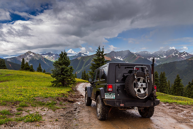
June was a busy month for me that prevented me from spending much time outside and then I got sick over the long Independence Day weekend, so it's been quite a while since I've been out hiking and camping and I really needed to get back into the mountains this weekend! Since I'm a little out of shape, I thought it would be a good idea to start out the season hiking a few easier peaks near Red Mountain Pass this weekend that I've thought about climbing for years. Diane and I left after work on Friday and drove through Ouray to one of our go-to campsites in Mineral Basin. We quickly setup camp at 11,600 feet elevation and were soon sleeping. I know that some people have trouble sleeping at higher elevations, but I almost always sleep well over 10,000 feet and this night was no exception.
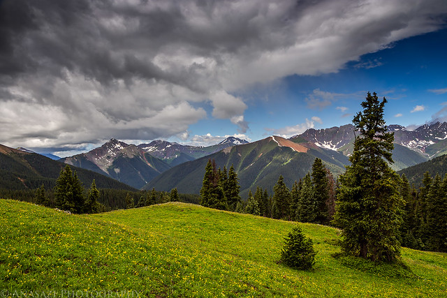
We woke up before sunrise on Saturday morning and made the short drive over to the other side of the valley to start climbing a few nearby 12,000 foot peaks. Our first goal was to reach the summit of McMillan Peak (12,804). It was a beautiful trail-less hike across the tundra with about 1,200 feet of elevation gain.
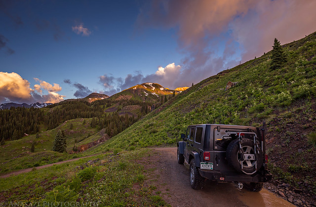
Driving down from Mineral Basin at sunrise.
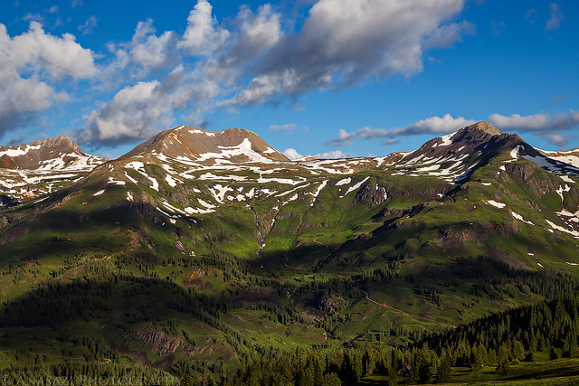
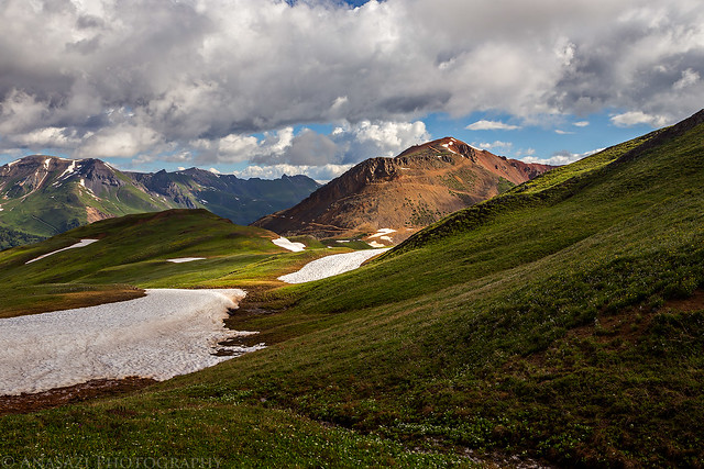
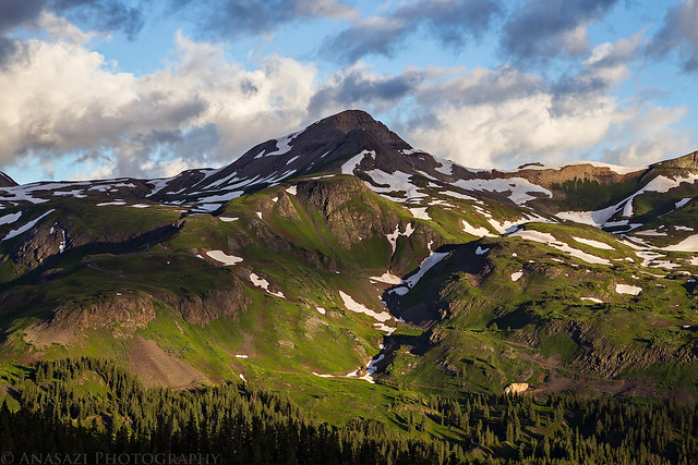
View across the valley towards Black Bear Pass as we started our hike. Trico Peak (13,321) is on the right and our campsite is hidden in the trees near the middle of the photo.
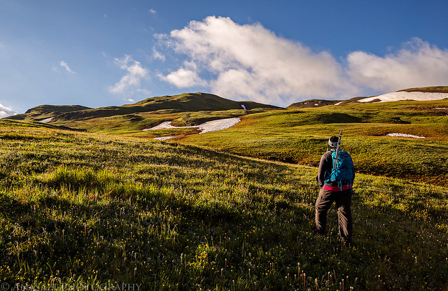
Hiking up the gentle tundra slope in the morning light.
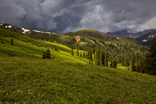
I typically start my hikes very early in the mountains to avoid the afternoon storms, but the clouds started building earlier than normal this morning.
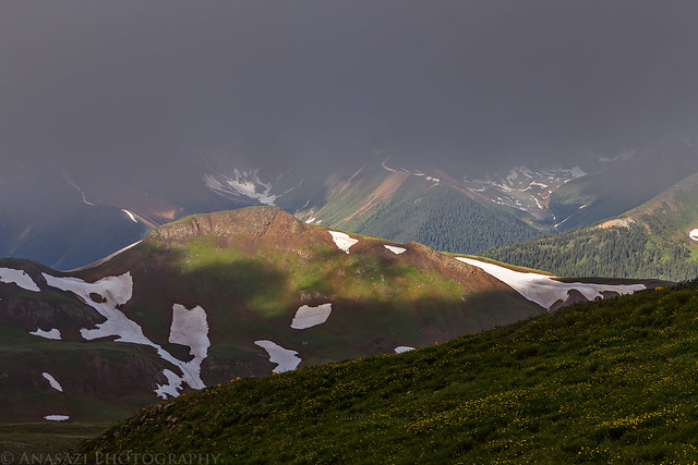
Low clouds looking towards Ice Lakes Basin.
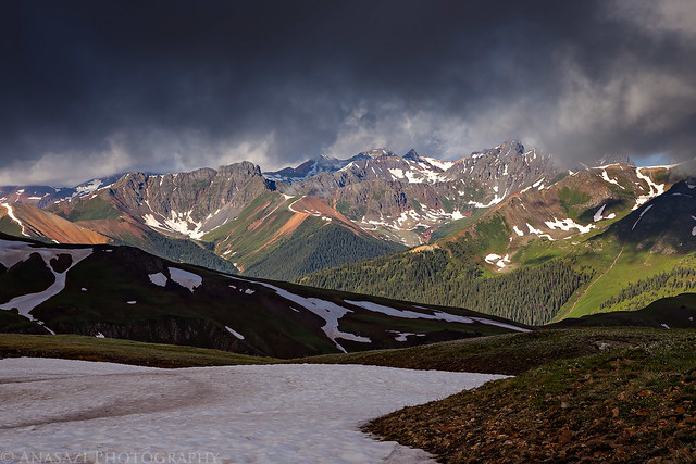
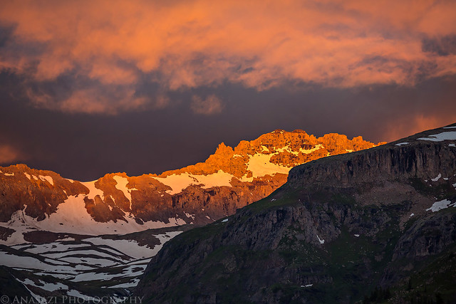
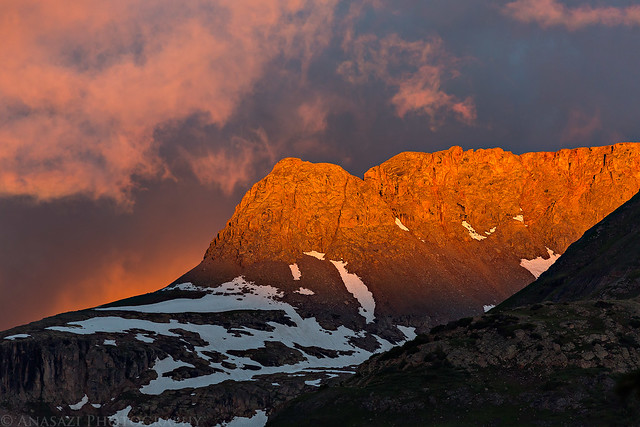
Clouds over Red Mountain #1 and Corkscrew Pass.
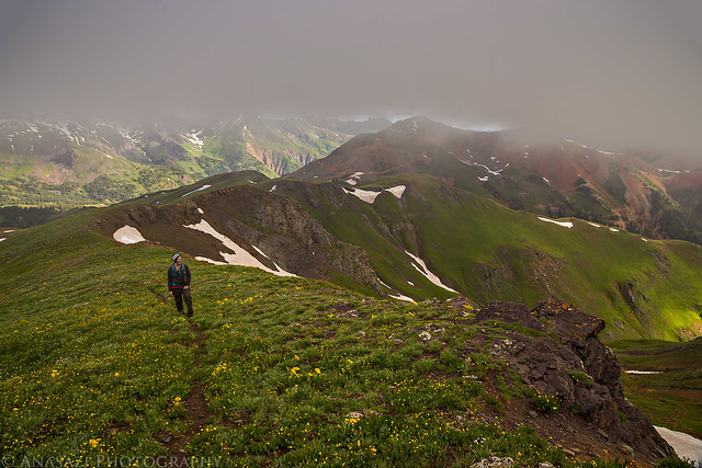
Diane following the final ridge to the summit.
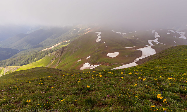
Limited views under the ceiling of clouds this morning.
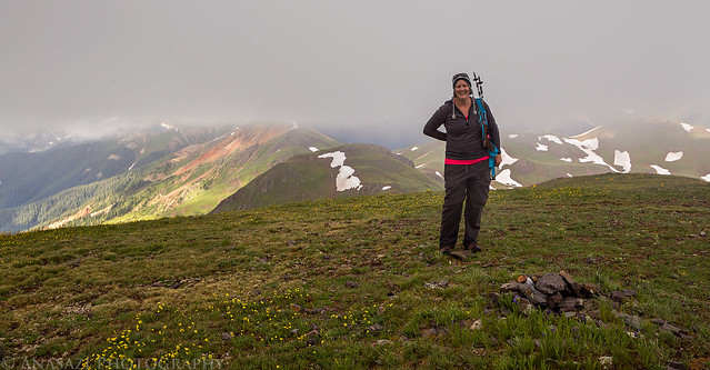
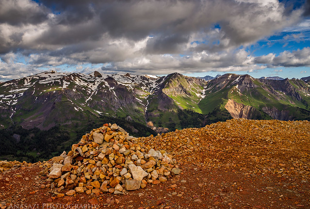
Diane on the summit of McMillan Peak. The visibility was pretty limited while we were up here and we didn't stick around too long since some of the clouds were starting to look threatening.
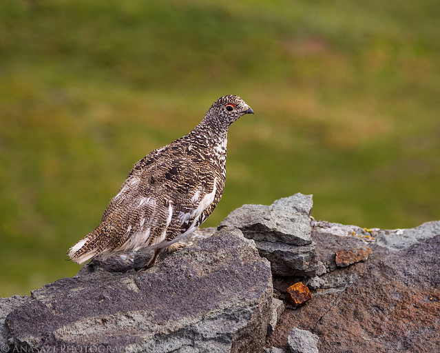
On our way down we followed the ridge that connects to Red Mountain #3. I almost stepped on this Ptarmigan before I even realized it was there. They sure do blend in well! This is probably the best photo of a bird I have ever taken.
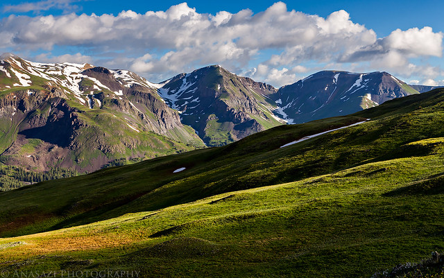
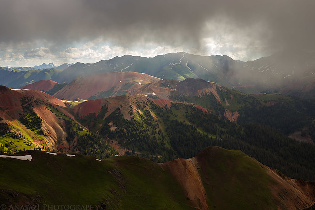
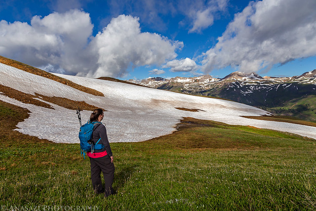
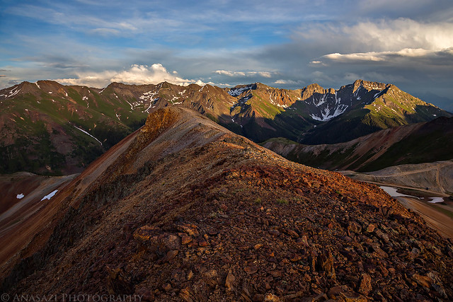
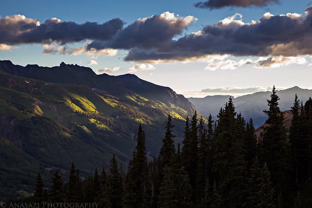
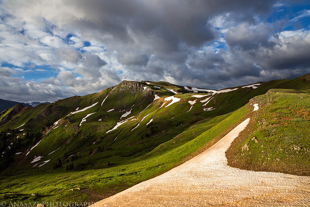
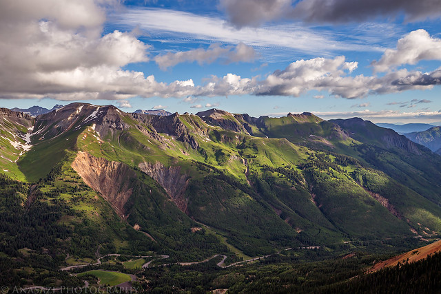
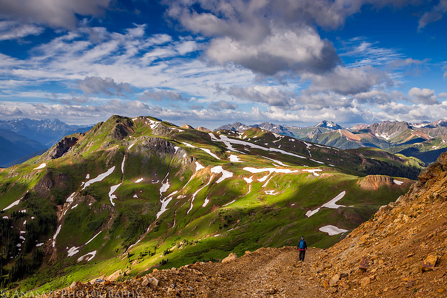
Great views as we were hiking down along the ridge after some of the low clouds blew over.
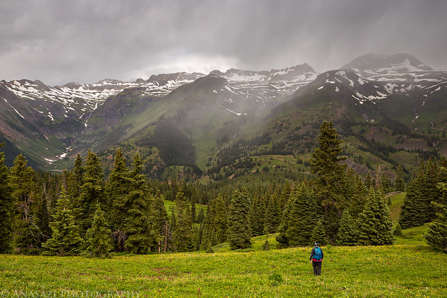
We were originally planning on hiking across the ridge to summit Red Mountain #3, but once we heard some thunder we decided to hike back down to the Jeep instead. The weather this weekend was really crazy! Typically the monsoon storms do not begin until the afternoon, but this morning we were chased off the mountain by stormy weather before 9:00am.
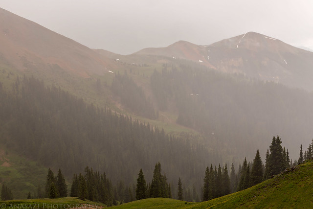
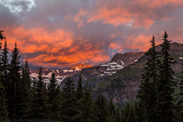
The unusual weather did create nice conditions for photography- just not for hiking above treeline.
Our decision to hike back down was a good one as we watched this storm move towards us.
We made it back to the Jeep before the storm reached us, but as we were driving through US Basin the hail and rain started coming down hard for a few minutes.
After the storm...
After reaching the highway we drove down to Silverton and then followed Cement Creek up to Corkscrew Pass. The sky had cleared up a bit and we were hoping to quickly summit Red Mountain #1 from the pass. It's a short hike but on steep and loose rock. We made it about 150 feet up before we heard thunder and saw another storm moving in, so we had to descend back to the Jeep again.
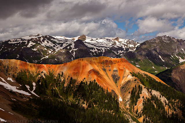
Red Mountain #2 from Corkscrew Pass.
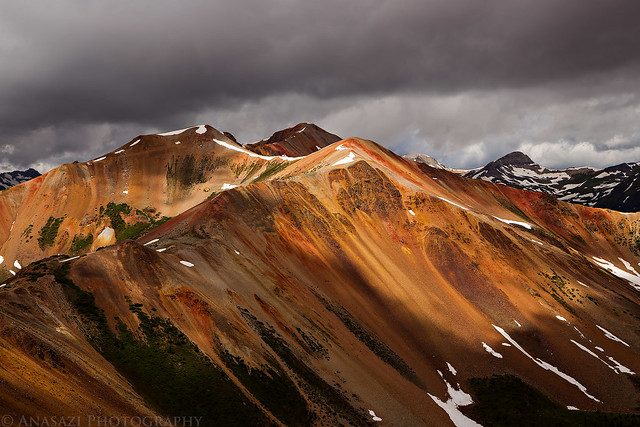
The other side of Red Mountain #3
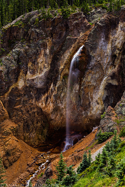
Since there were storms all around us, we decided to head over into Gray Copper Gulch and hike down to Gray Copper Falls since it would keep us below treeline.
Gray Copper Falls
After our hike back up from the waterfall, we drove to Ouray to grab some dinner and then stopped back at camp to relax for a little while. At this point it looked like the sky was clearing and the storms were done for the day, so we drove back over to Corkscrew Pass so I could attempt to summit Red Mountain #1 again before sunset.
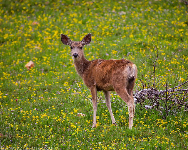
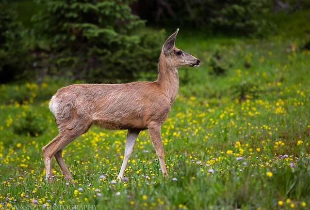
We came across a large group of deer in Corkscrew Gulch.
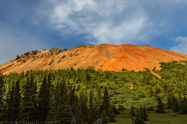
Red Mountain #1 from Corkscrew Gulch.
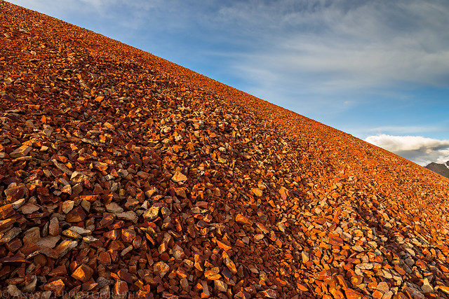
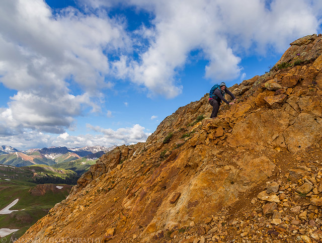
Steep and loose red rocks that I had to climb up to reach the summit.
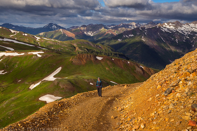
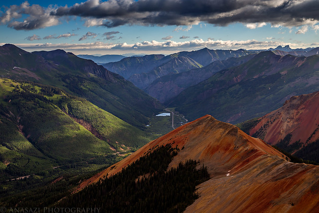
A nice view of Velocity Basin from the top.
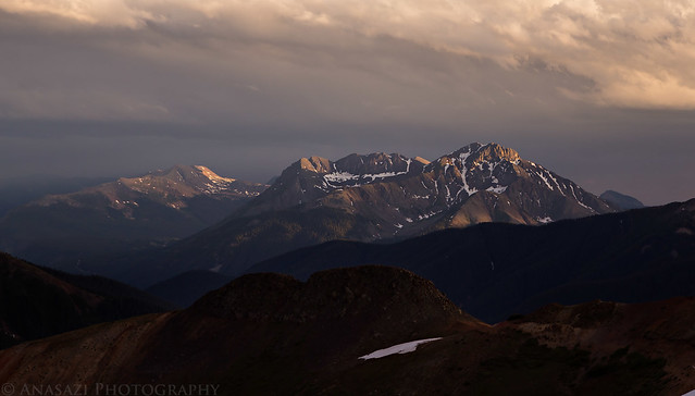
It figures that once I set foot on the very top of the mountain I would hear thunder and see lightning off towards the Grenadier's. It didn't look like the storm was headed my way, but I didn't want to stick around too long.
View from the summit of Red Mountain #1 (12,592)
After hiking back down from the summit, we drove back down through Corkscrew Gulch and then headed back to camp for the night. It had been a long day and we were pretty tired, so we fell right asleep after getting into our sleeping bags.
We woke up on Sunday morning even earlier since it appeared that the stormy weather was going to start early again. I was originally hoping to climb Ohio Peak this morning, but since we had been chased off red Mountain #3 by weather the previous day, we decided to attempt that one again.
Another beautiful sunrise this morning from near the trailhead.
There are a few antenna's on top of Red Mountain #3 which means there is a road all the way up to the top. The road passes through private property near the bottom and is not open to the public to drive. They do allow you to hike, ski or bicycle through their property, though.

Beautiful light across the valley.
A great view of Trico Peak, which we climbed last year.
A view across the ridge to McMillan Peak that we had climbed the previous day in the clouds.
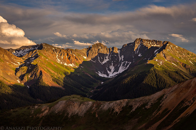
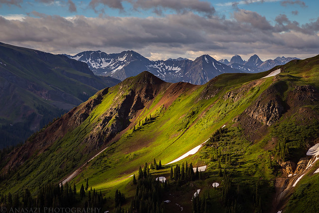
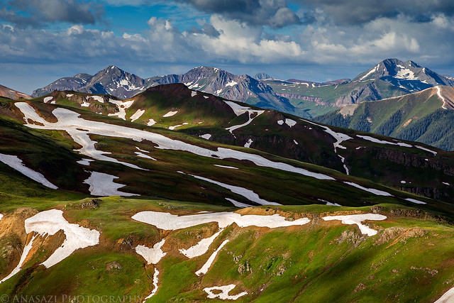
A great view over Prospect Gulch to Arrow Peak, Vestal Peak and the rest of the Grenadier Range.
Diane following me up the road.
View from the summit of Red Mountain #3 (12,890)
Looking down over Red Mountain #2 to Ironton Park.
The Million Dollar Highway snakes it's way up to Red Mountain Pass.
One section of the road near the top of the mountain was completely covered by a large snow drift that we had to get around. We saw two possible options. First, we could put on our microspikes and try to climb over it, but there was a lot of exposure below the drift and if we slipped it would be a long way down. We didn't like that idea. Our second option was to climb a short cliff composed of crumbly rock next to the road to get above the drift, which is what we did. So even though we followed an easy road most of the way, we still had to do a little real climbing to reach the top.
Diane climbing back down the cliff.
Great views all around as we hiked back down.
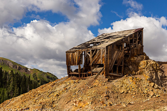
An old mining structure near the trailhead.
>> Red Mountain Pass Peaks Photo Gallery
>> The Original Trip Report on ADVENTR.CO
Featured image for home page:

June was a busy month for me that prevented me from spending much time outside and then I got sick over the long Independence Day weekend, so it's been quite a while since I've been out hiking and camping and I really needed to get back into the mountains this weekend! Since I'm a little out of shape, I thought it would be a good idea to start out the season hiking a few easier peaks near Red Mountain Pass this weekend that I've thought about climbing for years. Diane and I left after work on Friday and drove through Ouray to one of our go-to campsites in Mineral Basin. We quickly setup camp at 11,600 feet elevation and were soon sleeping. I know that some people have trouble sleeping at higher elevations, but I almost always sleep well over 10,000 feet and this night was no exception.
We woke up before sunrise on Saturday morning and made the short drive over to the other side of the valley to start climbing a few nearby 12,000 foot peaks. Our first goal was to reach the summit of McMillan Peak (12,804). It was a beautiful trail-less hike across the tundra with about 1,200 feet of elevation gain.
Driving down from Mineral Basin at sunrise.
View across the valley towards Black Bear Pass as we started our hike. Trico Peak (13,321) is on the right and our campsite is hidden in the trees near the middle of the photo.
Hiking up the gentle tundra slope in the morning light.
I typically start my hikes very early in the mountains to avoid the afternoon storms, but the clouds started building earlier than normal this morning.
Low clouds looking towards Ice Lakes Basin.
Clouds over Red Mountain #1 and Corkscrew Pass.
Diane following the final ridge to the summit.
Limited views under the ceiling of clouds this morning.
Diane on the summit of McMillan Peak. The visibility was pretty limited while we were up here and we didn't stick around too long since some of the clouds were starting to look threatening.
On our way down we followed the ridge that connects to Red Mountain #3. I almost stepped on this Ptarmigan before I even realized it was there. They sure do blend in well! This is probably the best photo of a bird I have ever taken.
Great views as we were hiking down along the ridge after some of the low clouds blew over.
We were originally planning on hiking across the ridge to summit Red Mountain #3, but once we heard some thunder we decided to hike back down to the Jeep instead. The weather this weekend was really crazy! Typically the monsoon storms do not begin until the afternoon, but this morning we were chased off the mountain by stormy weather before 9:00am.
The unusual weather did create nice conditions for photography- just not for hiking above treeline.
Our decision to hike back down was a good one as we watched this storm move towards us.
We made it back to the Jeep before the storm reached us, but as we were driving through US Basin the hail and rain started coming down hard for a few minutes.
After the storm...
After reaching the highway we drove down to Silverton and then followed Cement Creek up to Corkscrew Pass. The sky had cleared up a bit and we were hoping to quickly summit Red Mountain #1 from the pass. It's a short hike but on steep and loose rock. We made it about 150 feet up before we heard thunder and saw another storm moving in, so we had to descend back to the Jeep again.
Red Mountain #2 from Corkscrew Pass.
The other side of Red Mountain #3
Since there were storms all around us, we decided to head over into Gray Copper Gulch and hike down to Gray Copper Falls since it would keep us below treeline.
Gray Copper Falls
After our hike back up from the waterfall, we drove to Ouray to grab some dinner and then stopped back at camp to relax for a little while. At this point it looked like the sky was clearing and the storms were done for the day, so we drove back over to Corkscrew Pass so I could attempt to summit Red Mountain #1 again before sunset.
We came across a large group of deer in Corkscrew Gulch.
Red Mountain #1 from Corkscrew Gulch.
Steep and loose red rocks that I had to climb up to reach the summit.
A nice view of Velocity Basin from the top.
It figures that once I set foot on the very top of the mountain I would hear thunder and see lightning off towards the Grenadier's. It didn't look like the storm was headed my way, but I didn't want to stick around too long.
View from the summit of Red Mountain #1 (12,592)
After hiking back down from the summit, we drove back down through Corkscrew Gulch and then headed back to camp for the night. It had been a long day and we were pretty tired, so we fell right asleep after getting into our sleeping bags.
We woke up on Sunday morning even earlier since it appeared that the stormy weather was going to start early again. I was originally hoping to climb Ohio Peak this morning, but since we had been chased off red Mountain #3 by weather the previous day, we decided to attempt that one again.
Another beautiful sunrise this morning from near the trailhead.
There are a few antenna's on top of Red Mountain #3 which means there is a road all the way up to the top. The road passes through private property near the bottom and is not open to the public to drive. They do allow you to hike, ski or bicycle through their property, though.
Beautiful light across the valley.
A great view of Trico Peak, which we climbed last year.
A view across the ridge to McMillan Peak that we had climbed the previous day in the clouds.
A great view over Prospect Gulch to Arrow Peak, Vestal Peak and the rest of the Grenadier Range.
Diane following me up the road.
View from the summit of Red Mountain #3 (12,890)
Looking down over Red Mountain #2 to Ironton Park.
The Million Dollar Highway snakes it's way up to Red Mountain Pass.
One section of the road near the top of the mountain was completely covered by a large snow drift that we had to get around. We saw two possible options. First, we could put on our microspikes and try to climb over it, but there was a lot of exposure below the drift and if we slipped it would be a long way down. We didn't like that idea. Our second option was to climb a short cliff composed of crumbly rock next to the road to get above the drift, which is what we did. So even though we followed an easy road most of the way, we still had to do a little real climbing to reach the top.
Diane climbing back down the cliff.
Great views all around as we hiked back down.
An old mining structure near the trailhead.
>> Red Mountain Pass Peaks Photo Gallery
>> The Original Trip Report on ADVENTR.CO
Featured image for home page:
")
")