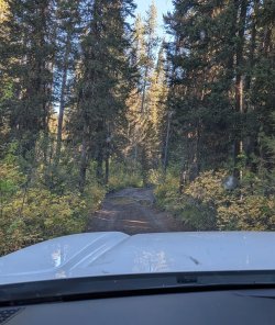
Hi, I got two nights at 9U4 in early August (4-5). I've gone in to Union Falls before, from the Grassy Lake Road, on Mountain Ash Creek Trail, going in near the dam. I'd like to try going in at Fish Lake. I understand the spur road to Grassy Lake is bad, but I'm told it is ok if one just drives slowly. We'll be in a pickup and an SUV, so I think we'll be ok. Any current info on the Fish Lake spur would be appreciated.
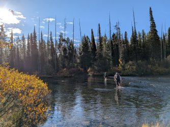
The hike itself... in just a couple of miles from Fish Lake, there is a ford of the Falls River. The Bohannon book lists it as 120' wide. For comparison, he lists the Snake River at the south entrance as 200' wide. The backcountry situation report lists it as fordable now. A different book I have says it should be 2-3 feet deep by mid-July. One person told me it should be shin to knee deep, and a little pushy. I'm asking for information about that ford. I know weather changes and years are different, but, I have to ask. Is it likely to be close to 2 feet by August? Is it just a pay attention and walk and you'll be fine type ford? Did you do it once and you're never doing it again? For perspective, I've forded Hellroaring Creek, the Snake at the south entrance, the Snake River upstream one ford, the Bechler in the Canyon, the Falls River upstream, and a bunch more around Yellowstone. I'm fine with most of what I have done, though that ford of the Snake upstream from 8C1 I don't want to do again. We may have not picked a good line. Any thoughts about that ford would be appreciated.
The same trip requires crossing Ash Creek a couple of times. I'm told there are logs to cross on. Any information about those fords?
I realize no one can just say, "It's a splish splash." But I don't want to get my little hiking party involved in trying to cross something like the Falls River crossing at Cave Falls. I'm chicken. I was telling Scatman that possibly I should take up cruising. It's not very scary and the food is pretty good.
Thanks.
Pringles
The hike itself... in just a couple of miles from Fish Lake, there is a ford of the Falls River. The Bohannon book lists it as 120' wide. For comparison, he lists the Snake River at the south entrance as 200' wide. The backcountry situation report lists it as fordable now. A different book I have says it should be 2-3 feet deep by mid-July. One person told me it should be shin to knee deep, and a little pushy. I'm asking for information about that ford. I know weather changes and years are different, but, I have to ask. Is it likely to be close to 2 feet by August? Is it just a pay attention and walk and you'll be fine type ford? Did you do it once and you're never doing it again? For perspective, I've forded Hellroaring Creek, the Snake at the south entrance, the Snake River upstream one ford, the Bechler in the Canyon, the Falls River upstream, and a bunch more around Yellowstone. I'm fine with most of what I have done, though that ford of the Snake upstream from 8C1 I don't want to do again. We may have not picked a good line. Any thoughts about that ford would be appreciated.
The same trip requires crossing Ash Creek a couple of times. I'm told there are logs to cross on. Any information about those fords?
I realize no one can just say, "It's a splish splash." But I don't want to get my little hiking party involved in trying to cross something like the Falls River crossing at Cave Falls. I'm chicken. I was telling Scatman that possibly I should take up cruising. It's not very scary and the food is pretty good.
Thanks.
Pringles