- Joined
- Jul 23, 2013
- Messages
- 1,666
My planned route for this ended up being altered recently. I had originally planned to start at the same spot and then find my way out to Oak Creek for the finish, but this past spring, I had studied out the map more and grew more curious about Sheets Gulch. After doing some research on it, I found it to be a much more appealing way to finish this hike. So..to exit via Sheets Gulch it was. But even that turned out to be more difficult than it needed to be.
Day 1
Sunday - May 27, 2018
I started out by having my wife drop me off at the Pleasant Creek trailhead in Capitol Reef National Park early in the afternoon after securing a backcountry camping permit from the Capitol Reef Visitor Center along the way, with plans to actually camp in upper Sheets Gulch. She would then return to her parents' place with our kids in Torrey. It turned out the permit wasn't entirely necessary as will be explained further on.
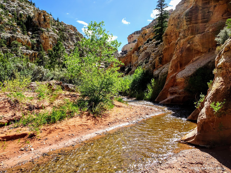
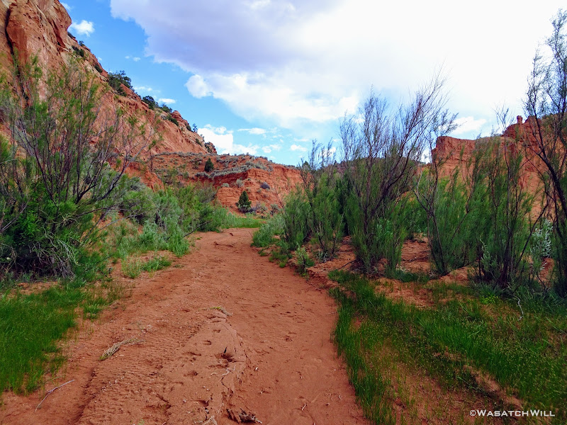
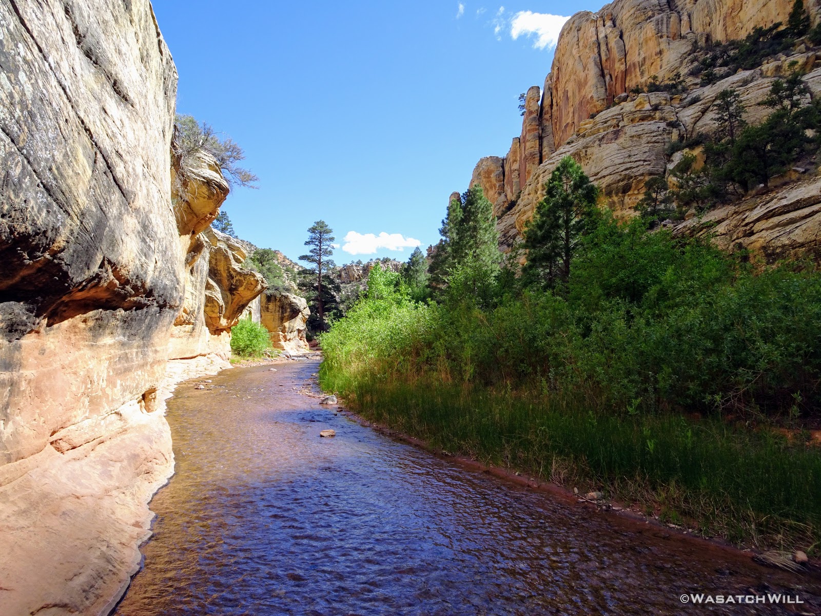
It was about 3 PM. The weather was warm, but not overwhelmingly hot. Indeed, it was pleasant enough, for a pleasant walk up Pleasant Creek as a I retraced the path my wife and I took exactly one year prior. Though this time, instead of an out'n'back, I would venture further on with my sites set on new ground, new landmarks and geological features to see, along an overnight end-to-end hike.
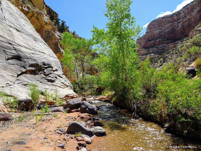
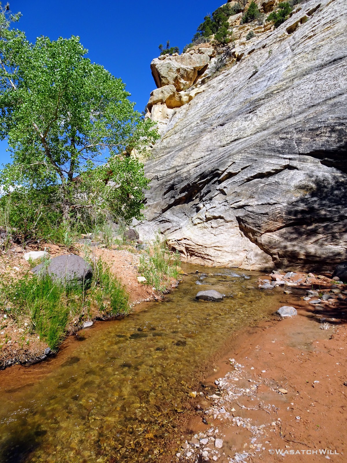
Pleasant Creek

Moving Upstream

Clear Water

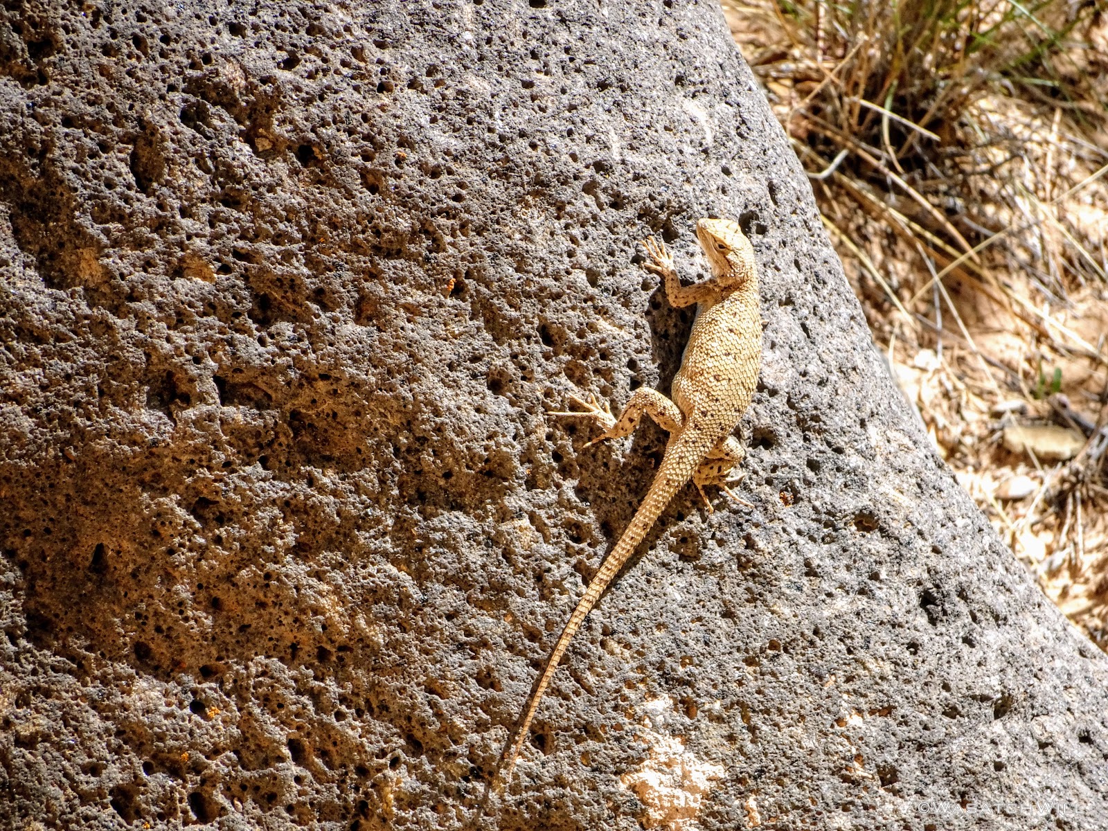
Lizard
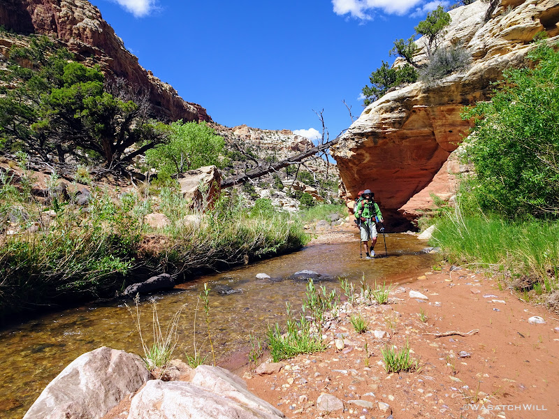
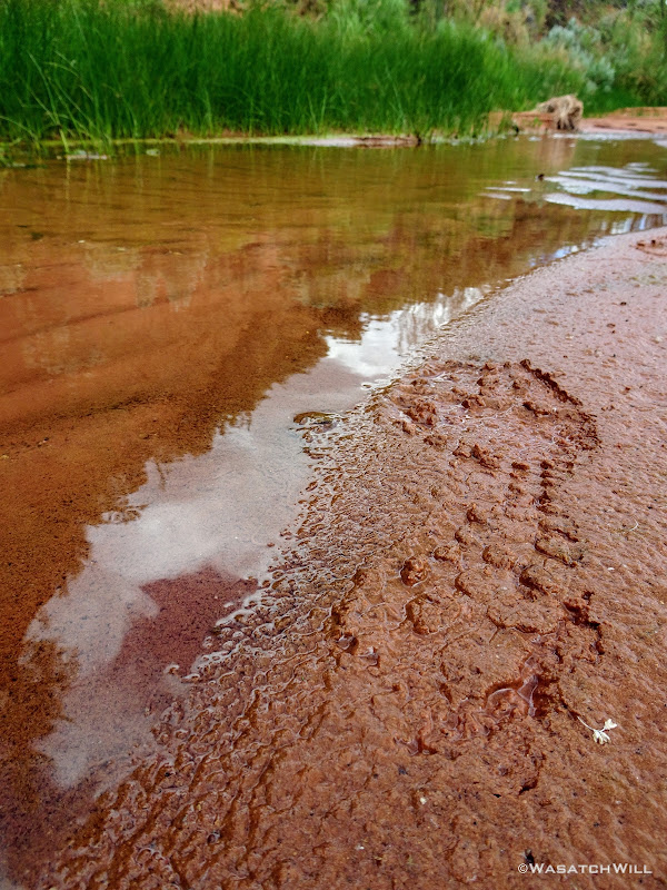
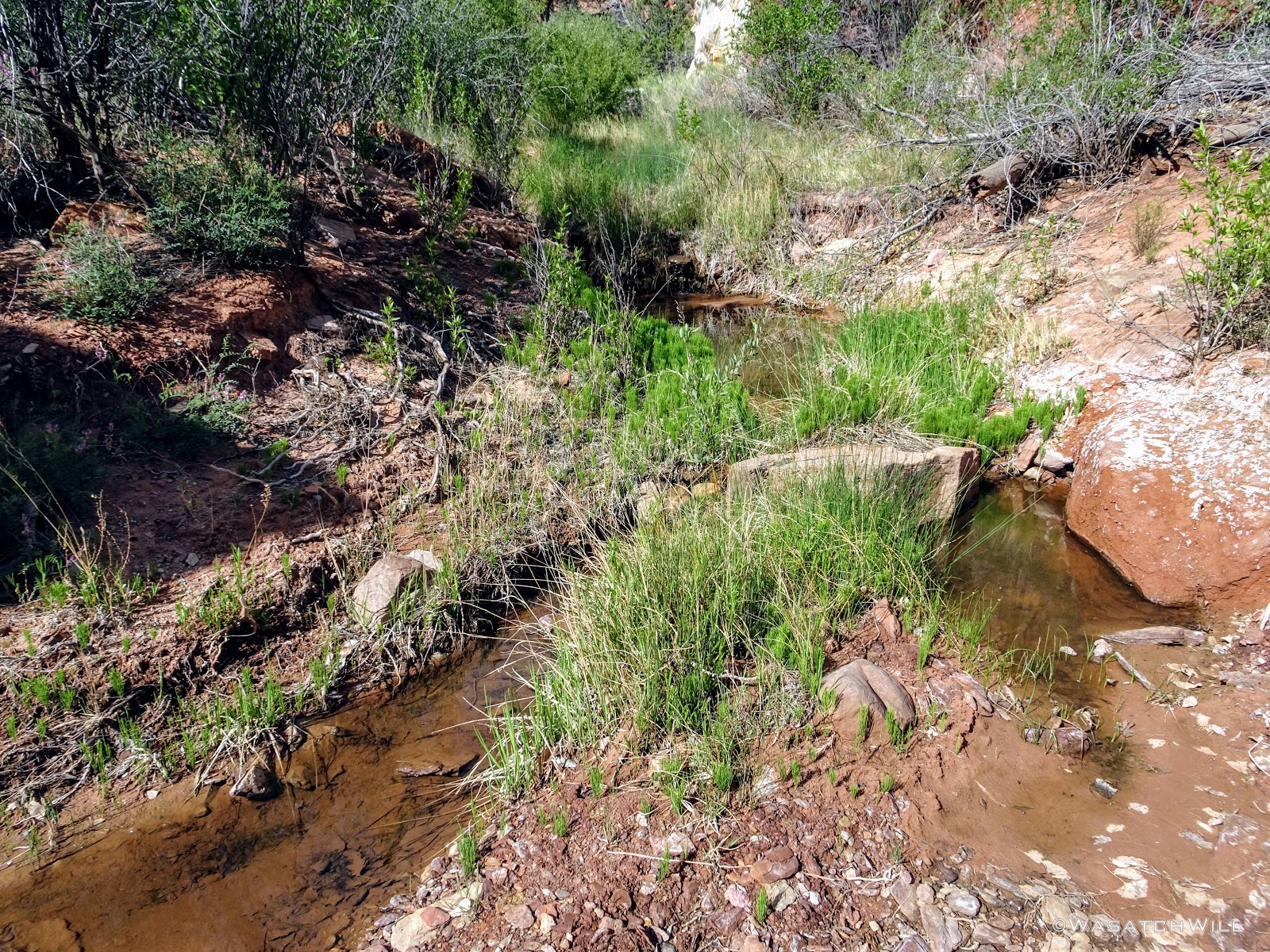
The path followed is largely a cattle path still used today by ranchers who, with special permission from the National Park Service, drive their cattle herd back and forth every spring and fall through the park between Boulder Mountain and Notom Ranch or the greater Strike Valley. Due to the creek draining off of active pastures, E. Coli bacteria has been confirmed multiple times in the creek, so it is extra important to ensure one has an effective and functional filter or other water treatment method.
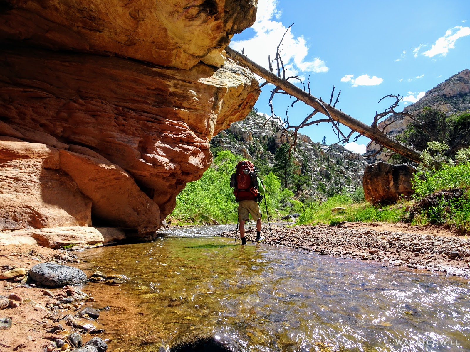
From Cattle Trail to Hiker Trail
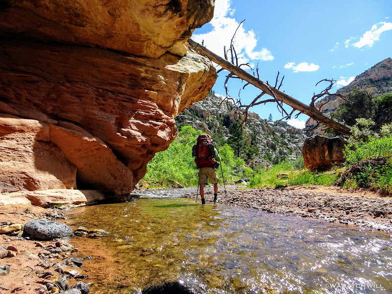
One of Many Creek Crossings
Coming to the Other Side
Further Upstream
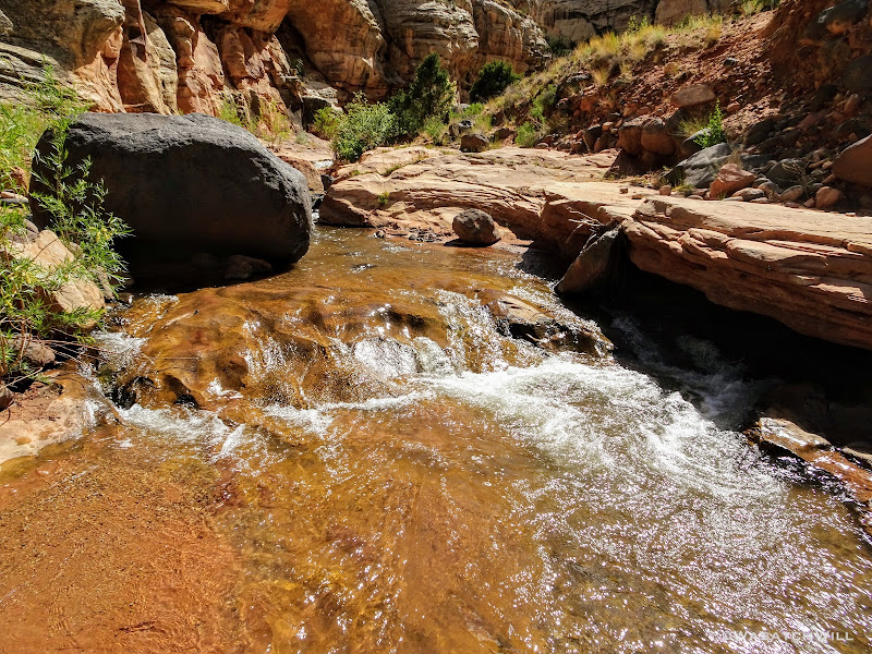
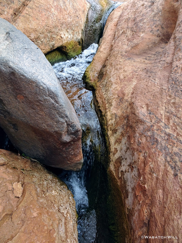
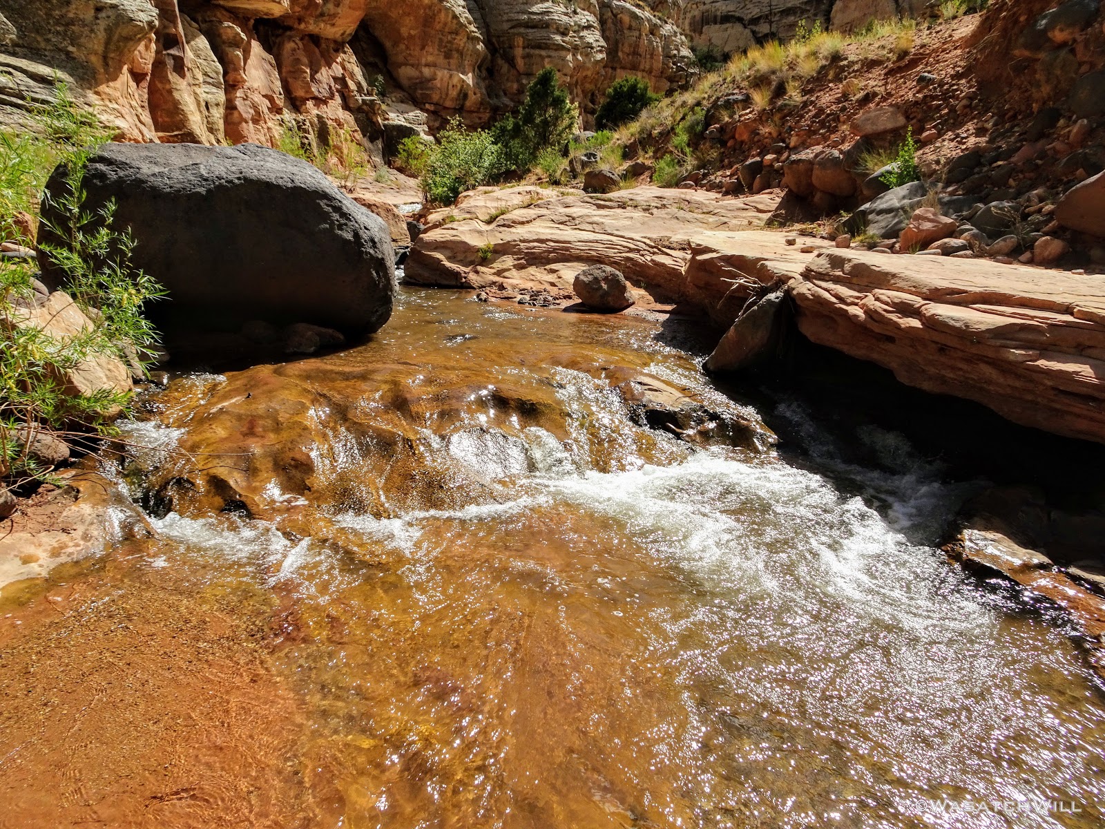
Small Cascade
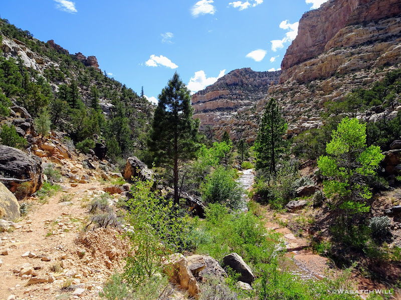
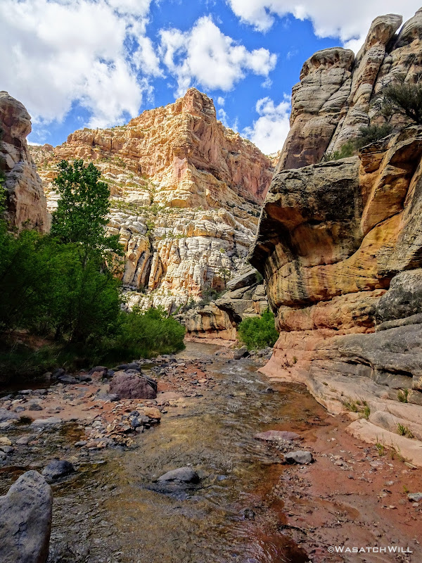
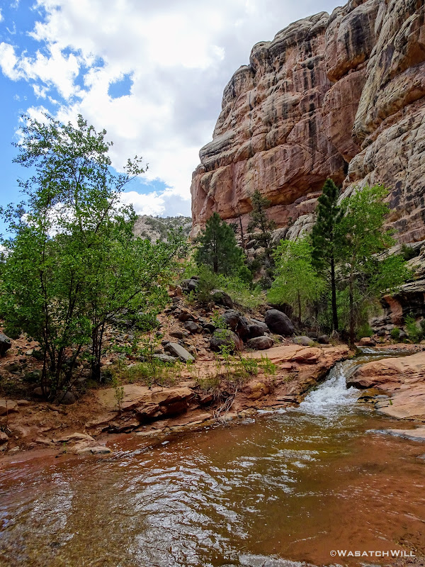
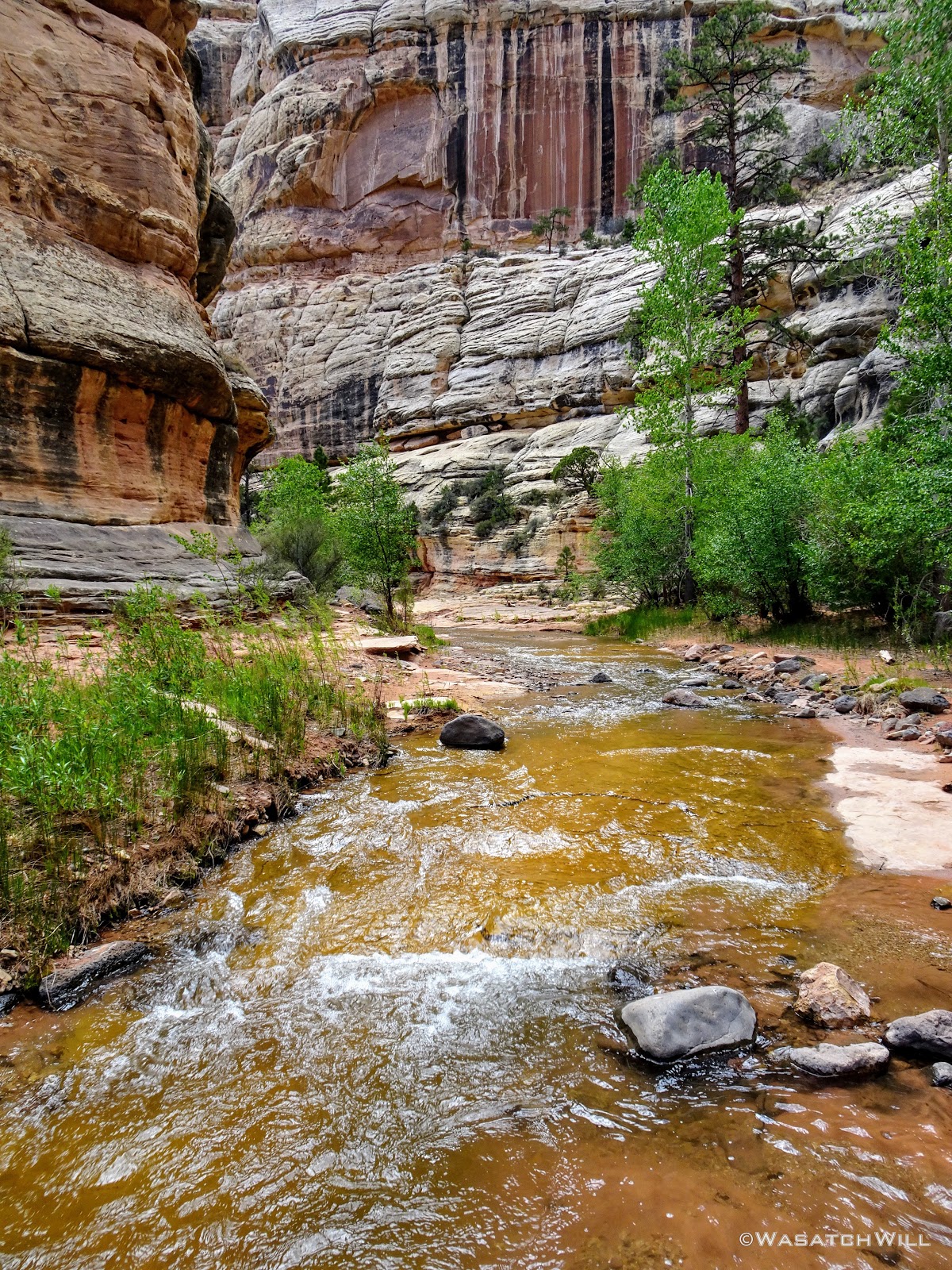
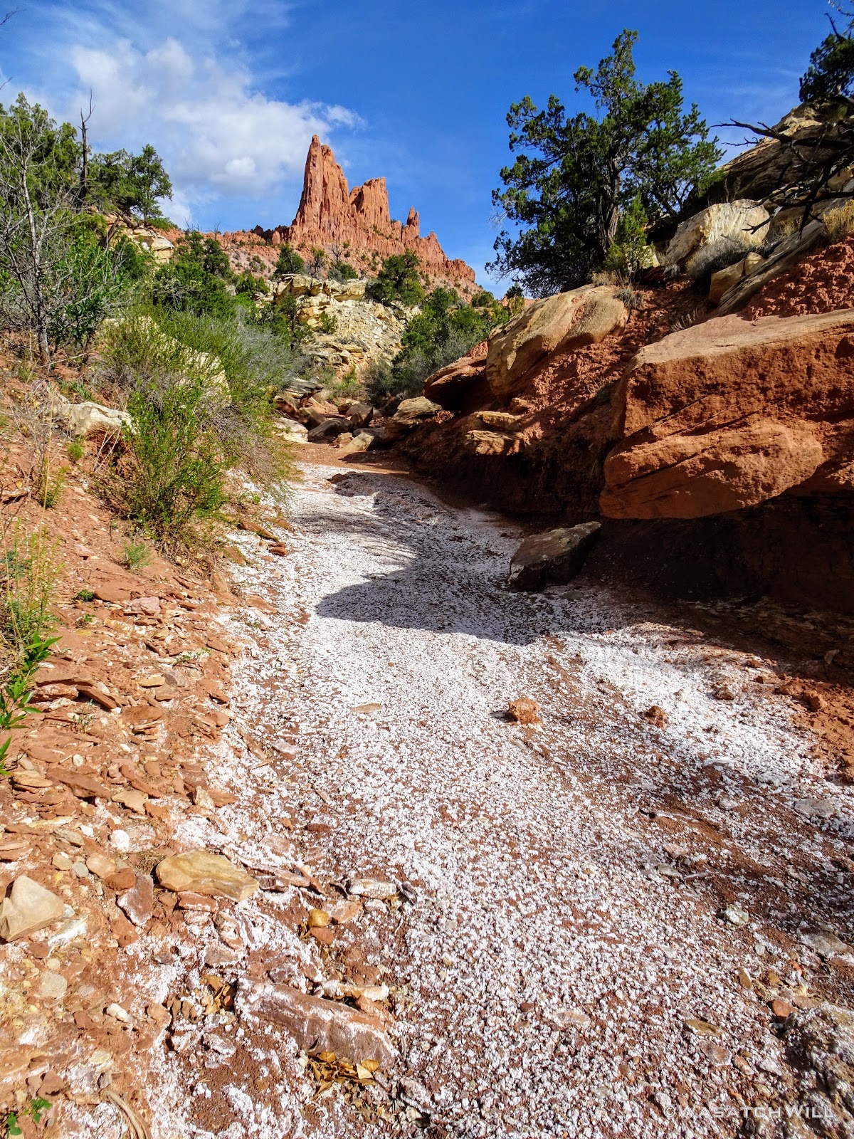
Once again, I was blown away at the beauty of the canyon walls rising up more dramatically as I progressed up stream. Ironically, the more climatic part of this section of the creek doesn't begin until just after leaving the park boundary.
Slickrock Cascades
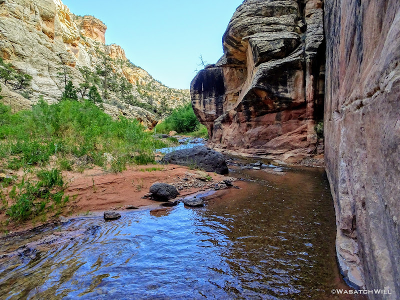
Creek Against Wall

Creek Against the Other Wall
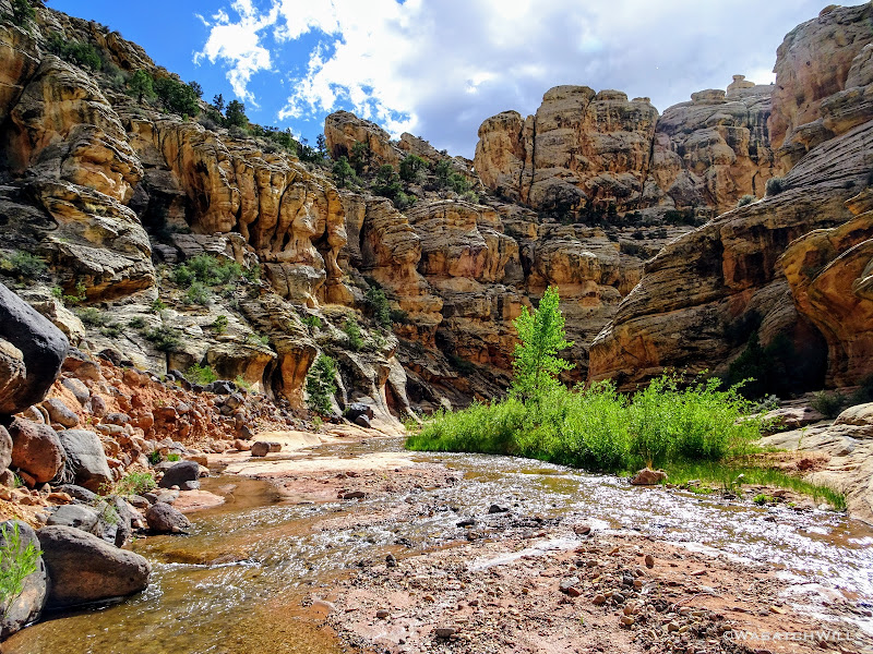
At one point I turned around to once again to behold what might well be the most majestic view along this stretch of the creek before continuing on.
Majestic
Textured Walls
A Sprinkling of Ponderosas
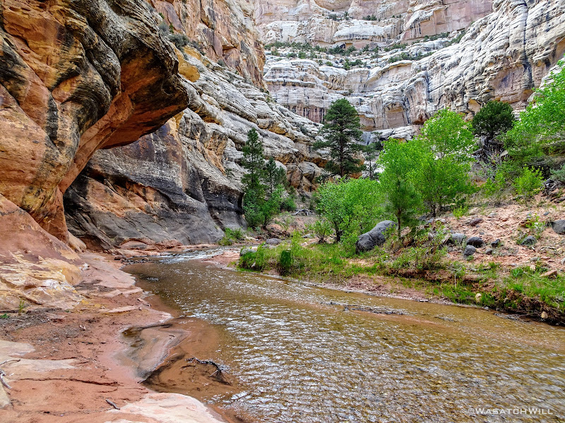
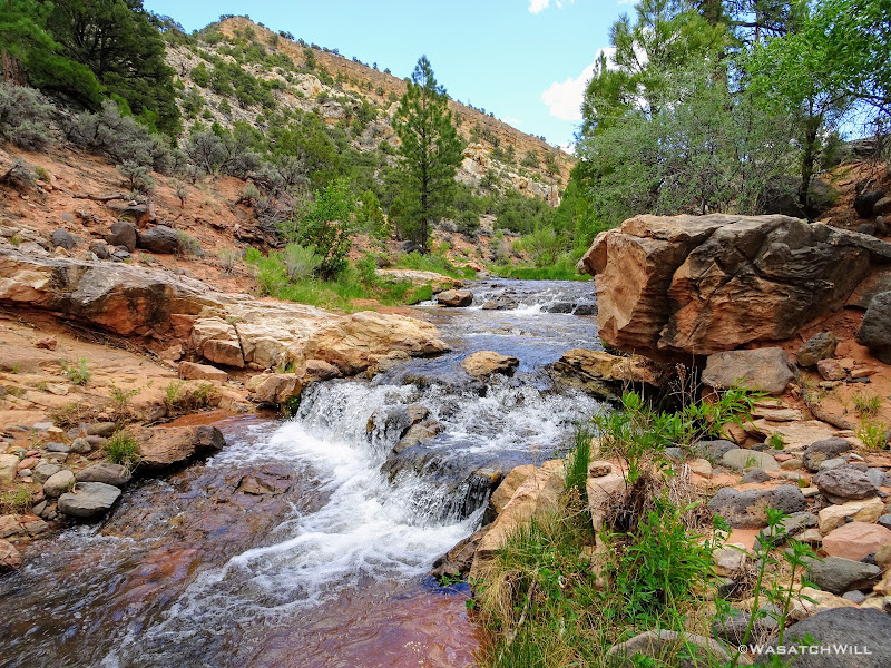
A Series of Small Cascades
Had it been any hotter and had I any more time to spare, I would have been sorely tempted to take a quick dip in one of the pools.
A Tempting Pool

Into the Open
Soon, the canyon walls came to an abrupt end and was back at in the open. I continued upstream, jumping over a cattle fence, en route.

Penstemons Along the Creek
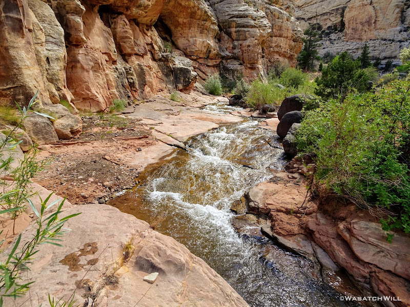
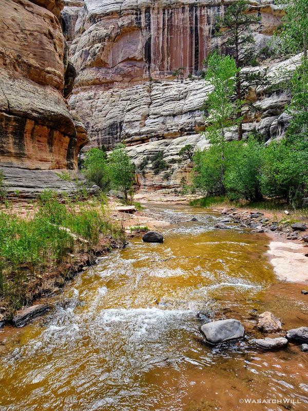
Another Waterfall

Bicolored Creek Bed

Waterfall + Pool
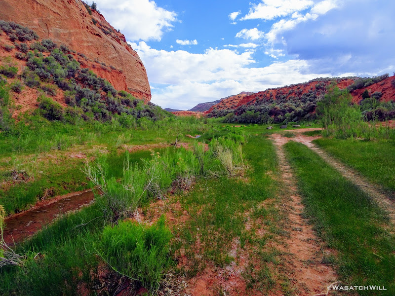
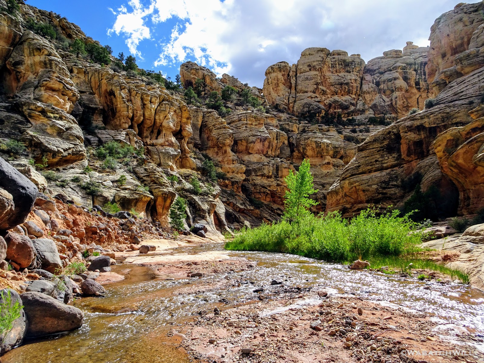
Eventually I arrived at the junction of Tantalus Creek and near the site Jessica and I had camped a year ago. This time, I'd continue on up Tantalus Creek up into Tantalus Flats and beyond. The green low lying grass was such a change of landscape and texture.
Tantalus Waterfall
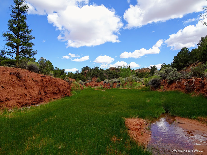
Lower Tantalus Flat
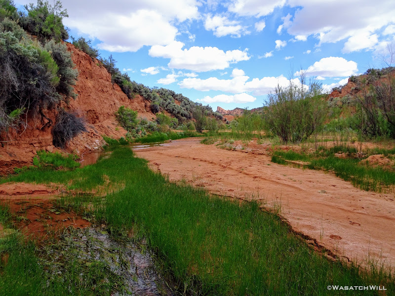
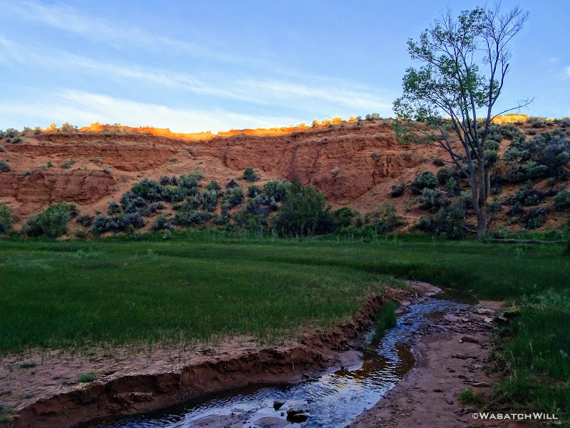
The creek was much gentler as it cut through the long grassy meadow, only interrupted once by a brief slab of sandstone where it had created an embryonic slot canyon.
Up Close on Tiny Tantalus Slot
Short Slot Canyon in Embryo
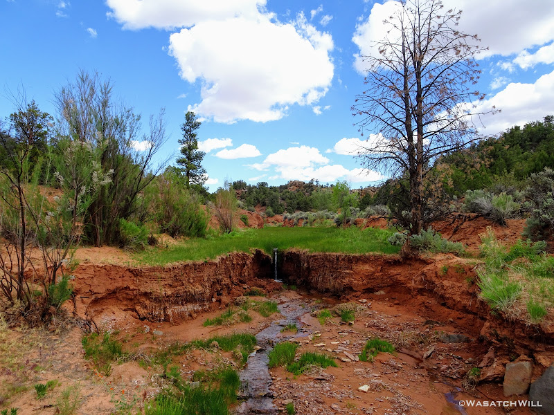
A little while later another break in the crust of the meadow gave rise to a short, drapery waterfall.
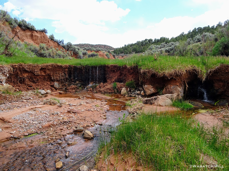
Another Break in the Flat
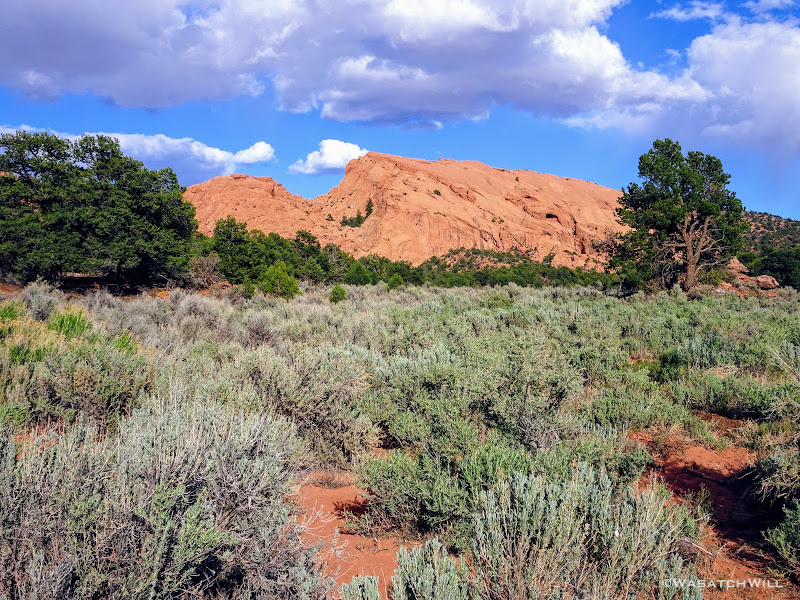
Soon, I had the Salmon in view off in the distance. The Salmon is a somewhat unique slab of sandstone that rises abruptly from the relatively flat landscape surrounding it. While I knew I could hook up with a road to carry on around its eastern face, I was greedy for some lesser traveled cross country hiking, both for the exploration factor and to check out some unnamed arches labeled on the map. I was also hopeful I could find a way around the western face of it as I sought to descend into Sheets Gulch further beyond.
The Salmon Comes Into View
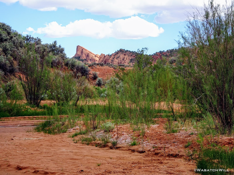
Zooming In On the Salmon
Take Only Photos (and water), Leave Only Footprints
Continuing on along the creek, I almost stumbled over a skull. Whether it belonged it a cow, a horse, or something else, I knew not. Still, it was a stark reminder of the circle of life.
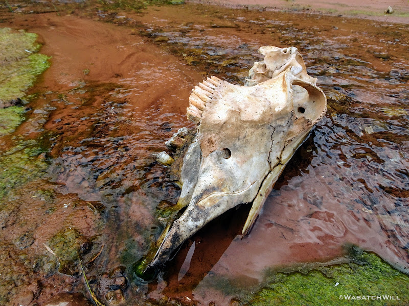
Mystery Animal Skull
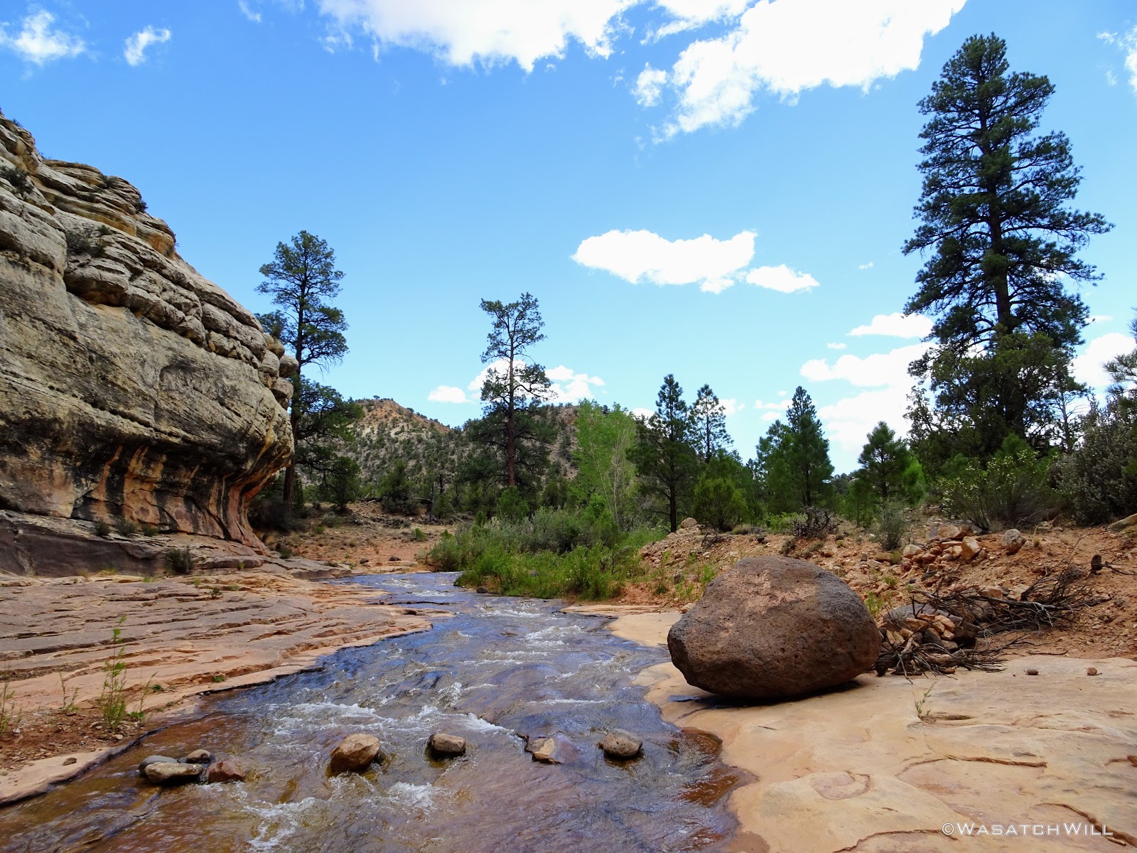
Soon as I was on the 4WD road. It was here that I could have opted to go left and keep things easy, but instead, I continued to follow it upstream before quickly leaving it again on my way up to Maverick Draw, the throughway that would lead me up to the western flanks of the Salmon.
Tantalus Flat Road
Once at the mouth of Maverick Draw, I loaded up my water capacity. I harvested 4.5 liters of water because I was not absolutely certain about a couple other possible sources I had marked out along my planned route, especially with the exceptionally dry winter. Better to play it safe than sorry I figured.
On up Maverick Draw, I went.
Entering Maverick Draw
At some point along the left side, I found a pathway leading up a break in the high running arroyo and out of the draw. This would prevent me from getting boxed in further up the draw. It would also bring me back within sight of the Salmon, this time, its more 'gradual' western slope.

Up On the Bench with the Salmon in View
Closer Up View of the Salmon
I had hoped to get up close to its arches, but the topography ended up being much more rugged than the maps had made it appear. It never ceases to amaze how much variance there can be within 40 feet of elevation out in these landscapes. I was still miles away from where I wanted to camp and time was speeding by. I did not have the time I wanted to try and find a way up the Salmon to get a closer view of the arches, so a close-up with my camera had to do.

Some Arches on the Salmon
I continued traversing the southwestern side of the Salmon in hopes of finding a suitable way over its ridge, or at least around its southern tip, to get to the mouth of Sheets Gulch.
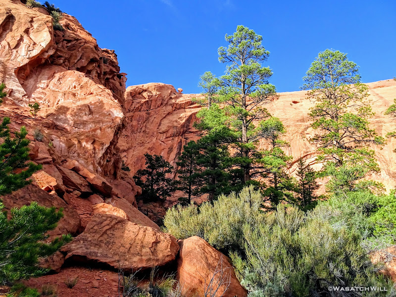
Big Ponderosas at the Foot of the Salmon
The views I had gambled for came to be all I had hoped for and more.

Another Arch Along the Salmon Ridge Top
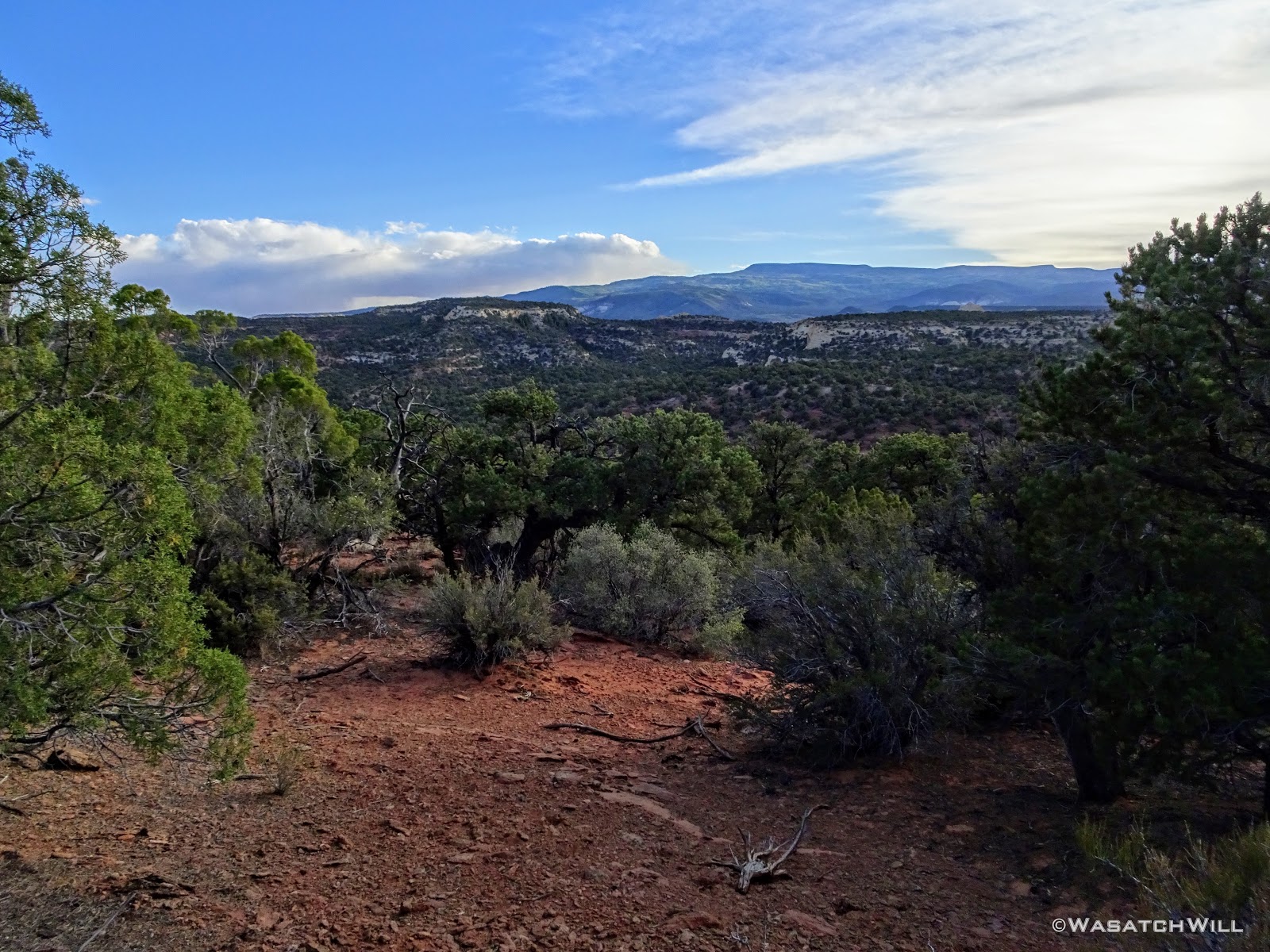
When I was able to look out and see the low-lying, yet surprisingly jagged Nick's Peak out below...it was an instant WOW moment.
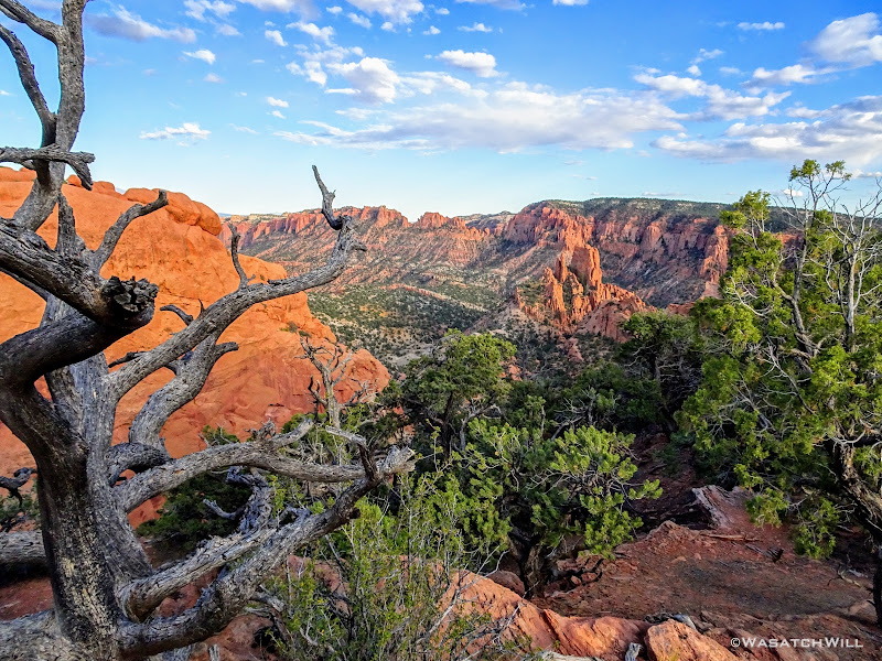
Nick's Peak (just right of center)
Out to the west rose Boulder Mountain. Not quite as dramatic and breathtaking.

Boulder Mountain Resting on the Horizon
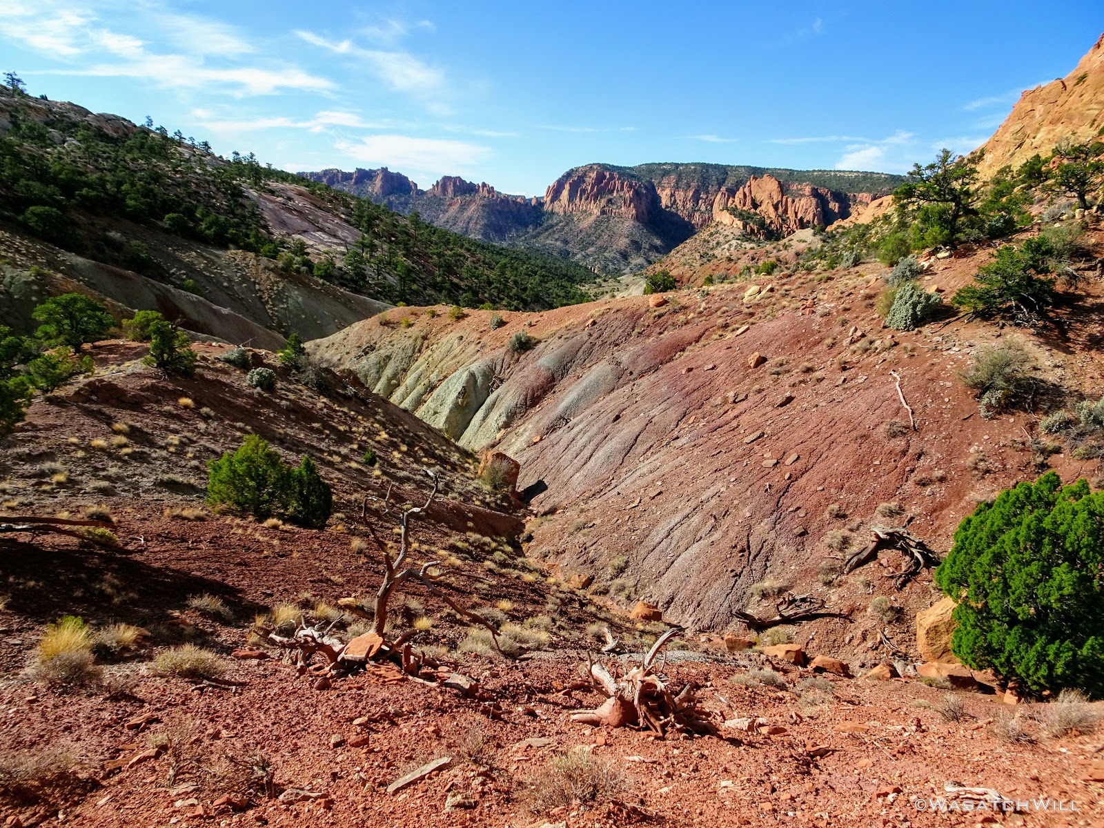
I continued on, first seeking a way to get down, over to, and up and over the saddle between the Salmon and Nick's Peak. When that failed due to impassable cliffs, even along the ridge itself, I sought a route down the drainage leading around the southern edges of Nick's Peak. That all too ended up in cliffs and impassable pour-offs time and again. Stumped, tired, and now in the final hour of any usable daylight, after hiking about eight+ miles in about five hours, I called it off. I found a small flat in which to make camp for the night, still well over three miles away as the crow flies, more by foot, from my desired destination for the night. I now had some new choices to think over through the night as I rested in a remote and rugged edge of Dixie National Forest.
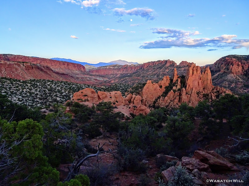
Closer Up on Nick's Peak with Sheets Gulch, Henry Mountains in the Distance (above center)
Exhausted and now a bit queasy, probably due to being partially dehydrated, I mixed up some gatorade, chugged a good bit of that down, got my tent up, and then got to rehydrating and eating some good ol' Mountain House Beef Stroganoff, which turned out to be quite a chore with my stomach feeling unwell. Still, I managed to force it all in me knowing that my body needed it and then retired to my tent to watch a movie where I would feel my body quickly begin to recover with the nutrients it had been starved of through the afternoon and evening in my vigorous efforts to keep to the original plan.
Day 2
Monday - May 28, 2018
It was a restful, clear, and calm night. I had made the decision sometime during the night to wake up before the sun rose, pack up camp just after sunrise, and start heading back the way I came immediately after. I was going to go back to the road that crossed Tantalus Flat and make another decision there based on time. Plans had been made to get picked up at the Sheets Gulch Trailhead along Notom Road at about 1 pm prior to the start of the trip but that was now looking like it wouldn't happen.
Sunrise came, and I was treated to a splendid little show along the eastern horizon as I got myself out of my tent.
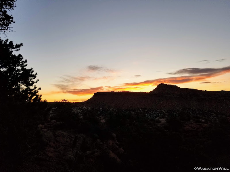
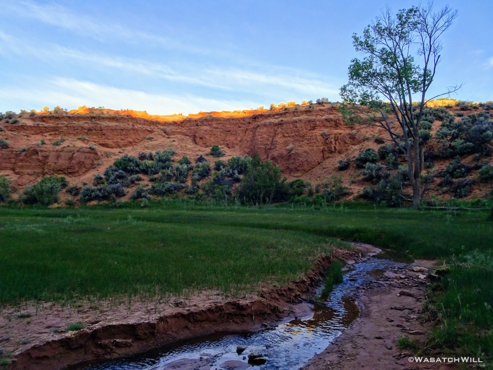
Sunrise Over Buck Point

The View Into Sheets Gulch from Camp
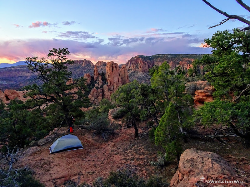
My Camp with Nick's Peak (center) Down Beyond

Primrose Flower
Back in Tantalus Flat
I arrived back at the road in Tantalus Flat at 8 AM. At this point, I decided I would hike down the road out into Sheets Draw and see how far I could get in two hours. I'd then make a decision to either turn back around and return up the road and wait to be picked up at another point along the road near Pleasant Creek further upstream...or...continue on with my original plan to hike out through Sheets Gulch. An update was sent out to my wife via my InReach and I topped off my water reserves with another liter of water before beginning the trek down the road.
Surprisingly, the road was in great shape and made for some relatively easy and fast walking with a pleasant morning breeze to keep the air somewhat comfortable. I could soon see the eastern face of the Salmon and Nick's Peak further down.
Along the Road with Salmon (center) and Nick's Peak (left) in view
Besides some regular birds and a rabbit that ran across the road in front of me, the only other wildlife I'd see was a fuzzy caterpillar inching its way along the side of the road.
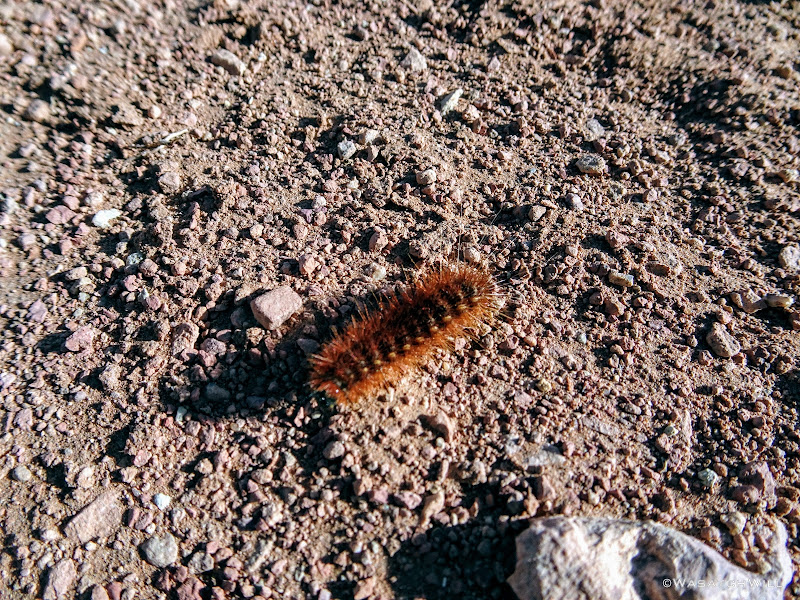
Fuzzy Caterpillar
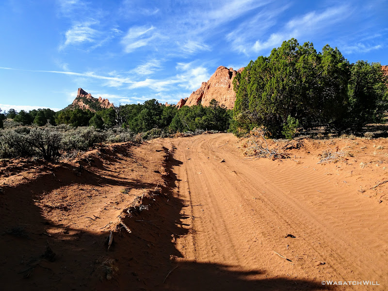
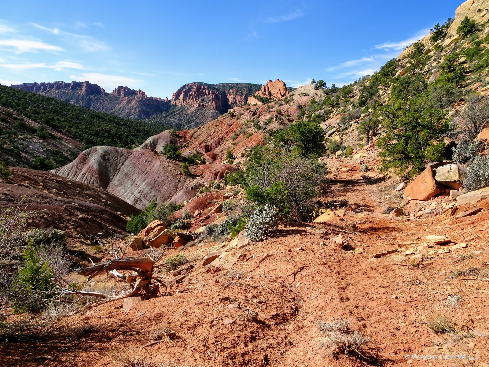
In just over 45 minutes, I covered 2 miles where the road turned up toward South Draw. I left the main road here, following a short spur road that dead-ended at another cattle fence.

Getting Closer to Sheets Gulch
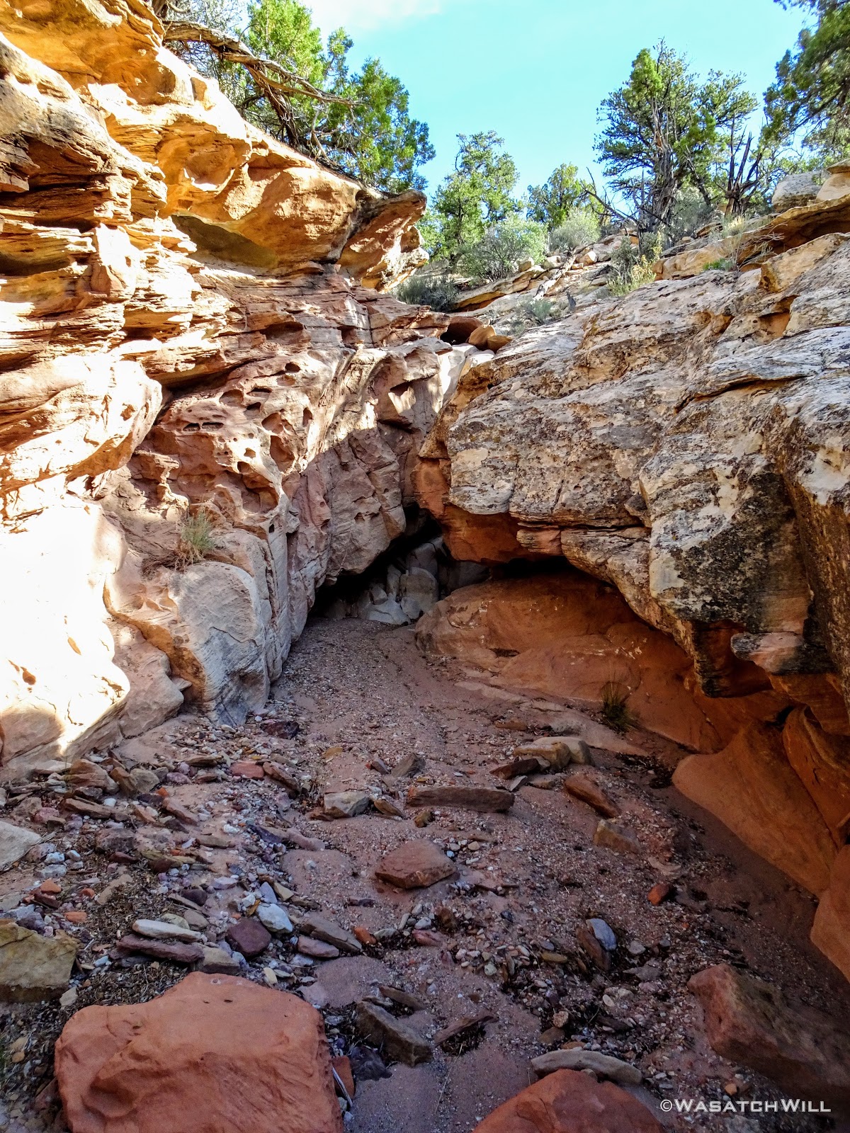
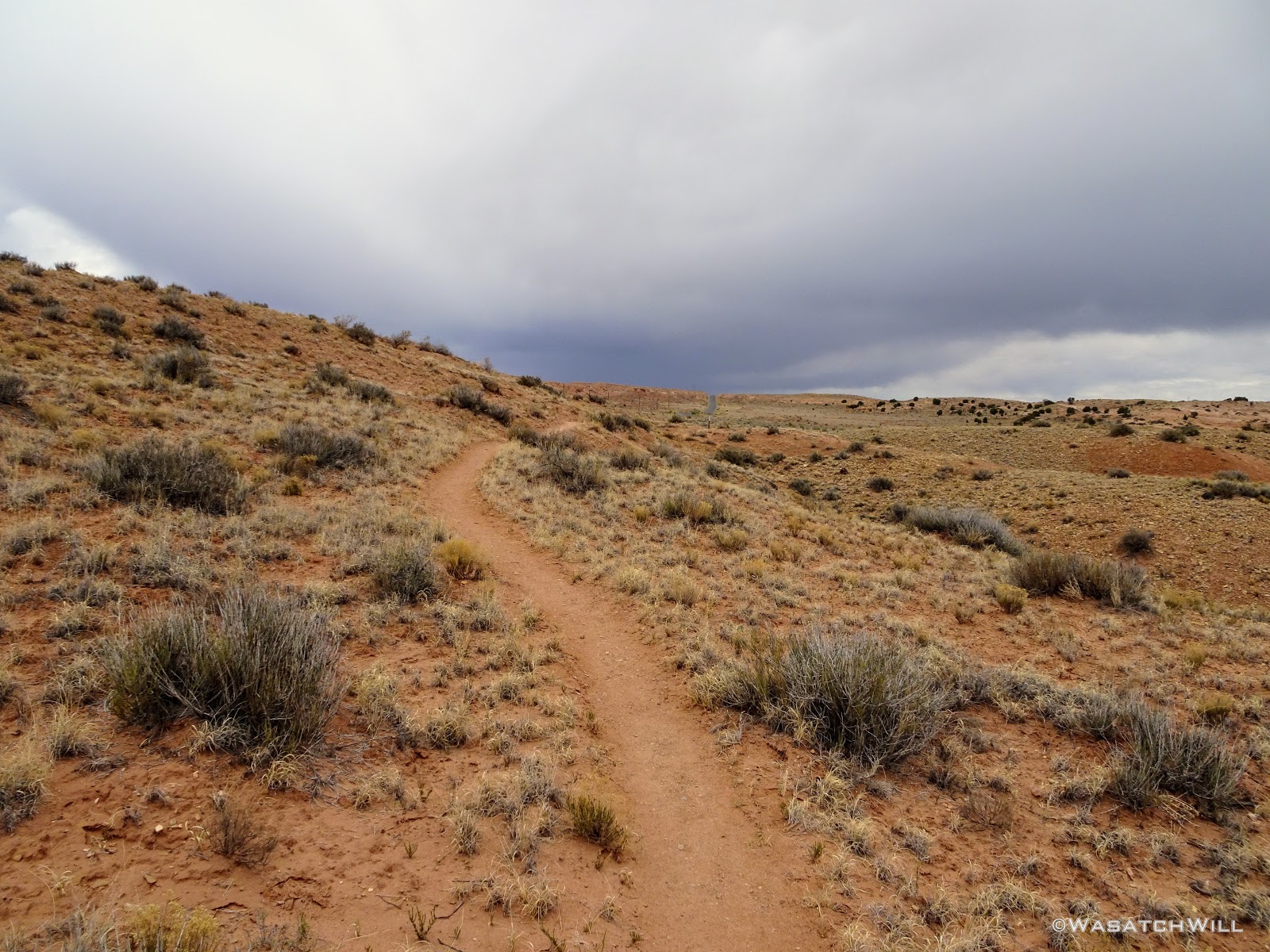
There was plenty of space to duck under the fence where the road reached a dead end, and there I found a found a foot path heading in the direction of Sheets Gulch. I even saw human shoe prints. It was a bit joyful to see such a sight after all the roaming I had done the evening before.

The Pathway Leading to Sheets Gulch
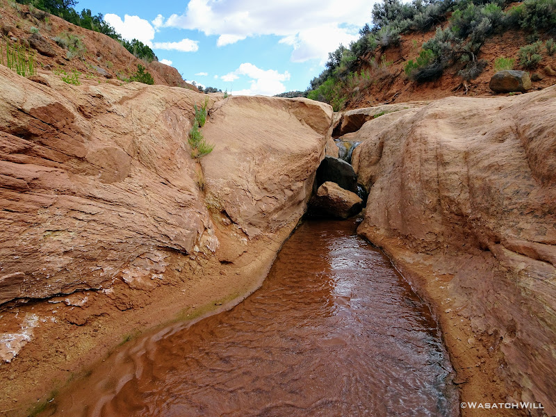
I followed the path down along the bench, then further down as it dropped into a gulley, still leading the way down to Sheets Gulch. There were a few little obstacles along the way in the form of short little dryfalls to navigate around and bypass to keep it entertaining.

Looking Back at One of the Obstacles Bypassed
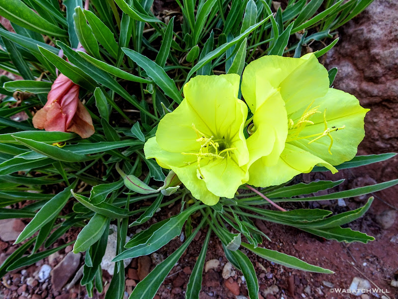
Yellow Primrose?
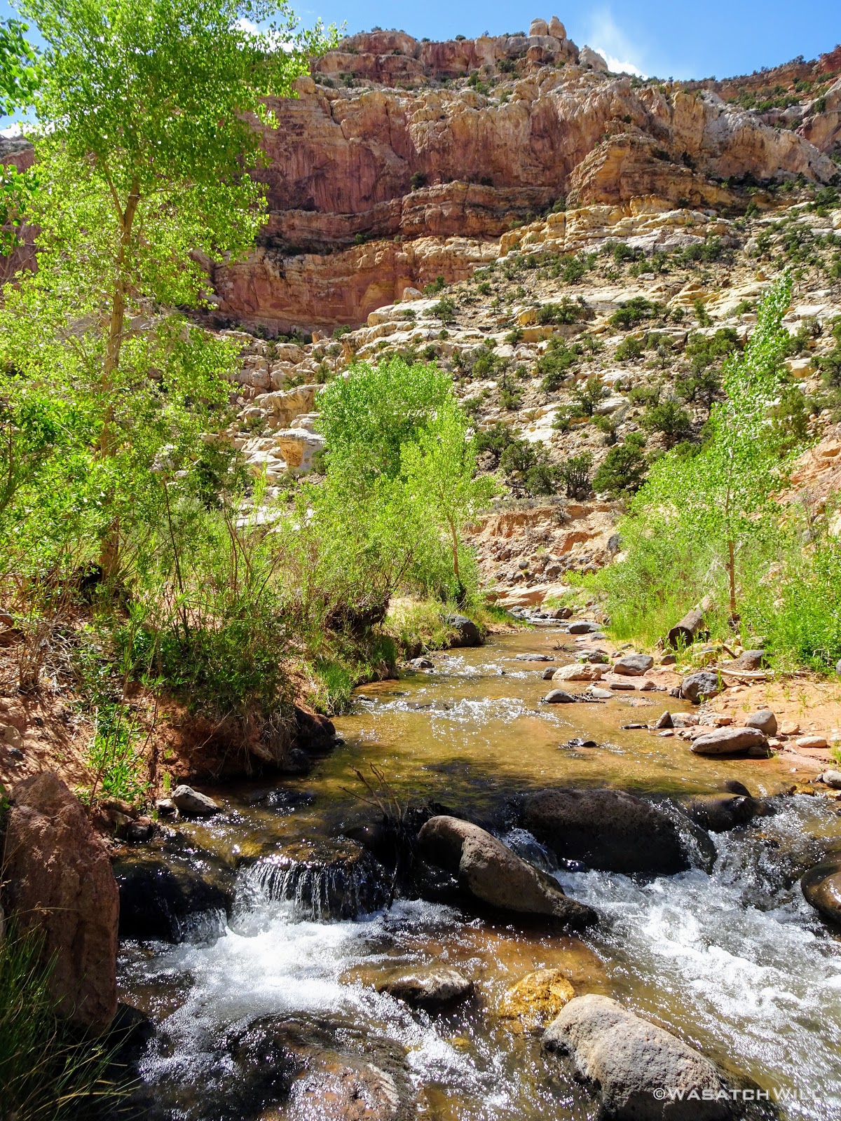
Another 45 minutes later, now about 9:30 AM, I reached one of the spots I had marked out as a possible, but uncertain, water source and what was more or less the mouth of Upper Sheets Gulch. There was water there indeed, and it even flowed on and off for a ways down through the upper reaches of the gulch before vanishing for good. I'll remember this should I ever hike this route again with wife, kids, and/or friends in the future.
With another half hour to go before it was time to make a final decision, I filtered a bit more water just for good measure and continued on down into the gulch. Even though my decision wasn't yet fully final, I knew I didn't want to hike back up the elevation I had just descended so I was feeling quite sure I was going to push on all the way down and out the gulch now.
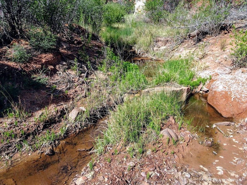
Water Source Confirmed
Looking Back up at Nick's Peak
Small Stream Flowing from Water Source
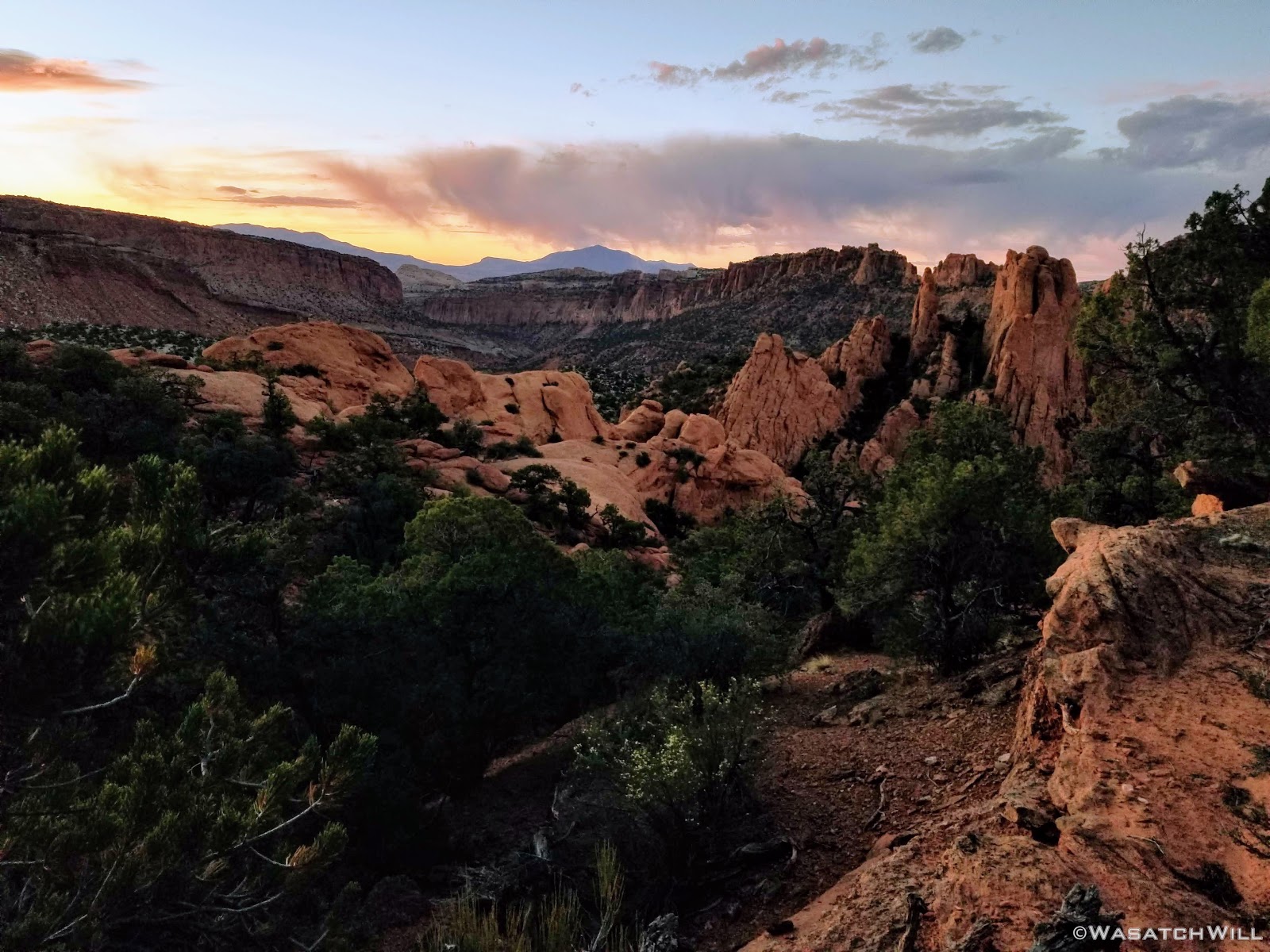
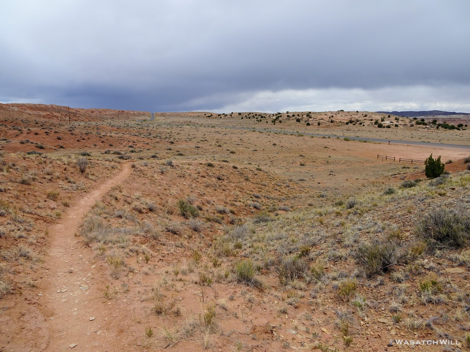
By 10 AM, I was now well into Sheets Gulch. Somewhere just after the water source, I had crossed back over into the Park boundary. If there was a sign marking the boundary, I missed it. After further considering the distance I had just traveled in the last 2 hours and the elevation I had descended (over 5 miles and over 500 feet in just over a mile of that stretch), I was now committed to finishing it out. I alerted my wife of the progress I had made and made arrangements to be picked at the same trailhead as planned at 2 PM rather than 1 PM. I also asked her to keep an eye on the weather radar and update me of any weather heading my way. Some dark clouds were brewing up back up toward Boulder Mountain, but I knew the feeders for Sheets Gulch were all much closer and that nothing from Boulder drained into Sheets. Still, I grew a little nervous at the sight of the clouds and hoped that such storms continued to track northeasterly in their typical pattern. Perhaps more than any other trip, this one served to make me more grateful than ever to have picked up an InReach when I did for its 2-way communication abilities.
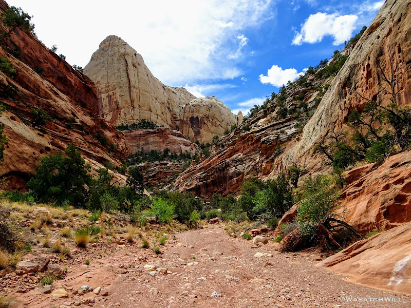
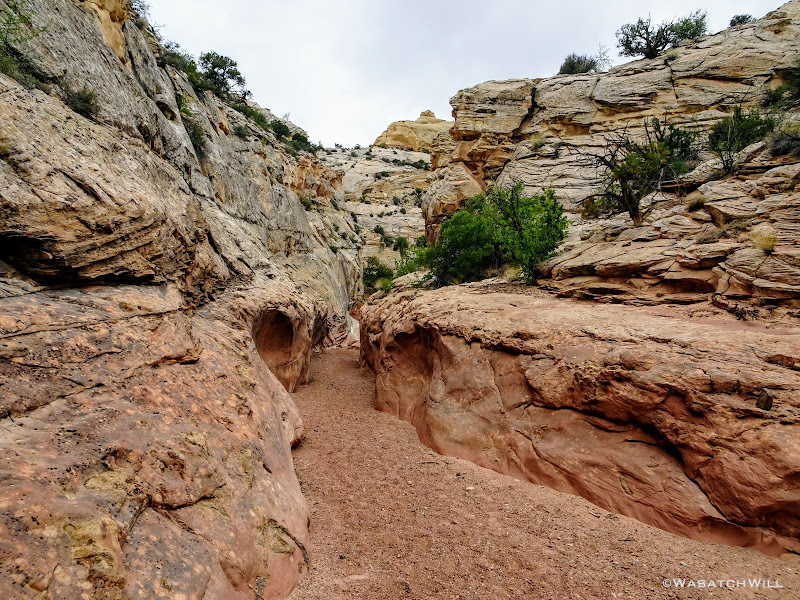
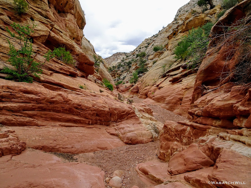
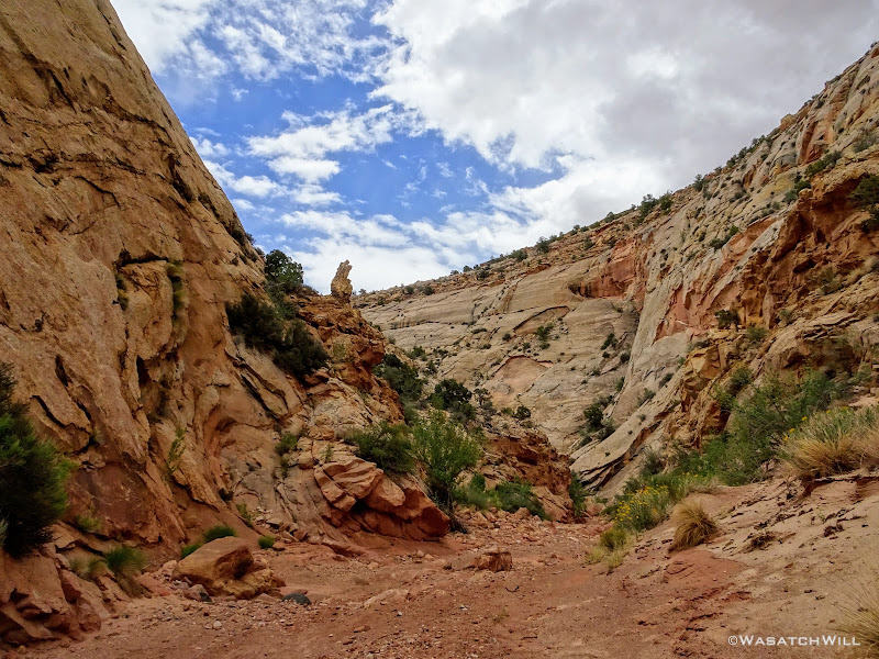
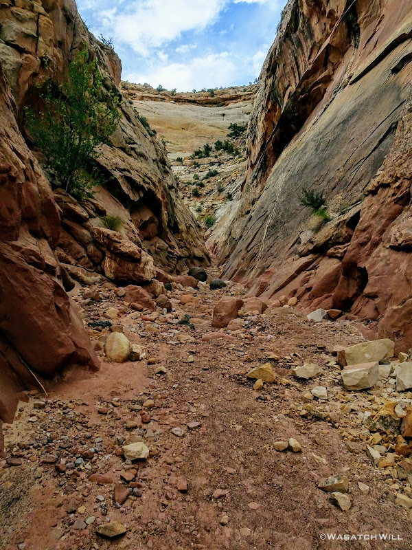
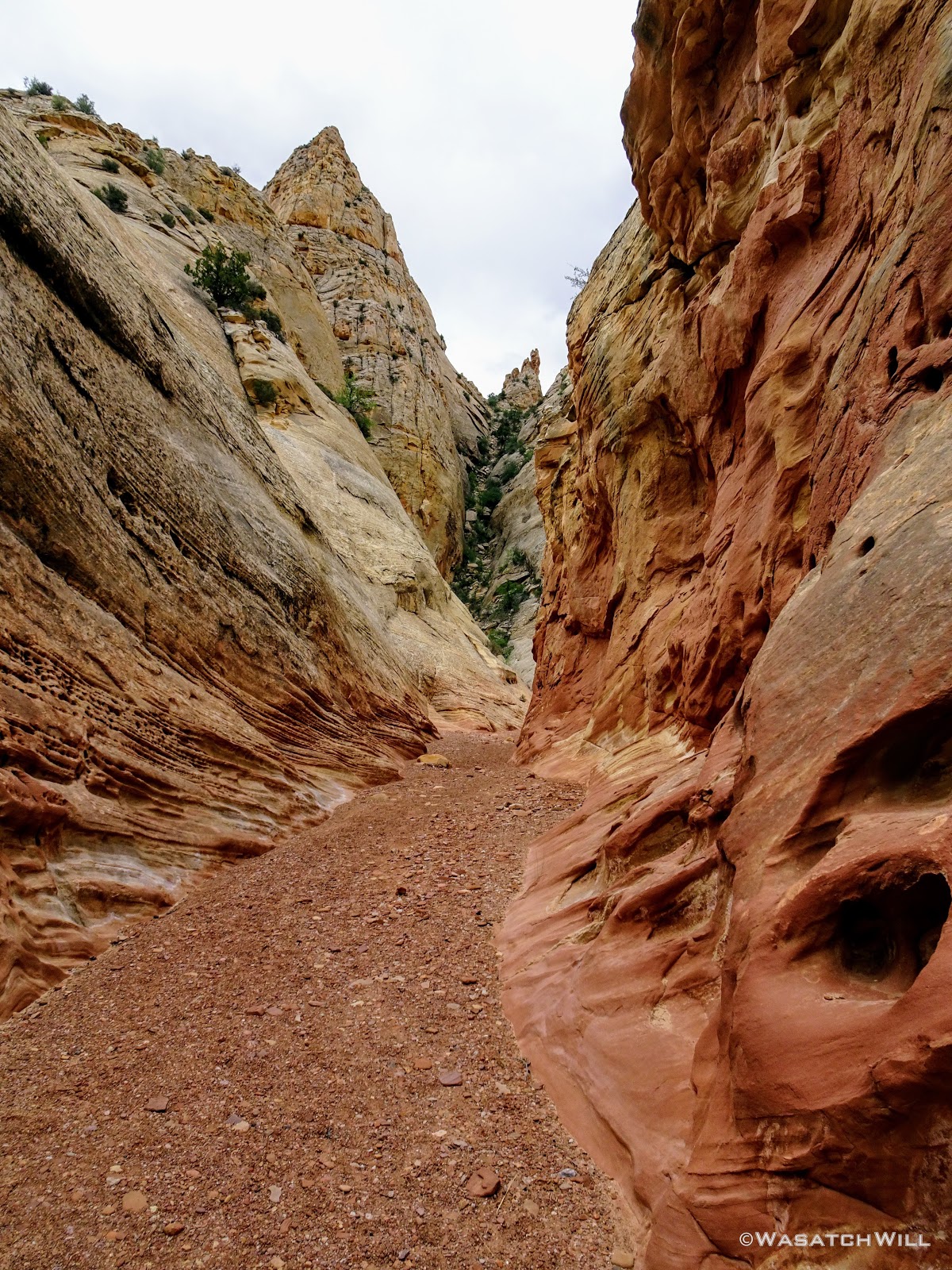
Notwithstanding the clouds behind me which I felt I was now racing, I looked back ahead down the gulch. This gorge through the Waterpocket Fold was about to get awesome! The race was on.

Getting into the More Exciting Parts
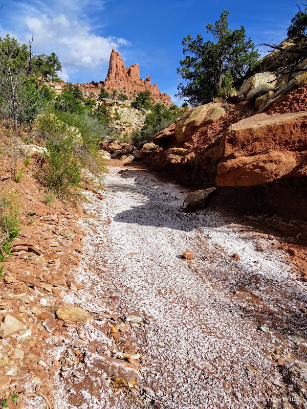
A Pinnacle Standing Watch over Upper Sheets Gulch
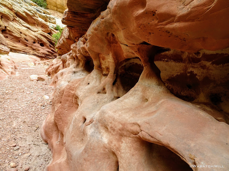
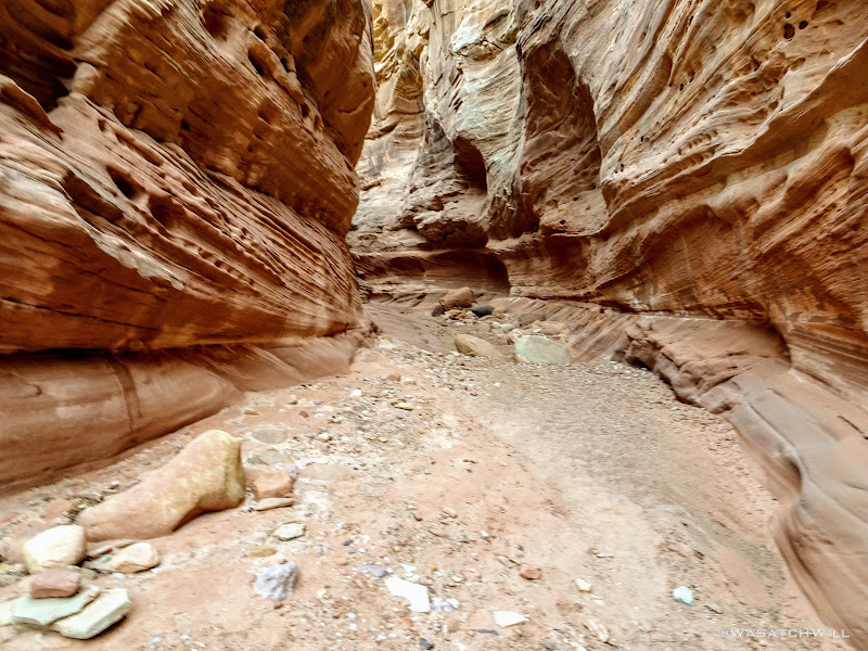
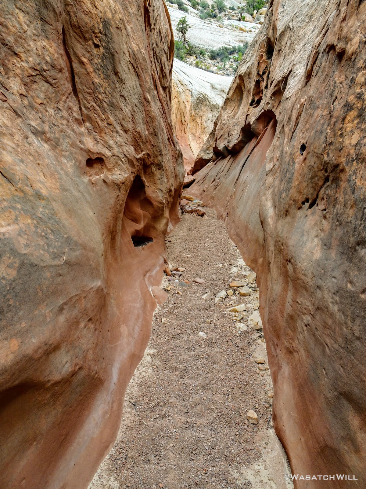
There was no shortage and thus no disappointment in the variety and uniqueness of the textures, colors, and geological features in the sandstone canyon walls, ledges. spires, domes, and pinnacles.
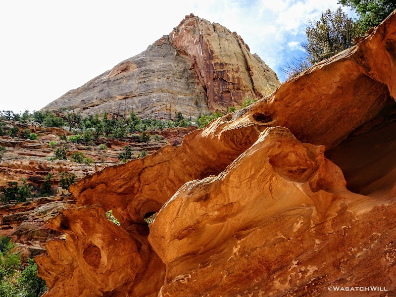
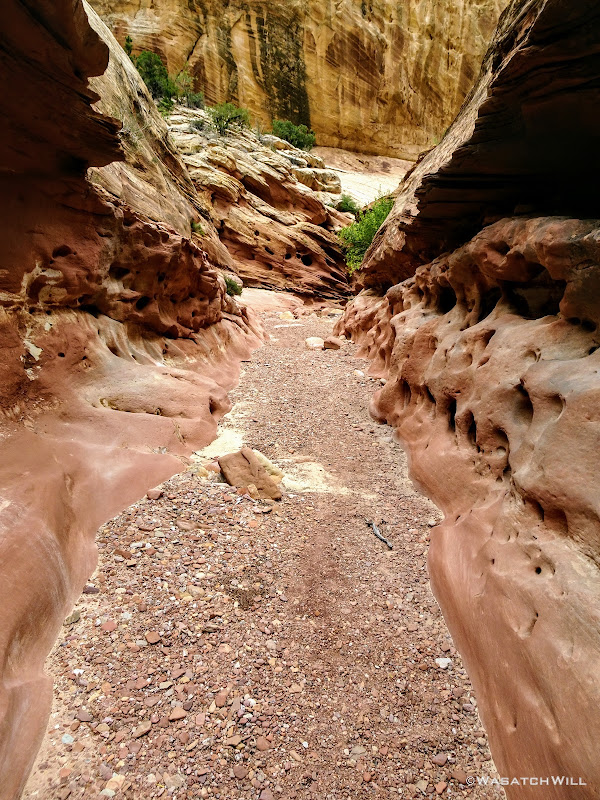
Sculpted Rock
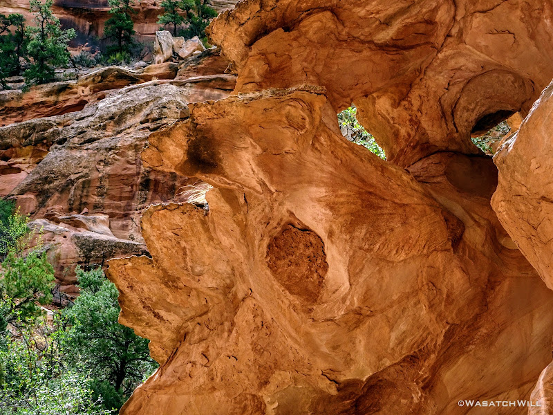
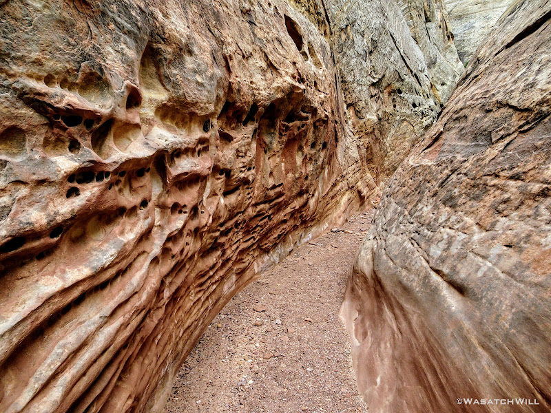
Holes Chiseled Out by Erosion
Another Navajo Sandstone Pinnacle Rising Up
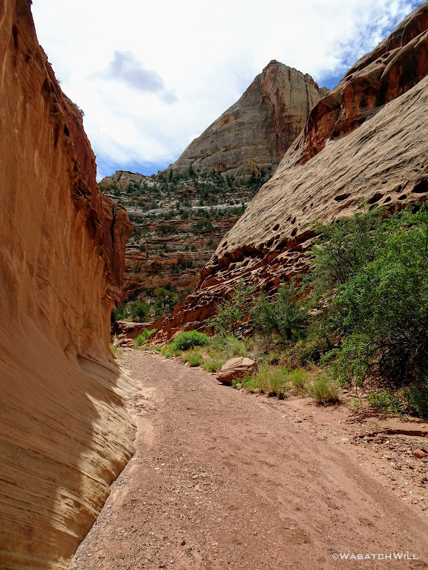
A Navajo Sandstone Dome Seen Above Through Some Narrows
More Pinnacles and Pillars
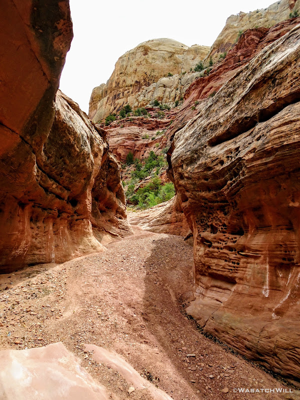
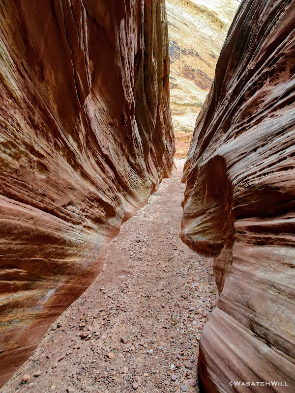
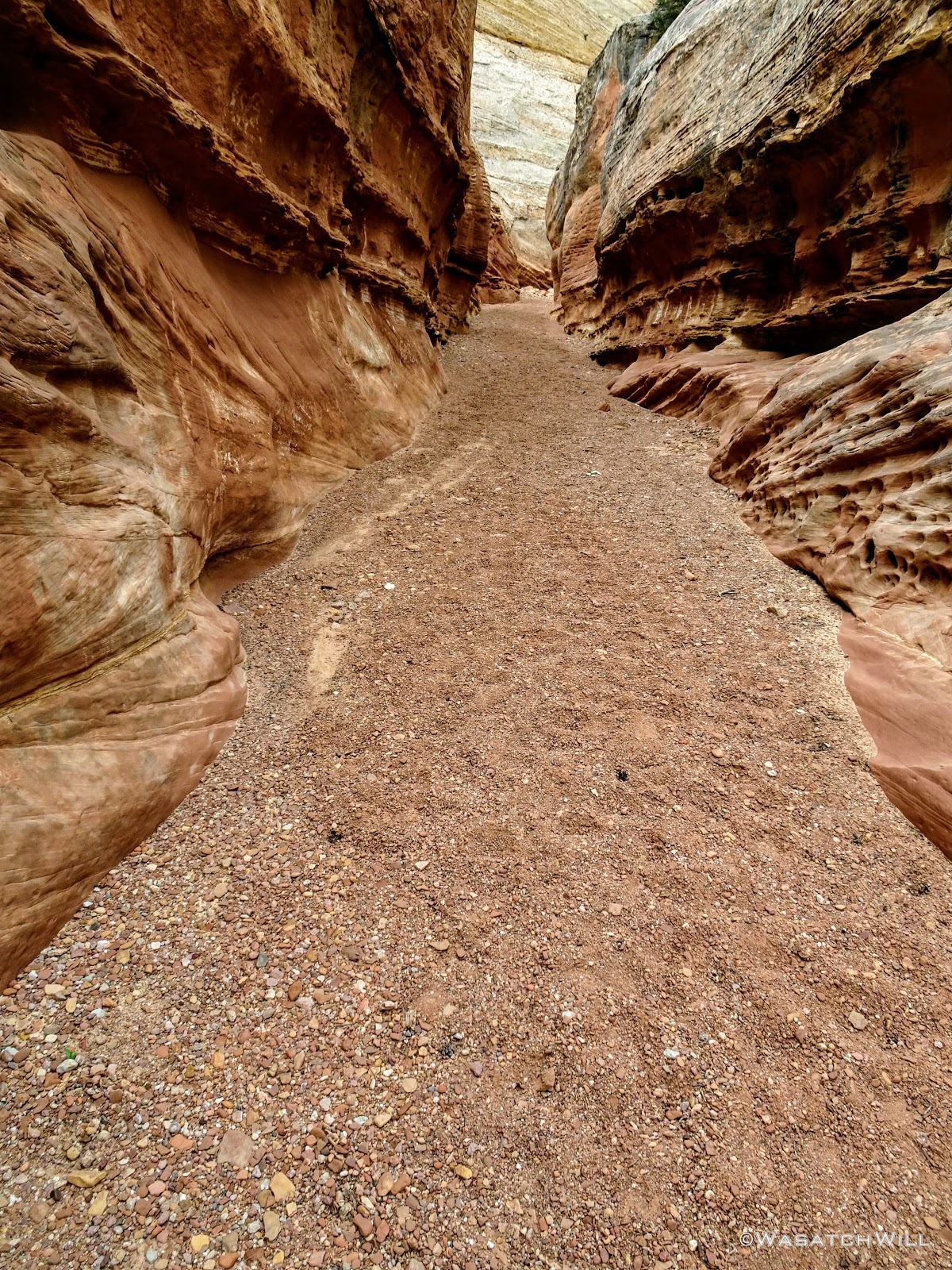
Another Section of Narrows
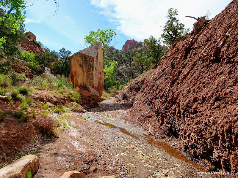
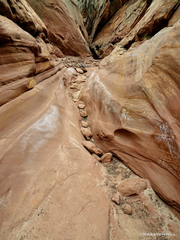
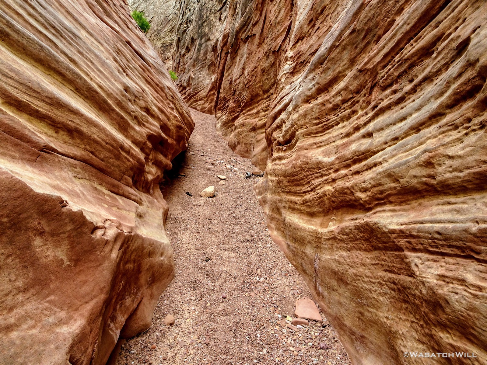
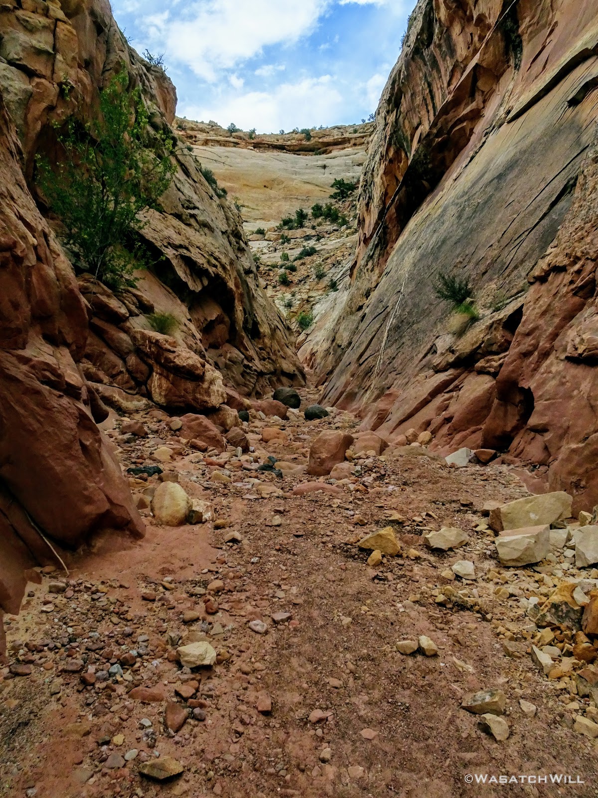
From narrows, to pour-off, to wide open, to a slot, to a drop, and back to wide open. Wash, rinse, and repeat.
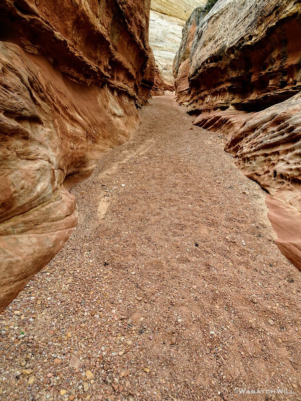
A True Slot, The First of a Few
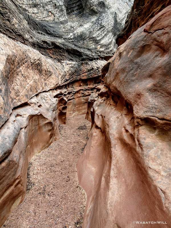
Deeper Into the Slot
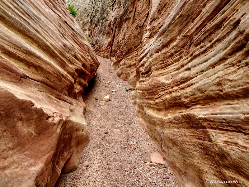
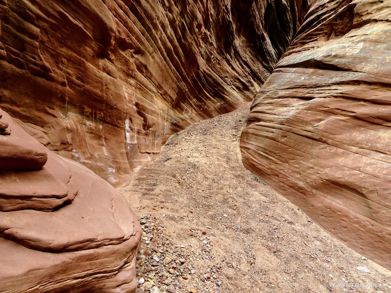
Vivid Textures in the Walls
Little Pillars Supporting a Layer of Sandstone

Another Slot!
Chasing the Light at the End of the Slot

Another Spire Rising Up High
And Another Slot
Twist and Turn
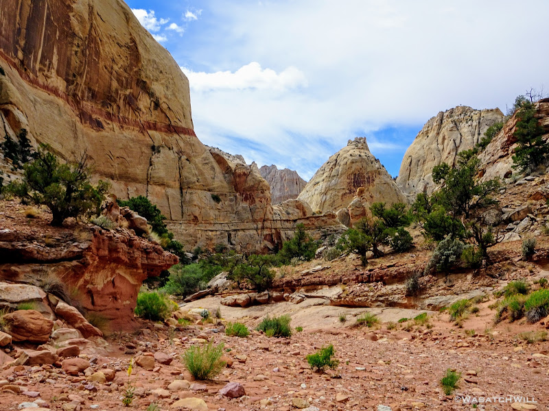
Back Out In the Open
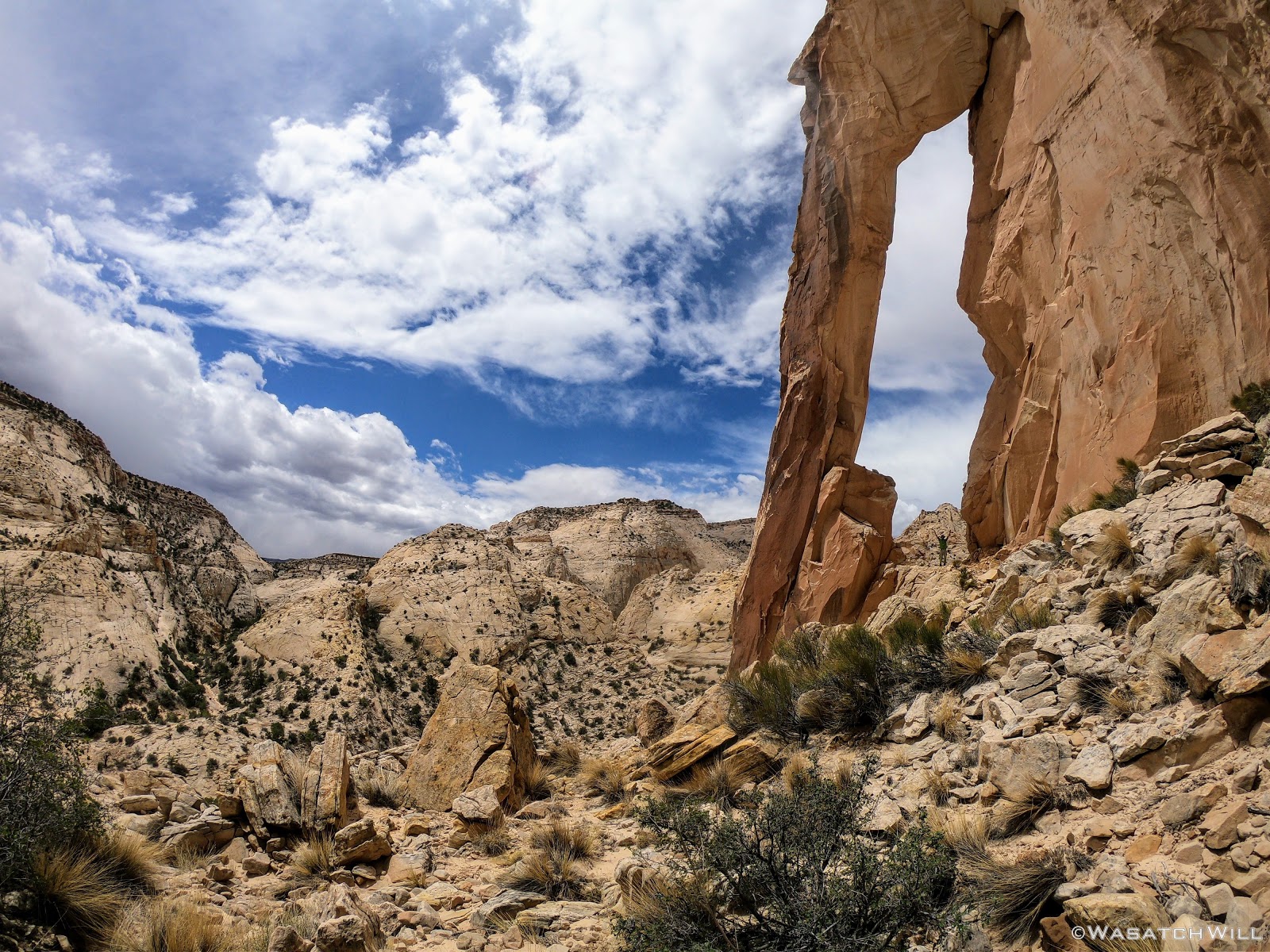
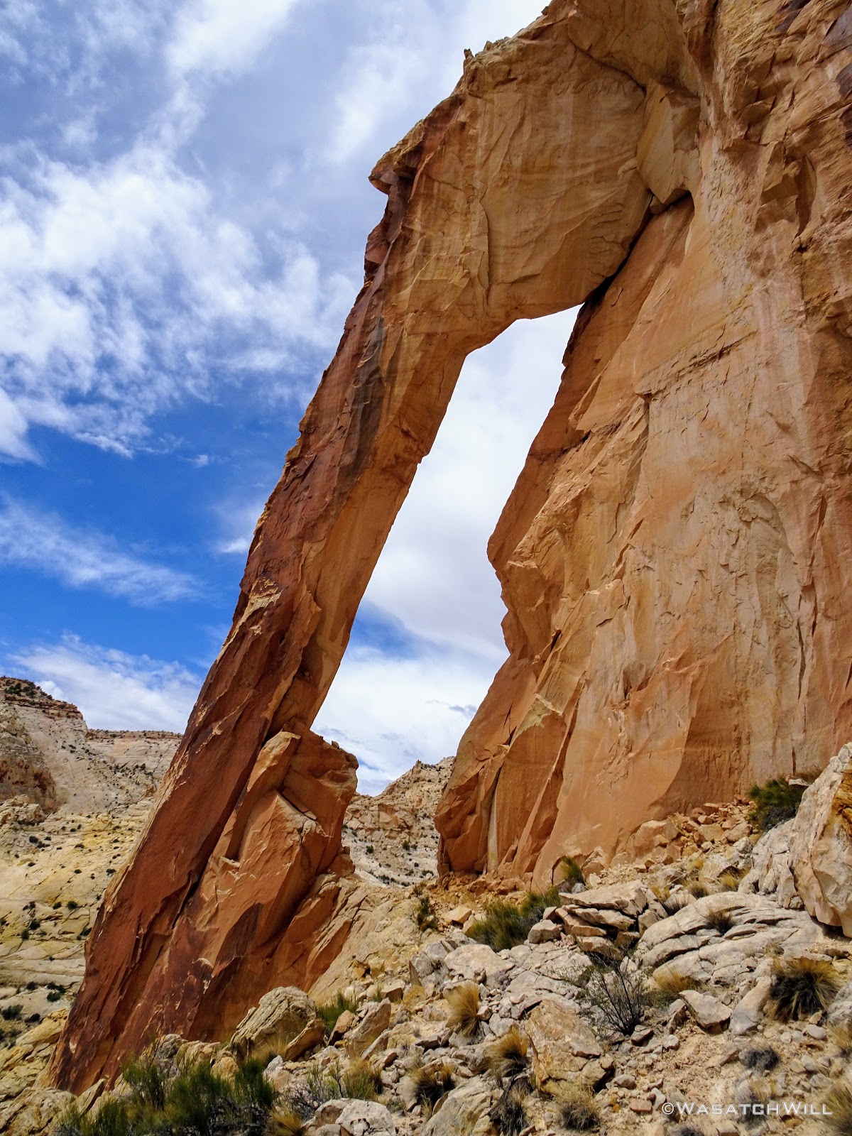
While racing the looming dark clouds behind me, the skies in front of me had remained blue. Then, as if by answered prayer, there was a break in the clouds behind me. They gave way to some blue sky and the clouds that remained lightened up to a friendlier looking white. I paused for a good rest on a low lying ledge beneath the great arch about two-thirds of the way down the gulch and re-fueled with some snacks and fluids. I then left my pack and climbed up the other side of the gulch to get an up close look at the arch.
For perspective, you can see how big it is with me standing in it in the picture immediately below. This was taken from a time lapse on my GoPro. The standard 10 second timer on a normal camera wouldn't be nearly enough time for me pull to this shot off.

'Sheets Arch'
The arch is not even labeled on standard maps, let alone having an official name. But...might as well call it Sheets Arch, as I believe most others who've hiked here refer to it as that.

'Sheets Arch' Portrait
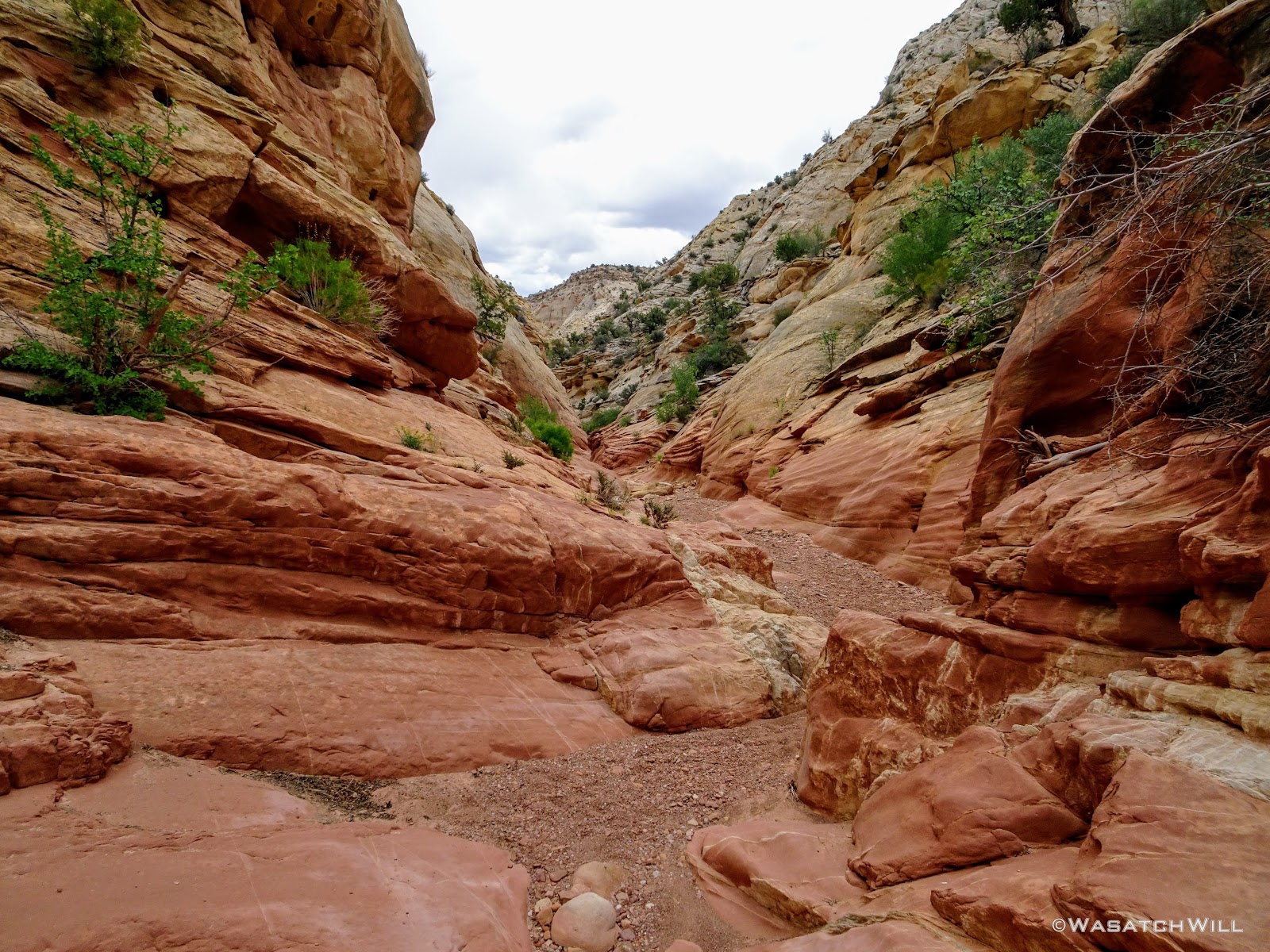
Back down at my pack, I resumed the rest of the hike down. Strangely, as I started to hike back down, the clouds behind me gathered back in on themselves and quickly started to darken up again. I never feared getting flushed out from a flood as there was always enough breaks in the narrows and slots to gain a ramp to a high ledge. What I feared was should a flood form, how long would I have to sit it out and would I end up having to stay another night? Though I knew any of that was highly unlikely, such thoughts still occupied the back of my mind.
I continued to hustle on down, pausing only for seconds at a time for a picture of any angles or other features that looked interesting.
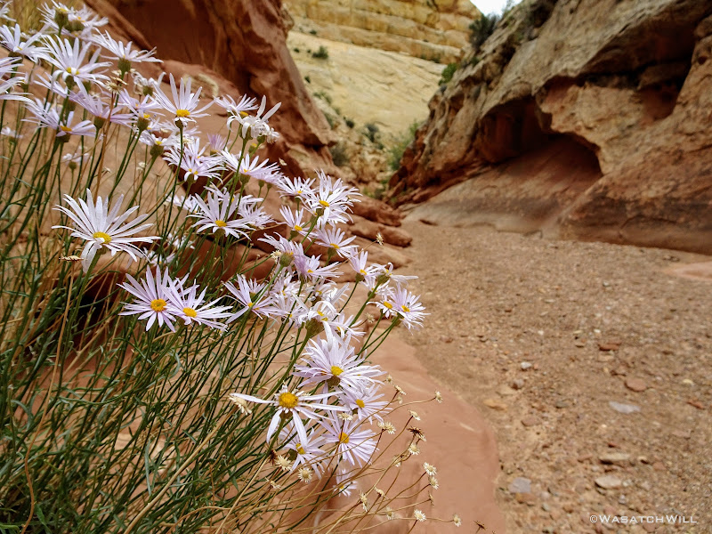
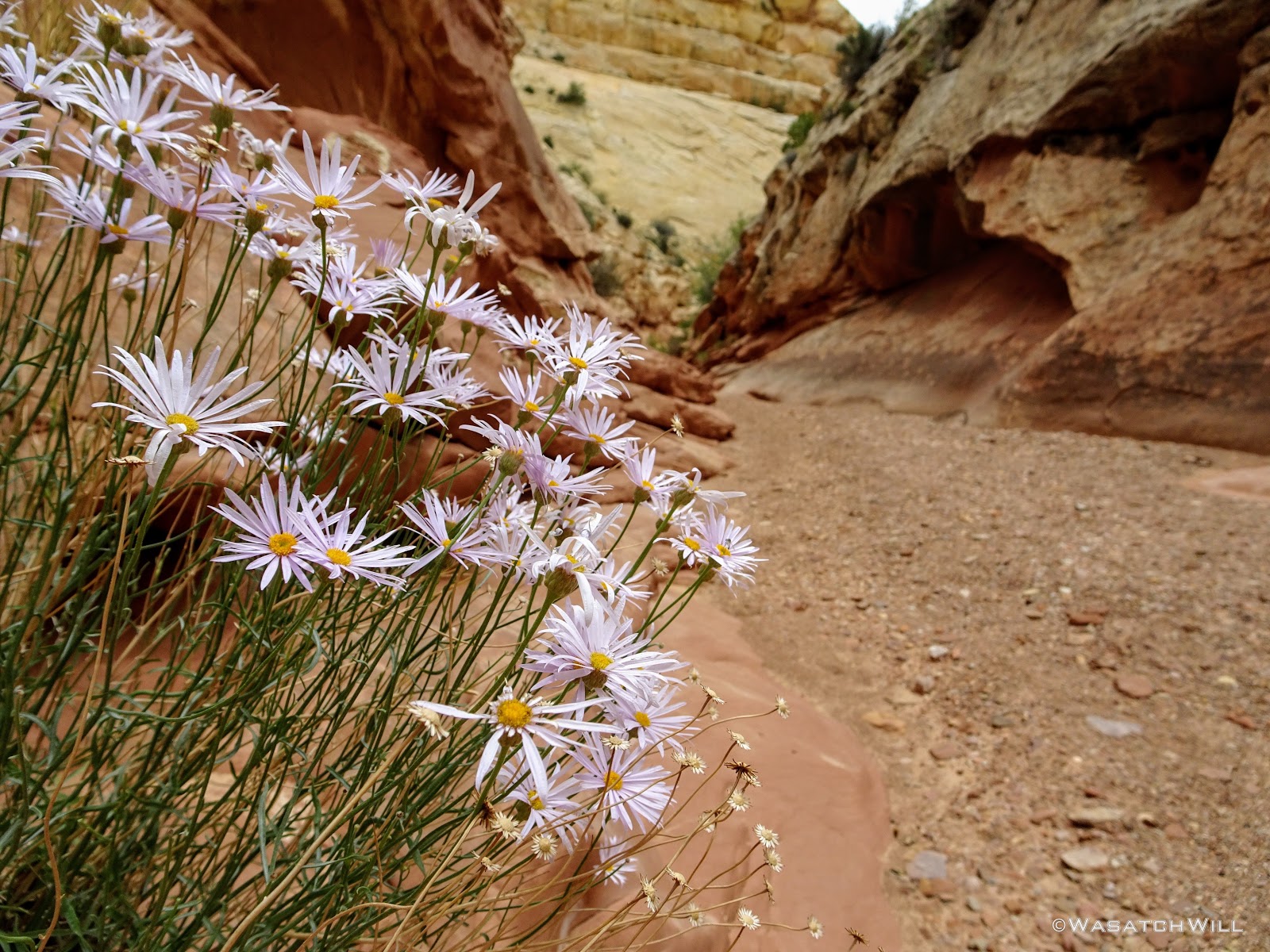
Desert Daisies
When I turned one bend, I looked up and saw a rock feature that looked a lot like a hand holding up the Boy Scout sign of three fingers pointed upward.
'Scout Sign Rock' - Can you see it?
So, I named it, unofficially, 'Scout Sign Rock'.
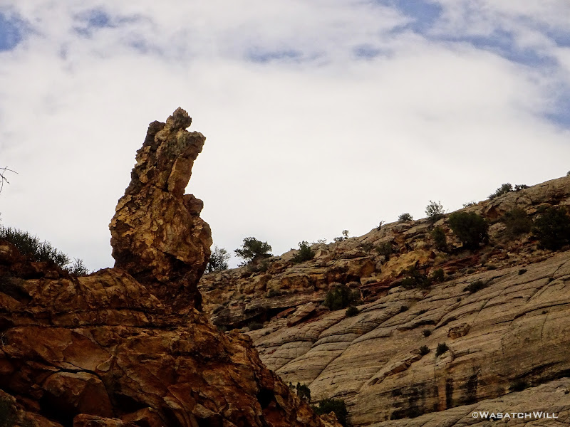
'Scout Sign Rock' Close-Up
And then on down the rest of the gulch, I continued.
Narrow Again She Goes

Yet Another Slot
Getting Closer to the Exit
And Closer
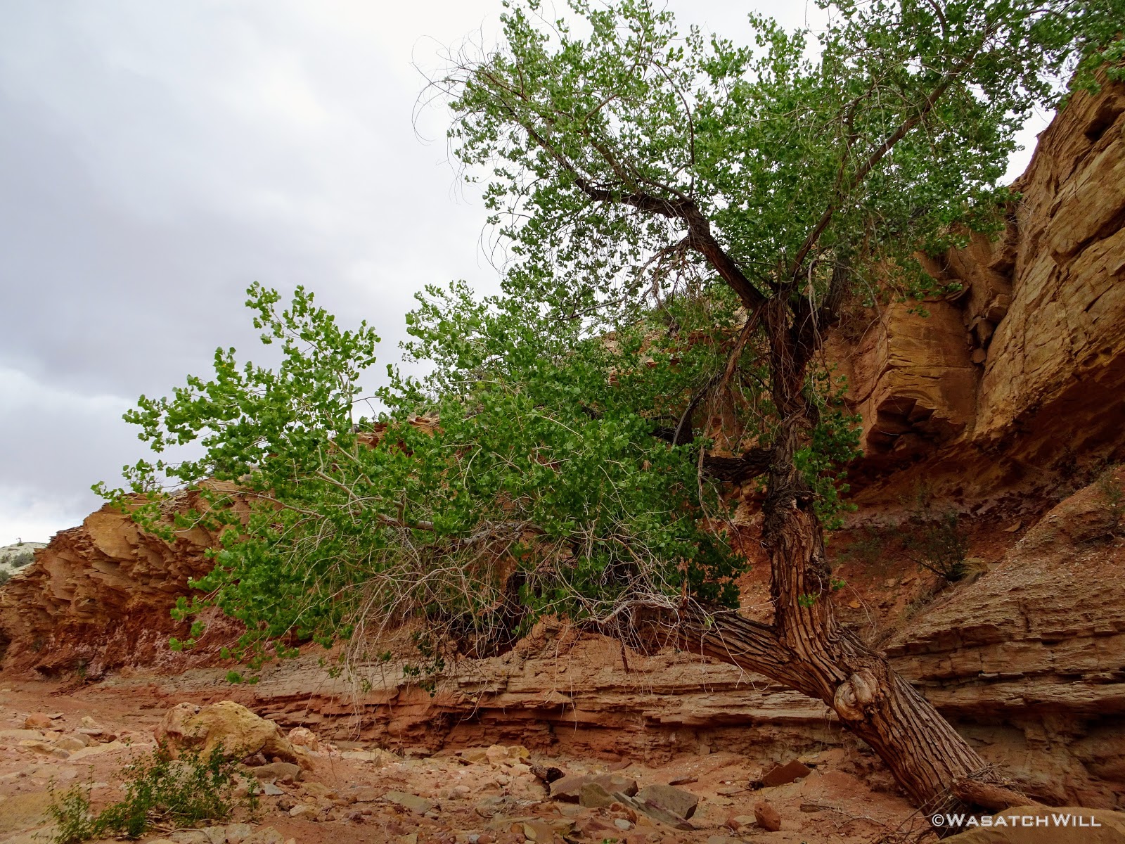
Finally, after passing through the final, and perhaps narrowest of the slots the gulch had to offer, I was in the clear for good. A Box Elder stood at the gates, as if it were holding a branch out to high five me for a job well done. It was only about 1:30 PM now and I knew the trailhead was now only about a mile away.
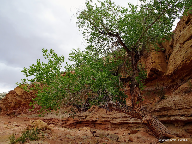
High-Fiving Box Elder at the Exit
Darker clouds were now starting to gather all around the horizon in all directions now and I even started to feel some rain drops. Was I ever glad to be out of there now!
Storms Brewing All Around
At last the trailhead came into sight, and a few hundred feet later, I was resting comfortably, arriving right on time at about 2 pm. What wasn't on time, was my ride. My father-in-law volunteered to be the one to come and get me, but wasn't able to make it out to the trailhead until a half-hour later. No matter! Now the clouds were a blessing, significantly cooling down the afternoon temperature as I sat there chugging down some more fluids and food.
On the Home Stretch to the Trailhead
Obligatory Selfie
For an overnight trip, I don't think I have ever covered so much distance in a 24 hour span. Altogether, it ended up being some 24ish miles I had hiked in that 24 hour period. Certainly nothing to brag about to the average marathoner or ultra trail runner or even a long trail thru-hiker, but still. I don't think I've ever seen such a variety of terrain in an overnight hike. Indeed, it may well have been my most epic overnight trip to date. This trip was an itch I was wanting to scratch all spring, and I'm glad it worked out the way it did. I'm glad I was able to turn what appeared to be a failure into a whopping success.
And once again, I found myself ever grateful for a wife who can support my outdoor addiction and all things backpacking with the ever-present urge to get out and explore. Of course, I'm also full of gratitude for her parents who are fortunate enough to now reside in Torrey, serving as a nice base to make a lot of these adventures in and around Capitol Reef National Park all logistically possible.
Video:
Day 1
Sunday - May 27, 2018
I started out by having my wife drop me off at the Pleasant Creek trailhead in Capitol Reef National Park early in the afternoon after securing a backcountry camping permit from the Capitol Reef Visitor Center along the way, with plans to actually camp in upper Sheets Gulch. She would then return to her parents' place with our kids in Torrey. It turned out the permit wasn't entirely necessary as will be explained further on.
It was about 3 PM. The weather was warm, but not overwhelmingly hot. Indeed, it was pleasant enough, for a pleasant walk up Pleasant Creek as a I retraced the path my wife and I took exactly one year prior. Though this time, instead of an out'n'back, I would venture further on with my sites set on new ground, new landmarks and geological features to see, along an overnight end-to-end hike.

Pleasant Creek
Moving Upstream
Clear Water
Lizard
The path followed is largely a cattle path still used today by ranchers who, with special permission from the National Park Service, drive their cattle herd back and forth every spring and fall through the park between Boulder Mountain and Notom Ranch or the greater Strike Valley. Due to the creek draining off of active pastures, E. Coli bacteria has been confirmed multiple times in the creek, so it is extra important to ensure one has an effective and functional filter or other water treatment method.

From Cattle Trail to Hiker Trail
One of Many Creek Crossings

Coming to the Other Side

Further Upstream
Small Cascade
Once again, I was blown away at the beauty of the canyon walls rising up more dramatically as I progressed up stream. Ironically, the more climatic part of this section of the creek doesn't begin until just after leaving the park boundary.

Slickrock Cascades

Creek Against Wall
Creek Against the Other Wall
At one point I turned around to once again to behold what might well be the most majestic view along this stretch of the creek before continuing on.

Majestic
Textured Walls

A Sprinkling of Ponderosas
A Series of Small Cascades
Had it been any hotter and had I any more time to spare, I would have been sorely tempted to take a quick dip in one of the pools.

A Tempting Pool
Into the Open
Soon, the canyon walls came to an abrupt end and was back at in the open. I continued upstream, jumping over a cattle fence, en route.
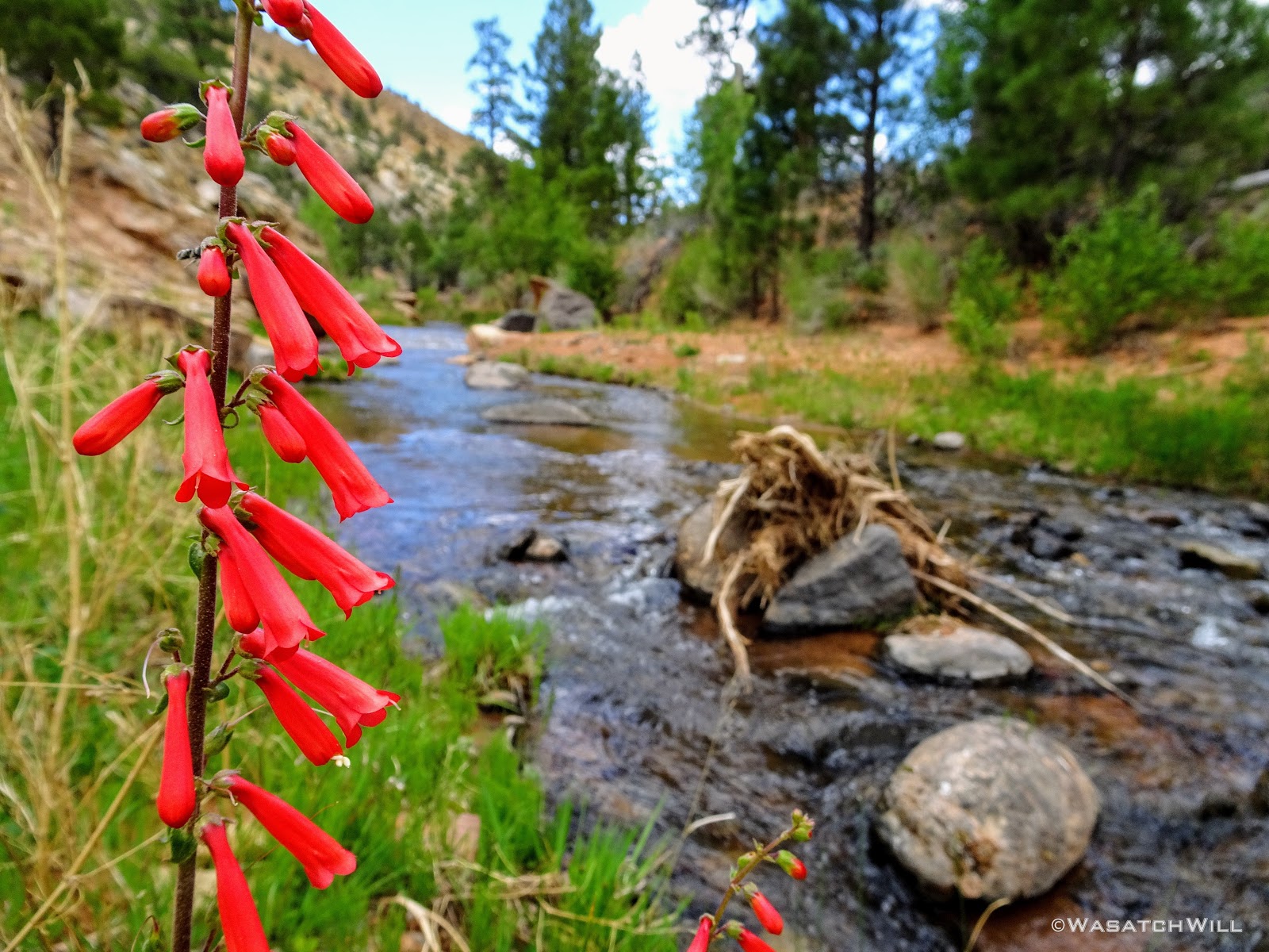
Penstemons Along the Creek

Another Waterfall
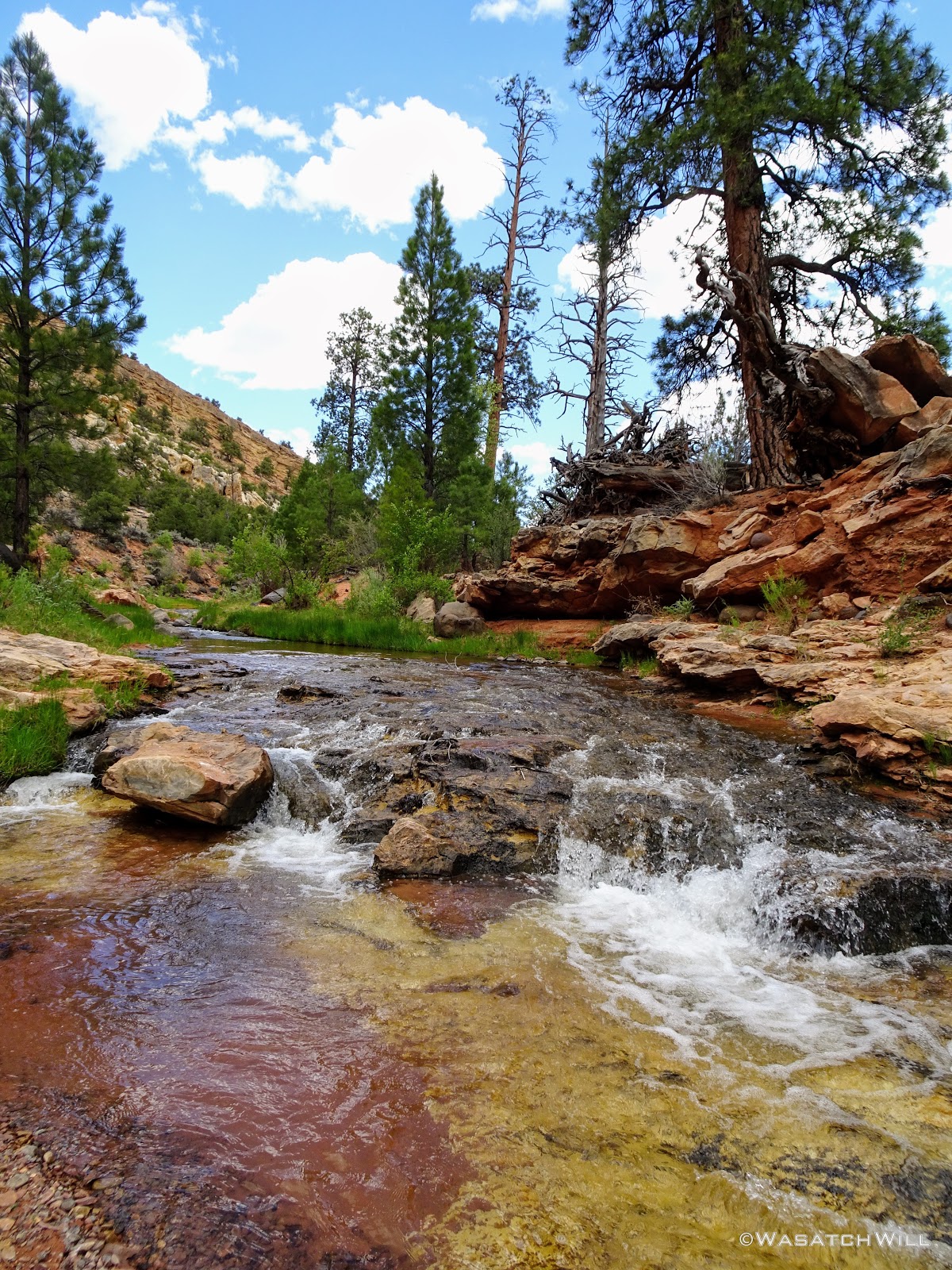
Bicolored Creek Bed
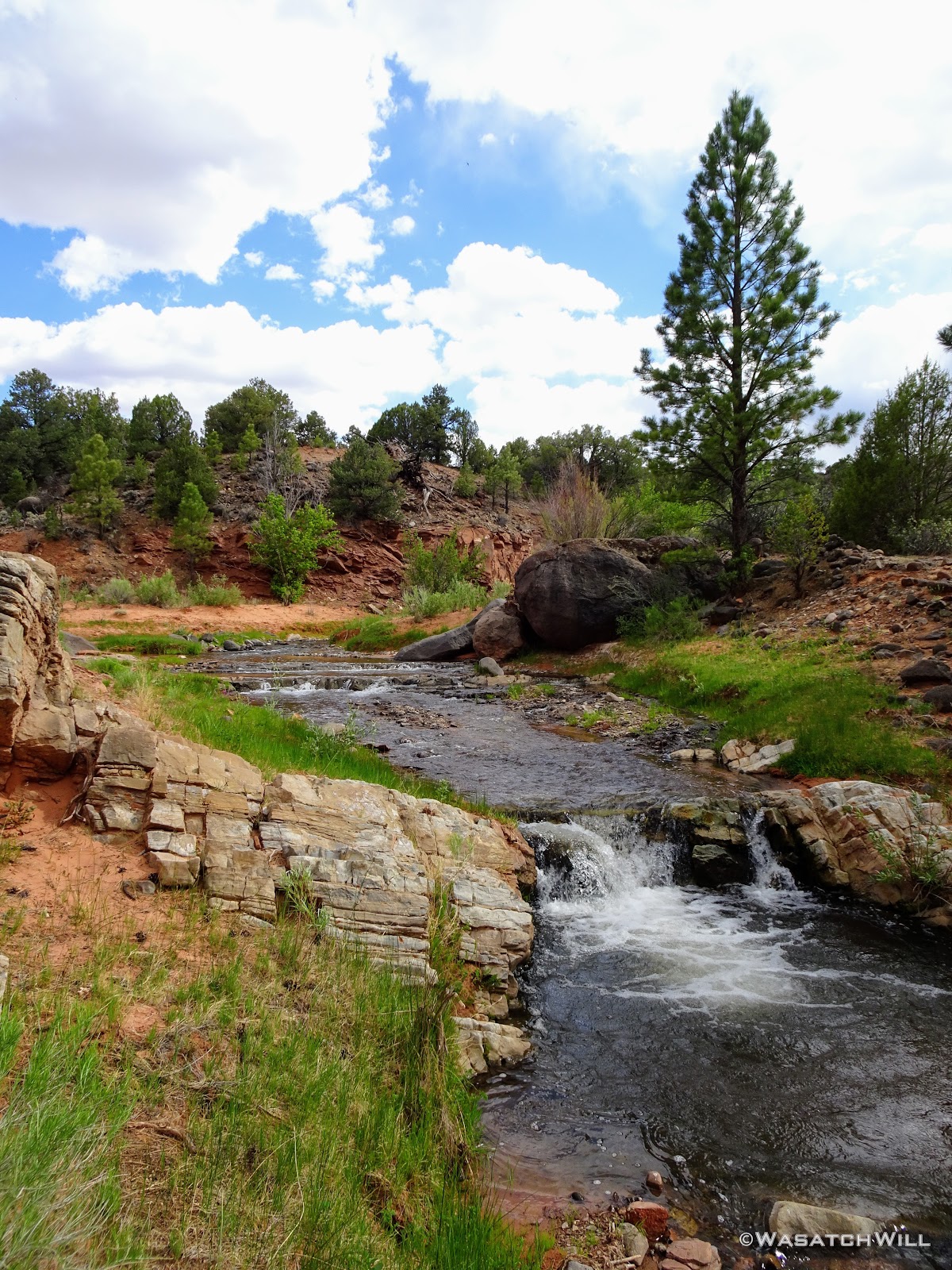
Waterfall + Pool
Eventually I arrived at the junction of Tantalus Creek and near the site Jessica and I had camped a year ago. This time, I'd continue on up Tantalus Creek up into Tantalus Flats and beyond. The green low lying grass was such a change of landscape and texture.

Tantalus Waterfall

Lower Tantalus Flat
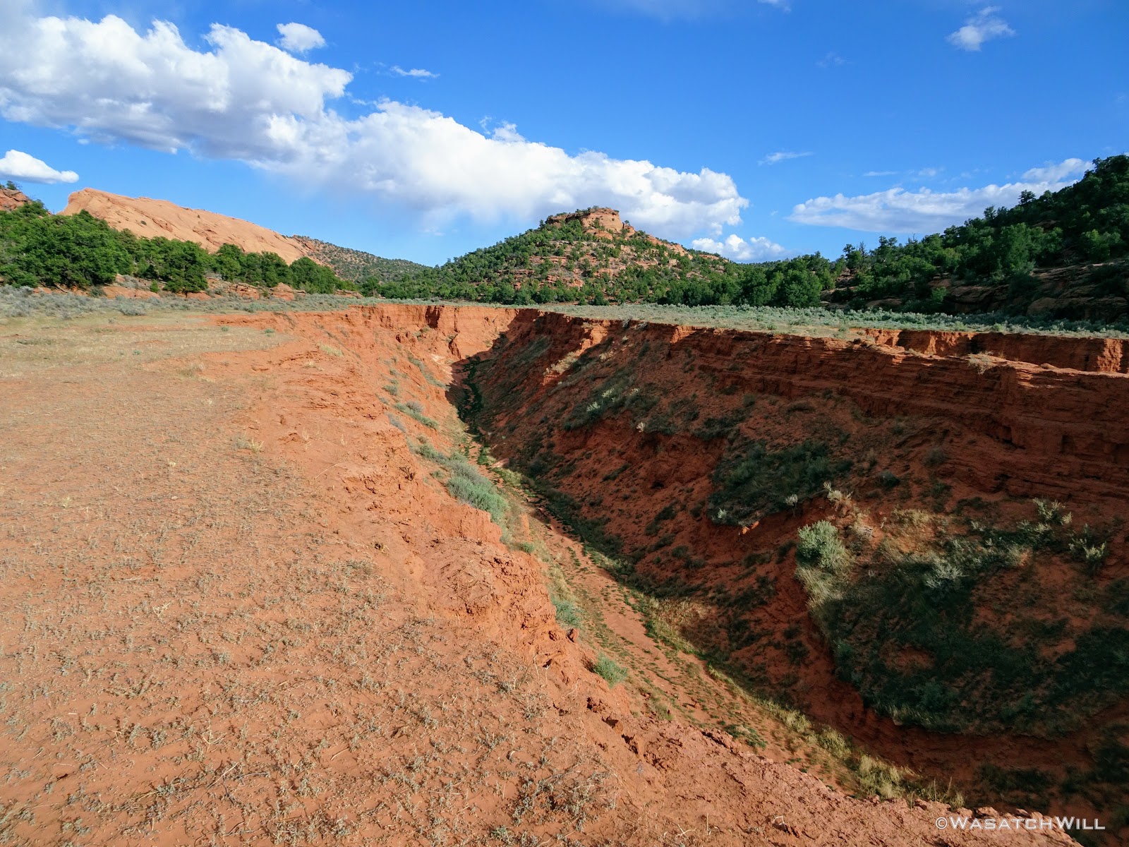
The creek was much gentler as it cut through the long grassy meadow, only interrupted once by a brief slab of sandstone where it had created an embryonic slot canyon.

Up Close on Tiny Tantalus Slot

Short Slot Canyon in Embryo
A little while later another break in the crust of the meadow gave rise to a short, drapery waterfall.

Another Break in the Flat
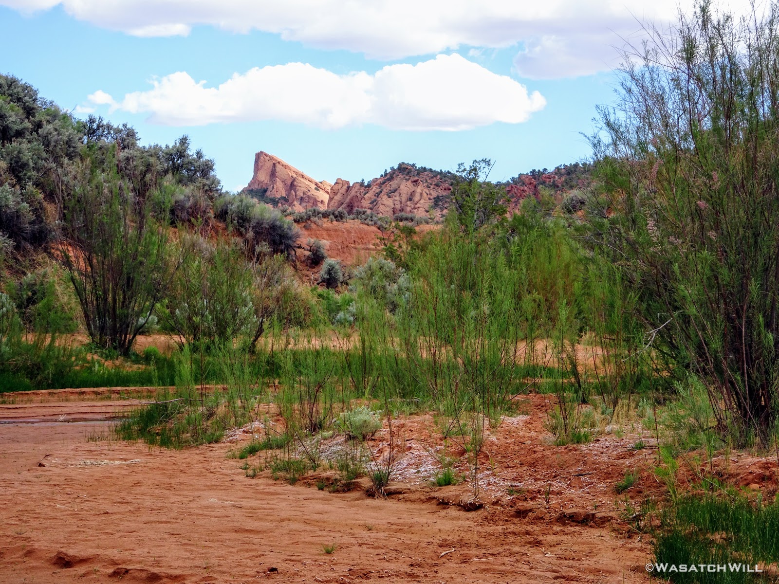
Soon, I had the Salmon in view off in the distance. The Salmon is a somewhat unique slab of sandstone that rises abruptly from the relatively flat landscape surrounding it. While I knew I could hook up with a road to carry on around its eastern face, I was greedy for some lesser traveled cross country hiking, both for the exploration factor and to check out some unnamed arches labeled on the map. I was also hopeful I could find a way around the western face of it as I sought to descend into Sheets Gulch further beyond.

The Salmon Comes Into View
Zooming In On the Salmon

Take Only Photos (and water), Leave Only Footprints
Continuing on along the creek, I almost stumbled over a skull. Whether it belonged it a cow, a horse, or something else, I knew not. Still, it was a stark reminder of the circle of life.

Mystery Animal Skull
Soon as I was on the 4WD road. It was here that I could have opted to go left and keep things easy, but instead, I continued to follow it upstream before quickly leaving it again on my way up to Maverick Draw, the throughway that would lead me up to the western flanks of the Salmon.

Tantalus Flat Road
Once at the mouth of Maverick Draw, I loaded up my water capacity. I harvested 4.5 liters of water because I was not absolutely certain about a couple other possible sources I had marked out along my planned route, especially with the exceptionally dry winter. Better to play it safe than sorry I figured.
On up Maverick Draw, I went.

Entering Maverick Draw
At some point along the left side, I found a pathway leading up a break in the high running arroyo and out of the draw. This would prevent me from getting boxed in further up the draw. It would also bring me back within sight of the Salmon, this time, its more 'gradual' western slope.
Up On the Bench with the Salmon in View

Closer Up View of the Salmon
I had hoped to get up close to its arches, but the topography ended up being much more rugged than the maps had made it appear. It never ceases to amaze how much variance there can be within 40 feet of elevation out in these landscapes. I was still miles away from where I wanted to camp and time was speeding by. I did not have the time I wanted to try and find a way up the Salmon to get a closer view of the arches, so a close-up with my camera had to do.
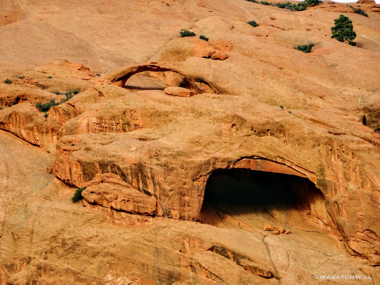
Some Arches on the Salmon
I continued traversing the southwestern side of the Salmon in hopes of finding a suitable way over its ridge, or at least around its southern tip, to get to the mouth of Sheets Gulch.
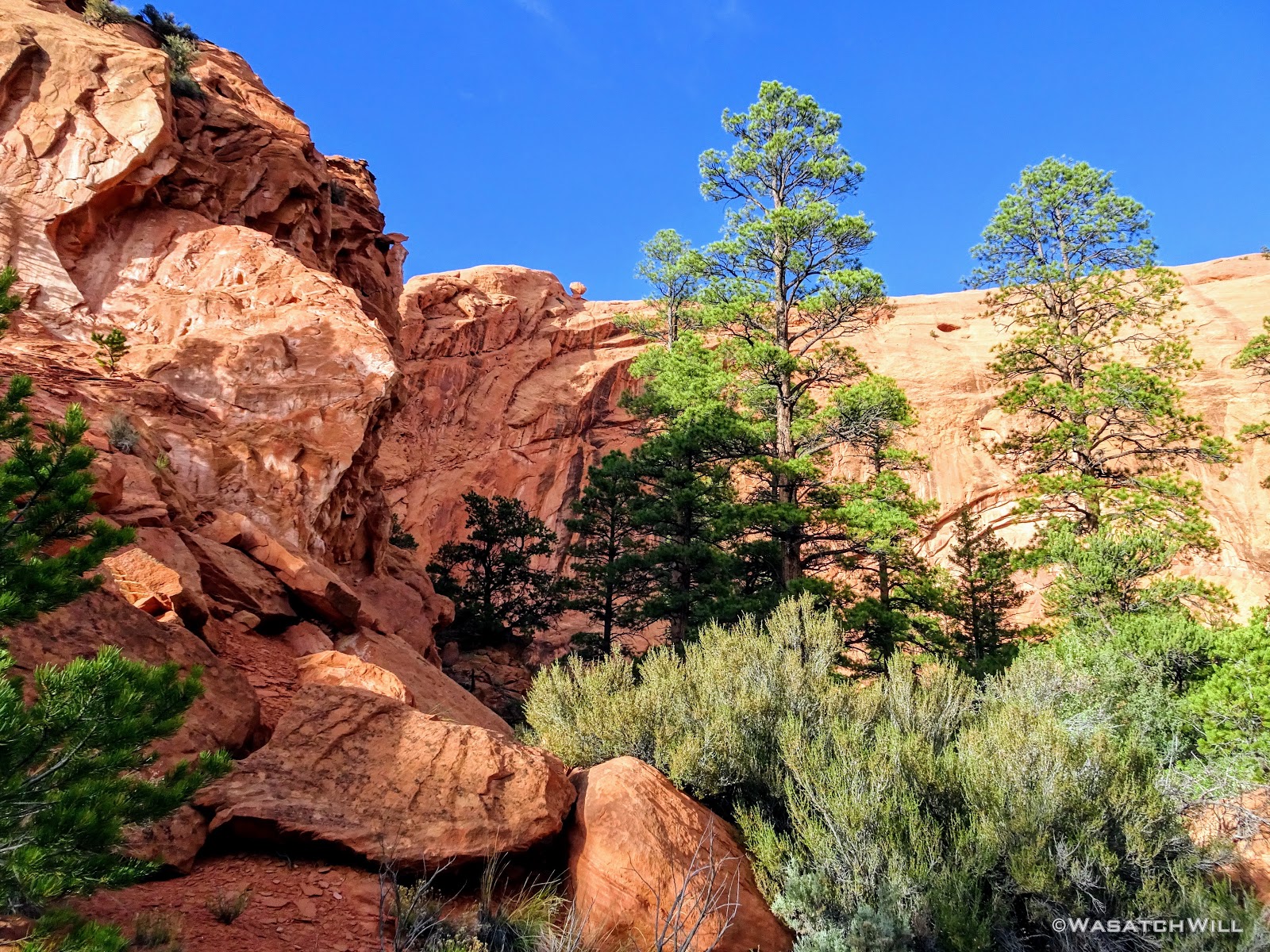
Big Ponderosas at the Foot of the Salmon
The views I had gambled for came to be all I had hoped for and more.
Another Arch Along the Salmon Ridge Top
When I was able to look out and see the low-lying, yet surprisingly jagged Nick's Peak out below...it was an instant WOW moment.

Nick's Peak (just right of center)
Out to the west rose Boulder Mountain. Not quite as dramatic and breathtaking.
Boulder Mountain Resting on the Horizon
I continued on, first seeking a way to get down, over to, and up and over the saddle between the Salmon and Nick's Peak. When that failed due to impassable cliffs, even along the ridge itself, I sought a route down the drainage leading around the southern edges of Nick's Peak. That all too ended up in cliffs and impassable pour-offs time and again. Stumped, tired, and now in the final hour of any usable daylight, after hiking about eight+ miles in about five hours, I called it off. I found a small flat in which to make camp for the night, still well over three miles away as the crow flies, more by foot, from my desired destination for the night. I now had some new choices to think over through the night as I rested in a remote and rugged edge of Dixie National Forest.

Closer Up on Nick's Peak with Sheets Gulch, Henry Mountains in the Distance (above center)
Exhausted and now a bit queasy, probably due to being partially dehydrated, I mixed up some gatorade, chugged a good bit of that down, got my tent up, and then got to rehydrating and eating some good ol' Mountain House Beef Stroganoff, which turned out to be quite a chore with my stomach feeling unwell. Still, I managed to force it all in me knowing that my body needed it and then retired to my tent to watch a movie where I would feel my body quickly begin to recover with the nutrients it had been starved of through the afternoon and evening in my vigorous efforts to keep to the original plan.
Day 2
Monday - May 28, 2018
It was a restful, clear, and calm night. I had made the decision sometime during the night to wake up before the sun rose, pack up camp just after sunrise, and start heading back the way I came immediately after. I was going to go back to the road that crossed Tantalus Flat and make another decision there based on time. Plans had been made to get picked up at the Sheets Gulch Trailhead along Notom Road at about 1 pm prior to the start of the trip but that was now looking like it wouldn't happen.
Sunrise came, and I was treated to a splendid little show along the eastern horizon as I got myself out of my tent.

Sunrise Over Buck Point
The View Into Sheets Gulch from Camp

My Camp with Nick's Peak (center) Down Beyond
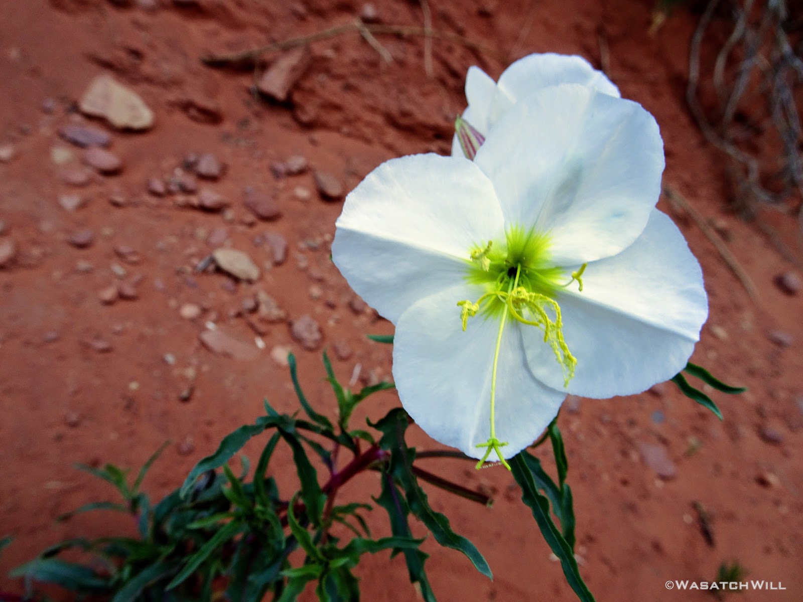
Primrose Flower
Back in Tantalus Flat
I arrived back at the road in Tantalus Flat at 8 AM. At this point, I decided I would hike down the road out into Sheets Draw and see how far I could get in two hours. I'd then make a decision to either turn back around and return up the road and wait to be picked up at another point along the road near Pleasant Creek further upstream...or...continue on with my original plan to hike out through Sheets Gulch. An update was sent out to my wife via my InReach and I topped off my water reserves with another liter of water before beginning the trek down the road.
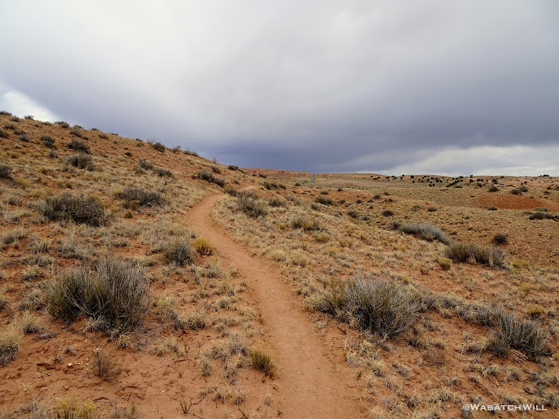
Surprisingly, the road was in great shape and made for some relatively easy and fast walking with a pleasant morning breeze to keep the air somewhat comfortable. I could soon see the eastern face of the Salmon and Nick's Peak further down.

Along the Road with Salmon (center) and Nick's Peak (left) in view
Besides some regular birds and a rabbit that ran across the road in front of me, the only other wildlife I'd see was a fuzzy caterpillar inching its way along the side of the road.
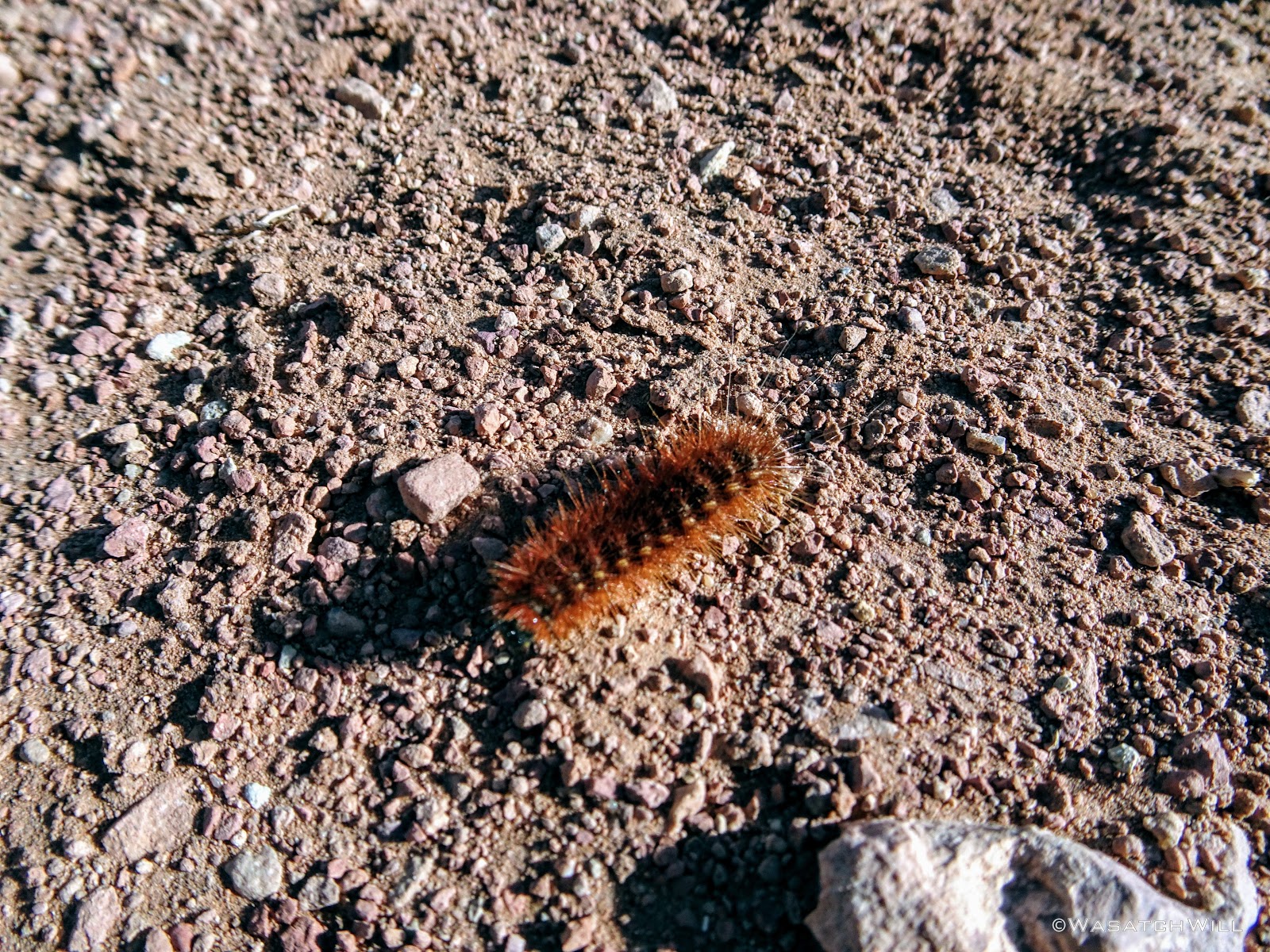
Fuzzy Caterpillar
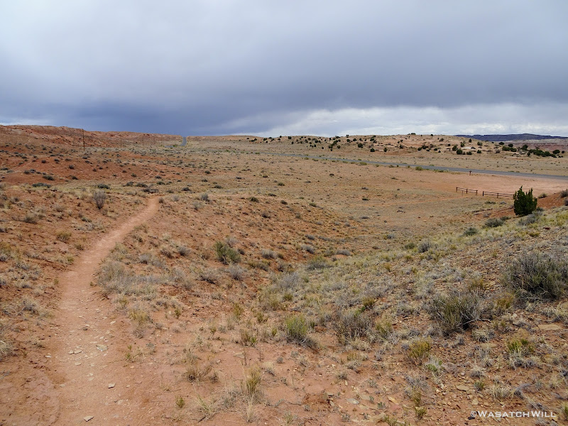
In just over 45 minutes, I covered 2 miles where the road turned up toward South Draw. I left the main road here, following a short spur road that dead-ended at another cattle fence.
Getting Closer to Sheets Gulch
There was plenty of space to duck under the fence where the road reached a dead end, and there I found a found a foot path heading in the direction of Sheets Gulch. I even saw human shoe prints. It was a bit joyful to see such a sight after all the roaming I had done the evening before.
The Pathway Leading to Sheets Gulch
I followed the path down along the bench, then further down as it dropped into a gulley, still leading the way down to Sheets Gulch. There were a few little obstacles along the way in the form of short little dryfalls to navigate around and bypass to keep it entertaining.
Looking Back at One of the Obstacles Bypassed

Yellow Primrose?
Another 45 minutes later, now about 9:30 AM, I reached one of the spots I had marked out as a possible, but uncertain, water source and what was more or less the mouth of Upper Sheets Gulch. There was water there indeed, and it even flowed on and off for a ways down through the upper reaches of the gulch before vanishing for good. I'll remember this should I ever hike this route again with wife, kids, and/or friends in the future.
With another half hour to go before it was time to make a final decision, I filtered a bit more water just for good measure and continued on down into the gulch. Even though my decision wasn't yet fully final, I knew I didn't want to hike back up the elevation I had just descended so I was feeling quite sure I was going to push on all the way down and out the gulch now.
Water Source Confirmed
Looking Back up at Nick's Peak
Small Stream Flowing from Water Source
By 10 AM, I was now well into Sheets Gulch. Somewhere just after the water source, I had crossed back over into the Park boundary. If there was a sign marking the boundary, I missed it. After further considering the distance I had just traveled in the last 2 hours and the elevation I had descended (over 5 miles and over 500 feet in just over a mile of that stretch), I was now committed to finishing it out. I alerted my wife of the progress I had made and made arrangements to be picked at the same trailhead as planned at 2 PM rather than 1 PM. I also asked her to keep an eye on the weather radar and update me of any weather heading my way. Some dark clouds were brewing up back up toward Boulder Mountain, but I knew the feeders for Sheets Gulch were all much closer and that nothing from Boulder drained into Sheets. Still, I grew a little nervous at the sight of the clouds and hoped that such storms continued to track northeasterly in their typical pattern. Perhaps more than any other trip, this one served to make me more grateful than ever to have picked up an InReach when I did for its 2-way communication abilities.
Notwithstanding the clouds behind me which I felt I was now racing, I looked back ahead down the gulch. This gorge through the Waterpocket Fold was about to get awesome! The race was on.
Getting into the More Exciting Parts

A Pinnacle Standing Watch over Upper Sheets Gulch
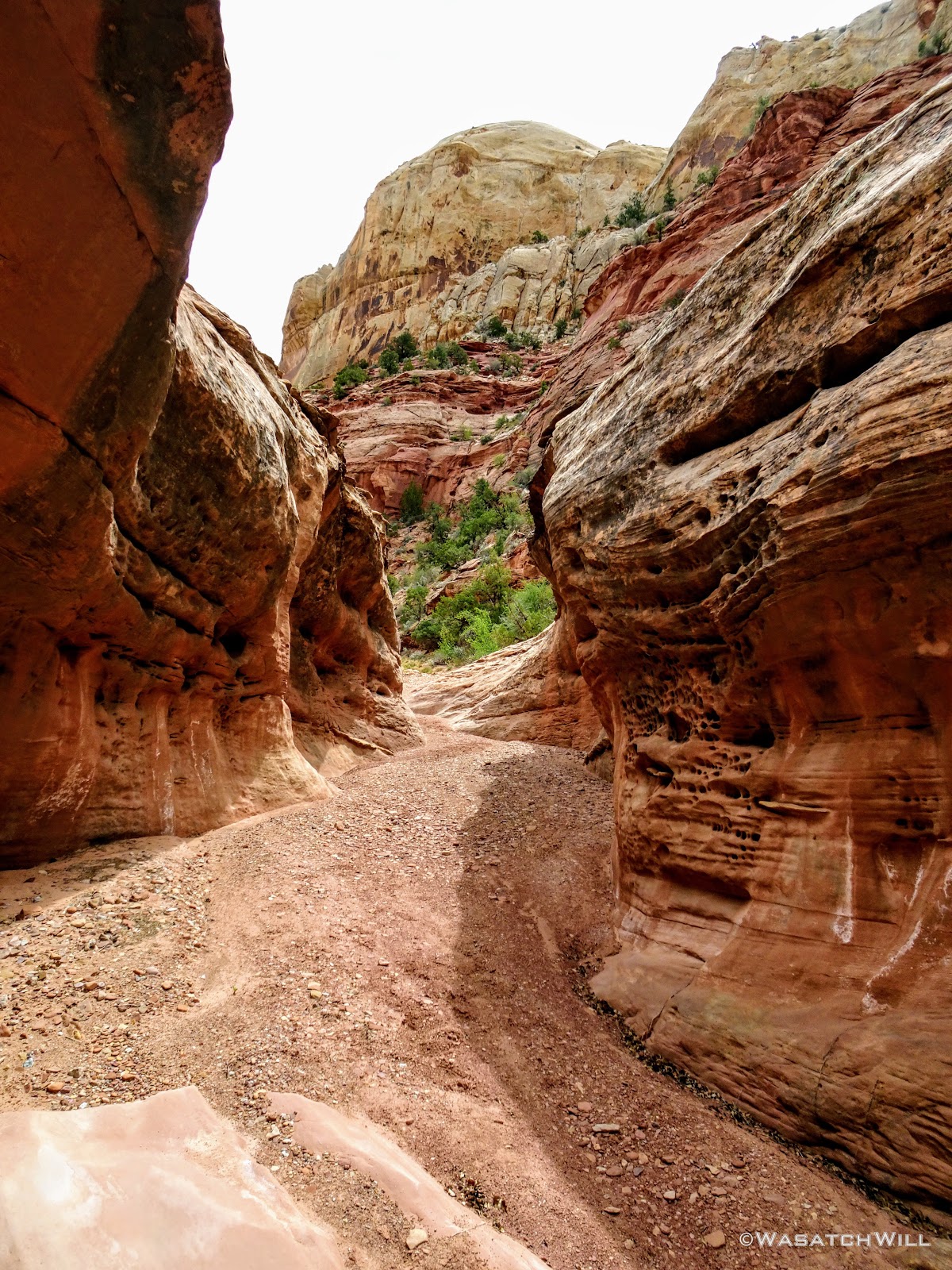
There was no shortage and thus no disappointment in the variety and uniqueness of the textures, colors, and geological features in the sandstone canyon walls, ledges. spires, domes, and pinnacles.

Sculpted Rock

Holes Chiseled Out by Erosion

Another Navajo Sandstone Pinnacle Rising Up
A Navajo Sandstone Dome Seen Above Through Some Narrows

More Pinnacles and Pillars

Another Section of Narrows
From narrows, to pour-off, to wide open, to a slot, to a drop, and back to wide open. Wash, rinse, and repeat.
A True Slot, The First of a Few
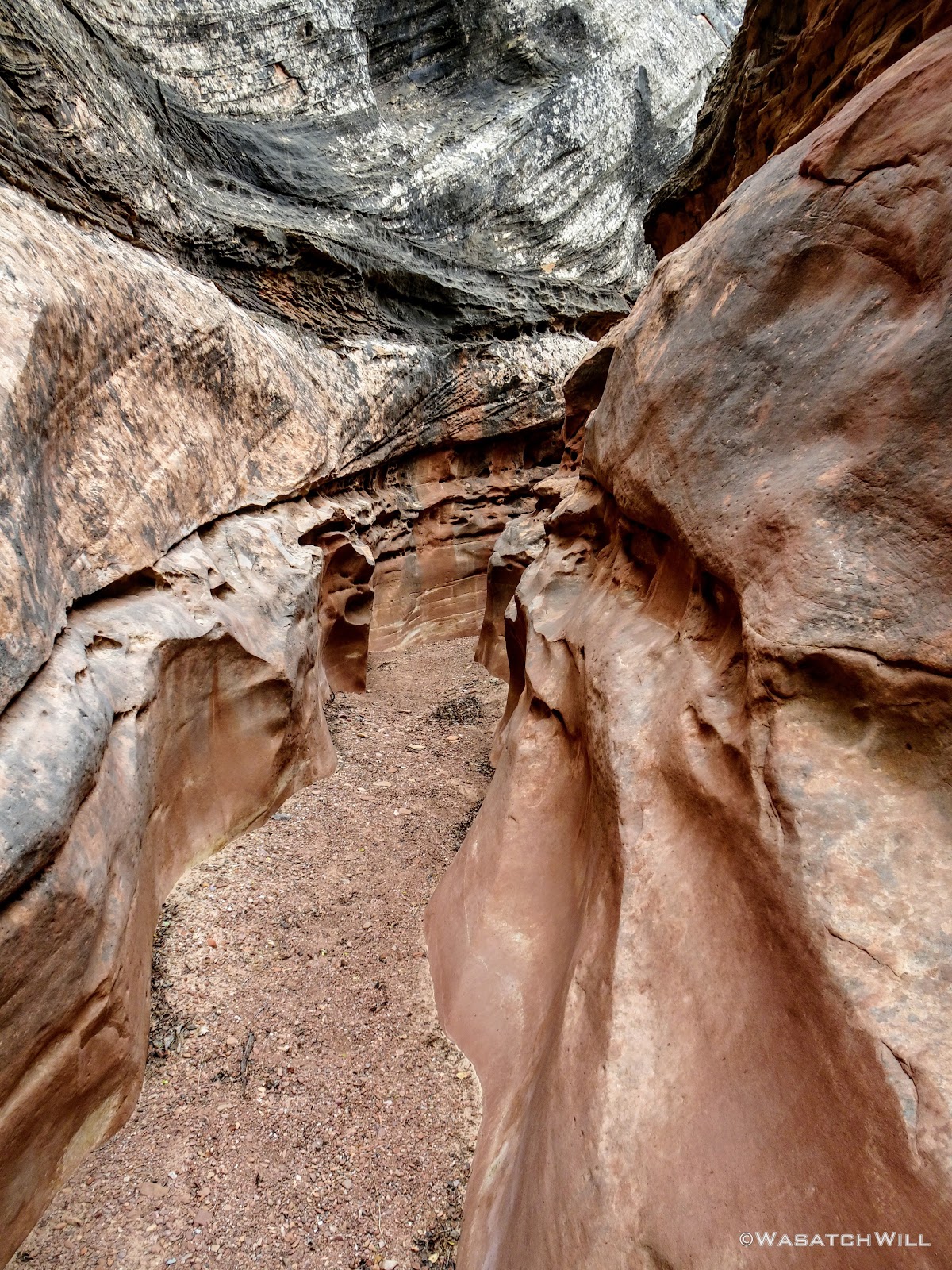
Deeper Into the Slot

Vivid Textures in the Walls

Little Pillars Supporting a Layer of Sandstone
Another Slot!

Chasing the Light at the End of the Slot
Another Spire Rising Up High
And Another Slot

Twist and Turn
Back Out In the Open
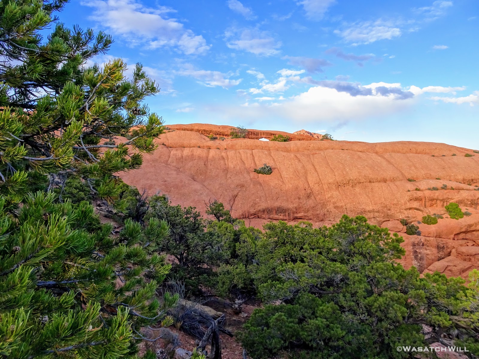
While racing the looming dark clouds behind me, the skies in front of me had remained blue. Then, as if by answered prayer, there was a break in the clouds behind me. They gave way to some blue sky and the clouds that remained lightened up to a friendlier looking white. I paused for a good rest on a low lying ledge beneath the great arch about two-thirds of the way down the gulch and re-fueled with some snacks and fluids. I then left my pack and climbed up the other side of the gulch to get an up close look at the arch.
For perspective, you can see how big it is with me standing in it in the picture immediately below. This was taken from a time lapse on my GoPro. The standard 10 second timer on a normal camera wouldn't be nearly enough time for me pull to this shot off.
'Sheets Arch'
The arch is not even labeled on standard maps, let alone having an official name. But...might as well call it Sheets Arch, as I believe most others who've hiked here refer to it as that.
'Sheets Arch' Portrait
Back down at my pack, I resumed the rest of the hike down. Strangely, as I started to hike back down, the clouds behind me gathered back in on themselves and quickly started to darken up again. I never feared getting flushed out from a flood as there was always enough breaks in the narrows and slots to gain a ramp to a high ledge. What I feared was should a flood form, how long would I have to sit it out and would I end up having to stay another night? Though I knew any of that was highly unlikely, such thoughts still occupied the back of my mind.
I continued to hustle on down, pausing only for seconds at a time for a picture of any angles or other features that looked interesting.
Desert Daisies
When I turned one bend, I looked up and saw a rock feature that looked a lot like a hand holding up the Boy Scout sign of three fingers pointed upward.

'Scout Sign Rock' - Can you see it?
So, I named it, unofficially, 'Scout Sign Rock'.

'Scout Sign Rock' Close-Up
And then on down the rest of the gulch, I continued.
Narrow Again She Goes
Yet Another Slot

Getting Closer to the Exit

And Closer
Finally, after passing through the final, and perhaps narrowest of the slots the gulch had to offer, I was in the clear for good. A Box Elder stood at the gates, as if it were holding a branch out to high five me for a job well done. It was only about 1:30 PM now and I knew the trailhead was now only about a mile away.
High-Fiving Box Elder at the Exit
Darker clouds were now starting to gather all around the horizon in all directions now and I even started to feel some rain drops. Was I ever glad to be out of there now!
Storms Brewing All Around
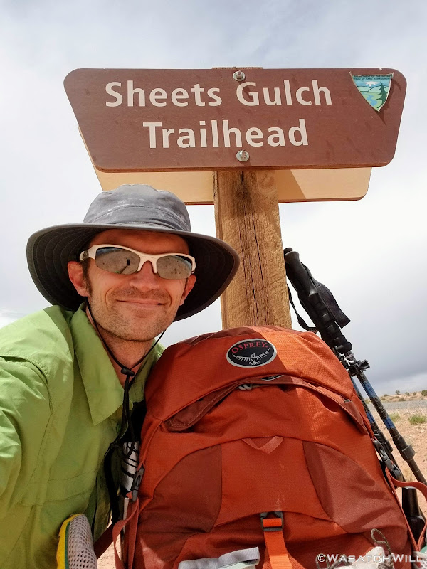
At last the trailhead came into sight, and a few hundred feet later, I was resting comfortably, arriving right on time at about 2 pm. What wasn't on time, was my ride. My father-in-law volunteered to be the one to come and get me, but wasn't able to make it out to the trailhead until a half-hour later. No matter! Now the clouds were a blessing, significantly cooling down the afternoon temperature as I sat there chugging down some more fluids and food.
On the Home Stretch to the Trailhead

Obligatory Selfie
For an overnight trip, I don't think I have ever covered so much distance in a 24 hour span. Altogether, it ended up being some 24ish miles I had hiked in that 24 hour period. Certainly nothing to brag about to the average marathoner or ultra trail runner or even a long trail thru-hiker, but still. I don't think I've ever seen such a variety of terrain in an overnight hike. Indeed, it may well have been my most epic overnight trip to date. This trip was an itch I was wanting to scratch all spring, and I'm glad it worked out the way it did. I'm glad I was able to turn what appeared to be a failure into a whopping success.
And once again, I found myself ever grateful for a wife who can support my outdoor addiction and all things backpacking with the ever-present urge to get out and explore. Of course, I'm also full of gratitude for her parents who are fortunate enough to now reside in Torrey, serving as a nice base to make a lot of these adventures in and around Capitol Reef National Park all logistically possible.
Video: