Planning help: North Winds Clear Lake Trailhead

wsp_scott

Member
.
Joined
May 16, 2016
Messages
1,293
I'm looking at a 7ish night trip out of the Clear Lake Trailhead in the North Winds for the last week of July, never been up there but I want to see some of the glaciers. I'm going out of Clear Lake because I'm meeting some idiots south of Cody the next week and I want to minimize driving.

Looking at Palister's book, I've drawn up a couple possibilities but I'm looking for feedback on some of the off-trail stuff. I'm likely to be solo if that changes an answer. I'm aware of the weather and if it goes sideways, I'd be perfectly happy walking back out the Glacier Trail. I’m not interested in peak bagging and I don’t fish.

Basic idea is hike in on the Glacier Trail over a couple days (24ish miles) and then go northwest up Gannet Creek (or Klondike Creek), Grasshopper Glacier, Grasshopper Creek, Goat Flat and out. (25ish miles)

Questions

Pallister’s book/maps show a route up Gannett Creek, but none of her trips, from what I can tell, goes up/down Gannett Creek. Any info?

What about up to Klondike Lake and then up Klondike Creek to Grasshopper Glacier?

The big question, how hard is Grasshopper Glacier from top to bottom? Crevasses? I would carry microspikes if needed (and I use hiking poles), but I don't have glacier experience and solo.

Anything else to add? Other places to check out in the general area?

Caltopo map: Red is Glacier Trail and Purple is the off-trail stuff
Click here to view on CalTopo
 
I looked at Joe Kelsey's WR climbing/hiking book. He talks about the drainage in reference to Gannett Peak. He states that it's possible to use Gannett Creek to reach Gannett Glacier, but the preferred approach for the peak is Dinwoody Creek.

I have also seen someone's Gannett Glacier bypass to Skurka's WRHR on Caltopo, and they propose staying high on the plateau just to the N rather than dropping into Gannett Creek. The other thing I noticed on the satellite view is that drainage appears to contain a big tongue of glacial moraine, which could make it a major slog.
 
Lol....
And you are afraid of Hidden Creek and a little ridge walk in the Teton?

If I wasnt going into Yellowstone the end of July, I'd go with you.... my favorite place in the Winds is the NE corner.

The switchbacks out of Bomber Basin will get you in shape for the ones at the start of Deer Creek......
 
Last edited:
That is some tough country for solo........ 7 nights is good. Switch your map to scanned topos / forest service..... instead of mapbuilder it will be easier to read.

I overlaid some routes for you..... Stay with Pallisters info, she knows the WInds.
The blue dashed line is a route I planned but have not done. The red dashed line I have done (down Gannett Creek) The only bad spot was at the red dot, where the rock is loose and can on both sides of the canyon, just have to pay attention. I have been along the one dashed yellow line labelled "A". The other dashed yellow lines are alternate ways.

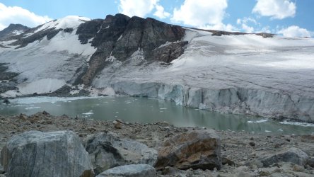
I had heard that coming up Grasshopper Creek to the toe of the Grasshopper glacier and getting on top of it was a real big pain, loose morraine ... The glacier toe (is dangerous) and walking on Grasshopper, one encounters large sun cups crevasses. Where we dropped of the ridge to near the head of Grasshopper we encountered 10 to 15ft deep crevasses. The lake near the dashed red line and the word Dinwoody is not there. People do go thru the canyon that is north of the "Sentinel", I thought Gannett was prettier. The view from dinwoody creek to Glacier pass is great and decent tundra camping.

Click here to view on CalTopo
 
Last edited:
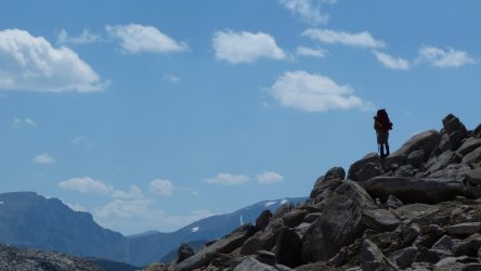
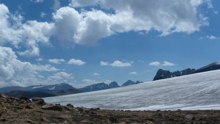
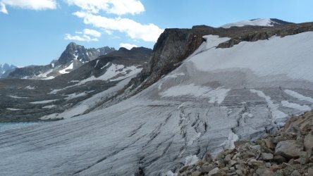
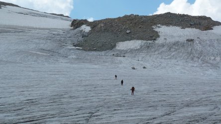
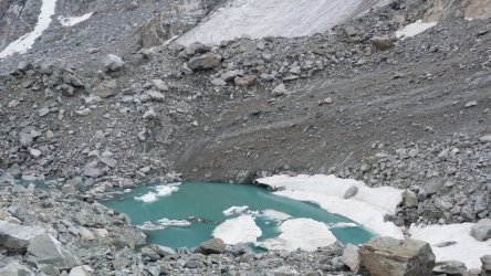
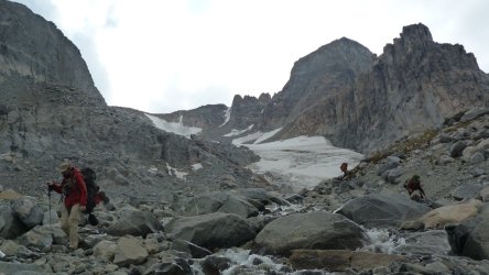
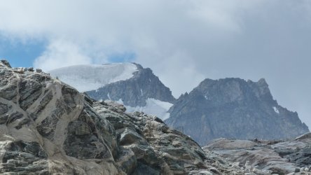
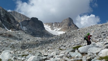
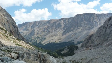
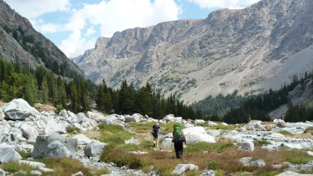
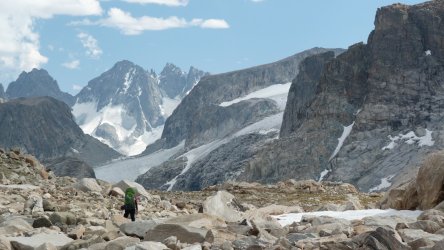
Her are some pics coming from the top down thru Gannett Creek....
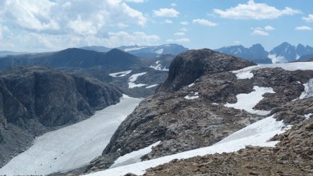
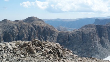
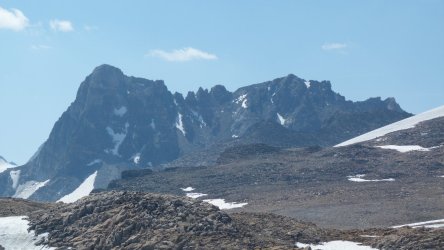
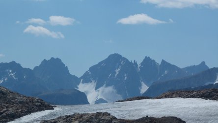
Pic 1 you can see Grasshopper Glacier in lower left. Pic 8 walking across Upper part of Grasshopper Glacier. Rest are going down Gannett Creek. Pic 13 is Gannett Peak. P1000798.JPGP1000799.JPGP1000802.JPGP1000803.JPGP1000805.JPGP1000812.JPGP1000836.JPGP1000841.JPGP1000849.JPGP1000854.JPGP1000867.JPG
P1000798.JPGP1000799.JPGP1000802.JPGP1000803.JPGP1000805.JPGP1000812.JPGP1000836.JPGP1000841.JPGP1000849.JPGP1000854.JPGP1000867.JPGP1000872.JPGP1000896.JPGP1000901.JPGP1000904.JPGP1000911.JPG
 
I looked at Joe Kelsey's WR climbing/hiking book. He talks about the drainage in reference to Gannett Peak. He states that it's possible to use Gannett Creek to reach Gannett Glacier, but the preferred approach for the peak is Dinwoody Creek.

I have also seen someone's Gannett Glacier bypass to Skurka's WRHR on Caltopo, and they propose staying high on the plateau just to the N rather than dropping into Gannett Creek. The other thing I noticed on the satellite view is that drainage appears to contain a big tongue of glacial moraine, which could make it a major slog.
That at least confirms Palister as far as Gannett Peak goes, makes sense to go all the way up Dinwoody if you want to climb the peak.

Thanks for that Caltopo link. I've read a couple trip reports of people doing his WRHR and I've thought about bypassing the glacier with the plateau, nice to see on someone else's map.
 
That is some tough country for solo........ 7 nights is good. Switch your map to scanned topos / forest service..... instead of mapbuilder it will be easier to read.

I overlaid some routes for you..... Stay with Pallisters info, she knows the WInds.
The blue dashed line is a route I planned but have not done. The red dashed line I have done (down Gannett Creek) The only bad spot was at the red dot, where the rock is loose and can on both sides of the canyon, just have to pay attention. I have been along the one dashed yellow line labelled "A". The other dashed yellow lines are alternate ways.

I had heard that coming up Grasshopper Creek to the toe of the Grasshopper glacier and getting on top of it was a real big pain, loose morraine ... The glacier toe (is dangerous) and walking on Grasshopper, one encounters large sun cups crevasses. Where we dropped of the ridge to near the head of Grasshopper we encountered 10 to 15ft deep crevasses. The lake near the dashed red line and the word Dinwoody is not there. People do go thru the canyon that is north of the "Sentinel", I thought Gannett was prettier. The view from dinwoody creek to Glacier pass is great and decent tundra camping.

Click here to view on CalTopo
I bounce back and forth between mapbuilder and USFS maps, sometimes there are too many details on the FS maps. I like seeing your red line, nice to know that someone has gone down Gannett Creek. I don't like the idea of 10 foot crevasses :)

You and @fossana both mention the morraine at the toe of Grasshopper, clearly I need to do some more research. But maybe a couple hours of Type 2 fun would make for a better story :)

thanks for the photos also
 
Toughen you up for .........................
 
In case anyone is interested, I found this from Pallister on HST regarding Grasshopper Glacier

"The last time I walked down the Grasshopper Glacier was in the 1970's and it has since, retreated considerably. I ran into a NOLS mountaineering course this summer and they were headed up the Grasshopper Glacier, so the route is still do-able, just more moraine and less glacier."
 
Back
Top