- Joined
- Apr 20, 2013
- Messages
- 1,539
I have read many trip reports through the years on this site, but figure a report may be the best way to say a belated Hello. Seeing the reports recently about Parunuweap, this seemed a good first trip to share.
In October of 2013, during what turned out to be the very last days of the government shutdown, my friend and I arrived at Zions as there were rumors the parks would be opening soon, and we might have a chance to do the West Rim and a bit more.
I had a map though of Parunuweap via Poverty road as a backup plan.
When we got to the gate of Zion before sunrise we talked with a few reporters who told us there was a chance of Zion opening later that morning. So we drove out to the east side, eerily empty for October, and stopped several times right in the middle of the rode to take in the views. Still killing time in the driving rain, we drove back out and up Kolob Terrace, it was strange to see the Left Fork trailhead completely void of cars except for a single ranger blocking the lot.
Enough talking, but a few pics from that morning in the rain and snow.
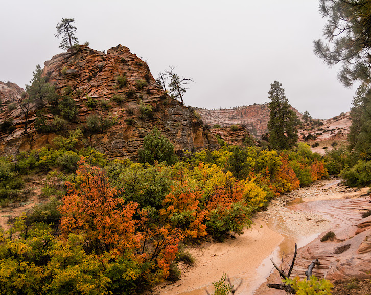
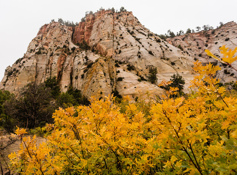
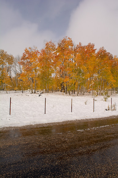
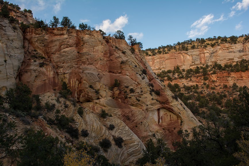
East Side pics...
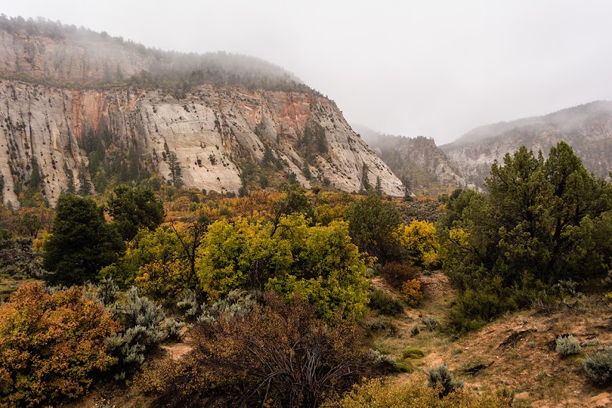
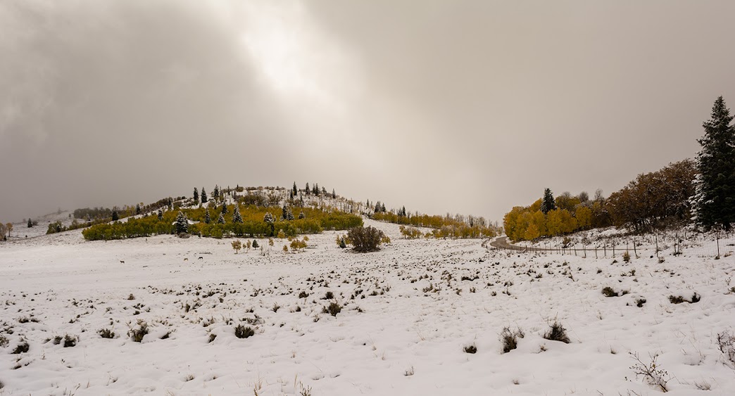
Now Kolob Terrace
Kolob Reservoir in the snow.

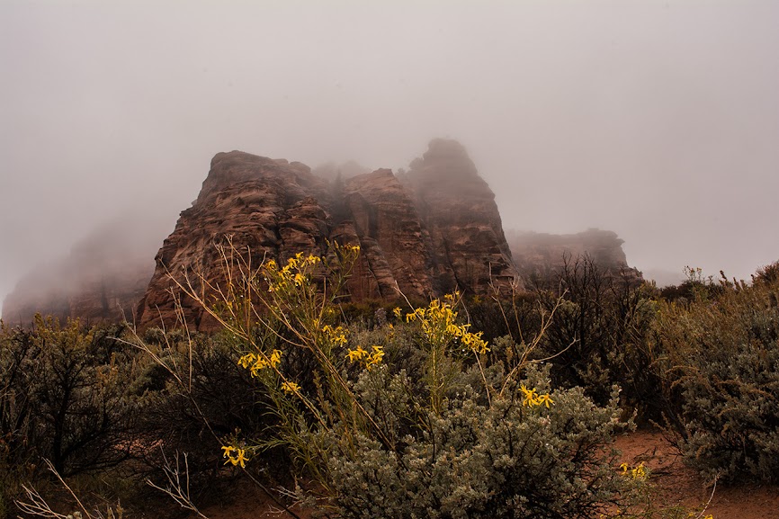
This is the closest we would get to the West Rim trailhead, this trip. There were rangers patrolling the trailheads, but when we had stopped at Wildcat it was evident some cars had stopped and a group or two had hiked off down the trail.
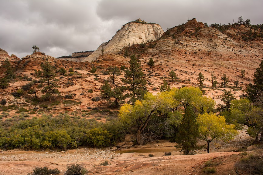
The clouds and mist on the sandstone mixed with fall colors was a fine site.
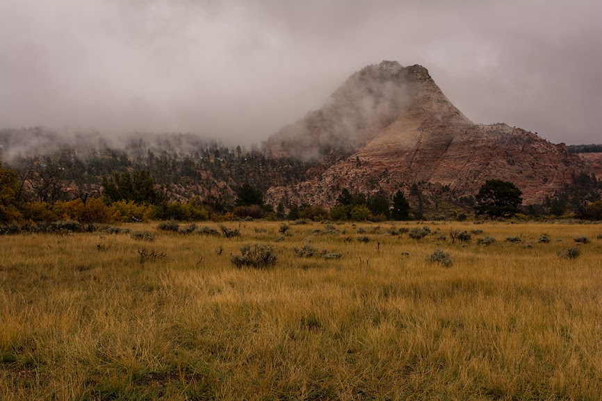
Nice mix of color.

On arriving back at Zion, the news was the park was for sure not opening that day, so with the rain starting to let up we decided on Parunuweap and went back through the East side.
Poverty road is about 2 miles from the East entrance, and on arriving, I knew there was one more obstacle.
Slick mud and a Sonata do not mix... and I did not want to leave my car just on the side of the highway.
When my friend opened the gate, I gunned the Sonata, and immediately started to slide on that perfectly slick mix of sand and water. I kept just enough momentum to slide sideways off of the road and behind a pickup parked where the road turned left. I tried to back up a little, to make sure we were off the road, but we were stuck into the mud a few inches and it would have to do.
The bad thing now was that we had to do the whole length of the road on foot.
The sun soon replaced sleet and rain, but the road was slick and it was the muck that clung to the bottom of shoes, making them heavy through those miles, and I almost ate mud a few times.
The road is mostly downhill after the first bit, but after a couple of miles you drop steeply down across a wash and then climb back out. It may have even been possible to take a car that distance on a dry road.
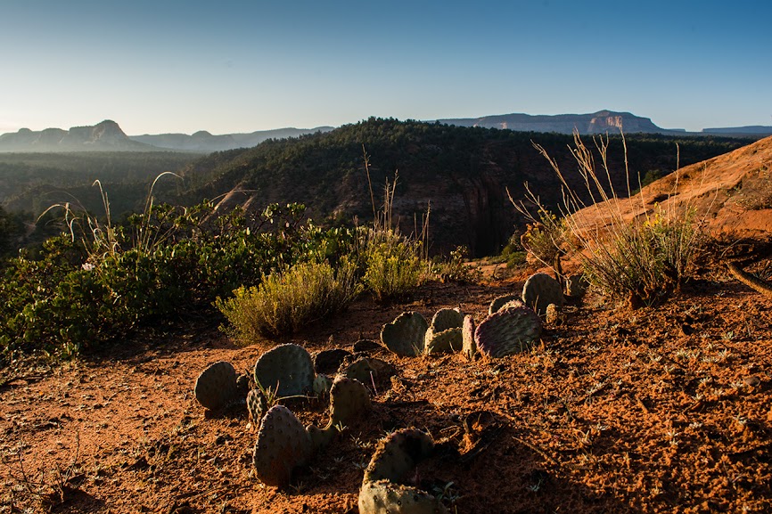
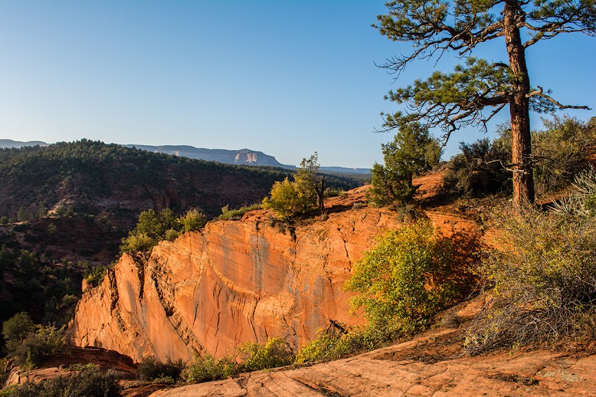
I did not take any pictures until we hit the edge where the road dropped down the white cliffs. We stopped there and had some pastrami and cheese. The weather had turned perfect, and the breaking clouds made the view down south along the river gorge quite spectacular.
The road here was completely washed out, and absolutely covered in the deer tracks of the groups of muleys we were seemingly driving down the trail ahead of us.

More... I loved the red stains on these.
Looking into the distance in the alpenglo.
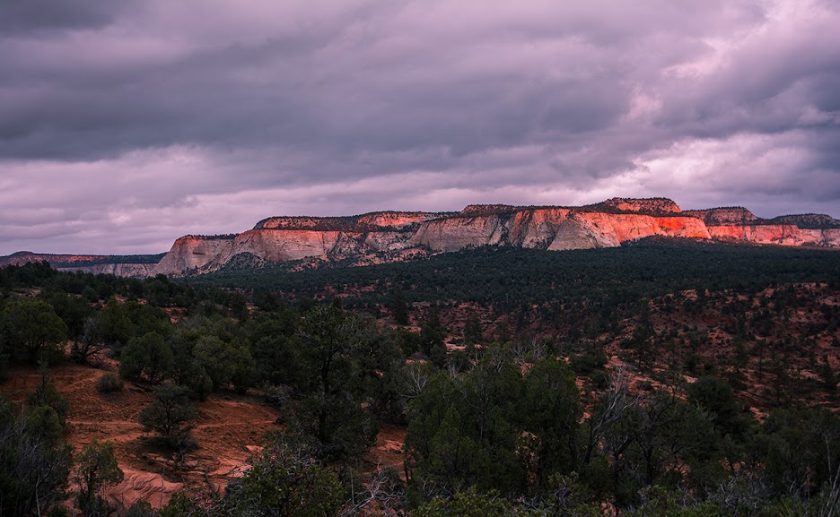
A bit of a sunset as we looked for a good place to camp.
In the twilight, a little ways after leaving the ATV trail and heading down the trail that leads to the canyon, we went past a cattle pond, and struck out across the bench to find a campsite that was a good ways off the trail. We had seen one track of footprints heading down into the canyon, but not a single soul since parking at the road.
We ate dinner and fell asleep to the playful calls of some coyotes, including some near midnight that seemed right on top of us. There was a bit more rain during the night, but the morning was crisp and fantastic.

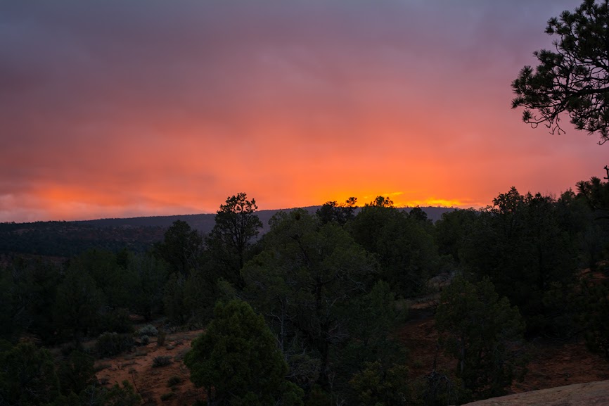
Sunrise.
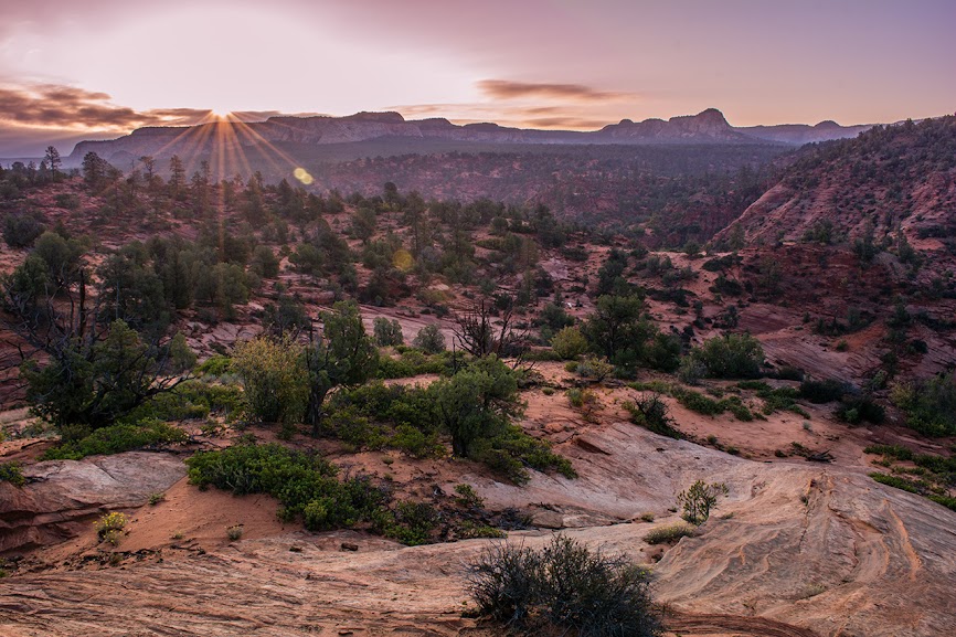
Warm autumn sunshine.
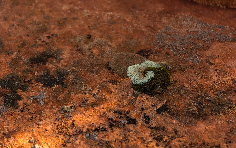
a natural yin-yang
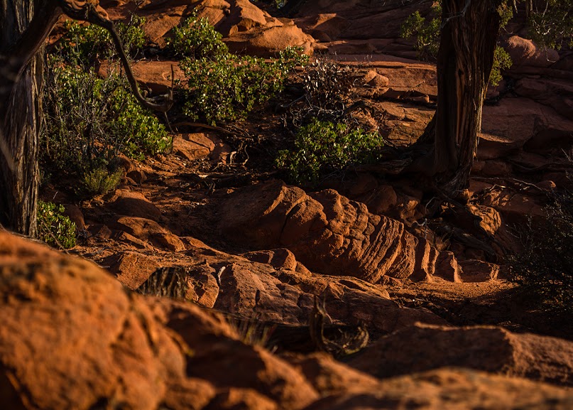
Playing with the sandstone and light.
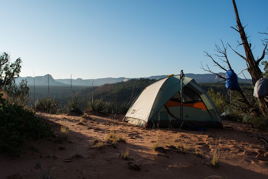
Camp.
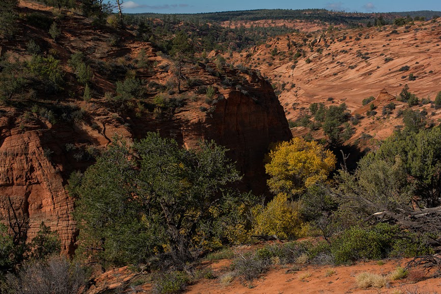
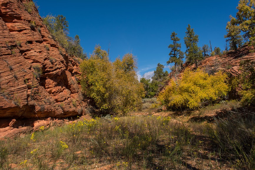
We broke camp, packed up and headed down the last bit of the cattle trail into Parunuweap. The cottonwoods were blazing.
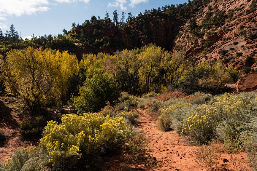
Silvery sage and gold
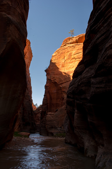
Down in the canyon

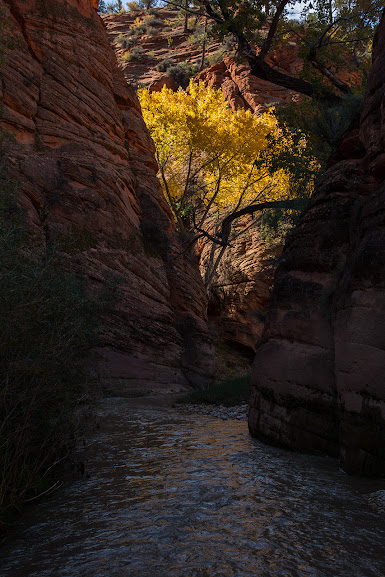
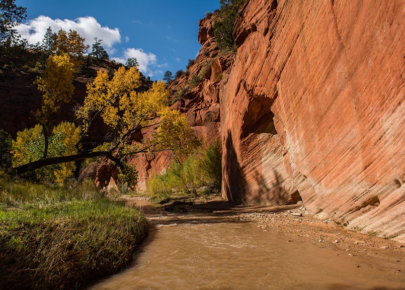
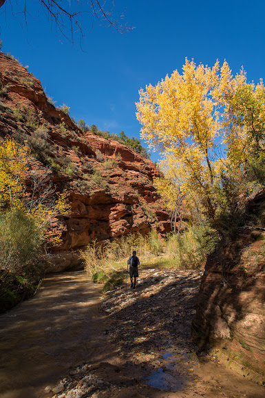
Once in the canyon we found a good high bench as a campsite, ditched our packs under some scrub, and went off down canyon. The water was still running high, and tamarisk became the curse word of the day, leading us to spend most of our time in the creek. A few times we ended up in water almost waist deep, but for many stretches it was calf deep.
So many great side canyons.


Finally a spot out of the water.
Another side canyon.

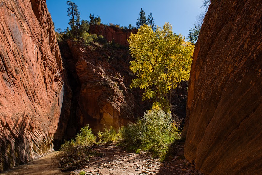
Every turn caught the eye with the fall colors.

The canyon deepens.
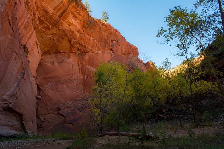

Then, the upper portion of the Barracks

There was something like this around every bend.
After a few hours we sat down for some lunch, just before the waterfall obstacle, and as we were packing up we heard voices.
Two girls and a guy in wetsuit bibs came around the corner. They had come down French, and were going up the Checkerboard Mesa route. They also brought news that the park was officially opening the next day.
Here is where we perhaps made a mistake. We decided to go back and hit Zions instead of doing another couple of nights.
A parting view.

We slogged out, hiking into the dark, but during the climbing my calf was cramping up, so we found a spot under a pinyon up along the road and spent the night.
When we got to the car early the next morning, the ground was still frozen, which meant there was no problem getting the car out and onto the road.
The trip wet my appetite for the canyon and side canyons, and in retrospect, after having spent all of the effort to get there we should have stayed and enjoyed more of it, but I do not recommend Poverty unless you drive on the road and take off some of those miles. They were poor in the mud, but in the heat and sand it would have been worse. Maybe a saving grace of entering through Poverty is that Mineral is only a short hike upstream from where you enter Parunuweap.
It was a terrific trip, and I will get back there sometime.
Featured image for home page:

In October of 2013, during what turned out to be the very last days of the government shutdown, my friend and I arrived at Zions as there were rumors the parks would be opening soon, and we might have a chance to do the West Rim and a bit more.
I had a map though of Parunuweap via Poverty road as a backup plan.
When we got to the gate of Zion before sunrise we talked with a few reporters who told us there was a chance of Zion opening later that morning. So we drove out to the east side, eerily empty for October, and stopped several times right in the middle of the rode to take in the views. Still killing time in the driving rain, we drove back out and up Kolob Terrace, it was strange to see the Left Fork trailhead completely void of cars except for a single ranger blocking the lot.
Enough talking, but a few pics from that morning in the rain and snow.
East Side pics...
Now Kolob Terrace
Kolob Reservoir in the snow.
This is the closest we would get to the West Rim trailhead, this trip. There were rangers patrolling the trailheads, but when we had stopped at Wildcat it was evident some cars had stopped and a group or two had hiked off down the trail.
The clouds and mist on the sandstone mixed with fall colors was a fine site.
Nice mix of color.
On arriving back at Zion, the news was the park was for sure not opening that day, so with the rain starting to let up we decided on Parunuweap and went back through the East side.
Poverty road is about 2 miles from the East entrance, and on arriving, I knew there was one more obstacle.
Slick mud and a Sonata do not mix... and I did not want to leave my car just on the side of the highway.
When my friend opened the gate, I gunned the Sonata, and immediately started to slide on that perfectly slick mix of sand and water. I kept just enough momentum to slide sideways off of the road and behind a pickup parked where the road turned left. I tried to back up a little, to make sure we were off the road, but we were stuck into the mud a few inches and it would have to do.
The bad thing now was that we had to do the whole length of the road on foot.
The sun soon replaced sleet and rain, but the road was slick and it was the muck that clung to the bottom of shoes, making them heavy through those miles, and I almost ate mud a few times.
The road is mostly downhill after the first bit, but after a couple of miles you drop steeply down across a wash and then climb back out. It may have even been possible to take a car that distance on a dry road.
I did not take any pictures until we hit the edge where the road dropped down the white cliffs. We stopped there and had some pastrami and cheese. The weather had turned perfect, and the breaking clouds made the view down south along the river gorge quite spectacular.
The road here was completely washed out, and absolutely covered in the deer tracks of the groups of muleys we were seemingly driving down the trail ahead of us.
More... I loved the red stains on these.
Looking into the distance in the alpenglo.
A bit of a sunset as we looked for a good place to camp.
In the twilight, a little ways after leaving the ATV trail and heading down the trail that leads to the canyon, we went past a cattle pond, and struck out across the bench to find a campsite that was a good ways off the trail. We had seen one track of footprints heading down into the canyon, but not a single soul since parking at the road.
We ate dinner and fell asleep to the playful calls of some coyotes, including some near midnight that seemed right on top of us. There was a bit more rain during the night, but the morning was crisp and fantastic.
Sunrise.
Warm autumn sunshine.
a natural yin-yang
Playing with the sandstone and light.
Camp.
We broke camp, packed up and headed down the last bit of the cattle trail into Parunuweap. The cottonwoods were blazing.
Silvery sage and gold
Down in the canyon
Once in the canyon we found a good high bench as a campsite, ditched our packs under some scrub, and went off down canyon. The water was still running high, and tamarisk became the curse word of the day, leading us to spend most of our time in the creek. A few times we ended up in water almost waist deep, but for many stretches it was calf deep.
So many great side canyons.
Finally a spot out of the water.
Another side canyon.
Every turn caught the eye with the fall colors.
The canyon deepens.
Then, the upper portion of the Barracks
There was something like this around every bend.
After a few hours we sat down for some lunch, just before the waterfall obstacle, and as we were packing up we heard voices.
Two girls and a guy in wetsuit bibs came around the corner. They had come down French, and were going up the Checkerboard Mesa route. They also brought news that the park was officially opening the next day.
Here is where we perhaps made a mistake. We decided to go back and hit Zions instead of doing another couple of nights.
A parting view.
We slogged out, hiking into the dark, but during the climbing my calf was cramping up, so we found a spot under a pinyon up along the road and spent the night.
When we got to the car early the next morning, the ground was still frozen, which meant there was no problem getting the car out and onto the road.
The trip wet my appetite for the canyon and side canyons, and in retrospect, after having spent all of the effort to get there we should have stayed and enjoyed more of it, but I do not recommend Poverty unless you drive on the road and take off some of those miles. They were poor in the mud, but in the heat and sand it would have been worse. Maybe a saving grace of entering through Poverty is that Mineral is only a short hike upstream from where you enter Parunuweap.
It was a terrific trip, and I will get back there sometime.
Featured image for home page:
") ... but it is usually a good sign when a place is washed out or hard to get to.
... but it is usually a good sign when a place is washed out or hard to get to.