AbinadiWitness
Member
- Joined
- Oct 25, 2017
- Messages
- 33
Okay! Here's part two of Colorado Trip 2017 # 1. ")
Where we left off in the last post we'd headed to Montrose for food at the restaurant called Pahgre's. Mitch drove Claron's car while I rode along, Dave drove himself. Jeff and Claron had come down from Yankee Boy Basin and the Ouray side and so had arrived a couple of hours or more ahead of us. We all met up and enjoyed the meal and then Dave left to head back to Utah while I rode with Jeff and Claron and Mitch were in Claron's car; I was going to swap out driving with Jeff as needed so he could get more sleep because he'd literally driven all night from Utah to Colorado to get there in time to do Mount Sneffels with us.
We fueled up at a gas station in Montrose and then began the long drive out to the Lake City, CO area - about 3.5 hours outside of Montrose. It wasn't too long before I swapped out with Jeff - actually while we were temporarily stopped on the highway for construction.
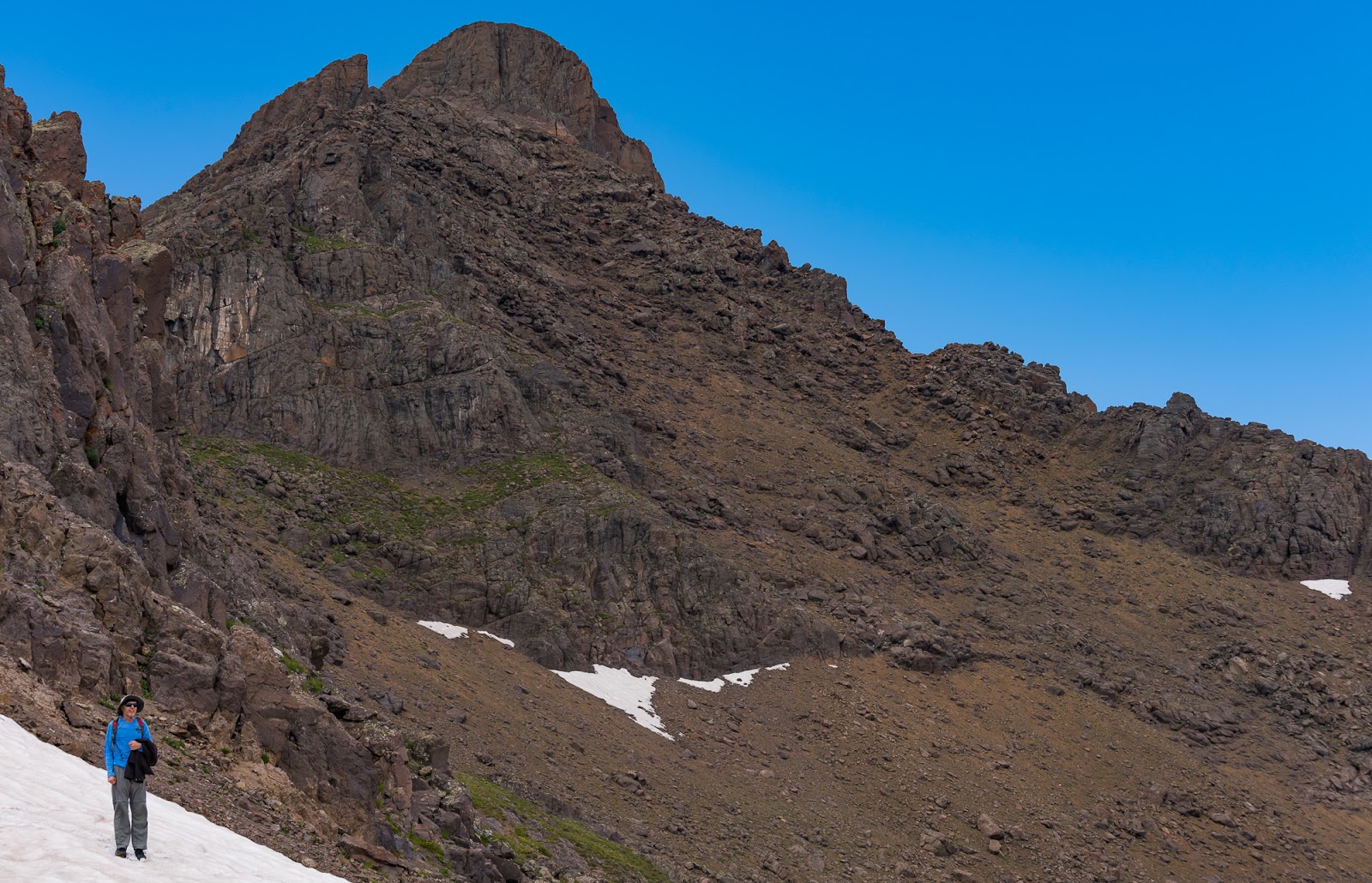
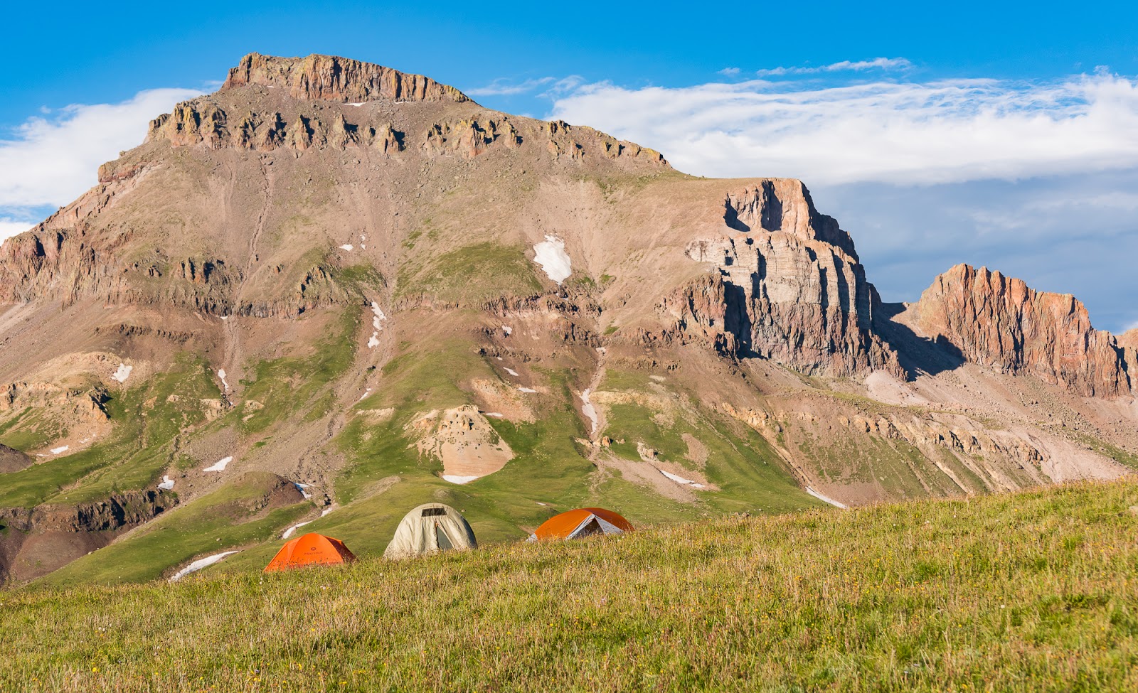
The fun part about this journey is that by the time we'd hiked out of Blue Lakes, traveled to Montrose, had dinner, and driven to (and through) Lake City and on to the trailhead (including choosing to park Claron's passenger car before the four of us [Mitch, Jeff, Claron, and I] all piled into Jeff's 4WD high-clearance vehicle with our gear it had gotten pretty late. We made it pretty close to the turn off for the 4WD-only part of the road up to the higher trailhead at Matterhorn Creek before we decided it wasn't wise to continue further in Claron's car; Jeff's had no problem getting to the upper TH, but the road is definitely high-clearance-required just past where we went.
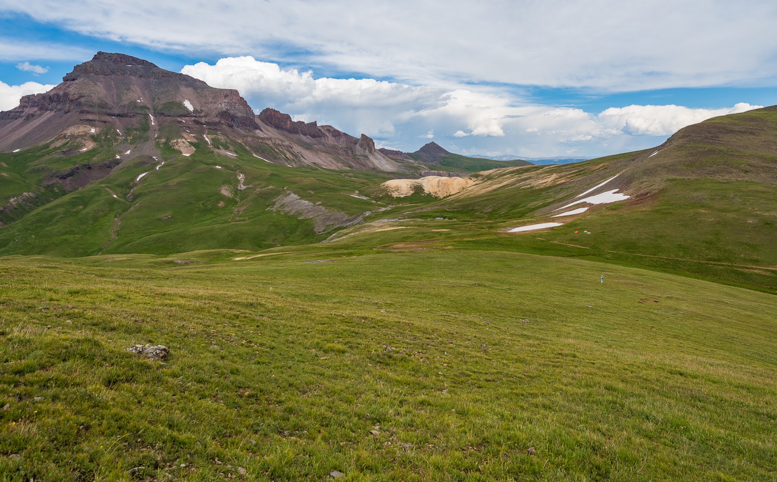
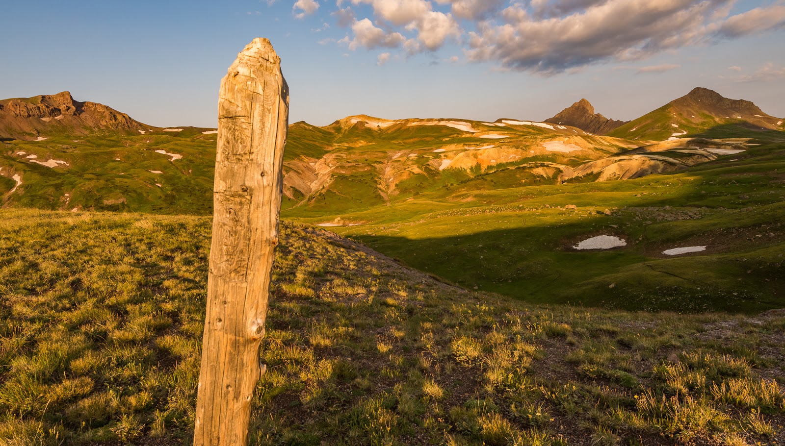
By the time we were at the trailhead and ready to pack in it was dark. Headlamps donned, we chose to pack in, since there was only about 1,800 feet of elevation gain over around 3 miles of approach. I don't recall when we actually started hiking in, but it was late. The approach trail was pleasant as expected (and as remembered by me from the previous trip in. We did our best, in the darkness and with references to our maps, to find a suitable camping spot near the southeast slopes of Matterhorn Peak at a gentle saddle area we'd identified. A lot of the area around Wetterhorn Peak is closed for restoration because of past overuse, so we had to go past that main basin up a bit higher. We found a suitable (mostly) level spot on some bumpy tundra and made our camp about 100 feet off the trail that crossed the pass, about 12,400 feet above sea level. We had camp set up about midnight and headed to bed. We'd planned not to worry about waking up too early the following day, since we had short hikes over relatively easy terrain the next day up Wetterhorn and Matterhorn Peaks.
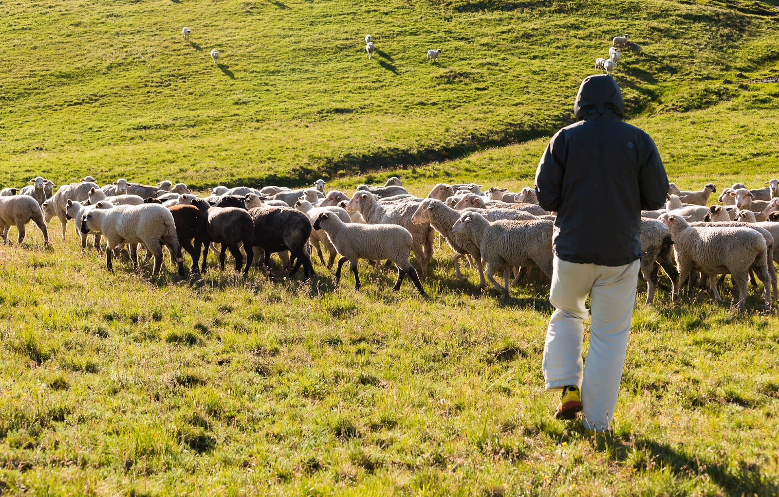
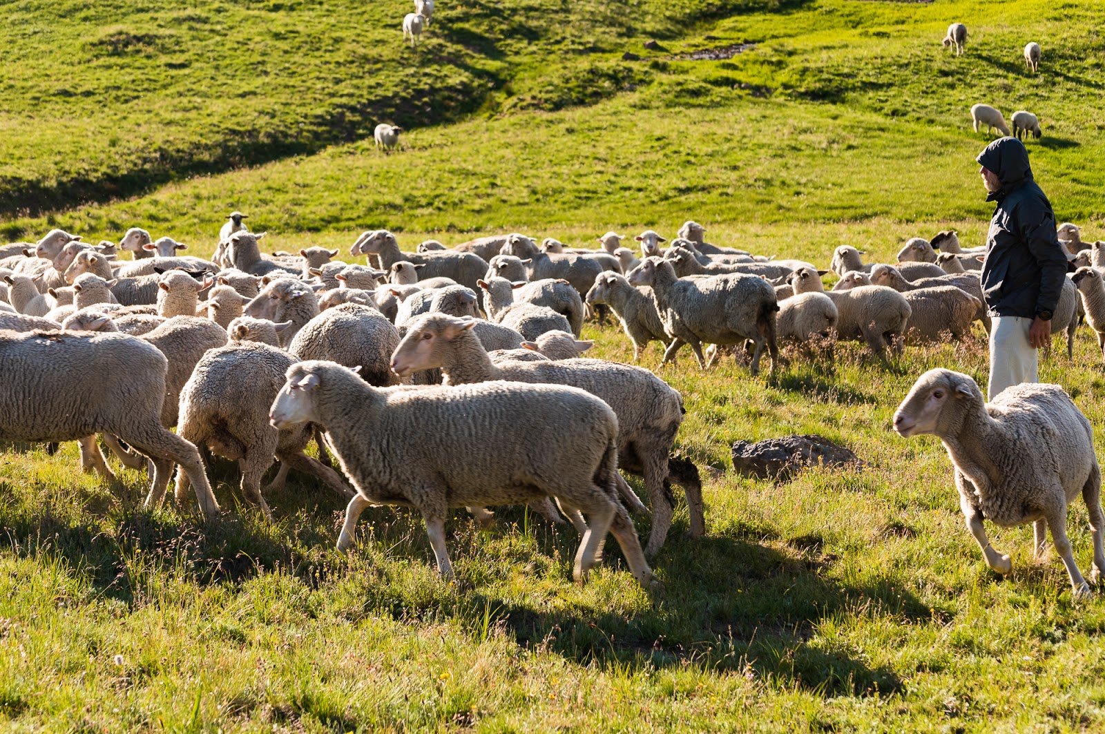
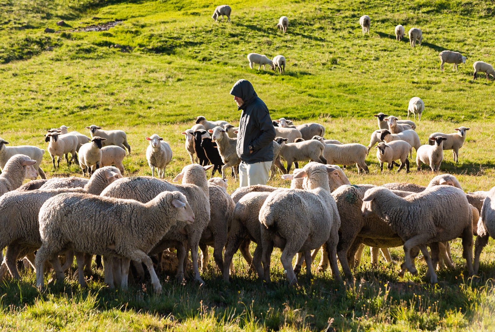
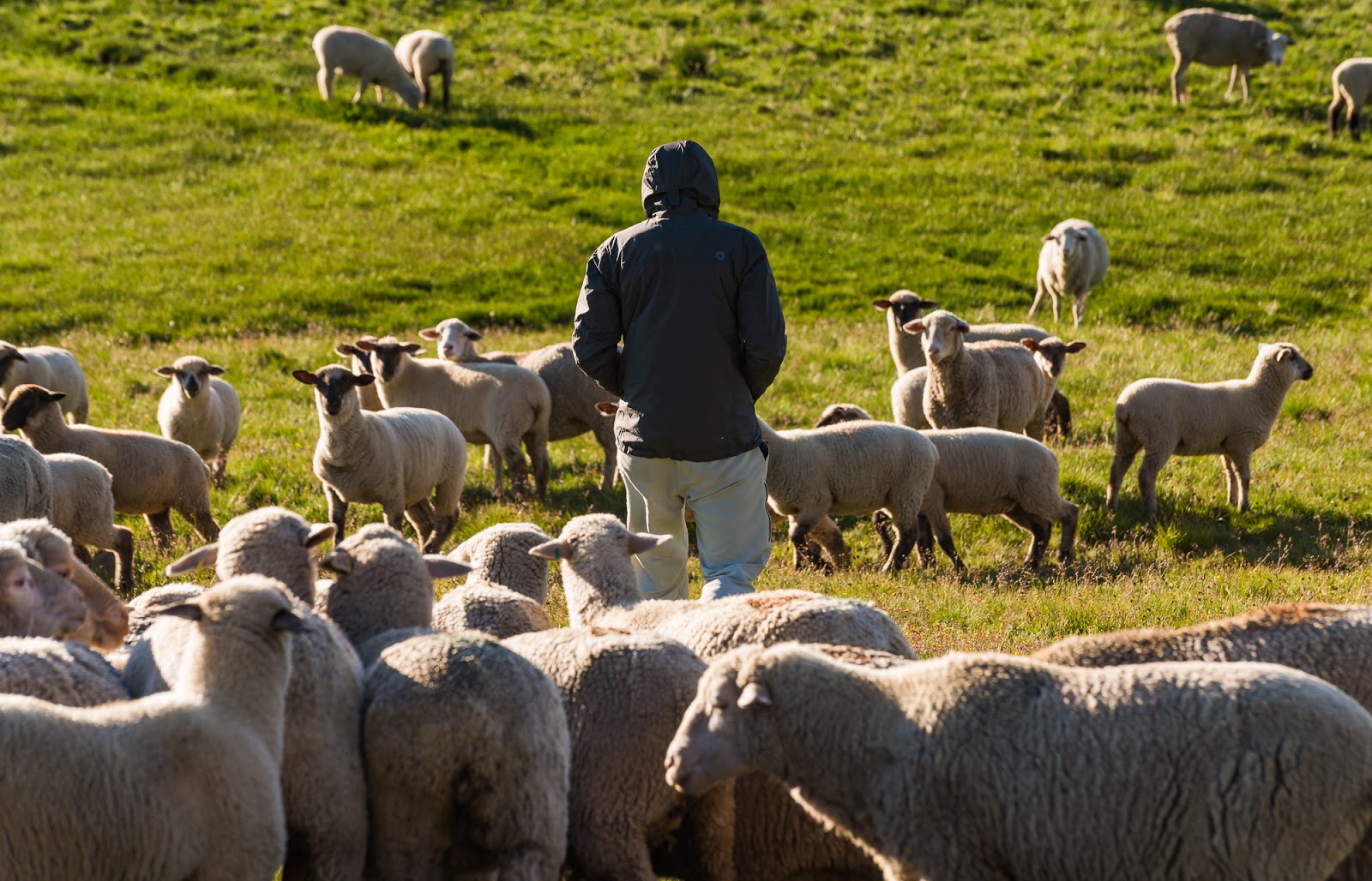
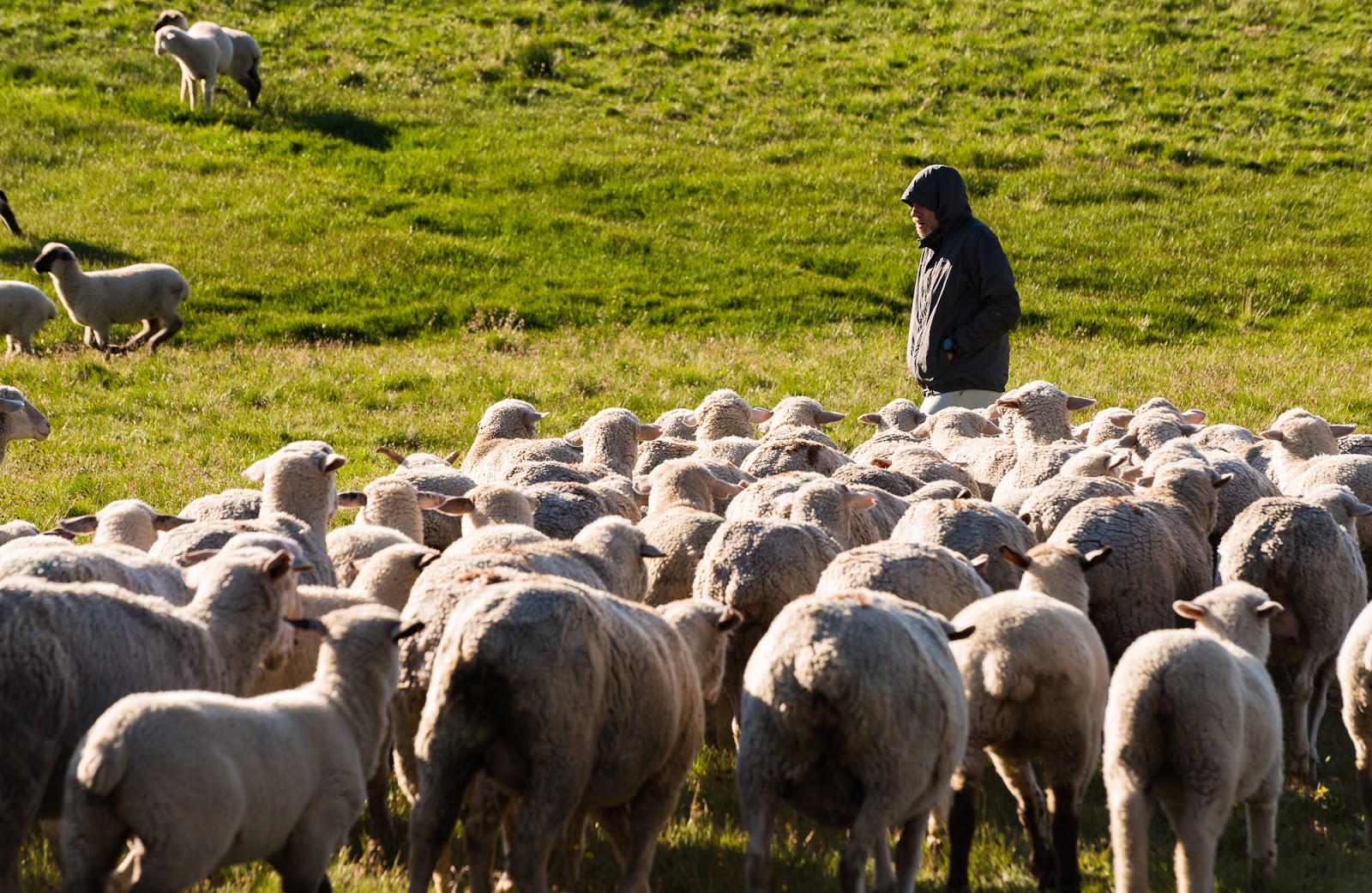
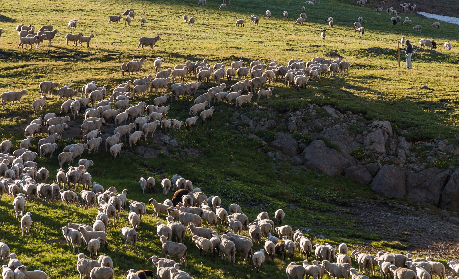
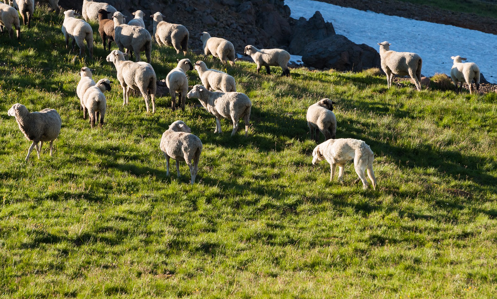
The following day we awoke to the sound of sheep - I say the sound, but that doesn't quite convey the feeling...let's try again...The following day we awoke to the cacophony of sheep - hundreds of sheep...perhaps a thousand sheep...they were crossing the pass and meandering across the slopes below Matterhorn Peak and heading slowly into Wetterhorn Basin. The sheep were spread over a huge area and we really do think there were around a thousand as near as we could guess; there were so many I couldn't capture the entire flock in any one picture...but it was a different experience waking up to sheep and having their not-too-distant company throughout the day. Apparently, sheep are very noisy when they wander...
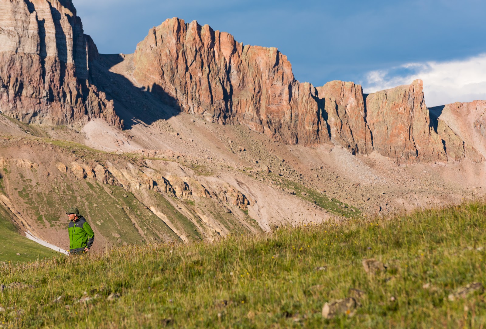
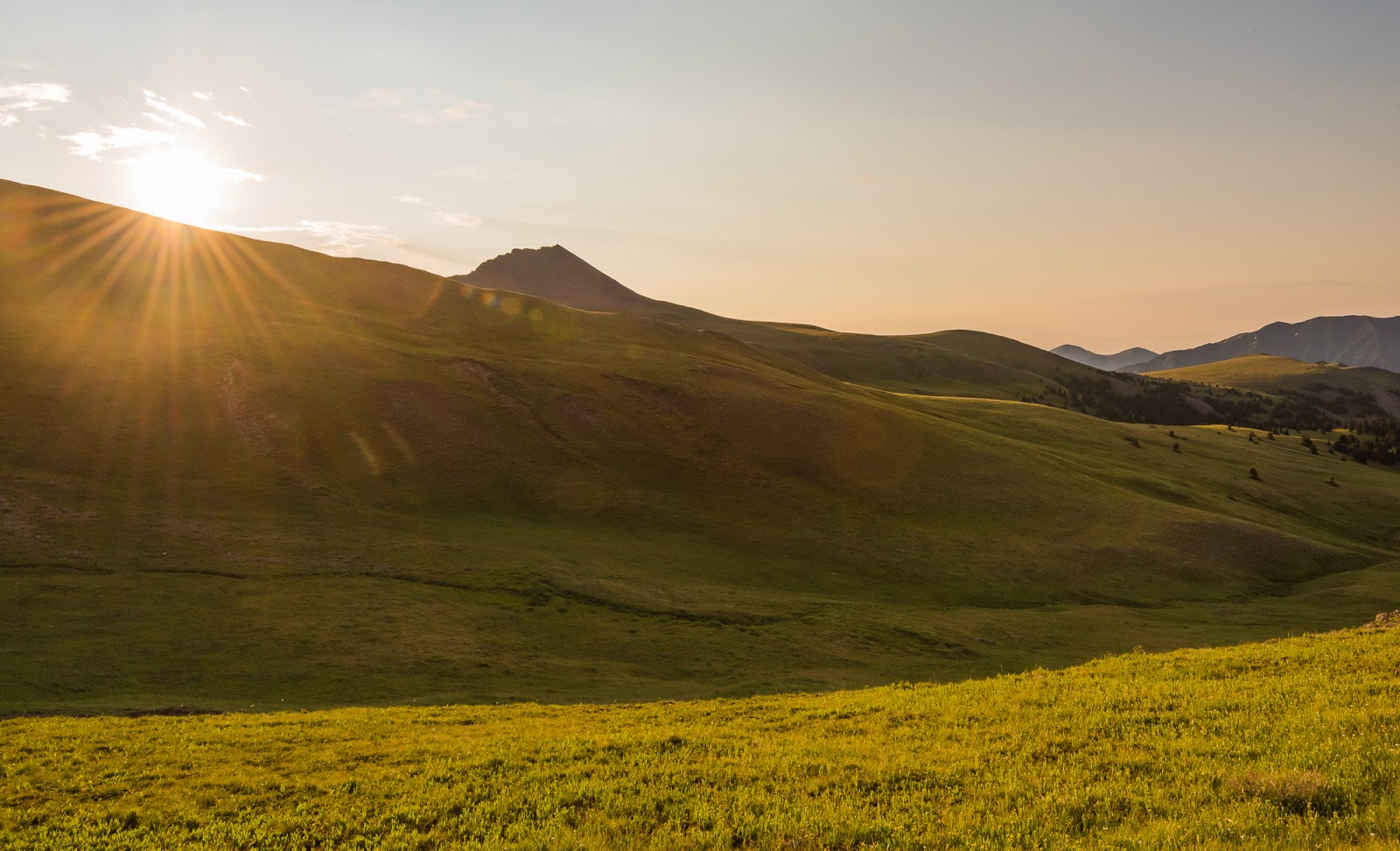
After watching the sheep marching across the landscape and making a grand ruckus (while we made our breakfast and got our gear together for our planned ascents) we were soon off and on our way down into the Wetterhorn/Matterhorn Basin, aiming to ascend the standard SE Ridge of Wetterhorn Peak (14,015 feet); we'd aim for Matterhorn Peak if the weather held later in the day. It was between 9:00 and 10:00 AM when we began our hike toward Wetterhorn Peak - which is very late to start a 14er, but the skies were good and the mileage short. Another tip: In the high country having frequent clear skies in the morning is pretty normal; storms almost always develop sometime in the late morning or early afternoon - and they can come on quite fast and be especially severe at these altitudes. There is no substitute for an early ascent for general safety on high peaks. If you go later you're gambling with things outside of your control; in our case the gamble paid off, but it doesn't always work out that way. Again, as a general rule, earlier is better for ascending tall peaks - especially in large areas of high elevation country (like the San Juan Range, the High Uintas, or the Wind River Range).
Where we left off in the last post we'd headed to Montrose for food at the restaurant called Pahgre's. Mitch drove Claron's car while I rode along, Dave drove himself. Jeff and Claron had come down from Yankee Boy Basin and the Ouray side and so had arrived a couple of hours or more ahead of us. We all met up and enjoyed the meal and then Dave left to head back to Utah while I rode with Jeff and Claron and Mitch were in Claron's car; I was going to swap out driving with Jeff as needed so he could get more sleep because he'd literally driven all night from Utah to Colorado to get there in time to do Mount Sneffels with us.
We fueled up at a gas station in Montrose and then began the long drive out to the Lake City, CO area - about 3.5 hours outside of Montrose. It wasn't too long before I swapped out with Jeff - actually while we were temporarily stopped on the highway for construction.
The fun part about this journey is that by the time we'd hiked out of Blue Lakes, traveled to Montrose, had dinner, and driven to (and through) Lake City and on to the trailhead (including choosing to park Claron's passenger car before the four of us [Mitch, Jeff, Claron, and I] all piled into Jeff's 4WD high-clearance vehicle with our gear it had gotten pretty late. We made it pretty close to the turn off for the 4WD-only part of the road up to the higher trailhead at Matterhorn Creek before we decided it wasn't wise to continue further in Claron's car; Jeff's had no problem getting to the upper TH, but the road is definitely high-clearance-required just past where we went.
By the time we were at the trailhead and ready to pack in it was dark. Headlamps donned, we chose to pack in, since there was only about 1,800 feet of elevation gain over around 3 miles of approach. I don't recall when we actually started hiking in, but it was late. The approach trail was pleasant as expected (and as remembered by me from the previous trip in. We did our best, in the darkness and with references to our maps, to find a suitable camping spot near the southeast slopes of Matterhorn Peak at a gentle saddle area we'd identified. A lot of the area around Wetterhorn Peak is closed for restoration because of past overuse, so we had to go past that main basin up a bit higher. We found a suitable (mostly) level spot on some bumpy tundra and made our camp about 100 feet off the trail that crossed the pass, about 12,400 feet above sea level. We had camp set up about midnight and headed to bed. We'd planned not to worry about waking up too early the following day, since we had short hikes over relatively easy terrain the next day up Wetterhorn and Matterhorn Peaks.
The following day we awoke to the sound of sheep - I say the sound, but that doesn't quite convey the feeling...let's try again...The following day we awoke to the cacophony of sheep - hundreds of sheep...perhaps a thousand sheep...they were crossing the pass and meandering across the slopes below Matterhorn Peak and heading slowly into Wetterhorn Basin. The sheep were spread over a huge area and we really do think there were around a thousand as near as we could guess; there were so many I couldn't capture the entire flock in any one picture...but it was a different experience waking up to sheep and having their not-too-distant company throughout the day. Apparently, sheep are very noisy when they wander...
After watching the sheep marching across the landscape and making a grand ruckus (while we made our breakfast and got our gear together for our planned ascents) we were soon off and on our way down into the Wetterhorn/Matterhorn Basin, aiming to ascend the standard SE Ridge of Wetterhorn Peak (14,015 feet); we'd aim for Matterhorn Peak if the weather held later in the day. It was between 9:00 and 10:00 AM when we began our hike toward Wetterhorn Peak - which is very late to start a 14er, but the skies were good and the mileage short. Another tip: In the high country having frequent clear skies in the morning is pretty normal; storms almost always develop sometime in the late morning or early afternoon - and they can come on quite fast and be especially severe at these altitudes. There is no substitute for an early ascent for general safety on high peaks. If you go later you're gambling with things outside of your control; in our case the gamble paid off, but it doesn't always work out that way. Again, as a general rule, earlier is better for ascending tall peaks - especially in large areas of high elevation country (like the San Juan Range, the High Uintas, or the Wind River Range).
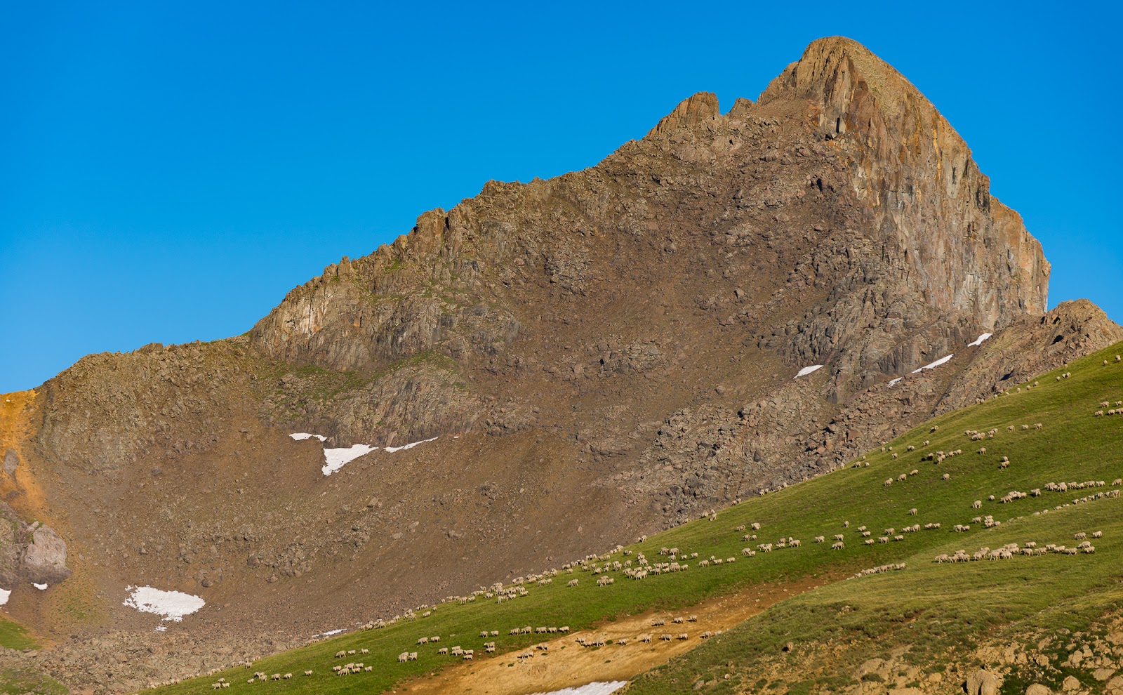
The lower slopes of Matterhorn Peak, covered with sheep - just a fraction of the massive heard we woke up to on the day we were heading to summit Wetterhorn and Matterhorn Peaks.

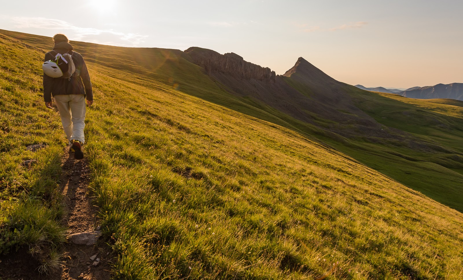
Claron moves up the trail toward a group of sheep - they were on both sides of the trail ahead and ended up moving to one side or the other as we passed by.
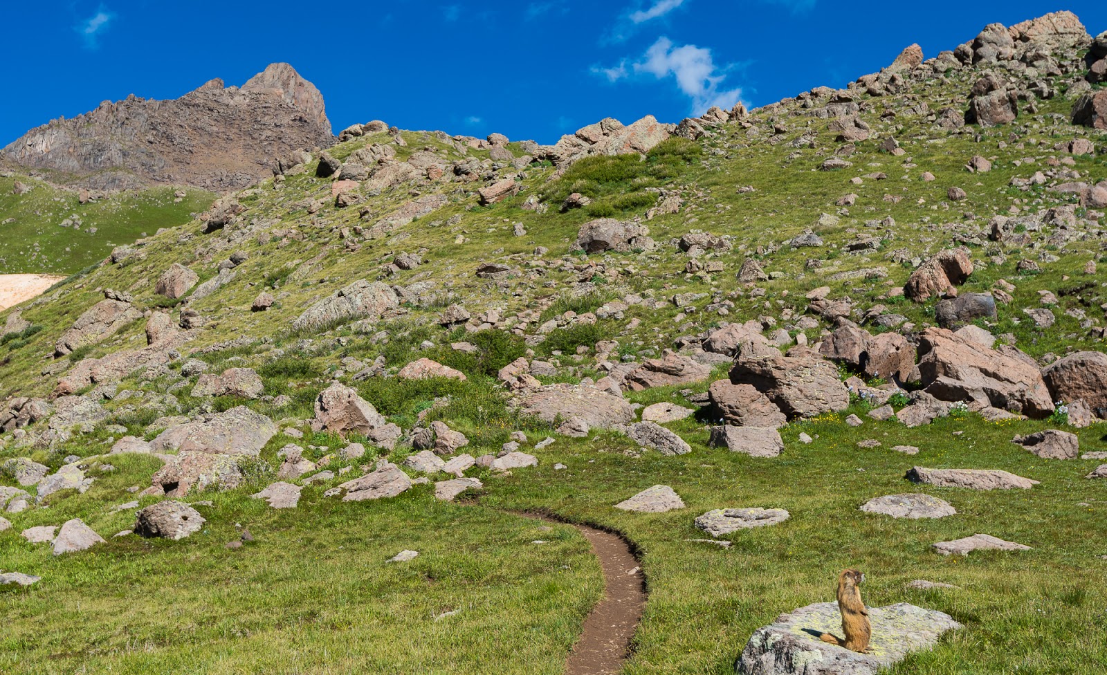
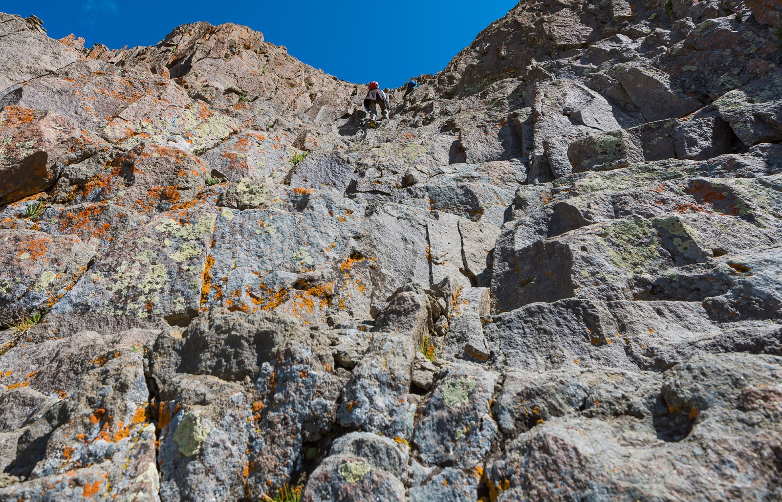
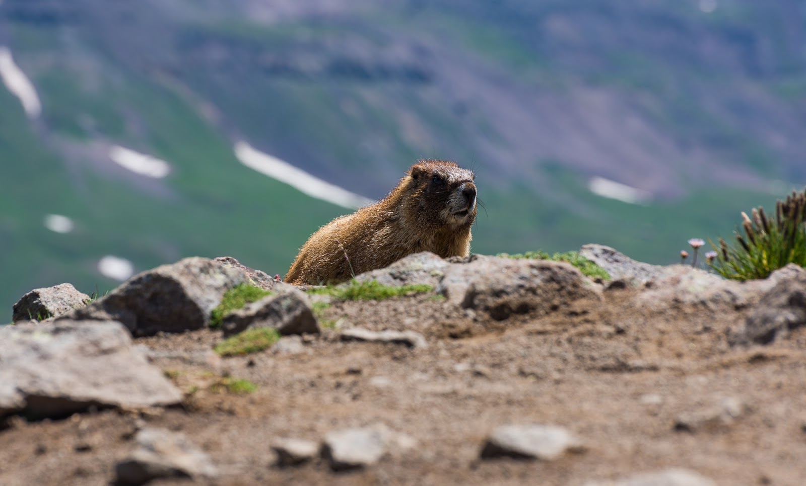
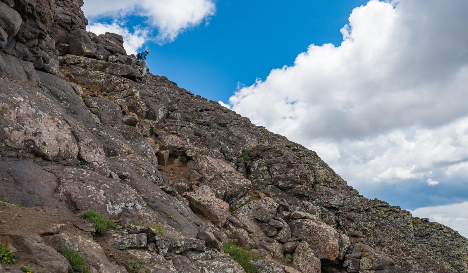
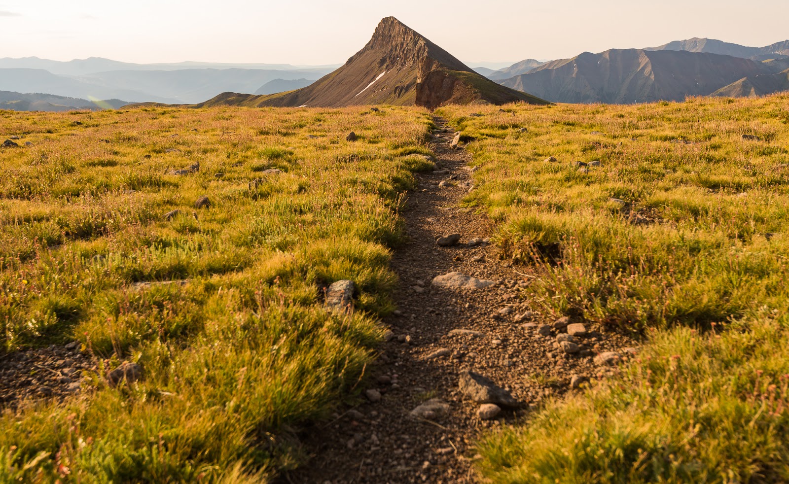
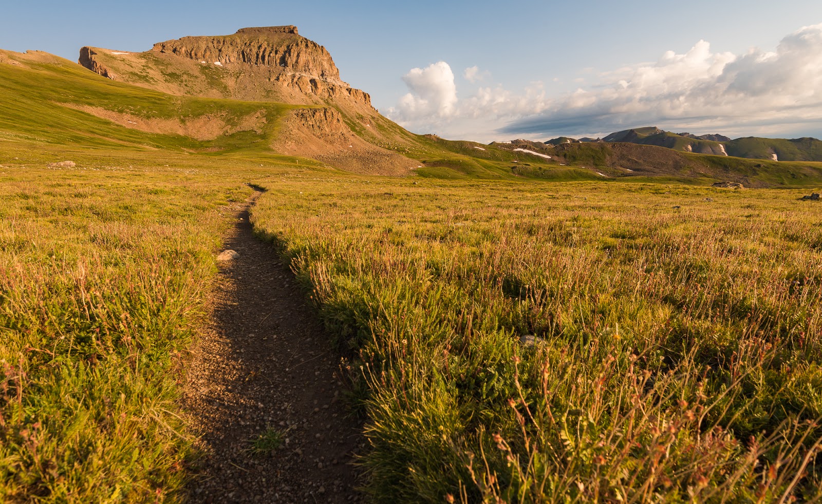
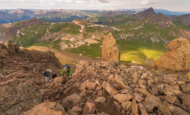
The terrain gets more bouldery as you progress upwards toward Wetterhorn Peak, but even though the terrain ultimately goes through a major boulder field there is good trail to follow all the way up to the high saddle (and just a bit beyond that too). Did you notice the marmot standing up toward the lower right?
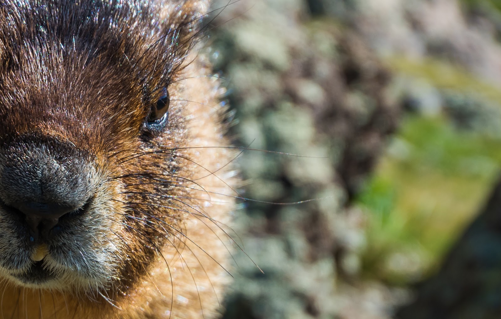
Marmot portrait.
We made pretty quick work of the ascent up Wetterhorn/Matterhorn Basin - seeing plenty of sheep and (big) marmots on the way. Soon we'd gained the beginnings of the high ridge and had the non-pleasure of climbing that short stretch of light-colored dirt that is so blissfully loose...Providentially, the slopes afterward are much more pleasant, and the higher you go the more pleasant and engaging they become.
Also - I don't recall mentioning it hitherto, but we were using beta (route information) gathered from 14ers.com on all these peaks; excellent resource I'll recommend to other summit-seekers of the high peaks in Colorado.
Also - I don't recall mentioning it hitherto, but we were using beta (route information) gathered from 14ers.com on all these peaks; excellent resource I'll recommend to other summit-seekers of the high peaks in Colorado.

From this point up to the top of the light yellow dirt area is unpleasantly loose...I actually remember slipping several times on the way up this first hill, but made it down without slipping by basically jogging down the slope(s).
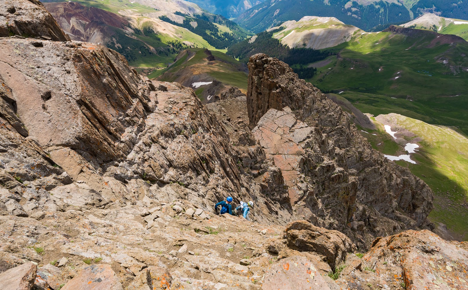
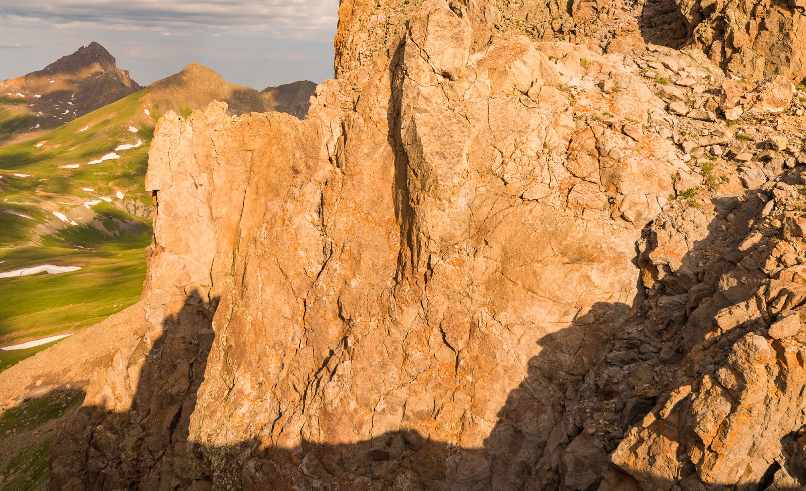
Claron moves past one side of "The Prow" somewhere along the upper reaches of Wetterhorn Peak during our ascent.
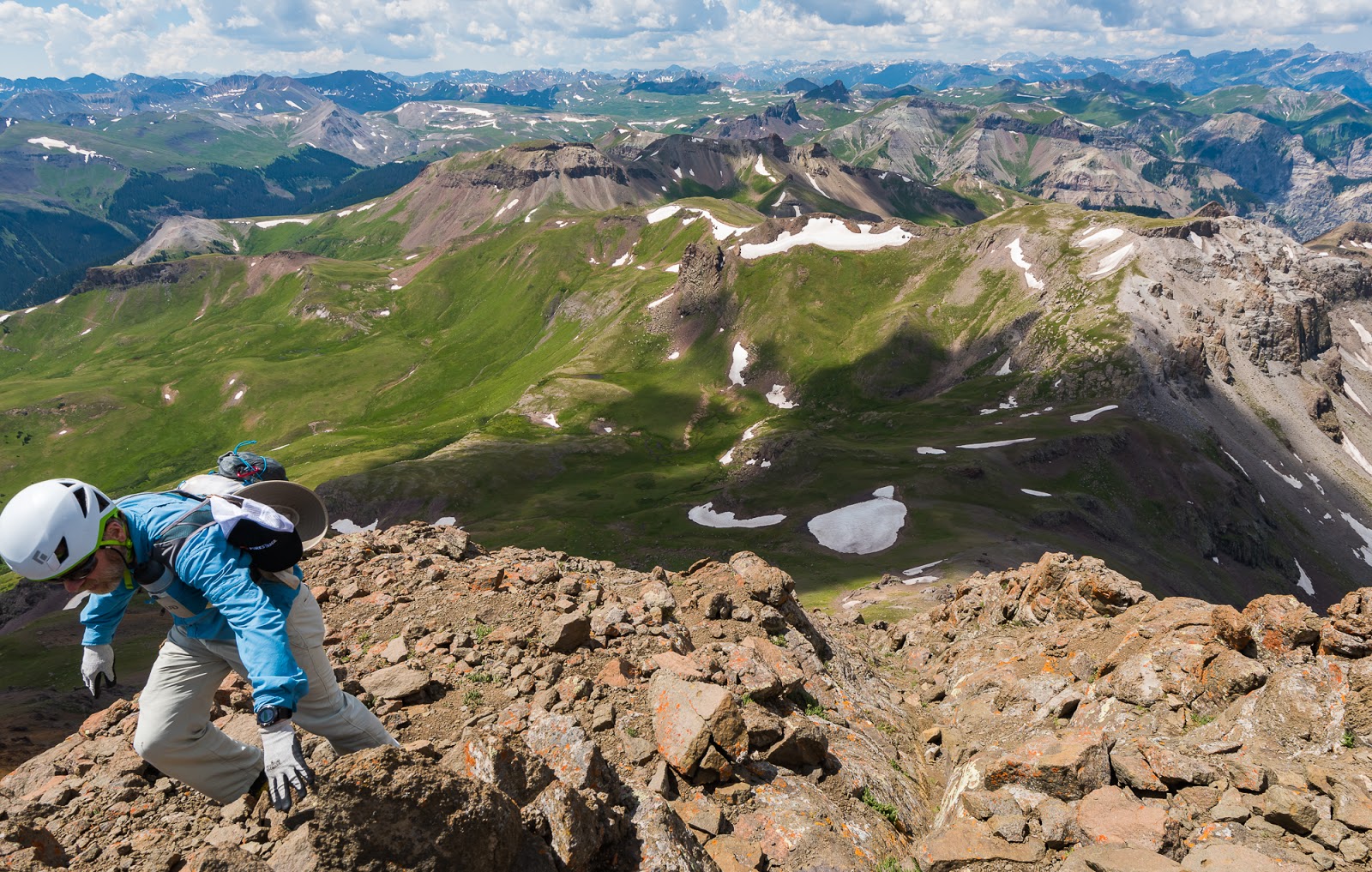
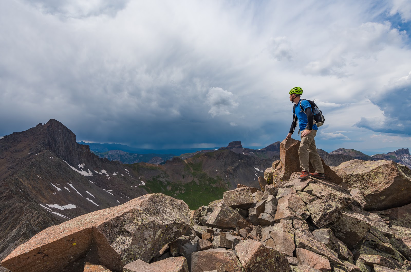
Mitch (right) and Jeff (left) having a blast on the final scramble up Wetterhorn Peak - really the treat of the entire route.

Claron tops out on Wetterhorn Peak's summit

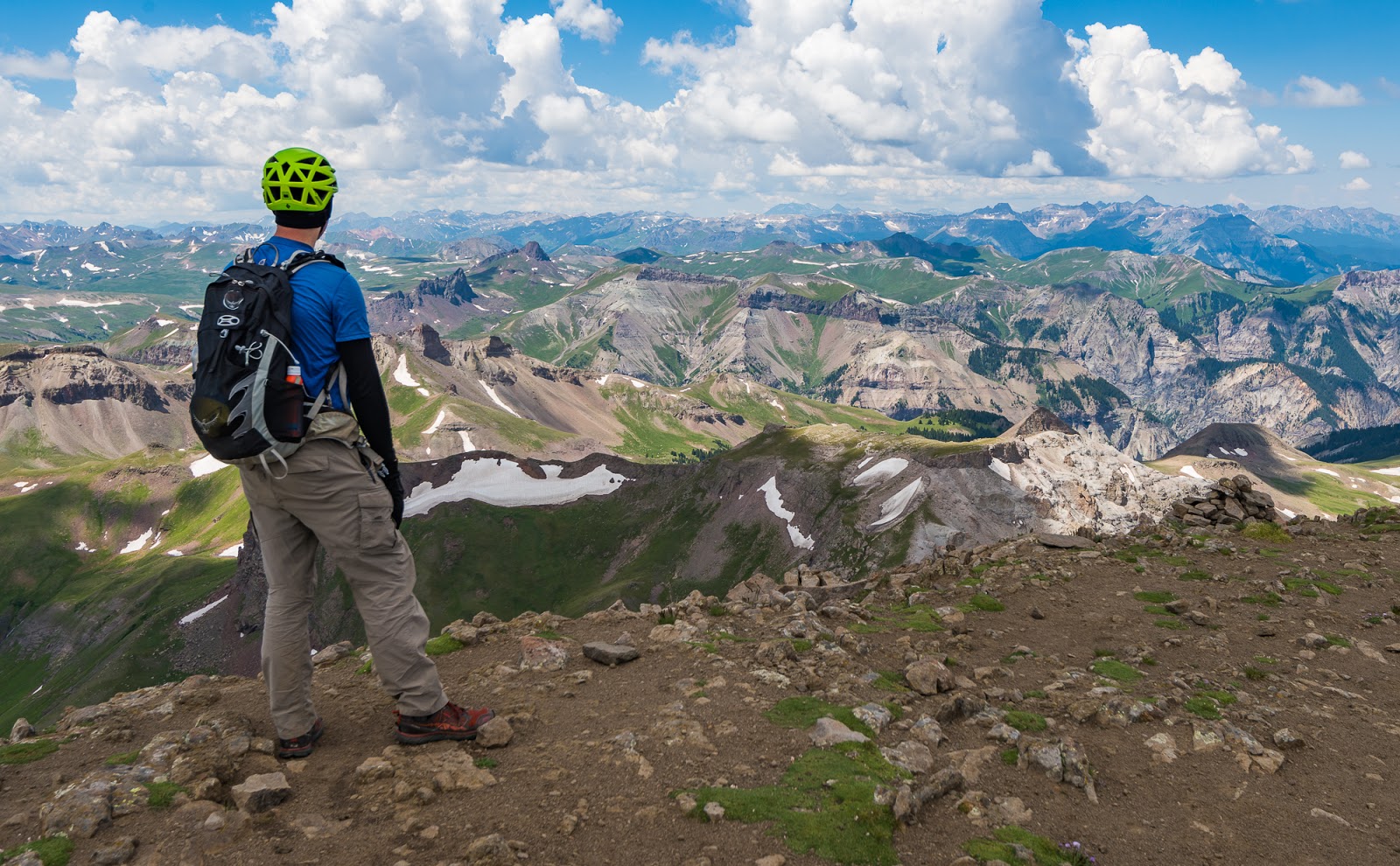
The "sea of mountains" visible from Wetterhorn Peak's summit.
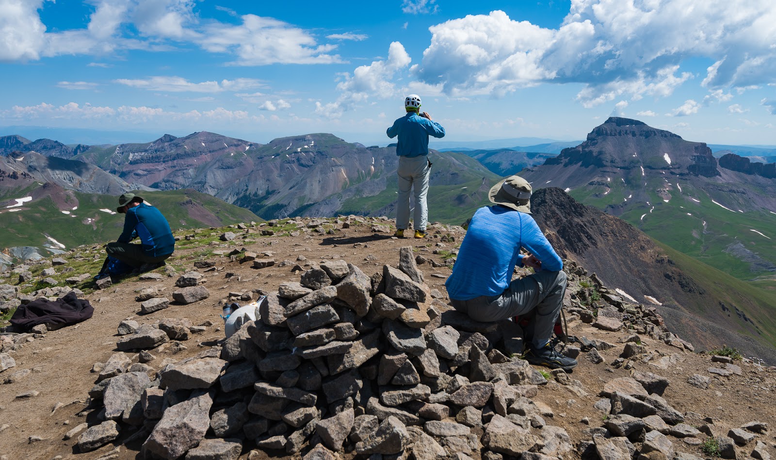
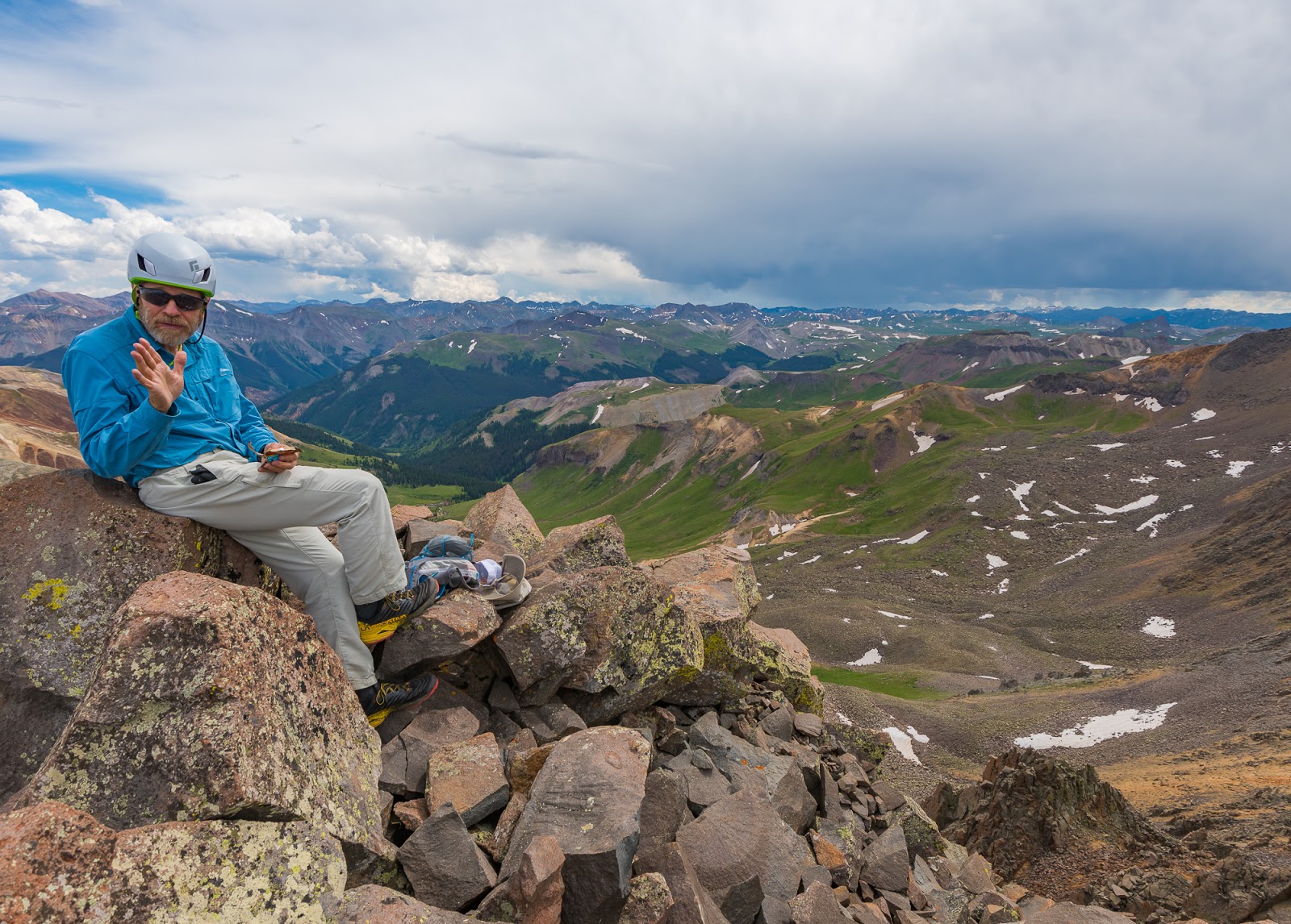
Snacking and picture taking on the summit of Wetterhorn Peak. (L - R: Jeff, Claron, and Mitch)

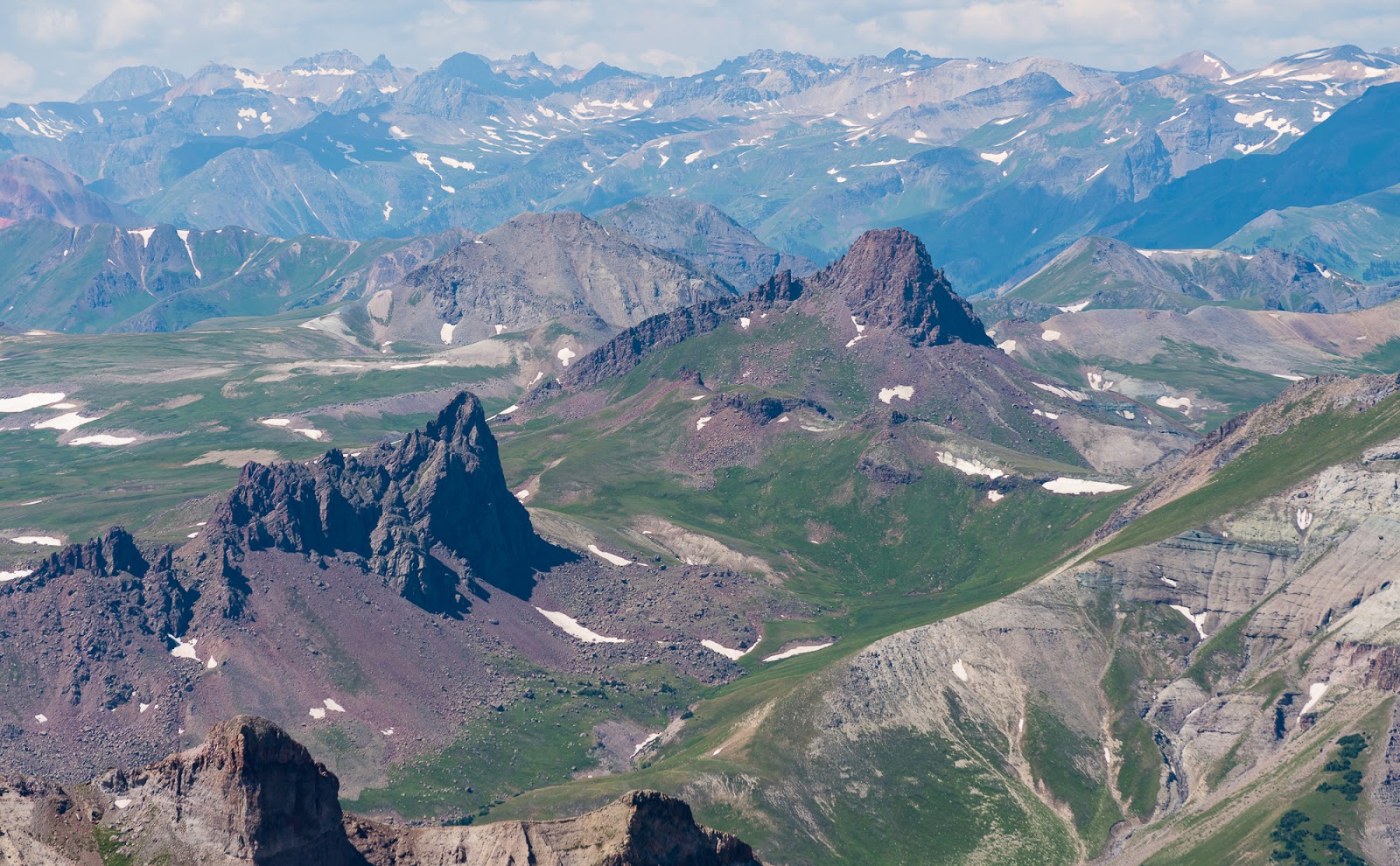
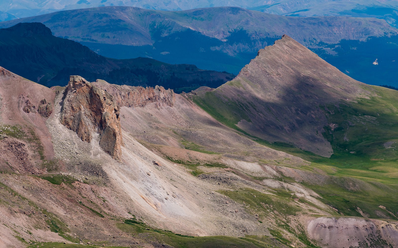
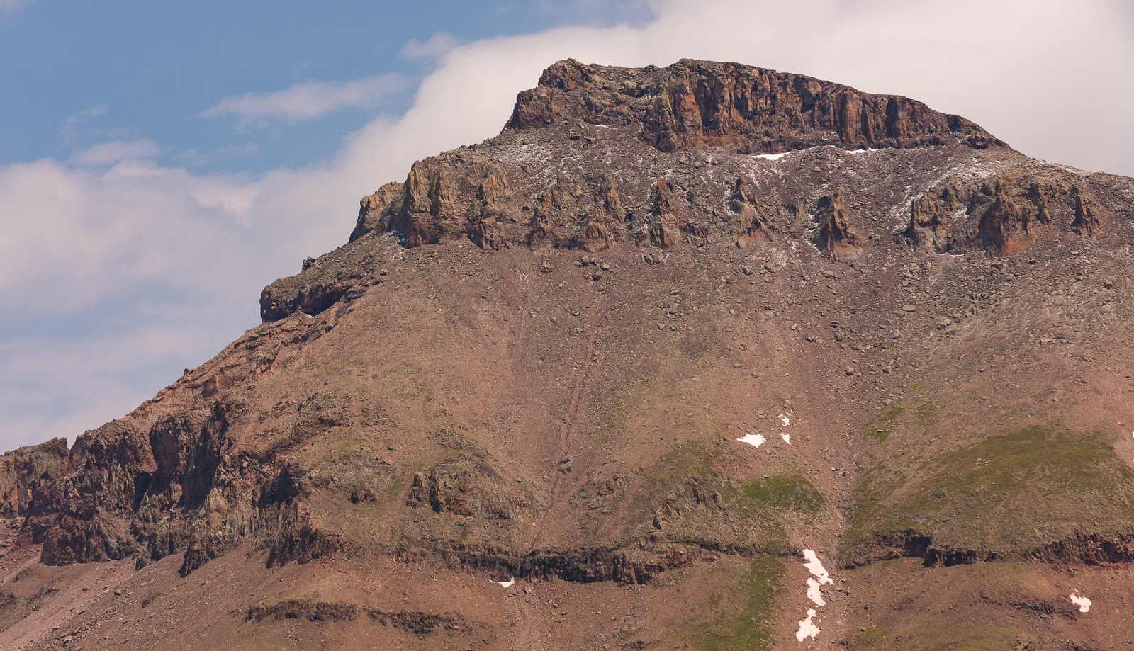
Sweet peak seen from Wetterhorn Peak - not sure if this one is named or not, but it's certainly impressive from this angle.
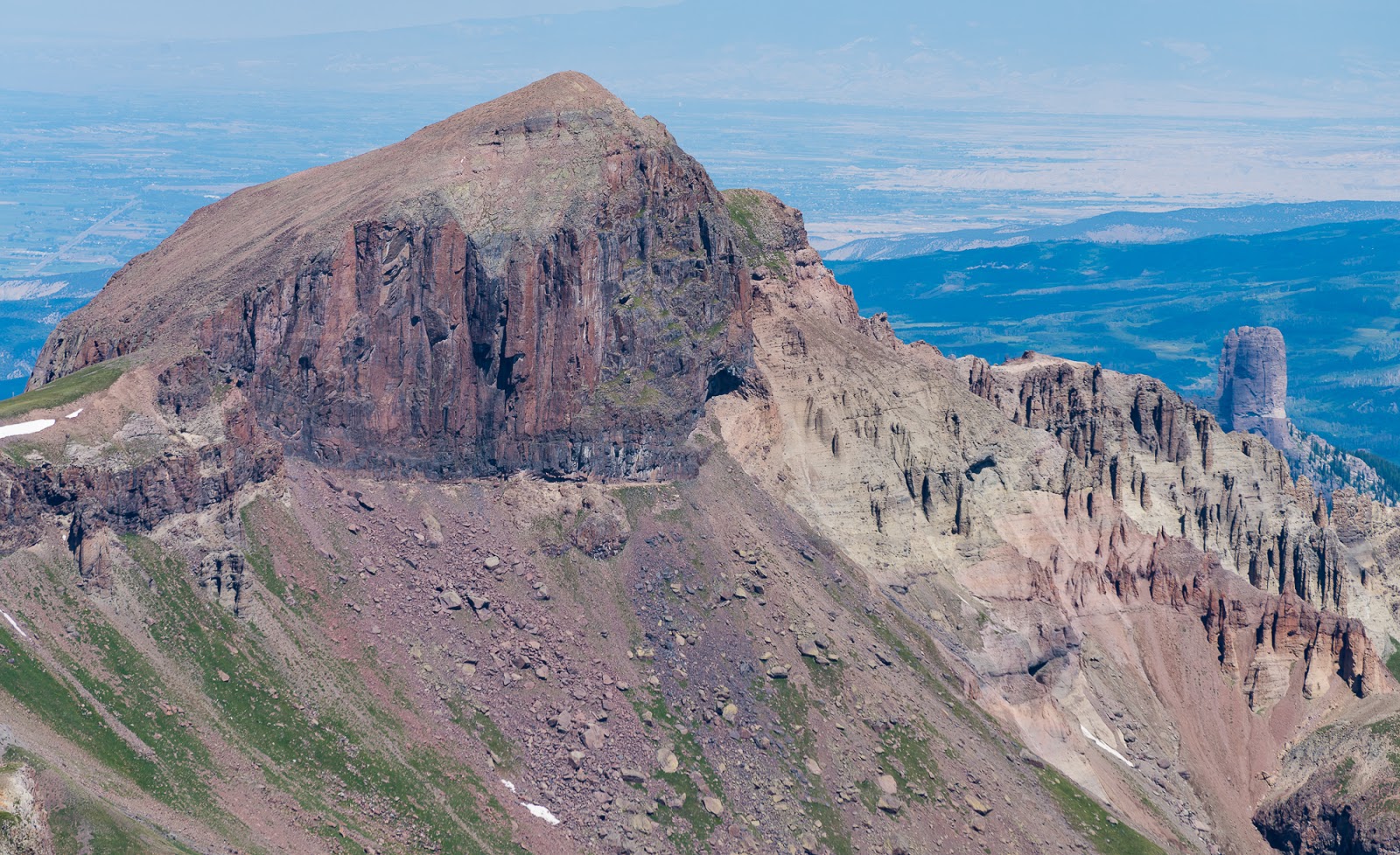
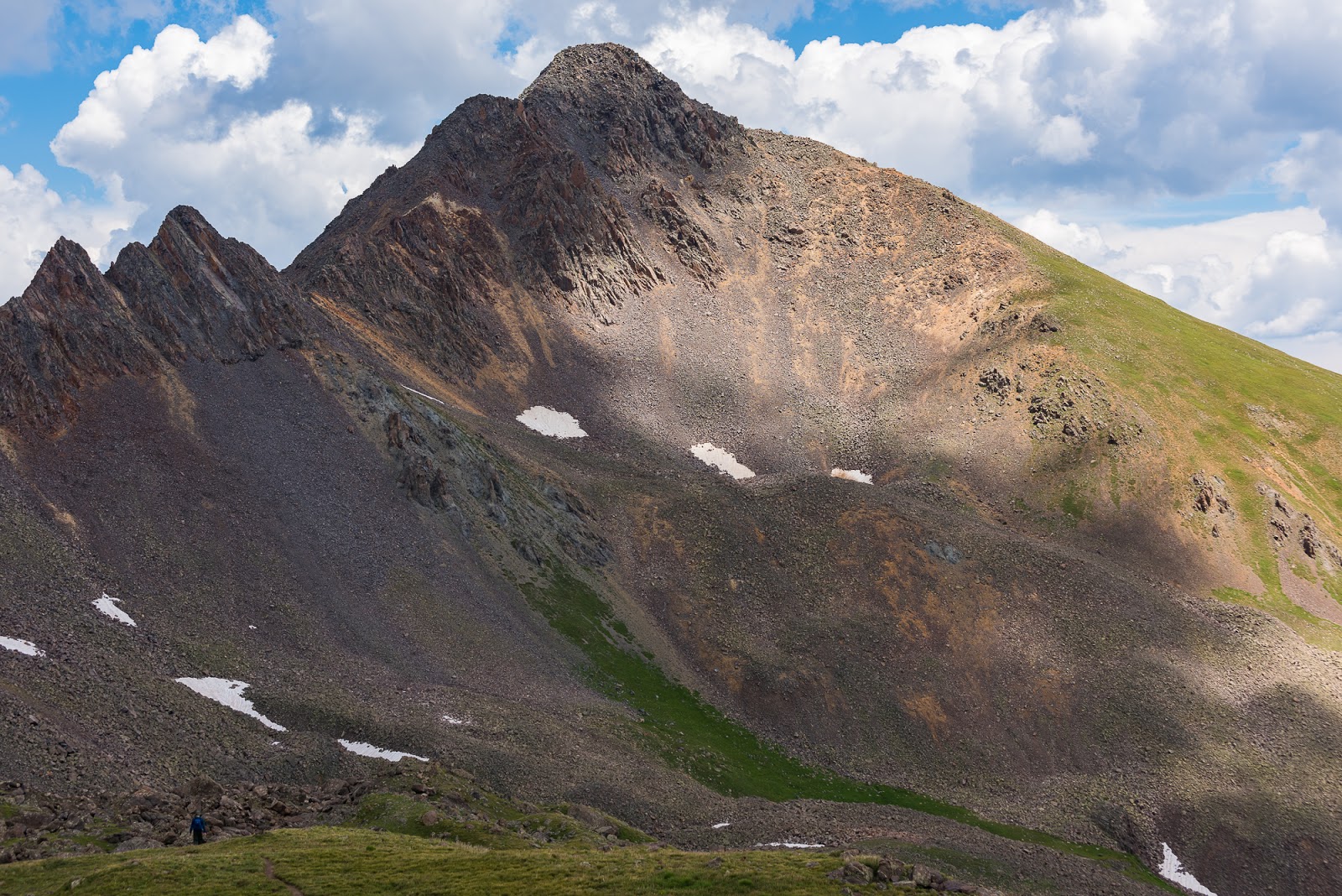
Redcliffs Peak (14,035 feet).
Coxcomb Peak (13,656 feet)

Mount Sneffels figures prominently in this view across a glorious stretch of the San Juan Range; the blue tint is from atmospheric haze.
A remote basin we were planning to visit later this week to climb some more 13ers.

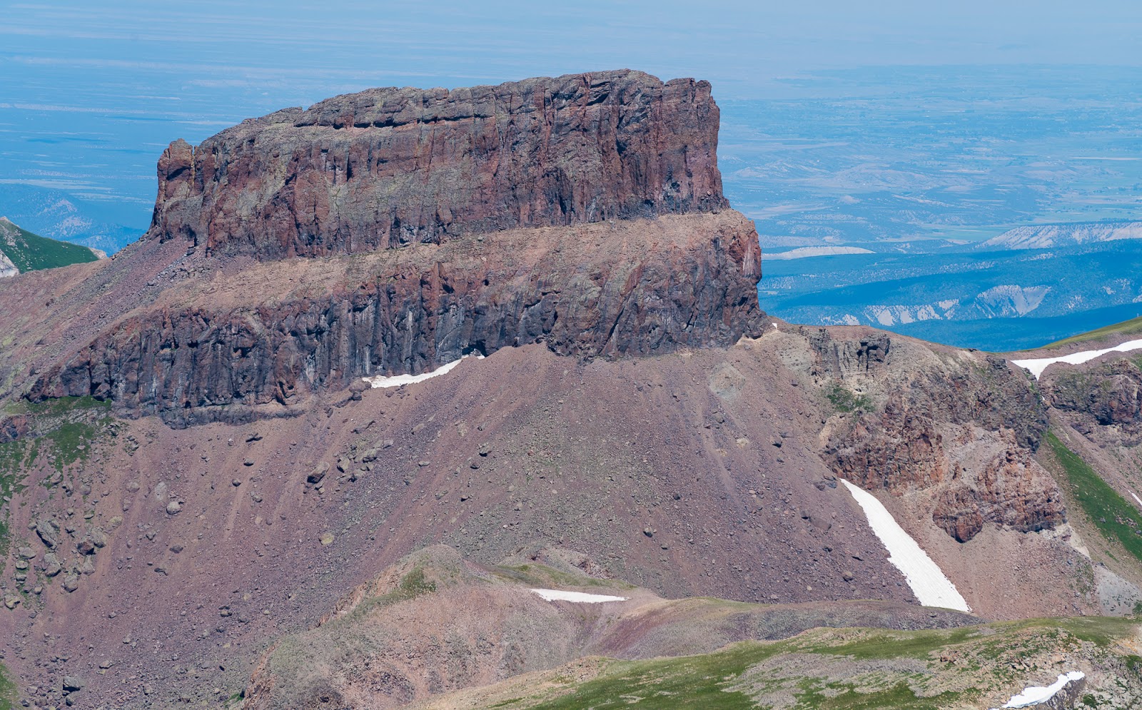
The very impressive Precipice Peak (13,144 feet), featuring a large cliff face extending up to the summit and many giant hoodoo formations (the pinnacles along the mid-to-lower sections of the peak).
I had been talking with Mitch, Jeff, and Claron on the way up to Wetterhorn Peak's summit about how I'd seen a marmot on the summit back in 2015 and couldn't figure out how it got up there when the summit is so ruggedly surrounded...when what to my wondering eyes should appear but another marmot here in 2017 - could be the same marmot for all I know...still not sure how it/they get up to this particular summit...
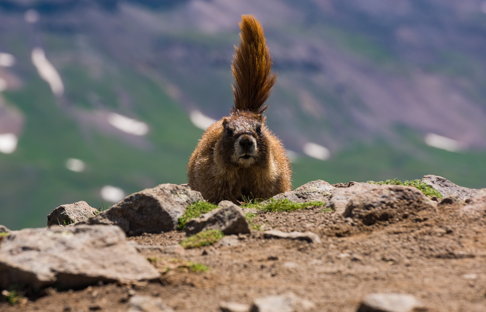
I had been talking with Mitch, Jeff, and Claron on the way up to Wetterhorn Peak's summit about how I'd seen a marmot on the summit back in 2015 and couldn't figure out how it got up there when the summit is so ruggedly surrounded...when what to my wondering eyes should appear but another marmot here in 2017 - could be the same marmot for all I know...still not sure how it/they get up to this particular summit...

Judgmental marmot wants to know why we're on its summit...
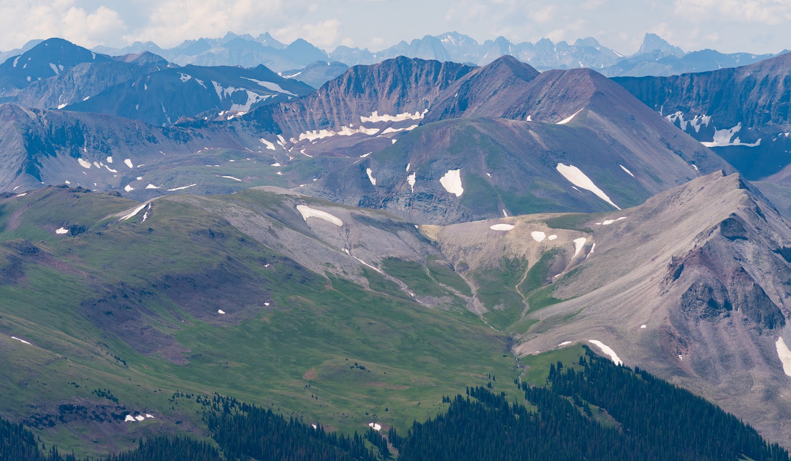
Looking to the Grenadier Range and the Needles Range near the far horizon ; I'm aiming to visit the Needles Range to climb the 14ers out there two weeks from this trip...
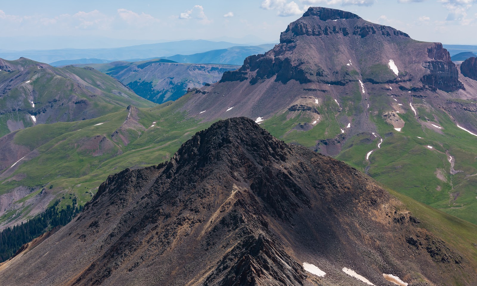
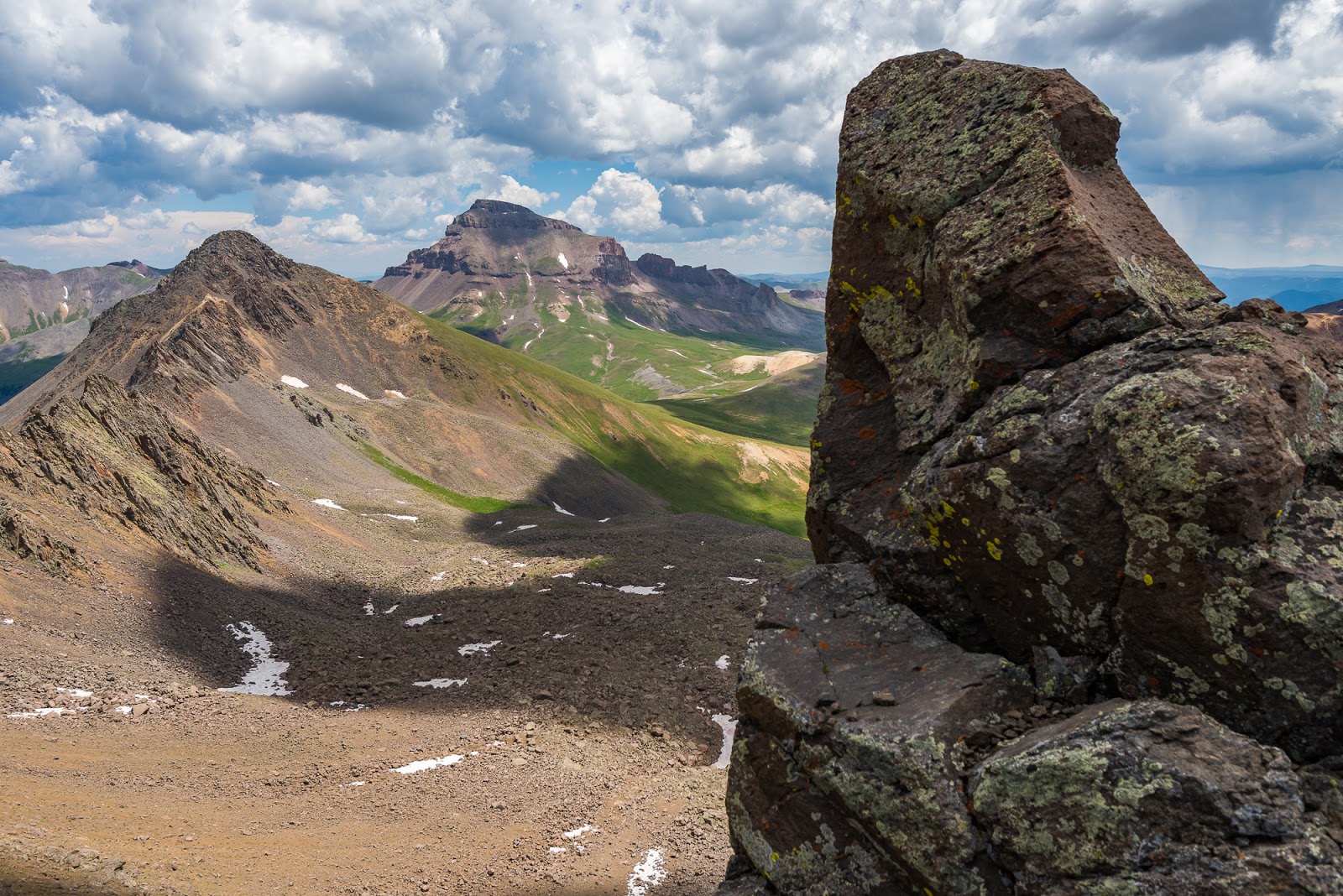
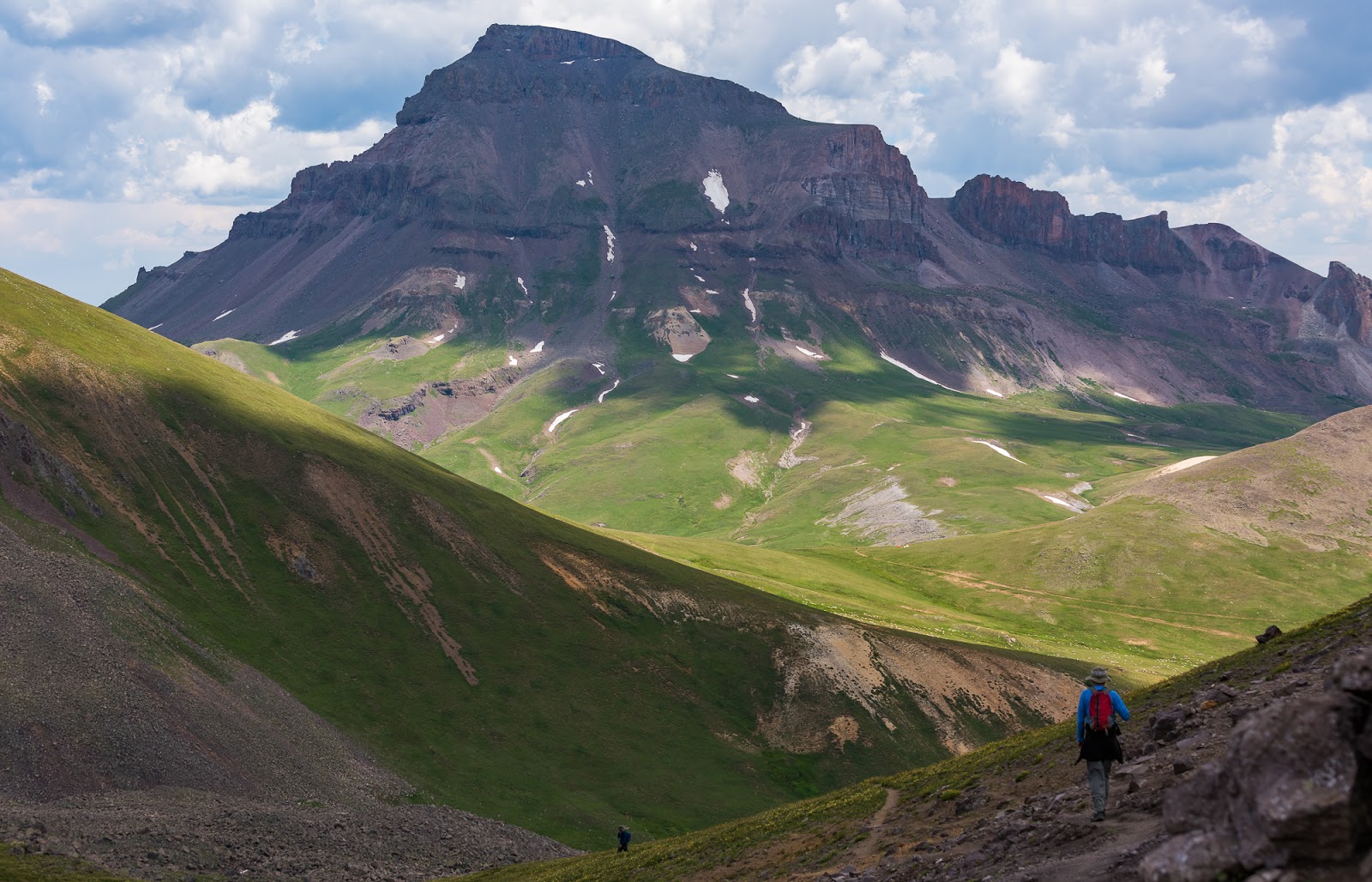
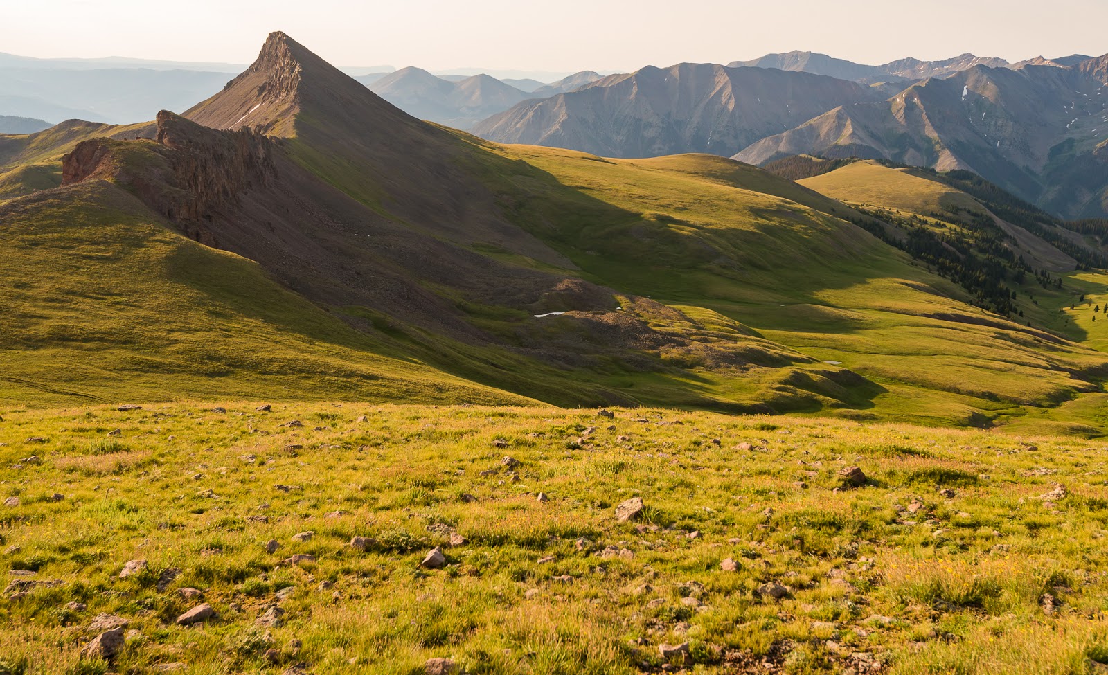
Our other target peaks for this area - Matterhorn Peak, a 13,000+ foot peak (the darker one in the foreground) and Uncompahgre Peak, the highpoint of the entire San Juan Range, over 14,300 feet tall (the big one in the background). We'd be aiming for Matterhorn Peak after Wetterhorn.
Our camp (upper right) at the high pass a little over 12,400 feet above sea level, seen from Wetterhorn Peak's summit.
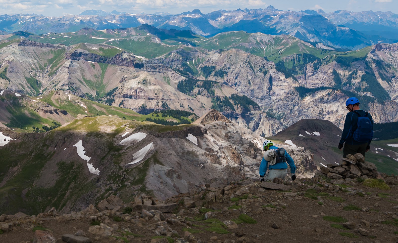
Claron and Mitch being descending from the top of Wetterhorn Peak.
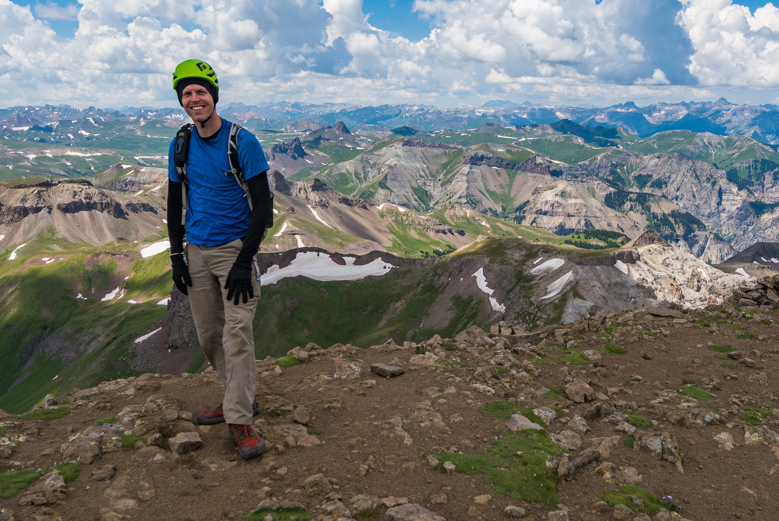
I almost forgot to get pictures on top of Wetterhorn Peak, but just before descending I asked Jeff to snag a couple for me, which he kindly did.
I almost forgot to get pictures on top of Wetterhorn Peak, but just before descending I asked Jeff to snag a couple for me, which he kindly did.
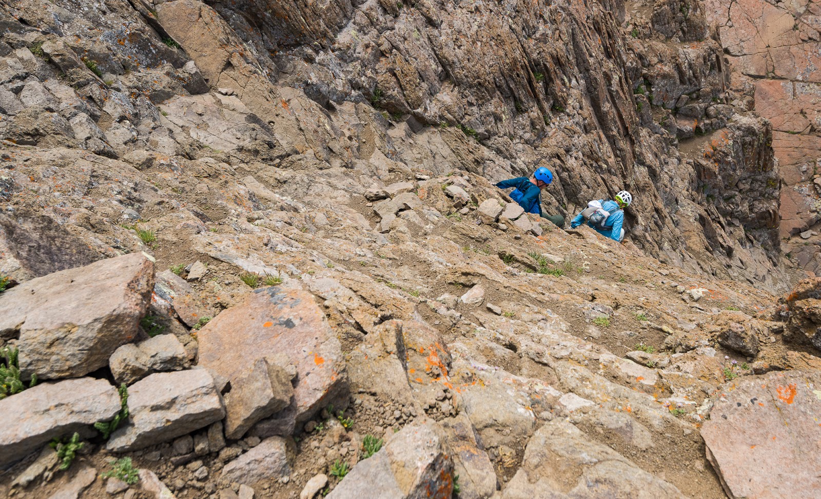
Looking down the final scramble on Wetterhorn Peak as Claron and Mitch continue down the steep scramble.
Looking down the final scramble on Wetterhorn Peak as Claron and Mitch continue down the steep scramble.
Jeff starts down the final scramble on Wetterhorn Peak.
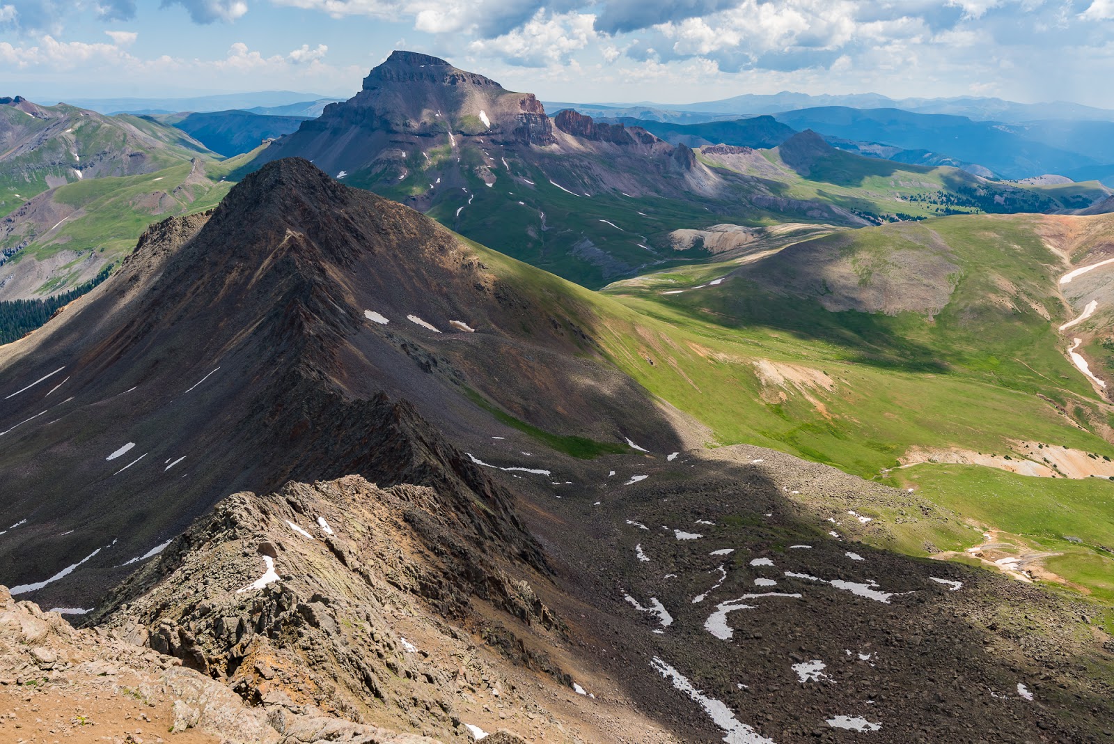
Another shot of Matterhorn and Uncompahgre Peaks. This shot also gives a pretty good overhead perspective of the nasty ridge between Wetterhorn and Matterhorn Peaks - very exposed and made of rotten (crumbly/loose) rock...
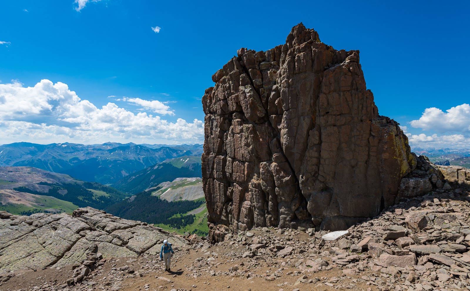
Claron tops out on "The Prow" on our quick diversionary scramble there.

Claron descending from "The Prow" after our brief visit to the summit.
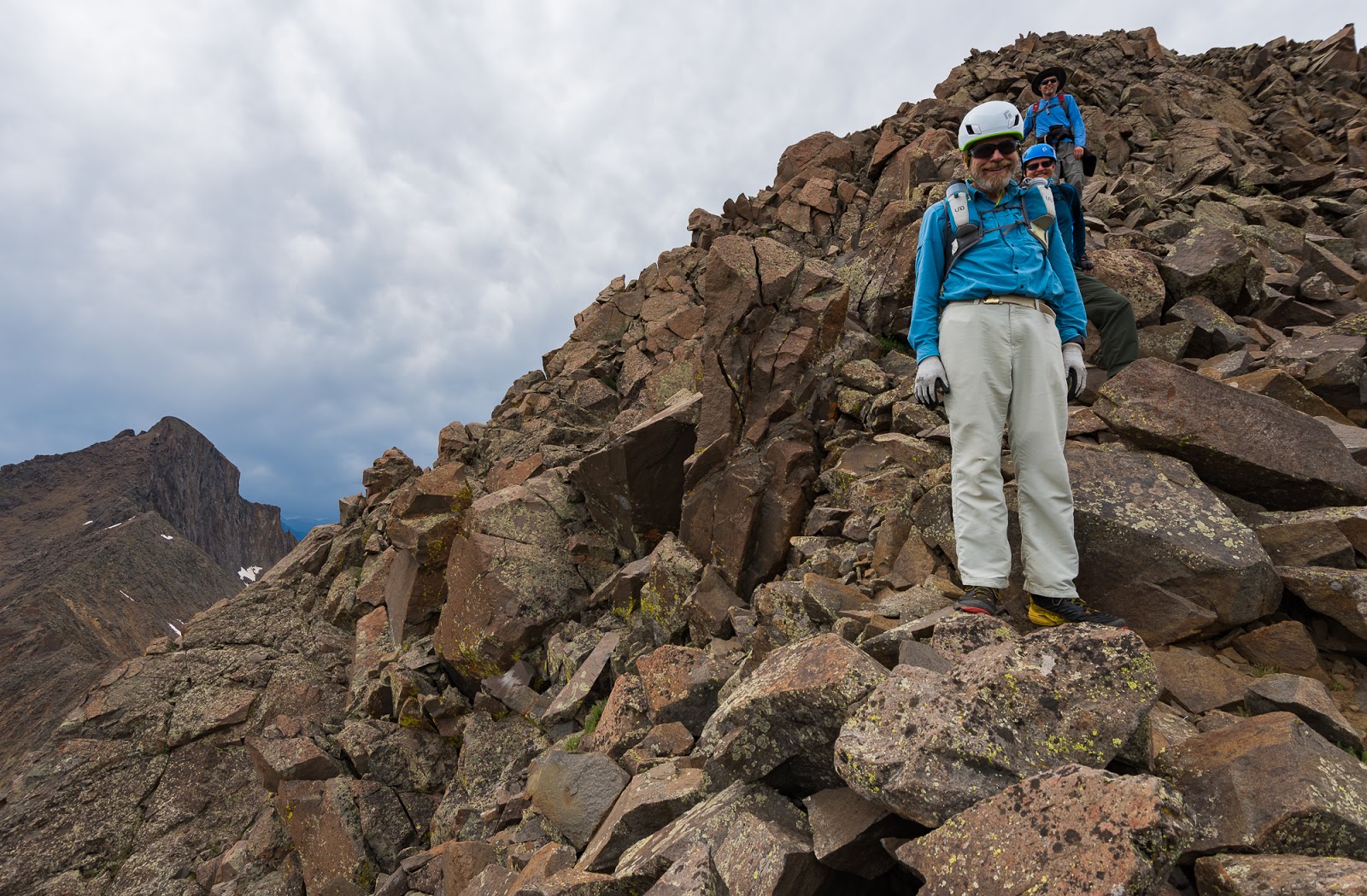
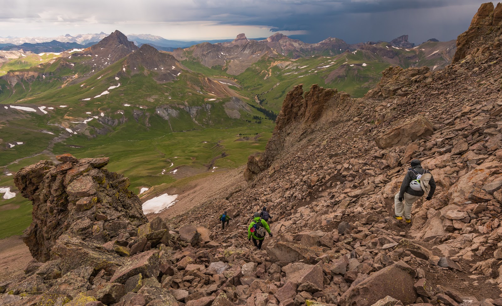
Claron navigating occasionally complex terrain on Wetterhorn Peak as we descend (usually nothing too complex here, unless your route-finding is really off the main route).
Views of Matterhorn (far left) and Uncompahgre (just left of center)Peaks from somewhere along the way as we descended Wetterhorn Peak.
Happily, the brief section of loose, yellow dirt that I don't enjoy was not so bad on the descent - I actually slipped more on the way up than I did on the way down...I found that quickly jogging down the slope made it much easier than trying to carefully walk down; not sure what phsyical processes I was engaging to make that work, but it worked all the same.
Claron found a decent sized snow field near the saddle where you begin the SE Ridge after ascending from the high basin below the peak and decided to grab some snow to melt into his water bottle. Jeff soon found his way to the same snowfield and decided to become a member of the "August Glissade Club".
Claron found a decent sized snow field near the saddle where you begin the SE Ridge after ascending from the high basin below the peak and decided to grab some snow to melt into his water bottle. Jeff soon found his way to the same snowfield and decided to become a member of the "August Glissade Club".
Jeff considers becoming a member of The August Glissade Club (t-shirts [maybe] pending).

The consideration past, Jeff becomes a full-fledged member of The August Glissade Club! Huzzah!
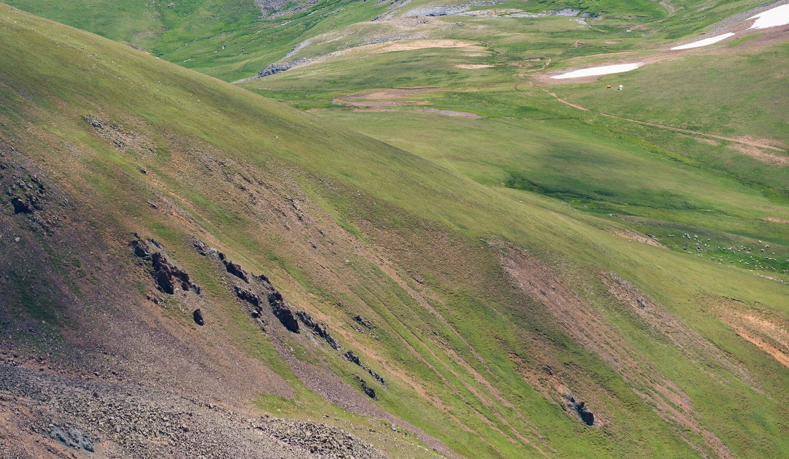
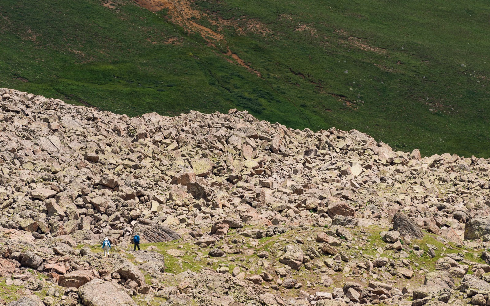
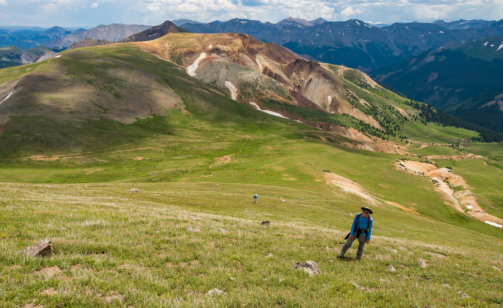
If you look close you can see Mitch working down the trail ahead (lower center) and Jeff continuing behind him while Uncompahgre Peak towers above in the distance about 4 - 5 miles away from here. So often a sense of scale gets lost in pictures of mountainous areas. This is big country, and an excellent place to let humility sink deeper into your bones...
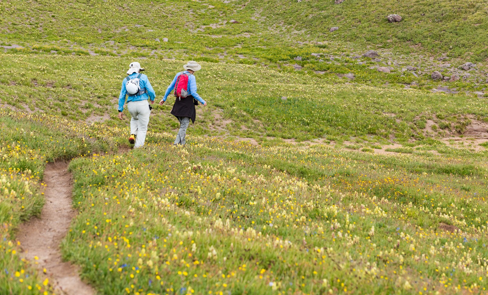
Claron and Jeff (L to R) marching along the trail through fields of wildflowers somewhere in Wetterhorn/Matterhorn Basin.
Can you see Mitch in this picture? Matterhorn Peak and the gressive, crumbly ridge between Wetterhorn and Matterhorn Peaks can be seen, just a bit, on the left.

Neat textural detail on a gently-contoured but interestingly colored peak across the way in Wetterhorn/Matterhorn Basin.

Another shot of Matterhorn Peak and some of the ridge; there are also two marmots here amid the rocks.
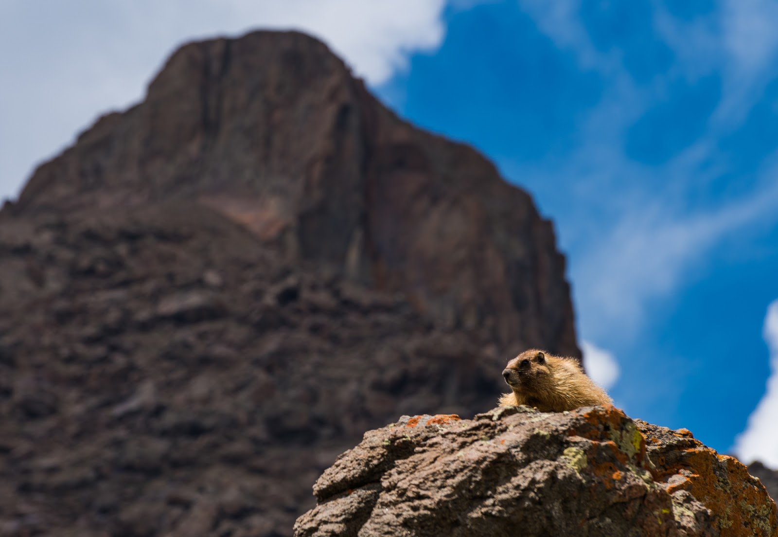
I was hoping for a shot like this: A marmot perched on a rock framed against the imposing bulk of Wetterhorn Peak's summit. Nice of the sun to highlight the marmot for me, and for the clouds to add a little dynamism to the sky.
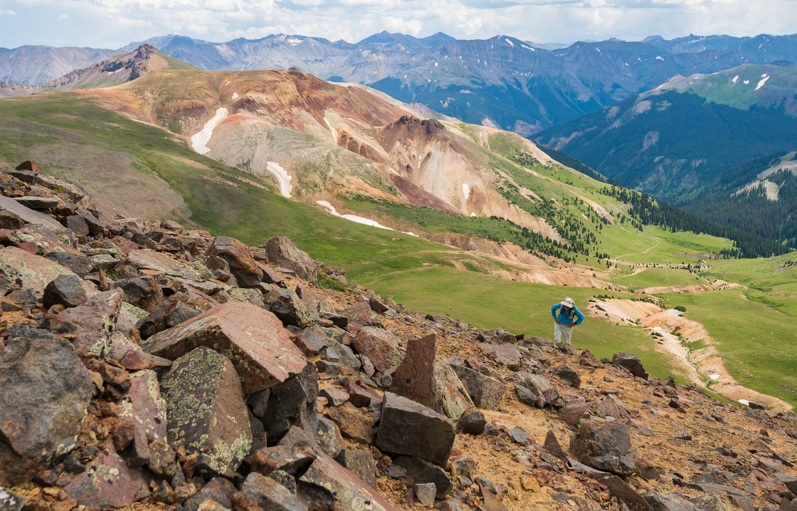
Claron and Mitch approaching the edge of a large boulder field in Upper Wetterhorn Basin; again, the trail takes you through boulder fields but you travel on trail, not over the boulders themselves, which is nice and makes travel up and down this stretch pretty quick.
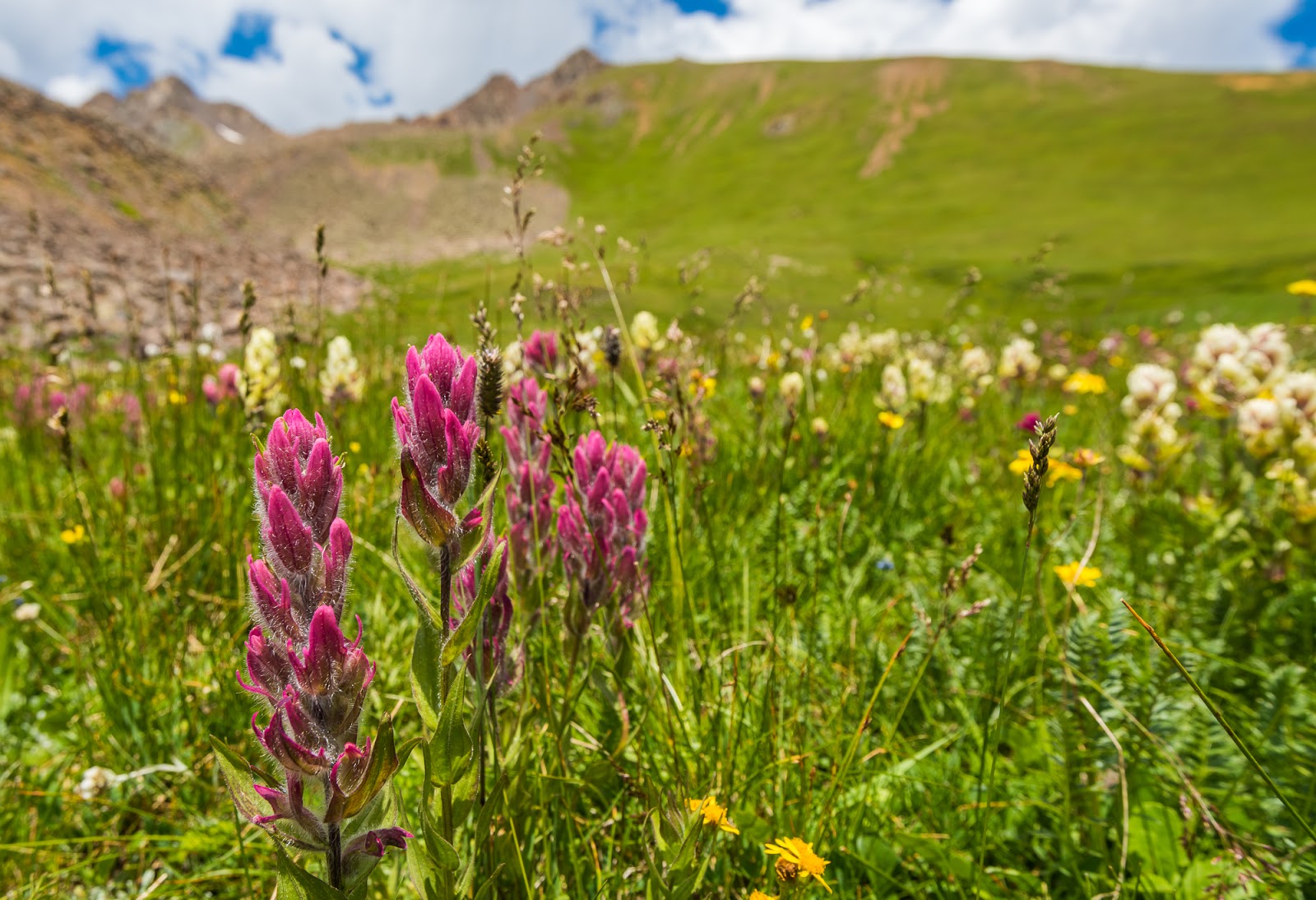
Detail from the thickest field of wildflowers we were privileged to travel through on this trip.
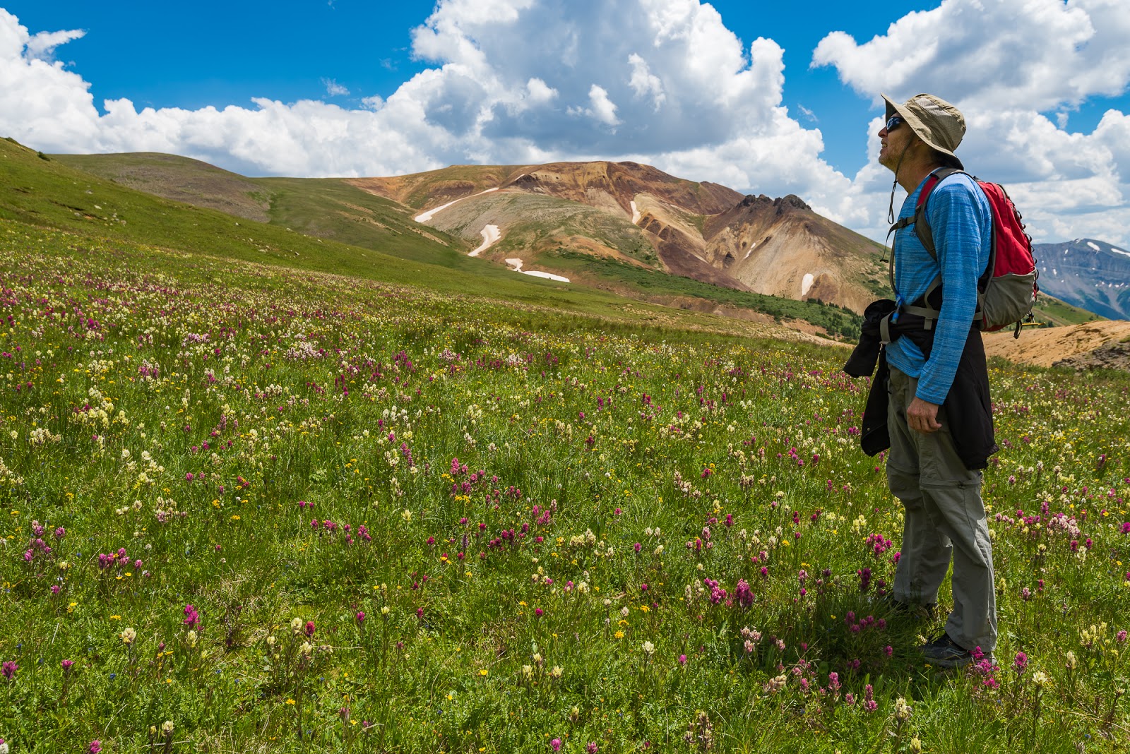
Jeff admiring the views in that exceptional flower field (and perhaps a bit apprehensively anticipating the approach of the steep wall of grass we had to climb to gain the higher slopes of Matterhorn Peak from the lower basin - and it really was steep!).
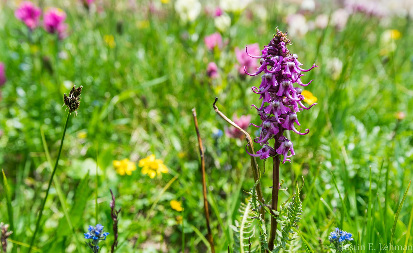
Someone in our group called these "elephant head flowers"; with a closer look it's not too hard to make the imaginative leap that association requires.

Claron climbs the steep headwall of the basin leading to Matterhorn Peak's upper slopes (there's no trail up Matterhorn Peak, you just pick a line that suits you best and follow it up to the "crux tower" at the top). This field of wildflowers was so abundantly stocked it was joyful simply to walk through such abundance...I hope this photo conveys a little of what this part of the hike was like and the happiness spending time among the flowers brings.

Mitch takes a quick rest break on the way up Matterhorn Peak's steep grassy slopes (which seem to continue a lot longer when you're actually ascending them than what they seem to advertise from down below); Wetterhorn Peak is seen behind.
Looking down the steep grassy slopes that make of the bottom two-thirds of Matterhorn Peak you can see Jeff and Claron marching up - and there's not much horizontal distance between Claron and I; the slopes are quite consistently steep.
Claron makes it up to the rocky transition area above the extensive lower grass slopes.
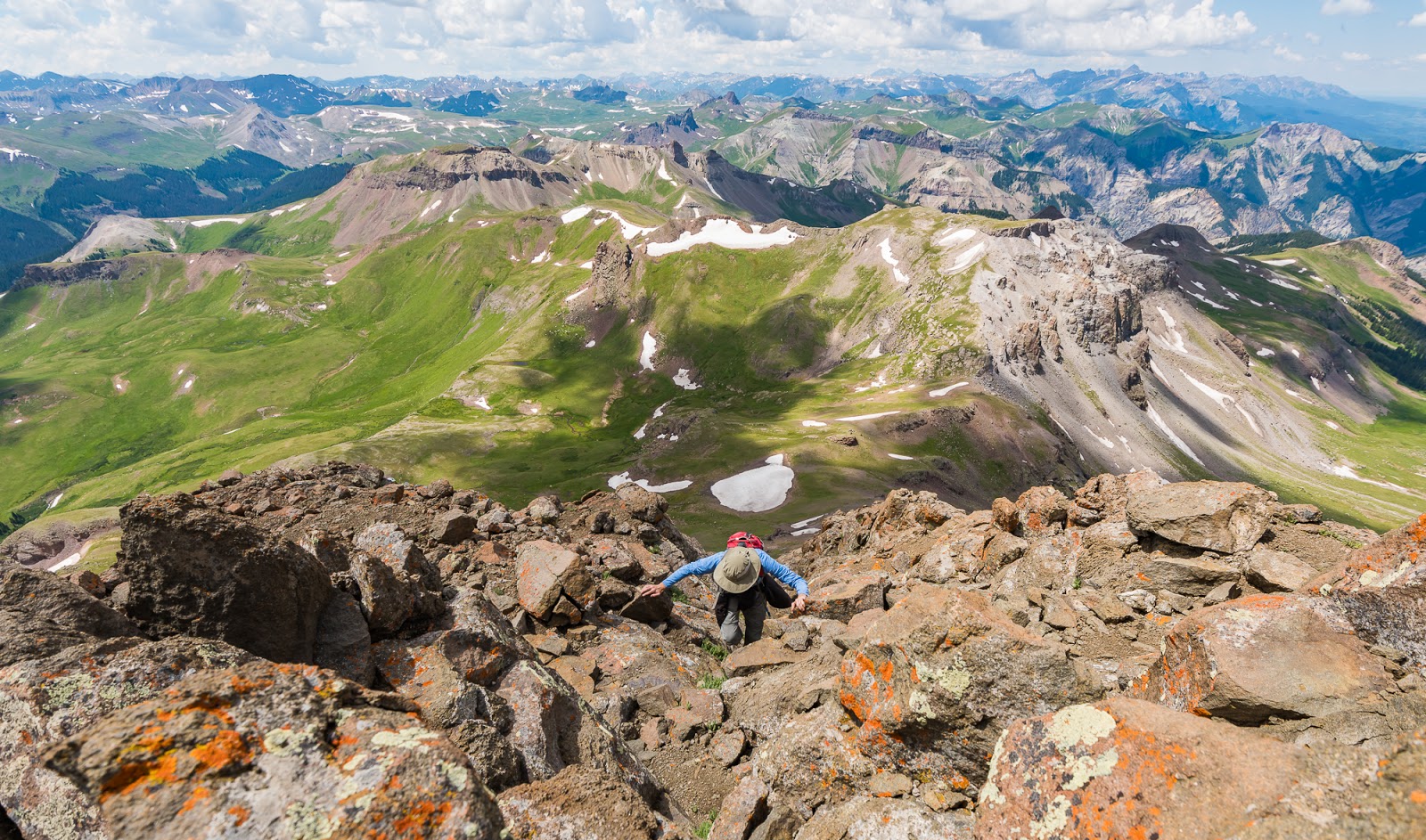
I really enjoyed this perspective of Wetterhorn Peak from Matterhorn Peak, especially with the stormy skies and Mount Sneffels and other more distant San Juan Range peaks beyond.
I really enjoy this peak; for me it resembles (largely) the shape of Utah's state highpoint, Kings Peak (13,528 feet), when seen from Henrys Fork Basin area.

Me, on the summit of Matterhorn Peak (13,590 feet).
Me, on the summit of Matterhorn Peak (13,590 feet).
Claron in story-telling mode, while we were taking a bit of a snack break on Matterhorn Peaks's summit before we began our descent.
I snagged this quick pic of Claron, Mitch, and Jeff as we worked down the "crux tower" on Matterhorn Peak. Steep, bouldery terrain here, but not too perilously loose.
Claron, far ahead, hurries down toward our conveniently-located camp on the other side of this high pass, at the base of Matterhorn Peak's gentle slopes.

Jeff completing the descent down Matterhorn Peak's slopes (which come to a more gentle angle as you near the high pass around 12,400 feet up). Wetterhorn Peak is visible in the distant left.
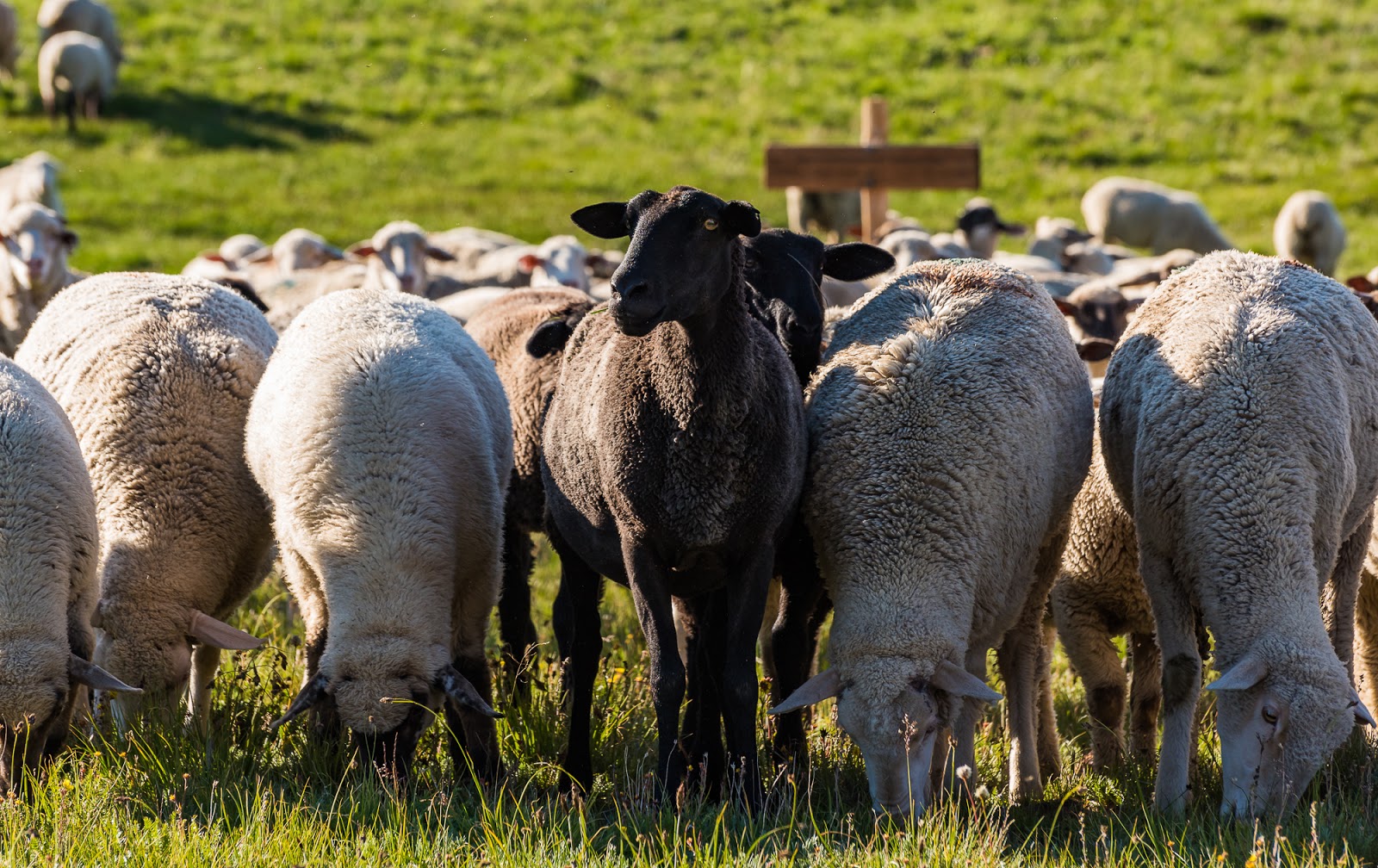
Black sheep - front and center.

This is how close the sheep got to our campsite before Claron decided to employ his own countermeasures against further sheepish encroaching...
Claron walks over to seek to dissuade the sheep from their invasive designs...

Shoo!
It's working!
...well...perhaps not so well...
Claron thinks he might be able to lead the sheep away from our camp instead so he starts walking away from within the group of sheep...
Are they following? Appears so...

I'll just keep going then...
Claron leads the sheep exodus onward and up Matterhorn Peak's lower slopes across the pass from our campsite.

The line goes on...

...and on...Claron's just visible in the upper right. By the way, this is only the beginning of all the sheep that migrated that way...huge group o'them critters out there...

This sheep seemed less than happy at our having steered his compatriots away from the savory grazing around our campsite....
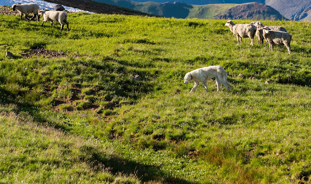
Found an old sheepdog out amidst the sheep...
The old dog moved slowly and didn't bark much; the sheep just generally kept their distance as the dog mostly casually moved toward them...the dog looks like its seen a lot of seasons of sheepherding....
Jeff walks against the imposing profile of Uncompahgre Peak, as seen from our campsite.

Detail on the slowly migrating sheep moving across the high pass and the slopes adjacent to it, just beyond our camp.
Detail on the slowly migrating sheep moving across the high pass and the slopes adjacent to it, just beyond our camp.
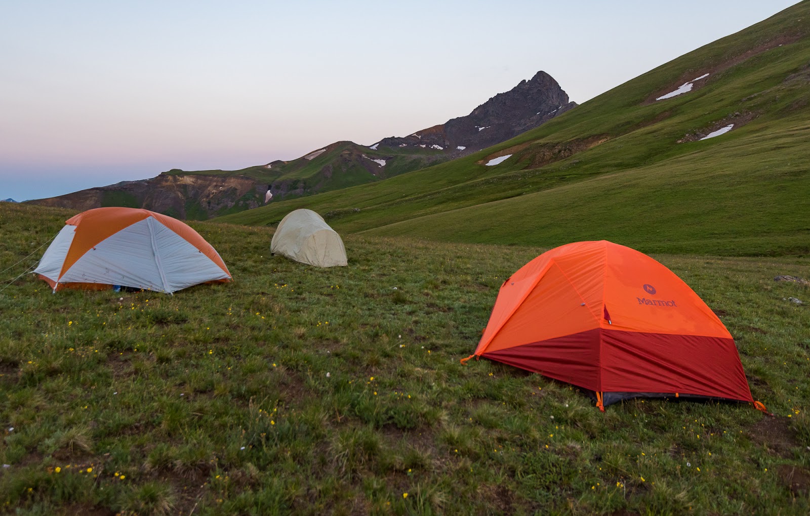
Our beautiful campsite out on the high tundra near the crest of the San Juan Range, with Uncompahgre Peak (14,308 feet), the highpoint of the entire range, lording over the vast area around it.
Mitch watches the sheep move against Uncompahgre Peak's imposing cliffs in the evening light.

Big sunflare and sunburst over the edge of Matterhorn Peak with the near-silhouetted Wetterhorn Peak behind; some of the many sheep that were in the area are visible here if you look in the shadowed foreground area also.

Stunning light on the beautiful contours of this expansive high tundra area...this scene is like a painting...but it was real...Fantastic!

Showing the neat sunrays piercing across the rugged ridge between Wetterhorn and Matterhorn Peaks near sunset time.

My favorite shot of the entire trip. The dynamic cloudscape, the texture of the whole scene - both on the grand and the minute scales - and the warm, golden light of the evening spilling across Uncompahgre Peak and accentuating the red, orange, and yellow tones of the scene was simply sublime! I didn't get the deep red light of the late sunset I was initially hoping for, but I might like what I got even better than what I had originally hoped for.
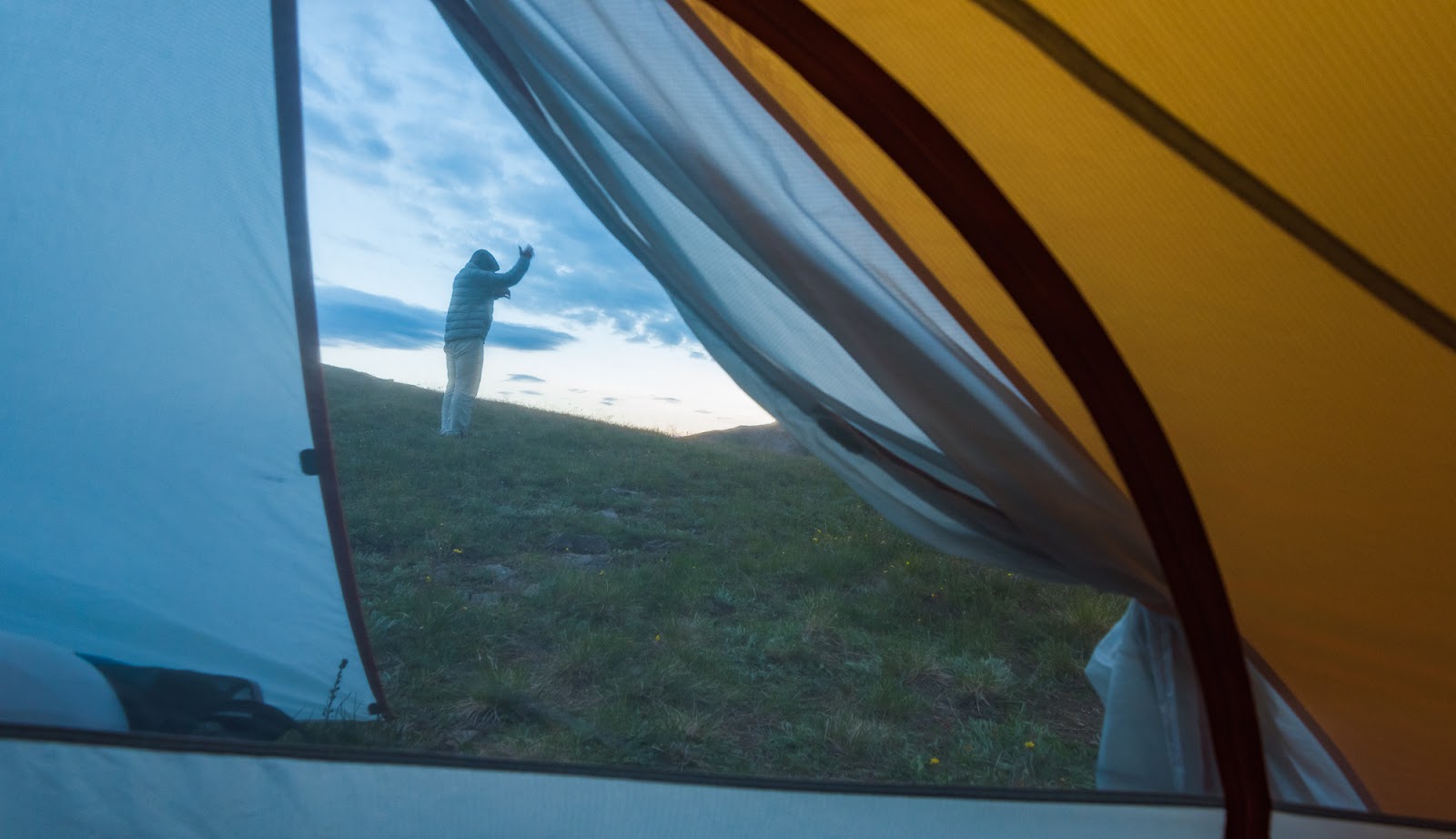
Claron dutifully does his own set of calisthenics each morning and night before getting going. He's a super-ambitious hiker and is well over 60 at this point, so it seems to be working for him. I really like Claron and enjoy sharing various adventures with him.
Pre-dawn light over our campsite a bit above 12,400 feet above sea level.
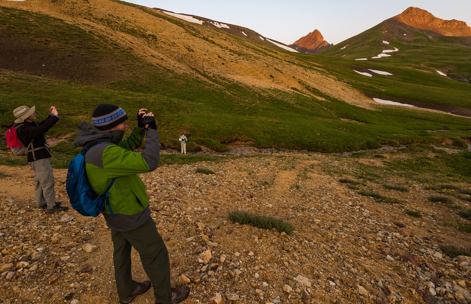
I couldn't get as good a shot of the sunrise on Wetterhorn and Matterhorn Peaks as I wanted to while we were on our way to Uncompahgre Peak, so I figured this picture of Jeff and Mitch taking a picture of the scene while Claron was filtering a little water in the background would work instead...
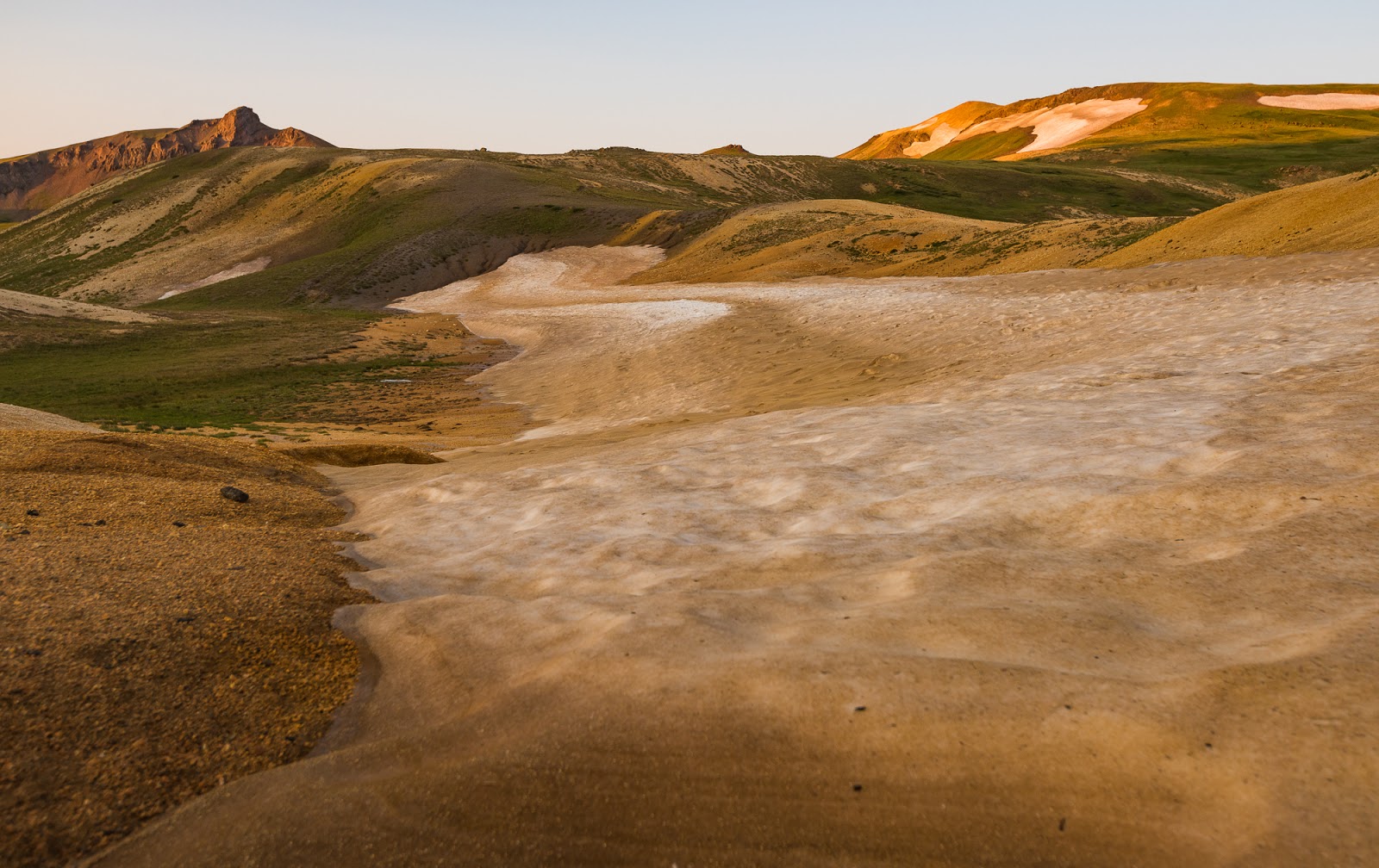
Sometimes these trips take you to some pretty otherworldly-looking terrain, like this scene in the vicinity of the largest snowfields we passed during our time in Colorado. Neat stuff! The darker striations on the snow's surface come from deposits of wind-blown dirt from the general area.

More lovely morning scenes from our journey up Uncompahgre Peak.

The sign!
Neat to see a completely different perspective on Uncompahgre Peak from along the approach. It really is just a class 2 approach up there (with maybe a stretch of class 2+/very low class 3 with low exposure up high).
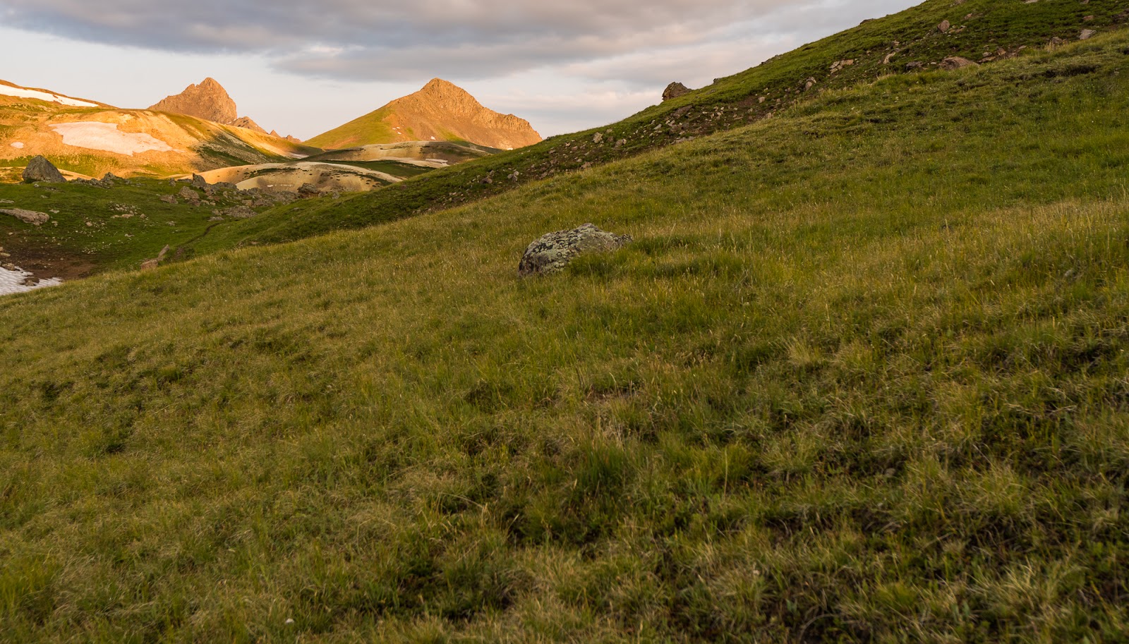
Looking back at Wetterhorn and Matterhorn Peaks as we continue our ascent up mostly gentle terrain (interrupted occasionally by a few steep hills between plateaus).
Glorious morning light washes across the high landscape from atop the first large plateau we ascended on our way up Uncompahgre Peak (there would be a few more ere the summit would be gained). From our high pass (camp) just over 12,400 feet up, we dropped several hundred feet into a larger basin and followed undulating terrain generally up from there until we began following the series of plateaus toward Uncompahgre's summit. The trail was well-marked and seemed easy to follow. There's a few (brief) moments of ambiguity up high around the bouldery/light scrambling part, but most of the way is very clear all the way up at a glance.
Sunburst over high tundra , looking toward that Kings Peak look-alike I mentioned earlier...
Claron marches upward toward the rising sun on our way to another high plateau.
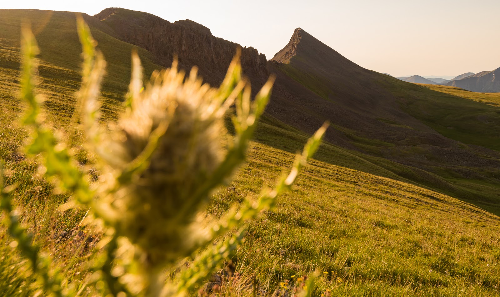
Mmmm...A thistle and a rugged peak...lovely.

Jeff and Claron trudge on up the slopes toward the next plateau. Uncompahgre's other side (which we'd soon be switch-backing up) begins to appear in the distance...
Looking back at that (now-not-so) Kings Peak look-alike, now seen edge-on from one of the high plateaus below Uncompahgre Peak.
Our fullest view of Uncompahgre Peak we'd had yet (from this side). It's neat how all this terrain is well above treeline in this area.
Looking back to that "Kings Peak look-alike" - at this point I readily concede it doesn't really look (anything) like Kings Peak...but I maintain from certain angles they do have a similar ridgeline shape...
Of the several viewpoints Uncomahgre Peak affords you through its rugged cliff bands this was my favorite view from our trip - with the yellow-orange stone aglow under the morning sun and the intervening tundra alight under the same fire, with cloud-shadows adding additional interest. throughout the scene..and Wetterhorn Peak's impressive profile providing the icing on the visual cake.
This is a view down the light-scrambling section that constitutes the crux (most challenging point) of Uncompahgre Peak; it's not bad, but you can notice our little group of very experienced hikers and scramblers using their hands a little bit on the way up.
A few more minutes and we were on the top of Uncompahgre Peak's summit - the highpoint of the San Juan Range at 14,308 feet! Mitch and I made it to the summit first, with Jeff and Claron close behind us. I spent a few minutes wandering away from the few other individuals not in our group and the others in our group and found a secluded little place behind a rock outcropping on the summit where I privately knelt down and shared this moment with God in prayer, thanking Him for the success we'd had here and on the other peaks and for giving me the strength and vision to seek this experience out and to carry it all out according to my design. Mountain summits are special places, and I feel a special nearness to God there that is sometimes elusive in other places; it was a privilege to share this highpoint with He who raised it (and me) up.
One of the benefits of my wandering around after my prayer, was that I came across a sweet-awesome vantage point for a great summit shot; I had one of the others take my picture with my camera and then all of them - once they'd seen the perspective on this place - wanted their picture taken their, so I took care of that after completing my own photo-opp.
Mitch and I made it to the summit first, with Jeff and Claron close behind us. I spent a few minutes wandering away from the few other individuals not in our group and the others in our group and found a secluded little place behind a rock outcropping on the summit where I privately knelt down and shared this moment with God in prayer, thanking Him for the success we'd had here and on the other peaks and for giving me the strength and vision to seek this experience out and to carry it all out according to my design. Mountain summits are special places, and I feel a special nearness to God there that is sometimes elusive in other places; it was a privilege to share this highpoint with He who raised it (and me) up. One of the benefits of my wandering around after my prayer, was that I came across a sweet-awesome vantage point for a great summit shot; I had one of the others take my picture with my camera and then all of them - once they'd seen the perspective on this place - wanted their picture taken their, so I took care of that after completing my own photo-opp.

The excellent vantage point I found on Uncompahgre Peak while exploring the summit area duirng our time up there. That's me, on the highpoint of the San Juan Range, 14,308 feet up!

Looking across Matterhorn and Wetterhorn Peaks (left) and Coxcomb and Redcliff Peaks (right) and many others from the summit of Uncompahgre Peak.
Retreating down the (wrong) gully over tedious boulder terrain as the increasingly threatening wall of thunder-rumbling storm sweeps across the landscape towards us...

Jeff navigates the terrain we all went across that we never should've had to cross...this was steep, and pretty shifty talus...I'm thinking the person in the lead went down a couple of gullies too early and we all followed "blindly" in our desire to beat the quickly approaching storm....
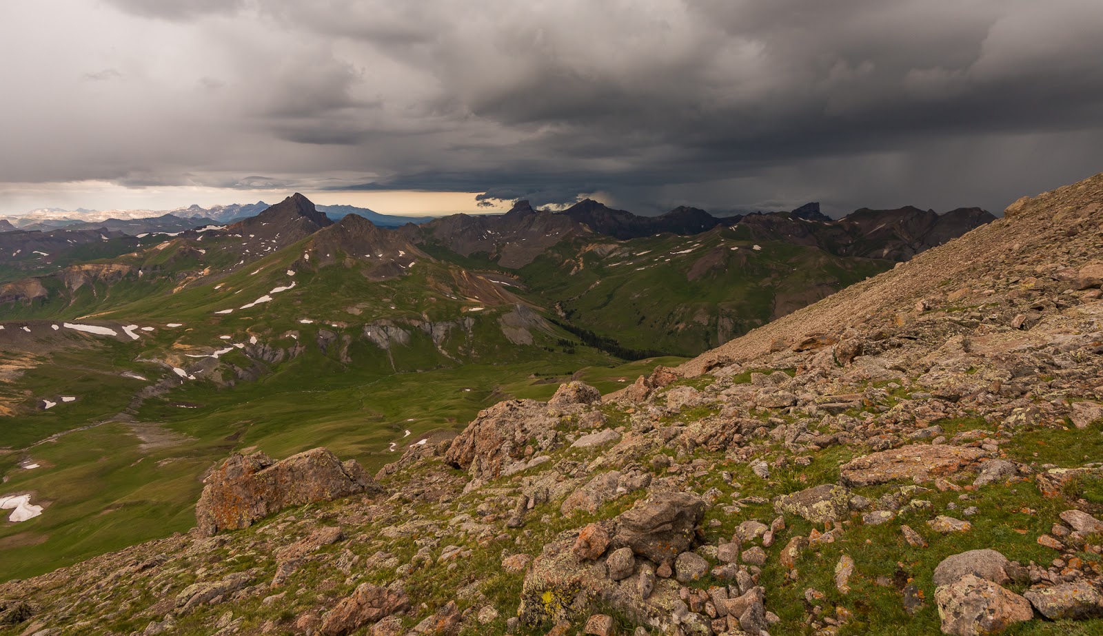
This is the last picture I took before stashing everything that could be damaged by water into a large waterproof dry bag that I bring with me - and then shoving the whole thing down in my backpack . This storm was moving so fast - those low dark clouds on the edge of the front were boiling over the peaks as the storm rolled inexorably toward us and the thunder was growing ever more immediate and menacing...
We were on the high tundra plain - somewhere in the upper 13,000+ foot elevations when the storm finally hit with near horizontal hail (about pencil eraser sized) mixed with rain; the wind was blowing sustained somewhere between 20 - 30 mph and gusting up to somewhere around 40 - 50 mph at its worst. The lightning and the thunder were very close - with many of the flashes of lightning seeming to illuminate the entire sky for an instant before the thunder exploded around us, seeming to come from every direction at once...it seemed like the thunder was coming from everywhere...There were times up high where I had to raise my hand up parallel with my hood on my waterproof jacket to shield my face from the hail...In later discussion we were collectively amazed with how intense this storm was, how long it lasted (approximately 3 hours), and how early in the day it hit. Most high-country storms tend to develop in the later morning or sometime in the afternoon, but this one hit us before 10:00 AM at full-force. Before setting out that morning we'd had a group prayer that I had the honor of offering; among other things, I prayed that we'd be kept safe on our journey to the peak and back so I wasn't worried as I might otherwise be, but we still made every effort to get back to camp as soon as possible. With the distance between the peak and our camp we had close to two hours of hiking in the storm, during which time it continued without abating (with the exception of a brief period of about 10 - 15 minutes). During the brief interlude where the storm calmed while we were still hiking back I saw some wild cloud formations swirling through the high valleys; I didn't dare get my camera out of the dry bag to photograph what I saw, but it was stunning the way the shredded clouds swirled through the valleys, hitting the peaks and crashed over the landscape like great waves of water in slow motion before the rain and hail resumed...
At this point our group was pretty spread out - Mitch in the lead, then me, then Jeff, then Claron...each trying to keep moving the whole time...Much of the time we couldn't see one another except one of us catching a momentary glimpse of another off in the distance ahead or behind. With the storm the temperature had dropped dramatically and so the hail was laying in piles on the ground. My hands were becoming numb, my lower half was totally soaked and my upper half was partially wet from sweat and water that had gotten in during the tempestuousness of the storm...We were hiking as quick as we could to get out of the storm and to keep our body heat up within safe thresholds. As well-prepared as we were for these conditions, the dangers of hypothermia always lurk nearby in storms like this so we did all we could to avoid larger issues as we continued on to camp.
Thankfully, though still intense, the storm was not raging as hard nearer our camp (somewhere between 12,000 and 13,000 feet up but nearer to 12k), but at this point we were tired, cold, and wet...I don't know what the others did on their way back because we were so spread out, but I sang hymns as I walked along and tried to tuck my numbing hands into my jacket sleeves a bit more to shield them from the pervasive cold (which was only partially effective).
When I finally made it back to camp there were literal drifts (wind-blown piles) of hailstones piled up against my side of the tent that were several feet across and maybe 4 - 6 inches tall. I had to shake them off the lower parts of the tent before opening the rainfly in the still-falling rain and shoving all the bedding up against the top end of the tent so it wouldn't get wet from all the water on me. This was, for me, the most intense storm I'd ever backpacked through. Wild!
To make the rest of the story shorter, we were all able to get back to our tents safely and get out of our wet stuff into a change of dry clothes. I don't know what the others do but I bring two sets of clothes on my backpacking trips - one to wear all the time and one to change into if the other gets soaked...I was exceptionally grateful for the extra change of clothes at this time as I pulled it out of my dry bag. We were all very cold when we got back to camp. Poor Claron was so cold and his hands were trembling bad enough that he couldn't even untie his shoes when he arrived at the tent, but we got things taken care of soon...I knew we had all avoided a much more dangerous situation by a pretty narrow margin with the extended exposure we'd all had to the harshness of the storm over the course of our hours-long return to camp...We spent the next hour or two bundled up in dry clothes and our sleeping bags in our tents as the storm continued to drop rain mingled with hail and strong winds on our camp...I believe we all slept for at least a bit after that, then gradually emerged. Now, about an hour or two after the storm, the sun was coming out intermittently between clouds and the wind was still gusty. There were visible hail drifts visible on the high peaks around us, and the piles of hail around our tent took multiple hours to melt off completely...We found creative ways to dry our clothes and we made the decision to break camp and head out sometime in the early afternoon. I was able to check in with some friends via my satellite communicator and found the next day's forecast was about 90% chance of thunderstorms, so we decided to pack out of the area rather than trying to head into a nearby basin as was our original plan.
This was maybe two hours after the storm had hit; much of the hail deposits had melted off in the occasionally sunny skies that developed later, but look how much hail was still on the ground up high on Uncompahgre, even after an hour or two of melting had occurred...Wild!

Remnants of the hail drifts that had piled up against the side of my tent during the height of the storm - these are consolidated hailstones - not snow - and this is what was left after an hour or two of melting had already occurred. When I went to get in my tent while the storm was still pounding I actually had to pull the windward side of the tent up to get the piles of accumulated hail off the tent before I could open the door - the material was being pulled downward and inward by the weight of the hail on the outside...it was quite an experience hiking through a storm like that...
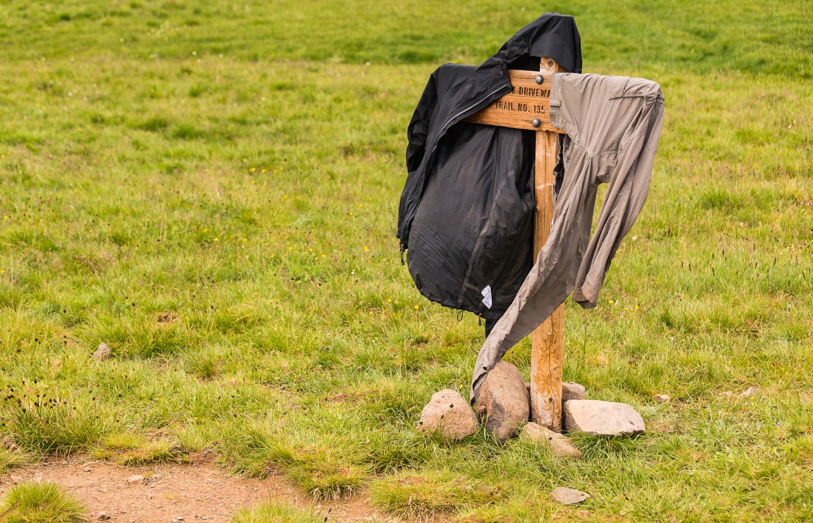
Putting the trail junction sign to good use after the storm with my rain jacket and the pants I was wearing during the storm hanging out to dry. We had gear spread out on the ground (which was occasionally problematic with the gusty winds that lasted for a good while after the storm had stopped precipitating - more than once, we had to chase various articles of gear across the countryside as the wind tried to carry it away). I also set up my large tripod that I use for my serious photography work on these trips and we hung things all over that as much as possible to let the wind help dry things out as much as we could.
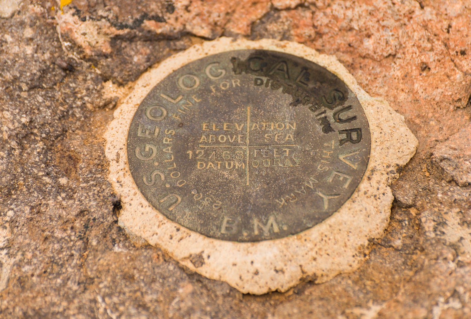
This benchmark was located very near to that trail junction sign adjacent to our camp I had my jacket and pants hanging on; our camp was just slightly above this, which means we were camping multiple days at least 12,463 feet above sea level. At this stage, this is the highest elevation I've camped at, whether for one night or multiple nights.
After some discussion we decided we'd head out to Lake City, a small mountain town in the area, and have dinner there before Jeff would split off to head home (he had to leave early) while Claron, Mitch, and I would head to the Black Canyon of the Gunnison National Park (which we had to pass on the way home anyway) where we'd camp overnight before touring the touristy overlooks along the canyon rim - then we'd grab dinner in Montrose and drive home.
Breaking camp went without incident and we were able to get things mostly dry except shoes and socks which were still quite wet at this stage...The hike out was quick and smooth, and the drive to Lake City normal and not too long. Just before we got into the little cafe where we had dinner, while Mitch was moving his pack he somehow unintentionally discharged his can of bear spray (the safety had, unbeknownst to us, been disengaged at some point while moving gear around) - spraying himself in the face and one of his eyes particularly and the rest of us got some "secondhand" effects - mostly coughing - from the spray in the air. Mitch spent a while rinsing his eye out and it was puffy and sore for some time thereafter. After the "excitement of the bear spray" we had a nice meal at a little cafe in town before parting ways with Jeff and the rest of us continuing our way to the Black Canyon.
We arrived at the canyon late at night and were blessed to find an open spot on Loop C which allows walk-in, first-come/first-served camping (the Loop A and B areas offer advanced reservations and were full). We camped next to a nice older couple who were sleeping in the bed of their truck and let us use some additional space in their campsite since the individual sites are fairly small.
Our visit to the various overlooks along the rim of the Black Canyon was a simple and enjoyable thing. We visited all the overlooks (except the one by the Visitor's Center) from the first one to the Painted Wall; Mitch, in particular, enjoyed the views at the Painted Wall.
After we'd seen the sights and taken some pictures there we split off and headed into Montrose for another round of delicious Pahgre's before beginning the journey home. The drive home was scenic, through the beautiful desert country of southern Colorado and southern Utah before transitioning into more familiar sights near Utah Valley; soon thereafter we were home.
Blue shades in the Black Canyon.
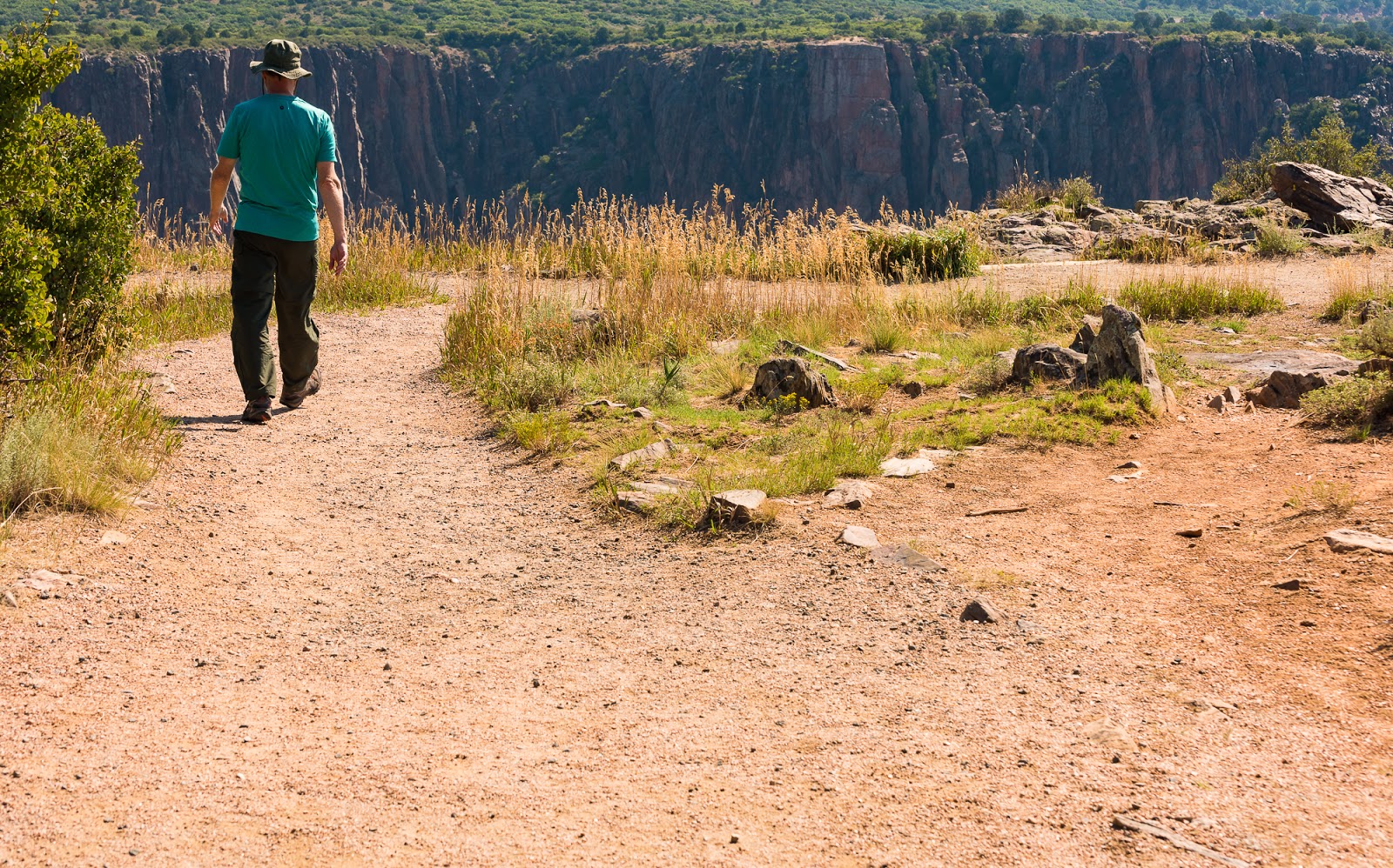
Mitch walks toward one of the scenic views along the canyon rim.
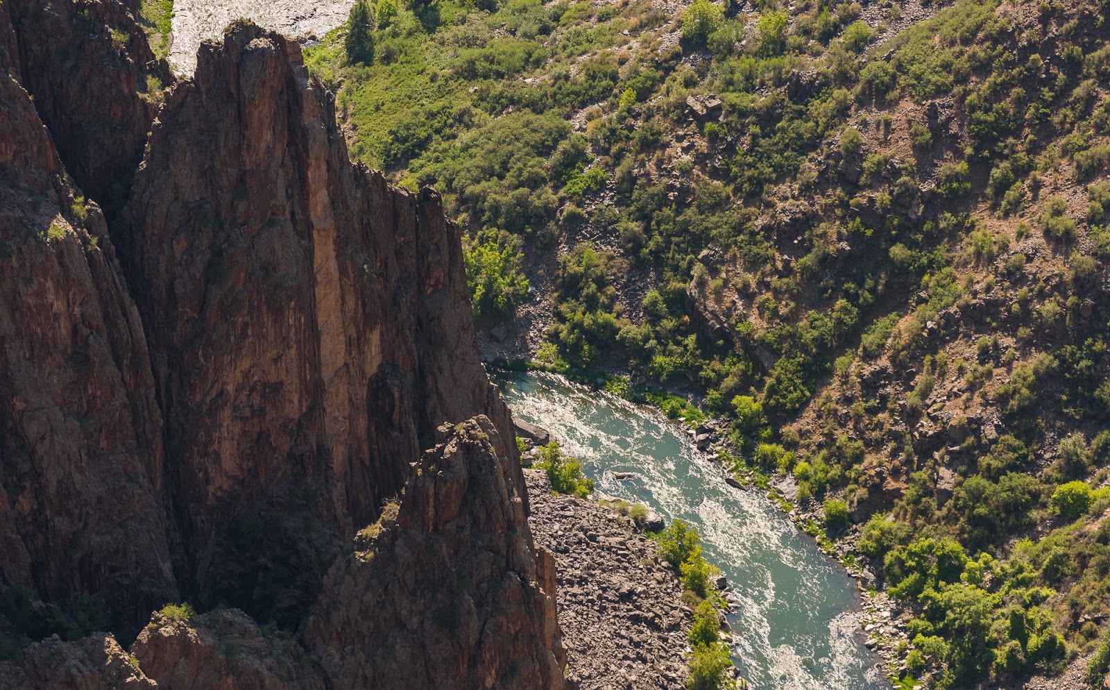
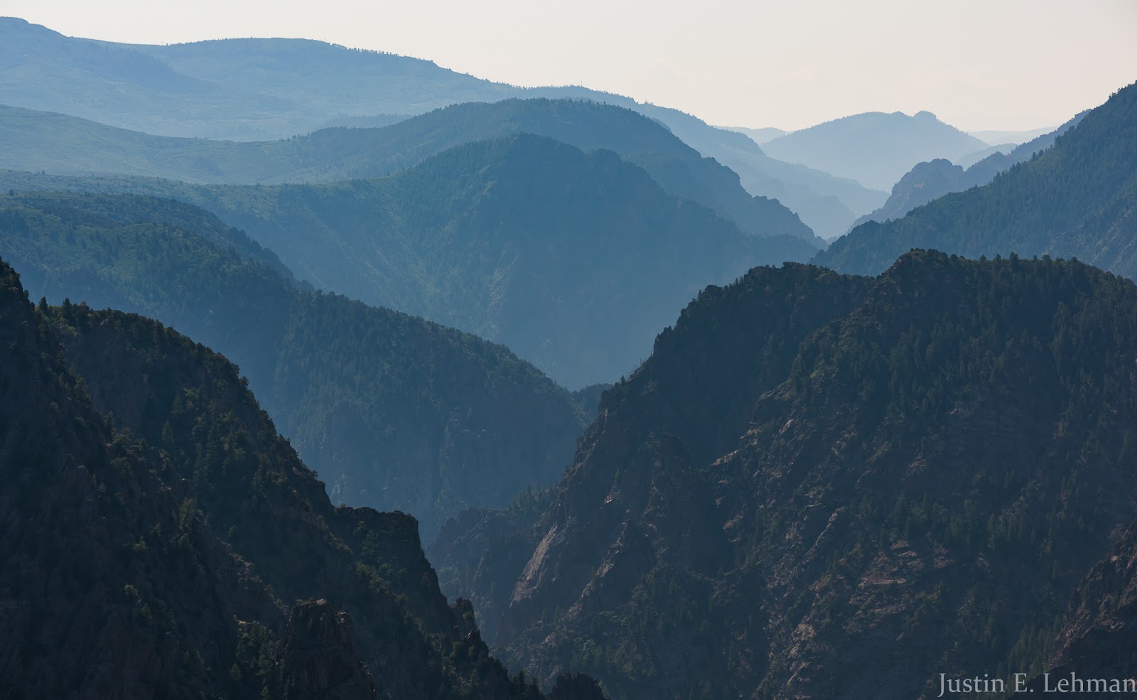
Black Canyon views.
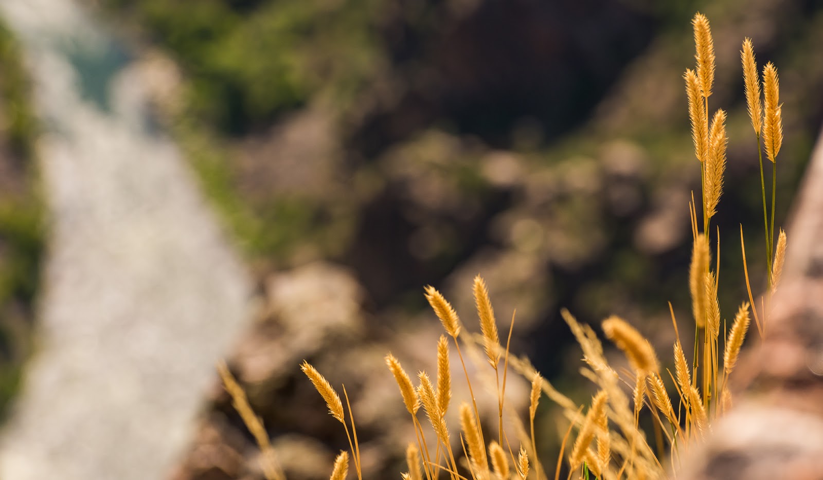
Black Canyon views.
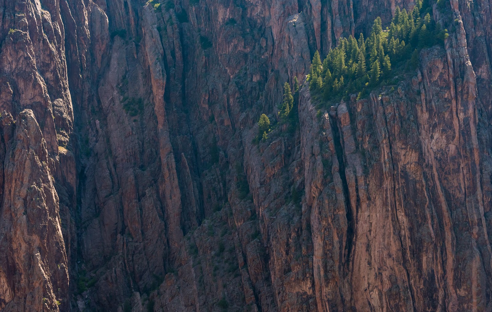
Black Canyon views.

Black Canyon views.
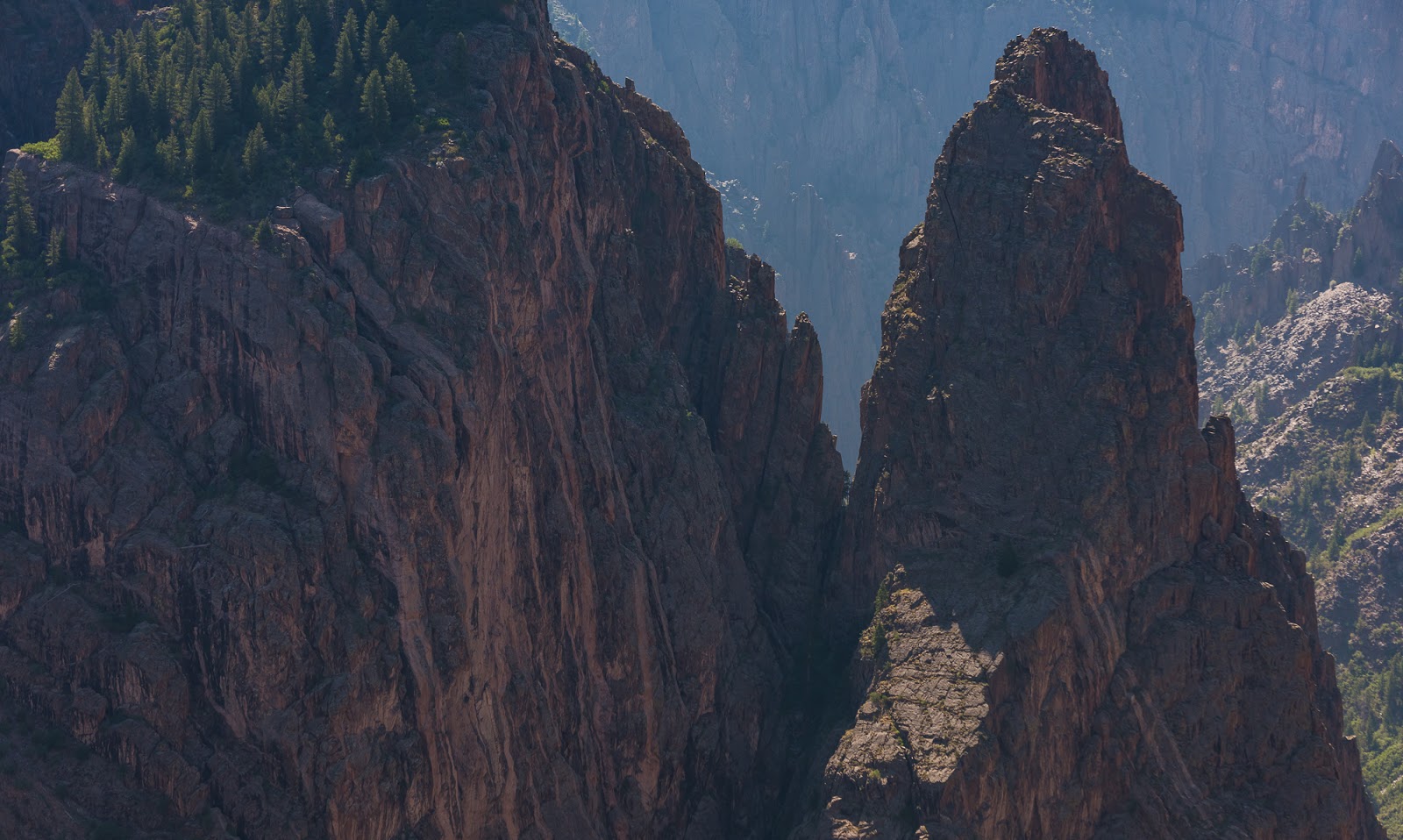
Black Canyon views.

Black Canyon views.

Black Canyon views.

Accident waiting to happen? (The ground he's on is down-sloping and there's a "that-would-kill-you" kind of a drop off immediately over the edge of those slabs he's on. Happily, he didn't fall, but his positioning was, admittedly, precarious.
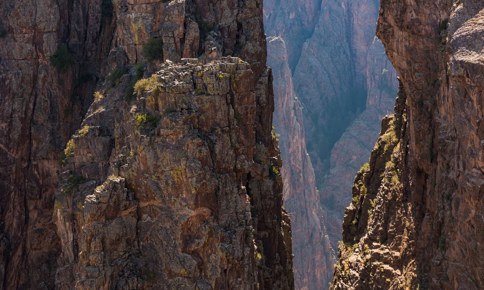
Black Canyon views.
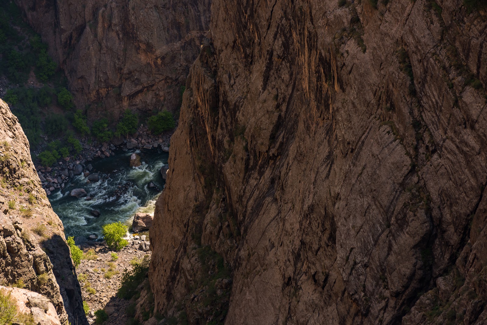
Black Canyon views.
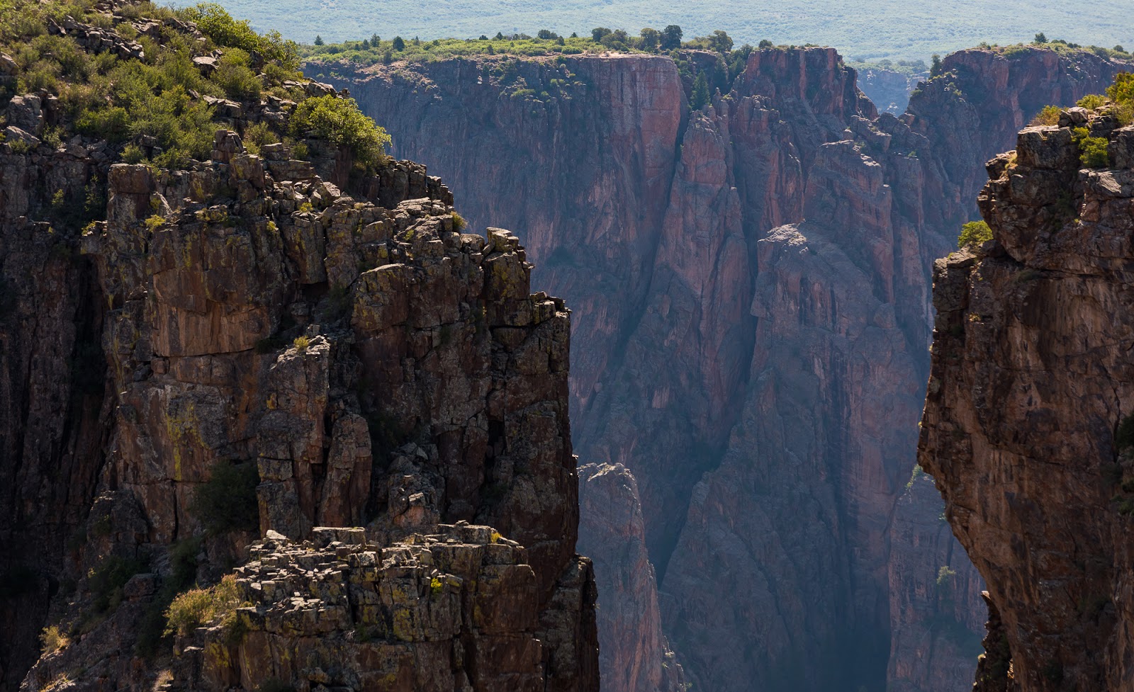
Black Canyon views.

Black Canyon views.
Black Canyon views.

I enjoyed the descriptive language on this informational panel. Fitting.
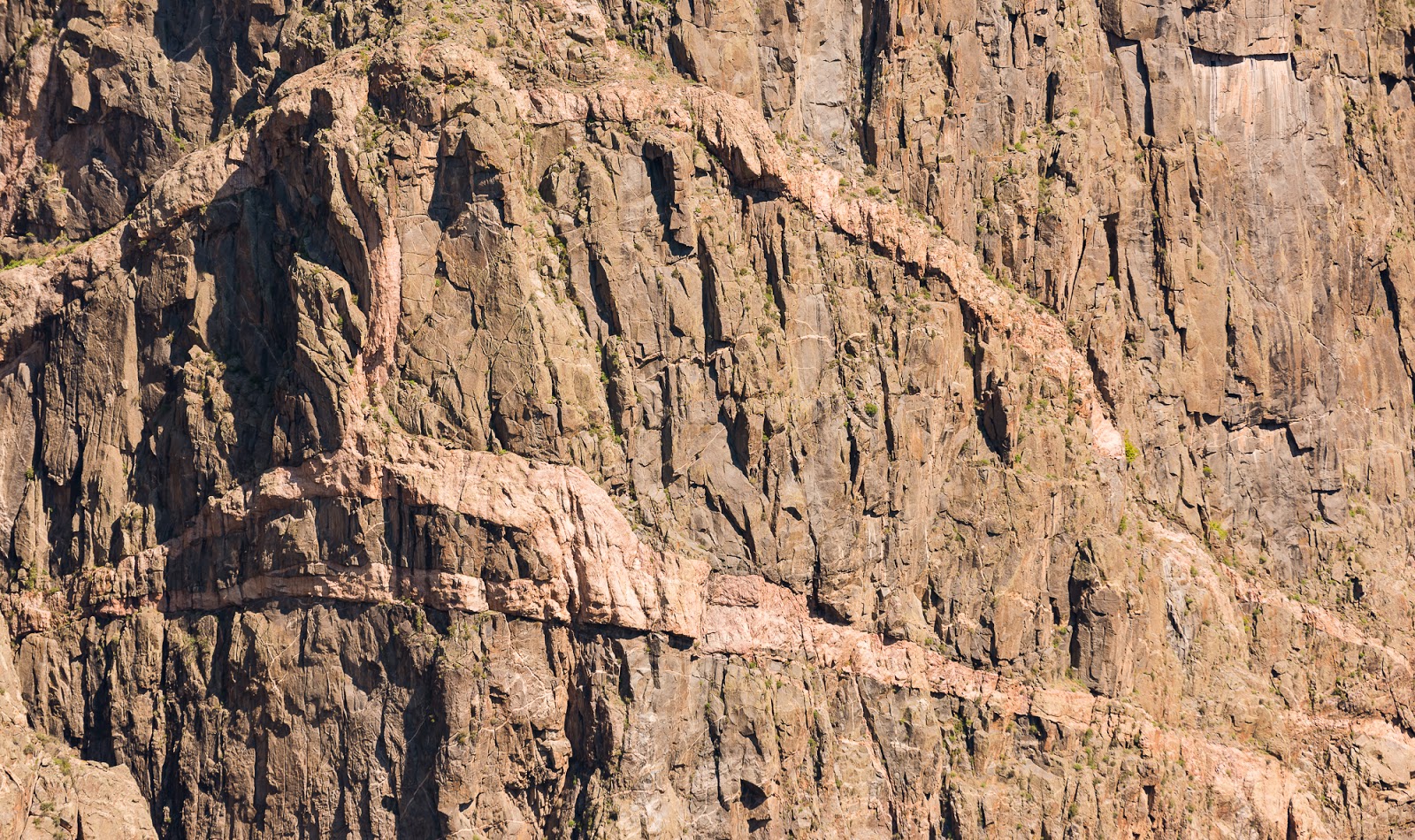
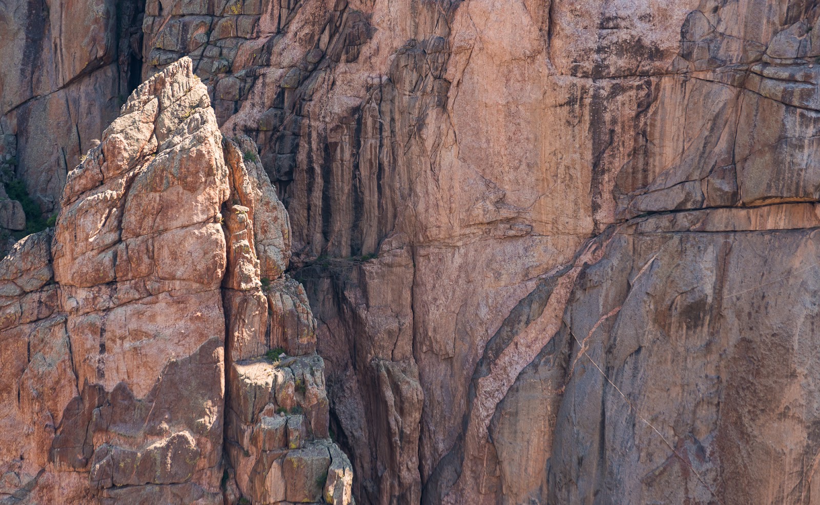
This detail shot is to show how the lighter stripes of rock in the canyon walls aren't just surface level coloration - they're actually complex intrusion layers of different rock that was forced into and through the main canyon walls. In this shot you can see how the lighter-colored stripes of rock are casting small shadows onto the larger cliff face because they are three-dimensional, not just surface level color striations like what you'll commonly come across in various canyon areas, etc.

Black Canyon views.
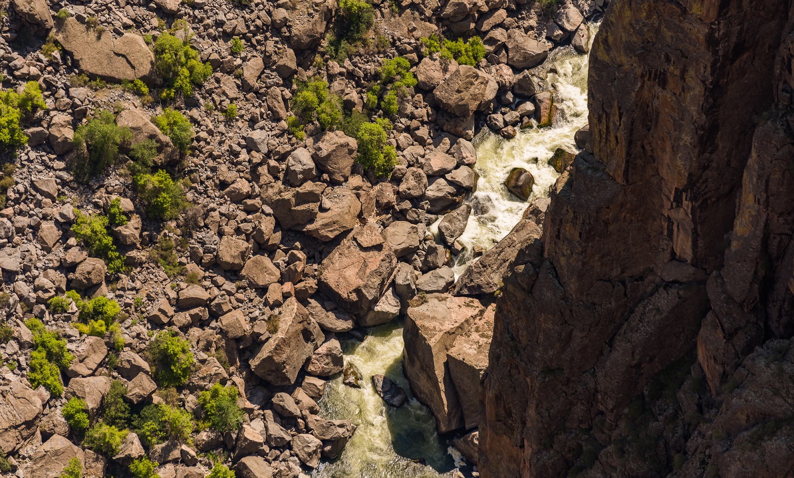
Black Canyon views.
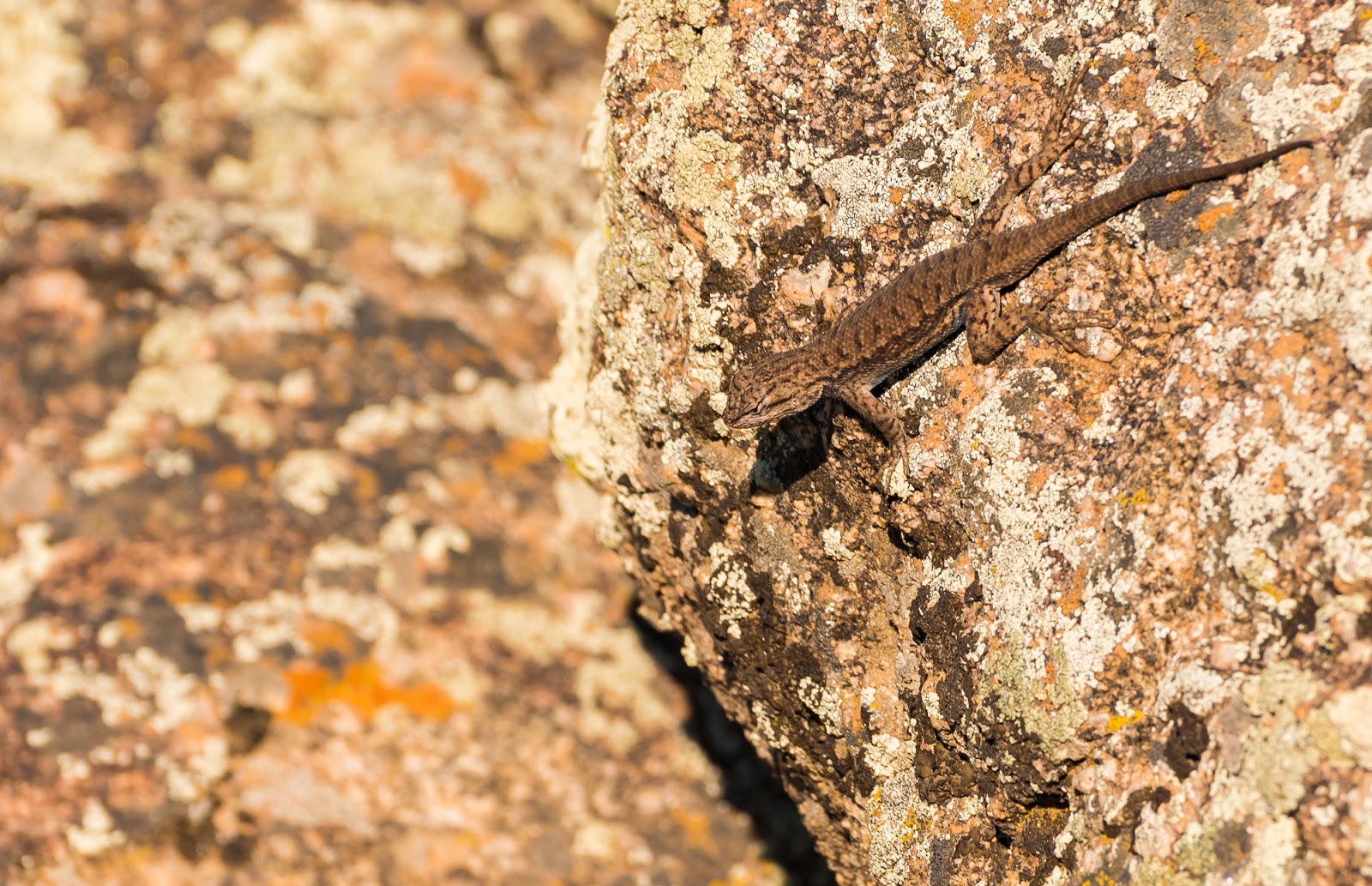
Spotted a little lizard out there at one of the overlooks; reminded me a bit of the anoles we get back home in Florida.

Black Canyon views.

Painted Wall Detail.
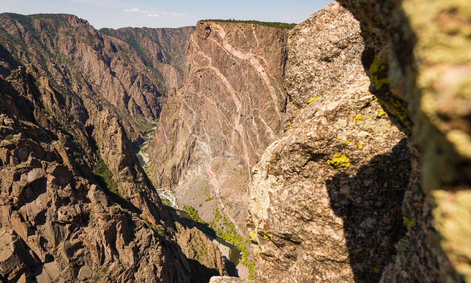
The Painted Wall, the highest cliff in Colorado.
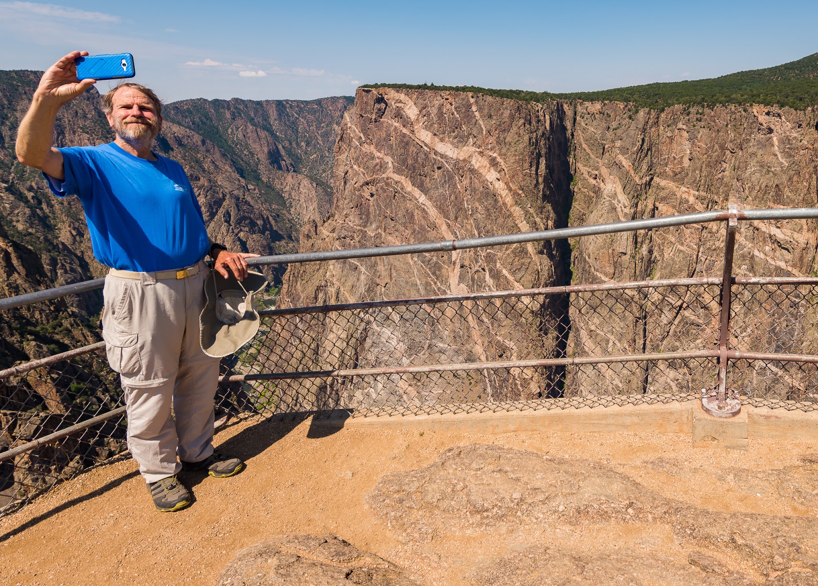
Claron, making sure the spot is graced with a selfie.
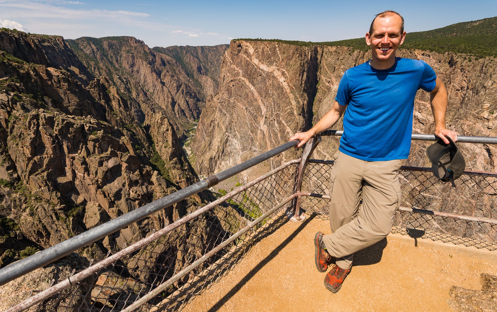
One of the guys (don't recall which) was kind enough to snap this photo of me at the Painted Wall overlook.
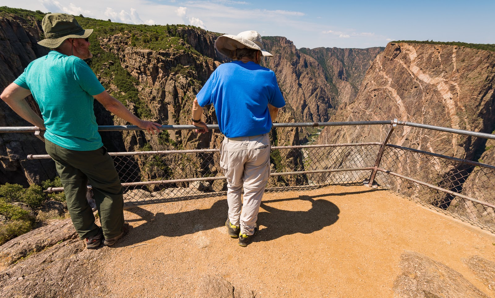
Mitch and Claron enjoying the view; this was Mitch's favorite stop of our brief tour along the rim of the Black Canyon of the Gunnison.
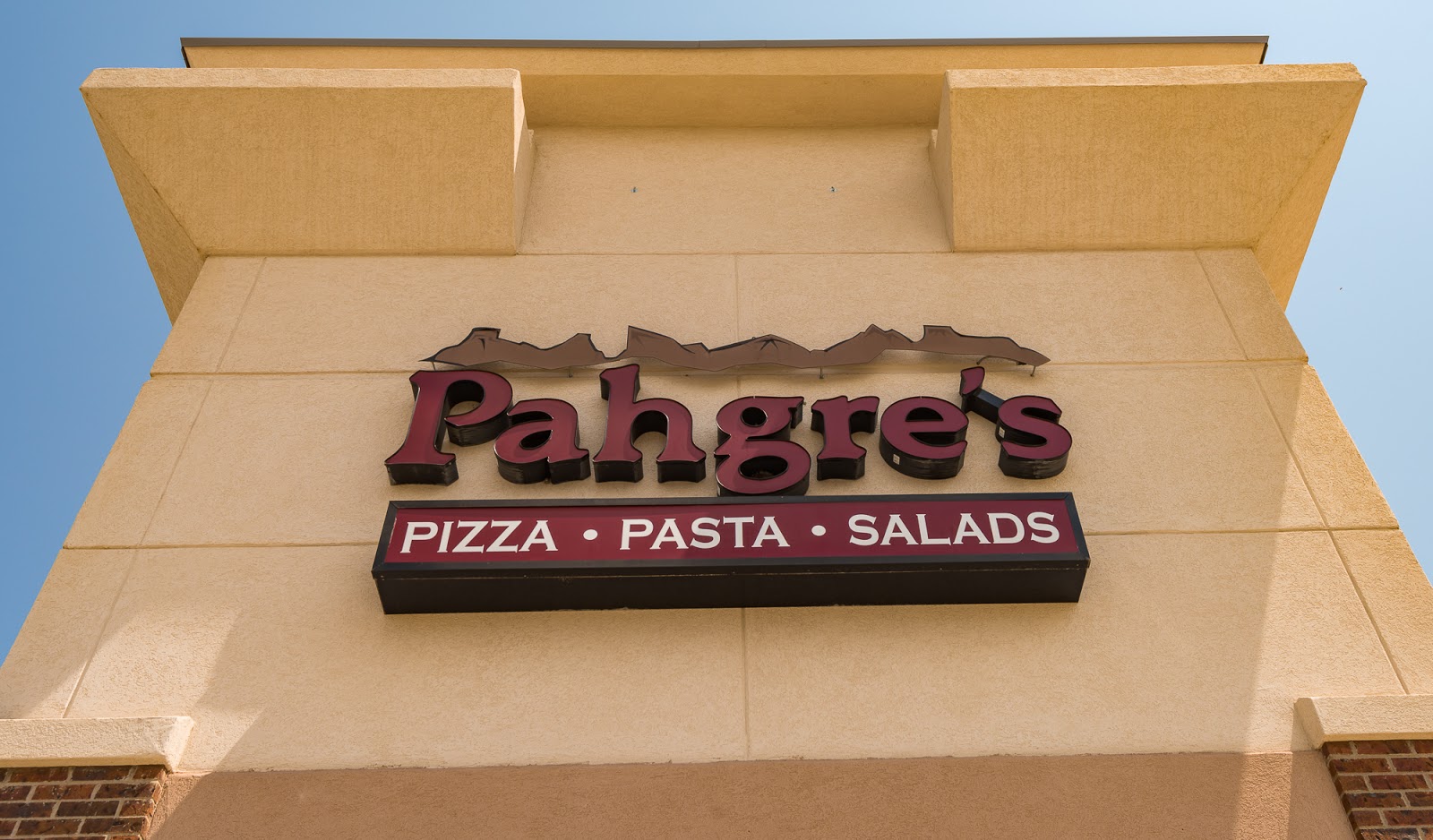
I needed to include the storefront of my favorite pizza place. I discovered this place back in 2015 seemingly by chance while spending a little time in Montrose during transitions from one area to another on my first Colorado backpacking trip, and was intrigued by their use of part of the name "Uncompahgre" - the tallest peak in the San Juan Range. Turns out the food here is fantastic. I've stopped by there every single trip I can find an excuse to pass through Montrose without going too far out of my way to do so. If you're ever down that way I heartily recommend it; also, for what it's worth, all the folks I went to Pahgre's with spoke glowingly about their experience there as well. Good food - and it tastes even better after climbing mountains!
Last edited: