IntrepidXJ
ADVENTR
- Joined
- Jan 17, 2012
- Messages
- 3,480
Easter | Sunday, April 20, 2014
My original plan for Easter Sunday was to hike and explore Sieber Canyon. Unfortunately, this road closed sign across Bs Road changed those plans when I tried to reach the trailhead first thing in the morning.
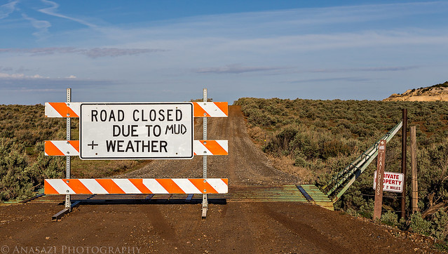
Change of Plans by IntrepidXJ, on Flickr
With no backup plan I decided to drive over to the upper Liberty Cap trailhead, since it was not too far away, to finally hike to Otto's Bathtub on Monument Mesa. When I arrived at the parking lot there was only one other vehicle parked there. I wouldn't see anyone else on the trail all day until I was almost back to my Jeep, which is when I passed many groups of hikers heading towards Liberty Cap. When I returned to the parking lot it was completely full. I was glad I got my usual early start and had plenty of solitude on the hike. The upper Liberty Cap trail follows an old closed road and is not my favorite place to hike, but the scenery around Otto's Bathtub made up for the first part of the hike. This is an area I am definitely going to have to return to in better light. While this area is referred to as Otto's Bathtub, in my opinion the scenery and arches around here are a much better reason to visit than seeing just that one feature.
Ready to start my hike across the old road on Monument Mesa.
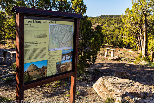
Upper Liberty Cap Trailhead by IntrepidXJ, on Flickr
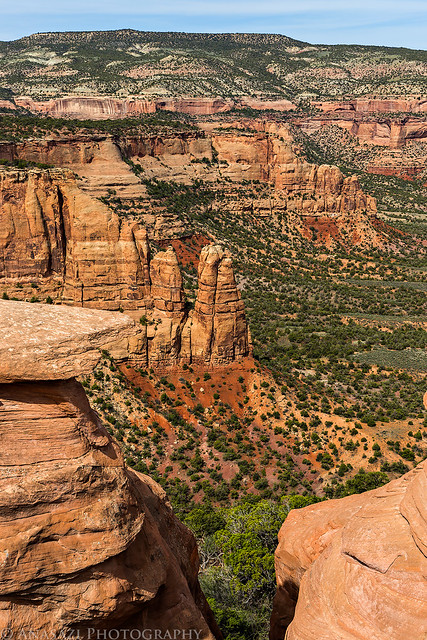
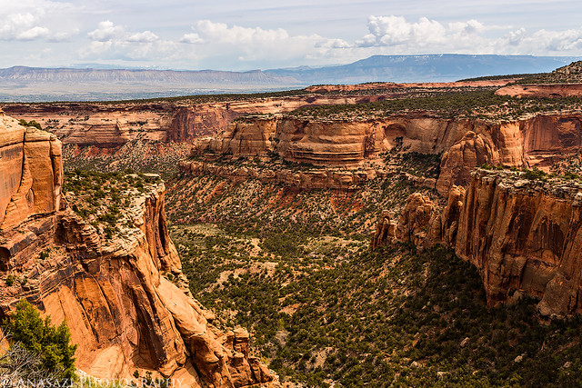
Shortly after leaving the main Liberty Cap trail I was treated to much better views over the upper reaches of Monument Canyon.
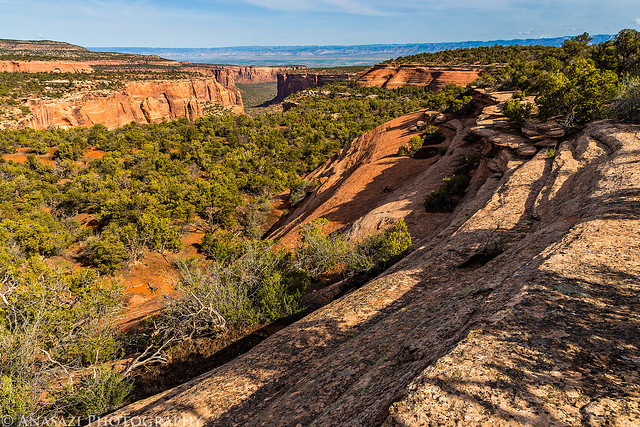
First View by IntrepidXJ, on Flickr
The trail followed the edge of the mesa top most of the way.
Follow the Edge by IntrepidXJ, on Flickr
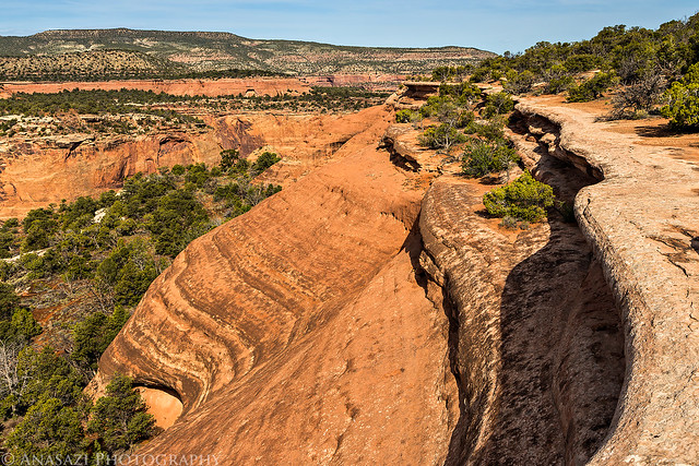
Edge by IntrepidXJ, on Flickr
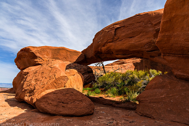
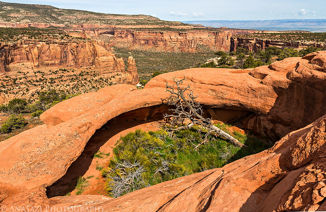
A cool little arch near Otto's Bathtub. Looking through the arch towards Monument Canyon and Saddlehorn.
Monument Mesa Arch by IntrepidXJ, on Flickr
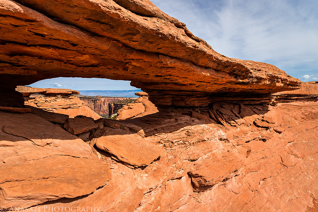
An even bigger arch found just a little bit further along the peninsula of sandstone.
Otto's Arch by IntrepidXJ, on Flickr
View from the inside.
Inside by IntrepidXJ, on Flickr
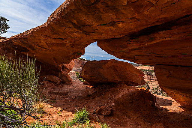
Looking down on the pocket oasis that contains the previous arch.
Oasis by IntrepidXJ, on Flickr
Hiking across the narrow sandstone bridge on top of the mesa.
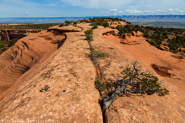
Bridge by IntrepidXJ, on Flickr
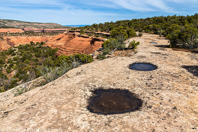
Thanks to all the rain we had the previous day, the potholes were full of water.
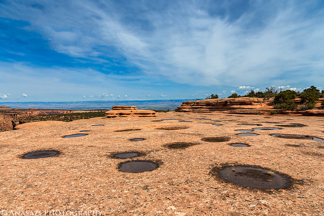
Potholes by IntrepidXJ, on Flickr
This is the very top of Otto's Bathtub, though you can't really see the bathtub portion as it's just out of view around the front opening. I've heard that John Otto used this particular pothole to catch rainwater and then bathe in it. Whether or not that is true I have no idea, but that's where the name comes from...
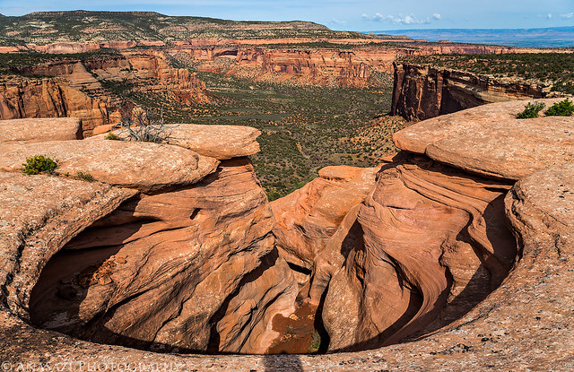
Bowl View by IntrepidXJ, on Flickr
Great view over Monument Canyon towards Black Ridge from the bathtub.
Canyon Below by IntrepidXJ, on Flickr
Sandstone playground on top of the mesa.
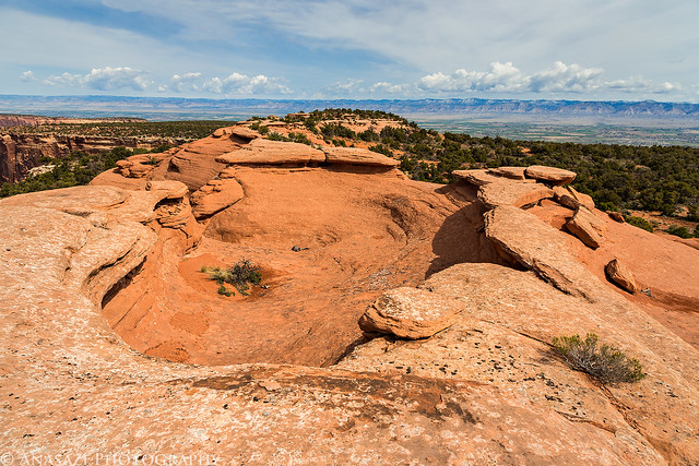
Sandstone Top by IntrepidXJ, on Flickr
The view along the edge as I hiked back towards the Liberty Cap trail.
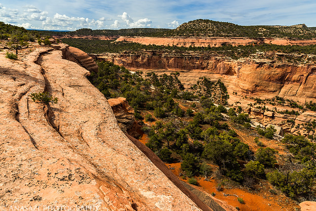
Up Canyon by IntrepidXJ, on Flickr
Shortly before reaching the trailhead I came across this one Mountain Ball Cactus in bloom. The first cactus in bloom I have seen this year.
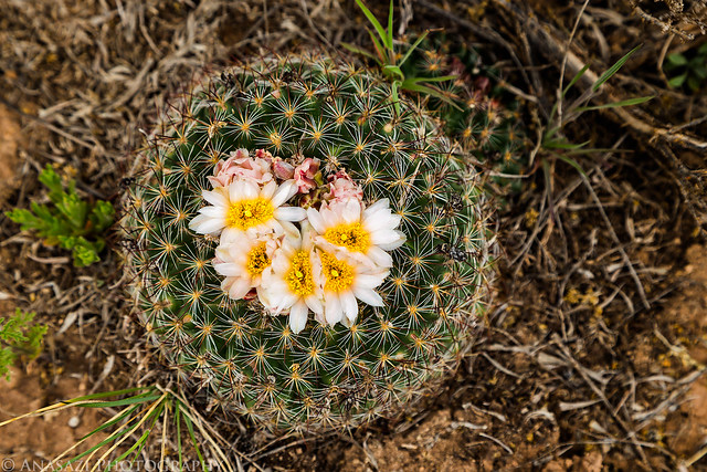
Mountain Ball Cactus by IntrepidXJ, on Flickr
After completing the 9 mile round-trip hike, I wanted to get in another short hike before heading home. I drove over to the upper Monument Canyon trailhead so I could hike up the short CCC Trail since it is one of the few official trails in the park I had yet to check out.
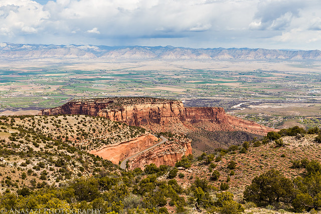
On the way to the trailhead I stopped along Rim Rock Drive for a different view over Monument Canyon towards Otto's Bathtub area.
Upper Monument Canyon by IntrepidXJ, on Flickr
That strip of sandstone on top of the mesa is where I had just hiked to Otto's Bathtub. The Grand Mesa is in the haze in the background.
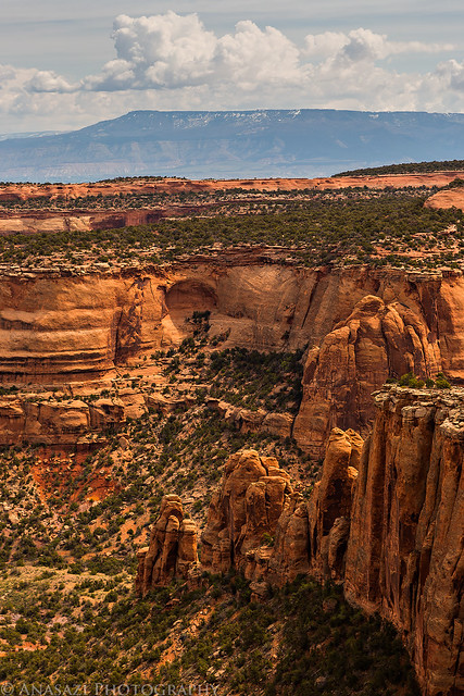
Monument Mesa View by IntrepidXJ, on Flickr
Staring the hike up the CCC Trail which was created by the Civilian Conservation Corp.
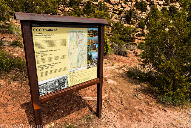
CCC Trailhead by IntrepidXJ, on Flickr
Climbing the trail to the top of the mesa.
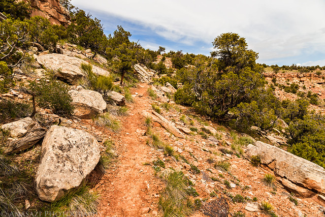
CCC Trail by IntrepidXJ, on Flickr
As I neared the top of the trail I came across a lot of these flowers. I wasn't sure what they were when I found them, but after doing some research at home, I believe they are Westwater Tumblemustard. If this is wrong, please let me know in the comments below.
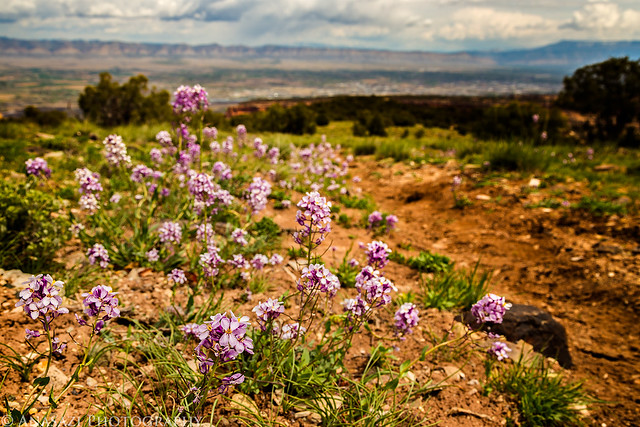
Along the Trail by IntrepidXJ, on Flickr
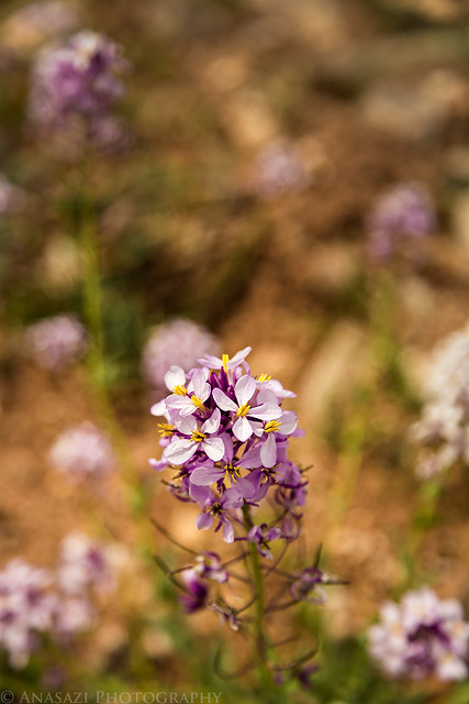
Westwater Tumblemustard by IntrepidXJ, on Flickr
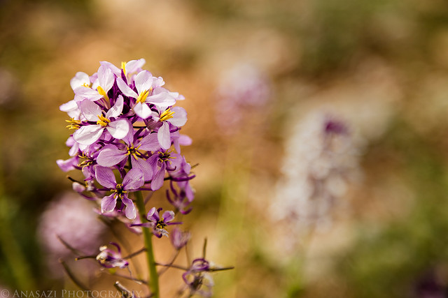
Westwater Tumblemustard II by IntrepidXJ, on Flickr
There were plenty of other flowers along the trail, too.
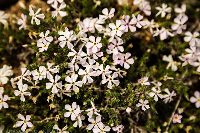
CCC Flowers by IntrepidXJ, on Flickr
Great clouds above.
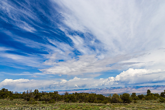
Black Ridge Clouds by IntrepidXJ, on Flickr
I turned around and hiked back down when I reached the junction with the Black Ridge trail. I hiked this one a few years ago, but I think I need to return and hike it again.
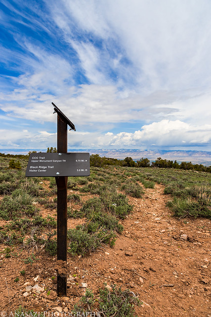
Black Ridge Junction by IntrepidXJ, on Flickr
A different view of The Island below as I hiked back down to my Jeep.
The Island Below by IntrepidXJ, on Flickr
>> Otto's Bathtub Photo Gallery
>> The Original Trip Report on ADVENTR.CO
Featured image for home page:

My original plan for Easter Sunday was to hike and explore Sieber Canyon. Unfortunately, this road closed sign across Bs Road changed those plans when I tried to reach the trailhead first thing in the morning.
Change of Plans by IntrepidXJ, on Flickr
With no backup plan I decided to drive over to the upper Liberty Cap trailhead, since it was not too far away, to finally hike to Otto's Bathtub on Monument Mesa. When I arrived at the parking lot there was only one other vehicle parked there. I wouldn't see anyone else on the trail all day until I was almost back to my Jeep, which is when I passed many groups of hikers heading towards Liberty Cap. When I returned to the parking lot it was completely full. I was glad I got my usual early start and had plenty of solitude on the hike. The upper Liberty Cap trail follows an old closed road and is not my favorite place to hike, but the scenery around Otto's Bathtub made up for the first part of the hike. This is an area I am definitely going to have to return to in better light. While this area is referred to as Otto's Bathtub, in my opinion the scenery and arches around here are a much better reason to visit than seeing just that one feature.
Ready to start my hike across the old road on Monument Mesa.
Upper Liberty Cap Trailhead by IntrepidXJ, on Flickr
Shortly after leaving the main Liberty Cap trail I was treated to much better views over the upper reaches of Monument Canyon.
First View by IntrepidXJ, on Flickr
The trail followed the edge of the mesa top most of the way.
Follow the Edge by IntrepidXJ, on Flickr
Edge by IntrepidXJ, on Flickr
A cool little arch near Otto's Bathtub. Looking through the arch towards Monument Canyon and Saddlehorn.
Monument Mesa Arch by IntrepidXJ, on Flickr
An even bigger arch found just a little bit further along the peninsula of sandstone.
Otto's Arch by IntrepidXJ, on Flickr
View from the inside.
Inside by IntrepidXJ, on Flickr
Looking down on the pocket oasis that contains the previous arch.
Oasis by IntrepidXJ, on Flickr
Hiking across the narrow sandstone bridge on top of the mesa.
Bridge by IntrepidXJ, on Flickr
Thanks to all the rain we had the previous day, the potholes were full of water.
Potholes by IntrepidXJ, on Flickr
This is the very top of Otto's Bathtub, though you can't really see the bathtub portion as it's just out of view around the front opening. I've heard that John Otto used this particular pothole to catch rainwater and then bathe in it. Whether or not that is true I have no idea, but that's where the name comes from...
Bowl View by IntrepidXJ, on Flickr
Great view over Monument Canyon towards Black Ridge from the bathtub.
Canyon Below by IntrepidXJ, on Flickr
Sandstone playground on top of the mesa.
Sandstone Top by IntrepidXJ, on Flickr
The view along the edge as I hiked back towards the Liberty Cap trail.
Up Canyon by IntrepidXJ, on Flickr
Shortly before reaching the trailhead I came across this one Mountain Ball Cactus in bloom. The first cactus in bloom I have seen this year.
Mountain Ball Cactus by IntrepidXJ, on Flickr
After completing the 9 mile round-trip hike, I wanted to get in another short hike before heading home. I drove over to the upper Monument Canyon trailhead so I could hike up the short CCC Trail since it is one of the few official trails in the park I had yet to check out.
On the way to the trailhead I stopped along Rim Rock Drive for a different view over Monument Canyon towards Otto's Bathtub area.
Upper Monument Canyon by IntrepidXJ, on Flickr
That strip of sandstone on top of the mesa is where I had just hiked to Otto's Bathtub. The Grand Mesa is in the haze in the background.
Monument Mesa View by IntrepidXJ, on Flickr
Staring the hike up the CCC Trail which was created by the Civilian Conservation Corp.
CCC Trailhead by IntrepidXJ, on Flickr
Climbing the trail to the top of the mesa.
CCC Trail by IntrepidXJ, on Flickr
As I neared the top of the trail I came across a lot of these flowers. I wasn't sure what they were when I found them, but after doing some research at home, I believe they are Westwater Tumblemustard. If this is wrong, please let me know in the comments below.
Along the Trail by IntrepidXJ, on Flickr
Westwater Tumblemustard by IntrepidXJ, on Flickr
Westwater Tumblemustard II by IntrepidXJ, on Flickr
There were plenty of other flowers along the trail, too.
CCC Flowers by IntrepidXJ, on Flickr
Great clouds above.
Black Ridge Clouds by IntrepidXJ, on Flickr
I turned around and hiked back down when I reached the junction with the Black Ridge trail. I hiked this one a few years ago, but I think I need to return and hike it again.
Black Ridge Junction by IntrepidXJ, on Flickr
A different view of The Island below as I hiked back down to my Jeep.
The Island Below by IntrepidXJ, on Flickr
>> Otto's Bathtub Photo Gallery
>> The Original Trip Report on ADVENTR.CO
Featured image for home page:
")