Old Yellowstone Trails

wsp_scott

Member
.
Joined
May 16, 2016
Messages
1,644
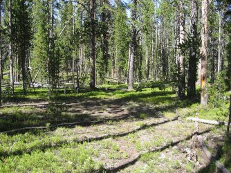
This summer I was in the Wapiti Lake area and did not see a "Buffalo Highway" but I am very curious. I'd love to find the first "trail", but I have seen a bit of the western side of the Hayden Valley, the 2nd two are also interesting. So has any here seen these "trails"

Tagging the most likely people to have been way off trail in the park and seen one of these. Feel free to direct message if you don't want to publicise
@scatman, @Outdoor_Fool @TheMountainRabbit


A couple quotes from the above page

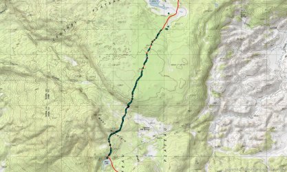
WAPITI LAKE TO AMETHYST MOUNTAIN
("THE BUFFALO HIGHWAY")

Where the last trail is probably a buffalo trail; this one is a certainty. It links the Wapiti Lake Trail to the Specimen Ridge Trail. This 10+ mile thoroughfare is probably the best example of a large scale, seasonal bison migration route still left in North America. Literally an 8-lane "buffalo highway"; it is impossible to miss with its multi-lane paths. It is the animals' major route of travel between the Pelican and Lamar Valleys.

BEACH LAKE TO MARY LAKE
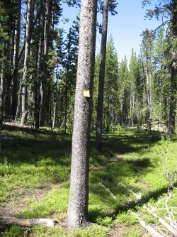
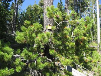
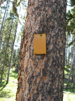
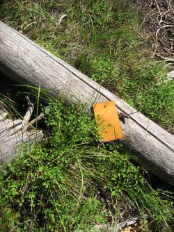
Although most maps show an old trail from the West Thumb-Fishing Bridge road, up Arnica Creek, to Beach Lake; and from Mary Lake north to the Canyon-Norris road; there is a connecting trail from Beach Lake to Mary Lake thus completing a north-south route across the Central Plateau. It is not easily followed and it does not quite link the two spots. It is marked with very old trail markers.
I haven't confirmed it, but I have been told of another man-made trail that links Beach Lake to Dryad Lake, also complete with trail markers.

DRYAD LAKE TO THE HAYDEN VALLEY
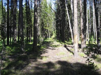
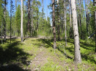
I stumbled onto this amazing trail in 1993. Its origins are completely unknown to me. It begins on the north side of Dryad Lake and heads almost due north until reaching the finger meadow of Trout Creek. Here I left the trail. It continued north towards the southwest corner of the Hayden Valley. Therefore it seems that I only hiked a portion of what must be a much longer trail. It is my contention that the entire 5 mile stretch that I walked was created by bison during their seasonal migrations. I should say that this is one of the best trails I have seen in Yellowstone. Man-made or not. It is never steep, follows the ridges perfectly, and is always easy to see with little deadfall. Apparently the bison construct a better trail than most people. I searched meticulously for any sign of man on this trail and found none. If anyone else has hiked in this section of the park, I would very much like to know.
 
BEACH LAKE TO MARY LAKE
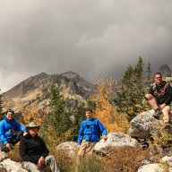
When at Mary Lake Hugh took me over to this trail - called it the Plateau Trail. We could clearly see the lane/trail markers as it led away from Mary Lake. I think he said the trail markers were one way/only in a North to South direction. Hugh has pictures, I'll make note of it when I finally get around to finishing the Mary Mountain Video.

This would be a fun one to follow!
 
When at Mary Lake Hugh took me over to this trail - called it the Plateau Trail. We could clearly see the lane/trail markers as it led away from Mary Lake. I think he said the trail markers were one way/only in a North to South direction. Hugh has pictures, I'll make note of it when I finally get around to finishing the Mary Mountain Video.

This would be a fun one to follow!

That would be a fun one to follow but not really possible in a reasonable dayhike, probably need to figure out how to do an undesignated backcountry permit. "Yes Mr Ranger, I pinky swear not to set up camp in the Hayden Valley" :)

thanks for the info
 
"We had every intention of being back to the car by sunset. . . but then it got dark so we had to stop for the night. :)

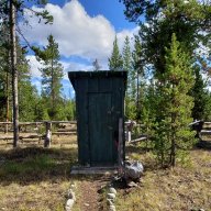
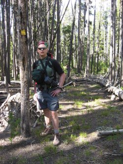
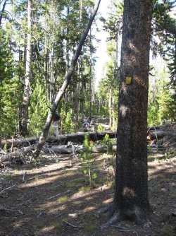
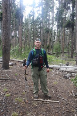
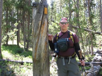
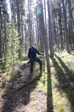
Here is a picture at the start of the Plateau Trail. I thought for sure he'd have all kinds of details for you in this post. . . this is right up his alley. Yesterday was beer night for him though. . . so he might still be dealing with the old Scatman hangover.

0O7A0909.JPG
 
This summer I was in the Wapiti Lake area and did not see a "Buffalo Highway" but I am very curious. I'd love to find the first "trail", but I have seen a bit of the western side of the Hayden Valley, the 2nd two are also interesting. So has any here seen these "trails"

WAPITI LAKE TO AMETHYST MOUNTAIN
("THE BUFFALO HIGHWAY")
Where the last trail is probably a buffalo trail; this one is a certainty. It links the Wapiti Lake Trail to the Specimen Ridge Trail. This 10+ mile thoroughfare is probably the best example of a large scale, seasonal bison migration route still left in North America. Literally an 8-lane "buffalo highway"; it is impossible to miss with its multi-lane paths. It is the animals' major route of travel between the Pelican and Lamar Valleys.
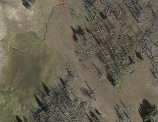
I'm surprised you guys didn't come across this one on the Mirror Plateau - especially on the low "passes" between each basin. There are long stretches that look like ATVs have been driving back and forth three abreast.
1791159596083.png
BEACH LAKE TO MARY LAKE
Although most maps show an old trail from the West Thumb-Fishing Bridge road, up Arnica Creek, to Beach Lake; and from Mary Lake north to the Canyon-Norris road; there is a connecting trail from Beach Lake to Mary Lake thus completing a north-south route across the Central Plateau. It is not easily followed and it does not quite link the two spots. It is marked with very old trail markers.
I haven't confirmed it, but I have been told of another man-made trail that links Beach Lake to Dryad Lake, also complete with trail markers.
Based on what I've seen of the forests north/northwest of Beach Lake, I have to imagine this one would be a nightmare to maintain - no wonder it's lost to time. I'd be curious to see it though. @TractorDoc - do you know if this is the south side of the old trail that goes up to Cygnet Lakes from Mary Lake? Or further west?
DRYAD LAKE TO THE HAYDEN VALLEY
I stumbled onto this amazing trail in 1993. Its origins are completely unknown to me. It begins on the north side of Dryad Lake and heads almost due north until reaching the finger meadow of Trout Creek. Here I left the trail. It continued north towards the southwest corner of the Hayden Valley. Therefore it seems that I only hiked a portion of what must be a much longer trail. It is my contention that the entire 5 mile stretch that I walked was created by bison during their seasonal migrations. I should say that this is one of the best trails I have seen in Yellowstone. Man-made or not. It is never steep, follows the ridges perfectly, and is always easy to see with little deadfall. Apparently the bison construct a better trail than most people. I searched meticulously for any sign of man on this trail and found none. If anyone else has hiked in this section of the park, I would very much like to know.
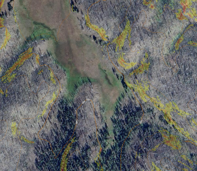
This one is on my list for early next summer - I have a loop drawn up from Bridge Bay. You can see where it enters/exits the Trout Creek drainage (about 1.5 miles from where Trout Creek enters Hayden on the smaller east fork of Trout Creek) on satellite photos.
1791161429977.png
 
I'm surprised you guys didn't come across this one on the Mirror Plateau
We were definitely on some bison highways on the plateau. It is the description from Wapiti Lake that puzzles me. Thanks for zooming in on the satellite, I spent some time on Google Earth, but if you don't zoom in the right place you miss those tracks.
 
"We had every intention of being back to the car by sunset. . . but then it got dark so we had to stop for the night. :)

Here is a picture at the start of the Plateau Trail. I thought for sure he'd have all kinds of details for you in this post. . . this is right up his alley. Yesterday was beer night for him though. . . so he might still be dealing with the old Scatman hangover.

View attachment 153229

I like the way you think, we just happened to have tents and sleeping bags and food for three nights just to be safe, never expected to use any of it :)
 
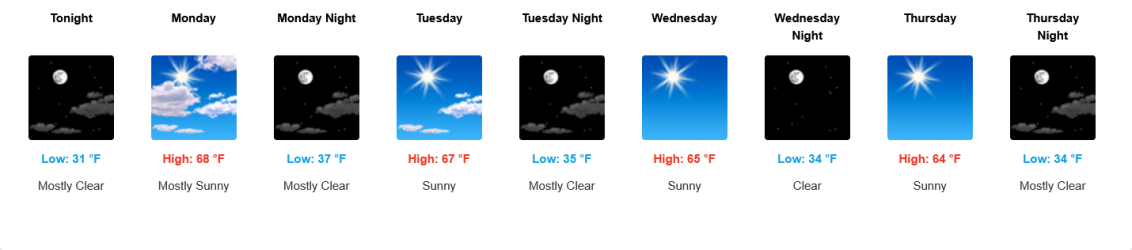
The weather looks crazy nice this week, I wish I was going to be on one of these trails. Ugh, I hate my job :)

1791163565567.png
 
@TractorDoc - do you know if this is the south side of the old trail that goes up to Cygnet Lakes from Mary Lake? Or further west?
Hugh checked out both trails while we were at Mary Lake. (Cygnet Lakes to Mary Lake, Start of the Plateau Trail to Beach Lake/West Thumb). Both trails are near the official Mary Mountain Trail, both are East of the Patrol Cabin. As you can imagine the Cygnet Lakes trail drops down from the North. The Plateau Trail angled off from what I will call the Northeast Corner of Mary Lake. The two probably even connected if one spent enough time following them. The picture I posted of Hugh is the start of the Plateau Trail (to Beach Lake), but if I posted a picture of him at the outlet of the Cygnet Lakes trail it would look very similar. :) Hope that makes sense/answers your question.
 
Scatman hangover? Good one.

The Plateau Trail was originally intended to run from the Cygnet Lakes Trailhead all the way to West Thumb. I have hiked the entire trail, but divided it up into two pieces. The old trail is approximately 22 miles in length. On the southern approach, it was a long day as our group started at 5:30 am and finished up in the dark at 10:30 pm. A long and exhausting day, but yes, it can be done as a single day hike.

Plateau_Trail_01.jpg
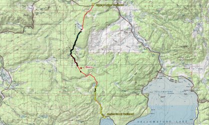
Plateau Trail with GPS coordinates (UTM Zone 12) of all trailmarkers along the unmaintained sections of the trail

The section from Cygnet Lakes to Mary Lake used to be a maintained trail. The Park stopped maintaining it in the late 70's early 80's time frame. The section from Beach Lake to West Thumb was no longer being maintained in the 1960's. The section between Mary Lake and Beach Lake was never completed. Started in the 1920's, the trail was only marked in the southern direction from Mary Lake. At some point the route was abandoned due to reasons that are unclear to me. The trail markers heading south will take you maybe 2/3rds of the way to Beach Lake. According the the old Park historian Lee Whittlesey, it was probably Park politics that forced the route to be discontinued. And Park politics that ceased the maintenance of the sections from Cygnet to Mary and West Thumb up to Beach.

To complete the trail, I started both times at Trout Creek and hiked up the old stagecoach road to where it intersects with the Mary Mountain Trail. I then followed the Mary Mountain Trail to Mary Lake. From there I have headed north to Cygnet Lakes three times on the old trail, and one time I went south following the trail markers until they ran out. From there I followed the likely path that I thought the old trail would take to Beach Lake, but I never ran into anymore trail markers until I reached Beach Lake and the markers started up again all the way to West Thumb.

Here are some close ups of the three main sections of the old Plateau Trail

Plateau_Trail_Cygnet_Lakes_to_Mary_Lake_01.jpg
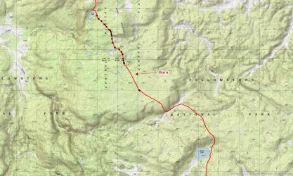
Cygnet Lakes to Mary Lake - I recorded GPS coordinates for all the trail markers I could find, either on standing trees or downfall

Plateau_Trail_Mary_Lake_to_Beach_Lake_01.jpg
Mary Lake to Beach Lake - I didn't record every trail marker on this one. I just didn't have enough time so there are probably double the amount or more that you see on this map. The section that was burned back in 1988 had no trail markers that I could find. Pure dumb luck that I ran into the last two trailmarkers after the burn section.

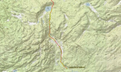
Plateau_Trail_Beach_Lake_to_West_Thumb_01.jpg
Beach Lake to West Thumb - GPS all markers that I could find whether on standing trees or down fall. A few of the points are on the trail in sections that
did not have trail markers present.


@TractorDoc and @TheMountainRabbit have both hiked the old trail from Beach to West Thumb on our hike to the headwaters of Alum Creek a few years back.

The trail coming down from Cygnet Lakes does marry up with the the route down to Beach Lake as there are old trail markers along the east side of Mary Lake that leads one to the southeast corner of the lake where the route then heads off to Beach Lake. I didn't show @TractorDoc these markers on our recent Mary Mountain hike because I was tired and I didn't want to step over all the downfall along the lake. :moses: It was easier for me to walk on the beach down to the southeast corner of Mary Lake.
It would be nice to complete the trail in one shot from Cygnet Lakes to West Thumb someday.

More to come! :)
 
Last edited:
It would be nice to complete the trail in one shot from Cygnet Lakes to West Thumb someday.

Definitely on my list.

How hard would it be to get a backpack permit if you promised to set up camp far away from the official trails and far away from the valley? Early summer to avoid the bear management shutdown. The whole middle of the loop would be awesome to wander around for a couple days.
 
Definitely on my list.

How hard would it be to get a backpack permit if you promised to set up camp far away from the official trails and far away from the valley? Early summer to avoid the bear management shutdown. The whole middle of the loop would be awesome to wander around for a couple days.

I don't believe that they let you get undesignated campsites on the Central Plateau. I know that they wouldn't let me get one there years ago when I used to occasionally get an undesignated sight. Might want to call the main backcountry office in Mammoth and inquire.
 
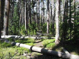
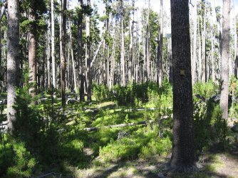
@wsp_scott - some shots from a couple of my hikes from Mary Lake north to Cygnet Lakes on the old trail

2009 hike
120.jpg
121.jpg
122.jpg
123.jpg
124.jpg
125.jpg
126.jpg
127.jpg
128.jpg
129.jpg
130.jpg
Reaching the meadows at Cygnet Lakes
131.jpg

My last trip in 2016 when I finally got smart and recorded GPS points for all the trail markers between the two lakes. Somehow I missed these on my previous two trips.

132.jpg
133.jpg
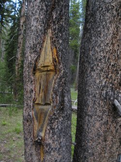
And an old "I" blaze
134.jpg
135.jpg

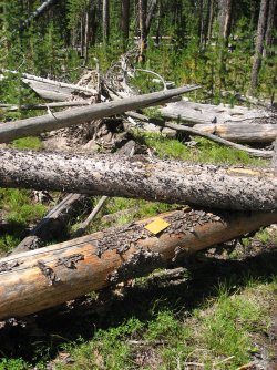
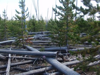
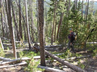
The first time I did this trail back in my film days, the trail was easy to follow as the snags hadn't fallen yet in the partial burn area between the lakes. It was a little more difficult in 2009, and the partial burn area was kind of nasty in 2016 as more trees had fallen and the new growth was getting bigger.
 
Last edited:
Sounds like an epic dayhike is in store. I measured something like 22 miles, a very epic day. It could be a BCP meetup, only the insane will show up :)
I'm not insane enough ? ........or maybe I've gotten wise as getting older, to stay away from 20 mile dayhikes..... ?
 
Here are some shots heading the other way from Mary Lake towards Beach Lake on the old Plateau Trail from 2011.


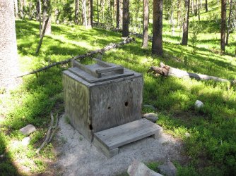
This one's for @TractorDoc - the old pit toilet at the Mary Lake Patrol Cabin :)
140.jpg

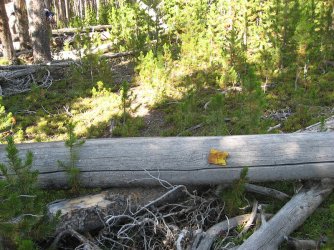
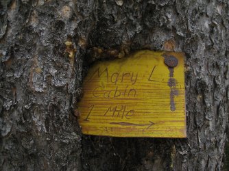
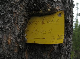
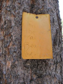
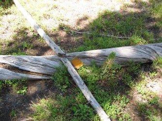
Yep, this is the way. Reads: This is the old trail to Beach L. (not all marked) JCS - 1974
141.jpg

142.jpg

Some thermal area not too far from Mary Lake
143.jpg

144.jpg
145.jpg
146.jpg

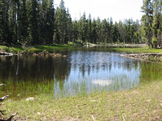
A pond near the old route
147.jpg

148.jpg

Getting close to entering the burn
149.jpg

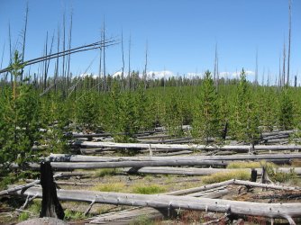
The burn - no trail markers were found through the burn stretch. The burned area from 1988 is approximately 0.9 miles across
following the old route. I'm guessing this would be rough going today.
149b.jpg

Those standing trees in the distance are the end of the burn
150.jpg

Pure dumb luck as we hit a trail marker after the burned area. This one was maybe 300 feet
from the burned area. This also happens to be the second to last marker on the way to Beach
Lake. I didn't take a picture of the last marker because I didn't realize at the time that it was the
last trail marker. :( It was located 134 feet from the second to last marker.
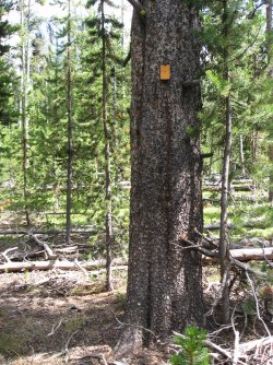
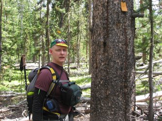
151.jpg

At the second to last trail marker
152.jpg

Making our way, unmarked to Beach Lake
153.jpg

Meadows along Spruce Creek. There was no water in Spruce Creek back in 2011.
154.jpg

Arriving at Beach Lake in the evening
155.jpg

Old Plateau Trail heading trough some meadows south of Beach Lake. Getting dark and thus not in focus
156.jpg

Hiking through the meadows along Arnica Creek - a couple of headlamps to light our way. Finished up at 10:30 pm for a 17 hour
day.
157.jpg
 
Last edited:
Back
Top