- Joined
- May 5, 2012
- Messages
- 1,732
If you say the word "notch" to me, my mind goes to the Uintas. To the gap on the skyline above Wall Lake. To Ibantic Lake in its shadow.
Utah has another notable notch, one nearly as high and perhaps more dramatic: Notch Peak.
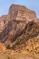
Sitting on the southern end of the House Range in the West Desert, Notch Peak presents a dramatic face to eastbound travelers on U.S. Highway 6. I remember first seeing that massive cliff while driving home from my first visit to Great Basin National Park and thinking someday, I'll stand on the top of that cliff.
Someday finally arrived.
A strong, wet storm system swept across Utah on Saturday, April 7, 2018. I kept watching satellite and radar imagery, looking for a gap. The state was largely socked in, with the exception of some pockets in the southern and central regions. In the afternoon, I noticed a hole opening in Nevada. It slid east. Time to go.
Roads were wet around Delta, evidence of the recent rain. Once west of town, the situation improved.

Passing to the south of the House Range, I turned north onto the Tule Valley Road and headed up toward the base of Notch Peak.
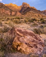
Sure enough, sunlight started filtering through the gap in the clouds I'd observed earlier.
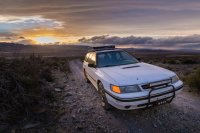
Flat tire worry abounded as I raced the twilight over rocky two-track.
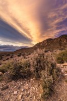
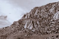
The light kept growing more and more dramatic, forcing me to stop and admire.
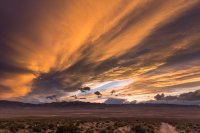
In spite of all the turmoil in the sky, the air at ground level was still. Silence pervaded.
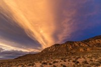
Knolls giving way to hillocks giving way to mountains. The Deep Creeks obscured the setting sun.
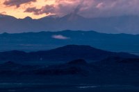
There were a couple of absolutely gorgeous camp sites at the top of the 4wd road west of Notch Peak, near some old mine prospects.
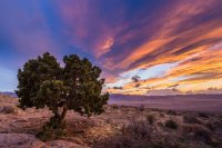
Unfortunately, the entire area had been ravaged by sheep. It was impossible to step without placing a foot on dung. The oppressive stench invaded my nostrils. I would not be spending the night.

I returned to Highway 6 and headed back the way I had come, turning off this time on the east side of the House Range. I parked in a large pullout near the Notch Peak Trailhead, popped the rear hatch and stretched out in the back of the car. Lightning crackled on the eastern horizon, the tail end of the storm moving beyond Delta.
Crystal blue skies replaced the clouds by morning. Rising with the sun, I arranged my pack and set out up Sawtooth Canyon.
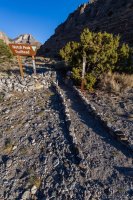
Hey, a little arch!
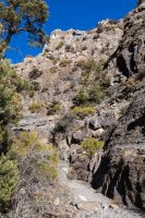
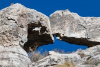
Temperatures were cool bordering on cold, especially in the shade. Crusty snow remained in the scramble section of the canyon.
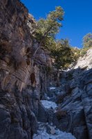
The trail continued to climb, becoming gradually more steep. Upon exiting the (dry) watercourse, expansive views opened to the south and east. Frisco Peak just cut through above the dusty haze.
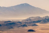
Swasey Peak blocked views to the north.

I'd have to keep ascending. Vegetation really thinned out above 9,000 feet. The ponderosas that survived the desert sun in the dark recesses of the canyon disappeared.

At the saddle between Notch Peak and Sawtooth Mountain, I peered into the chasm. My stomach turned. I couldn't see bottom.
One last push of about 450 vertical feet and I reached the summit.
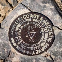
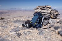
The already impressive views became 360-degree amazing.
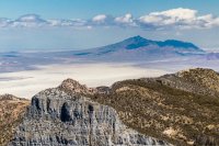
Here you can see the major landmarks to the north.
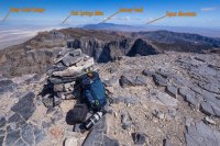
To the west, Wheeler Peak in Great Basin National Park came into view. That's almost exactly 50 miles distant.
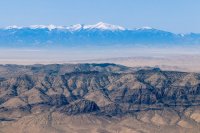
Using the telephoto, you can make out Baker and the Lehman Caves Road through the haze.
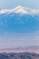
Between us ran the ribbon of Highway 6.
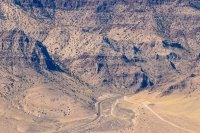
To my back, eastward, sat the dusty bed of Sevier Lake. Like the Great Salt Lake, it is a remnant of Lake Bonneville. It occupies an endorheic basin, where water has no outlet to the sea.

Edging a toe up to the brink of the precipice, the sinking sensation returned to my gut.
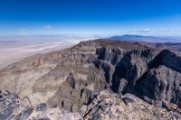
Noon had come and gone. I returned to the trailhead, the hike down taking about an hour less than the one going uphill.
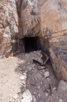
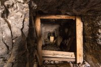
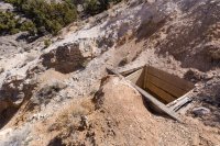
Nearby, I paused to check out this old mine adit.
The 2,600 of vertical over 7.5 miles left my winter legs quite sore for a day or two. Those views though...
Utah has another notable notch, one nearly as high and perhaps more dramatic: Notch Peak.

Sitting on the southern end of the House Range in the West Desert, Notch Peak presents a dramatic face to eastbound travelers on U.S. Highway 6. I remember first seeing that massive cliff while driving home from my first visit to Great Basin National Park and thinking someday, I'll stand on the top of that cliff.
Someday finally arrived.
A strong, wet storm system swept across Utah on Saturday, April 7, 2018. I kept watching satellite and radar imagery, looking for a gap. The state was largely socked in, with the exception of some pockets in the southern and central regions. In the afternoon, I noticed a hole opening in Nevada. It slid east. Time to go.
Roads were wet around Delta, evidence of the recent rain. Once west of town, the situation improved.

Passing to the south of the House Range, I turned north onto the Tule Valley Road and headed up toward the base of Notch Peak.

Sure enough, sunlight started filtering through the gap in the clouds I'd observed earlier.

Flat tire worry abounded as I raced the twilight over rocky two-track.


The light kept growing more and more dramatic, forcing me to stop and admire.

In spite of all the turmoil in the sky, the air at ground level was still. Silence pervaded.

Knolls giving way to hillocks giving way to mountains. The Deep Creeks obscured the setting sun.

There were a couple of absolutely gorgeous camp sites at the top of the 4wd road west of Notch Peak, near some old mine prospects.

Unfortunately, the entire area had been ravaged by sheep. It was impossible to step without placing a foot on dung. The oppressive stench invaded my nostrils. I would not be spending the night.

I returned to Highway 6 and headed back the way I had come, turning off this time on the east side of the House Range. I parked in a large pullout near the Notch Peak Trailhead, popped the rear hatch and stretched out in the back of the car. Lightning crackled on the eastern horizon, the tail end of the storm moving beyond Delta.
Crystal blue skies replaced the clouds by morning. Rising with the sun, I arranged my pack and set out up Sawtooth Canyon.

Hey, a little arch!


Temperatures were cool bordering on cold, especially in the shade. Crusty snow remained in the scramble section of the canyon.

The trail continued to climb, becoming gradually more steep. Upon exiting the (dry) watercourse, expansive views opened to the south and east. Frisco Peak just cut through above the dusty haze.

Swasey Peak blocked views to the north.

I'd have to keep ascending. Vegetation really thinned out above 9,000 feet. The ponderosas that survived the desert sun in the dark recesses of the canyon disappeared.

At the saddle between Notch Peak and Sawtooth Mountain, I peered into the chasm. My stomach turned. I couldn't see bottom.
One last push of about 450 vertical feet and I reached the summit.


The already impressive views became 360-degree amazing.

Here you can see the major landmarks to the north.

To the west, Wheeler Peak in Great Basin National Park came into view. That's almost exactly 50 miles distant.

Using the telephoto, you can make out Baker and the Lehman Caves Road through the haze.

Between us ran the ribbon of Highway 6.

To my back, eastward, sat the dusty bed of Sevier Lake. Like the Great Salt Lake, it is a remnant of Lake Bonneville. It occupies an endorheic basin, where water has no outlet to the sea.
Edging a toe up to the brink of the precipice, the sinking sensation returned to my gut.

Noon had come and gone. I returned to the trailhead, the hike down taking about an hour less than the one going uphill.
Nearby, I paused to check out this old mine adit.


The 2,600 of vertical over 7.5 miles left my winter legs quite sore for a day or two. Those views though...
Last edited:
