Vegan.Hiker
Member
- Joined
- Jul 5, 2014
- Messages
- 2,099
The Northern Forest Canoe Trail (NFCT) is a 740 mile, long-distance paddling trail which was historically travelled by Native Americans. The trail begins in Old Forge, NY in the Adirondacks and ends at Fort Kent in Maine and connects the major watersheds of New York, Vermont, Quebec, New Hampshire, and Maine. The trail is often described as the water version of the Appalachian Trail and there are many similarities: both are long-distance trails that most people will use for day trips or short overnight trips; but some travel it in it's entirety, either by thru padding, or in sections. The 740 mile trail covers 56 lakes and ponds, 22 rivers and streams, and 62 "carries" (portages) totaling 55 miles. The trail is divided into 13 sections.
This past week, I spent 5 days paddling section 2 of the NFCT which is 1 of the 3 sections in the Adirondacks. I chose this section because it is the most remote of the 3 NY sections and contained a lot of variety (lakes, rivers, ponds, creeks, portages, and lots of opportunities for hiking side trips). Besides 3 portages totaling roughly 3 miles on some really rough trails, this section also required me to paddle through 2 sets of hand operated locks which are each over a century old.
This trip was a bit of a trial for me to find out if I would want to section paddle the entire NFCT. My paddlecraft for this trip was my Pungo 120 kayak.
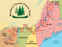
This is a large scale map of the trail marking it's 13 sections.
The itinerary for my trip was as follows:
Day 1
Camped along Lake Eaton in Long Lake, NY
Mileage: 0 miles
Day 2
Dropped off my spare car key at the outfitter which was shuttling my car to my end destination.
Paddle Long Lake to the mouth of the Raquette River
Paddle the Raquette River to Raquette Falls
First portage around Raquette Falls (1.3 miles)
Paddle to a lean-to a few miles downstream of the falls
Mileage: ~ 16 miles paddling plus 1.3 miles portaging
Day 3
Continued up the Raquette River to Stony Creek
Paddled Stony Creek to Stony Creek Ponds
Second Portage from Stony Creek Ponds to Upper Saranac Lake (1.1 miles)
Paddle Upper Saranac Lake
Third portage to Middle Saranac Lake (0.4 miles)
Paddle across Middle Saranac Lake to campsite near the Ampersand Mountain trailhead
Mileage: ~ 14.5 miles paddling plus 1.5 miles portaging
Day 4
Hike out and back up the Ampersand Mountain trail to the summit.
Paddle the remainder of Middle Saranac Lake
Paddle the Saranac River, passing through the Upper Locks
Paddle Lower Saranac Lake to campsite
Mileage: ~ 7.5 miles hiking plus 4 miles of paddling
Day 5
Paddle the remainder of Lower Saranac Lake
Paddle through First Pond and Second Pond
Pass through the Lower Locks
Paddle through Oseetah Lake
Paddle through Flower Lake
End at Saranac Lake Village
Mileage: ~ 8.5 miles paddling
Total mileage according to Gaia: 53.45 miles (43.15 paddling, 2.8 portaging, 7.5 hiking)
DAY 1
It was a little cloudy my first night camping along Eaton Lake. I was tempted to paddle out on the lake for the sunset but it didn't look like there would be one worth photographing and I knew I'd get my fill of paddling over the next few days.. So I just decided to just relax by the fire the first night and do some reading by headlamp.
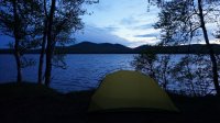
This was my campsite as it began to get dark . I was going to go without the rainfly at first but as I mentioned it got cloudy and the wind began to pick up a little. It's grainy and a bit out of focus, but I just wasn't in the mood to play with the camera.
DAY 2
The next morning, the clouds looked like they might break up. I walked along the shore to find a good spot to photograph the sunrise.
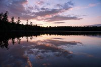
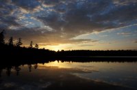
As I was packing up my tent and sleeping gear, I took a few more shots from the bank of my campsite. It looked like I could have great weather.
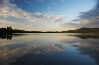
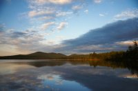
I headed down to Raquette River Outfitters to arrange my car transport, then I was off on my way. First order of business was to paddle the 9 mile length of Long Lake. This took much longer than anticipated because a strong headwind developed and a good amount of chop.
Looking down Long Lake. The first island marks the first 3 miles of the 9 mile long lake.
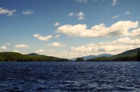
I was happy to reach the Raquette River to escape the wind and chop on Long Lake. It was nice to have some current as well. The weather was volatile, rain then sun, rain then sun.
A picture of the Raquette River when the sun was out a little. I realized it was going to be a challenge to take pictures in a bobbing, drifting kayak.
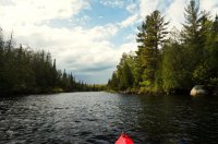
About 6 miles down the Raquette River, as the weather was deteriorating, I came to the first portage around Raquette Falls. Raquette Falls is a series of 3 main waterfalls interspersed with class IV and V rapids. The carry around the falls is 1.3 miles.
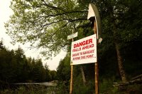
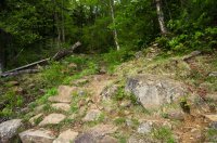
This portage was by far the hardest part of my trip. The trail was rough. Constant up and downs and strewn with boulders. It was barely passable with my kayak cart and I was exhausted from already paddling 15 miles. It took me about 3 hours to portage the 1.3 miles. To make things worse it rained throughout the whole ordeal.
My first look at the portage was met with a groan.
It felt like I was backpacking with a 35 lb kayak and 50 pounds of gear in tow... probably because I basically was.
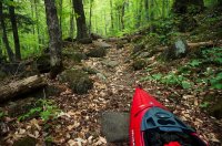
Three exhausting hours later I finally made it back to the river downstream of the falls. There was a hiking trail that leads you back to get a view of the lower falls but I was beat and decided to keep moving. So I put back into the Raquette River in search of a lean-to that was about a mile and a half down river according to my map.
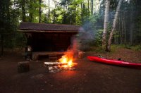
I found the lean-to and settled in for the night.
DAY 3
A view from the lean-to the next morning. The Raquette River is about 8 feet down the bank in front of the lean-to.
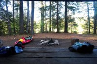
Stony Creek wound back and forth in a never-ending "S" pattern and was banked with tall grass. The name is quite inaccurate as It wasn't stony at all. Most of Stony Creek was very narrow, only about 10-12 feet in many spots, so this isn't really a good illustration but it was the only picture I took in this section.
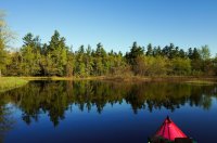
Stony Creek opened up into Stony Creek Ponds after a few miles. Stony Creek Ponds was a beautiful pine forest lake.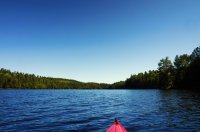
At the end of Stony Creek Ponds was my second portage; a 1.1 mile trail to Upper Saranac Lake. It wasn't fun, but it wasn't nearly as bad as the Raquette Falls carry. While it still had a lot of up and down, it wasn't as rocky you can see in the picture below. The trail eventually merged with a gravel road too, which made life easy.
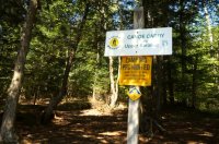
There were also some planks which helped move things along.
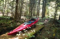
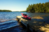
1.1 miles later I arrived at Upper Saranac Lake. I would need to search the eastern shore for my third and final portage. I saw a couple of boats on Upper Saranac which was the first sign of life since I launched at Long Lake.
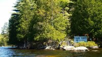
I had read that the next portage was difficult to find, but I guess someone decided to fix that with a large sign.
Preparing for my third and final carry. This one was only 0.4 miles and was an easy dirt road leading to a short quarter mile trail.
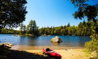
The portage led me to Middle Saranac Lake.
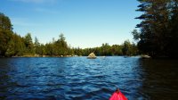
I paddled across Middle Saranac Lake to camp near the base of Ampersand Mountain . I would be hiking it the next day.
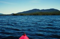
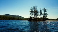
There were lots of tiny islands which was pretty cool.
My campsite for the night.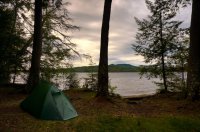
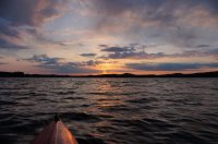
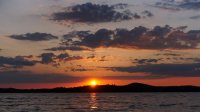
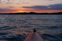
Despite the nonstop paddling, I felt like taking a night paddle to see the sunset. . It was pretty hard to take pictures with the choppy water, but I managed to take a few anyway.
DAY 4
On this day I took a hike up Ampersand Mountain. I was able to catch the trail about 200 feet from my campsite. The hike was fairly easy; only 7.5 miles with only 1,800' elevation gain, so I was done before 11 am.
As soon as I put on my pack and walked away from the lake and onto the trail, I immediately felt like I was back in my element.
The first few miles of the hike felt like an idyllic walk in the woods.
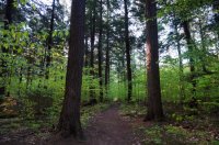
The trail followed along a stream which it crossed several times.
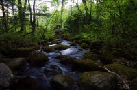
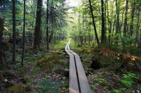
There was an unusually long section of boardwalk.
The view looking east from the summit.
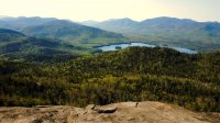
Looking west towards Middle Saranac Lake
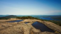
Looking north towards Lower Saranac Lake where I would be heading next.
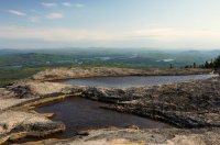
After the hike, it was back on the water. I paddled the Saranac River to Lower Saranac Lake.
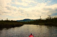
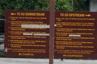
I arrived at the upper locks. I read that you usually need to operate these yourself.
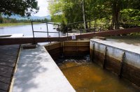
But as I was pondering the instructions, a Ranger came out and said she would operate it for me. So I just paddled in and then paddled out when the gates opened.
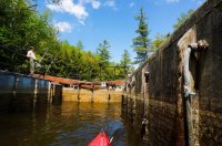
The Saranac River was quite beautiful.
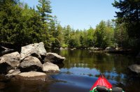
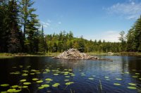
There were a few beaver dams along the way.
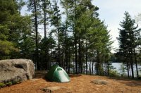
When I arrived at Lower Saranac Lake, I set up camp on an island which was labeled Pope Island on my map.
DAY 5
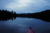
The weather forecast for my final day was for rain starting at around 9 am. Since I still had 8.5 miles to paddle before getting to where my car was dropped, I decided to wake up at 3:30 a.m. and start paddling in the dark by headlamp. It turned out to be extremely peaceful as the water was as still as glass.
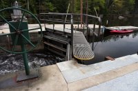
At the Upper Locks there was no ranger on duty so I had to figure out how to operate it myself this time.
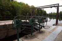
It wasn't really that hard, but it took a little bit of muscle to spin those doors open and closed.
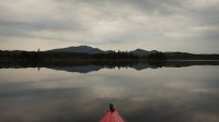
Even though it was cloudy it was peaceful and relaxing.
Then as I knew would happen as I approached the end, I started to come across signs of civilization. First it was a few houses built on some of the islands.
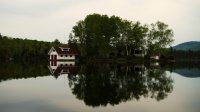
Then I rounded a bend and there was Saranac Lake Village.
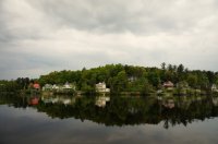
I bet a lot of NFCT paddlers stop here for some ice cream when finishing this section.
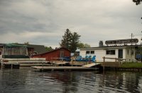
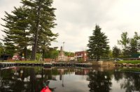
And this dock marked the end of my trip.
Final Thoughts:
While I enjoyed this trip I realized that I don't really want to purse doing the entire 740 mile trail. For one, I realized that I don't have the ideal setup. I came across 4 guys from Boston who were doing the entire trail. They told me that they started in kayaks but switched to Placid Boatworks UL canoes. They weigh 18 lbs and are easier to portage upside down on your shoulders with the padded brace. Also with a canoe, all of your other gear can be easily stored in one large backpacking pack, whereas in the kayak I had to pack everything in 8 or 9 pieces to fit which made portaging a more complex process. At $3,500 for the model they suggested, it ain't gonna happen for me. I also realized that I enjoy backpacking much more than paddling. The day that I hiked was probably my favorite day of the trip and I came to realize that I enjoy the views from up above better than from down on the water. All in all it was still a fun experience.
Featured image for home page:
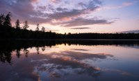
This past week, I spent 5 days paddling section 2 of the NFCT which is 1 of the 3 sections in the Adirondacks. I chose this section because it is the most remote of the 3 NY sections and contained a lot of variety (lakes, rivers, ponds, creeks, portages, and lots of opportunities for hiking side trips). Besides 3 portages totaling roughly 3 miles on some really rough trails, this section also required me to paddle through 2 sets of hand operated locks which are each over a century old.
This trip was a bit of a trial for me to find out if I would want to section paddle the entire NFCT. My paddlecraft for this trip was my Pungo 120 kayak.
This is a large scale map of the trail marking it's 13 sections.

The itinerary for my trip was as follows:
Day 1
Camped along Lake Eaton in Long Lake, NY
Mileage: 0 miles
Day 2
Dropped off my spare car key at the outfitter which was shuttling my car to my end destination.
Paddle Long Lake to the mouth of the Raquette River
Paddle the Raquette River to Raquette Falls
First portage around Raquette Falls (1.3 miles)
Paddle to a lean-to a few miles downstream of the falls
Mileage: ~ 16 miles paddling plus 1.3 miles portaging
Day 3
Continued up the Raquette River to Stony Creek
Paddled Stony Creek to Stony Creek Ponds
Second Portage from Stony Creek Ponds to Upper Saranac Lake (1.1 miles)
Paddle Upper Saranac Lake
Third portage to Middle Saranac Lake (0.4 miles)
Paddle across Middle Saranac Lake to campsite near the Ampersand Mountain trailhead
Mileage: ~ 14.5 miles paddling plus 1.5 miles portaging
Day 4
Hike out and back up the Ampersand Mountain trail to the summit.
Paddle the remainder of Middle Saranac Lake
Paddle the Saranac River, passing through the Upper Locks
Paddle Lower Saranac Lake to campsite
Mileage: ~ 7.5 miles hiking plus 4 miles of paddling
Day 5
Paddle the remainder of Lower Saranac Lake
Paddle through First Pond and Second Pond
Pass through the Lower Locks
Paddle through Oseetah Lake
Paddle through Flower Lake
End at Saranac Lake Village
Mileage: ~ 8.5 miles paddling
Total mileage according to Gaia: 53.45 miles (43.15 paddling, 2.8 portaging, 7.5 hiking)
DAY 1
It was a little cloudy my first night camping along Eaton Lake. I was tempted to paddle out on the lake for the sunset but it didn't look like there would be one worth photographing and I knew I'd get my fill of paddling over the next few days.. So I just decided to just relax by the fire the first night and do some reading by headlamp.
This was my campsite as it began to get dark . I was going to go without the rainfly at first but as I mentioned it got cloudy and the wind began to pick up a little. It's grainy and a bit out of focus, but I just wasn't in the mood to play with the camera.

DAY 2
The next morning, the clouds looked like they might break up. I walked along the shore to find a good spot to photograph the sunrise.


As I was packing up my tent and sleeping gear, I took a few more shots from the bank of my campsite. It looked like I could have great weather.


I headed down to Raquette River Outfitters to arrange my car transport, then I was off on my way. First order of business was to paddle the 9 mile length of Long Lake. This took much longer than anticipated because a strong headwind developed and a good amount of chop.
Looking down Long Lake. The first island marks the first 3 miles of the 9 mile long lake.

I was happy to reach the Raquette River to escape the wind and chop on Long Lake. It was nice to have some current as well. The weather was volatile, rain then sun, rain then sun.
A picture of the Raquette River when the sun was out a little. I realized it was going to be a challenge to take pictures in a bobbing, drifting kayak.

About 6 miles down the Raquette River, as the weather was deteriorating, I came to the first portage around Raquette Falls. Raquette Falls is a series of 3 main waterfalls interspersed with class IV and V rapids. The carry around the falls is 1.3 miles.

This portage was by far the hardest part of my trip. The trail was rough. Constant up and downs and strewn with boulders. It was barely passable with my kayak cart and I was exhausted from already paddling 15 miles. It took me about 3 hours to portage the 1.3 miles. To make things worse it rained throughout the whole ordeal.
My first look at the portage was met with a groan.

It felt like I was backpacking with a 35 lb kayak and 50 pounds of gear in tow... probably because I basically was.

Three exhausting hours later I finally made it back to the river downstream of the falls. There was a hiking trail that leads you back to get a view of the lower falls but I was beat and decided to keep moving. So I put back into the Raquette River in search of a lean-to that was about a mile and a half down river according to my map.
I found the lean-to and settled in for the night.

DAY 3
A view from the lean-to the next morning. The Raquette River is about 8 feet down the bank in front of the lean-to.

Stony Creek wound back and forth in a never-ending "S" pattern and was banked with tall grass. The name is quite inaccurate as It wasn't stony at all. Most of Stony Creek was very narrow, only about 10-12 feet in many spots, so this isn't really a good illustration but it was the only picture I took in this section.

Stony Creek opened up into Stony Creek Ponds after a few miles. Stony Creek Ponds was a beautiful pine forest lake.

At the end of Stony Creek Ponds was my second portage; a 1.1 mile trail to Upper Saranac Lake. It wasn't fun, but it wasn't nearly as bad as the Raquette Falls carry. While it still had a lot of up and down, it wasn't as rocky you can see in the picture below. The trail eventually merged with a gravel road too, which made life easy.

There were also some planks which helped move things along.

1.1 miles later I arrived at Upper Saranac Lake. I would need to search the eastern shore for my third and final portage. I saw a couple of boats on Upper Saranac which was the first sign of life since I launched at Long Lake.

I had read that the next portage was difficult to find, but I guess someone decided to fix that with a large sign.

Preparing for my third and final carry. This one was only 0.4 miles and was an easy dirt road leading to a short quarter mile trail.

The portage led me to Middle Saranac Lake.

I paddled across Middle Saranac Lake to camp near the base of Ampersand Mountain . I would be hiking it the next day.

There were lots of tiny islands which was pretty cool.

My campsite for the night.

Despite the nonstop paddling, I felt like taking a night paddle to see the sunset. . It was pretty hard to take pictures with the choppy water, but I managed to take a few anyway.


DAY 4
On this day I took a hike up Ampersand Mountain. I was able to catch the trail about 200 feet from my campsite. The hike was fairly easy; only 7.5 miles with only 1,800' elevation gain, so I was done before 11 am.
As soon as I put on my pack and walked away from the lake and onto the trail, I immediately felt like I was back in my element.
The first few miles of the hike felt like an idyllic walk in the woods.

The trail followed along a stream which it crossed several times.

There was an unusually long section of boardwalk.

The view looking east from the summit.

Looking west towards Middle Saranac Lake

Looking north towards Lower Saranac Lake where I would be heading next.

After the hike, it was back on the water. I paddled the Saranac River to Lower Saranac Lake.

I arrived at the upper locks. I read that you usually need to operate these yourself.

But as I was pondering the instructions, a Ranger came out and said she would operate it for me. So I just paddled in and then paddled out when the gates opened.


The Saranac River was quite beautiful.

There were a few beaver dams along the way.

When I arrived at Lower Saranac Lake, I set up camp on an island which was labeled Pope Island on my map.

DAY 5
The weather forecast for my final day was for rain starting at around 9 am. Since I still had 8.5 miles to paddle before getting to where my car was dropped, I decided to wake up at 3:30 a.m. and start paddling in the dark by headlamp. It turned out to be extremely peaceful as the water was as still as glass.

At the Upper Locks there was no ranger on duty so I had to figure out how to operate it myself this time.

It wasn't really that hard, but it took a little bit of muscle to spin those doors open and closed.

Even though it was cloudy it was peaceful and relaxing.

Then as I knew would happen as I approached the end, I started to come across signs of civilization. First it was a few houses built on some of the islands.

Then I rounded a bend and there was Saranac Lake Village.

I bet a lot of NFCT paddlers stop here for some ice cream when finishing this section.

And this dock marked the end of my trip.

Final Thoughts:
While I enjoyed this trip I realized that I don't really want to purse doing the entire 740 mile trail. For one, I realized that I don't have the ideal setup. I came across 4 guys from Boston who were doing the entire trail. They told me that they started in kayaks but switched to Placid Boatworks UL canoes. They weigh 18 lbs and are easier to portage upside down on your shoulders with the padded brace. Also with a canoe, all of your other gear can be easily stored in one large backpacking pack, whereas in the kayak I had to pack everything in 8 or 9 pieces to fit which made portaging a more complex process. At $3,500 for the model they suggested, it ain't gonna happen for me. I also realized that I enjoy backpacking much more than paddling. The day that I hiked was probably my favorite day of the trip and I came to realize that I enjoy the views from up above better than from down on the water. All in all it was still a fun experience.
Featured image for home page:

Last edited:

