- Joined
- Sep 10, 2021
- Messages
- 47
With the favorable weather Northern Utah had in May, it was plausible my daughter and I could sneak in an early Uinta backpack. The US Forest Service Vernal Office indicated that all the southern Uinta trailheads would be open for the upcoming weekend, the first weekend in June. We planned on entering at Grandview Trailhead which provides access to the Grandaddy Lake Basin, in the SW corner of the Uintas.
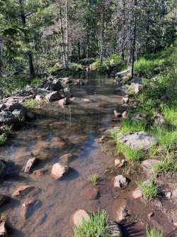
As we turned onto the Forest Service Road 315, the locked gate in front of us blocked our plans. Plan B was now required. Just north of the locked gate was the MIll Flat Trailhead. The North Fork Duchesne River Trail, 081, started and ran north. The first couple hundred yards of the trail was saturated and in many areas had a couple inches of standing water. Once out of this low area, the trail dried out a bit and we were able to enjoy the day.
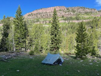
We found a nice open meadow to camp in this forested zone for a couple nights.
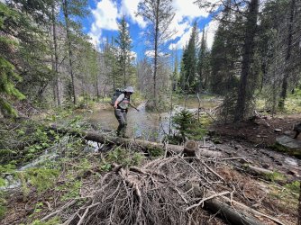
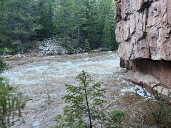
The trail ran along the Duchesne River, which was quite the torrent. The only person we saw over the weekend indicated that two weeks earlier you could walk up the river’s edge as the water was in a small main channel. Now the river was fed by a fast melting snow pack and was swollen close to flood stage.
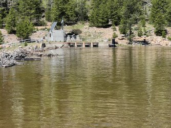
Normally much of the river’s flow is diverted into a tunnel. Moving the water from the Green River Drainage and into the Provo River Drainage. This moves the water into the south end of the Salt Lake Valley.
We were able to hike about 5 miles north before the trail crossed the river. Crossing the river would have been difficult to do with the current water level even at the diversion dam. The river flows in a small gorge, named on the map as Cataract Gorge. It was a fun early season backpack or hike from one of the nearby car camping sites. The trail would be great for a family outing.
Our camp for two nights...
The trail seemed more like a stream in a few spots.
Here is a photo of the Duchesne Tunnel Inlet.
The following are photos of the Duchesne River in the "Cataract Gorge"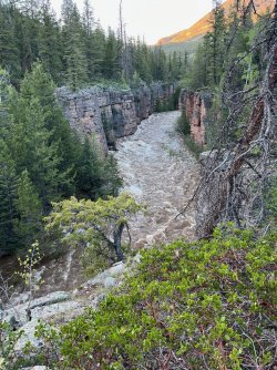
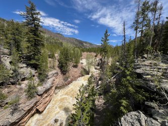
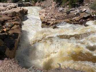
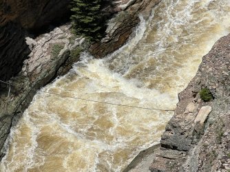
Thanks for reading and I hope you enjoyed this short early season trip.
As we turned onto the Forest Service Road 315, the locked gate in front of us blocked our plans. Plan B was now required. Just north of the locked gate was the MIll Flat Trailhead. The North Fork Duchesne River Trail, 081, started and ran north. The first couple hundred yards of the trail was saturated and in many areas had a couple inches of standing water. Once out of this low area, the trail dried out a bit and we were able to enjoy the day.
We found a nice open meadow to camp in this forested zone for a couple nights.
The trail ran along the Duchesne River, which was quite the torrent. The only person we saw over the weekend indicated that two weeks earlier you could walk up the river’s edge as the water was in a small main channel. Now the river was fed by a fast melting snow pack and was swollen close to flood stage.
Normally much of the river’s flow is diverted into a tunnel. Moving the water from the Green River Drainage and into the Provo River Drainage. This moves the water into the south end of the Salt Lake Valley.
We were able to hike about 5 miles north before the trail crossed the river. Crossing the river would have been difficult to do with the current water level even at the diversion dam. The river flows in a small gorge, named on the map as Cataract Gorge. It was a fun early season backpack or hike from one of the nearby car camping sites. The trail would be great for a family outing.
Our camp for two nights...

The trail seemed more like a stream in a few spots.


Here is a photo of the Duchesne Tunnel Inlet.

The following are photos of the Duchesne River in the "Cataract Gorge"


Thanks for reading and I hope you enjoyed this short early season trip.
