This is my first trip report that I have ever written. I have been following backcountrypost.com since it began, and have been reading Nick’s trip reports of the Uintas since last year, but just had not joined yet. On July 26th through 29th I made a trip up to the Uintas and decided I would try and write up a report, so here goes:
I only get to go backpacking about once a year right now, although I’m always hopeful that I can increase that. Since that is the case, I plan the event 4 or 5 months before and have a lot of anticipation before the date finally arrives. For this trip, I had my 71 year old dad come along, as he still loves backpacking and two friends in my neighborhood. When choosing destinations, I, like many other people on this site, prefer places where I can find solitude. So for this trip, I chose Norice and Priord lakes, up the right hand fork of the East Fork of the Bear River. While researching, I could not find many trip reports or images of these lakes, so it seemed like a perfect place to try.
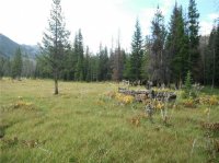
We left Salt Lake City at 4:30 on Friday morning and arrived at the East Fork of the Bear trailhead around 6:45. We quickly put our packs on, signed the register and were on the trail by 7 am. The first miles of trail still shows signs of fire damage that took place a few years ago, but all the new growth really made it beautiful in a unique way. The beginning of the trail descends quite a bit, which we knew would be tough on the return trip. There are some nice bridges and walkways during this section that had been constructed and were very pleasant. We hiked without event until we reached the tie hack cabins that I have seen on other people’s trip reports to Allsop Lake. We were a little worried about the “unhappy” clouds that seemed to be gathering. It seemed pretty early for the regular afternoon thunderstorms.
Tie Hack Cabins along the trail
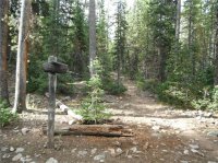
At 4 miles, we reached the fork in the trail, where the left trail leads to Allsop and the right leads to Norice and Priord Lakes. According to one of the few trip reports I found and the USGS map, there should be a nice bridge to cross the river there, but we were disappointed to see that no such bridge currently existed. I was also surprised how much water was in the river since we were having such a dry and warm year. We found a couple of logs and rocks to cross on and continued on our way.
The sign at the fork
The trail then began to deteriorate, since it is much less used than others and doesn’t see the upkeep of other trails. The weather didn’t want to wait any longer, and it began to rain. Nothing heavy yet, but still made the trail a little more difficult with slick rocks and more mud patches than normal. We soon came to another crossing of the river, and once again, no good to place to cross. We wandered upstream a bit and found a log that we could cross on, although it had a steep angle to it.
We continued up the basin, walking through varying marshy meadows and tall trees. We also came to a spot where there was a lot of elevation gain, relative to the rest of the trail. This trail really doesn’t climb a lot, but it seemed most of the uphill was right in this spot. The USGS map shows this spot as a spring, and there was some water slowly leaking out of the mountainside here.
Towards what we thought was the end of the trail, we crossed the river again. Still no good crossing, but with the rain coming and going, it didn’t matter that a few of us had slipped in the river at this and previous crossings. After this, the rain began to be much heavier. It was still warm, so I didn’t worry too much about rain gear. After all, we were supposed to be close to Norice Lake, which is where we planned on camping, and I just wanted to get there as soon as possible. I had read and estimated that the trail was about 8 to 9 miles. The GPS, following the trail on the map, said 8.4 miles. We reached 8.4 miles only to have the GPS report we were still a mile away. The disappearing trail and the much heavier rain made the last mile seem very long.
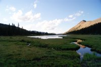
We finally reached Norice Lake at 12:30 and the GPS registering 9.4 miles. We found a nice campsite near an inlet stream to the lake. Although the lake itself is not very scenic (it’s only 3 feet deep and didn’t provide some of the prettier lake colors I’m used to seeing in the Uintas), the basin was beautiful. By the time we set up camp, many of the clouds had cleared and did not return that day. We hung around camp the first afternoon and evening and recovered from the hike up.
Looking north across Norice Lake
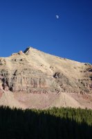
The moon over Yard Peak
The night was uneventful, with no rain or wind, and we woke up around 6:30. We had a quick breakfast, and then I wanted to explore Priord Lake and the upper basin before any clouds began appearing. We hiked up the .6 miles to Priord and were amazed at its beauty. It was a very blue green, and absolutely beautiful. We were surprised when a dog came out and barked at us. It was the only evidence of any one else up in the basin that we saw, although we never saw its owners. We hiked our way around the lake and took the beauty in. We hiked back to our camp and lounged around a bit, deciding on our next course of action.
The map doesn't name this peak, but I think others have called it Priord Peak, with Priord Lake.
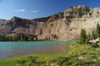
Across Priod Lake towards Yard Peak
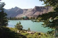
Looking north across Priord Lake
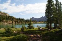
My dad, although having recovered quite a bit from the previous day’s hike, didn’t really want to do much more day hiking, especially after the trip up to Priord. My friend wanted to hike up above the treeline on the east side of Norice Lake to see if we could get some better views. Since it was just the treeline, I decided to go along, as did our other friend. We made it up past the treeline and were directly below the saddle between Yard Peak and another peak east of Norice. We were hoping that we could make it up to the saddle, but I was fairly spent, so I relaxed while my two friends kept climbing. It became steeper than they preferred and it soon became evident that they weren’t going to make it to the top, especially due to the afternoon storms that were rolling in. When we got back down, we realized they were not near as close as we had thought, as we could see the bigger picture from the bottom of the basin.
Looking north up the basin from my spot on the climb to the saddle
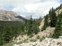
Looking at the Priord Lake Cirque from my spot on the climb to the saddle
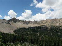
Looking at Yard Peak from my spot on the climb to the saddle
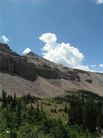
Looking up the rest of the way to the saddle
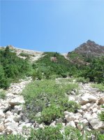
The thunderstorms did come, but they stayed mostly in Amethyst Basin, just to the west of us. There were some good lightning blasts, and I love the way the thunder echoes around the basin. It was fairly pleasant for us, since there was not even enough rain in our basin, at least at our campsite, to get us wet. When we got home the next day, we learned that lighting from that particular thunderstorm had actually struck a man near Amethyst Lake, so that was sad.
The rest of the day we didn’t do much, and were getting ready to go to bed when we heard things I’m still not used to hearing in the wilderness…cows. For some reason they got very vocal right around 10, and were very annoying, but soon became quite enough that we could get some sleep.
We woke up at 6 the next morning and quickly broke camp and prepared for the long hike back out. The weather looked fantastic, and it held the whole morning. Nothing eventful as we hiked, and we enjoyed the quiet beauty of the wilderness. The uphill climb right at the end of the trailhead was fairly painful, but we were excited to get back to the car where ice cold water was waiting for us in a cooler. I was excited to see a truck with a backcountry post sticker on the back window, since I had finally made the decision to post this report on the site.
Overall, I loved this hike. It would be nice to have some maintenance on the trail, but at the same time, that is one reason not a lot of people hike there. It was a fairly easy hike with not a lot of uphill climbs, but the distance made it just as tough for us as previous trails with a lot of elevation gain. I would love to do this trail again, but with so many unexplored places left to go, only time will tell.
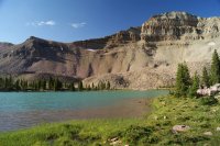
Featured image for home page:
I only get to go backpacking about once a year right now, although I’m always hopeful that I can increase that. Since that is the case, I plan the event 4 or 5 months before and have a lot of anticipation before the date finally arrives. For this trip, I had my 71 year old dad come along, as he still loves backpacking and two friends in my neighborhood. When choosing destinations, I, like many other people on this site, prefer places where I can find solitude. So for this trip, I chose Norice and Priord lakes, up the right hand fork of the East Fork of the Bear River. While researching, I could not find many trip reports or images of these lakes, so it seemed like a perfect place to try.
We left Salt Lake City at 4:30 on Friday morning and arrived at the East Fork of the Bear trailhead around 6:45. We quickly put our packs on, signed the register and were on the trail by 7 am. The first miles of trail still shows signs of fire damage that took place a few years ago, but all the new growth really made it beautiful in a unique way. The beginning of the trail descends quite a bit, which we knew would be tough on the return trip. There are some nice bridges and walkways during this section that had been constructed and were very pleasant. We hiked without event until we reached the tie hack cabins that I have seen on other people’s trip reports to Allsop Lake. We were a little worried about the “unhappy” clouds that seemed to be gathering. It seemed pretty early for the regular afternoon thunderstorms.
Tie Hack Cabins along the trail

At 4 miles, we reached the fork in the trail, where the left trail leads to Allsop and the right leads to Norice and Priord Lakes. According to one of the few trip reports I found and the USGS map, there should be a nice bridge to cross the river there, but we were disappointed to see that no such bridge currently existed. I was also surprised how much water was in the river since we were having such a dry and warm year. We found a couple of logs and rocks to cross on and continued on our way.
The sign at the fork

The trail then began to deteriorate, since it is much less used than others and doesn’t see the upkeep of other trails. The weather didn’t want to wait any longer, and it began to rain. Nothing heavy yet, but still made the trail a little more difficult with slick rocks and more mud patches than normal. We soon came to another crossing of the river, and once again, no good to place to cross. We wandered upstream a bit and found a log that we could cross on, although it had a steep angle to it.
We continued up the basin, walking through varying marshy meadows and tall trees. We also came to a spot where there was a lot of elevation gain, relative to the rest of the trail. This trail really doesn’t climb a lot, but it seemed most of the uphill was right in this spot. The USGS map shows this spot as a spring, and there was some water slowly leaking out of the mountainside here.
Towards what we thought was the end of the trail, we crossed the river again. Still no good crossing, but with the rain coming and going, it didn’t matter that a few of us had slipped in the river at this and previous crossings. After this, the rain began to be much heavier. It was still warm, so I didn’t worry too much about rain gear. After all, we were supposed to be close to Norice Lake, which is where we planned on camping, and I just wanted to get there as soon as possible. I had read and estimated that the trail was about 8 to 9 miles. The GPS, following the trail on the map, said 8.4 miles. We reached 8.4 miles only to have the GPS report we were still a mile away. The disappearing trail and the much heavier rain made the last mile seem very long.
We finally reached Norice Lake at 12:30 and the GPS registering 9.4 miles. We found a nice campsite near an inlet stream to the lake. Although the lake itself is not very scenic (it’s only 3 feet deep and didn’t provide some of the prettier lake colors I’m used to seeing in the Uintas), the basin was beautiful. By the time we set up camp, many of the clouds had cleared and did not return that day. We hung around camp the first afternoon and evening and recovered from the hike up.
Looking north across Norice Lake

The moon over Yard Peak

The night was uneventful, with no rain or wind, and we woke up around 6:30. We had a quick breakfast, and then I wanted to explore Priord Lake and the upper basin before any clouds began appearing. We hiked up the .6 miles to Priord and were amazed at its beauty. It was a very blue green, and absolutely beautiful. We were surprised when a dog came out and barked at us. It was the only evidence of any one else up in the basin that we saw, although we never saw its owners. We hiked our way around the lake and took the beauty in. We hiked back to our camp and lounged around a bit, deciding on our next course of action.
The map doesn't name this peak, but I think others have called it Priord Peak, with Priord Lake.

Across Priod Lake towards Yard Peak

Looking north across Priord Lake

My dad, although having recovered quite a bit from the previous day’s hike, didn’t really want to do much more day hiking, especially after the trip up to Priord. My friend wanted to hike up above the treeline on the east side of Norice Lake to see if we could get some better views. Since it was just the treeline, I decided to go along, as did our other friend. We made it up past the treeline and were directly below the saddle between Yard Peak and another peak east of Norice. We were hoping that we could make it up to the saddle, but I was fairly spent, so I relaxed while my two friends kept climbing. It became steeper than they preferred and it soon became evident that they weren’t going to make it to the top, especially due to the afternoon storms that were rolling in. When we got back down, we realized they were not near as close as we had thought, as we could see the bigger picture from the bottom of the basin.
Looking north up the basin from my spot on the climb to the saddle

Looking at the Priord Lake Cirque from my spot on the climb to the saddle

Looking at Yard Peak from my spot on the climb to the saddle

Looking up the rest of the way to the saddle

The thunderstorms did come, but they stayed mostly in Amethyst Basin, just to the west of us. There were some good lightning blasts, and I love the way the thunder echoes around the basin. It was fairly pleasant for us, since there was not even enough rain in our basin, at least at our campsite, to get us wet. When we got home the next day, we learned that lighting from that particular thunderstorm had actually struck a man near Amethyst Lake, so that was sad.
The rest of the day we didn’t do much, and were getting ready to go to bed when we heard things I’m still not used to hearing in the wilderness…cows. For some reason they got very vocal right around 10, and were very annoying, but soon became quite enough that we could get some sleep.
We woke up at 6 the next morning and quickly broke camp and prepared for the long hike back out. The weather looked fantastic, and it held the whole morning. Nothing eventful as we hiked, and we enjoyed the quiet beauty of the wilderness. The uphill climb right at the end of the trailhead was fairly painful, but we were excited to get back to the car where ice cold water was waiting for us in a cooler. I was excited to see a truck with a backcountry post sticker on the back window, since I had finally made the decision to post this report on the site.
Overall, I loved this hike. It would be nice to have some maintenance on the trail, but at the same time, that is one reason not a lot of people hike there. It was a fairly easy hike with not a lot of uphill climbs, but the distance made it just as tough for us as previous trails with a lot of elevation gain. I would love to do this trail again, but with so many unexplored places left to go, only time will tell.
Featured image for home page:

