- Joined
- May 5, 2012
- Messages
- 1,732
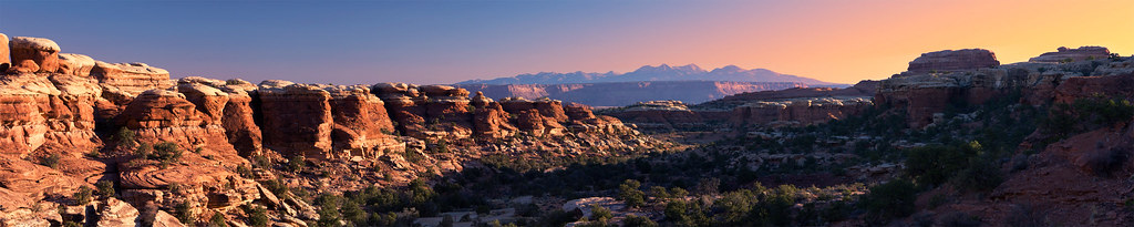
This trip, as originally conceived, was to be a four night, five day excursion into the backcountry of Canyonlands National Park. I'd hoped to link the highlights of the Needles using an extended loop, traveling counter-clockwise from the Squaw Campground trailhead to Chelser Park, Elephant Canyon and eventually out through Lost Canyon.
My goals included testing the lower limits of my 15 ºF sleeping back and seeing how I'd mentally hold up through an extended period solo. A series of factors modified the trip, cutting off a night and a day and turning my long loop into two shorter excursions. I did achieve the first goal and partly achieved the second.
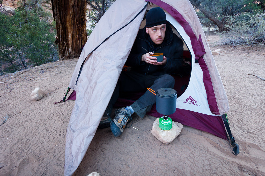
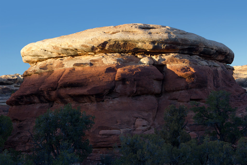
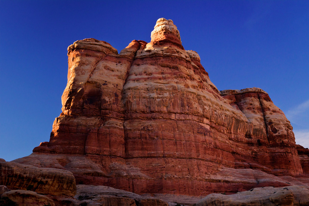
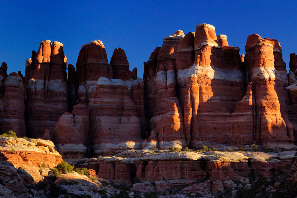
Overbaked by ashergrey, on Flickr
My plans didn't coalesce until less than two weeks before the 24th of November, meaning I did not have reservations for any of the requisite campsites. With that in mind, I set off from Salt Lake early on the morning of the 24th with the intention of reaching the Needles District visitor's center well before noon. Unfortunately, by the time I arrived both the CP1 and EC3 campsites (my preferred sites for Saturday night) were taken. CP1 was also occupied the next night.
The availability of filterable water was also in question, so on the fly I decided to split the trip in half, turning my one loop into two. For the first night I'd head the opposite direction, up Lost Canyon to LC3. The following day I could cross over to Squaw Canyon and spend a night at SQ1. On the third day, I'd hike out to the Squaw Flat trailhead then drive over to Elephant Hill and launch out again for another two nights, the first at EC3 and the second at CP1.
I've heard people call the Lost/Squaw trail a "lollipop loop". Doing two loop hikes back to back, I dubbed this itinerary the "two scoops" variation.
First, Lost and Squaw.
[PARSEHTML]<iframe src="http://www.mappingsupport.com/p/gmap4.php?q=http://dl.dropbox.com/u/3847512/GPS/Lost_and_Squaw.kml&t=t4" frameborder="0" marginheight="0" scrolling="no" width="800" height="800"></iframe><br><br>[/PARSEHTML]The short winter days meant that the sun already seemed too far overhead by the time I hit the trail (roughly 11:30 a.m.).


Still, I had solitude and scenery. Temperatures were warm enough to warrant pants and a short-sleeve shirt. I made it into Lost Canyon quickly.
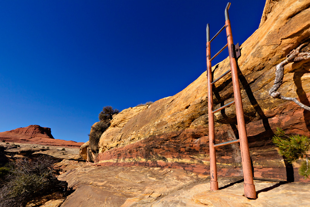
Lost Canyon ladder by ashergrey, on Flickr
I'd read about some mild exposure on the Lost Canyon loop but couldn't really gauge the severity of it from other people's brief posts. Reasonable or not, I tend to be more sensitive to exposure situations when I'm solo and when I'm loaded down with a full pack. The first taste of exposure comes just after the ladder as you traverse a ledge under an overhang. Looking back, no sweat.

It's easy to understand Lost Canyon's name when you reach the canyon floor. Unlike some of the other trails in the Needles, the LC trail is constantly intersected by short side canyons. Anyone unfamiliar with the terrain or basic route-finding could run into trouble if they strayed too far from the trail.
On the way to LC3 I passed only two people, a couple headed the opposite direction. LC3 is a nice sandy spot under some trees, set off the trail about 25 yards. I pitched camp here and had lunch.
With some sunlight to burn, I headed back into the canyon and moved off trail up the drainage to reconnoiter a bit. The wash is wide and rocky. The sandy patches were surprisingly firm, having remained frozen throughout the day. There were no other footprints in the wash, telling me it had been some time since anyone wandered that direction.
I headed back to camp at dusk. The stars were twinkling half an hour later so I set up for some camera work. A big waxing gibbous moon dimmed the stars, but also bathed the landscape in soft light.
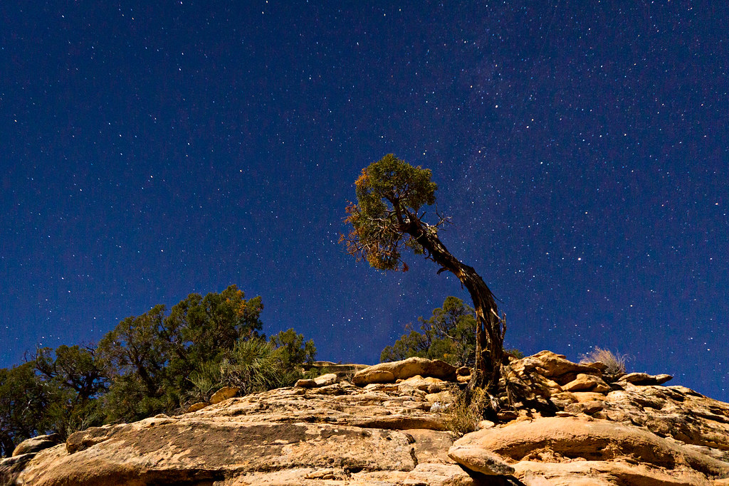
Moonlit tree by ashergrey, on Flickr

The dark and cold, along with a lack of fire or company, caused me to retreat to my sleeping bag early. I was able to drop off to sleep by about 7 p.m. and managed to stay down nearly 12 hours, thanks no doubt to my early rise that morning.
When I awoke on Sunday the dry air bore a bitter cold tinge. Layers came out of my pack.
Breakfast at LC3 by ashergrey, on Flickr
With plenty of time to kill before breaking camp, I decided to further my exploring in upper Lost Canyon. That's generally where I stumbled across these little relics.
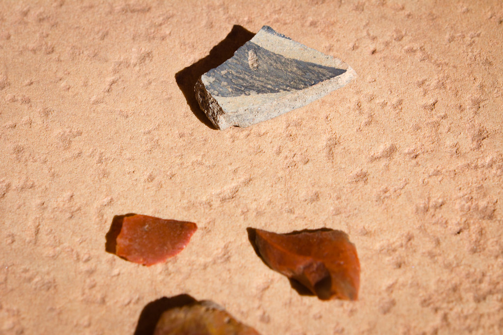
Potsherd and Flint by ashergrey, on Flickr
They were set like this and probably have been for much longer than I've been on the planet. Needless to say, they're still there now.

Even where mankind has not made an impact, we can't help but see ourselves.
Stonefaced by ashergrey, on Flickr
The stone in the wash bottom of upper Lost Canyon is pretty uninteresting and homogenous from what I could see, with a few exceptions. I always seem to find interesting rocks in and around Capitol Reef but this rivals anything I've come across elsewhere. The color and shape reminded me of a certain human organ.
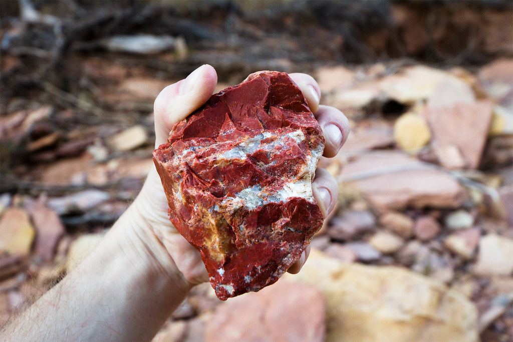
Heart of Stone by ashergrey, on Flickr
At one point I stopped in the sun to warm up and as I stood, quiet and unmoving, a very large raven came down to a nearby tree. They're noisy, crafty birds and will talk to humans even if we can't understand what they're saying.
[PARSEHTML]<audio controls><source src="http://dl.dropbox.com/u/3847512/Raven.mp3">Your browser does not support HTML5.</audio>[/PARSEHTML]Even this late in the season a hint of autumn color persisted.

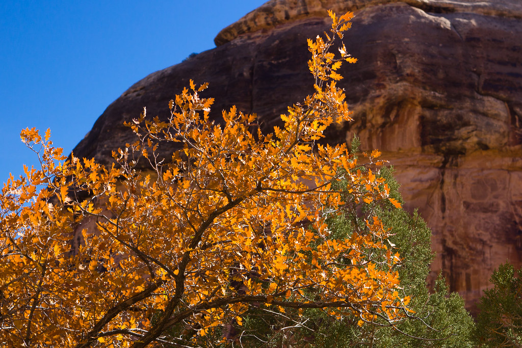
Clinging to Autumn by ashergrey, on Flickr
One thing that struck me about all of Lost Canyon is just how responsible trail users have been. The tracks are narrow and often times there are patches of deep, thick cryptobiotic soil within inches of where feet have fallen. This is in contrast to so many areas of southern Utah where tourists and cattle have trampled the ground.
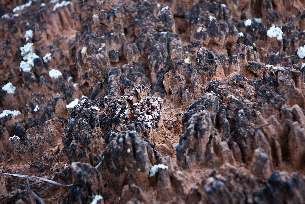
Crypto by ashergrey, on Flickr
Returning to camp, I broke down my gear and headed up the side canyon that leads out of Lost Canyon over to Squaw Canyon. This is the one spot in the trip where exposure became an (albeit brief) issue for me. The trail reaches a point where one has to step off a small platform and scramble up a pitched sandstone slab. The scramble is only up about five feet and there are a pair of toeholds chiseled into the rock. Handholds are scarce though and the drop below the slab is significant enough to be problematic.
This kind of thing wouldn't bother me had I not been laden down with a big pack on my back and camera on my chest, or if I'd not been alone. As it was, I had to stop and psych up a bit before dragging myself up the scramble.

This is looking back down at the slab. Not that bad in retrospect but exposure has a way of playing tricks on the brain.
The slickrock route between Lost and Squaw Canyons is very scenic. From the saddle between them, a hiker can look north-west up Squaw or north-east up Lost and get a sense of just what a maze the terrain creates.
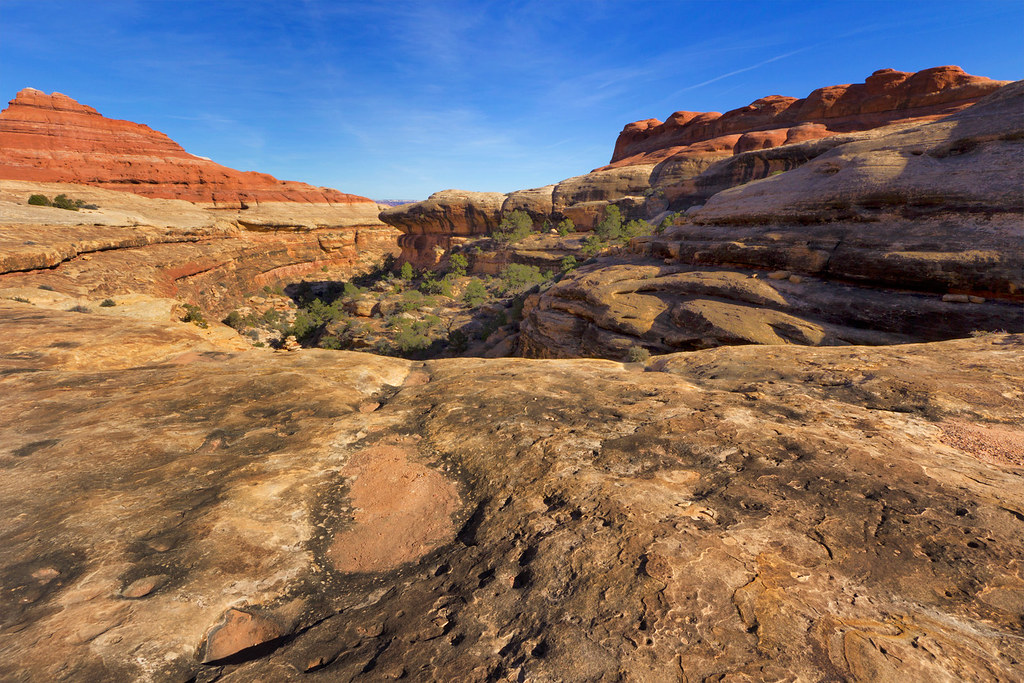
LC exit by ashergrey, on Flickr
Role Model by ashergrey, on Flickr
After leaving the barren rock, the trail drops down a series of little cascades as it descends on the Squaw side.

A funny thing happened as I headed toward SQ1. The trail, which is not particularly pretty once it reaches the wide canyon bottom, seemed to go on forever. The campsites in the Needles are marked with wooden posts that can be easy to miss if you're not looking… or even if you are. Checking my GPS at one point, I realized I'd passed SQ1 by a third of a mile.

From the point where I realized this, I was only half a mile from closing the lollipop and 1.6 miles from the trailhead.

Heading back to SQ1 would mean adding an unnecessary two-thirds of a mile on my already tired feet (.3 miles to the campsite and the same .3 miles back out the next morning). But returning to the trailhead would mean an earlier start on the second loop. What to do?

I went with the second option and kept on trudging on toward Squaw Flat. This ended up being the more photogenic choice as well.
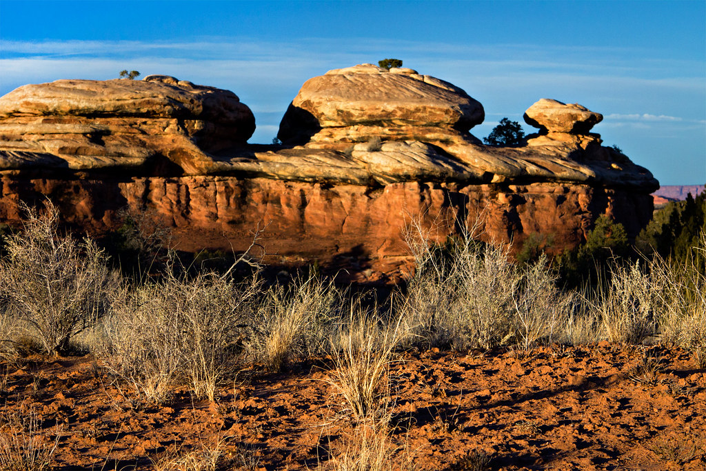
Flapjack Stack by ashergrey, on Flickr
Weeds by ashergrey, on Flickr
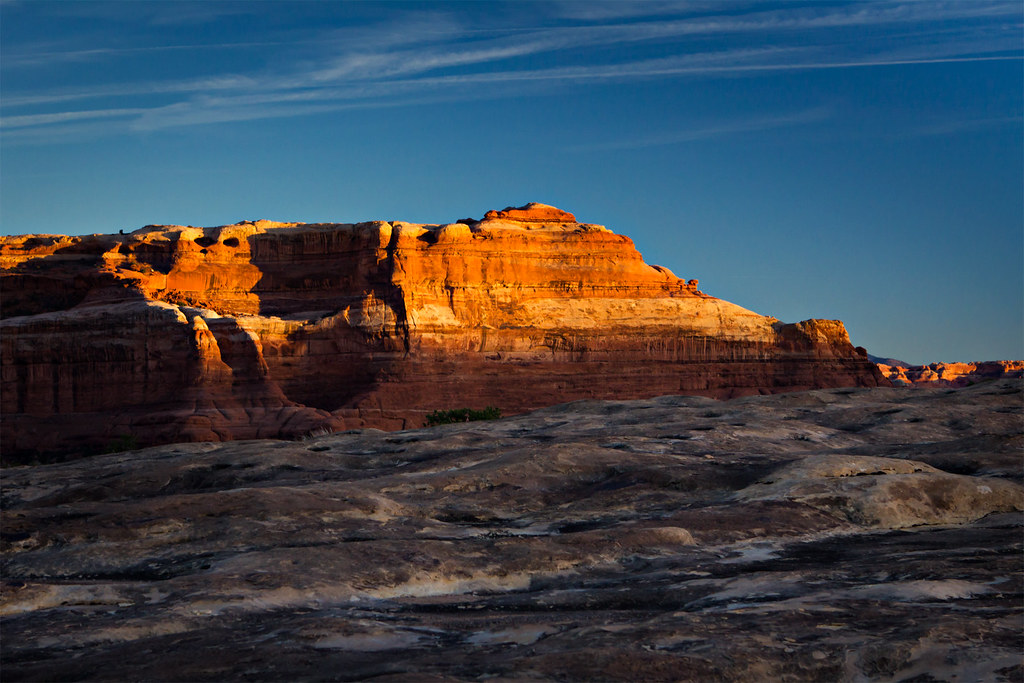
Looking Back by ashergrey, on Flickr
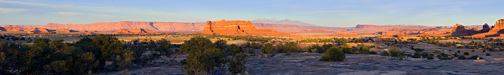
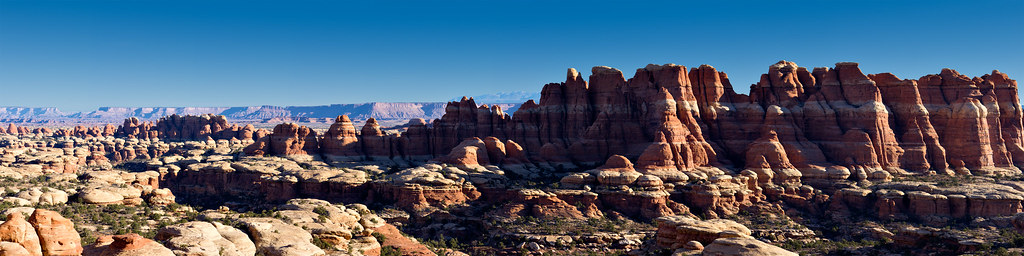
Squaw pano by ashergrey, on Flickr
Along the way back to the trailhead at dusk I saw the only people for all of day two: one couple and a solo woman. I chatted with the woman a bit. She'd come across from the Peekaboo Trail on a day hike and mentioned she envied me for backpacking it. If I had to guess I'd say she was in her late 30s or early 40s but she'd had both of her knees replaced. She explained that long day hikes are hard on her artificial joints. From what I could see she was still remarkably spry.

Night came on shortly after I arrived at the trailhead. I topped off my water and loaded into the wagon for the short drive over to Elephant Hill. Full dark had fallen by the time I arrived and though I'd intended to spend night two in a cold tent, I did indulge in the luxury of having the car's heat at my disposal. There were no other vehicles there which encouraged me as it meant the holiday weekend crowds had cleared out of Chesler Park… and no one would get mad at me for sleeping in my car.
As I made ready for bed, I noticed that my right achilles felt a bit sore, as if a blister were starting to form. This wasn't severe though so I put it out of mind. After rolling out my bag in the back of the Subaru I read for a bit and made it to bed around 8 p.m.
Scoop two: Elephant Canyon and Chelser Park
[PARSEHTML]<iframe src="http://www.mappingsupport.com/p/gmap4.php?q=http://dl.dropbox.com/u/3847512/GPS/Elephant_and_Chelser.kml&t=t4" frameborder="0" marginheight="0" scrolling="no" width="800" height="800"></iframe><br><br>[/PARSEHTML]
Getting out of bed on day three seemed a lot easier with heat on demand from the car. The sore tendon hadn't improved overnight and it screamed as I pulled my shoes, stiff with the overnight cold, back onto my feet. I still had to pile on the layers before setting off on the second leg of the two scoops trip. Rising out of the shadows and into the sun, I soon shed those layers to avoid losing too much moisture as sweat.
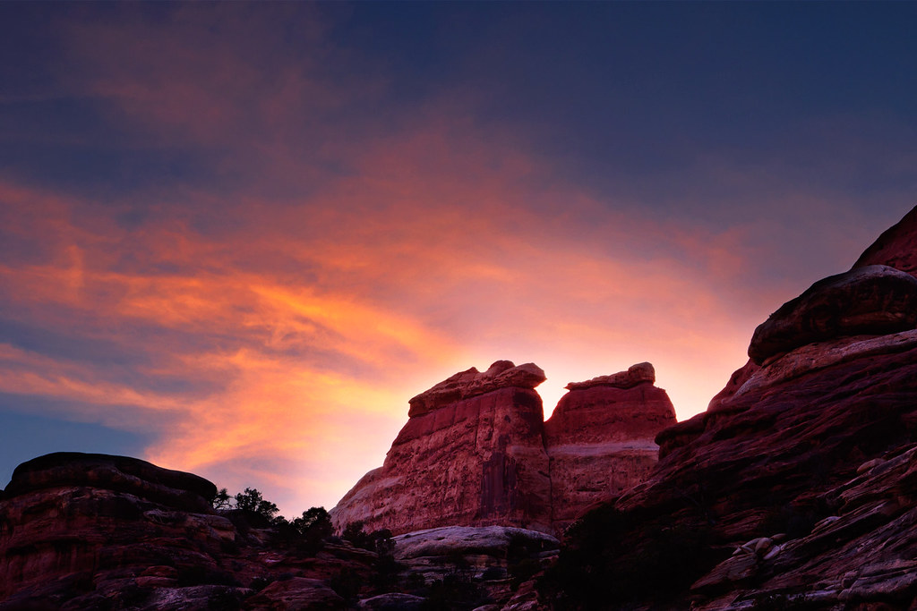
La Sal sunrise by ashergrey, on Flickr
Crack by ashergrey, on Flickr
The trail in Elephant Canyon is kind of odd. It wanders out of the wash bottom, rising on the west side of the canyon. This is nice in that it keeps hikers out of the sand, but it also adds a lot of unnecessary ups and downs to the walk. I ended up missing the marker for EC3 at first because I'd opted to just walk up the wash.
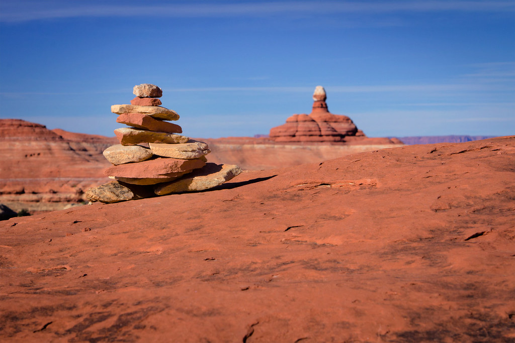
Cairn? by ashergrey, on Flickr
I dropped pack at EC3 and set up camp, then had lunch and read for a bit. My achilles had really started to throb so I slapped one of those blister-prevention bandaids across the trouble spot. It didn't do much to relieve the pain though. Ignoring the discomfort, I headed further up canyon to see Druid Arch.
The canyon narrows up past EC3 and there's a nice section where the trail takes you along a ledge above a big dryfall and pool. Upper Elephant Canyon would be a pretty amazing place to see flowing with water, though I'm not sure I'd really want to be in it at the time. There's one little dryfall that makes for a fun scramble up (and slide down) on the way to (and from) Druid Arch.

There's also a cool ladder/crossbar assist up some boulders.

The final obstacle to reaching Druid is a steep climb up a slope scattered with rocks.

The arch itself is oriented in such a way that as hikers come up the canyon, it appears to be just another pinnacle. It's not until viewed from the side that the pinnacle becomes an arch. And it's an awesome arch… no pictures I've seen (including my own) do it any justice. So many Utah arches have a "delicate" look to them. Druid does not. For a freestanding arch, it is incredibly imposing.
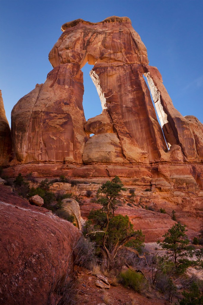
Druid Arch by ashergrey, on Flickr
But the declination of the sun at this time of year isn't flattering to Druid. Neither are the late afternoon hours, which backlight the arch. The best time to photograph Druid would be at sunrise, which would mean starting early in the predawn. Given the cold, that wasn't going to happen for me this trip.
I headed back to camp as it started to get dim. A raven monitoring my approach at one point sent a warning message, making a low looping pass over my head.
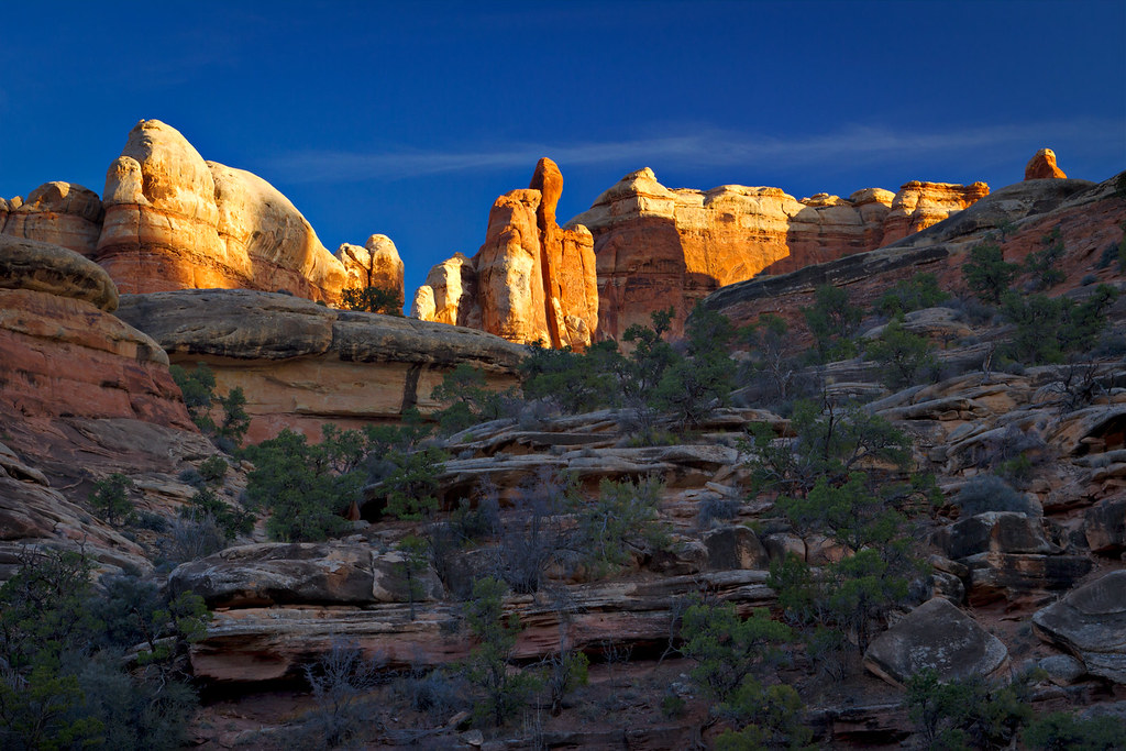
Upper EC by ashergrey, on Flickr

If you want to watch the sun set in the Needles, EC3 is a great place to do it. As I ate dinner I had to keep stopping to take shots. The light peaked over the space of about 15 minutes.
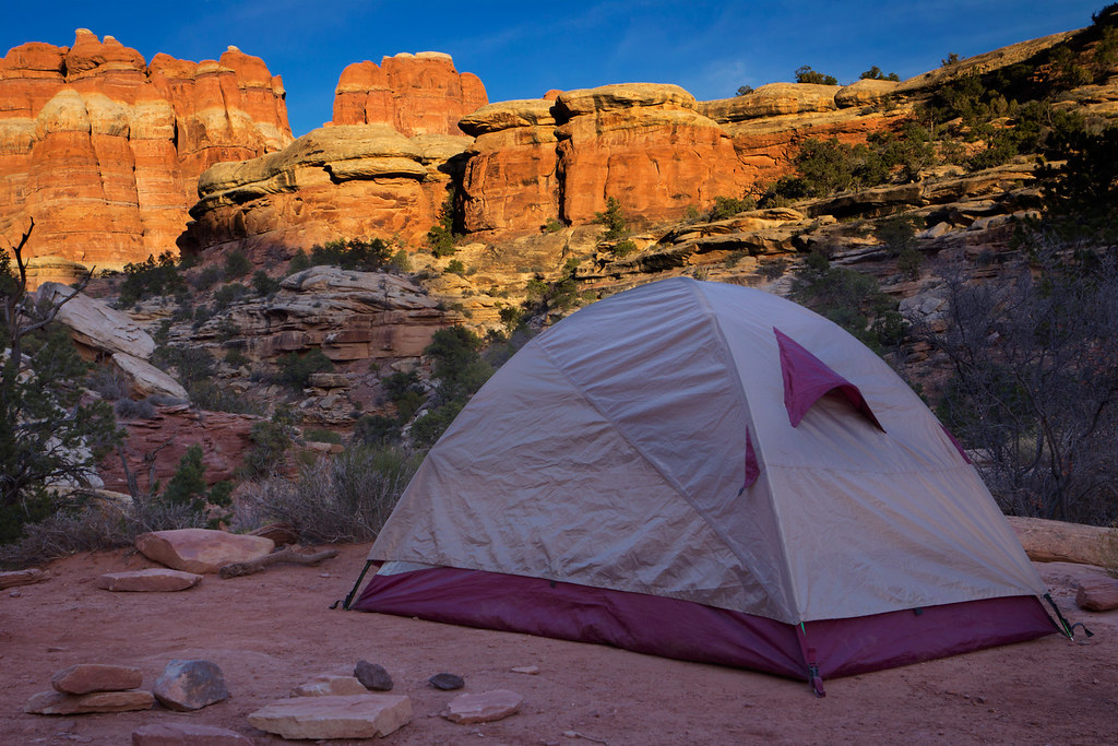
Tent by ashergrey, on Flickr
Last of the Afternoon by ashergrey, on Flickr
Skies for my trip had been clear, but there was just enough texture at the right time.
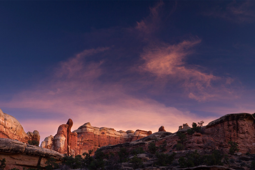
Dusk at EC3 by ashergrey, on Flickr
On day three I did not see a single other person. I cannot remember the last time I've gone an entire day without so much as a sight of another human being. I recorded my bed time as 7:30.
The night proved to be much colder this time around. While I was warm enough inside my bag, the air seemed to sting the only exposed section of my body: my face. I kept ducking down in the bag, keeping my head beneath the draft collar. This presented another problem though. Having not bathed or showered now in days, the warm sweaty stink inside the bag proved quite unpleasant.
With these two competing factors forcing me awake around 4 a.m., I put on some music and impatiently awaited the morning. By about 6 I couldn't take the boredom anymore and decided to dress and break camp. My shoes were again frozen stiff. The pain in my right achilles became significant as I pulled them on and I at last admitted to myself it was not a blister. Soreness hobbled me a bit, causing a slight limp until I really started moving and stretched out the tendon.
My tent was rimed with ice, as were the poles. My hands would go numb when exposed to the air so I kept pulling them out of my gloves to load gear, then shoving them back in to warm. As the sunlight at last began to peek over top of the canyon walls, I set off for day four.

I dubbed this the "desert assassin" look. It will become a fashion rage, no doubt.
EC3 Sunrise by ashergrey, on Flickr
The crossover between Elephant Canyon and Chesler Park proved to be my favorite section of trail on the trip. I'd highly recommend people day hiking either area to make the diversion. I didn't take many photos here though because the cold kept me moving.
Crossover by ashergrey, on Flickr
The breakout into Chelser Park comes as a surprise. The entire area was silent and still. After being enclosed in canyons, the long sight lines were a welcome change of pace.

Gunsight Butte and Mount Pennell by ashergrey, on Flickr
When I hit the intersection with the Chesler Park loop I faced a choice. My first thought had been to hoof it clockwise around the loop, chewing up time and getting through the Joint Trail. But the soreness of my leg continued to hound. I told myself I'd go over to my campsite at CP1 and see how I felt before deciding what to do.
Exiting Chesler Park by ashergrey, on Flickr
By the time I reached CP1, I'd all but made up my mind. The severe cold of the previous night, along with the pain in my leg, convinced me to scrap plans for night four and day five. This meant skipping the Joint Trail and heading straight back out to the trailhead.
On the way out, I saw one older couple and the lady with the replaced knees. She and I chatted a bit more about our respective itineraries. She was headed to the Joint Trail to relive her rock climbing days. I told her a bit about Druid Arch and encouraged her to get out that way if the opportunity presented itself. There were only two other vehicles at Elephant Hill when I made it back to my car… so it appears I'd had the entire section of the park to myself for that brief time. Pretty awesome.

I stopped in at the visitor's center on my way out to let the rangers know I wouldn't be in CP1 Tuesday night after all. They had recorded the overnight low temperature the night previous at 19 ºF. I decided that's about as close as I'd like to get to my bag's 15 ºF rating. The ranger at the desk also told me there had been about 500 people through on Saturday (when I arrived). By Monday that number had dropped to about 40. On Tuesday, the day I left, I was only the 7th person through the visitor's center.

Featured image for home page:

My goals included testing the lower limits of my 15 ºF sleeping back and seeing how I'd mentally hold up through an extended period solo. A series of factors modified the trip, cutting off a night and a day and turning my long loop into two shorter excursions. I did achieve the first goal and partly achieved the second.
Overbaked by ashergrey, on Flickr
My plans didn't coalesce until less than two weeks before the 24th of November, meaning I did not have reservations for any of the requisite campsites. With that in mind, I set off from Salt Lake early on the morning of the 24th with the intention of reaching the Needles District visitor's center well before noon. Unfortunately, by the time I arrived both the CP1 and EC3 campsites (my preferred sites for Saturday night) were taken. CP1 was also occupied the next night.
The availability of filterable water was also in question, so on the fly I decided to split the trip in half, turning my one loop into two. For the first night I'd head the opposite direction, up Lost Canyon to LC3. The following day I could cross over to Squaw Canyon and spend a night at SQ1. On the third day, I'd hike out to the Squaw Flat trailhead then drive over to Elephant Hill and launch out again for another two nights, the first at EC3 and the second at CP1.
I've heard people call the Lost/Squaw trail a "lollipop loop". Doing two loop hikes back to back, I dubbed this itinerary the "two scoops" variation.
First, Lost and Squaw.
[PARSEHTML]<iframe src="http://www.mappingsupport.com/p/gmap4.php?q=http://dl.dropbox.com/u/3847512/GPS/Lost_and_Squaw.kml&t=t4" frameborder="0" marginheight="0" scrolling="no" width="800" height="800"></iframe><br><br>[/PARSEHTML]The short winter days meant that the sun already seemed too far overhead by the time I hit the trail (roughly 11:30 a.m.).
Still, I had solitude and scenery. Temperatures were warm enough to warrant pants and a short-sleeve shirt. I made it into Lost Canyon quickly.
Lost Canyon ladder by ashergrey, on Flickr
I'd read about some mild exposure on the Lost Canyon loop but couldn't really gauge the severity of it from other people's brief posts. Reasonable or not, I tend to be more sensitive to exposure situations when I'm solo and when I'm loaded down with a full pack. The first taste of exposure comes just after the ladder as you traverse a ledge under an overhang. Looking back, no sweat.
It's easy to understand Lost Canyon's name when you reach the canyon floor. Unlike some of the other trails in the Needles, the LC trail is constantly intersected by short side canyons. Anyone unfamiliar with the terrain or basic route-finding could run into trouble if they strayed too far from the trail.
On the way to LC3 I passed only two people, a couple headed the opposite direction. LC3 is a nice sandy spot under some trees, set off the trail about 25 yards. I pitched camp here and had lunch.
With some sunlight to burn, I headed back into the canyon and moved off trail up the drainage to reconnoiter a bit. The wash is wide and rocky. The sandy patches were surprisingly firm, having remained frozen throughout the day. There were no other footprints in the wash, telling me it had been some time since anyone wandered that direction.
I headed back to camp at dusk. The stars were twinkling half an hour later so I set up for some camera work. A big waxing gibbous moon dimmed the stars, but also bathed the landscape in soft light.
Moonlit tree by ashergrey, on Flickr
The dark and cold, along with a lack of fire or company, caused me to retreat to my sleeping bag early. I was able to drop off to sleep by about 7 p.m. and managed to stay down nearly 12 hours, thanks no doubt to my early rise that morning.
When I awoke on Sunday the dry air bore a bitter cold tinge. Layers came out of my pack.
Breakfast at LC3 by ashergrey, on Flickr
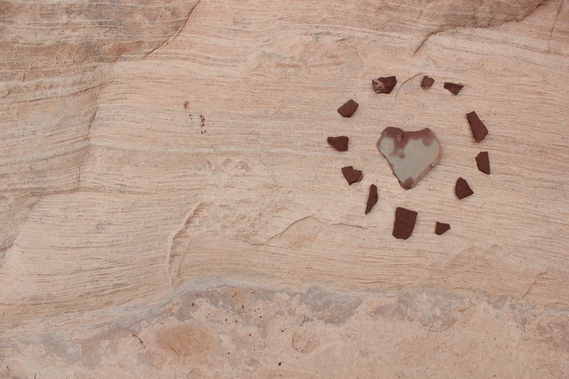
With plenty of time to kill before breaking camp, I decided to further my exploring in upper Lost Canyon. That's generally where I stumbled across these little relics.
Potsherd and Flint by ashergrey, on Flickr
They were set like this and probably have been for much longer than I've been on the planet. Needless to say, they're still there now.
Even where mankind has not made an impact, we can't help but see ourselves.
Stonefaced by ashergrey, on Flickr
The stone in the wash bottom of upper Lost Canyon is pretty uninteresting and homogenous from what I could see, with a few exceptions. I always seem to find interesting rocks in and around Capitol Reef but this rivals anything I've come across elsewhere. The color and shape reminded me of a certain human organ.
Heart of Stone by ashergrey, on Flickr
At one point I stopped in the sun to warm up and as I stood, quiet and unmoving, a very large raven came down to a nearby tree. They're noisy, crafty birds and will talk to humans even if we can't understand what they're saying.
[PARSEHTML]<audio controls><source src="http://dl.dropbox.com/u/3847512/Raven.mp3">Your browser does not support HTML5.</audio>[/PARSEHTML]Even this late in the season a hint of autumn color persisted.
Clinging to Autumn by ashergrey, on Flickr
One thing that struck me about all of Lost Canyon is just how responsible trail users have been. The tracks are narrow and often times there are patches of deep, thick cryptobiotic soil within inches of where feet have fallen. This is in contrast to so many areas of southern Utah where tourists and cattle have trampled the ground.
Crypto by ashergrey, on Flickr
Returning to camp, I broke down my gear and headed up the side canyon that leads out of Lost Canyon over to Squaw Canyon. This is the one spot in the trip where exposure became an (albeit brief) issue for me. The trail reaches a point where one has to step off a small platform and scramble up a pitched sandstone slab. The scramble is only up about five feet and there are a pair of toeholds chiseled into the rock. Handholds are scarce though and the drop below the slab is significant enough to be problematic.
This kind of thing wouldn't bother me had I not been laden down with a big pack on my back and camera on my chest, or if I'd not been alone. As it was, I had to stop and psych up a bit before dragging myself up the scramble.
This is looking back down at the slab. Not that bad in retrospect but exposure has a way of playing tricks on the brain.
The slickrock route between Lost and Squaw Canyons is very scenic. From the saddle between them, a hiker can look north-west up Squaw or north-east up Lost and get a sense of just what a maze the terrain creates.
LC exit by ashergrey, on Flickr
Role Model by ashergrey, on Flickr
After leaving the barren rock, the trail drops down a series of little cascades as it descends on the Squaw side.
A funny thing happened as I headed toward SQ1. The trail, which is not particularly pretty once it reaches the wide canyon bottom, seemed to go on forever. The campsites in the Needles are marked with wooden posts that can be easy to miss if you're not looking… or even if you are. Checking my GPS at one point, I realized I'd passed SQ1 by a third of a mile.
From the point where I realized this, I was only half a mile from closing the lollipop and 1.6 miles from the trailhead.
Heading back to SQ1 would mean adding an unnecessary two-thirds of a mile on my already tired feet (.3 miles to the campsite and the same .3 miles back out the next morning). But returning to the trailhead would mean an earlier start on the second loop. What to do?
I went with the second option and kept on trudging on toward Squaw Flat. This ended up being the more photogenic choice as well.
Flapjack Stack by ashergrey, on Flickr
Weeds by ashergrey, on Flickr
Looking Back by ashergrey, on Flickr
Squaw pano by ashergrey, on Flickr
Along the way back to the trailhead at dusk I saw the only people for all of day two: one couple and a solo woman. I chatted with the woman a bit. She'd come across from the Peekaboo Trail on a day hike and mentioned she envied me for backpacking it. If I had to guess I'd say she was in her late 30s or early 40s but she'd had both of her knees replaced. She explained that long day hikes are hard on her artificial joints. From what I could see she was still remarkably spry.
Night came on shortly after I arrived at the trailhead. I topped off my water and loaded into the wagon for the short drive over to Elephant Hill. Full dark had fallen by the time I arrived and though I'd intended to spend night two in a cold tent, I did indulge in the luxury of having the car's heat at my disposal. There were no other vehicles there which encouraged me as it meant the holiday weekend crowds had cleared out of Chesler Park… and no one would get mad at me for sleeping in my car.
As I made ready for bed, I noticed that my right achilles felt a bit sore, as if a blister were starting to form. This wasn't severe though so I put it out of mind. After rolling out my bag in the back of the Subaru I read for a bit and made it to bed around 8 p.m.
Scoop two: Elephant Canyon and Chelser Park
[PARSEHTML]<iframe src="http://www.mappingsupport.com/p/gmap4.php?q=http://dl.dropbox.com/u/3847512/GPS/Elephant_and_Chelser.kml&t=t4" frameborder="0" marginheight="0" scrolling="no" width="800" height="800"></iframe><br><br>[/PARSEHTML]
Getting out of bed on day three seemed a lot easier with heat on demand from the car. The sore tendon hadn't improved overnight and it screamed as I pulled my shoes, stiff with the overnight cold, back onto my feet. I still had to pile on the layers before setting off on the second leg of the two scoops trip. Rising out of the shadows and into the sun, I soon shed those layers to avoid losing too much moisture as sweat.
La Sal sunrise by ashergrey, on Flickr
Crack by ashergrey, on Flickr
The trail in Elephant Canyon is kind of odd. It wanders out of the wash bottom, rising on the west side of the canyon. This is nice in that it keeps hikers out of the sand, but it also adds a lot of unnecessary ups and downs to the walk. I ended up missing the marker for EC3 at first because I'd opted to just walk up the wash.
Cairn? by ashergrey, on Flickr
I dropped pack at EC3 and set up camp, then had lunch and read for a bit. My achilles had really started to throb so I slapped one of those blister-prevention bandaids across the trouble spot. It didn't do much to relieve the pain though. Ignoring the discomfort, I headed further up canyon to see Druid Arch.
The canyon narrows up past EC3 and there's a nice section where the trail takes you along a ledge above a big dryfall and pool. Upper Elephant Canyon would be a pretty amazing place to see flowing with water, though I'm not sure I'd really want to be in it at the time. There's one little dryfall that makes for a fun scramble up (and slide down) on the way to (and from) Druid Arch.
There's also a cool ladder/crossbar assist up some boulders.
The final obstacle to reaching Druid is a steep climb up a slope scattered with rocks.
The arch itself is oriented in such a way that as hikers come up the canyon, it appears to be just another pinnacle. It's not until viewed from the side that the pinnacle becomes an arch. And it's an awesome arch… no pictures I've seen (including my own) do it any justice. So many Utah arches have a "delicate" look to them. Druid does not. For a freestanding arch, it is incredibly imposing.
Druid Arch by ashergrey, on Flickr
But the declination of the sun at this time of year isn't flattering to Druid. Neither are the late afternoon hours, which backlight the arch. The best time to photograph Druid would be at sunrise, which would mean starting early in the predawn. Given the cold, that wasn't going to happen for me this trip.
I headed back to camp as it started to get dim. A raven monitoring my approach at one point sent a warning message, making a low looping pass over my head.
Upper EC by ashergrey, on Flickr
If you want to watch the sun set in the Needles, EC3 is a great place to do it. As I ate dinner I had to keep stopping to take shots. The light peaked over the space of about 15 minutes.
Tent by ashergrey, on Flickr
Last of the Afternoon by ashergrey, on Flickr
Skies for my trip had been clear, but there was just enough texture at the right time.
Dusk at EC3 by ashergrey, on Flickr
On day three I did not see a single other person. I cannot remember the last time I've gone an entire day without so much as a sight of another human being. I recorded my bed time as 7:30.
The night proved to be much colder this time around. While I was warm enough inside my bag, the air seemed to sting the only exposed section of my body: my face. I kept ducking down in the bag, keeping my head beneath the draft collar. This presented another problem though. Having not bathed or showered now in days, the warm sweaty stink inside the bag proved quite unpleasant.
With these two competing factors forcing me awake around 4 a.m., I put on some music and impatiently awaited the morning. By about 6 I couldn't take the boredom anymore and decided to dress and break camp. My shoes were again frozen stiff. The pain in my right achilles became significant as I pulled them on and I at last admitted to myself it was not a blister. Soreness hobbled me a bit, causing a slight limp until I really started moving and stretched out the tendon.
My tent was rimed with ice, as were the poles. My hands would go numb when exposed to the air so I kept pulling them out of my gloves to load gear, then shoving them back in to warm. As the sunlight at last began to peek over top of the canyon walls, I set off for day four.
I dubbed this the "desert assassin" look. It will become a fashion rage, no doubt.
EC3 Sunrise by ashergrey, on Flickr
The crossover between Elephant Canyon and Chesler Park proved to be my favorite section of trail on the trip. I'd highly recommend people day hiking either area to make the diversion. I didn't take many photos here though because the cold kept me moving.
Crossover by ashergrey, on Flickr
The breakout into Chelser Park comes as a surprise. The entire area was silent and still. After being enclosed in canyons, the long sight lines were a welcome change of pace.
Gunsight Butte and Mount Pennell by ashergrey, on Flickr
When I hit the intersection with the Chesler Park loop I faced a choice. My first thought had been to hoof it clockwise around the loop, chewing up time and getting through the Joint Trail. But the soreness of my leg continued to hound. I told myself I'd go over to my campsite at CP1 and see how I felt before deciding what to do.
Exiting Chesler Park by ashergrey, on Flickr
By the time I reached CP1, I'd all but made up my mind. The severe cold of the previous night, along with the pain in my leg, convinced me to scrap plans for night four and day five. This meant skipping the Joint Trail and heading straight back out to the trailhead.
On the way out, I saw one older couple and the lady with the replaced knees. She and I chatted a bit more about our respective itineraries. She was headed to the Joint Trail to relive her rock climbing days. I told her a bit about Druid Arch and encouraged her to get out that way if the opportunity presented itself. There were only two other vehicles at Elephant Hill when I made it back to my car… so it appears I'd had the entire section of the park to myself for that brief time. Pretty awesome.
I stopped in at the visitor's center on my way out to let the rangers know I wouldn't be in CP1 Tuesday night after all. They had recorded the overnight low temperature the night previous at 19 ºF. I decided that's about as close as I'd like to get to my bag's 15 ºF rating. The ranger at the desk also told me there had been about 500 people through on Saturday (when I arrived). By Monday that number had dropped to about 40. On Tuesday, the day I left, I was only the 7th person through the visitor's center.
Featured image for home page: