- Joined
- Jul 23, 2013
- Messages
- 1,666
At the beginning of the 2020, I had made my usual set of plans for various trips to aim for throughout the year. Then March happened. With the exception a quick little overnight trip up on Southern Utah's Boulder Mountain a couple months later over Memorial Day weekend with my wife and older daughters, it wouldn't be until late July that I would get out again for some real wilderness wandering.
Due to numerous uncertainties the great pandemic had brought upon society, my usual work schedule had been shifted around. Fortunately, I was one of the lucky ones to not have suffered any setbacks in hours. However, due to not knowing if any co-workers would find themselves needing to take any quarantine measures, I didn't dare try to ask for vacation time for a while, for fear of leaving the rest of our department extra short-handed. Instead...Most of the spring and early summer, when not at work, had been spent staying at home, rebuilding our vegetable garden beds and then building a new playhouse for my kids.
By late July, things had settled back into a better routine with work and I finally felt comfortable with where things were at to go away with my family for the better part of the week. We wisely chose to go up to Jess's family cabin on the north slopes of the Uintas. Having that cabin proved to be far more fortunate than it ever had after seeing how unbelievably busy the Mirror Lake Highway corridor was with all the Covid campers and crowds sprawled out everywhere.
Plans were for Jess to bring me back up the road the following day and drop me off at the Highline Trailhead where I would attempt to loop Middle Basin and Naturalist Basin together over 3 days, 2 nights.
Thursday - July 23, 2020
It was a bluebird morning and I felt like I was biting at the bit, an anxious horse let out of the gates as I step out of the car, slung on my pack, and bid adieux to my family. They would go back to the cabin for some more leisure time. I would go on to engage myself with some slightly more strenuous activity.
It didn't take long for me to start feeling a bit winded. Due to the already aforementioned circumstances, I had not done well to keep my aerobic fitness up for the several months leading up to this trip and my lungs were now paying a bit of a price. I made the smart decision to forgo climbing up and over the pass into Middle Basin as I had originally sought to do and decided to take the more level and easier going route out and up into Naturalist Basin.
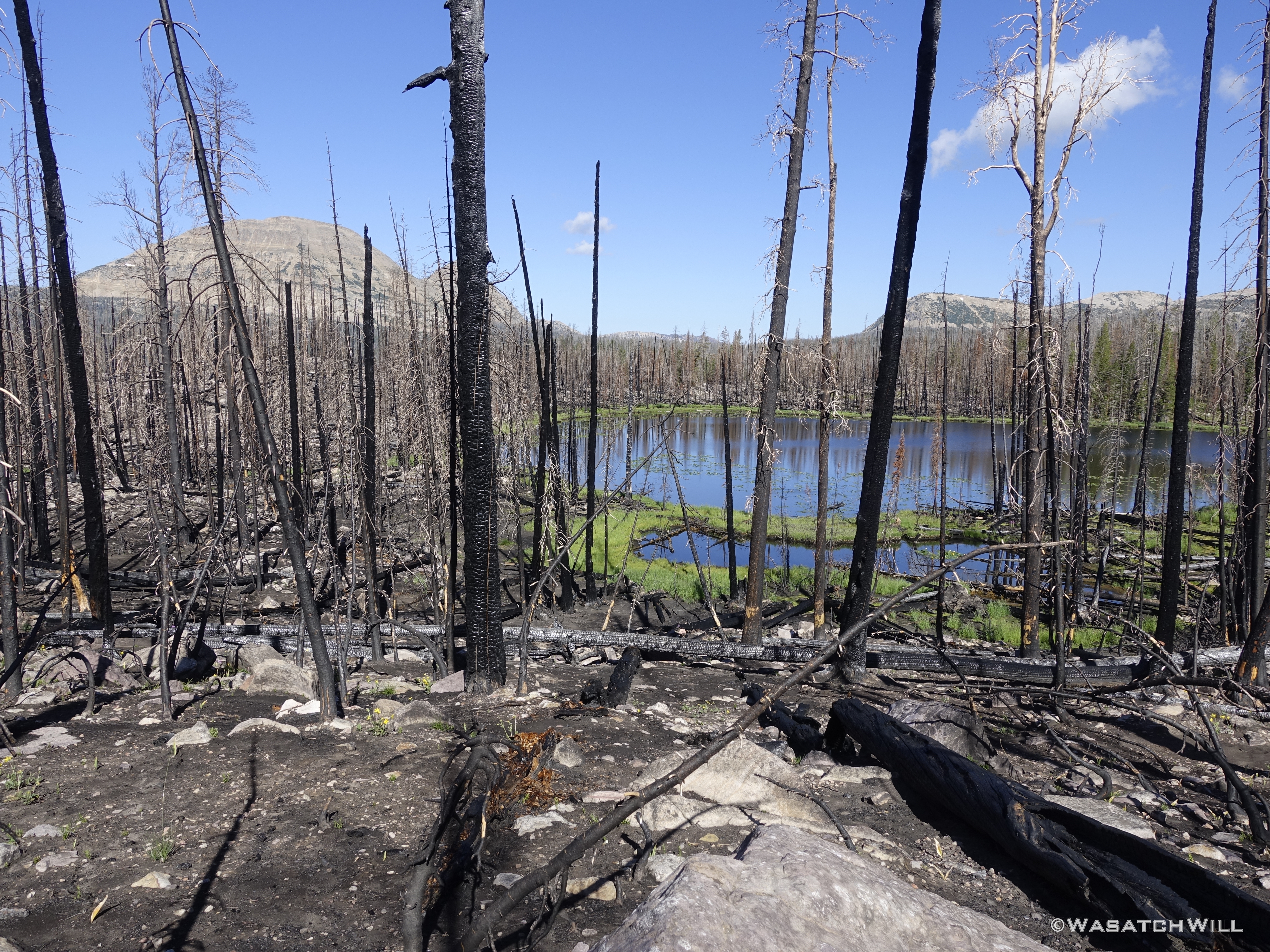
I hadn't been back up.in the Murdoch Basin since before the big fire that tore through the area in 2018, so for me, it was like stepping into a whole different and somewhat desolate world when I found myself in the burn scar. It was only fitting that some of the only living flora growing around was lots of Fireweed flowers in the area of Scudder Lake.
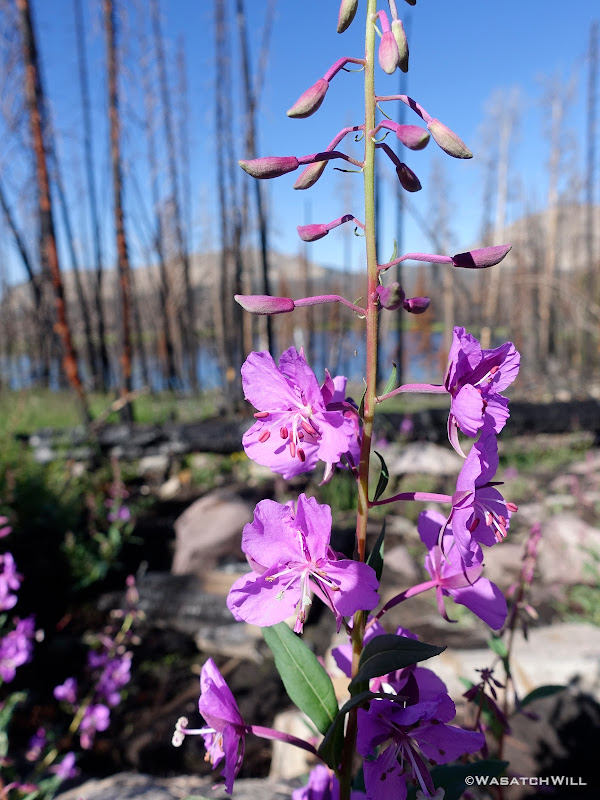
Fireweed
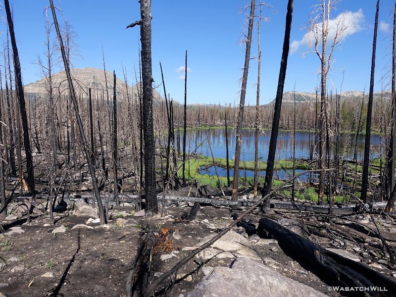
Scudder Lake within the Murdoch Basin fire scar
Rather than take the more established, designated and high-traffic trail into Naturalist Basin, I chose to bypass the junction for pursue what I had hoped would be a more scenic backway in. To do so would require progressing further on to Pigeon Milk Spring, where I'd take a lunch break and wait out a bit of weather before before going on as if to hike up over Rocky Sea Pass.
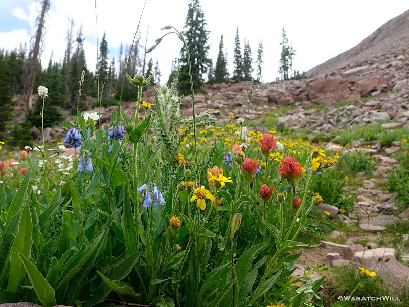
Wildflowers at the base of Rocky Sea Pass
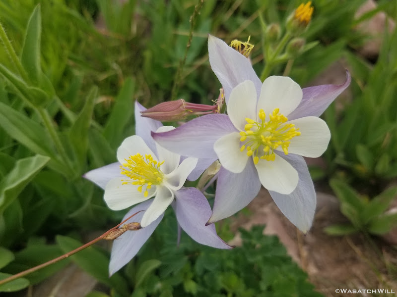
Columbine

Briefly heading up the lower half of Rocky Sea Pass
Elephant Head flower stalk
However, about half-way up the pass, I would say goodbye to the trail for the rest of the day. A group of other backpackers who had just passed me by would stay faithful to the trail. They were on a quest to finish off the length of the Highline Trail, hiking eastbound to Chapeta Lake. They had already hiked the eastern most section, from the eastern terminus on US 191 and went westbound to Chapeta Lake.
As for me, I set my bearing along a cross-country route into Naturalist Basin through a side I had been wanting to do more exploring and scout out possibilities for linking up some more creative routes for a future time.
Vacating the Highline Trail for some cross-country exploration
More wildflowers
Indian Paintbrush
Mount Agassiz in the distance
Overlooking a marshy meadow
Hyatt Lake
Having passed by Hyatt Lake, I began to look around for a suitable camp. In doing so, a small parade of elk (about two does and two fawns) pushed on to an upper bench in the distance. I did find a spot that would do well enough, however, with lots of daylight to spare and having seen no fish activity at nearby Hyatt Lake, I decided that I wanted to push on a little further to the next bench up and see what I could find up there.
It wouldn't be as soon as I had hoped though as a nice little storm cell came flying in. Rather than expose myself out in some open meadows I was going to travel through, I threw up my tent and tucked down into some trees and took a little siesta while waiting for it to clear back out.
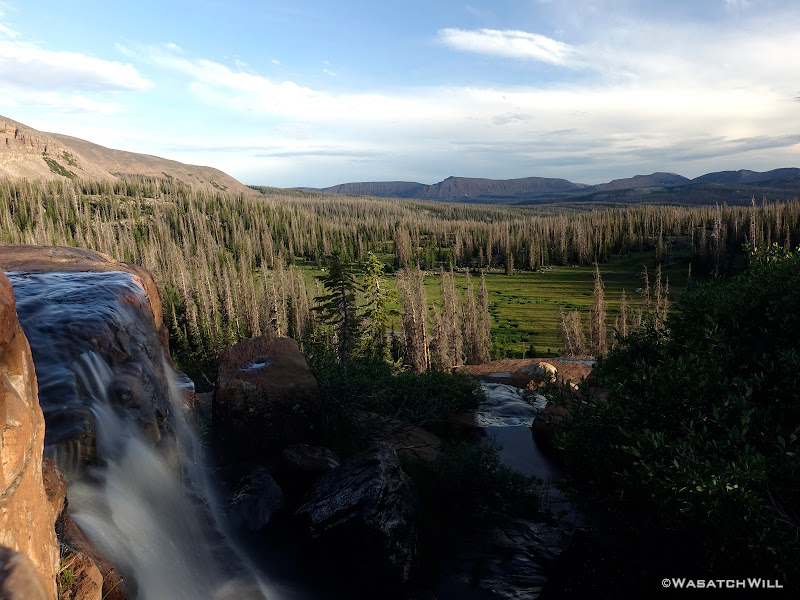
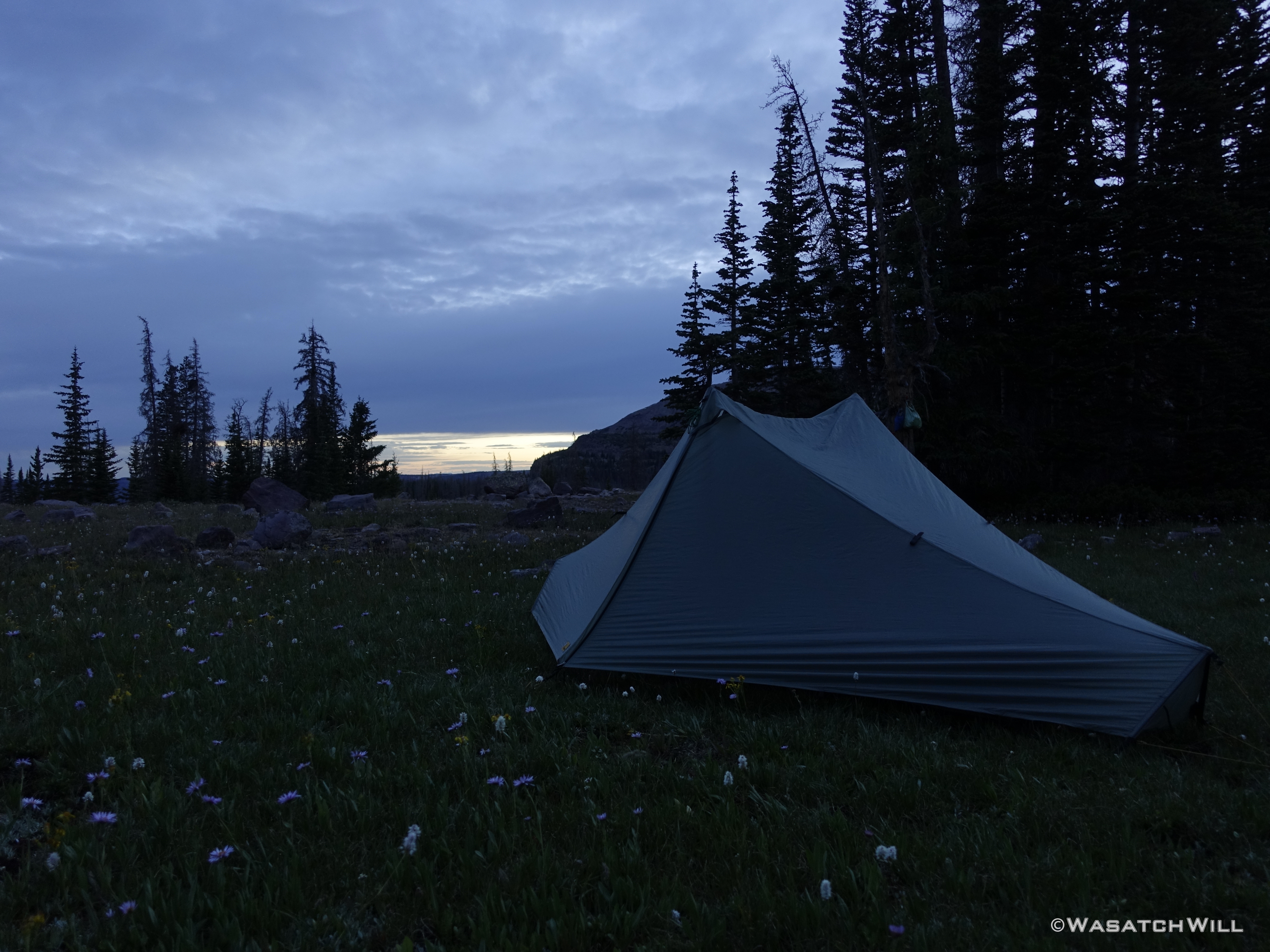
Not quite two hours later, blue skies opened up again and I continued on a few hundred more yards to what I thought was an even more prime spot to call home for the evening, at the edge of some trees alongside a big open meadow.

Camp, Day #1
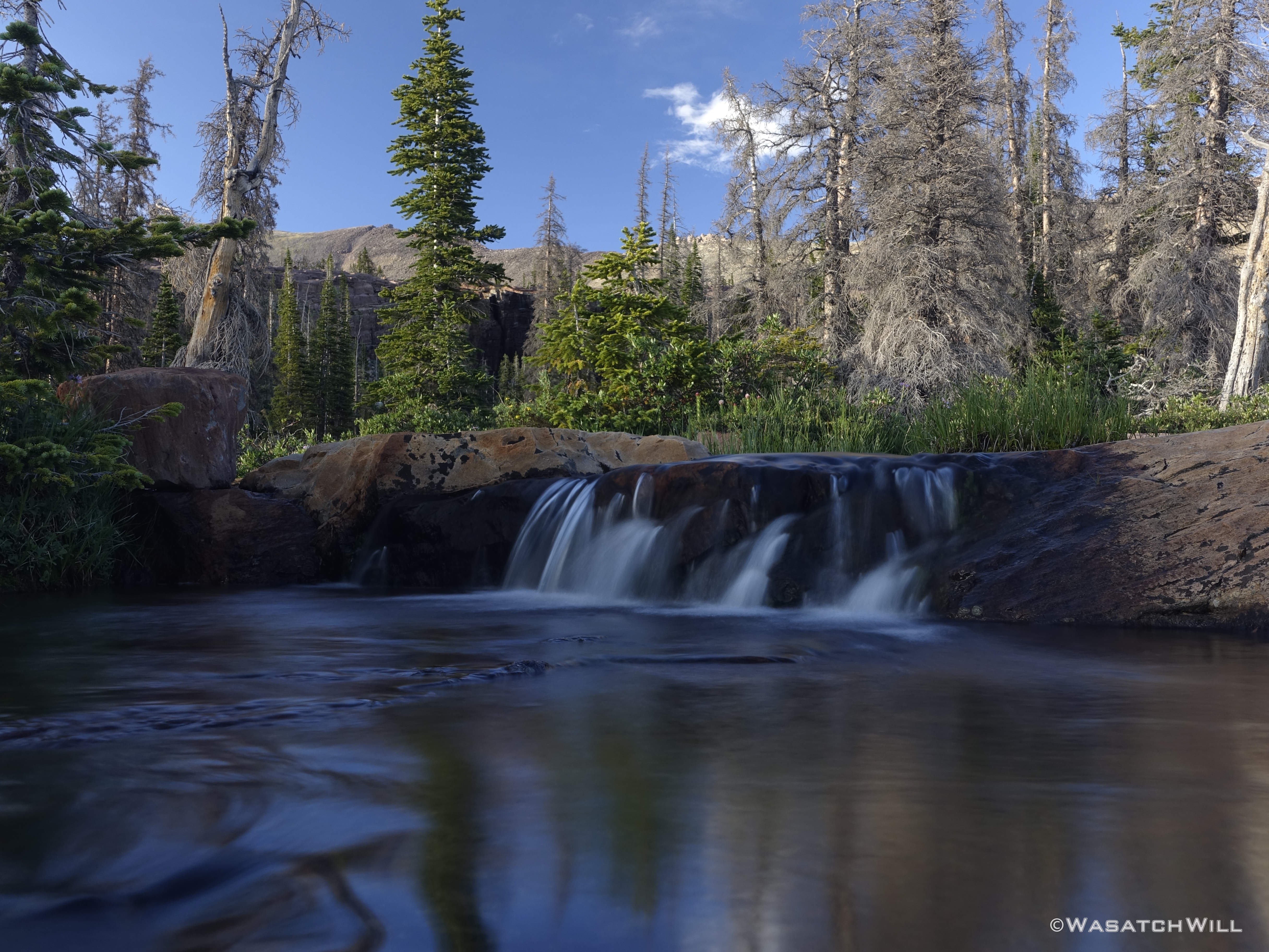
With camp all set up and dinner now eaten, I decided to use the last couple hours of light to wander cross-country some more over to Jordan Lake about a half mile away and to see how crowded it was and see if I could find a good spot available to do some fishing. Along the way, I'd enjoy views of the abundant waterfalls along the bench above me as well as those dropping off the bench I was on myself.
Waterfall
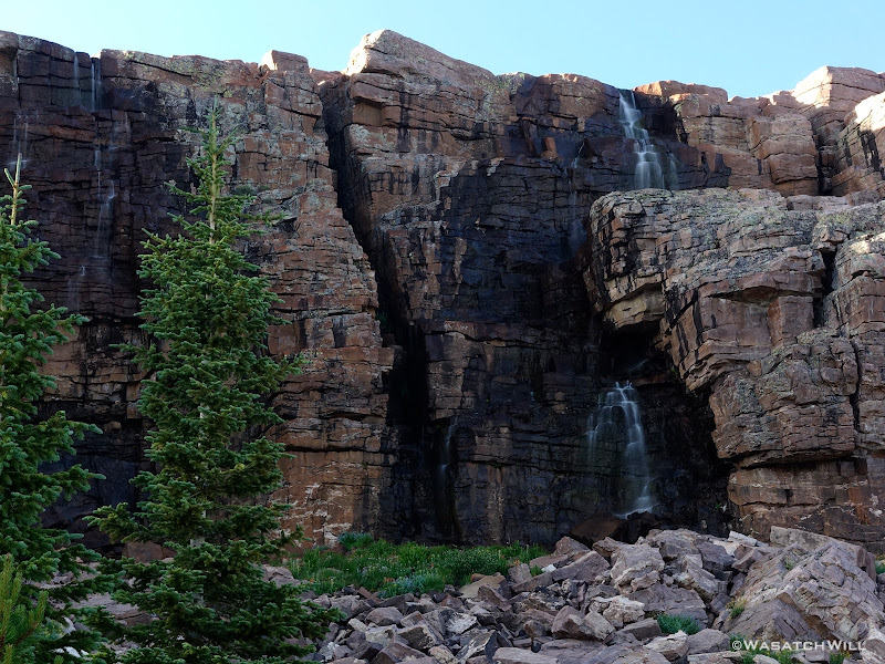
Waterfall closer-up
Above a waterfall overlooking the Duchesne drainage
A high mountain creek
Once I arrived at Jordan Lake, it indeed looked there was a good share of campers scattered around the shorelines with the usual campsites all occupied. To my pleasant surprise though, there wasn't really anyone actually along the shore doing any fishing themselves. I took the liberty to pop down off the bench above from where I was and found a nice little set of rocks from which to set up on.
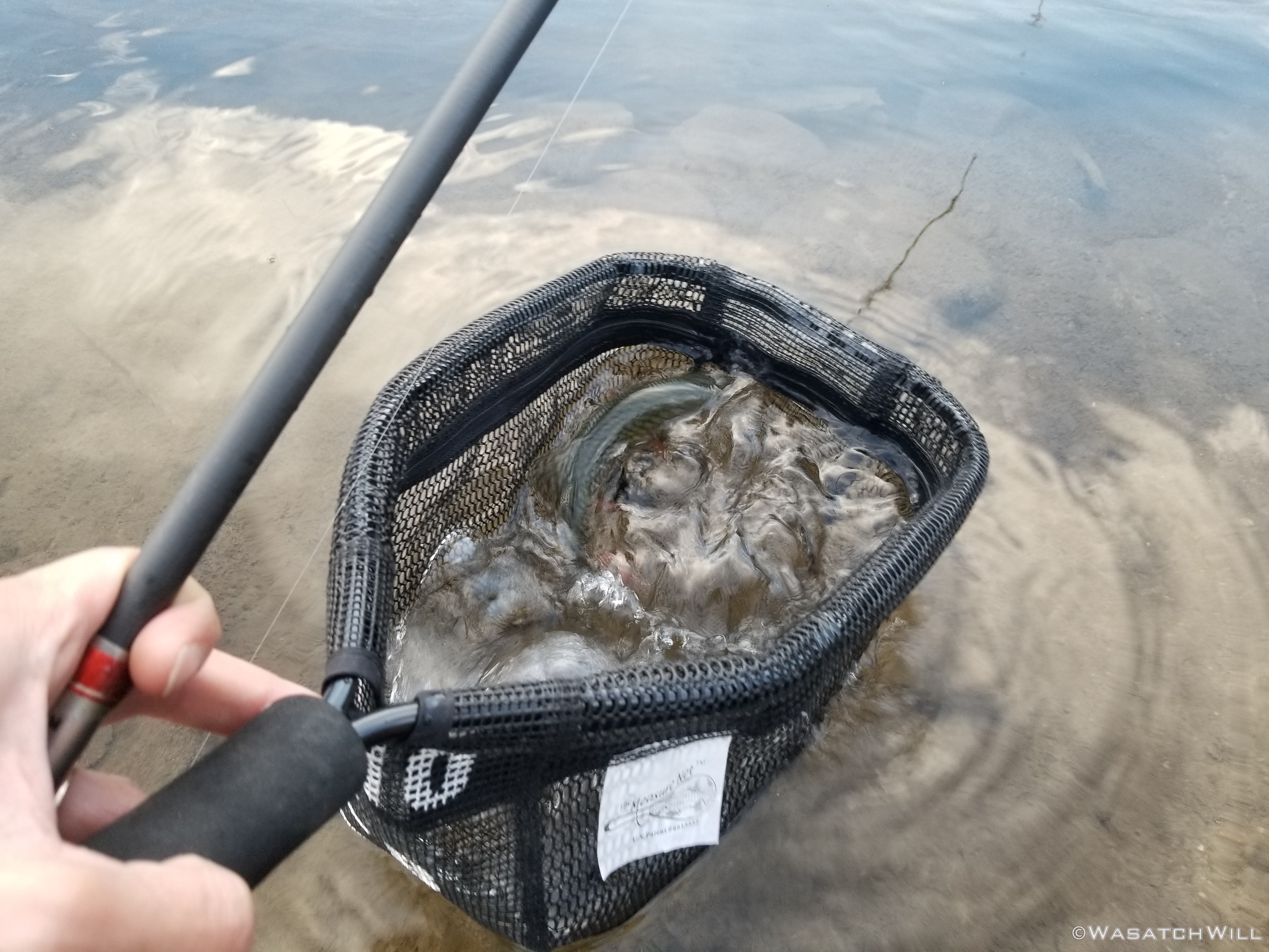
I didn't expect to get much action though as I figured this lake received a lot of pressure and I only had about a half hour to do much before I wanted to get going back to my camp. Amazingly, I was able to reel in a few fish. I would have netted more, but it was my first time going barbless and that took some adjustments to get a feel for the right tension to keep on my line. Needless to say, I had a couple more than normal get away from me.
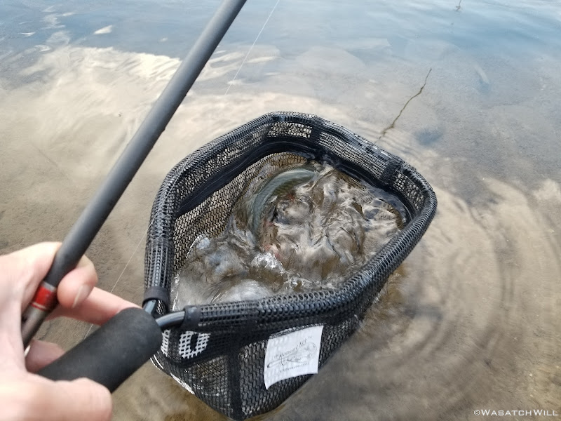
Netting a fish at Jordan Lake
Not wanting to overstay my welcome, and more importantly, not wanting to arrive back at my camp before it was too dark, I picked up my gear and made the brief sojourn back.
Back at Camp
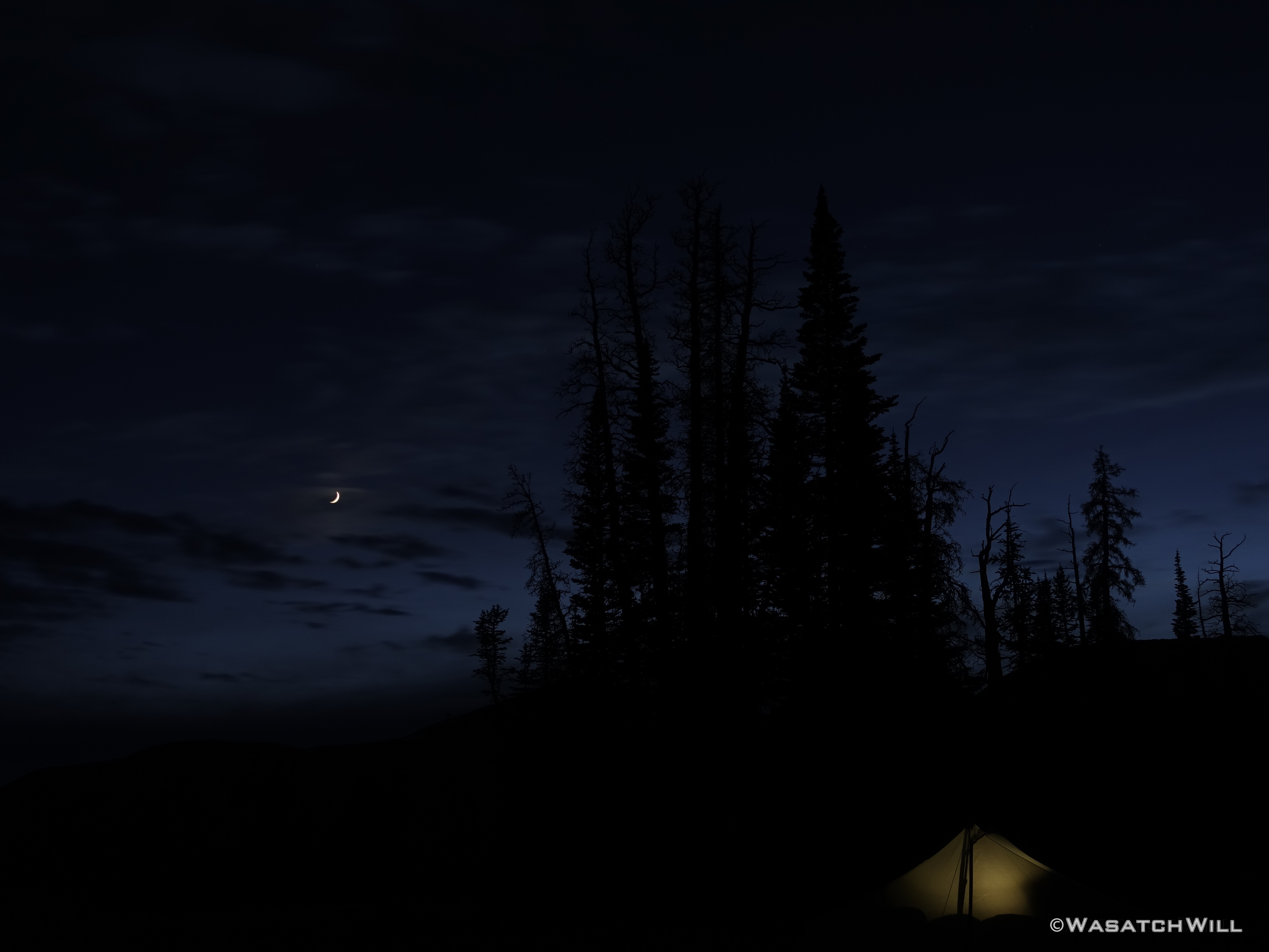
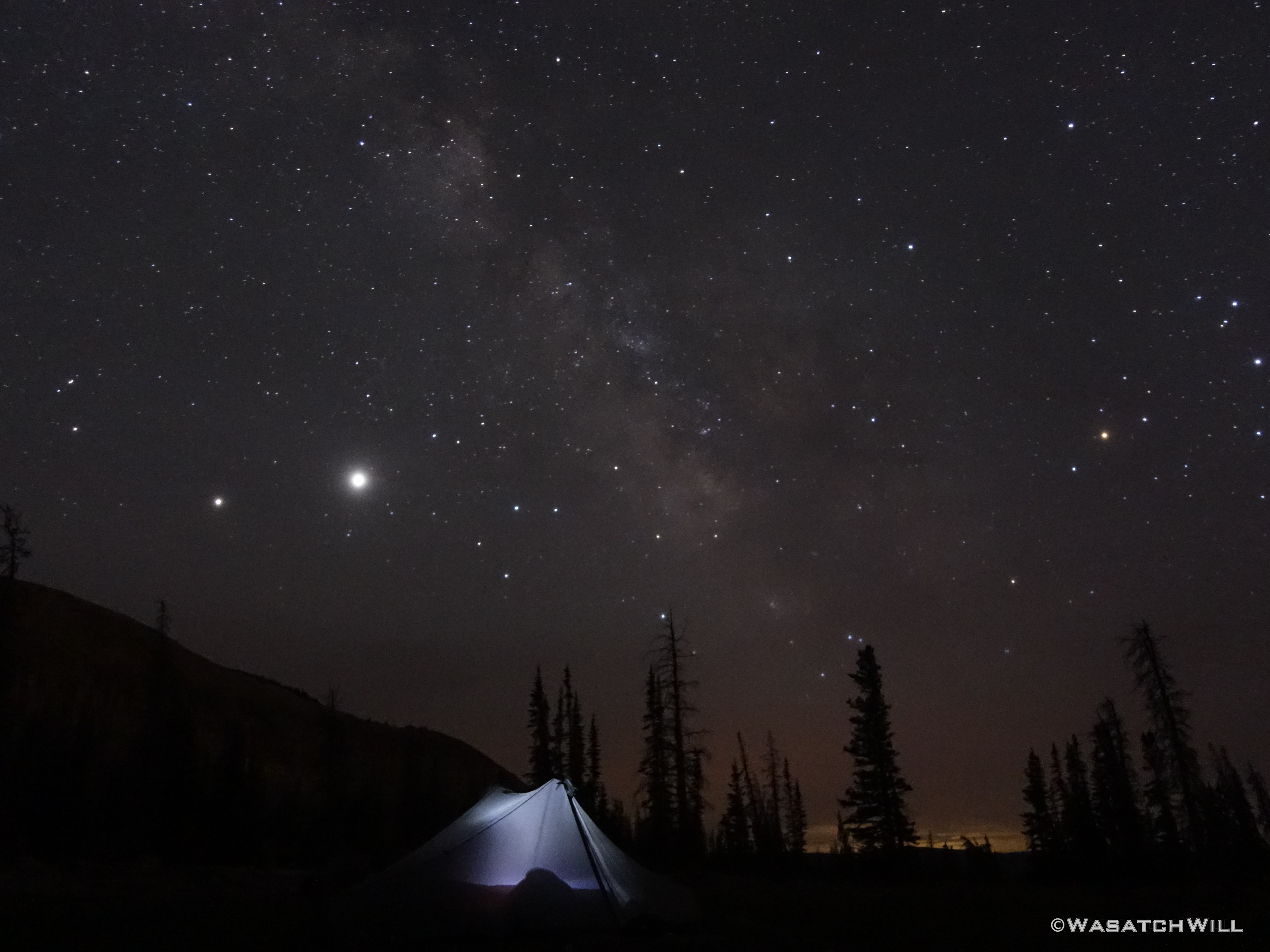
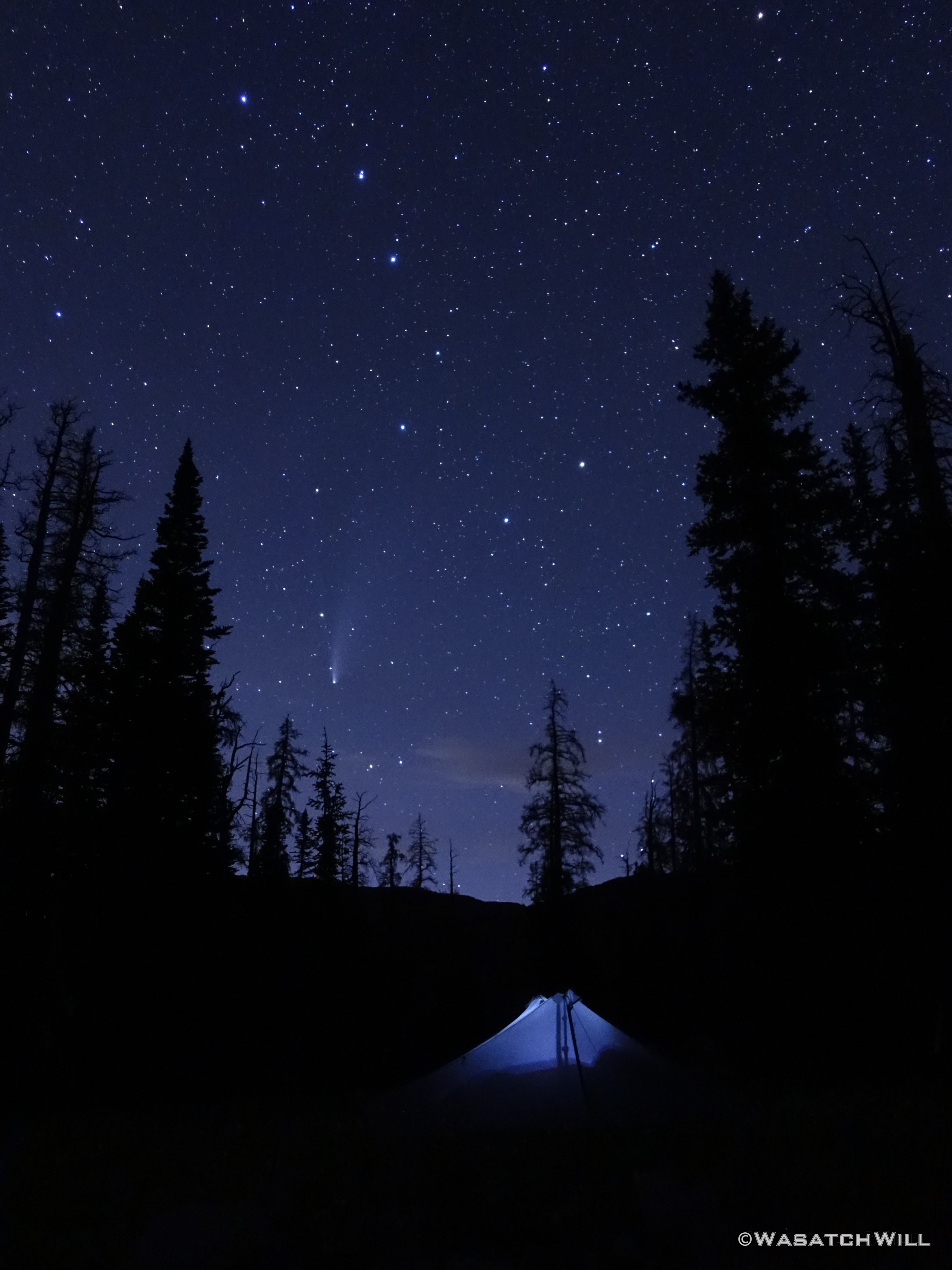
As the skies darkened the stars grew brighter, this night in the backcountry held a promise to deliver on something I may well never get to experience again in such a setting. The Neowise Comet had just passed it's peak evening viewing windows in the weeks before, but it had only been the day before where it had passed Earth at the closest distance it would get to Earth, so there was still plenty to see of it on this night, and it did not disappoint when captured with my newly acquired Sony RX100 camera I had gotten, specifically to have a compact, lightweight option capable of delivering some modestly decent shots of the night sky while out on my backpacking trips.
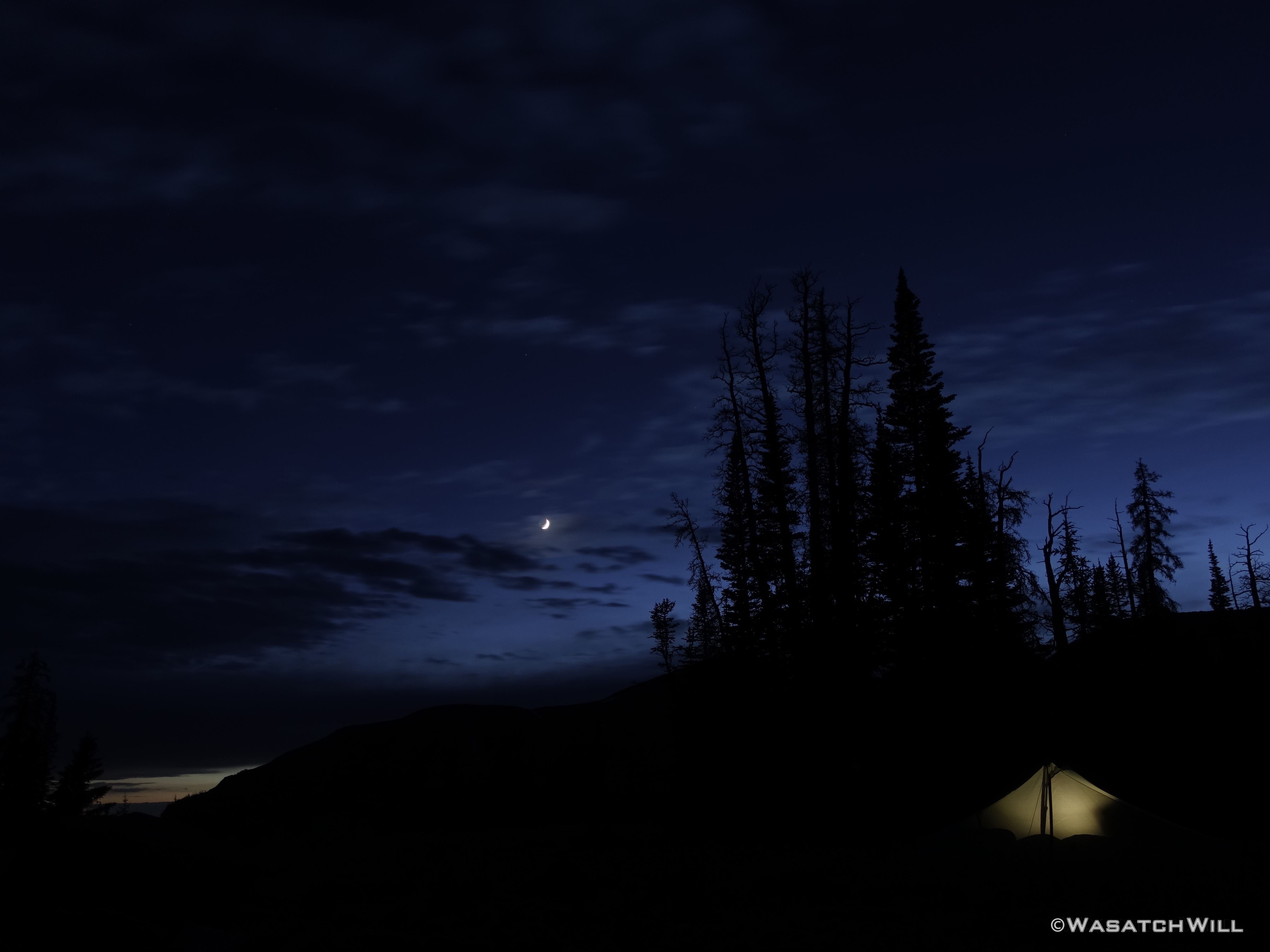
Tent-glow beneath the moon
Tent-glow beneath the moon
Milky Way Delights
Neowise
Satisfied with some of the results I was able to get, I retired back into my tent and rested for the next day.
Friday - July 24, 2020
On my way out of camp the next morning, a buck and I startled each other. Off it went into the trees to spy on me while I passed on by.
The Big Buck
I made my way back over to Jordan Lake where I could pick up the use trail that climbs up to the bench where Shaler Lake sits.
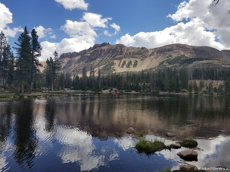
Jordan Lake
Shaler Lake
From Shaler Lake it was on over to Faxon Lake.
Faxon Lake
I scrambled around Faxon Lake and up the drainage toward Spread Eagle Peak in hopes of finding a good way up to the ridge above to be able to drop down into Middle Basin from there. I had a couple spots marked out on my maps that had looked like they might go. And one might have, but but on the side of the ridge I was on, it looked more loose and steep that I cared to attempt with my current level of fitness and being solo. I believe it would go OK with more time and care for someone who was more in shape because it was only one of about 2 spots one could gain the ridge if doing Spread Eagle Peak from the basin.
Instead, I bailed on that attempt and decided to continue to circumnavigate the upper bench of Naturalist Basin.
Faxon Lake with Spread Eagle Peak above
I would go on to pass by LeConte Lake, before stopping in the boulders above Blue Lake. There I would take a lunch, assess the skies, and ponder making another attempt up the ridge I had marked out as another likely route.
Sure enough, while I was sitting on a rock having lunch, darker clouds began to build up a bit and make me wonder if they'd progress into anything bigger and badder in a short amount of time. Ultimately I decided to still scout it out but not take my pack up with me. I had scrambled up through the boulder field that continues on to the ridge from above Blue Lake on my first visit to Naturalist Basin in an effort to climb on up to Mount Aggasiz, but I knew it was nothing but a sheer vertical drop off a high cliff on the other side. So I picked another saddle further over on the ridge and aimed for that. It wasn't too far that I figured if there was a nice enough looking way down the other side, it wouldn't take too much effort to come back down, retrieve my pack and head back up and over.
Well, I made it up pretty smoothly, but by the time I did hit the saddle, gathering clouds moving in were starting to look a little more ominous and I was feeling more pressure to get back down sooner than spend much time looking for an safe and stable enough line down off the other side into Middle Basin. I decided to forgo any attempt to come back up with the pack and simply return another time when I could attempt the loop I was trying to do in reverse, now knowing a straight forward way off the ridge from the saddle I was on back down into Naturalist Basin. It would be much easier to survey the Middle Basin side of the ridge from below than from above and there pick a line to try.

View of LeConte Lake and Jordan Lakes from high on the ridge
LeConte Lake
Not sure why I didn't think to get a picture of Middle Basin from the saddle when I was up there in addition to the picture I took looking back down into Naturalist. But it is there in my video at the end of this post.
I returned down, retrieved my pack, and opted to head on back down to the Highline trail and settle for a visit out to Packard Lake and accompanying Wilder and Wyman Lakes for the night, as I had yet to ever over to those lakes before. To avoid the scramble down a bunch of boulders to get to the shores of Blue Lake, I chose a milder approach that required I head back in the direction of LeConte Lake and then bending back tower Blue Lake on some lower terrain. There were more meadows and wildflowers to enjoy along the way as well.
Indian Paintbrush
As it so happened, all the darkening clouds that were threatening to spin off some thunderstorms seemingly vanished even quicker than they had formed and much of the sky went blue again.
Walking the tundra meadows
En route, I'd pass right by the shallow little Walcott Lake, which was more like Walcott Tarn now. This was my third time up into Naturalist and it was obvious that the low snow year had taken its toll here for it was much smaller than I remember it ever being and did not look like anything deserving of an official name.
Walcott Lake

Parry's Primrose

Columbine
Past Walcott was Blue Lake once more and from there it was on down to the Morat Lakes. By now, several other folks were up and about checking out the lakes while some others aimed for the ridge and Mount Agassiz.
Blue Lake (Mt Aggasiz above)
Blue Lake (Mt Aggasiz above)
Morat Lakes
Waterfall above Morat Lakes
West Morat Lake
East Morat Lake
I stopped at Morat Lakes to try a little more fishing. No such luck catching anything here though. There were a handful of folks camped nearby these lakes as expected too. Impressively, all were further up in the trees and heeding the call to keep their camps 200 feet from the lakes and major water sources. That's not always the case around lakes like these.
From Morat Lakes, it was back down into denser stands of trees where I followed the trail back out to the main Highline Trail. Being a Friday afternoon I fully expected to encounter hoards of folks on their way up to Naturalist Basin to spend the weekend. Surprisingly, it remained rather quiet for the next mile or two. As I got close to the junction with the Highline Trail however, the weekend rush was on. I passed by at least a dozen or more groups within a short span of time and many more once on the Highline Trail proper as I merrily made my way down to the junction that would lead me off to Packard Lake.
In time, I finally arrived at Packard Lake passing by a huge group of campers tightly packed into the small strip of land between the trail and Wilder Lake. I had held my breath in hopes of finding a good vacant site once I arrived at Packard. To my surprise, I hadn't encountered anyone after the big family/friends gathering at Wilder. I was thinking to settle into one of the campsites within the dense shady trees at Packard, but there really wasn't any good spot for a me to cast a line without risk of some major tangles or getting my feet real wet. There didn't seem to be an obvious trail around the lake and looked like nothing but a huge deadfall obstacle course to get around to any better spots to cast across the lake.
I then thought of a really choice looking site I had scouted out back near Wyman Lake I had filed away in my mind in case that was nothing available to be found at Packard. Despite being free of people, I still decided to return back to Wyman to set up camp near there. On my way out, I checked out the view overlooking the East Fork of the Duchesne River right by Packard Lake. For whatever reason I didn't bother to get my camera out to get a picture of the view though. I think it was because I would have been shooting more into the sun where the most interesting part of the view was. As I turned around I did see an older couple camped out near the big view overlooking the East Fork of the . I was happy to leave the area all to themselves I thought in my head, barring anyone else arriving in late.
Blue Lake (Mt Aggasiz above)
Back in the meadow near Wyman Lake, I planted my tent and thought myself fortunate to obtain a measure of quiet, peaceful solitude that comes with being alone once more. Perhaps this was in part due to the fact that unlike Packard and Wilder, Wyman didn't seem to have any fish activity in it, whatsoever. I concluded it must be too shallow to sustain fish over winter. Such solitude didn't last long though, for as I was sitting down to dinner, a large group came by hooting and hollering. I felt bad for the other couple back by Packard, as I was sure they were heading back in that way. There was no other site that I had seen between where I was and Packard, save what was right along the shoreline of Wyman Lake. Surely they wouldn't set up there, within eyesight of me up in the meadow.
Surely they did, however. Hammocks and tents were set up in a little strip of shoreline that was no more than 10 to 20 feet wide between water's edge and the trail. Perhaps they had anticipated camping where I was set up at and were disappointed to find I had beaten them to the prime spot higher up in the meadow, a spot that would have better accommodated the group. Perhaps they were simply respectful enough to not intrude on my camp while also being desperate enough to get set up somewhere, anywhere, with what little daylight there had been left.
Once they had their camp all set up, a couple of them got some fishing poles out and tried to fish away the night. I sat there in the distance and kind of smirked knowing there was nothing to catch in that lake. Fortunately, they remained good neighbors the rest of the evening by keeping the noise down and remained much quieter, save an occasional chuckle and laugh, than the volume of noise they had produced on the trail coming in.
Indeed, it turned out to be another quiet, enjoyable and relaxing evening after all.

Camp, Day #2
As I went to bed, I decided to make the effort to get up and break camp fairly early, with the intent of hiking back out to Butterfly Lake to do some fishing there in the morning right across from the trailhead where I would await Jess to pick me up and take me back to the cabin to finish out the weekend with another night there.
Saturday - July 25, 2020
Rising early and breaking camp, I set aside an energy bar to serve as breakfast to go while I hiked back out to the Highline. The hike back to the trailhead was leisurely one and relatively enjoyable, passing by some occasional backpackers and many more day-hikers going in either direction, passing through the burn scar once more.

Highline Trail through the Murdoch burn scar
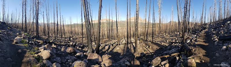
Burn scar pano
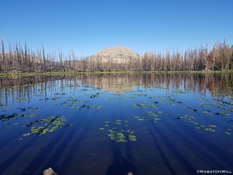
Scudder Lake (Bald Mountain above)
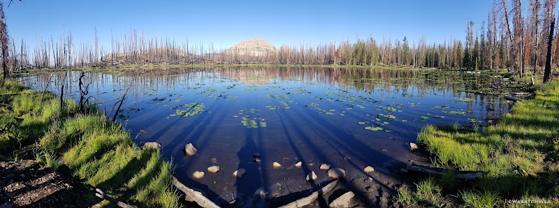
Scudder Lake
I arrived back at the trailhead about mid morning leaving me a good couple of hours to spend fishing with the crowds at Butterfly Lake before the scheduled time for Jess to pick me up back at the trailhead.
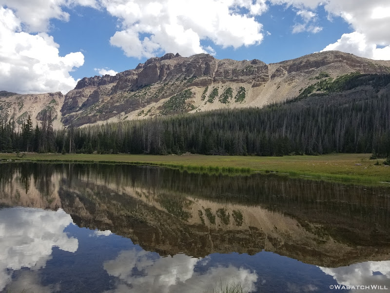
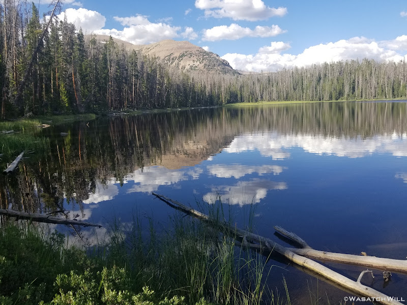
Hayden Peak reflection
Again, I didn't count on catching anything at Butterfly Lake given the crowds and how much pressure it obviously got. To my surprise I was able to land a few fish though and got a number of other hits.

Butterfly Lake
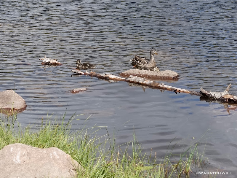
Mama duck and ducklings
Hayden Peak across Butterfly Lake
Pick up time came and I strolled back up to the roadside. A walked back into the trailhead parking and unlike 3 days before, every single space in both the hiker and the horse-rider lot was completely full and everything in between to the point that people were having to revert to parking on the side of the highway to access the trailhead.
I therefore took the opportunity to return to the road and perched myself where I could "hitch-hike" when I saw Jess approaching in our car.
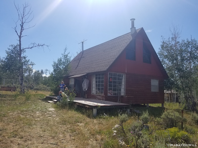
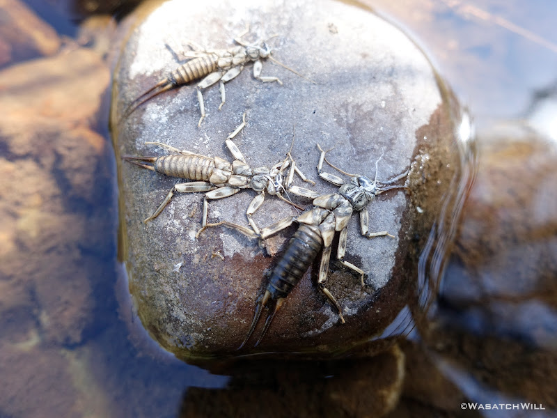
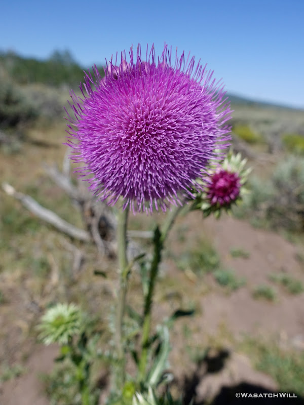
Back at the cabin, there were plenty other sights to be had in going out for some walks with the family later that evening and the following morning.
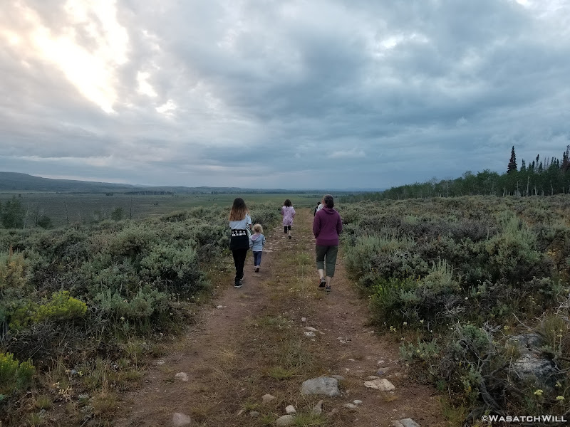
Family walk

Natural Black and White
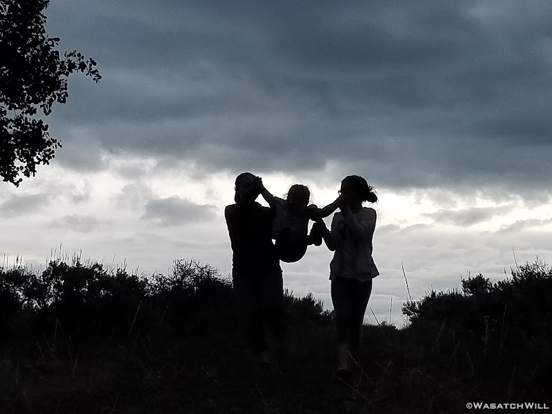
Sillouettes
Cabin

Daisies
Stonefly Nymphs
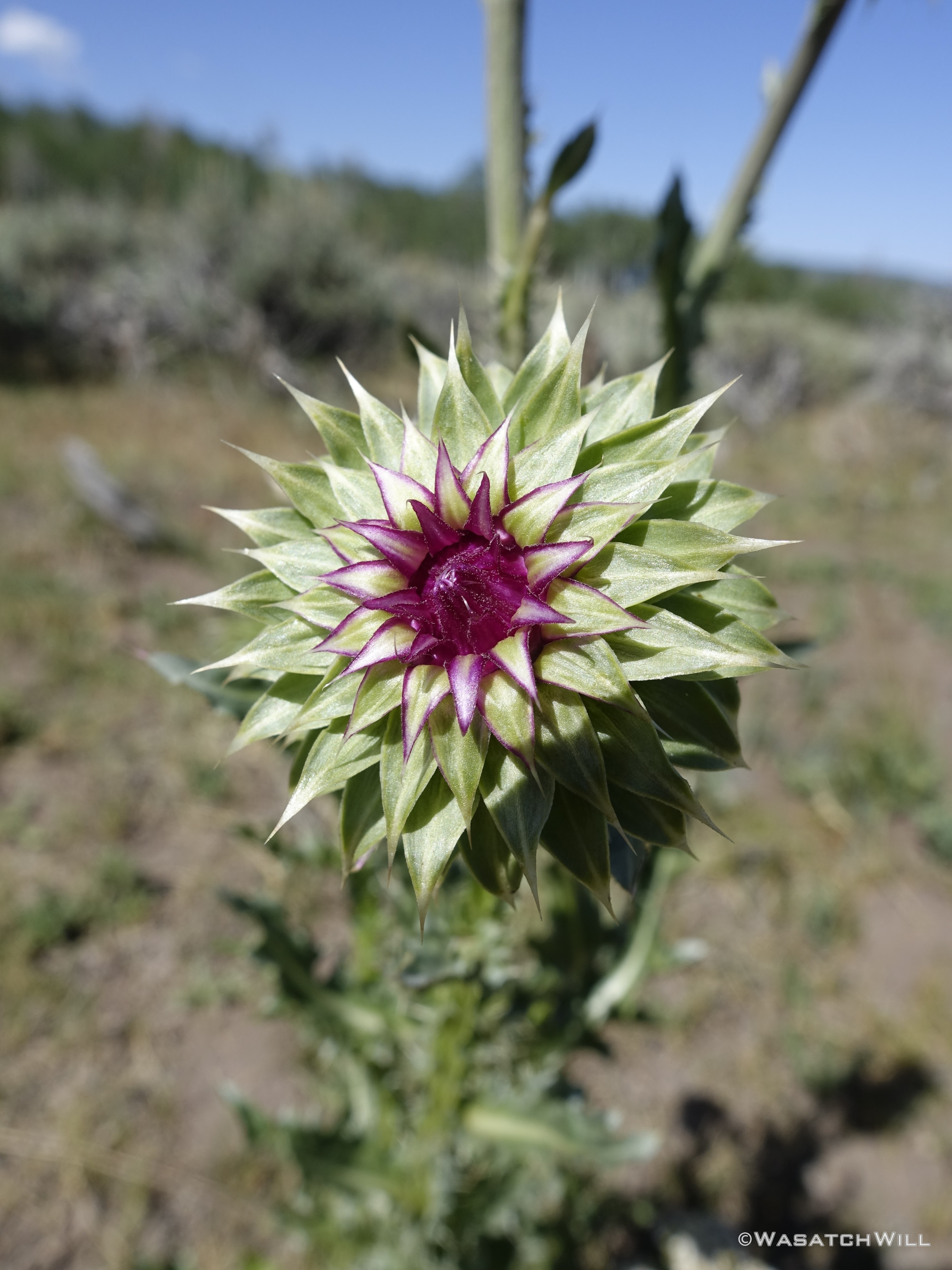
Thistle bloom
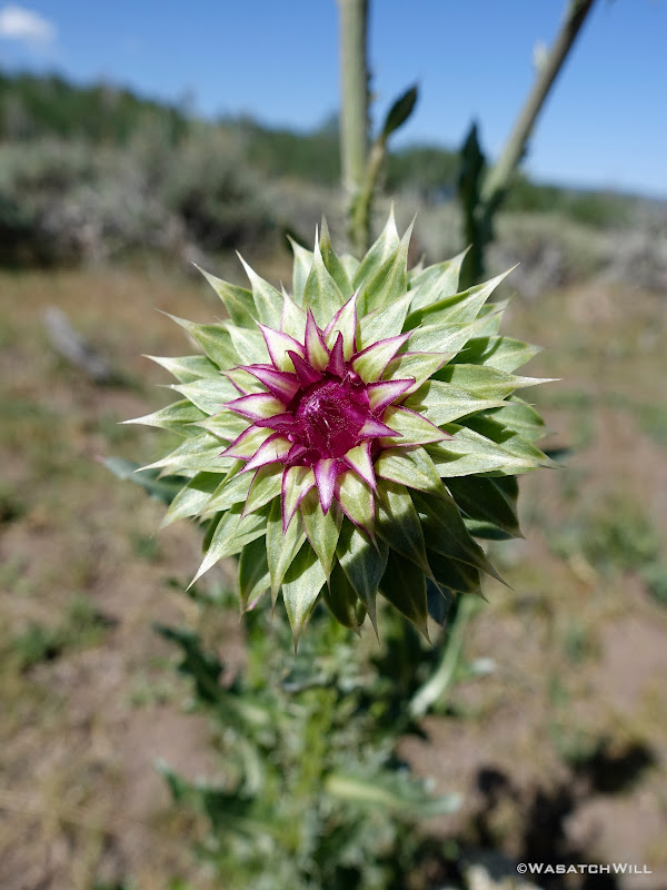
Thistle flower bud
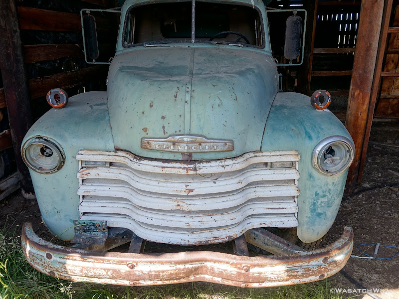
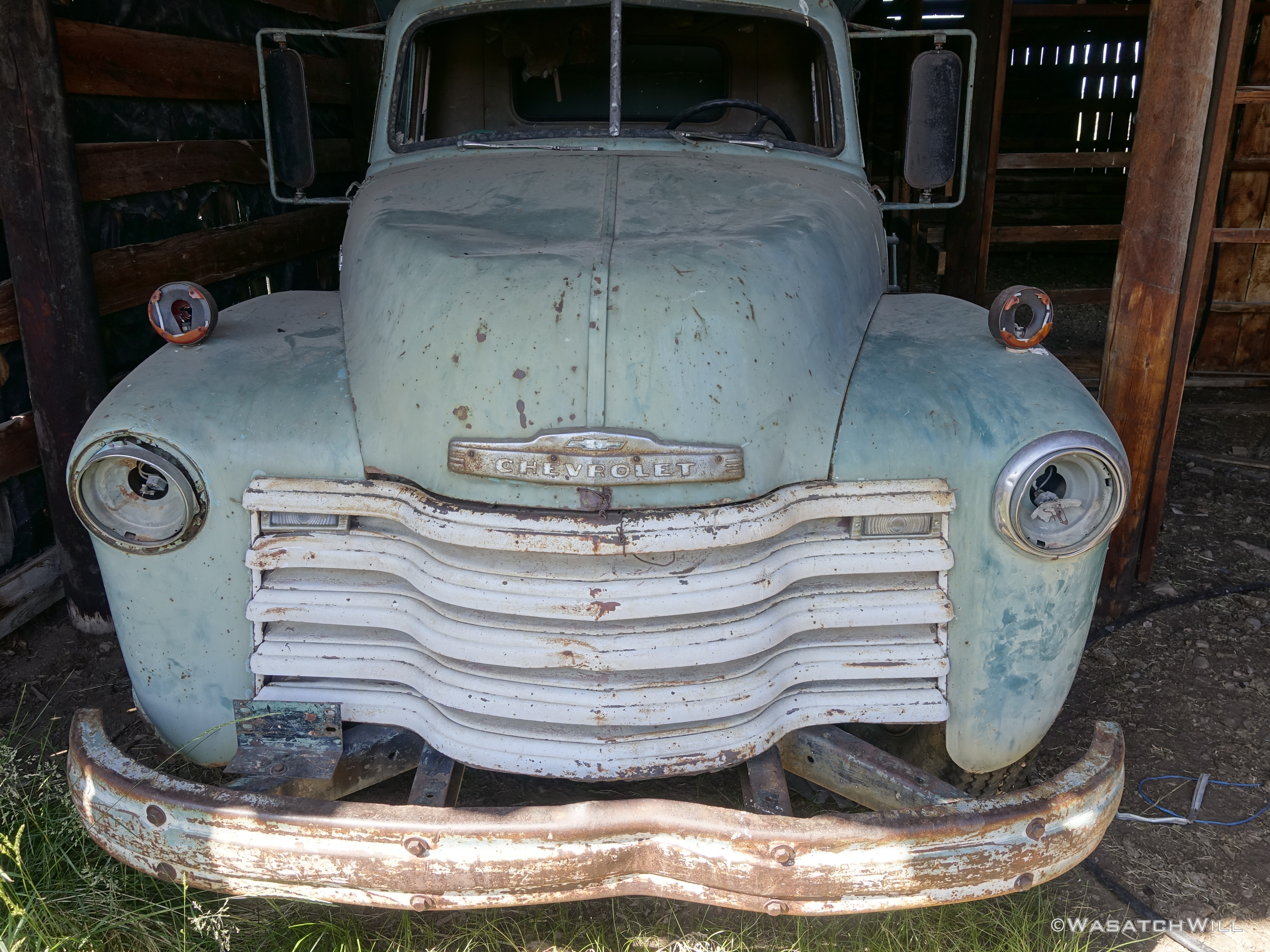
Old rustic Chevy truck
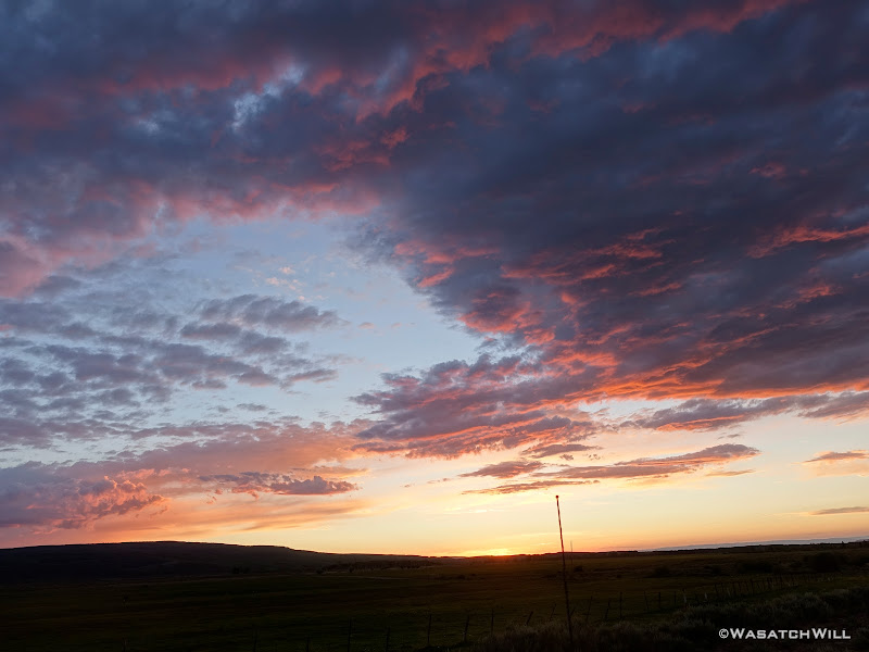
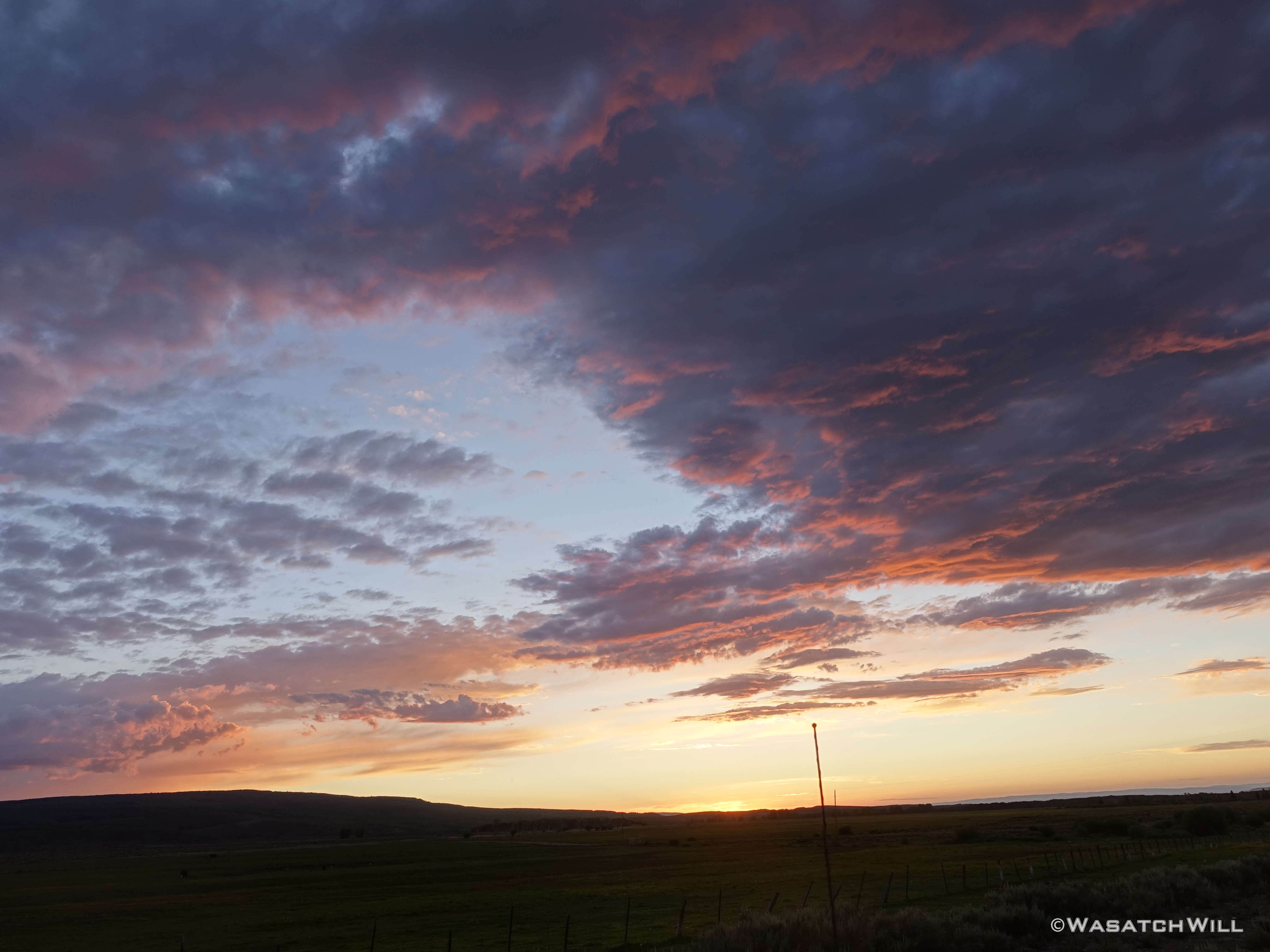
Sunset
It was another great trip with the family with a nice little backpacking trip sandwiched in between.
Due to numerous uncertainties the great pandemic had brought upon society, my usual work schedule had been shifted around. Fortunately, I was one of the lucky ones to not have suffered any setbacks in hours. However, due to not knowing if any co-workers would find themselves needing to take any quarantine measures, I didn't dare try to ask for vacation time for a while, for fear of leaving the rest of our department extra short-handed. Instead...Most of the spring and early summer, when not at work, had been spent staying at home, rebuilding our vegetable garden beds and then building a new playhouse for my kids.
By late July, things had settled back into a better routine with work and I finally felt comfortable with where things were at to go away with my family for the better part of the week. We wisely chose to go up to Jess's family cabin on the north slopes of the Uintas. Having that cabin proved to be far more fortunate than it ever had after seeing how unbelievably busy the Mirror Lake Highway corridor was with all the Covid campers and crowds sprawled out everywhere.
Plans were for Jess to bring me back up the road the following day and drop me off at the Highline Trailhead where I would attempt to loop Middle Basin and Naturalist Basin together over 3 days, 2 nights.
Thursday - July 23, 2020
It was a bluebird morning and I felt like I was biting at the bit, an anxious horse let out of the gates as I step out of the car, slung on my pack, and bid adieux to my family. They would go back to the cabin for some more leisure time. I would go on to engage myself with some slightly more strenuous activity.
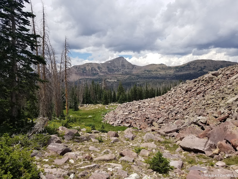
It didn't take long for me to start feeling a bit winded. Due to the already aforementioned circumstances, I had not done well to keep my aerobic fitness up for the several months leading up to this trip and my lungs were now paying a bit of a price. I made the smart decision to forgo climbing up and over the pass into Middle Basin as I had originally sought to do and decided to take the more level and easier going route out and up into Naturalist Basin.
I hadn't been back up.in the Murdoch Basin since before the big fire that tore through the area in 2018, so for me, it was like stepping into a whole different and somewhat desolate world when I found myself in the burn scar. It was only fitting that some of the only living flora growing around was lots of Fireweed flowers in the area of Scudder Lake.

Fireweed
Scudder Lake within the Murdoch Basin fire scar
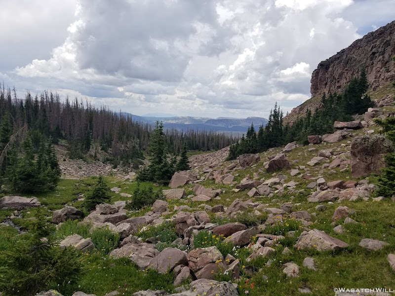
Rather than take the more established, designated and high-traffic trail into Naturalist Basin, I chose to bypass the junction for pursue what I had hoped would be a more scenic backway in. To do so would require progressing further on to Pigeon Milk Spring, where I'd take a lunch break and wait out a bit of weather before before going on as if to hike up over Rocky Sea Pass.
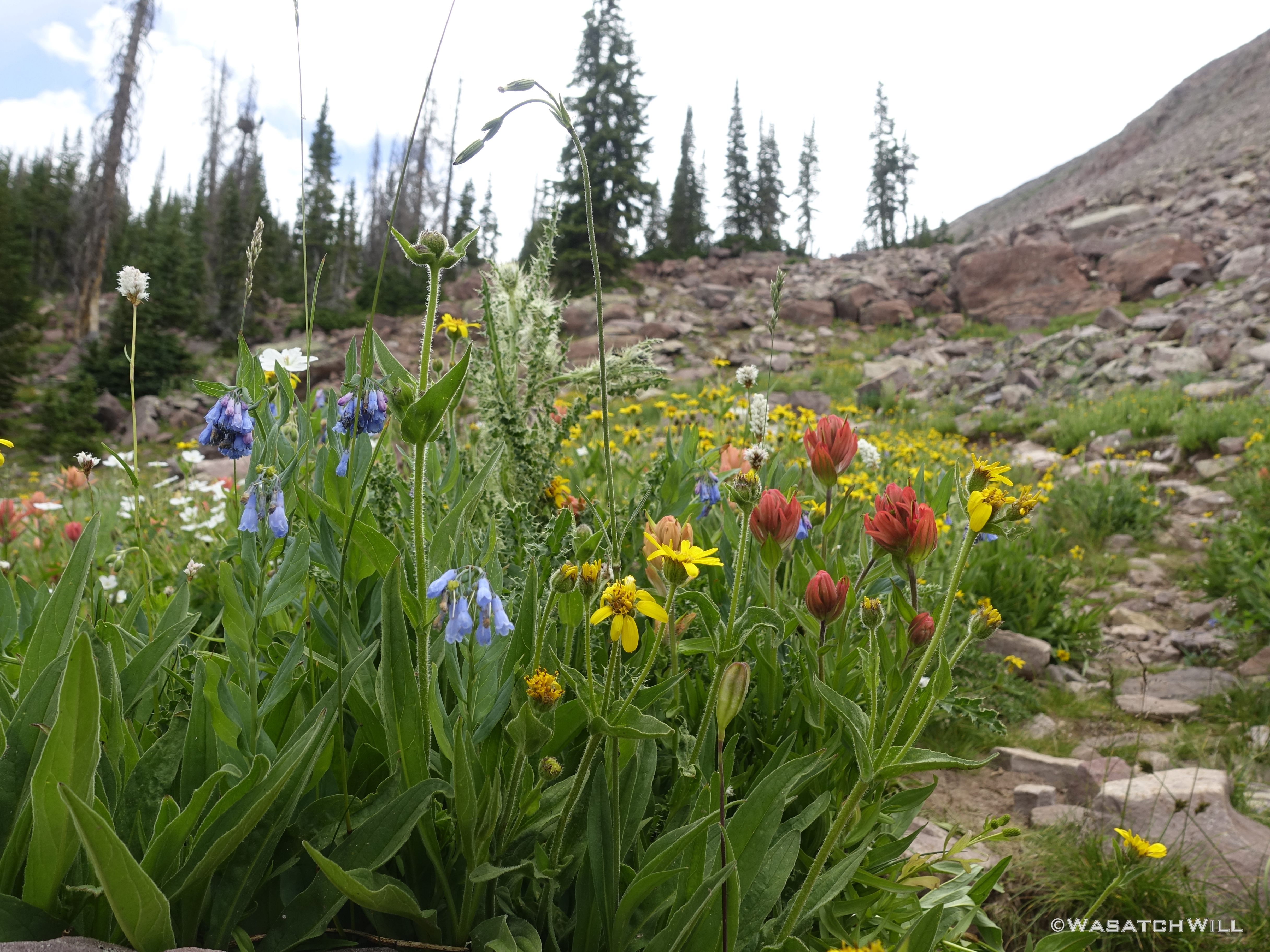
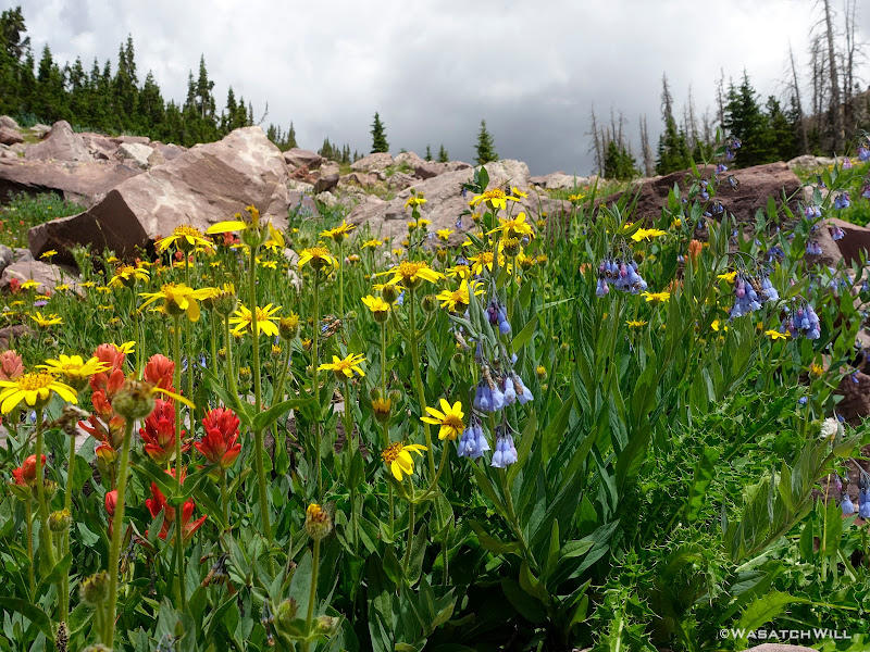
Wildflowers at the base of Rocky Sea Pass

Columbine
Briefly heading up the lower half of Rocky Sea Pass

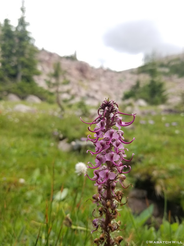
Elephant Head flower stalk
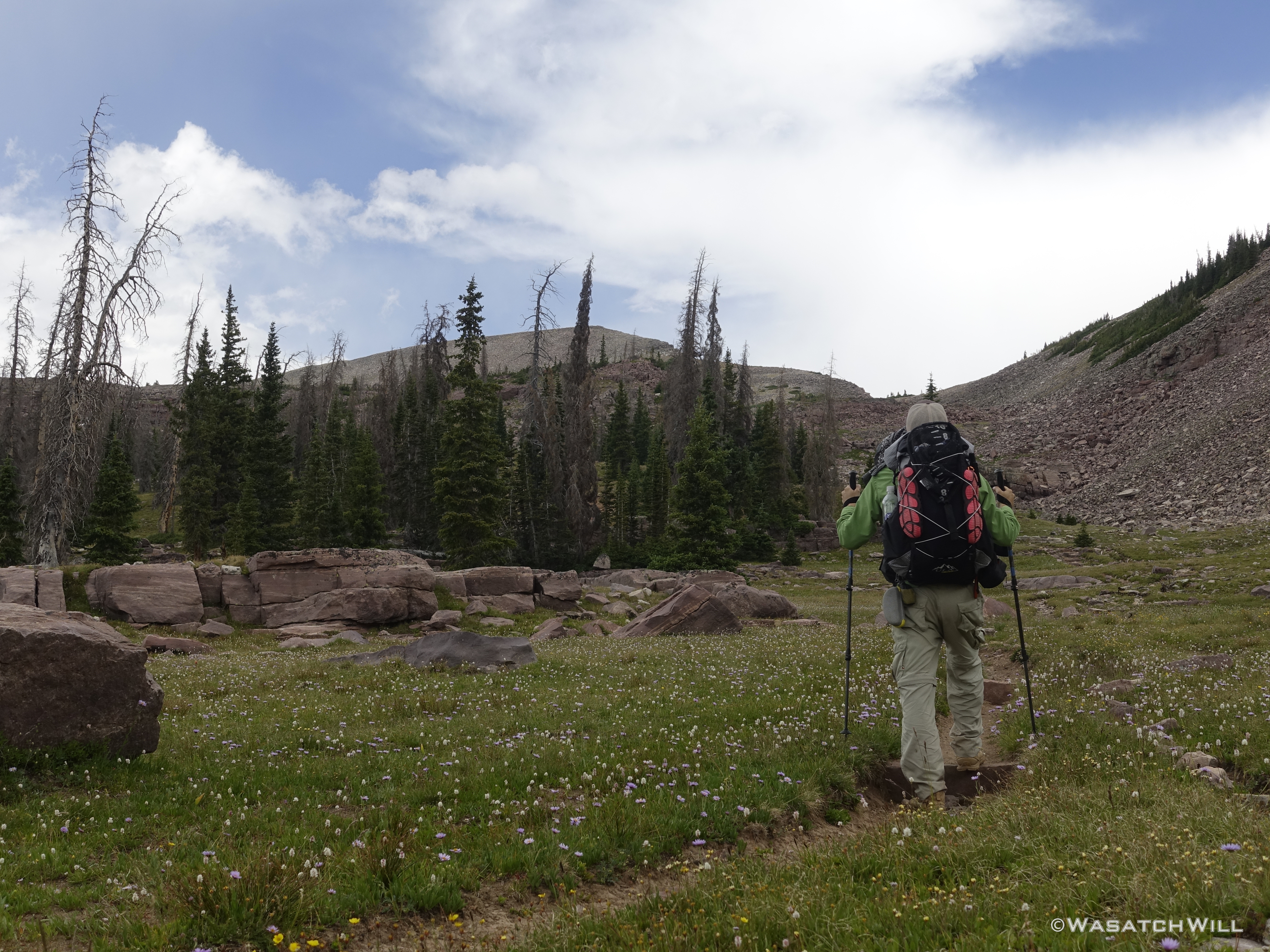
However, about half-way up the pass, I would say goodbye to the trail for the rest of the day. A group of other backpackers who had just passed me by would stay faithful to the trail. They were on a quest to finish off the length of the Highline Trail, hiking eastbound to Chapeta Lake. They had already hiked the eastern most section, from the eastern terminus on US 191 and went westbound to Chapeta Lake.
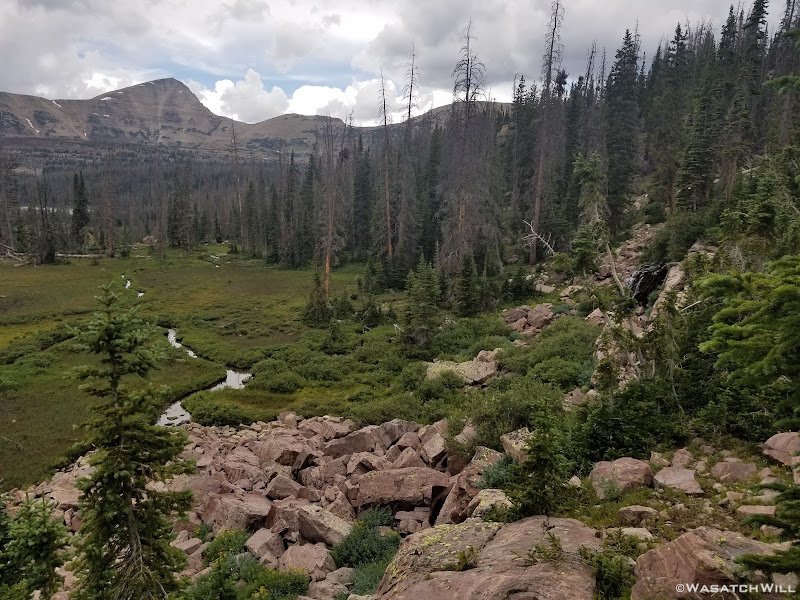
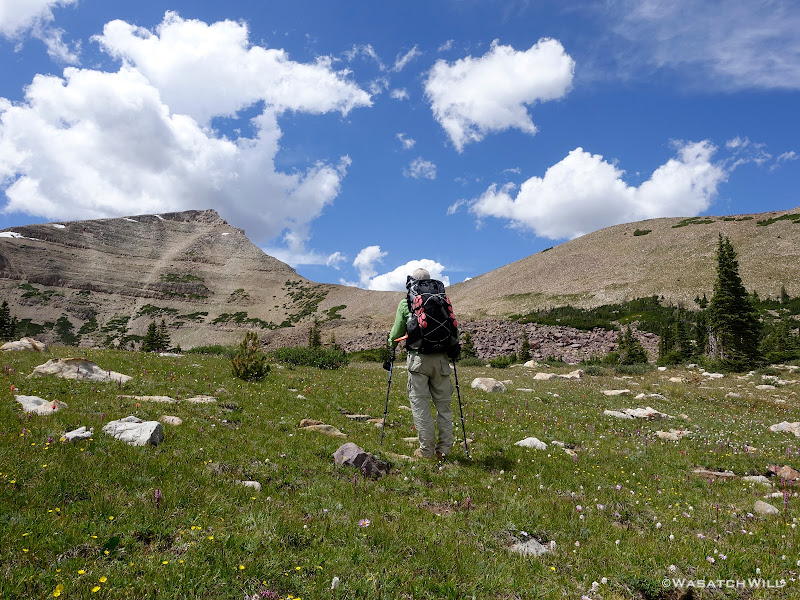
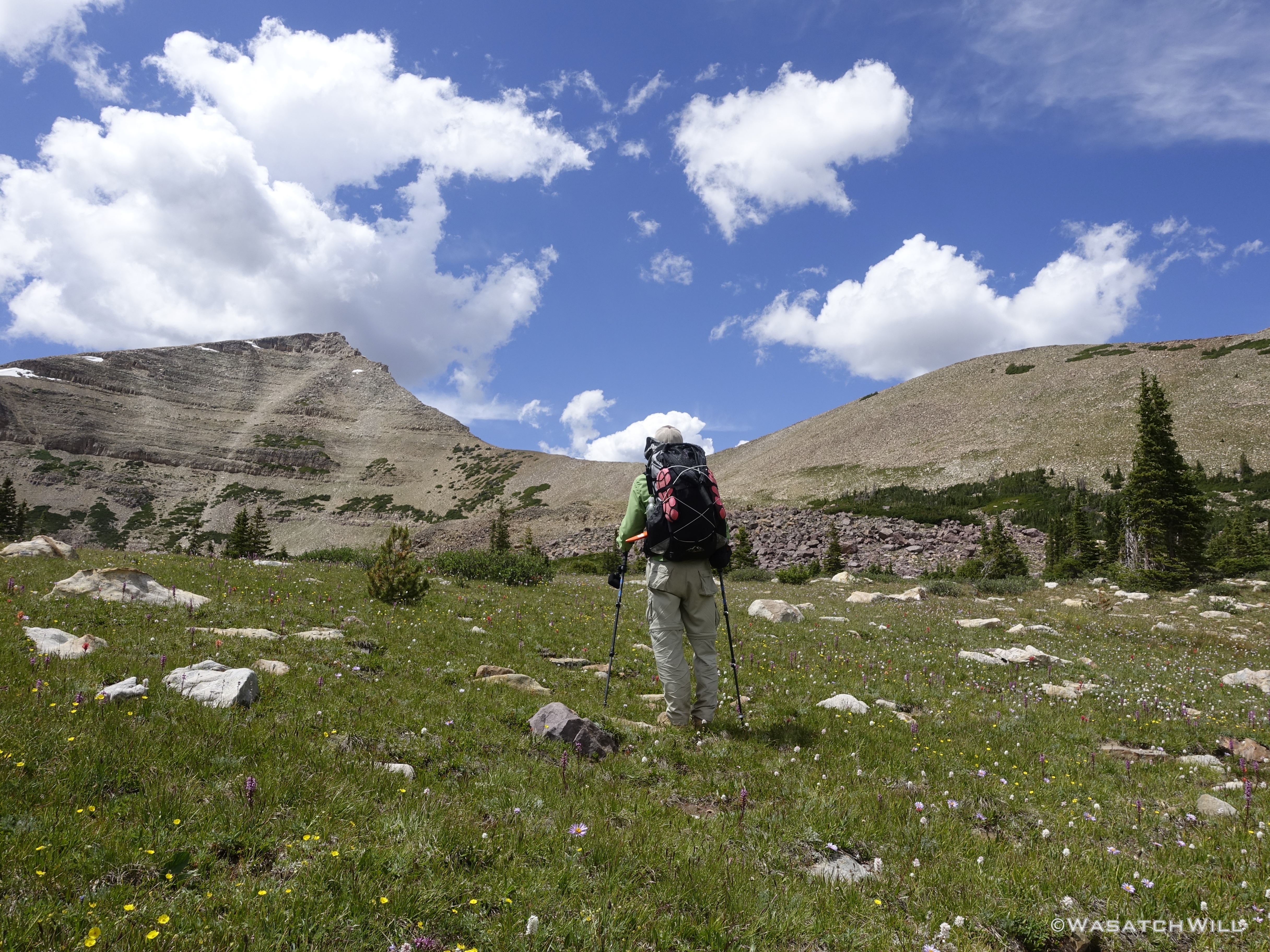
As for me, I set my bearing along a cross-country route into Naturalist Basin through a side I had been wanting to do more exploring and scout out possibilities for linking up some more creative routes for a future time.

Vacating the Highline Trail for some cross-country exploration

More wildflowers
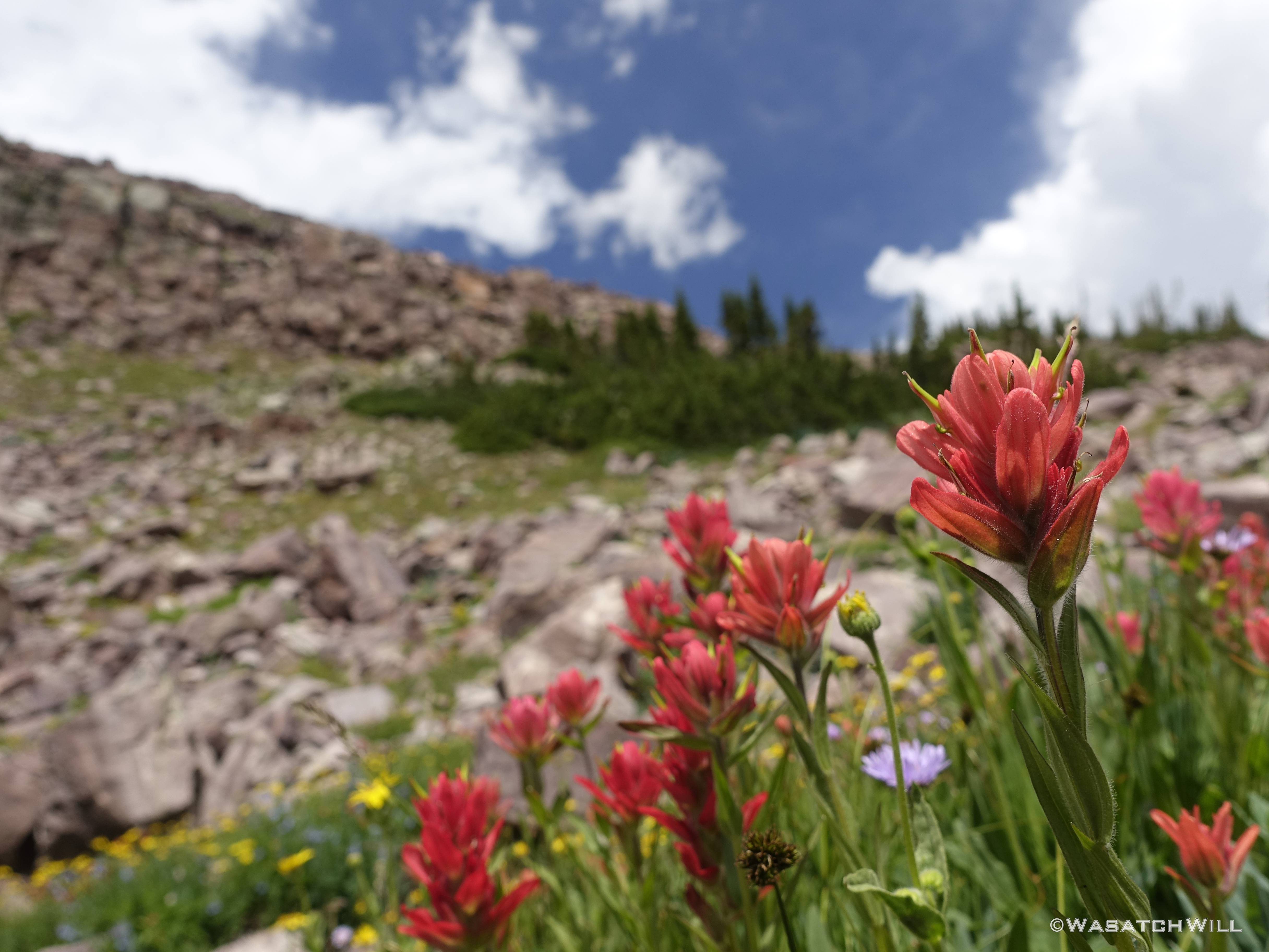
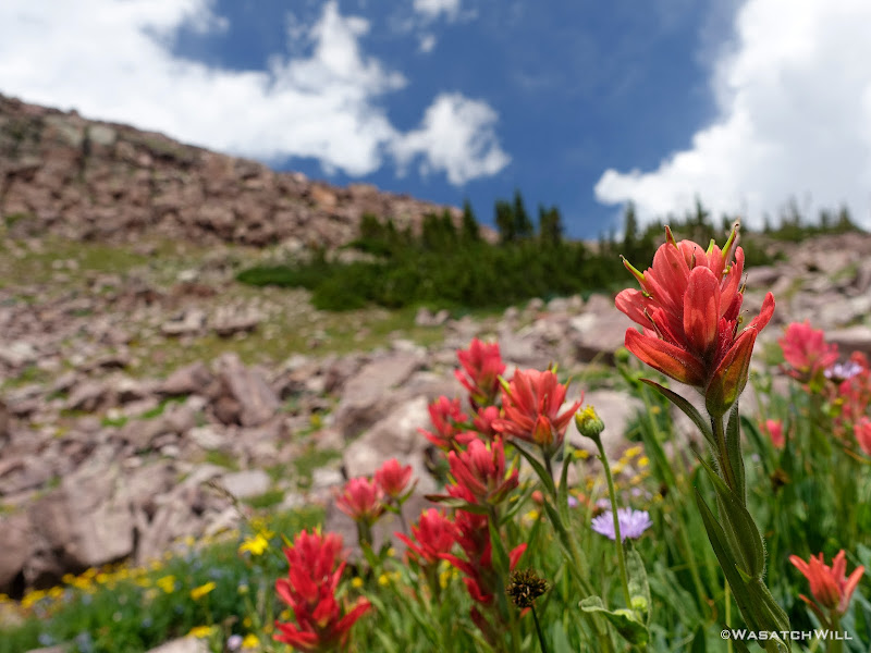
Indian Paintbrush

Mount Agassiz in the distance
Overlooking a marshy meadow

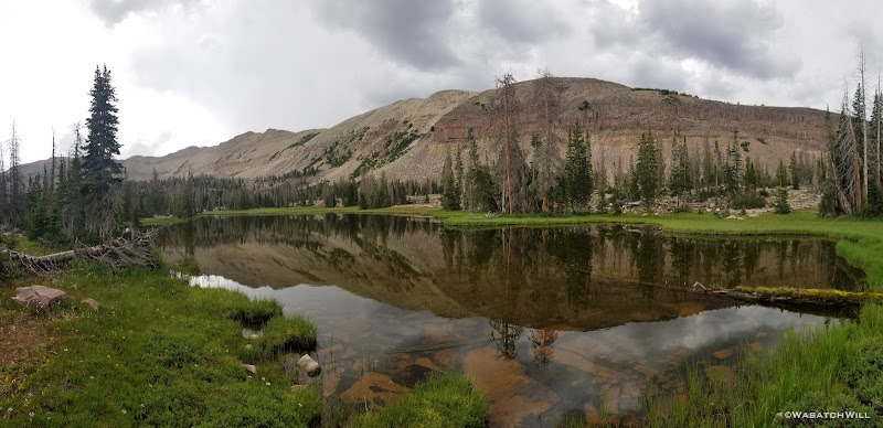
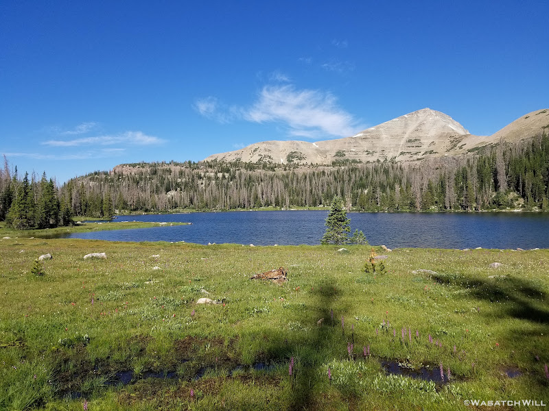
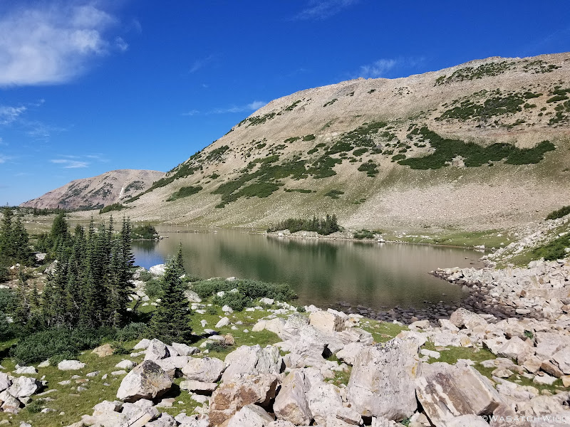
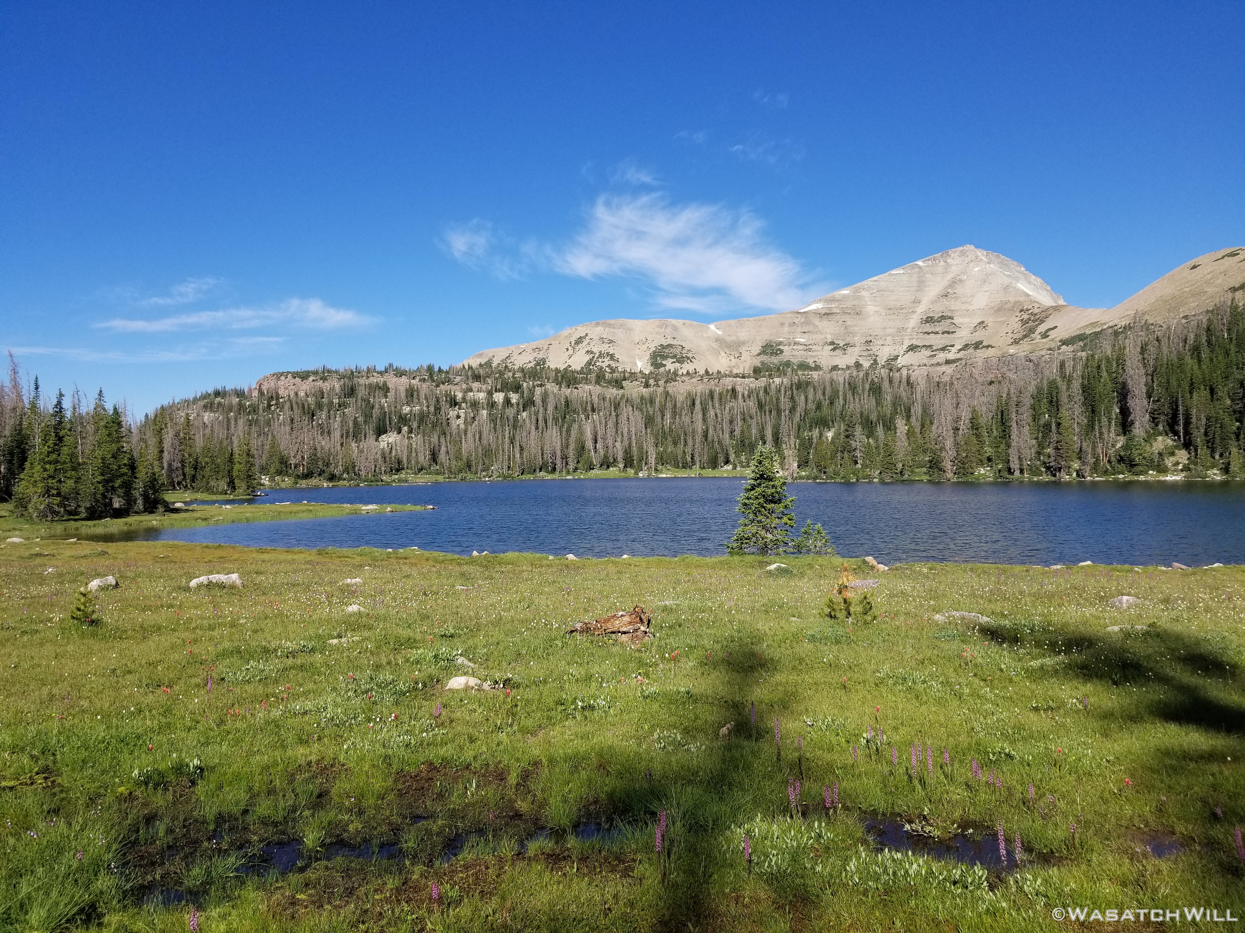
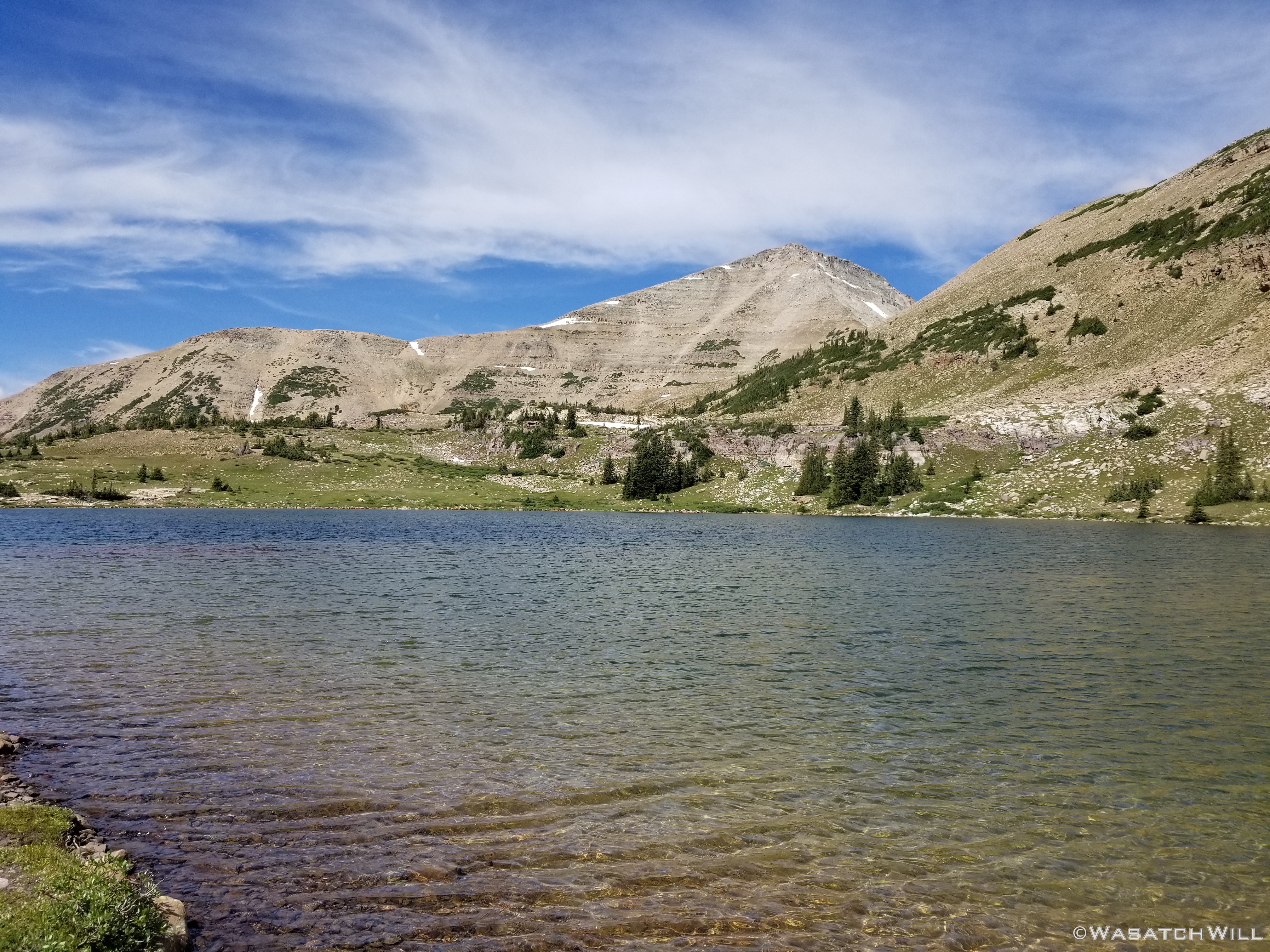
Hyatt Lake
Having passed by Hyatt Lake, I began to look around for a suitable camp. In doing so, a small parade of elk (about two does and two fawns) pushed on to an upper bench in the distance. I did find a spot that would do well enough, however, with lots of daylight to spare and having seen no fish activity at nearby Hyatt Lake, I decided that I wanted to push on a little further to the next bench up and see what I could find up there.
It wouldn't be as soon as I had hoped though as a nice little storm cell came flying in. Rather than expose myself out in some open meadows I was going to travel through, I threw up my tent and tucked down into some trees and took a little siesta while waiting for it to clear back out.
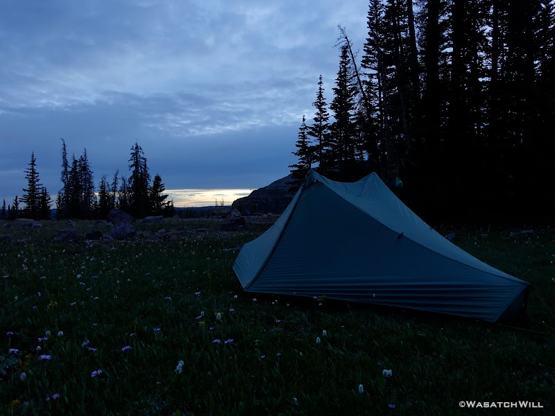
Not quite two hours later, blue skies opened up again and I continued on a few hundred more yards to what I thought was an even more prime spot to call home for the evening, at the edge of some trees alongside a big open meadow.
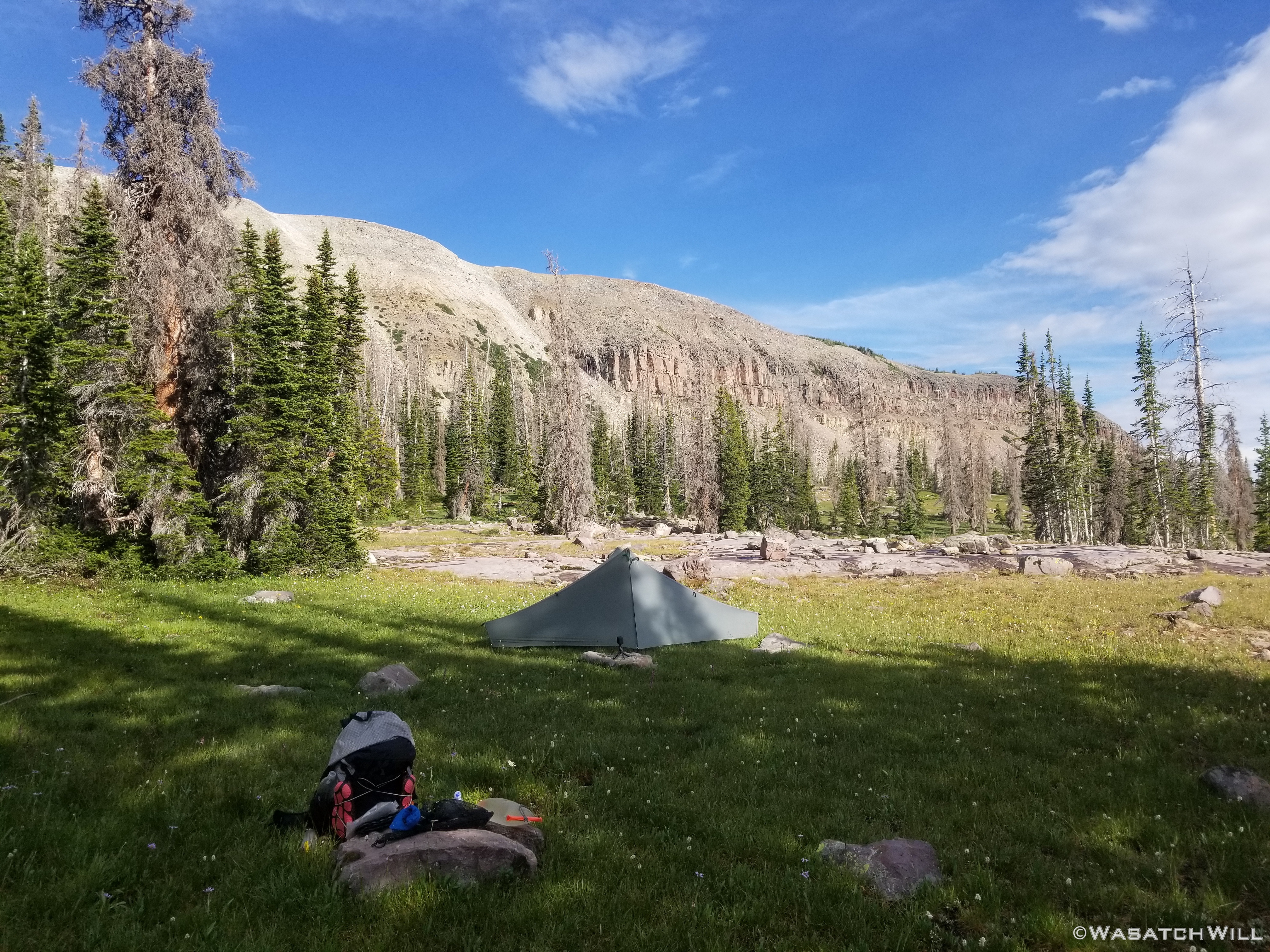
Camp, Day #1
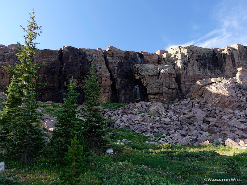
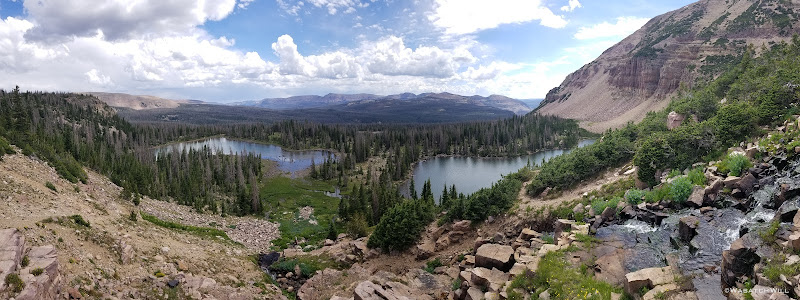
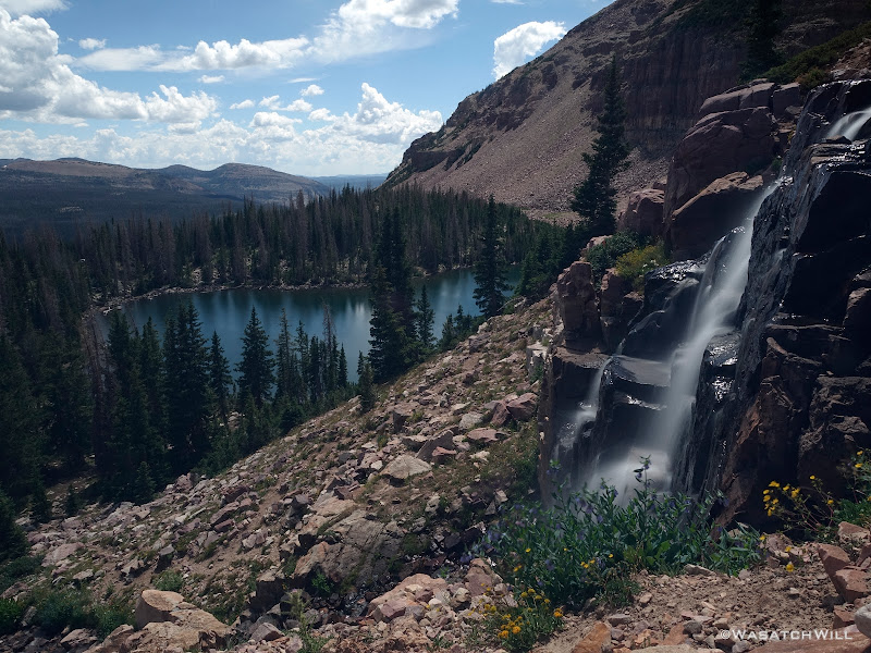
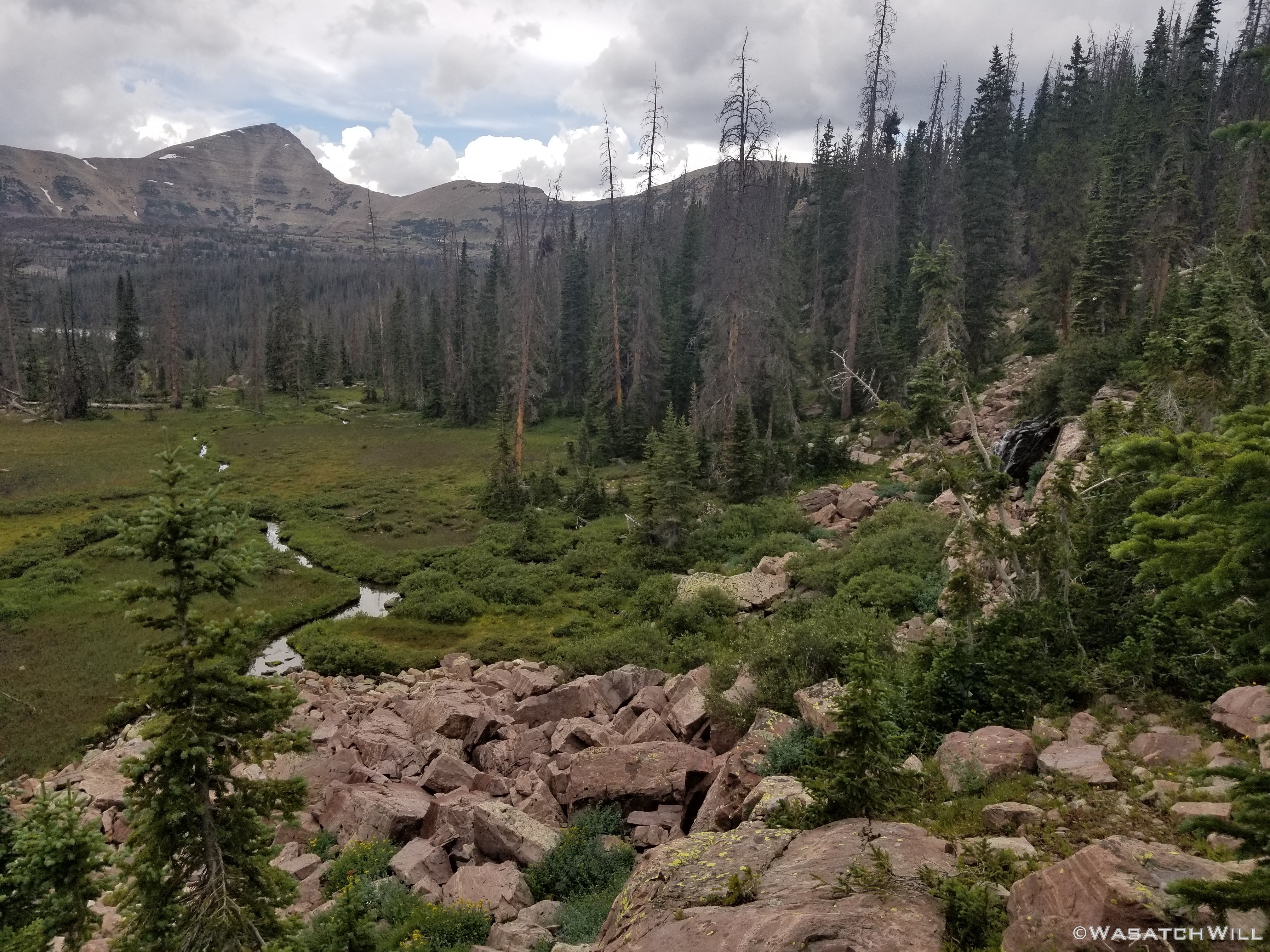
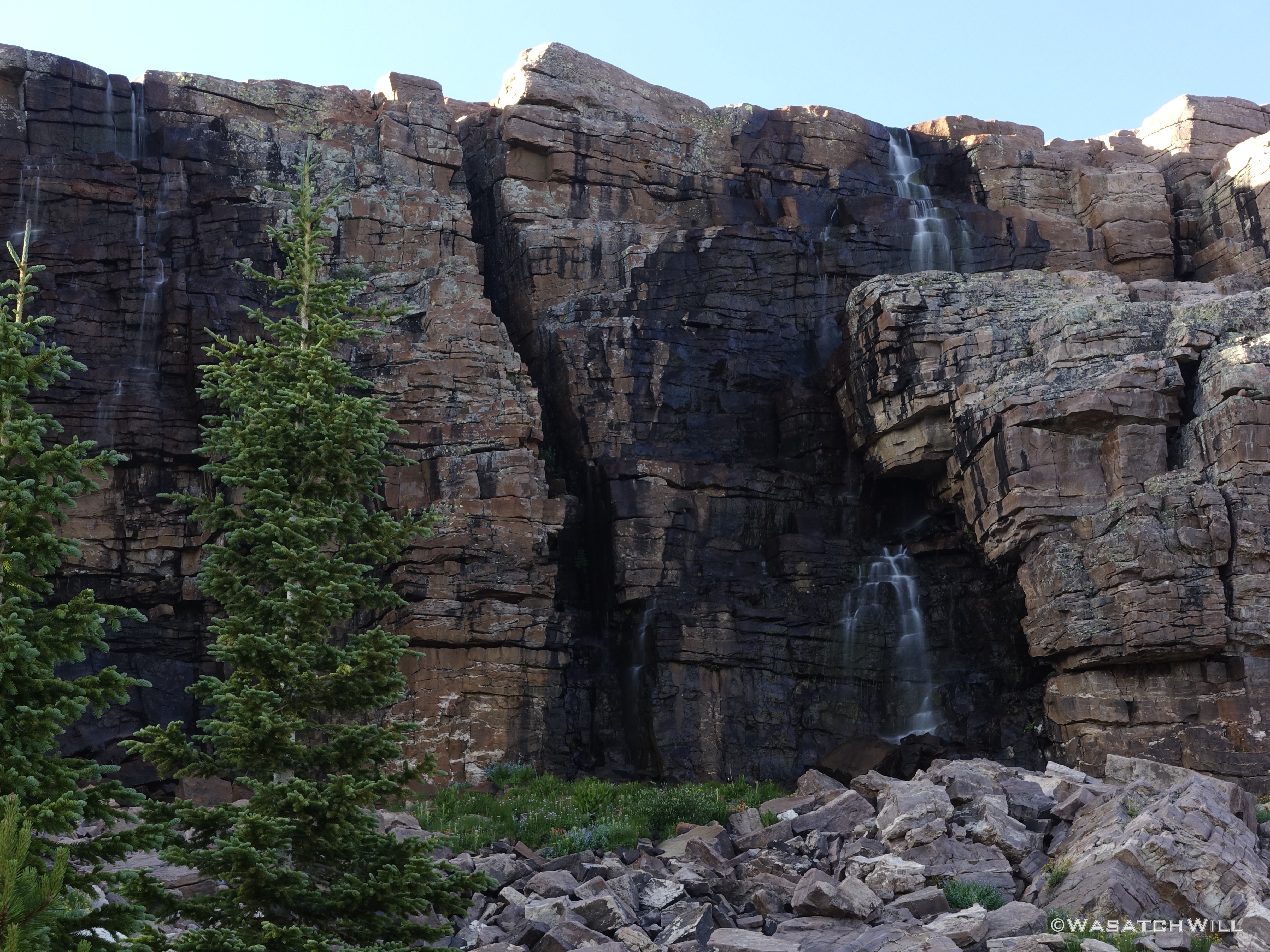
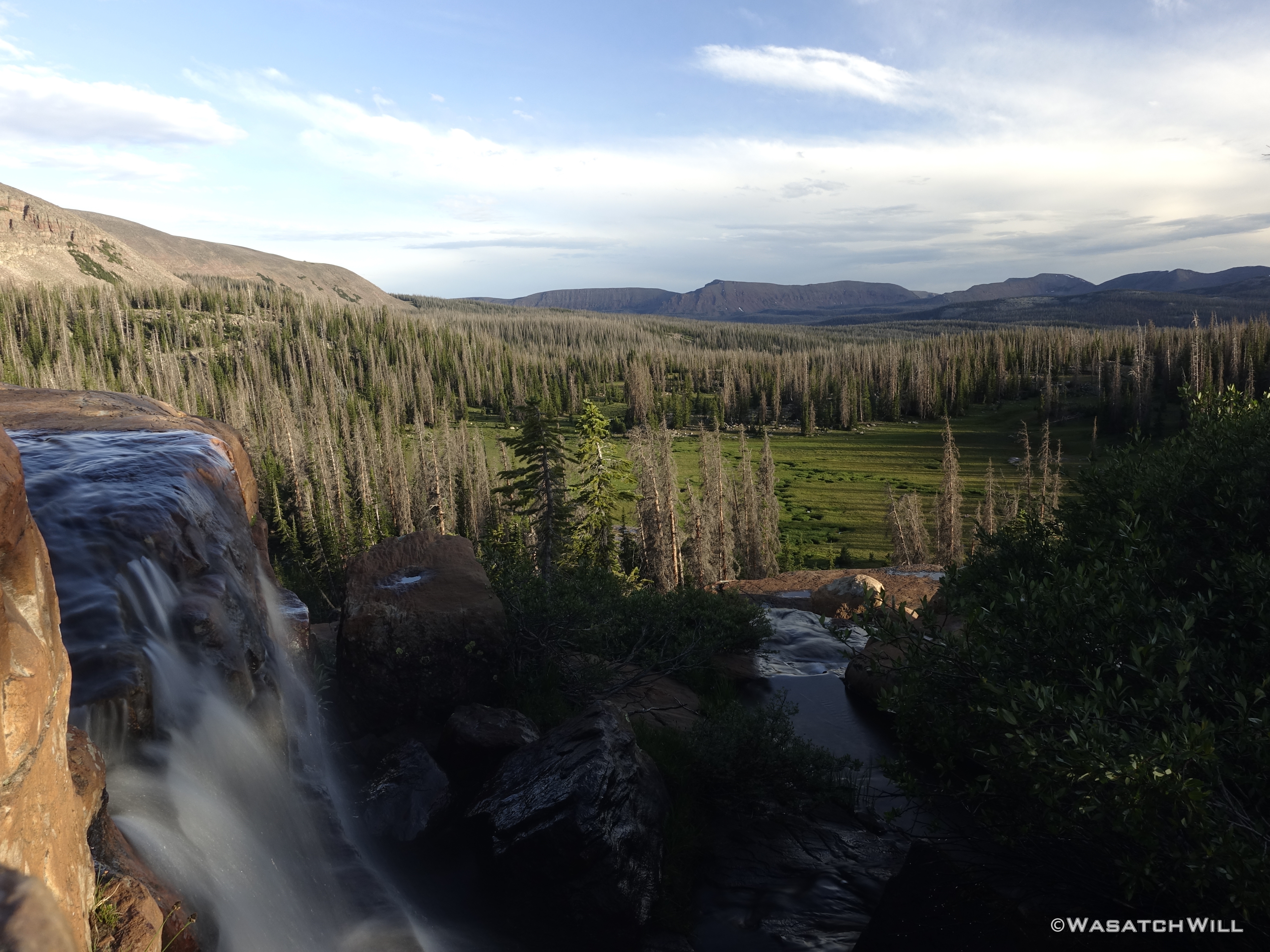
With camp all set up and dinner now eaten, I decided to use the last couple hours of light to wander cross-country some more over to Jordan Lake about a half mile away and to see how crowded it was and see if I could find a good spot available to do some fishing. Along the way, I'd enjoy views of the abundant waterfalls along the bench above me as well as those dropping off the bench I was on myself.
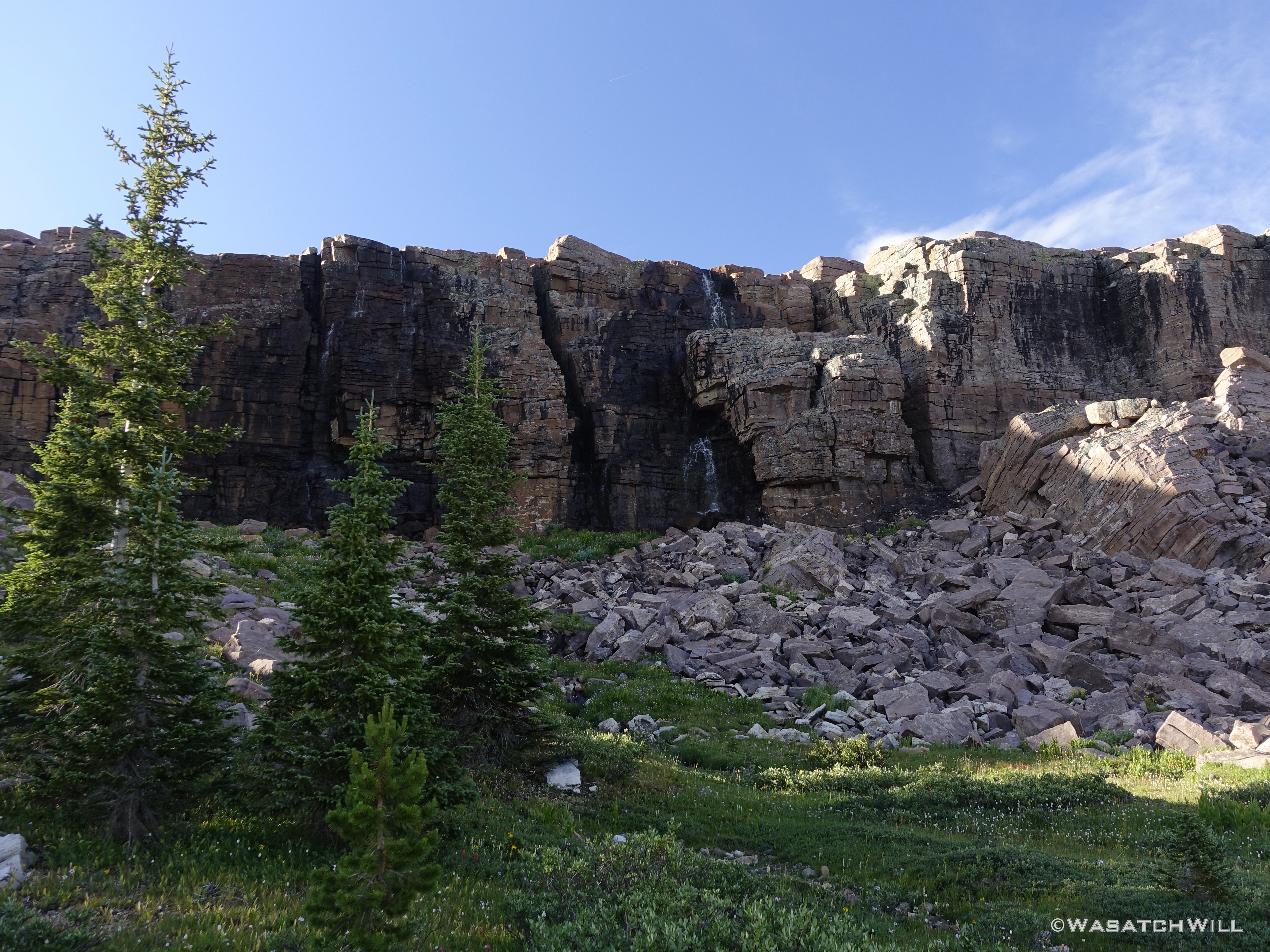
Waterfall
Waterfall closer-up
Above a waterfall overlooking the Duchesne drainage
A high mountain creek
Once I arrived at Jordan Lake, it indeed looked there was a good share of campers scattered around the shorelines with the usual campsites all occupied. To my pleasant surprise though, there wasn't really anyone actually along the shore doing any fishing themselves. I took the liberty to pop down off the bench above from where I was and found a nice little set of rocks from which to set up on.
I didn't expect to get much action though as I figured this lake received a lot of pressure and I only had about a half hour to do much before I wanted to get going back to my camp. Amazingly, I was able to reel in a few fish. I would have netted more, but it was my first time going barbless and that took some adjustments to get a feel for the right tension to keep on my line. Needless to say, I had a couple more than normal get away from me.
Netting a fish at Jordan Lake
Not wanting to overstay my welcome, and more importantly, not wanting to arrive back at my camp before it was too dark, I picked up my gear and made the brief sojourn back.
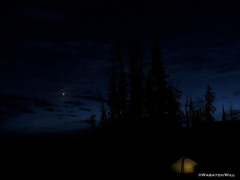
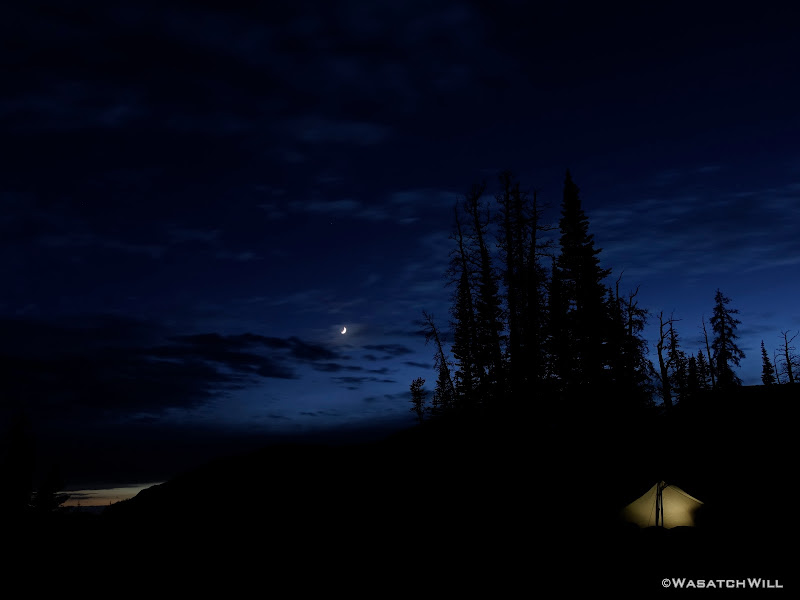
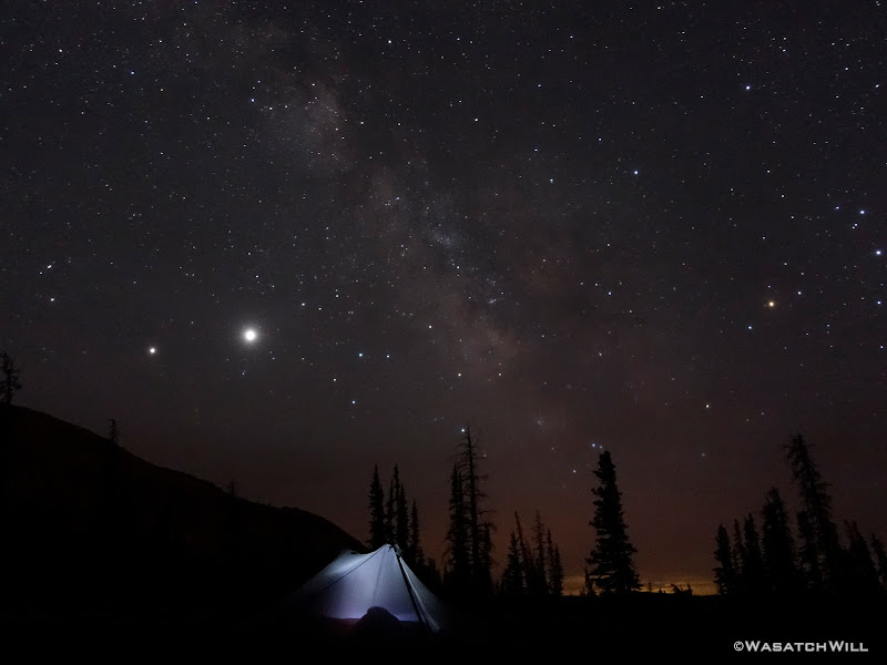
Back at Camp
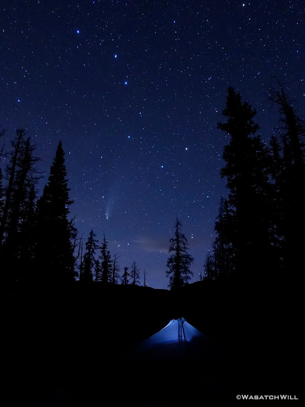
As the skies darkened the stars grew brighter, this night in the backcountry held a promise to deliver on something I may well never get to experience again in such a setting. The Neowise Comet had just passed it's peak evening viewing windows in the weeks before, but it had only been the day before where it had passed Earth at the closest distance it would get to Earth, so there was still plenty to see of it on this night, and it did not disappoint when captured with my newly acquired Sony RX100 camera I had gotten, specifically to have a compact, lightweight option capable of delivering some modestly decent shots of the night sky while out on my backpacking trips.
Tent-glow beneath the moon
Tent-glow beneath the moon
Milky Way Delights
Neowise
Satisfied with some of the results I was able to get, I retired back into my tent and rested for the next day.
Friday - July 24, 2020
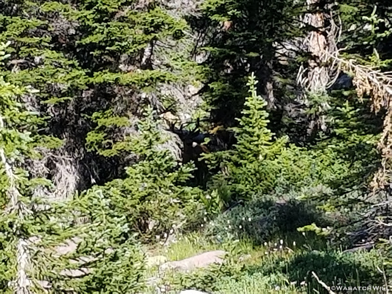
On my way out of camp the next morning, a buck and I startled each other. Off it went into the trees to spy on me while I passed on by.
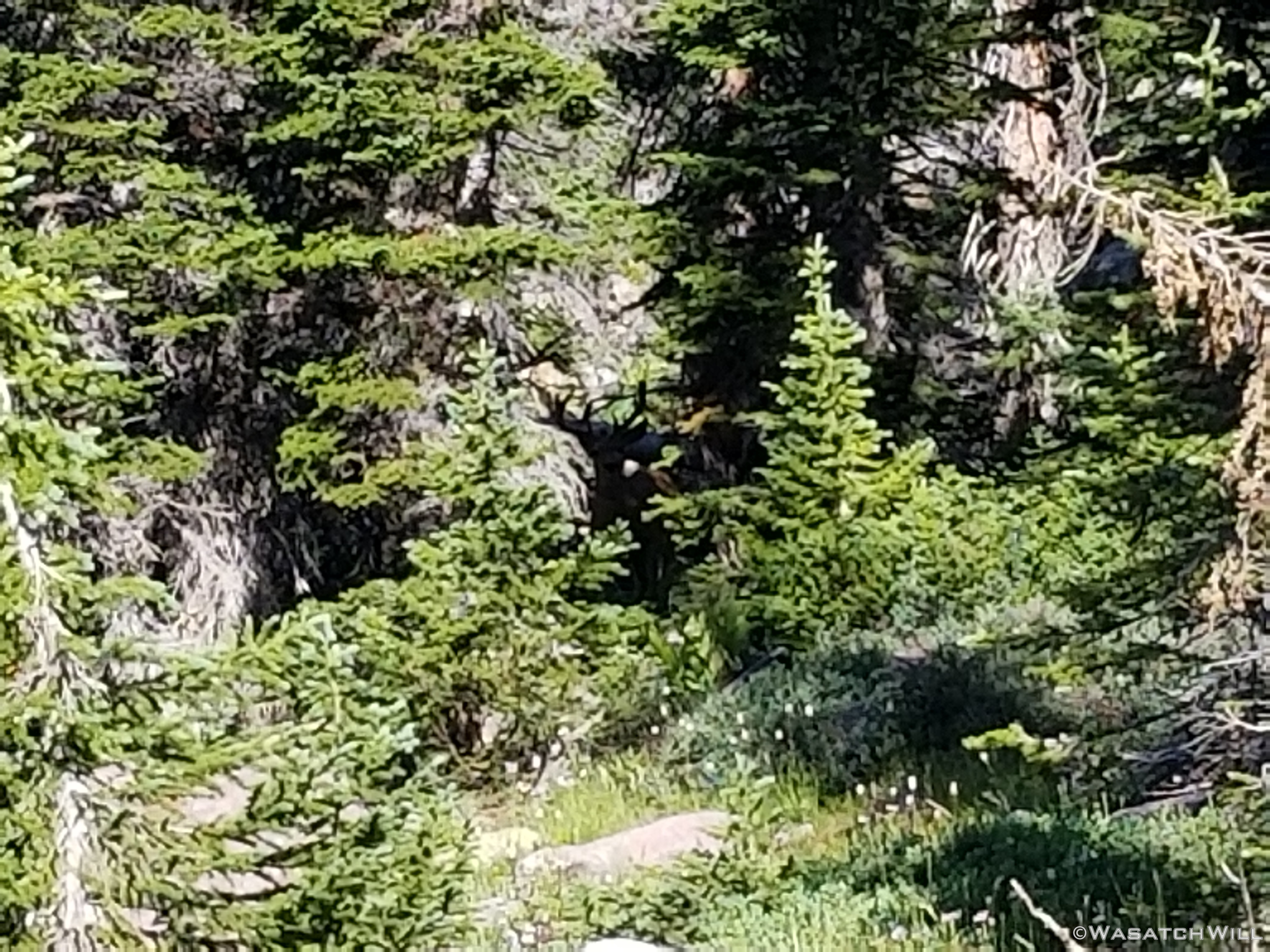
The Big Buck
I made my way back over to Jordan Lake where I could pick up the use trail that climbs up to the bench where Shaler Lake sits.
Jordan Lake
Shaler Lake
From Shaler Lake it was on over to Faxon Lake.
Faxon Lake
I scrambled around Faxon Lake and up the drainage toward Spread Eagle Peak in hopes of finding a good way up to the ridge above to be able to drop down into Middle Basin from there. I had a couple spots marked out on my maps that had looked like they might go. And one might have, but but on the side of the ridge I was on, it looked more loose and steep that I cared to attempt with my current level of fitness and being solo. I believe it would go OK with more time and care for someone who was more in shape because it was only one of about 2 spots one could gain the ridge if doing Spread Eagle Peak from the basin.
Instead, I bailed on that attempt and decided to continue to circumnavigate the upper bench of Naturalist Basin.

Faxon Lake with Spread Eagle Peak above
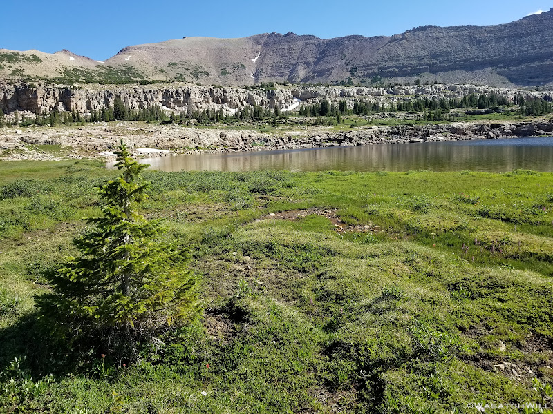
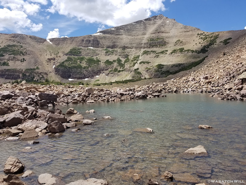
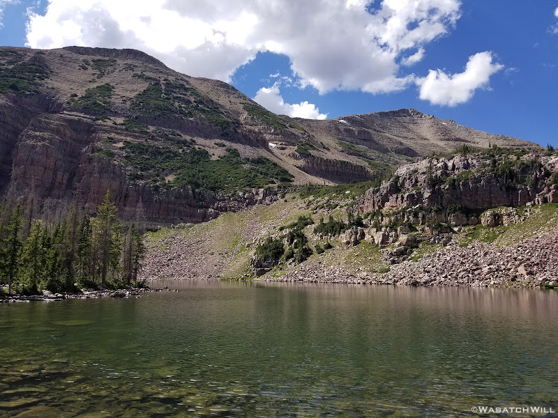
I would go on to pass by LeConte Lake, before stopping in the boulders above Blue Lake. There I would take a lunch, assess the skies, and ponder making another attempt up the ridge I had marked out as another likely route.
Sure enough, while I was sitting on a rock having lunch, darker clouds began to build up a bit and make me wonder if they'd progress into anything bigger and badder in a short amount of time. Ultimately I decided to still scout it out but not take my pack up with me. I had scrambled up through the boulder field that continues on to the ridge from above Blue Lake on my first visit to Naturalist Basin in an effort to climb on up to Mount Aggasiz, but I knew it was nothing but a sheer vertical drop off a high cliff on the other side. So I picked another saddle further over on the ridge and aimed for that. It wasn't too far that I figured if there was a nice enough looking way down the other side, it wouldn't take too much effort to come back down, retrieve my pack and head back up and over.
Well, I made it up pretty smoothly, but by the time I did hit the saddle, gathering clouds moving in were starting to look a little more ominous and I was feeling more pressure to get back down sooner than spend much time looking for an safe and stable enough line down off the other side into Middle Basin. I decided to forgo any attempt to come back up with the pack and simply return another time when I could attempt the loop I was trying to do in reverse, now knowing a straight forward way off the ridge from the saddle I was on back down into Naturalist Basin. It would be much easier to survey the Middle Basin side of the ridge from below than from above and there pick a line to try.
View of LeConte Lake and Jordan Lakes from high on the ridge
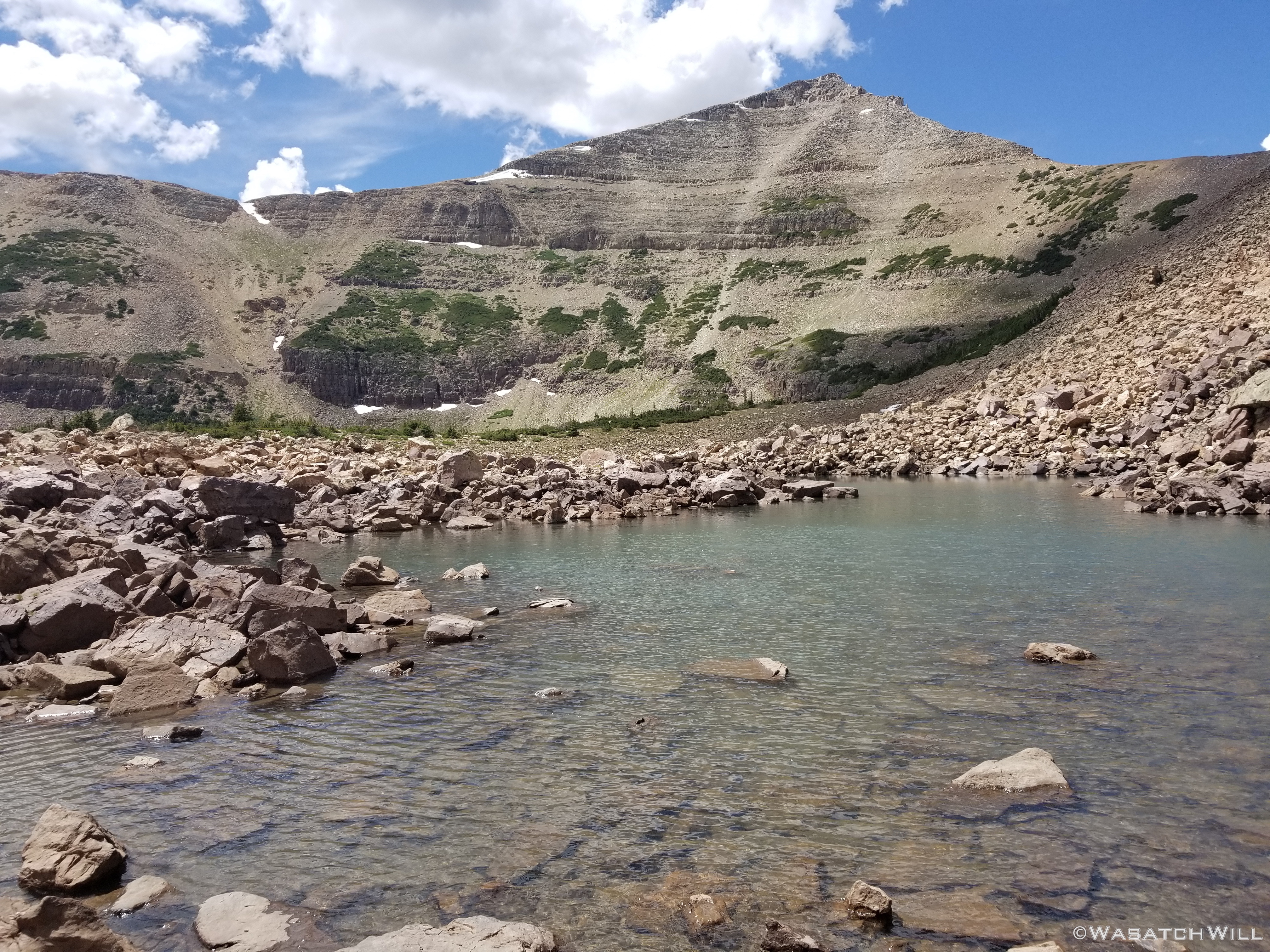
LeConte Lake
Not sure why I didn't think to get a picture of Middle Basin from the saddle when I was up there in addition to the picture I took looking back down into Naturalist. But it is there in my video at the end of this post.
I returned down, retrieved my pack, and opted to head on back down to the Highline trail and settle for a visit out to Packard Lake and accompanying Wilder and Wyman Lakes for the night, as I had yet to ever over to those lakes before. To avoid the scramble down a bunch of boulders to get to the shores of Blue Lake, I chose a milder approach that required I head back in the direction of LeConte Lake and then bending back tower Blue Lake on some lower terrain. There were more meadows and wildflowers to enjoy along the way as well.

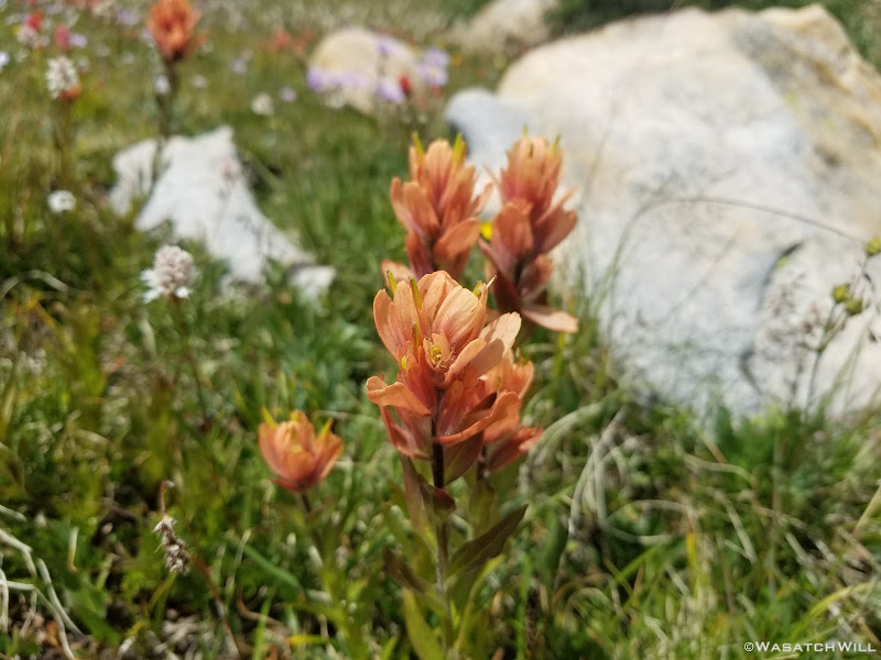
Indian Paintbrush
As it so happened, all the darkening clouds that were threatening to spin off some thunderstorms seemingly vanished even quicker than they had formed and much of the sky went blue again.
Walking the tundra meadows
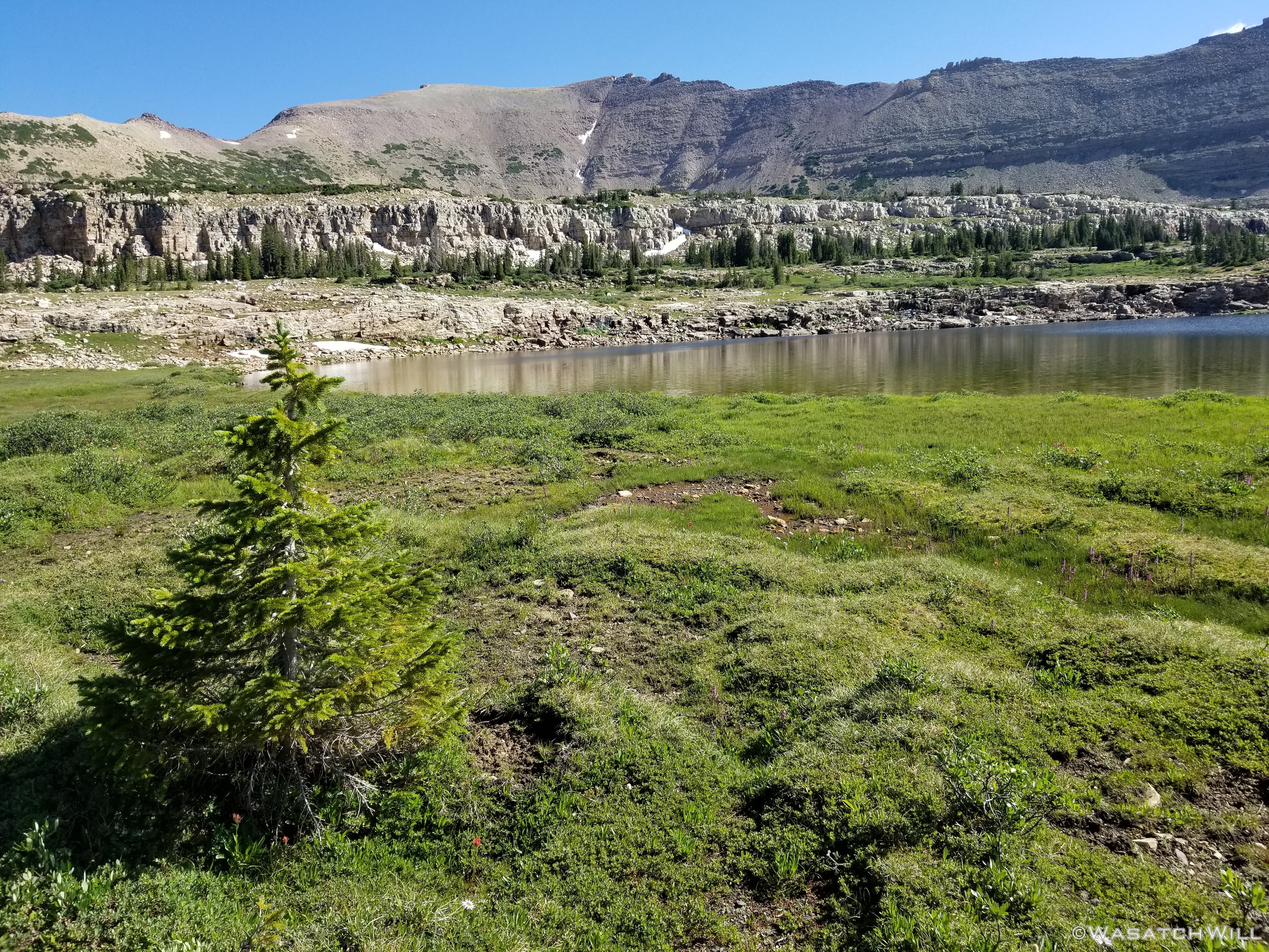
En route, I'd pass right by the shallow little Walcott Lake, which was more like Walcott Tarn now. This was my third time up into Naturalist and it was obvious that the low snow year had taken its toll here for it was much smaller than I remember it ever being and did not look like anything deserving of an official name.
Walcott Lake
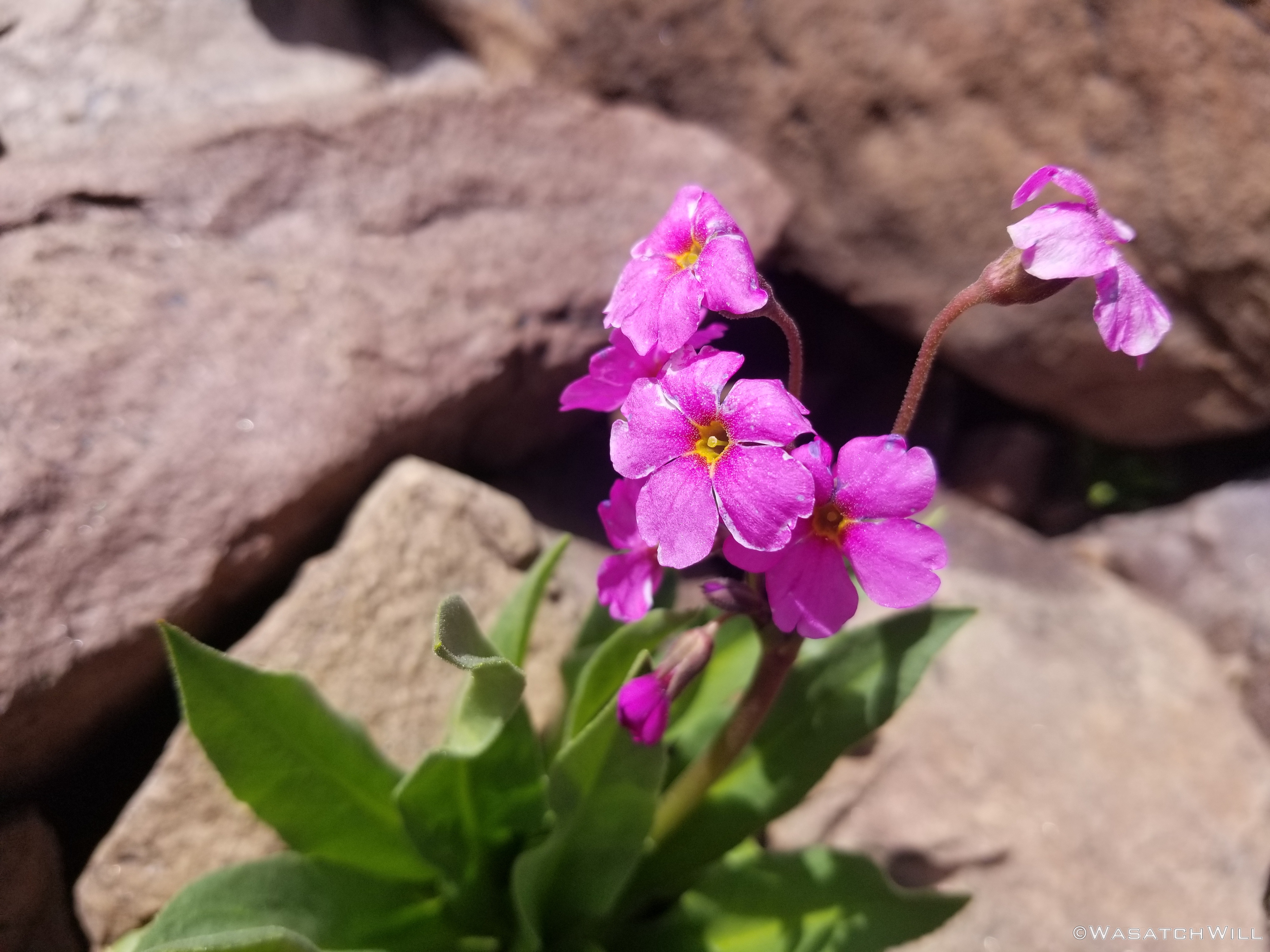
Parry's Primrose
Columbine
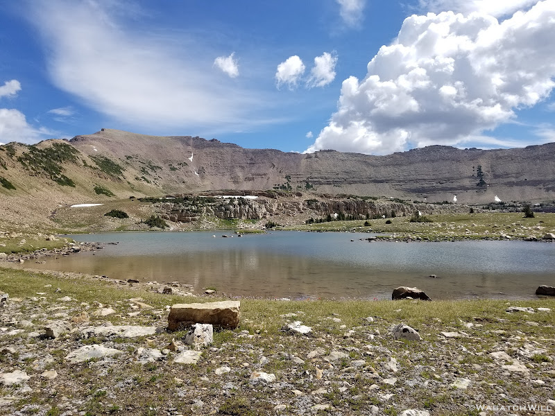
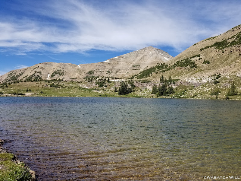
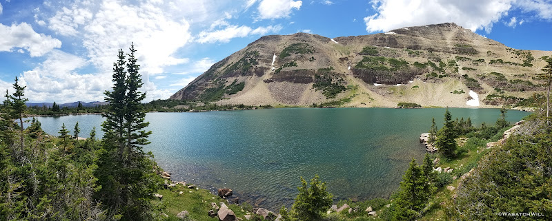
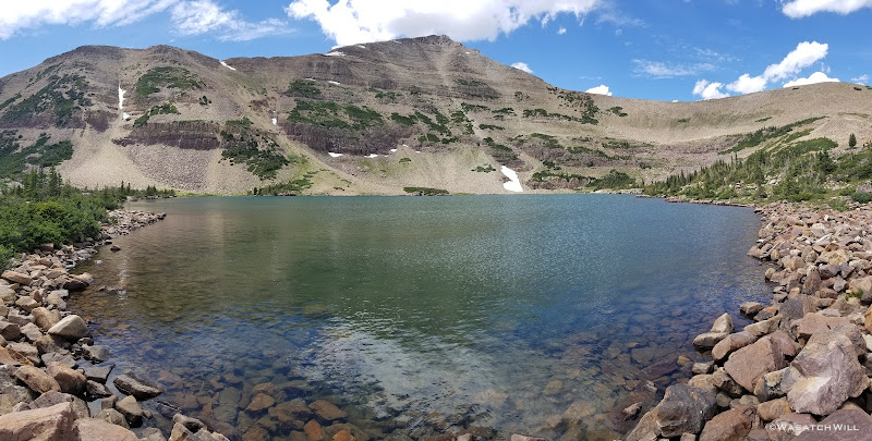
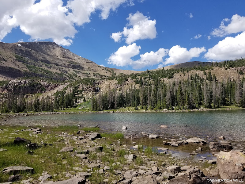
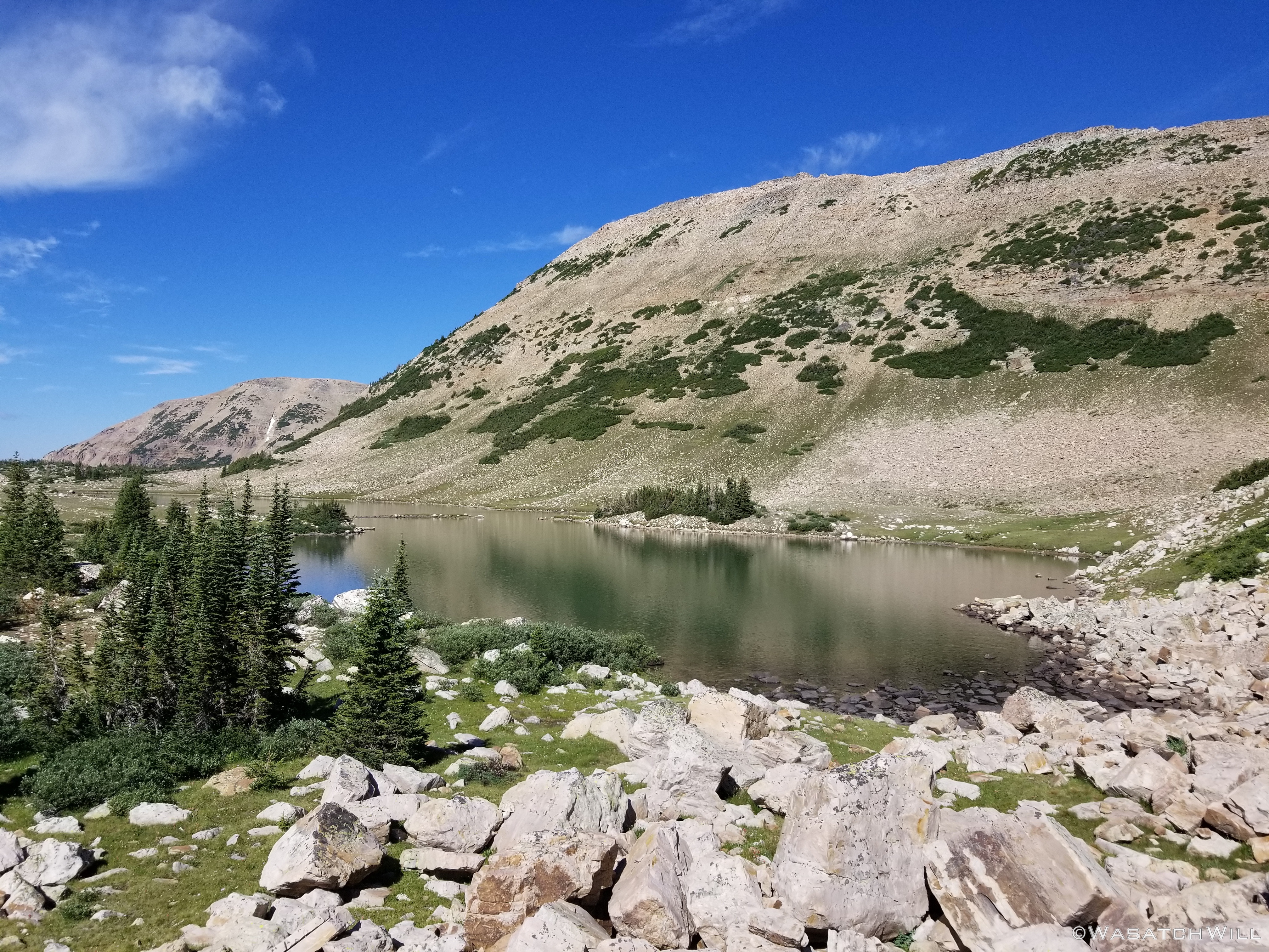
Past Walcott was Blue Lake once more and from there it was on down to the Morat Lakes. By now, several other folks were up and about checking out the lakes while some others aimed for the ridge and Mount Agassiz.
Blue Lake (Mt Aggasiz above)

Blue Lake (Mt Aggasiz above)

Morat Lakes
Waterfall above Morat Lakes

West Morat Lake

East Morat Lake
I stopped at Morat Lakes to try a little more fishing. No such luck catching anything here though. There were a handful of folks camped nearby these lakes as expected too. Impressively, all were further up in the trees and heeding the call to keep their camps 200 feet from the lakes and major water sources. That's not always the case around lakes like these.
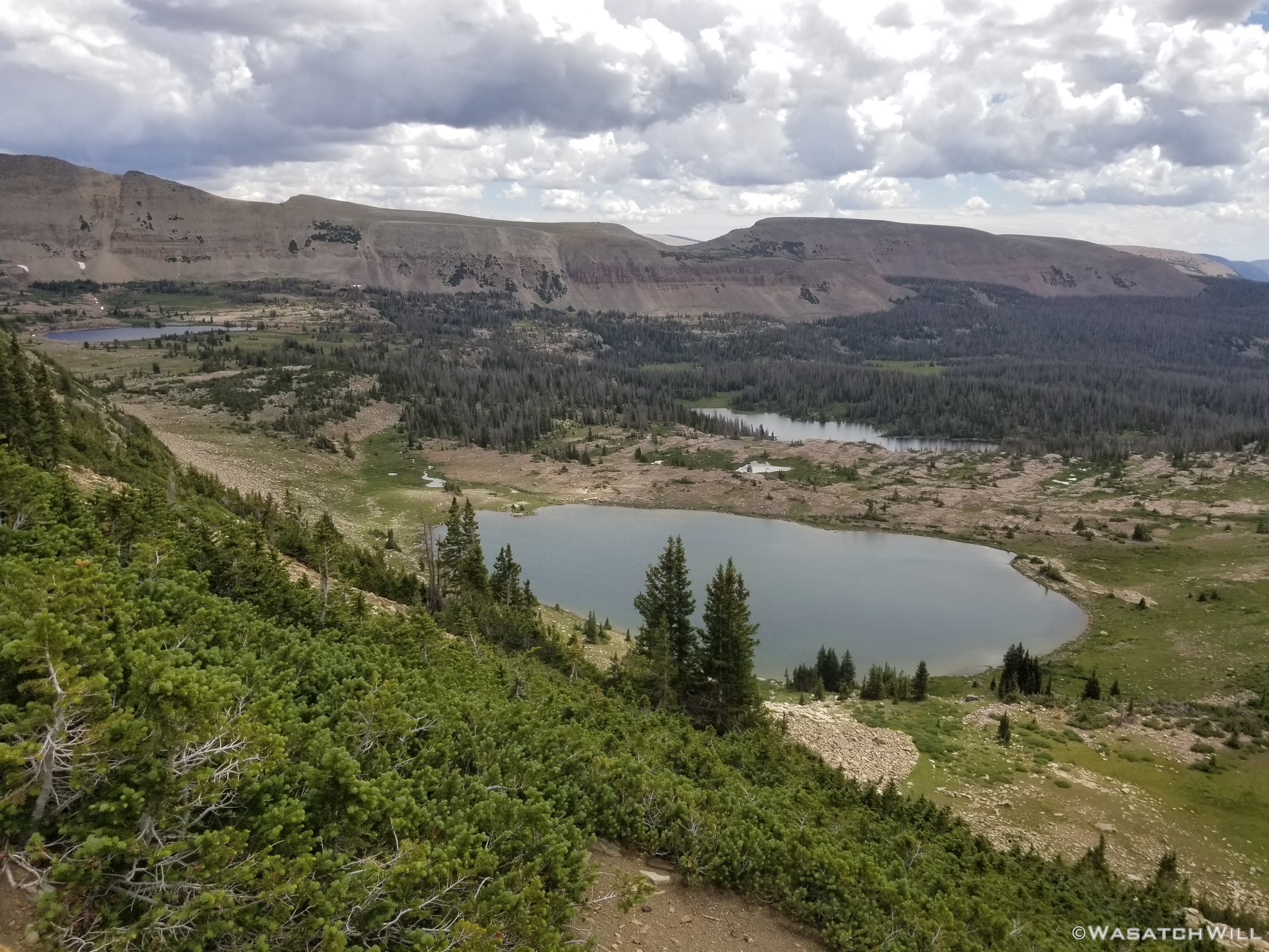
From Morat Lakes, it was back down into denser stands of trees where I followed the trail back out to the main Highline Trail. Being a Friday afternoon I fully expected to encounter hoards of folks on their way up to Naturalist Basin to spend the weekend. Surprisingly, it remained rather quiet for the next mile or two. As I got close to the junction with the Highline Trail however, the weekend rush was on. I passed by at least a dozen or more groups within a short span of time and many more once on the Highline Trail proper as I merrily made my way down to the junction that would lead me off to Packard Lake.
In time, I finally arrived at Packard Lake passing by a huge group of campers tightly packed into the small strip of land between the trail and Wilder Lake. I had held my breath in hopes of finding a good vacant site once I arrived at Packard. To my surprise, I hadn't encountered anyone after the big family/friends gathering at Wilder. I was thinking to settle into one of the campsites within the dense shady trees at Packard, but there really wasn't any good spot for a me to cast a line without risk of some major tangles or getting my feet real wet. There didn't seem to be an obvious trail around the lake and looked like nothing but a huge deadfall obstacle course to get around to any better spots to cast across the lake.
I then thought of a really choice looking site I had scouted out back near Wyman Lake I had filed away in my mind in case that was nothing available to be found at Packard. Despite being free of people, I still decided to return back to Wyman to set up camp near there. On my way out, I checked out the view overlooking the East Fork of the Duchesne River right by Packard Lake. For whatever reason I didn't bother to get my camera out to get a picture of the view though. I think it was because I would have been shooting more into the sun where the most interesting part of the view was. As I turned around I did see an older couple camped out near the big view overlooking the East Fork of the . I was happy to leave the area all to themselves I thought in my head, barring anyone else arriving in late.

Blue Lake (Mt Aggasiz above)
Back in the meadow near Wyman Lake, I planted my tent and thought myself fortunate to obtain a measure of quiet, peaceful solitude that comes with being alone once more. Perhaps this was in part due to the fact that unlike Packard and Wilder, Wyman didn't seem to have any fish activity in it, whatsoever. I concluded it must be too shallow to sustain fish over winter. Such solitude didn't last long though, for as I was sitting down to dinner, a large group came by hooting and hollering. I felt bad for the other couple back by Packard, as I was sure they were heading back in that way. There was no other site that I had seen between where I was and Packard, save what was right along the shoreline of Wyman Lake. Surely they wouldn't set up there, within eyesight of me up in the meadow.
Surely they did, however. Hammocks and tents were set up in a little strip of shoreline that was no more than 10 to 20 feet wide between water's edge and the trail. Perhaps they had anticipated camping where I was set up at and were disappointed to find I had beaten them to the prime spot higher up in the meadow, a spot that would have better accommodated the group. Perhaps they were simply respectful enough to not intrude on my camp while also being desperate enough to get set up somewhere, anywhere, with what little daylight there had been left.
Once they had their camp all set up, a couple of them got some fishing poles out and tried to fish away the night. I sat there in the distance and kind of smirked knowing there was nothing to catch in that lake. Fortunately, they remained good neighbors the rest of the evening by keeping the noise down and remained much quieter, save an occasional chuckle and laugh, than the volume of noise they had produced on the trail coming in.
Indeed, it turned out to be another quiet, enjoyable and relaxing evening after all.
Camp, Day #2
As I went to bed, I decided to make the effort to get up and break camp fairly early, with the intent of hiking back out to Butterfly Lake to do some fishing there in the morning right across from the trailhead where I would await Jess to pick me up and take me back to the cabin to finish out the weekend with another night there.
Saturday - July 25, 2020
Rising early and breaking camp, I set aside an energy bar to serve as breakfast to go while I hiked back out to the Highline. The hike back to the trailhead was leisurely one and relatively enjoyable, passing by some occasional backpackers and many more day-hikers going in either direction, passing through the burn scar once more.
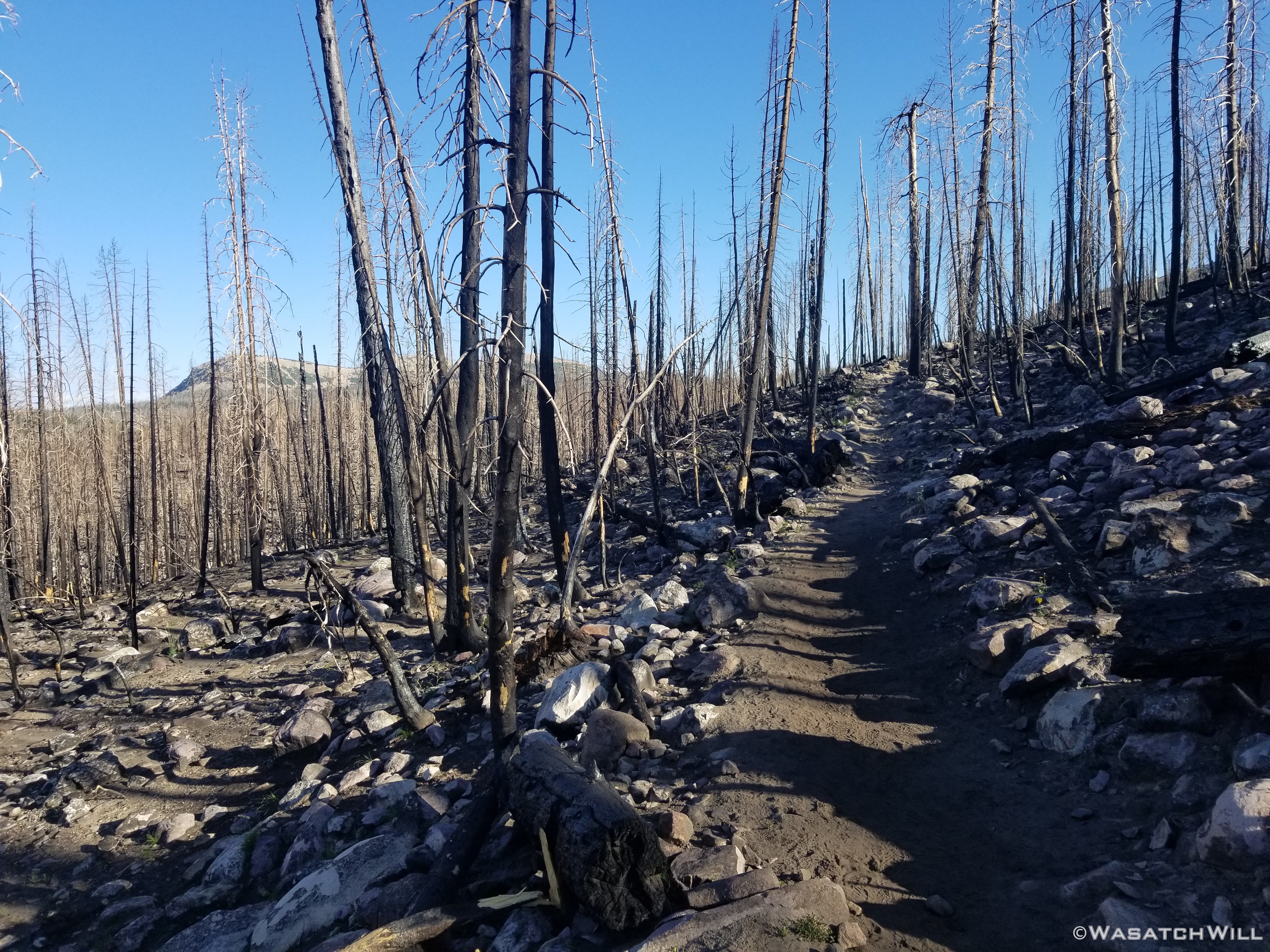
Highline Trail through the Murdoch burn scar
Burn scar pano
Scudder Lake (Bald Mountain above)
Scudder Lake
I arrived back at the trailhead about mid morning leaving me a good couple of hours to spend fishing with the crowds at Butterfly Lake before the scheduled time for Jess to pick me up back at the trailhead.

Hayden Peak reflection
Again, I didn't count on catching anything at Butterfly Lake given the crowds and how much pressure it obviously got. To my surprise I was able to land a few fish though and got a number of other hits.
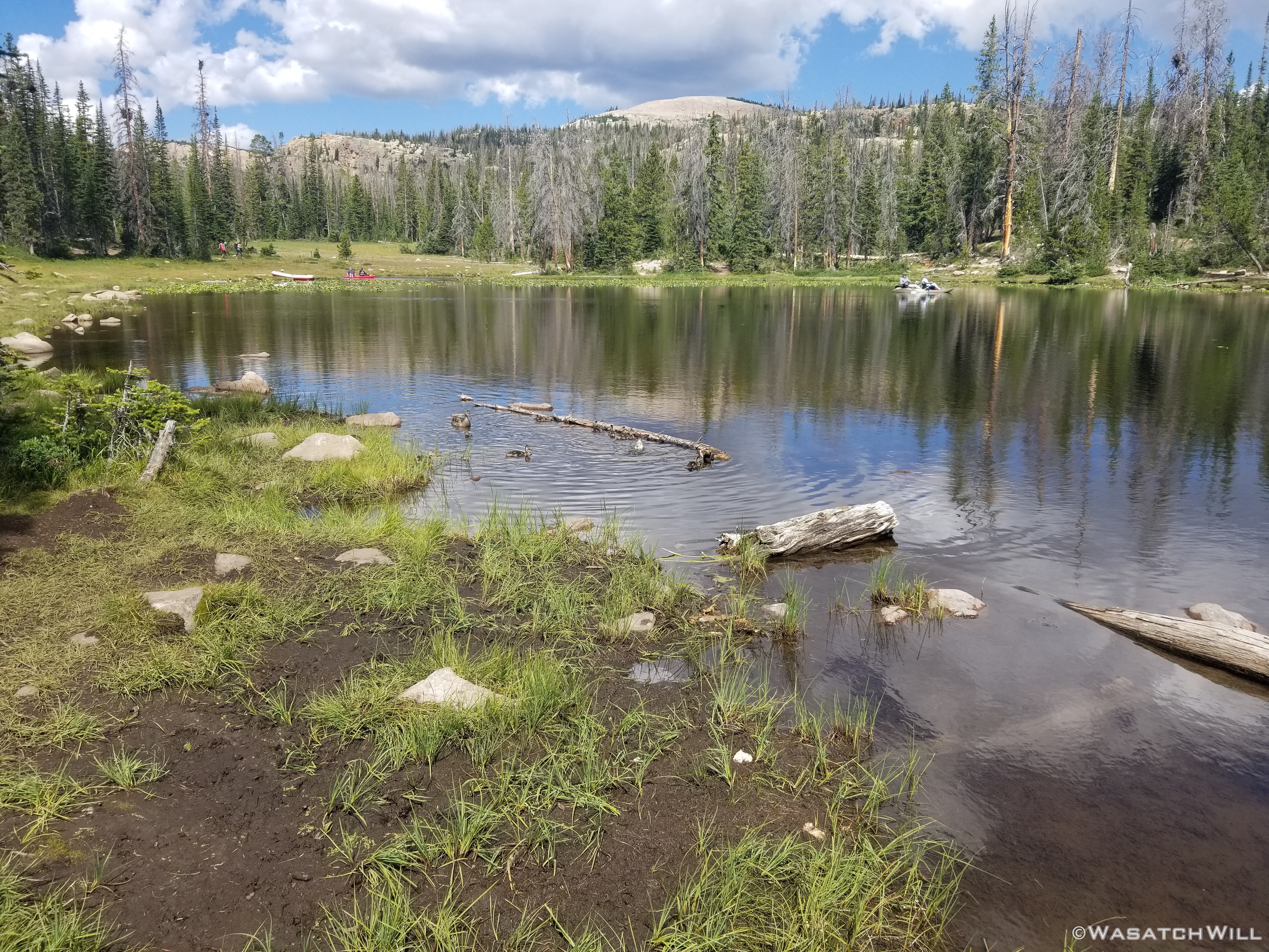
Butterfly Lake
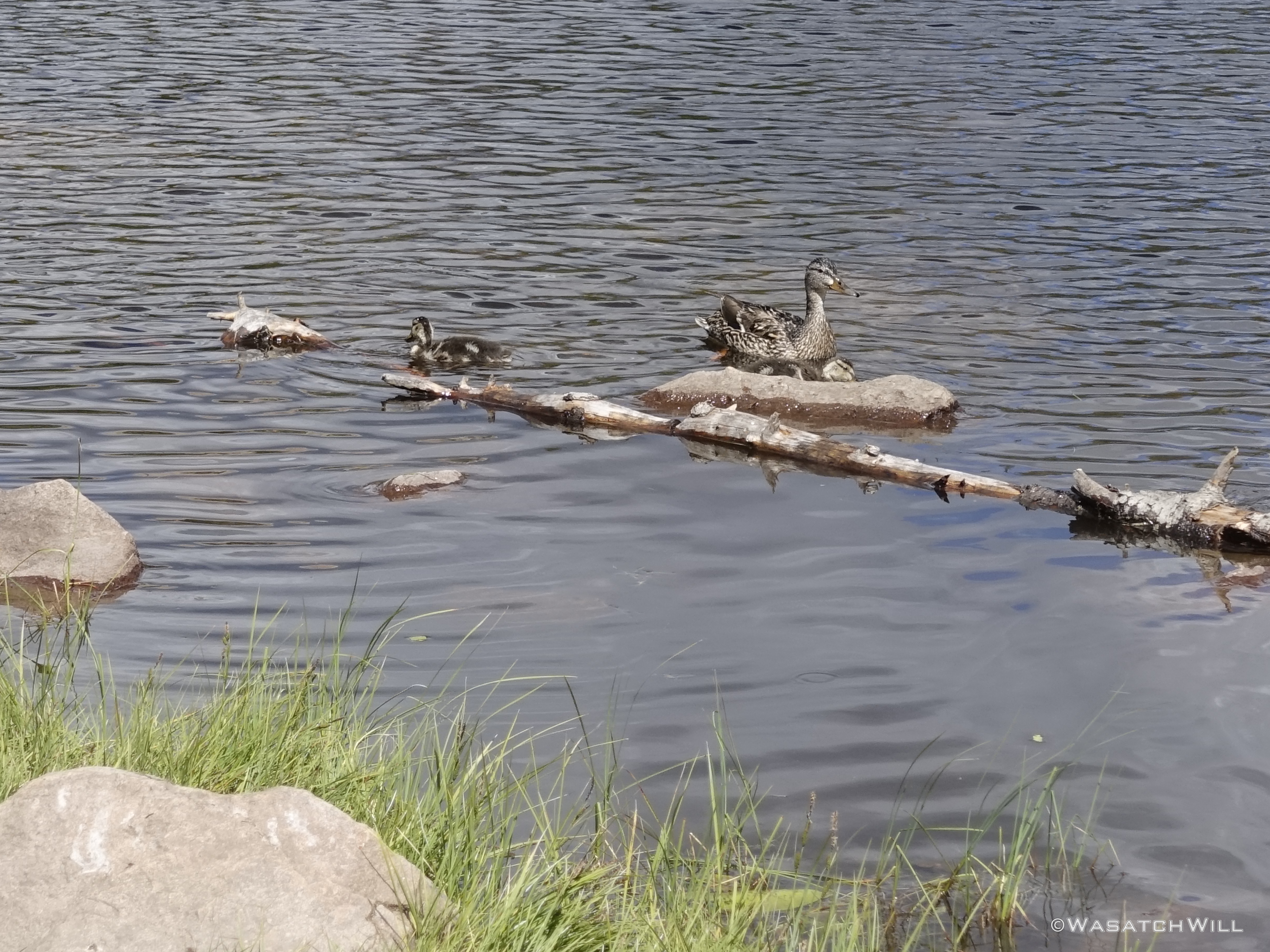
Mama duck and ducklings

Hayden Peak across Butterfly Lake
Pick up time came and I strolled back up to the roadside. A walked back into the trailhead parking and unlike 3 days before, every single space in both the hiker and the horse-rider lot was completely full and everything in between to the point that people were having to revert to parking on the side of the highway to access the trailhead.
I therefore took the opportunity to return to the road and perched myself where I could "hitch-hike" when I saw Jess approaching in our car.
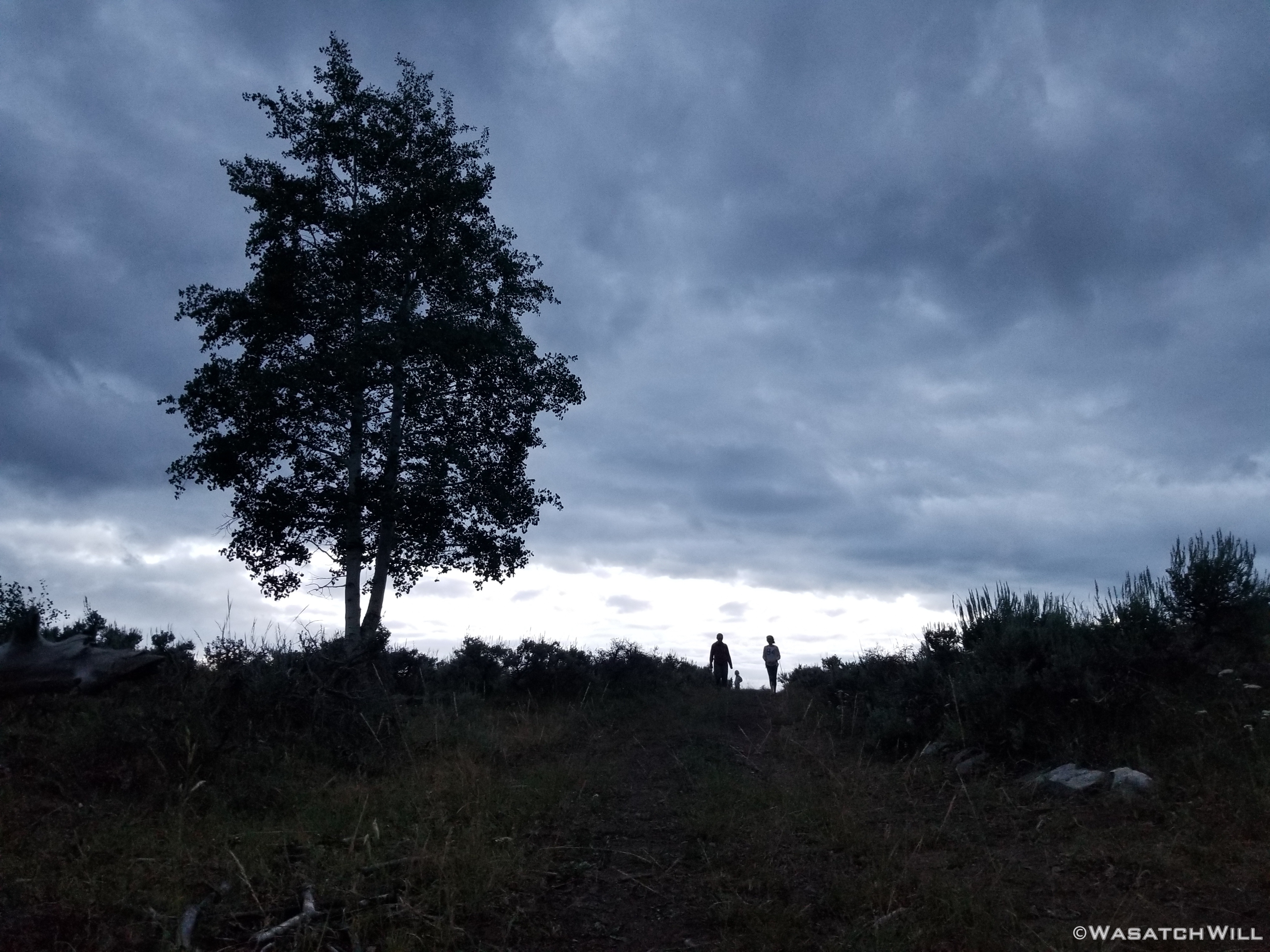
Back at the cabin, there were plenty other sights to be had in going out for some walks with the family later that evening and the following morning.

Family walk
Natural Black and White

Sillouettes
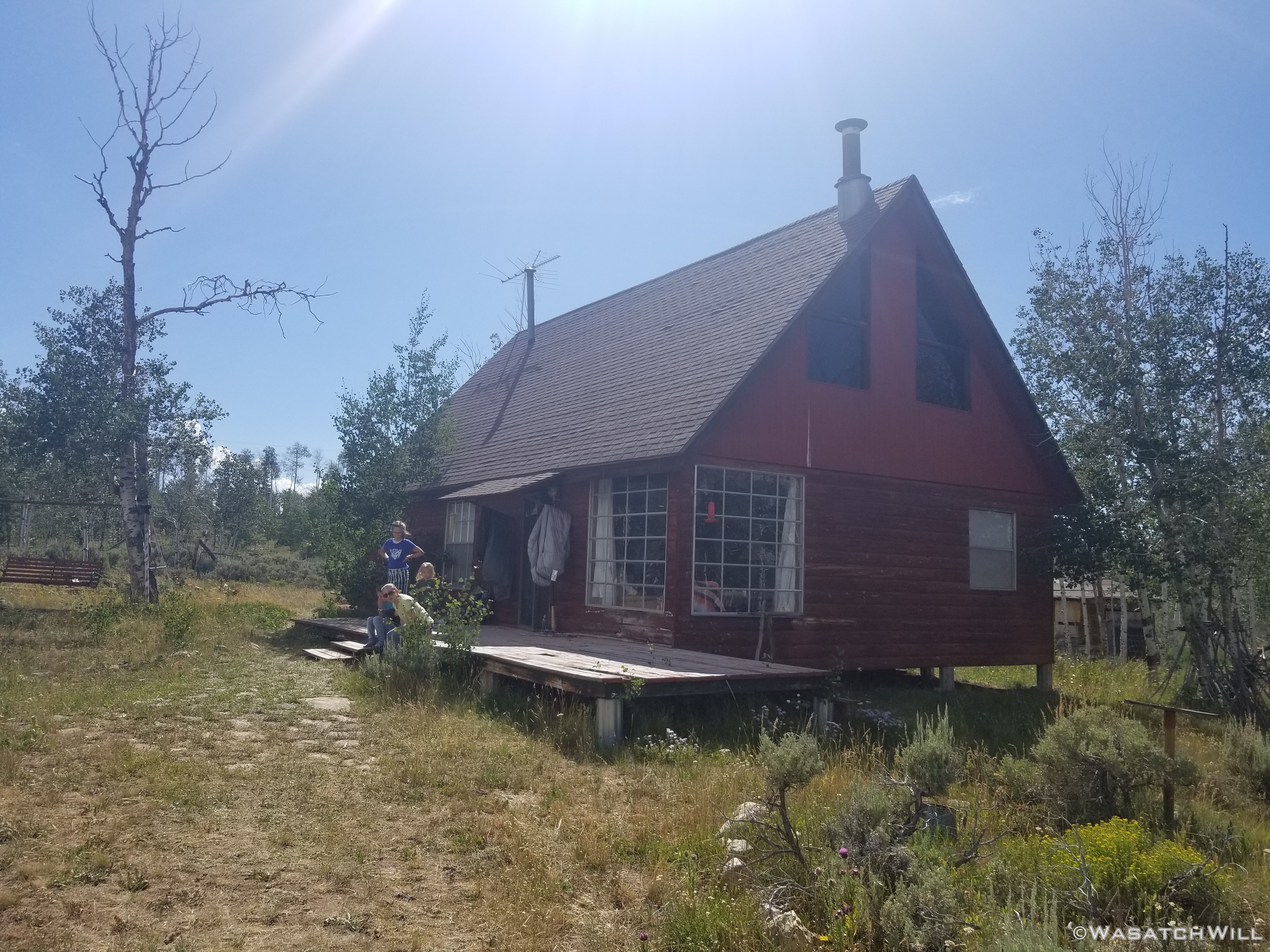
Cabin
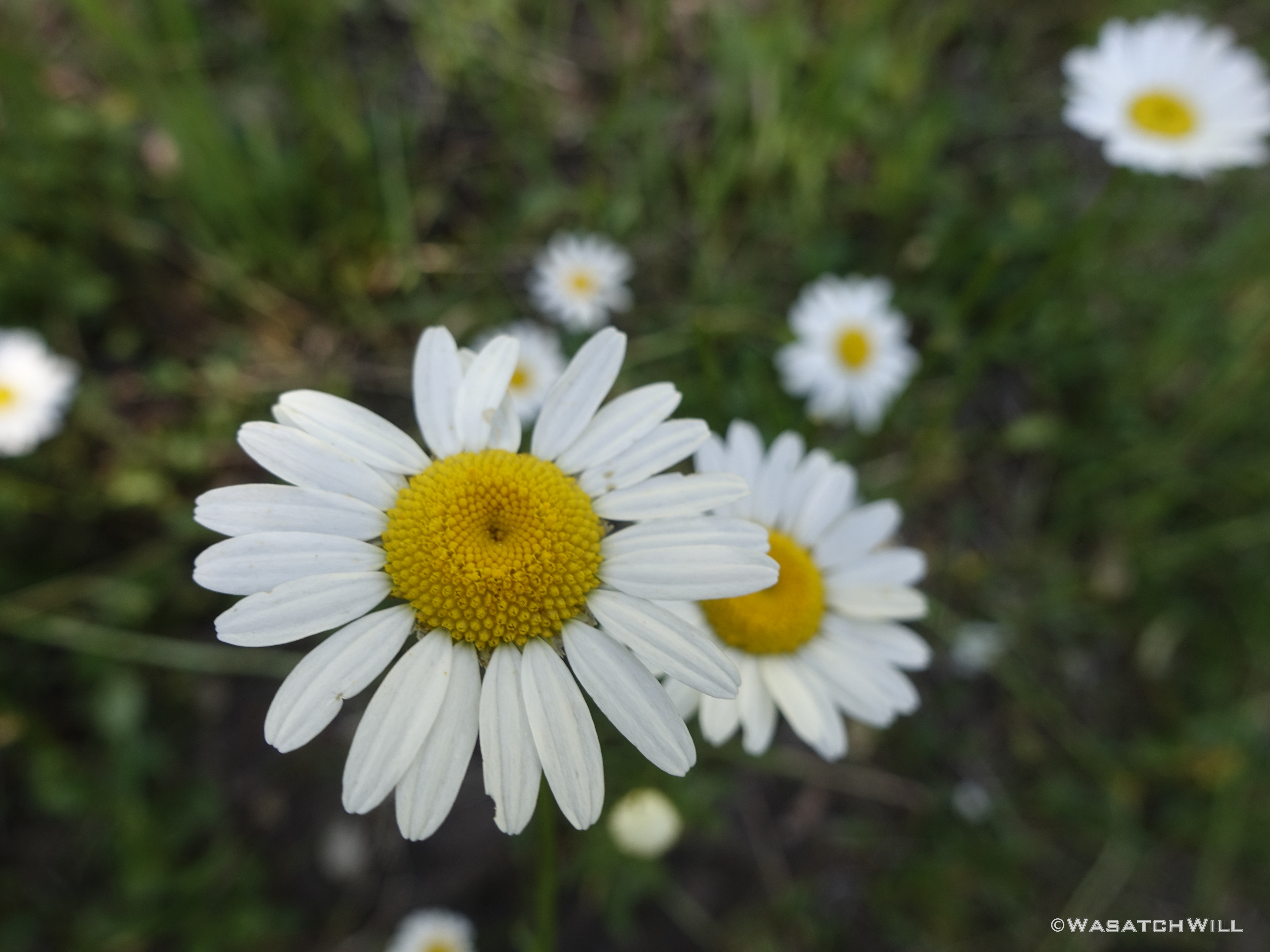
Daisies
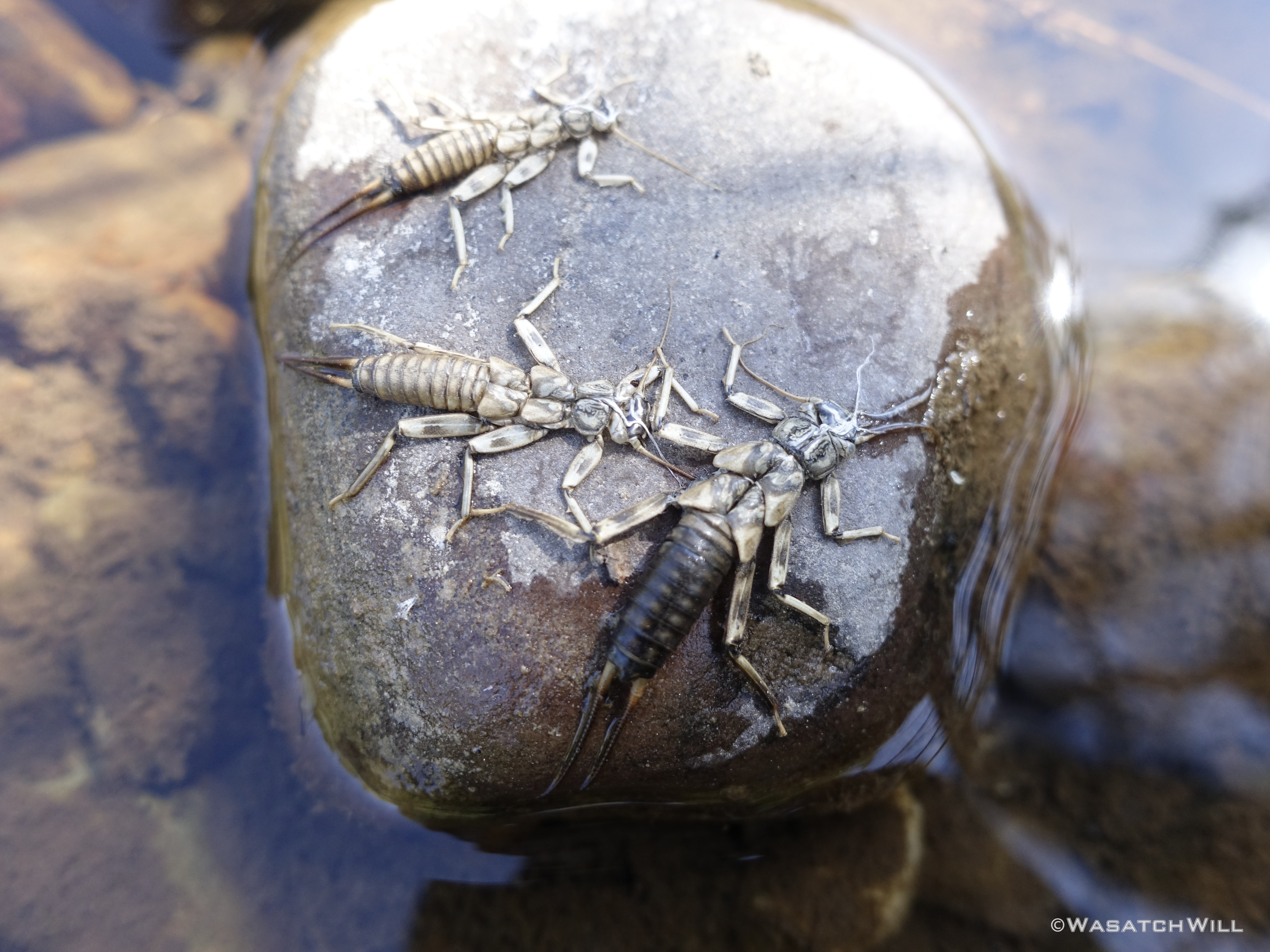
Stonefly Nymphs
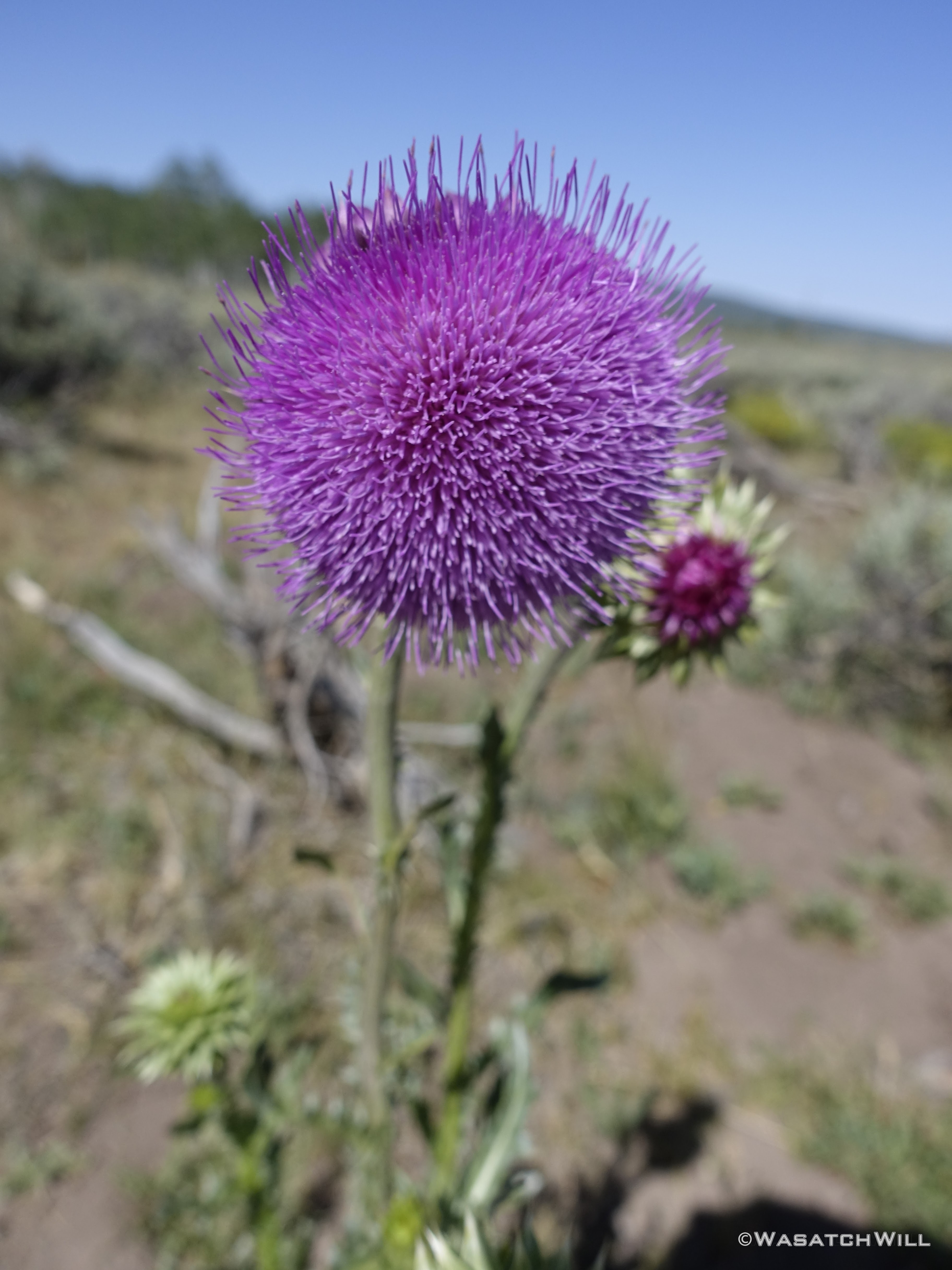
Thistle bloom
Thistle flower bud
Old rustic Chevy truck
Sunset
It was another great trip with the family with a nice little backpacking trip sandwiched in between.
")