HomerJ
Member
- Joined
- Jan 19, 2012
- Messages
- 1,199
Mt Naomi is 21 feet shy of 10,000' (I like to round up and say 10,000! LOL!) and is the highest point in the Cache. There are many ways to hike Mt Naomi with the most popular (and easiest) starting at Tony Grove Lake. The road is paved all the was to the lake. Unfortunately there is a fee to park at the lake. I think the fee is up to $5/day now, but I could be wrong. It is 3.2 miles and 1900+ elevation gain to Mt Naomi.
6-28-2009
A friend and I decided that we would hike Mt Naomi. We had a backpacking trip in the Wind Rivers planned in August and needed to get in better shape before the trip. I had never hiked Mt Naomi this early in the summer and my friend had never hiked it at all.
The trail starts out fairly gradual, but soon starts to climb. Just as the trail started to get steep we ran into some snow in a shady area. We scrambled up the snow, found dry ground and continued on. Not much further and we found snow covering most of the trail. It was a nice sunny day and the snow made it a fun, although more difficult hike.
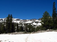
Normally there is no stream/water along the trail, but this time there was a lot from all the melting snow!
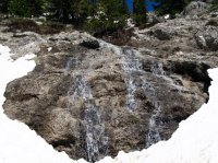
We continued hiking on. Often the trail would disappear under long stretches of snow and we would work our way over to a bare ridge and continue up the mountain.
Here is a shot taken of the Unitas. You probably can't see them in this photo, but they are just below the clouds in the distance.
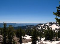
Here is a close up. The snow covered peaks are the Unitas (90+ miles away)! I always stop here when hiking the trail to look for the Unitas!
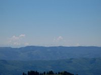
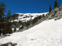
The saddle looking down into Smithfield Canyon. From here it's and easy, sometimes scramble, up the ridge to the South to Mt Naomi.
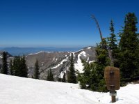
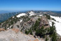
We finally made it to the top. Here's a few looking North.
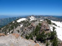
Looking south.
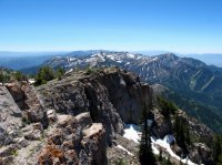
Looking into Cache Valley, Wellsville Mountains in the distance.
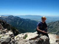
After resting and eating our lunch, we decided to check out High Creek Lake. So we headed back down to the saddle and dropped over into Smithfield Canyon. There was lots of snow and soon we had completely lost the trail. I knew where the lake was so we decided to side hill it across to the ridge above the saddle between Smithfield and High Creek Canyons. We tried to stay as high as we could so we wouldn't have to climb back up as much on the way back. Eventually we made it to the ridge and could see High Creek Lake.
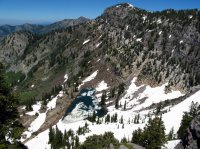
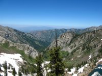
View down High Creek Canyon. The following year I hiked up this canyon.
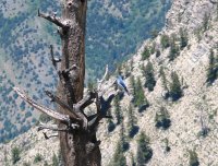
Along the ridge we were on I spotted this Mt Bluejay (I think) and took a picture.
When we were done checking out the lake we headed back the way we came. It was a lot more work getting back up to the saddle we'd dropped over. Once back at the saddle though it was all down hill to the car. The snow made for some great boot skiing along the way! By the time we reached the car we both were quite tired from all the hiking!
Featured image for slideshow:
6-28-2009
A friend and I decided that we would hike Mt Naomi. We had a backpacking trip in the Wind Rivers planned in August and needed to get in better shape before the trip. I had never hiked Mt Naomi this early in the summer and my friend had never hiked it at all.
The trail starts out fairly gradual, but soon starts to climb. Just as the trail started to get steep we ran into some snow in a shady area. We scrambled up the snow, found dry ground and continued on. Not much further and we found snow covering most of the trail. It was a nice sunny day and the snow made it a fun, although more difficult hike.

Normally there is no stream/water along the trail, but this time there was a lot from all the melting snow!

We continued hiking on. Often the trail would disappear under long stretches of snow and we would work our way over to a bare ridge and continue up the mountain.
Here is a shot taken of the Unitas. You probably can't see them in this photo, but they are just below the clouds in the distance.

Here is a close up. The snow covered peaks are the Unitas (90+ miles away)! I always stop here when hiking the trail to look for the Unitas!


The saddle looking down into Smithfield Canyon. From here it's and easy, sometimes scramble, up the ridge to the South to Mt Naomi.

We finally made it to the top. Here's a few looking North.

Looking south.

Looking into Cache Valley, Wellsville Mountains in the distance.

After resting and eating our lunch, we decided to check out High Creek Lake. So we headed back down to the saddle and dropped over into Smithfield Canyon. There was lots of snow and soon we had completely lost the trail. I knew where the lake was so we decided to side hill it across to the ridge above the saddle between Smithfield and High Creek Canyons. We tried to stay as high as we could so we wouldn't have to climb back up as much on the way back. Eventually we made it to the ridge and could see High Creek Lake.

View down High Creek Canyon. The following year I hiked up this canyon.

Along the ridge we were on I spotted this Mt Bluejay (I think) and took a picture.

When we were done checking out the lake we headed back the way we came. It was a lot more work getting back up to the saddle we'd dropped over. Once back at the saddle though it was all down hill to the car. The snow made for some great boot skiing along the way! By the time we reached the car we both were quite tired from all the hiking!
Featured image for slideshow:

