Udink
Still right here.
- Joined
- Jan 17, 2012
- Messages
- 1,748
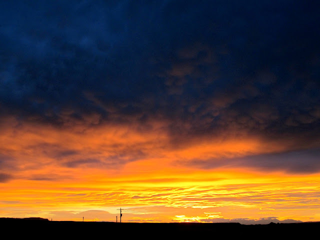
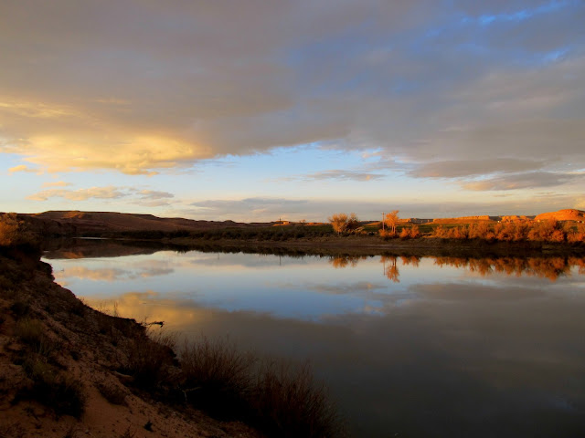
There was a brilliant sunrise just outside of Green River on Saturday morning. I pulled to the side of US-6 to get a photo of it, and after I was under way again it got better and better. I wish I'd have stopped again for another photo when the sunrise was at its peak.
Sunrise just outside of Green River
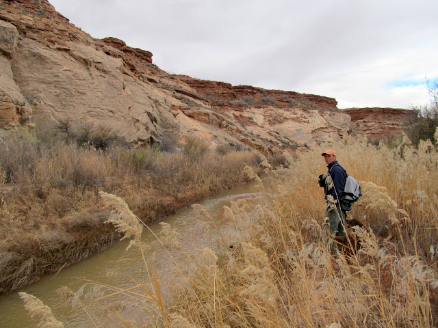
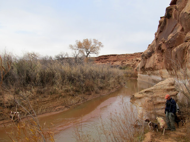
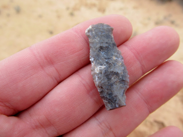
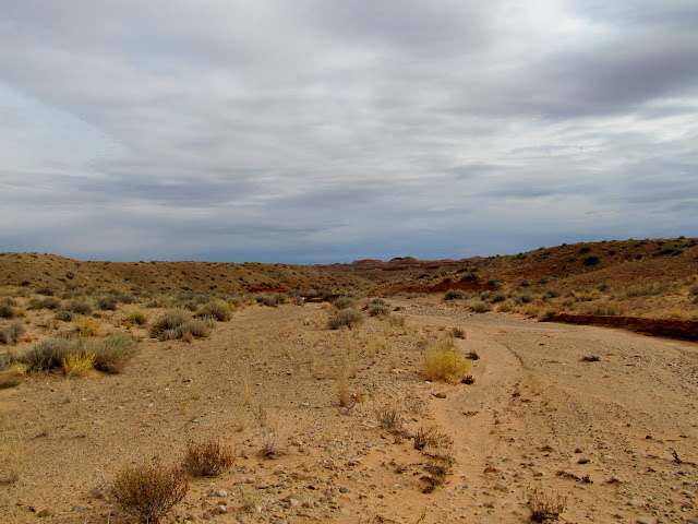
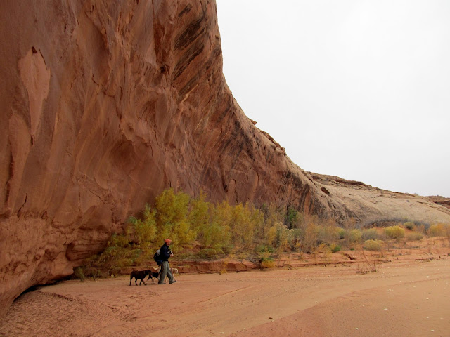
Alan and I, along with our combined four dogs, had gotten a 6AM start from Price in order to take advantage of every minute of available daylight. Earlier in the week I'd been considering a solo overnighter along the lower San Rafael River area, but when Alan texted me saying he was looking to do a day trip on Saturday, we decided to see how much we could squeeze into a single day. We started our exploration along a stretch of the San Rafael River. I'd checked the flow the previous day and the river was running at 21 CFS. I was hoping we could cross it without getting wet but it was wider and deeper than I imagined. We did a lot of bushwhacking while scoping out the river and the cliffs to the north, but our search didn't yield any new rock art. Next we drove a little farther and then hiked along the south end of a low, wide sandstone butte. There was a lot of raw chert material on the ground (typical for anywhere along the San Rafael River), and we found a couple of broken arrowheads and several areas full of chert flakes.
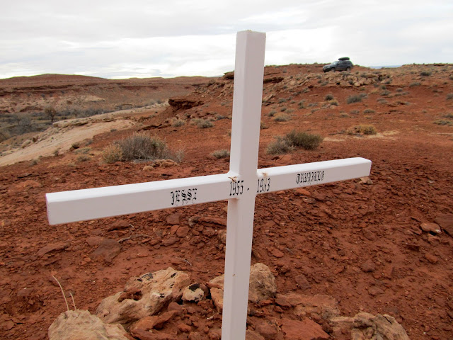
Jesse Trujillo, 1955-1983
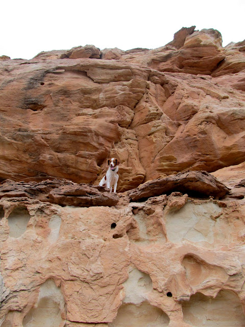
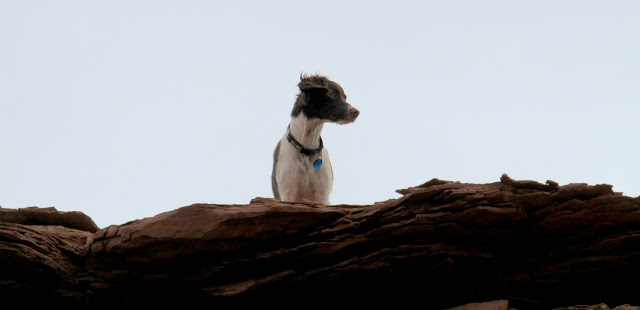
Torrey got herself ledged out and had to be coaxed back down
Bushwhacking along the San Rafael River
Daisy and Boulder running
Pinched out by the river
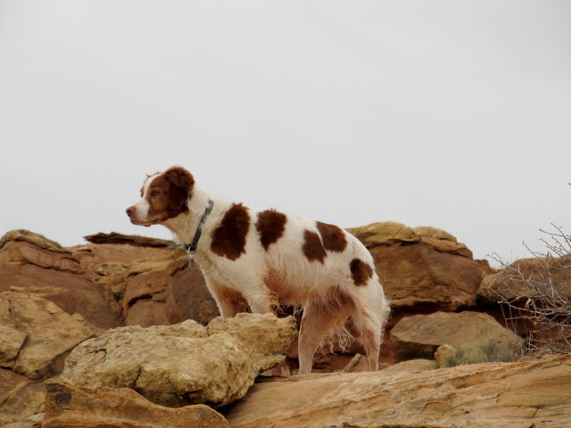
Boulder
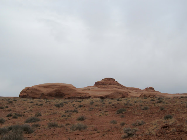
Sandstone buttes rising from the flat desert
An odd arrowhead with a rounded tip
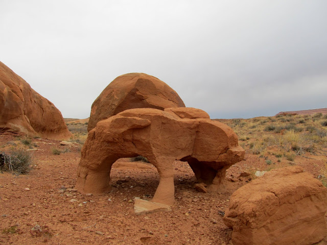
Double arch in a boulder
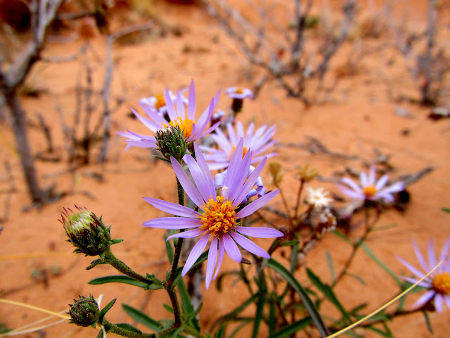
Purple aster flowers, still blooming despite the freezing nighttime temps
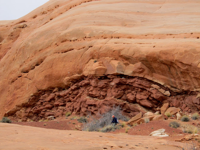
Alan exploring below some cliffs
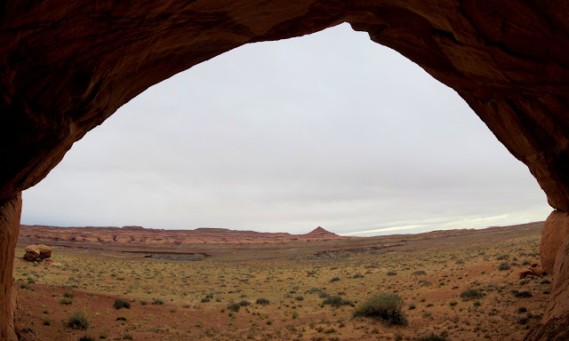
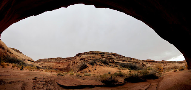
View out of an alcove toward the Cone
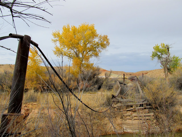
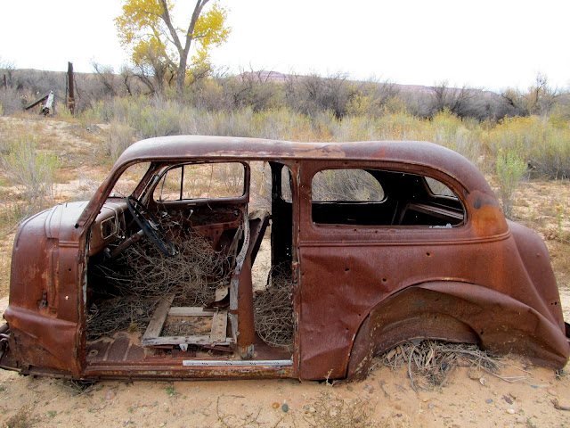
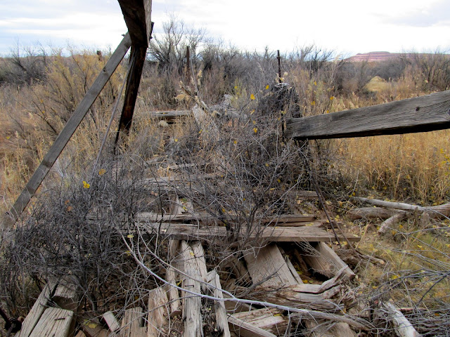
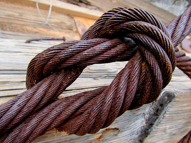
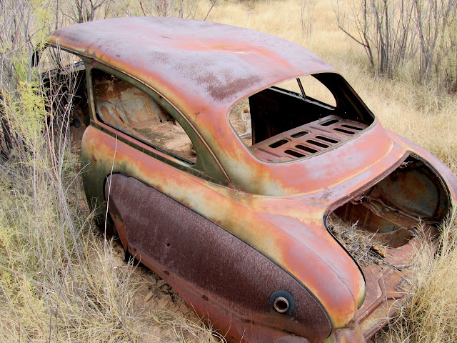
Our next stop was at the old bridge over the San Rafael, just a short distance downstream from the current bridge. There is some new, higher-resolution imagery in Google Earth for much of Utah, and it allowed me to spot the bridge using my computer while planning for this trip. We first approached from the south since we could drive quite close to the old bridge, but most of what remains of the bridge is on the north side of the river. We drove around to the north side and hiked down a wash to get to the bridge from that direction. The abutment and part of the bridge structure and deck is still intact on the north side, and one support cable still spans the river. Nearby were a few old cars. In researching the bridge, the only information I could find was in the book Tales of Canyonland Cowboys by Richard Negri. It contains this quote from Wiladeane Chaffin Wubbin Hills (Ned Chaffin's niece) taken from interviews in 1995 and 1996: "We went down into the canyon [Horseshoe Canyon] on the old road that Granddad Lou and his brother Arth had built through a contract with Phillips Petroleum in 1928 and 1929. ... This was about the same time they built (for Phillips again) the old bridge across the San Rafael River about a mile upriver from our ranch. That bridge was an engineering feat, and it's still standing although not useable."
Old San Rafael River bridge viewed from the south side of the river
We hiked down this wash to get to the north side of the bridge
Car near the bridge
Old San Rafael River bridge
Reef knot in one-inch steel cable
Car near the bridge
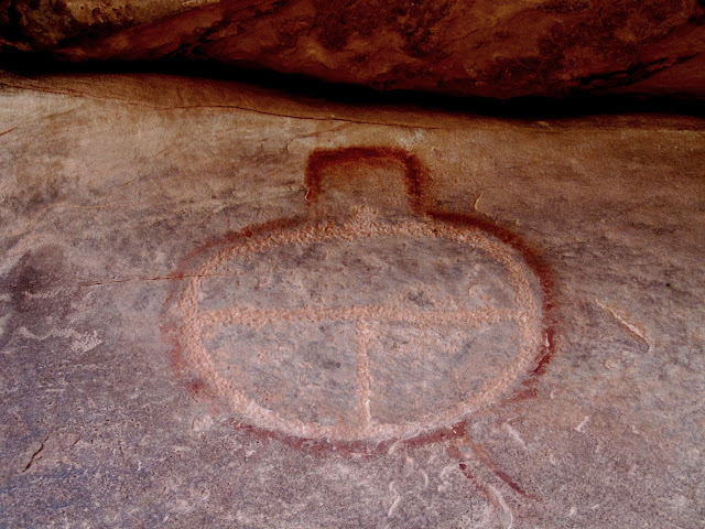
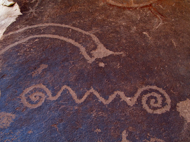
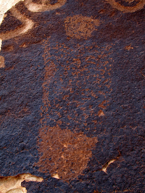
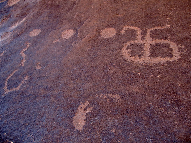
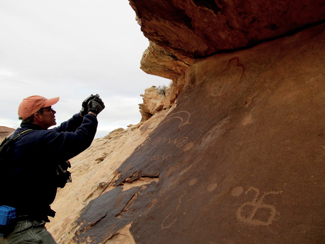
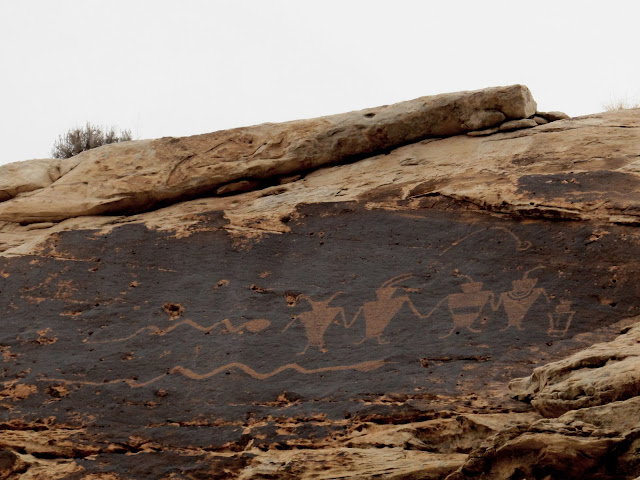
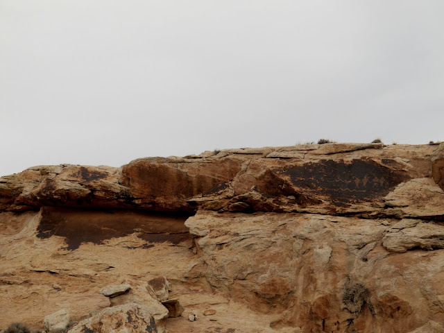
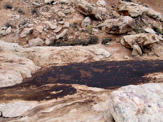
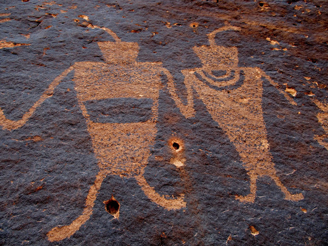
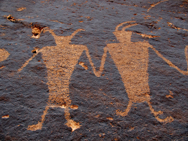
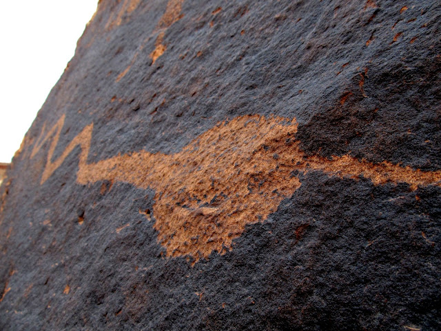
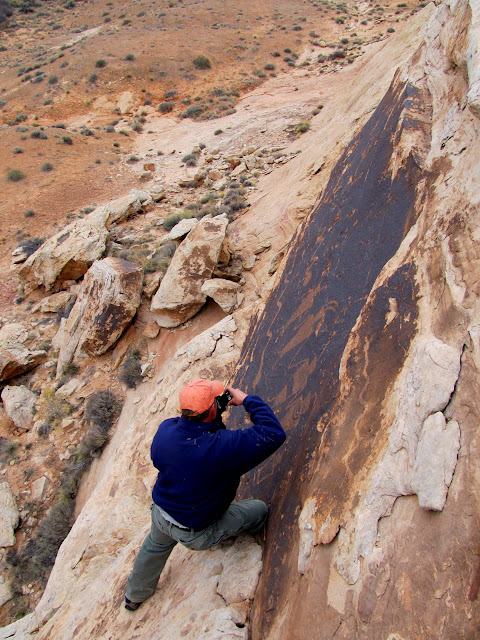
There was some rock art nearby that Alan had been to once before. We made a quick trip over to see it and I was thoroughly impressed. There were some really great Fremont petroglyphs high up on a cliff that we approached from the bottom at first. We climbed up to one of the panels to get a close look, but the other panel couldn't be accessed from the bottom. We hiked around to the top and found that we were able to climb down to the other petroglyph panel to get some closer photographs. The ledge below the rock art was narrow and we each took turns climbing down while the other stayed above and held the dogs at bay.
Petroglyphs and pictograph
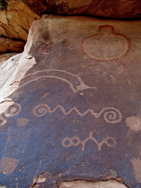
Petroglyph/pictograph mix
Petroglyphs
Petroglyphs
Petroglyphs
Alan photographing the rock art
Petroglyphs
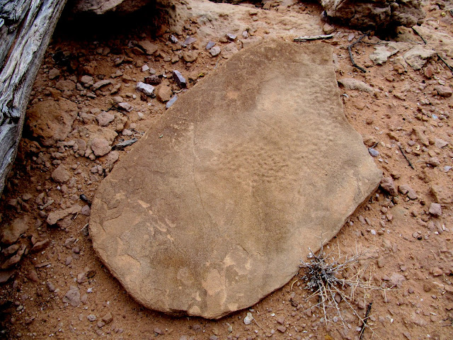
Possible grinding stone
Both petroglyph panels (the one on the left is difficult to make out)
Petroglyphs viewed from above
Petroglyphs
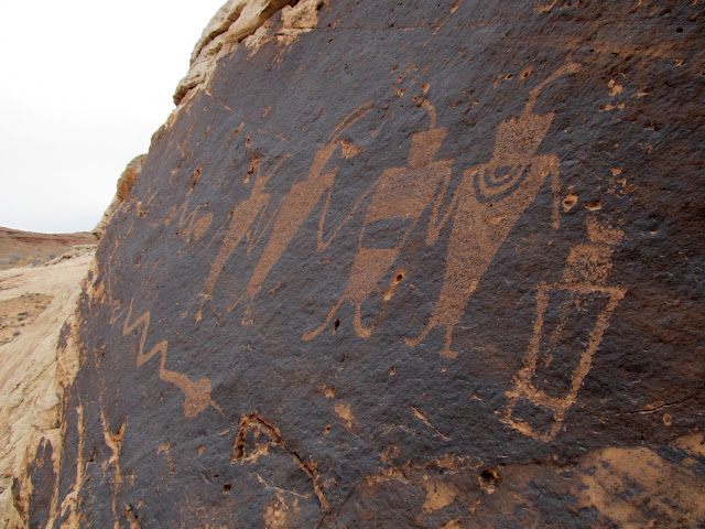
Petroglyphs
Petroglyphs
Petroglyphs
Alan photographing the petroglyphs
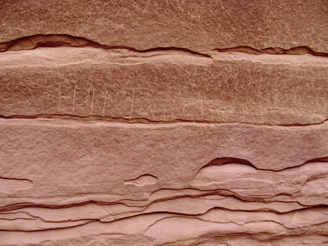
Next we spent a couple of hours exploring Moonshine Wash near its confluence with the San Rafael River. I was really hoping to check out the cliffs on the north side of the river, opposite Moonshine Wash, but again the water was too deep to cross. We hiked about 3.5 miles total in Moonshine Wash but only found some relatively recent sheepherder names scrawled into the canyon walls.
Moonshine Wash
Moonshine Wash
H.H. Twitchell, 1935
Moonshine Wash
Moonshine Wash alcove
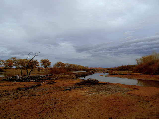
San Rafael River at the Moonshine Wash confluence
Torrey climbing out of Moonshine Wash
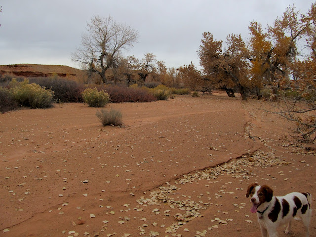
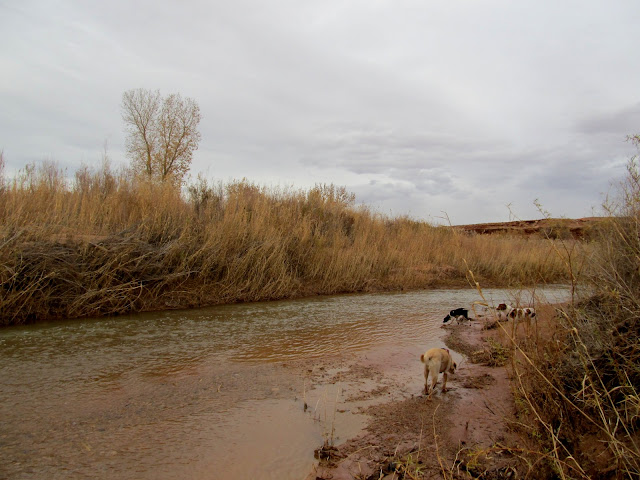
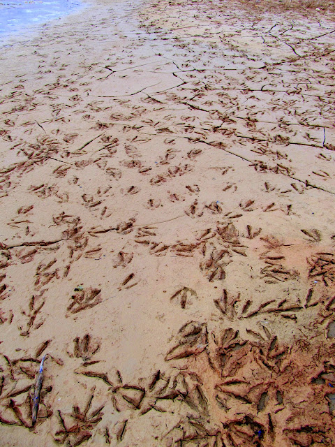
We drove back to the north and took a road that skirts around the north side of Chaffin Ranch and ends at the confluence of the San Rafael River and the Green River. There we planned on looking for arrowheads, but first we followed a trail through the tamarisk to the banks of the Green where the San Rafael enters it. There were a lot of animal tracks in the mud at the confluence--mostly from large birds, but I also saw tracks from deer, raccoon, and other small critters. We returned through the tamarisk trail and looked in some low sand dunes just north of the San Rafael's floodplain for arrowheads. John Wesley Powell mentions this area in his book, The Exploration of the Colorado River and its Canyons, regarding his first expedition in 1869: "July 14.--This morning we pass some curious black bluffs on the right, then two or three short canyons, and then we discover the mouth of the San Rafael, a stream which comes down from the distant mountains in the west. Here we stop for an hour or two and take a short walk up the valley, and find it is a frequent resort for Indians. Arrowheads are scattered about, many of them very beautiful; flint chips are strewn over the ground in great profusion, and the trails are well worn." Alan and I didn't find any arrowheads nor much chert. Perhaps the area has changed a lot since Powell's visit almost 150 years ago.
Green River and San Rafael River confluence
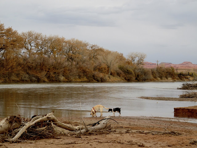
Daisy and Boulder at the Green/San Rafael confluence
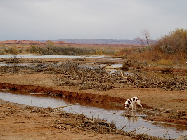
Torrey at the Green/San Rafael confluence
Huge bird tracks at the Green/San Rafael confluence
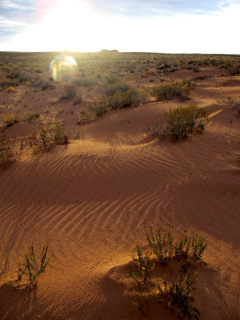
Sand ripples
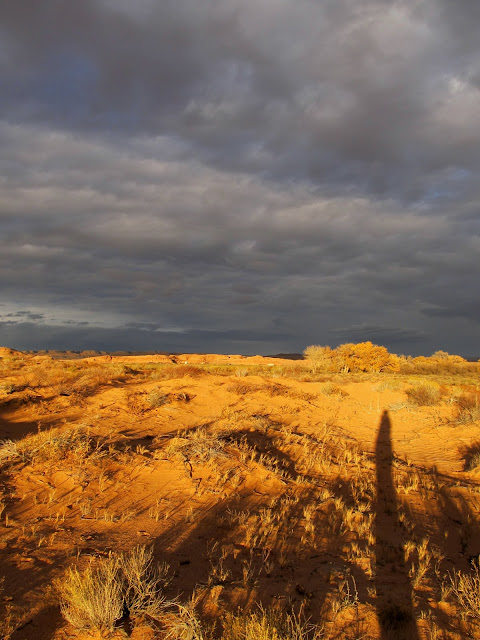
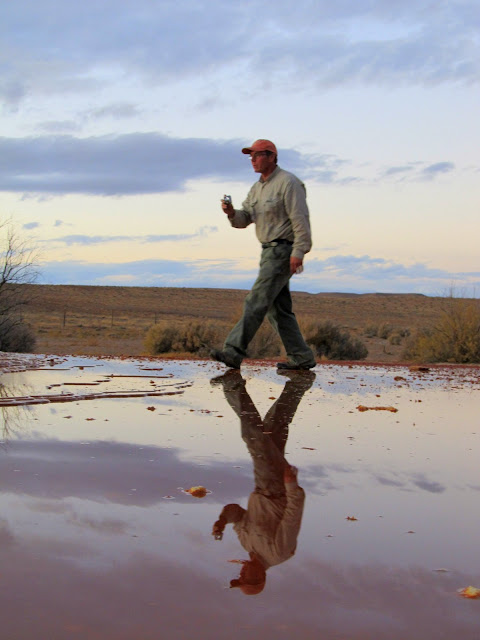
My shadow at sunset
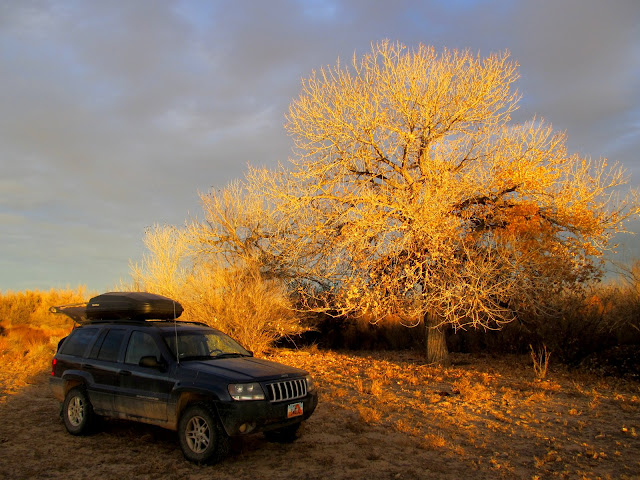
Jeep and cottonwood
Green River
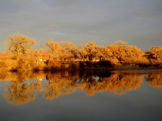
Cottonwoods at Ruby Ranch
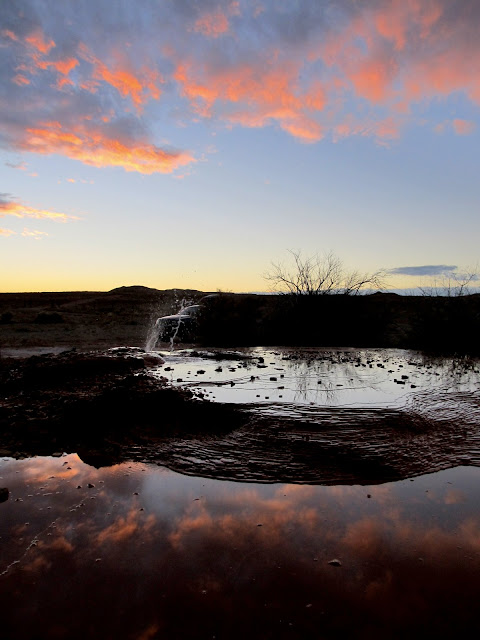
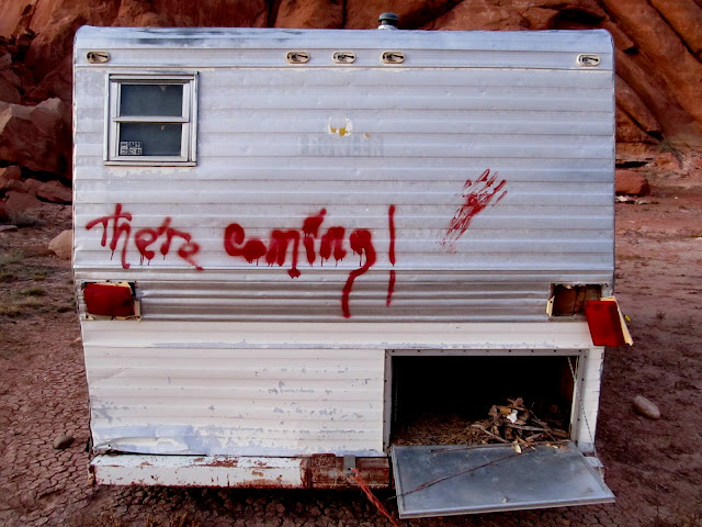
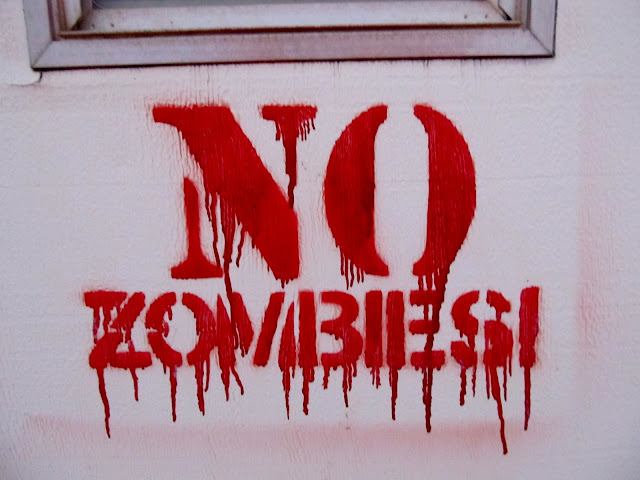
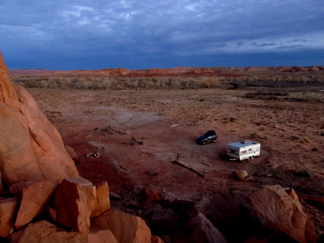
The sun was setting when we got back to the Jeep. We drove to Chaffin Geyser since Alan had never been there before. The geyser was sputtering and made for some nice images with the pink clouds reflecting off the thin layer of water. Finally, during the last few minutes of dusk, we drove another half-mile and looked at the cliffs just north of Chaffin Ranch. A camp trailer has sat abandoned there for years, and I found the graffiti on it amusing. Just as we'd begun the morning's drive in full darkness, so did we start driving home in the dark, having fit everything into the day that we'd hoped.
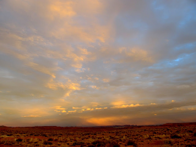
Clouds at sunset
Clouds and Chaffin Geyser
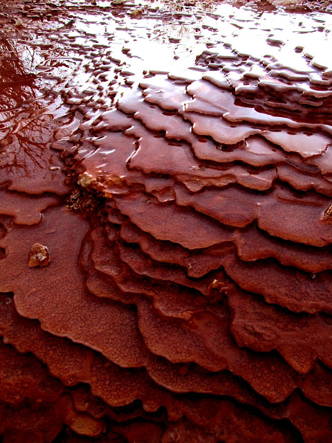
Tiny travertine terraces
Alan at Chaffin Geyser
Trailer at Chaffin Ranch
No Zombies stenciled on the trailer door
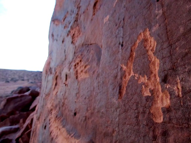
Solitary A carved into the rock near Chaffin Ranch
Jeep and trailer at Chaffin Ranch
Full photo gallery:
https://picasaweb.google.com/Dennis.Udink/LowerSanRafael
[parsehtml]<iframe width="640" height="480" frameborder="0" scrolling="no" marginheight="0" marginwidth="0" src="https://maps.google.com/maps?q=http:%2F%2Fudink.org%2Fgeo%2FLowerSanRafael.kmz&hl=en&sll=39.60063,-110.806334&sspn=0.082005,0.169086&t=h&ie=UTF8&ll=38.756225,-110.162144&spn=0.064255,0.109692&z=13&output=embed"></iframe><br /><small><a href="https://maps.google.com/maps?q=http:%2F%2Fudink.org%2Fgeo%2FLowerSanRafael.kmz&hl=en&sll=39.60063,-110.806334&sspn=0.082005,0.169086&t=h&ie=UTF8&ll=38.756225,-110.162144&spn=0.064255,0.109692&z=13&source=embed" style="color:#0000FF;text-align:left">View Larger Map</a></small>[/parsehtml]http://udink.org/geo/LowerSanRafael.kmz
Featured image for home page:

Sunrise just outside of Green River
Alan and I, along with our combined four dogs, had gotten a 6AM start from Price in order to take advantage of every minute of available daylight. Earlier in the week I'd been considering a solo overnighter along the lower San Rafael River area, but when Alan texted me saying he was looking to do a day trip on Saturday, we decided to see how much we could squeeze into a single day. We started our exploration along a stretch of the San Rafael River. I'd checked the flow the previous day and the river was running at 21 CFS. I was hoping we could cross it without getting wet but it was wider and deeper than I imagined. We did a lot of bushwhacking while scoping out the river and the cliffs to the north, but our search didn't yield any new rock art. Next we drove a little farther and then hiked along the south end of a low, wide sandstone butte. There was a lot of raw chert material on the ground (typical for anywhere along the San Rafael River), and we found a couple of broken arrowheads and several areas full of chert flakes.
Jesse Trujillo, 1955-1983
Torrey got herself ledged out and had to be coaxed back down
Bushwhacking along the San Rafael River
Daisy and Boulder running
Pinched out by the river
Boulder
Sandstone buttes rising from the flat desert
An odd arrowhead with a rounded tip
Double arch in a boulder
Purple aster flowers, still blooming despite the freezing nighttime temps
Alan exploring below some cliffs
View out of an alcove toward the Cone
Our next stop was at the old bridge over the San Rafael, just a short distance downstream from the current bridge. There is some new, higher-resolution imagery in Google Earth for much of Utah, and it allowed me to spot the bridge using my computer while planning for this trip. We first approached from the south since we could drive quite close to the old bridge, but most of what remains of the bridge is on the north side of the river. We drove around to the north side and hiked down a wash to get to the bridge from that direction. The abutment and part of the bridge structure and deck is still intact on the north side, and one support cable still spans the river. Nearby were a few old cars. In researching the bridge, the only information I could find was in the book Tales of Canyonland Cowboys by Richard Negri. It contains this quote from Wiladeane Chaffin Wubbin Hills (Ned Chaffin's niece) taken from interviews in 1995 and 1996: "We went down into the canyon [Horseshoe Canyon] on the old road that Granddad Lou and his brother Arth had built through a contract with Phillips Petroleum in 1928 and 1929. ... This was about the same time they built (for Phillips again) the old bridge across the San Rafael River about a mile upriver from our ranch. That bridge was an engineering feat, and it's still standing although not useable."
Old San Rafael River bridge viewed from the south side of the river
We hiked down this wash to get to the north side of the bridge
Car near the bridge
Old San Rafael River bridge
Reef knot in one-inch steel cable
Car near the bridge
There was some rock art nearby that Alan had been to once before. We made a quick trip over to see it and I was thoroughly impressed. There were some really great Fremont petroglyphs high up on a cliff that we approached from the bottom at first. We climbed up to one of the panels to get a close look, but the other panel couldn't be accessed from the bottom. We hiked around to the top and found that we were able to climb down to the other petroglyph panel to get some closer photographs. The ledge below the rock art was narrow and we each took turns climbing down while the other stayed above and held the dogs at bay.
Petroglyphs and pictograph
Petroglyph/pictograph mix
Petroglyphs
Petroglyphs
Petroglyphs
Alan photographing the rock art
Petroglyphs
Possible grinding stone
Both petroglyph panels (the one on the left is difficult to make out)
Petroglyphs viewed from above
Petroglyphs
Petroglyphs
Petroglyphs
Petroglyphs
Alan photographing the petroglyphs
Next we spent a couple of hours exploring Moonshine Wash near its confluence with the San Rafael River. I was really hoping to check out the cliffs on the north side of the river, opposite Moonshine Wash, but again the water was too deep to cross. We hiked about 3.5 miles total in Moonshine Wash but only found some relatively recent sheepherder names scrawled into the canyon walls.
Moonshine Wash
Moonshine Wash
H.H. Twitchell, 1935
Moonshine Wash
Moonshine Wash alcove
San Rafael River at the Moonshine Wash confluence
Torrey climbing out of Moonshine Wash
We drove back to the north and took a road that skirts around the north side of Chaffin Ranch and ends at the confluence of the San Rafael River and the Green River. There we planned on looking for arrowheads, but first we followed a trail through the tamarisk to the banks of the Green where the San Rafael enters it. There were a lot of animal tracks in the mud at the confluence--mostly from large birds, but I also saw tracks from deer, raccoon, and other small critters. We returned through the tamarisk trail and looked in some low sand dunes just north of the San Rafael's floodplain for arrowheads. John Wesley Powell mentions this area in his book, The Exploration of the Colorado River and its Canyons, regarding his first expedition in 1869: "July 14.--This morning we pass some curious black bluffs on the right, then two or three short canyons, and then we discover the mouth of the San Rafael, a stream which comes down from the distant mountains in the west. Here we stop for an hour or two and take a short walk up the valley, and find it is a frequent resort for Indians. Arrowheads are scattered about, many of them very beautiful; flint chips are strewn over the ground in great profusion, and the trails are well worn." Alan and I didn't find any arrowheads nor much chert. Perhaps the area has changed a lot since Powell's visit almost 150 years ago.
Green River and San Rafael River confluence
Daisy and Boulder at the Green/San Rafael confluence
Torrey at the Green/San Rafael confluence
Huge bird tracks at the Green/San Rafael confluence
Sand ripples
My shadow at sunset
Jeep and cottonwood
Green River
Cottonwoods at Ruby Ranch
The sun was setting when we got back to the Jeep. We drove to Chaffin Geyser since Alan had never been there before. The geyser was sputtering and made for some nice images with the pink clouds reflecting off the thin layer of water. Finally, during the last few minutes of dusk, we drove another half-mile and looked at the cliffs just north of Chaffin Ranch. A camp trailer has sat abandoned there for years, and I found the graffiti on it amusing. Just as we'd begun the morning's drive in full darkness, so did we start driving home in the dark, having fit everything into the day that we'd hoped.
Clouds at sunset
Clouds and Chaffin Geyser
Tiny travertine terraces
Alan at Chaffin Geyser
Trailer at Chaffin Ranch
No Zombies stenciled on the trailer door
Solitary A carved into the rock near Chaffin Ranch
Jeep and trailer at Chaffin Ranch
Full photo gallery:
https://picasaweb.google.com/Dennis.Udink/LowerSanRafael
[parsehtml]<iframe width="640" height="480" frameborder="0" scrolling="no" marginheight="0" marginwidth="0" src="https://maps.google.com/maps?q=http:%2F%2Fudink.org%2Fgeo%2FLowerSanRafael.kmz&hl=en&sll=39.60063,-110.806334&sspn=0.082005,0.169086&t=h&ie=UTF8&ll=38.756225,-110.162144&spn=0.064255,0.109692&z=13&output=embed"></iframe><br /><small><a href="https://maps.google.com/maps?q=http:%2F%2Fudink.org%2Fgeo%2FLowerSanRafael.kmz&hl=en&sll=39.60063,-110.806334&sspn=0.082005,0.169086&t=h&ie=UTF8&ll=38.756225,-110.162144&spn=0.064255,0.109692&z=13&source=embed" style="color:#0000FF;text-align:left">View Larger Map</a></small>[/parsehtml]http://udink.org/geo/LowerSanRafael.kmz
Featured image for home page:
")