Udink
Still right here.
- Joined
- Jan 17, 2012
- Messages
- 1,742
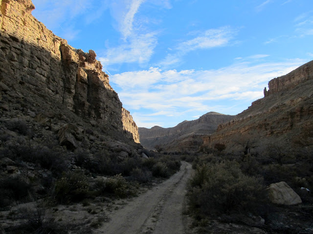
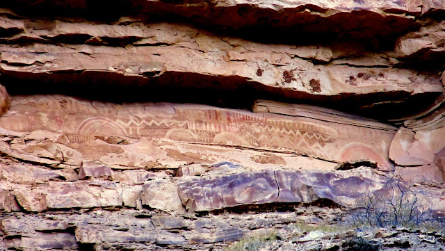
I didn't expect that the lower Price River held so much rock art, but I accompanied Alan on a trip there this past weekend and we found a lot. I was glad to have a guide because much of the rock art is difficult to find unless you know where to look. Alan drove his truck and we got about as far as possible in an F-250 before beginning to hike. We hiked farther down the road and saw some petroglyphs and pictographs that I'd missed on my previous trips in the area. There was one pictograph panel in particular that was amazing, but we couldn't find a way to climb up to it. It appears that since the rock art was made a rockfall has rendered it inaccessible. We continued past the point where the road leaves the canyon and looked for a place to cross the river.
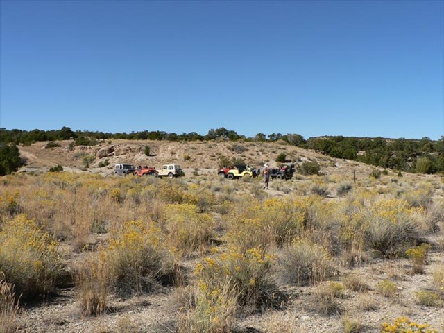
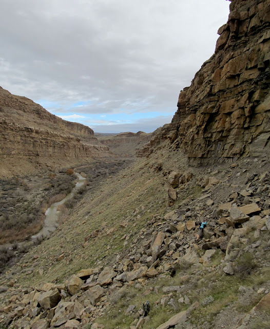
Starting the hike with blue skies
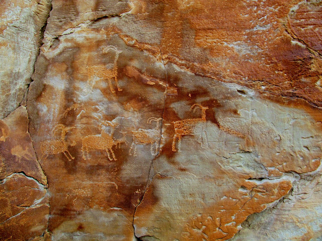
Petroglyphs high above the road
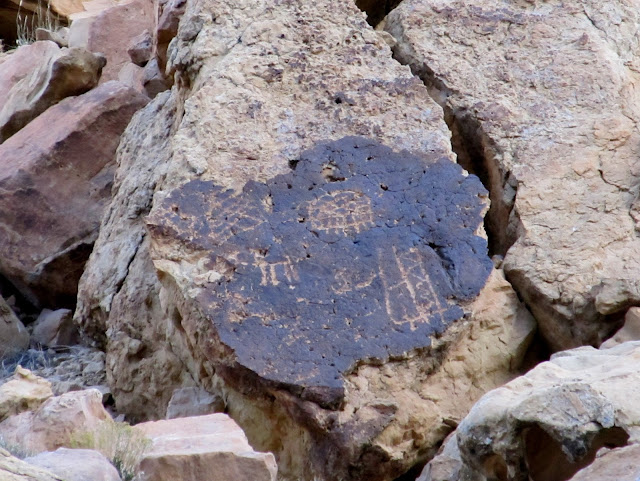
Petroglyphs high above the road
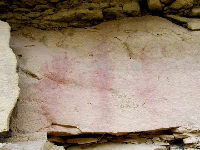
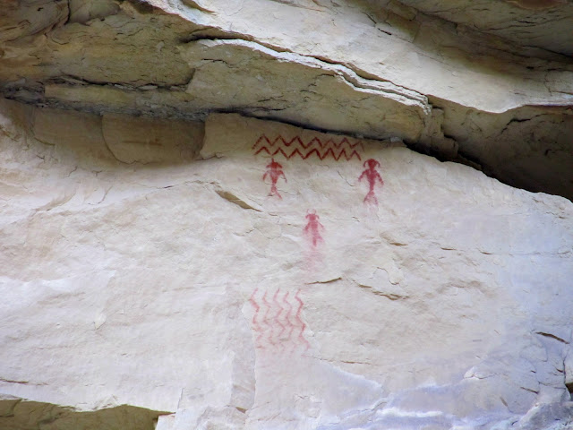
Red and yellow pictographs
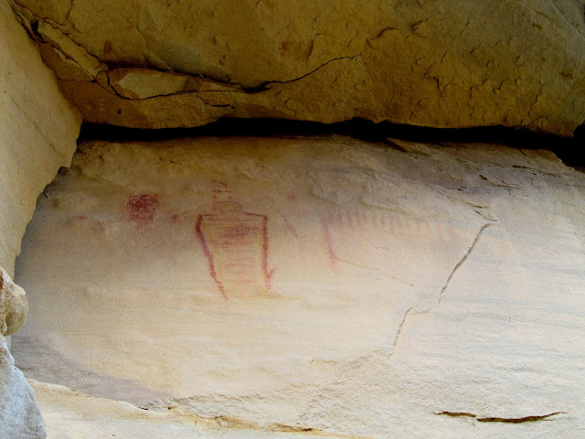
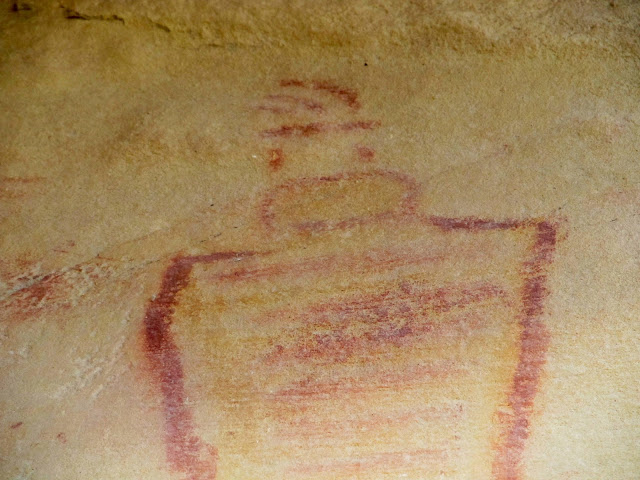
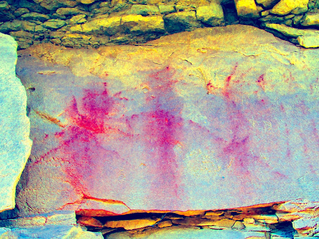
Closeup of red and yellow pictograph
Amazing and inaccessible pictograph panel
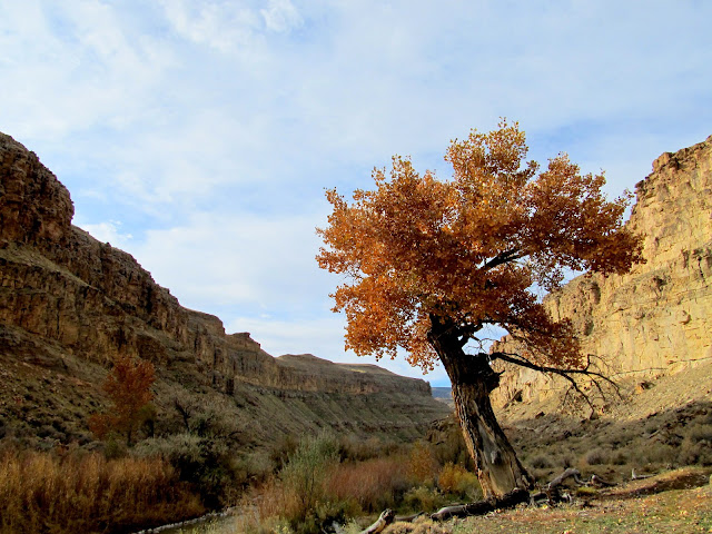
Cottonwood along the Price River
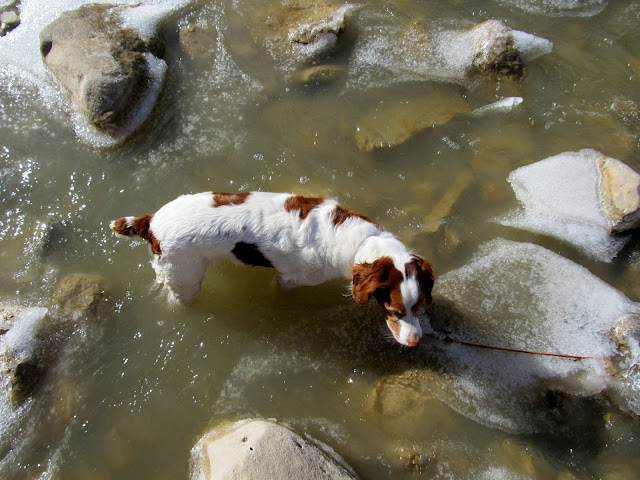
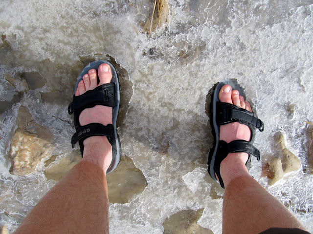
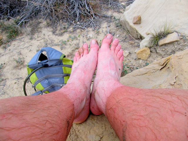
I had never attempted to cross a river on foot before. We changed into sandals, rolled our pant legs up, and waded across the bitter cold water. The water was only mid-shin deep, and it was so cold that it was painful. Torrey and both of Alan's dogs followed us without complaint, but Boulder refused to follow me across. I had to wait until the pain in my feet subsided, then I crossed again to leash her up and bring her back to the opposite side of the river.
Torrey in the icy water
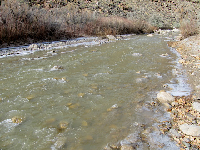
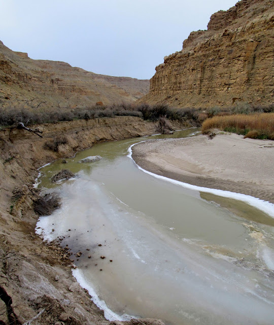
Our crossing point
Breaking through ice after crossing the river
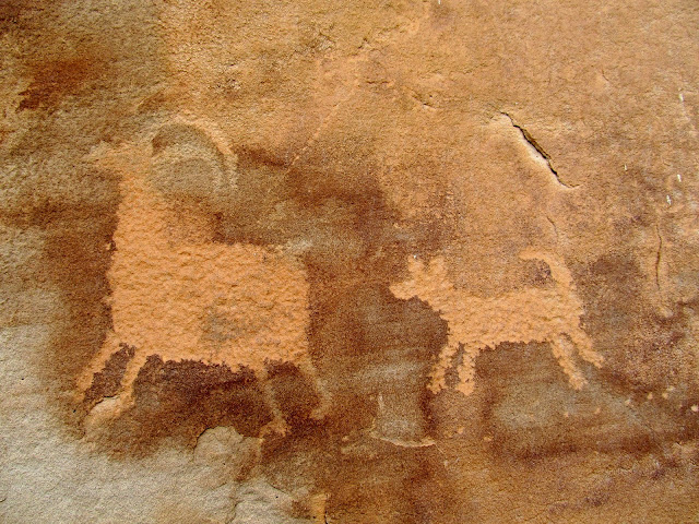
There were a couple of really nice petroglyph panels that had bighorn sheep similar to many I've seen in Nine Mile Canyon. Our turnaround point was at some white pictographs that Alan had heard about, but when we arrived he remembered seeing them on a previous trip.
Sheep and dog
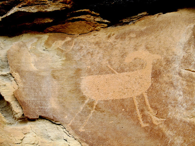
Long-necked sheep
Sheep with hooves
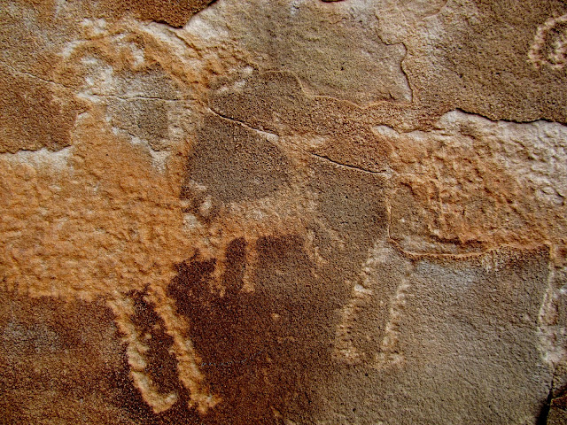
On each side of this petroglyph panel, there appear to be human figures pointing arrows at each other
Archer (top left) and sheep with an arrow in its back
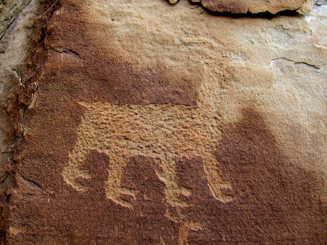
Bighorn sheep
Possibly another dog with bighorn sheep
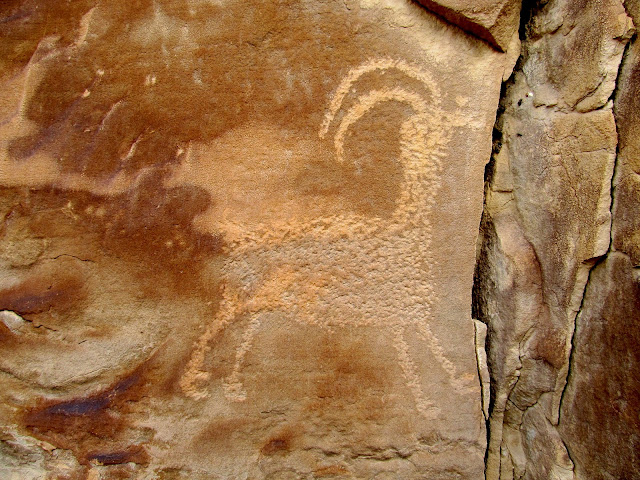
Awesome sheep petroglyph
Natural arch
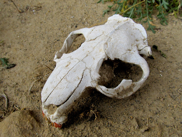
Beaver skull
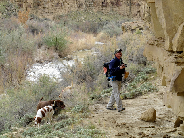
Alan photographing some rock art
White pictographs
We hiked back upstream alongside the river and passed up the place we'd crossed earlier in the day, hoping to find rock art that wasn't easily visible from the opposite side. We did find some new-to-us rock art on that side, but it was nothing spectacular.
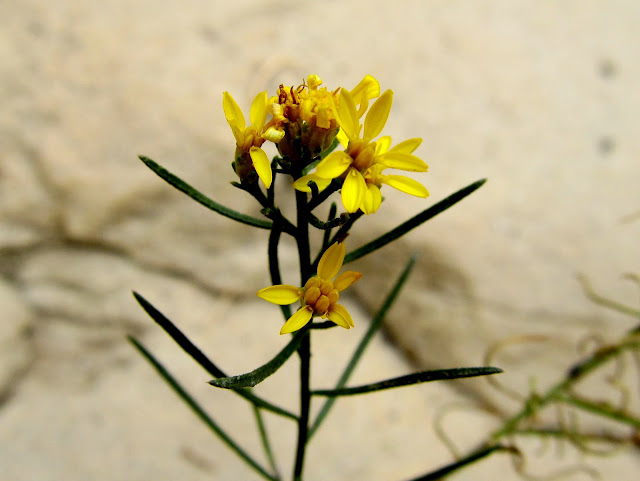
A flower hanging on despite freezing temperatures
Bear scat
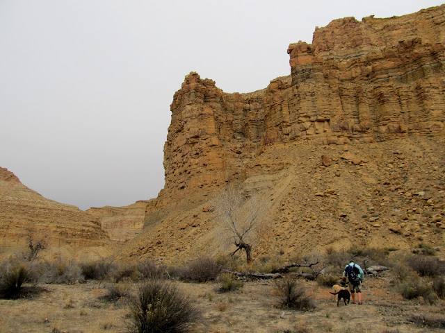
Climbing high above the river
Faded pictographs
Faded pictographs, DStretch enhanced
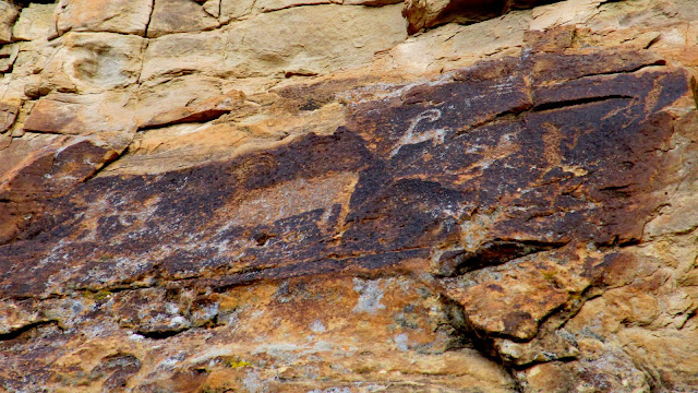
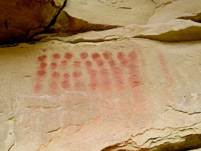
Red dots
Frozen Price River
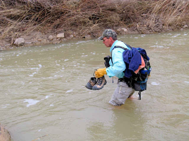
One last time we crossed the river--it was my fourth crossing but only Alan's second. We couldn't find a nice place to cross. This time it involved a lot of heavy bushwhacking, and the water was a lot deeper, coming up to mid-thigh on me. We stopped at one last rock art panel, one that we'd both seen before and is probably one of the few well-known sites in the area. As soon as we got back to the truck it started snowing, which, according to a text from my wife, it had been doing much of the day in Price. We'd lucked out and had decent weather for our hike, and combined with the amount of rock art we found it made for a great day.
Alan crossing in relatively deep water
Hiking out to the road
My legs and feet turned red from the freezing water
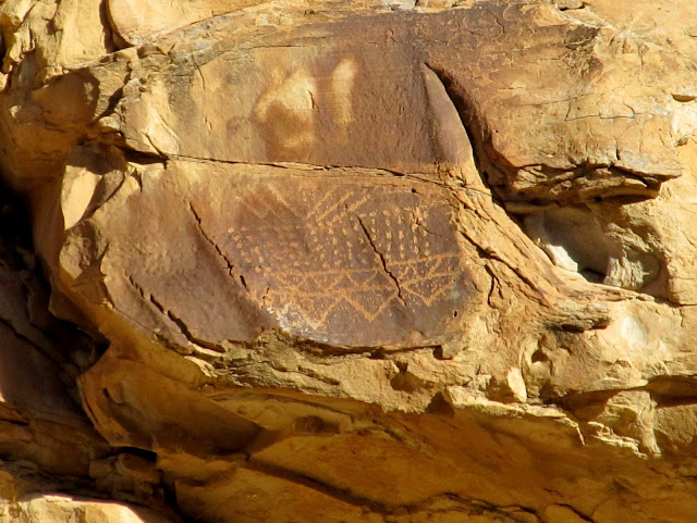
Pictographs
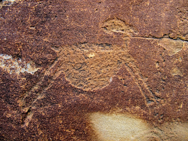
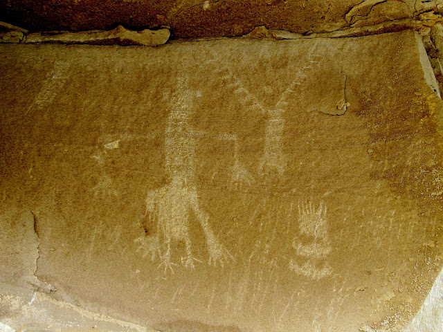
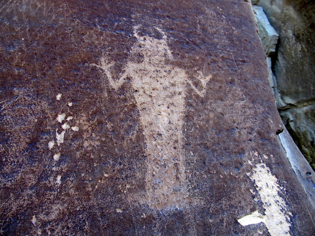
Horned anthropomorph
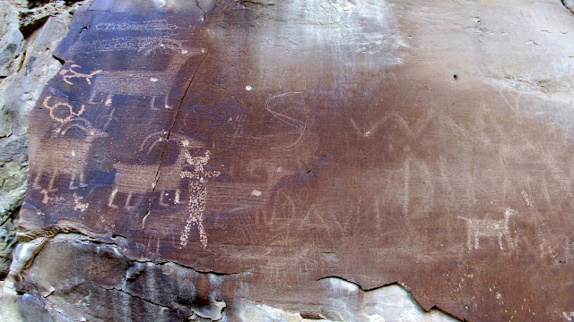
Abraded sheep overlaid with newer petroglyphs
Low clouds that brought snow right at the end of the hike
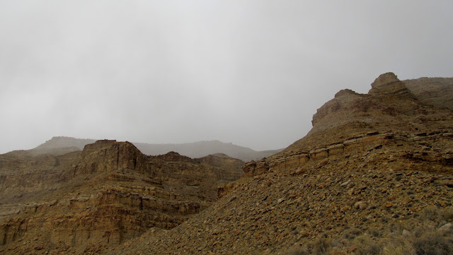
Photo Gallery: https://picasaweb.google.com/Dennis.Udink/LowerPriceRiver
Featured image for home page:

Starting the hike with blue skies
Petroglyphs high above the road
Petroglyphs high above the road
Red and yellow pictographs
Closeup of red and yellow pictograph
Amazing and inaccessible pictograph panel
Cottonwood along the Price River
I had never attempted to cross a river on foot before. We changed into sandals, rolled our pant legs up, and waded across the bitter cold water. The water was only mid-shin deep, and it was so cold that it was painful. Torrey and both of Alan's dogs followed us without complaint, but Boulder refused to follow me across. I had to wait until the pain in my feet subsided, then I crossed again to leash her up and bring her back to the opposite side of the river.
Torrey in the icy water
Our crossing point
Breaking through ice after crossing the river
There were a couple of really nice petroglyph panels that had bighorn sheep similar to many I've seen in Nine Mile Canyon. Our turnaround point was at some white pictographs that Alan had heard about, but when we arrived he remembered seeing them on a previous trip.
Sheep and dog
Long-necked sheep
Sheep with hooves
On each side of this petroglyph panel, there appear to be human figures pointing arrows at each other
Archer (top left) and sheep with an arrow in its back
Bighorn sheep
Possibly another dog with bighorn sheep
Awesome sheep petroglyph
Natural arch
Beaver skull
Alan photographing some rock art
White pictographs
We hiked back upstream alongside the river and passed up the place we'd crossed earlier in the day, hoping to find rock art that wasn't easily visible from the opposite side. We did find some new-to-us rock art on that side, but it was nothing spectacular.
A flower hanging on despite freezing temperatures
Bear scat
Climbing high above the river
Faded pictographs
Faded pictographs, DStretch enhanced
Red dots
Frozen Price River
One last time we crossed the river--it was my fourth crossing but only Alan's second. We couldn't find a nice place to cross. This time it involved a lot of heavy bushwhacking, and the water was a lot deeper, coming up to mid-thigh on me. We stopped at one last rock art panel, one that we'd both seen before and is probably one of the few well-known sites in the area. As soon as we got back to the truck it started snowing, which, according to a text from my wife, it had been doing much of the day in Price. We'd lucked out and had decent weather for our hike, and combined with the amount of rock art we found it made for a great day.
Alan crossing in relatively deep water
Hiking out to the road
My legs and feet turned red from the freezing water
Pictographs
Horned anthropomorph
Abraded sheep overlaid with newer petroglyphs
Low clouds that brought snow right at the end of the hike
Photo Gallery: https://picasaweb.google.com/Dennis.Udink/LowerPriceRiver
Featured image for home page:

.jpg")
")