- Joined
- Aug 8, 2016
- Messages
- 2,078
What is "Looping the Highline"?
Since doing the entire Uinta Highline Trail with my brother in two section hikes (McKee Draw to Henry's Fork-2016, Uinta River Trail head to Hayden Pass Trail head-2017) I've been looking for opportunities to return to the interior of the Uintas using routes which are not through hikes nor out-and-back routes. The rules for a route are simple: First, the route must be a loop returning to the originating trailhead with at least some miles on the Highline trail. Lolly pop loops are okay as long as the "handle" is not so long to essentially be an out-and-back. Second they must be three nights max. A bonus is a segment that is less traveled or even off trail to make the route work and perhaps get into some new, remoter areas.
This is my third and last trip of 2019.
With the Highline Trail running in an east-west direction most all of the access, aside from the termini at Hayden Pass or McKee Draw, generally involves routes running north and south. With northerly approaches being a bit closer to home the routes I have chosen so far involve crossing the spine of the Uintas to get to the Highline on the way in and again on the way out. For this most recent trip I kept eyeing a large above-tree-line rise just west of the Beaver Creek drainage running south in the area of the Coffin benchmark then swinging east, terminating near Rainbow lake. Looking at the topology on maps and satellite imagery it looked like it could be doable but would involve over six miles of off-trail travel. I had never done anything like this before. I was nervous about taking on such a challenge but it kept calling me to give it a try.
You might enjoy this video documenting the trip. Being there conveys the experience much better than I might put into words.
If not, please read on...
Day 1
The trip began on a chilly September 13th, a Friday, just before 8:00am at Hoop Lake. The route began on the Burnt Ridge trail.
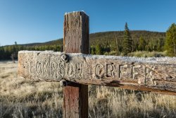
The trail climbs quickly right off the bat from about 9,200 to 9,800 feet in less than a mile. The trail eventually leveled out a bit, crossed the High Uintas Wilderness Boundary, and revealed a nice view north into Wyoming.
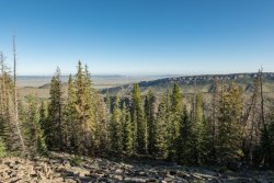
Passing by a beautiful meadow showing her golden fall colors.
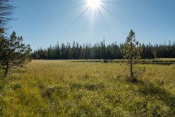
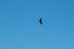
I began to come out of the trees along the flanks of Thompson Peak where I took my lunch break. I had some company with a Golden Eagle soaring above...
After coming down from the slopes of Thompson Peak I quickly discovered I could not find the trail. I looked all around but could not find any trace of it. My planned route on my InReach showed the trail contoured around the base of the peak at my elevation so I just continued on. Perhaps a half of a mile farther I finally stumbled onto a cairn. My guess is the trail had dropped down into the trees somewhere below where I had taken lunch and had just come up to where I was. Continuing I arrived at Burnt Ridge and would change trails heading across a large meadow in the direction of my route. Once on the other side I was unable to find a cairn or blaze anywhere so I continued on navigating using my route. I found the trail about ten minutes later. This would be the theme a couple more times on this day but always managed to reacquire the trail.
The trail begins to drop down into the Beaver Creek drainage where the trail was much easier to follow. I finally came to a branch of the East Fork Beaver creek, my first water source of the day, and tanked up. Long meadow would be my next stop. From here I would cross two more trail junctions, the Highline B trail and the Beaver Lake trail.
Looking across Long Meadow at my target for the evening, the long ridge on the right.
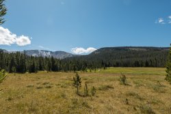
At the north end of Long Meadow I crossed Beaver Creek and took my last break of the day to rest a bit and water up. Tomorrow would be a much different than today as I would be heading off trail for about 6 1/2 miles without any water sources. I filled up my 0.7 liter and 1.0 liter Smart Water bottles, a Gatorade bottle and my Sawyer Squeeze bag hoping this would be enough water for making dinner tonight, sips during the night and for the trip to Rainbow Lake.
A look at where I would be going tomorrow as I left Long Meadow...
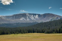
Climbing the ridge ahead was a bit of a chore with the extra water weight but I pressed on. I continued on this trail to a point I had mapped out to go off trail to the south in search of a campsite for the night. I got everything set up for the night and made dinner. I found I had cell service here so I called my wife to tell her good night and drifted off to sleep.
Day 2
Morning came with some colder temperatures, probably in the high 30's I would guess. I had slept pretty well and was rested up and ready to begin the grand adventure. A few hundred yards from the campsite I began to come out of the trees for my first look at where I would be heading today. My initial target would be the Coffin Benchmark ridge seen as the prominent peak here...
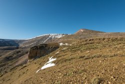
My approach would be adjusted as I got closer. Cliff areas and what appeared as steep slopes would be a concern yet I still didn't have enough data to dial in my direction just yet.
Looking back I could see Long Meadow where I had been the prior evening in the distance with Thompson peak on the right...
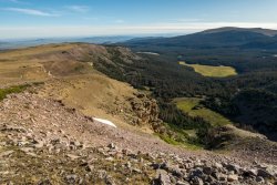
I had originally planned on going right up the ridge line to the benchmark, then over to the other side. As I got up on the slope the character of the rocks changed to larger in size, looking like it wouldn't take much to get something moving. I was not comfortable in this environment so dropped down just a bit and started contouring around to the south.
The stunning Queen's Cirque came into view...
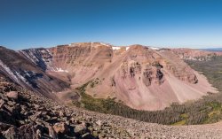
A bit further on the slope seemed to mellow just a bit and it looked like I might be able to approach the ridge by doubling back. Once on top it was much easier going. I say "easier" but I must impress "relatively easier". Travel across these rocky slopes is non-trivial. Travel is slow. Choice of every step must be taken with care. Rocks which appear to be solidly settled can give you quite a surprise so you have to be alert at all times.
I began my search for the Coffin Benchmark and soon found it!
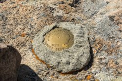
The view from the benchmark was even more spectacular!
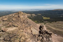
Turning around to the southwest provided a view of several of the big peaks including Kings Peak just left of center and Gilbert Peak on the extreme right.
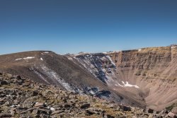
Heading back south along the ridge and down to a saddle I finally got my first view of Rainbow Lake and the other Davis Lakes in the areas. My route would now take me further south then swing to the east along the flat ridge on the right...
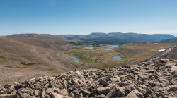
Just about when it was time to head east I wanted to drop around to the west just a bit to take a lunch break and take in the view of the spectacular Kings-Emmons ridge...
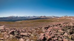
A closer look at Gunsight Peak towering over the Gilbert Creek drainage...
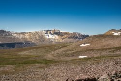
Back to the trudge. Looking at the vast sea of rocks I had yet to cross was pretty daunting. It would have been easy to get discouraged as travel is so tedious and exhausting...
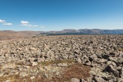
Part way along the ridge I got a closer look at the lakes down in the basin...
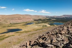
FINALLY! I turned the corner to start heading down to Rainbow Lake. I was excited to see a trail appear that I could follow most of the way down...
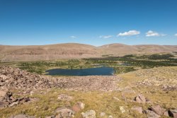
A look across Rainbow Lake up to the pass from which I had come...
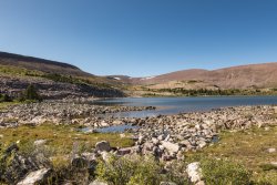
The plan from here was to take the trail down to the Kidney Lakes where I would connect up with the Davis Lakes Trail and on down to the Highline. I missed a cutoff to a connector somewhere above the upper Kidney lake that would have taken me to that junction so I decided to continue on down to the upper Kidney Lake to water up...
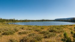
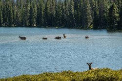
I was surprised to find several elk out in the lake. I'm much more used to seeing moose in the water so this was a treat...
Heading back up the trail I headed off trail to the east to find the Davis Lakes trail. I found where the connector trail I had missed came to where I thought the Davis Lakes trail would be but I couldn't find it anywhere. Back to routing by the GPS. I finally found some cairns marking the trail a mile or two later. It felt better to be back on trail.
At this point I was feeling pretty exhausted from the day's travels and I quickly decided there was no way I could make it to my planned area to camp just short of Fox Lake. I continued on until the light was waning and found a nice meadow to pitch the tent. I got things set up and headed back to a nearby creek to get water. I quickly made and ate dinner. It was pretty hard to eat being as exhausted as I was but did the best I could.
Tonight would be much colder than the previous and I was so glad I had brought along a down throw to throw over my 20 degree sleeping bag. I got into bed and listened to the elk bugling near by, hearing them moving around in the trees. It was pretty cool.
It ended up being a hard 12-mile day. It took a while for my muscles and joints to "settle down" but eventually the vitamin I kicked it a bit and I got to sleep, mostly. After a 2am bathroom break I got back into the sack and got settled and really fell soundly to sleep until the morning sun woke me. That last sleep was the best!
Day 3
It was a frosty morning. I had to wipe down the tent in an effort to get most of it off before I packed it up. My sleeping bag and throw was covered with a lot of moisture. I probably should have found a camp site in the trees rather out in the open. But, at least, I stayed warm.
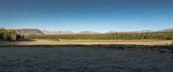
Heading out for the day on what I thought was the Highline Trail...
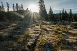
A final look back at the big mountains...
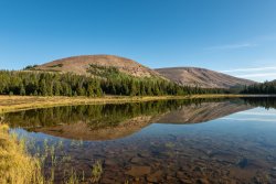
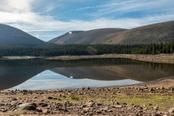
An absolutely beautiful refection on an unnamed lake along the way...
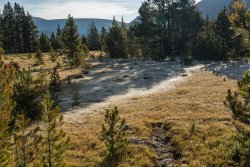
It was fascinating see the influence of the sun on the frost...
Thinking I was on the Highline trail I was looking for the Uinta River Trail junction. I was surprised when I encountered a trail sign telling me I had not been on the Highline but was still on the Davis Lakes trail. This meant I had stopped last night even shorter than I had realized and that today's miles were going to be a bit bigger. Just a short stretch further I crossed the Uinta River tail junction and continued on toward Fox Lake.
Crossing one of many beautiful creeks...
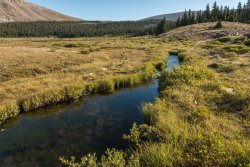
Fox Lake was quite a bit lower than when I was here just a few weeks ago in Episode One...
Just around the corner is the Divide Pass trail junction. I headed on up. The travel is not terribly steep but the slope is persistent all the way to the pass. Just past half way to the pass is Divide Lake with a final look at the east end of the Kings-Emmons ridge...
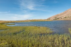
A beautiful tarn curiously located just below the pass...
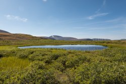
Heading on down to down to Island lake to my favorite spring with the best water of the trip..
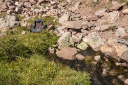
Saying good bye to Island Lake...
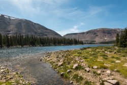
From Island lake back to Hoop lake the trail is much easier to follow. It was nice to be back down in the trees. The weather was nice and warm with a gentle breeze making for a great day to hike. A final stop at Kabell Creek would be my last water stop of the day.
With the previous day's travel producing fewer miles than I had planned meant today would be a bit longer. As I finished up at the trail head the GPS ticked off 17 miles. It was a long but wonderful day.
A beautiful sight seeing Hoop Lake come into view...

This was definitely one of the hardest hikes I've done. I asked myself if I would make that off-trail crossing again. I have to say, I'm not sure. But I can say I'm very glad I had done it once!
Since doing the entire Uinta Highline Trail with my brother in two section hikes (McKee Draw to Henry's Fork-2016, Uinta River Trail head to Hayden Pass Trail head-2017) I've been looking for opportunities to return to the interior of the Uintas using routes which are not through hikes nor out-and-back routes. The rules for a route are simple: First, the route must be a loop returning to the originating trailhead with at least some miles on the Highline trail. Lolly pop loops are okay as long as the "handle" is not so long to essentially be an out-and-back. Second they must be three nights max. A bonus is a segment that is less traveled or even off trail to make the route work and perhaps get into some new, remoter areas.
This is my third and last trip of 2019.
With the Highline Trail running in an east-west direction most all of the access, aside from the termini at Hayden Pass or McKee Draw, generally involves routes running north and south. With northerly approaches being a bit closer to home the routes I have chosen so far involve crossing the spine of the Uintas to get to the Highline on the way in and again on the way out. For this most recent trip I kept eyeing a large above-tree-line rise just west of the Beaver Creek drainage running south in the area of the Coffin benchmark then swinging east, terminating near Rainbow lake. Looking at the topology on maps and satellite imagery it looked like it could be doable but would involve over six miles of off-trail travel. I had never done anything like this before. I was nervous about taking on such a challenge but it kept calling me to give it a try.
You might enjoy this video documenting the trip. Being there conveys the experience much better than I might put into words.
If not, please read on...
Day 1
The trip began on a chilly September 13th, a Friday, just before 8:00am at Hoop Lake. The route began on the Burnt Ridge trail.

The trail climbs quickly right off the bat from about 9,200 to 9,800 feet in less than a mile. The trail eventually leveled out a bit, crossed the High Uintas Wilderness Boundary, and revealed a nice view north into Wyoming.

Passing by a beautiful meadow showing her golden fall colors.

I began to come out of the trees along the flanks of Thompson Peak where I took my lunch break. I had some company with a Golden Eagle soaring above...

After coming down from the slopes of Thompson Peak I quickly discovered I could not find the trail. I looked all around but could not find any trace of it. My planned route on my InReach showed the trail contoured around the base of the peak at my elevation so I just continued on. Perhaps a half of a mile farther I finally stumbled onto a cairn. My guess is the trail had dropped down into the trees somewhere below where I had taken lunch and had just come up to where I was. Continuing I arrived at Burnt Ridge and would change trails heading across a large meadow in the direction of my route. Once on the other side I was unable to find a cairn or blaze anywhere so I continued on navigating using my route. I found the trail about ten minutes later. This would be the theme a couple more times on this day but always managed to reacquire the trail.
The trail begins to drop down into the Beaver Creek drainage where the trail was much easier to follow. I finally came to a branch of the East Fork Beaver creek, my first water source of the day, and tanked up. Long meadow would be my next stop. From here I would cross two more trail junctions, the Highline B trail and the Beaver Lake trail.
Looking across Long Meadow at my target for the evening, the long ridge on the right.

At the north end of Long Meadow I crossed Beaver Creek and took my last break of the day to rest a bit and water up. Tomorrow would be a much different than today as I would be heading off trail for about 6 1/2 miles without any water sources. I filled up my 0.7 liter and 1.0 liter Smart Water bottles, a Gatorade bottle and my Sawyer Squeeze bag hoping this would be enough water for making dinner tonight, sips during the night and for the trip to Rainbow Lake.
A look at where I would be going tomorrow as I left Long Meadow...

Climbing the ridge ahead was a bit of a chore with the extra water weight but I pressed on. I continued on this trail to a point I had mapped out to go off trail to the south in search of a campsite for the night. I got everything set up for the night and made dinner. I found I had cell service here so I called my wife to tell her good night and drifted off to sleep.
Day 2
Morning came with some colder temperatures, probably in the high 30's I would guess. I had slept pretty well and was rested up and ready to begin the grand adventure. A few hundred yards from the campsite I began to come out of the trees for my first look at where I would be heading today. My initial target would be the Coffin Benchmark ridge seen as the prominent peak here...

My approach would be adjusted as I got closer. Cliff areas and what appeared as steep slopes would be a concern yet I still didn't have enough data to dial in my direction just yet.
Looking back I could see Long Meadow where I had been the prior evening in the distance with Thompson peak on the right...

I had originally planned on going right up the ridge line to the benchmark, then over to the other side. As I got up on the slope the character of the rocks changed to larger in size, looking like it wouldn't take much to get something moving. I was not comfortable in this environment so dropped down just a bit and started contouring around to the south.
The stunning Queen's Cirque came into view...

A bit further on the slope seemed to mellow just a bit and it looked like I might be able to approach the ridge by doubling back. Once on top it was much easier going. I say "easier" but I must impress "relatively easier". Travel across these rocky slopes is non-trivial. Travel is slow. Choice of every step must be taken with care. Rocks which appear to be solidly settled can give you quite a surprise so you have to be alert at all times.
I began my search for the Coffin Benchmark and soon found it!

The view from the benchmark was even more spectacular!

Turning around to the southwest provided a view of several of the big peaks including Kings Peak just left of center and Gilbert Peak on the extreme right.

Heading back south along the ridge and down to a saddle I finally got my first view of Rainbow Lake and the other Davis Lakes in the areas. My route would now take me further south then swing to the east along the flat ridge on the right...

Just about when it was time to head east I wanted to drop around to the west just a bit to take a lunch break and take in the view of the spectacular Kings-Emmons ridge...

A closer look at Gunsight Peak towering over the Gilbert Creek drainage...

Back to the trudge. Looking at the vast sea of rocks I had yet to cross was pretty daunting. It would have been easy to get discouraged as travel is so tedious and exhausting...

Part way along the ridge I got a closer look at the lakes down in the basin...

FINALLY! I turned the corner to start heading down to Rainbow Lake. I was excited to see a trail appear that I could follow most of the way down...

A look across Rainbow Lake up to the pass from which I had come...

The plan from here was to take the trail down to the Kidney Lakes where I would connect up with the Davis Lakes Trail and on down to the Highline. I missed a cutoff to a connector somewhere above the upper Kidney lake that would have taken me to that junction so I decided to continue on down to the upper Kidney Lake to water up...

I was surprised to find several elk out in the lake. I'm much more used to seeing moose in the water so this was a treat...

Heading back up the trail I headed off trail to the east to find the Davis Lakes trail. I found where the connector trail I had missed came to where I thought the Davis Lakes trail would be but I couldn't find it anywhere. Back to routing by the GPS. I finally found some cairns marking the trail a mile or two later. It felt better to be back on trail.
At this point I was feeling pretty exhausted from the day's travels and I quickly decided there was no way I could make it to my planned area to camp just short of Fox Lake. I continued on until the light was waning and found a nice meadow to pitch the tent. I got things set up and headed back to a nearby creek to get water. I quickly made and ate dinner. It was pretty hard to eat being as exhausted as I was but did the best I could.
Tonight would be much colder than the previous and I was so glad I had brought along a down throw to throw over my 20 degree sleeping bag. I got into bed and listened to the elk bugling near by, hearing them moving around in the trees. It was pretty cool.
It ended up being a hard 12-mile day. It took a while for my muscles and joints to "settle down" but eventually the vitamin I kicked it a bit and I got to sleep, mostly. After a 2am bathroom break I got back into the sack and got settled and really fell soundly to sleep until the morning sun woke me. That last sleep was the best!
Day 3
It was a frosty morning. I had to wipe down the tent in an effort to get most of it off before I packed it up. My sleeping bag and throw was covered with a lot of moisture. I probably should have found a camp site in the trees rather out in the open. But, at least, I stayed warm.
Heading out for the day on what I thought was the Highline Trail...

A final look back at the big mountains...

An absolutely beautiful refection on an unnamed lake along the way...

It was fascinating see the influence of the sun on the frost...

Thinking I was on the Highline trail I was looking for the Uinta River Trail junction. I was surprised when I encountered a trail sign telling me I had not been on the Highline but was still on the Davis Lakes trail. This meant I had stopped last night even shorter than I had realized and that today's miles were going to be a bit bigger. Just a short stretch further I crossed the Uinta River tail junction and continued on toward Fox Lake.
Crossing one of many beautiful creeks...

Fox Lake was quite a bit lower than when I was here just a few weeks ago in Episode One...

Just around the corner is the Divide Pass trail junction. I headed on up. The travel is not terribly steep but the slope is persistent all the way to the pass. Just past half way to the pass is Divide Lake with a final look at the east end of the Kings-Emmons ridge...

A beautiful tarn curiously located just below the pass...

Heading on down to down to Island lake to my favorite spring with the best water of the trip..

Saying good bye to Island Lake...

From Island lake back to Hoop lake the trail is much easier to follow. It was nice to be back down in the trees. The weather was nice and warm with a gentle breeze making for a great day to hike. A final stop at Kabell Creek would be my last water stop of the day.
With the previous day's travel producing fewer miles than I had planned meant today would be a bit longer. As I finished up at the trail head the GPS ticked off 17 miles. It was a long but wonderful day.
A beautiful sight seeing Hoop Lake come into view...

This was definitely one of the hardest hikes I've done. I asked myself if I would make that off-trail crossing again. I have to say, I'm not sure. But I can say I'm very glad I had done it once!
Last edited:
