intuitive cat
Jurassic Dust in my Bones
- Joined
- Mar 9, 2012
- Messages
- 402
This hike is in the Escalante Canyons section of the Grand Staircase - Escalante National Monument and part of the Harris Wash drainage system.
Some of my friends had explored this area and from everything I had heard, I knew I had to get out there.
It is an area between Old Sheffield Road/Spencer Flats, Bighorn Canyon, Red Breaks, and Harris Wash. This is serious color & Moki Marble land (some as big as softballs) full of large potholes, small fracture crack canyons, sinuous domes, and some very large sand dunes which rest against the eastern Bighorn Canyon bench.
When I got home & plotted the route I'd taken, i was sad to se that I had come so close to Zebra Slot and not realized it. The weather was turning bad, though - windy and the skies darkening - so I had to move rather quickly on my return route, with sand whipping around me like crazy.
During my route down, most of the sand fortunately blew around only a few inches off of the ground.
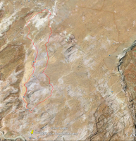
The Route:
Bighorn canyon on the left, Red Breaks on the right. Old Sheffield/Spencer Flats Road visible at the top right with the Pyramid dominating the top center
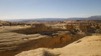
I'd parked at a small slickrock area at the end of a barely perceptible spurr road that heads south from Old SHeffield Road just before the drop into Big Spencer Flats. The end of the road is closed to vehicular traffic now.
In this first photo, I am hiking the closed section of the road and am about to drop down into the drainage just past the end of this small side canyon. A better route would be to walk down the slickrock on the opposite side of the small canyon. view is west/southwest.
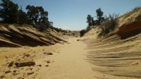
A short walk down a winding sandy wash led to here, which is the gateway to an expansive open rolling slickrock area.
Just before I enter the open area, I spy a little treat to my left in the back of a small drainage.
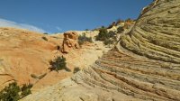
As I entered the open area, the colors shifted dramatically and abruptly
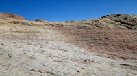
The open area is dominated by grayish purple and pink tones and incredible crossbedding.
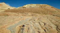
Due to the huge amount of fine loose sand produced by the huge sand dunes further down the drainage, the whole are is affected as much by wind erosion as by water. lines somehow become both sharp and rounded at the same time.
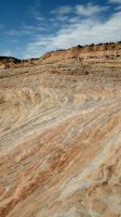
This is the top of a small dome which was catching sand from the dunes to its west.
All of the dunes were glowing brilliant reddish gold. truly amazing and a perfect contrast with the purple grays.
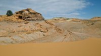
A pretty sweet hoodoo surrounded by color
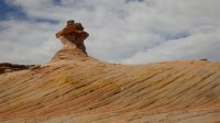
Looking upwards from the base of the sand dunes.
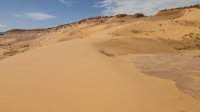
Once below the sand dunes, Moki Marbles started to appear
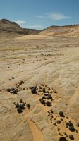
The slickrock gives way to a broad, lovely sandy wash which turns a corner around this hoodoo ridge. As I was approaching this, I had a perma-grin from watching sand vortices roll off of it and move down the dome which is to its left (not visible in this). I failed at getting a good shot of it though
With all of the sand blowing around, I was glad that I have a rugged camera (Pentax WG-1)
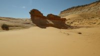
After curving around the hoodoo ridge, I came across this lovely pour-off and the drainage narrowed.
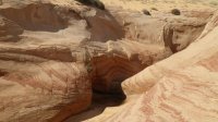
The next bend revealed an amazing deep hole which is the home of two cottonwoods.
There is a picture on Panoramio which shows the water reaching the furthest Cottonwood.
When I was there, there was only a small pool at the deepest part of the hole, which is to the back & left of this shot.
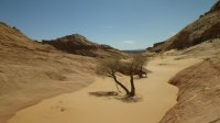
Here are the cottonwoods as seen from 'downstream'
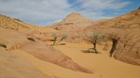
This is the point at which i looped back. I am looking North/Northeast.
If one is coming from Zebra Alot, heading to the left of this formation leads to the cottonwoods. heading to the right leads to the drainage that runs down from the stand alone dome on Spencer Flats which is locally referred to as the Pyramid. There is a string of large tinajas (potholes) directly on the right of this formation.
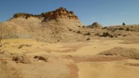
One of the huge tinajas.
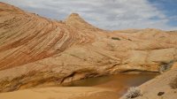
Looking back southwest.
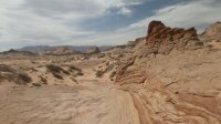
Longer view of the dunes.
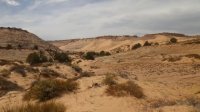
Looking northeast towards the backside of the Pyramid.
If the weather would not have been starting to turn, I would have headed up the drainage towards it. Instead, I had to slog it cross country to try to get back to my car before what looked like possible snow moved in (the snow never came, but the temp certainly dropped).
What is amazing is how calm these pictures look when i was actually getting pummeled by sand whenever i was in an area even remotely exposed, which was pretty much everywhere except right up against the eastern sides of domes.
Aslo, notice the small arch I stumbled upon.
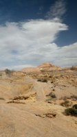
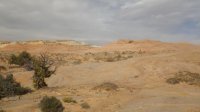
The home stretch. The final destination is the other side of the white bench.
overall it was an amazing hike & i can hardly wait to hike down & get in some of those waterholes when summer gets here.
I think my mileage was between 8 and 9 miles for this loop.
I highly recommend the route by the cottonwoods and dunes as a return route for anyone doing the Bighorn Canyon loop.
I don't recommend the overland slog I had to do on the return portion of this loop. I did find a few random moki marble gardens amongst the sand & brush, but I think it would be wiser and more enjoyable to follow the drainage up to the Pyramid.
Some of my friends had explored this area and from everything I had heard, I knew I had to get out there.
It is an area between Old Sheffield Road/Spencer Flats, Bighorn Canyon, Red Breaks, and Harris Wash. This is serious color & Moki Marble land (some as big as softballs) full of large potholes, small fracture crack canyons, sinuous domes, and some very large sand dunes which rest against the eastern Bighorn Canyon bench.
When I got home & plotted the route I'd taken, i was sad to se that I had come so close to Zebra Slot and not realized it. The weather was turning bad, though - windy and the skies darkening - so I had to move rather quickly on my return route, with sand whipping around me like crazy.
During my route down, most of the sand fortunately blew around only a few inches off of the ground.
The Route:
Bighorn canyon on the left, Red Breaks on the right. Old Sheffield/Spencer Flats Road visible at the top right with the Pyramid dominating the top center

I'd parked at a small slickrock area at the end of a barely perceptible spurr road that heads south from Old SHeffield Road just before the drop into Big Spencer Flats. The end of the road is closed to vehicular traffic now.
In this first photo, I am hiking the closed section of the road and am about to drop down into the drainage just past the end of this small side canyon. A better route would be to walk down the slickrock on the opposite side of the small canyon. view is west/southwest.

A short walk down a winding sandy wash led to here, which is the gateway to an expansive open rolling slickrock area.

Just before I enter the open area, I spy a little treat to my left in the back of a small drainage.

As I entered the open area, the colors shifted dramatically and abruptly

The open area is dominated by grayish purple and pink tones and incredible crossbedding.

Due to the huge amount of fine loose sand produced by the huge sand dunes further down the drainage, the whole are is affected as much by wind erosion as by water. lines somehow become both sharp and rounded at the same time.

This is the top of a small dome which was catching sand from the dunes to its west.
All of the dunes were glowing brilliant reddish gold. truly amazing and a perfect contrast with the purple grays.

A pretty sweet hoodoo surrounded by color

Looking upwards from the base of the sand dunes.

Once below the sand dunes, Moki Marbles started to appear

The slickrock gives way to a broad, lovely sandy wash which turns a corner around this hoodoo ridge. As I was approaching this, I had a perma-grin from watching sand vortices roll off of it and move down the dome which is to its left (not visible in this). I failed at getting a good shot of it though
With all of the sand blowing around, I was glad that I have a rugged camera (Pentax WG-1)

After curving around the hoodoo ridge, I came across this lovely pour-off and the drainage narrowed.

The next bend revealed an amazing deep hole which is the home of two cottonwoods.
There is a picture on Panoramio which shows the water reaching the furthest Cottonwood.
When I was there, there was only a small pool at the deepest part of the hole, which is to the back & left of this shot.

Here are the cottonwoods as seen from 'downstream'

This is the point at which i looped back. I am looking North/Northeast.
If one is coming from Zebra Alot, heading to the left of this formation leads to the cottonwoods. heading to the right leads to the drainage that runs down from the stand alone dome on Spencer Flats which is locally referred to as the Pyramid. There is a string of large tinajas (potholes) directly on the right of this formation.

One of the huge tinajas.

Looking back southwest.

Longer view of the dunes.

Looking northeast towards the backside of the Pyramid.
If the weather would not have been starting to turn, I would have headed up the drainage towards it. Instead, I had to slog it cross country to try to get back to my car before what looked like possible snow moved in (the snow never came, but the temp certainly dropped).
What is amazing is how calm these pictures look when i was actually getting pummeled by sand whenever i was in an area even remotely exposed, which was pretty much everywhere except right up against the eastern sides of domes.
Aslo, notice the small arch I stumbled upon.

The home stretch. The final destination is the other side of the white bench.

overall it was an amazing hike & i can hardly wait to hike down & get in some of those waterholes when summer gets here.
I think my mileage was between 8 and 9 miles for this loop.
I highly recommend the route by the cottonwoods and dunes as a return route for anyone doing the Bighorn Canyon loop.
I don't recommend the overland slog I had to do on the return portion of this loop. I did find a few random moki marble gardens amongst the sand & brush, but I think it would be wiser and more enjoyable to follow the drainage up to the Pyramid.
