Udink
Still right here.
- Joined
- Jan 17, 2012
- Messages
- 1,748
October 1-6, 2019
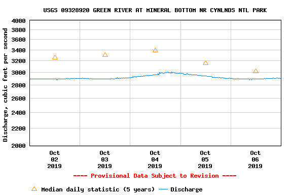
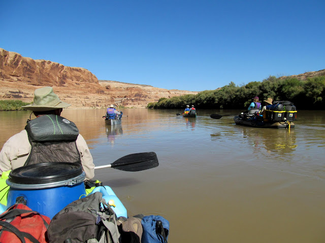
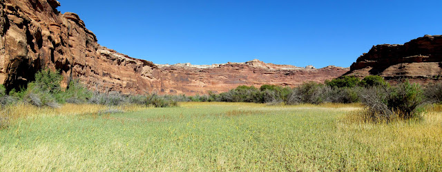
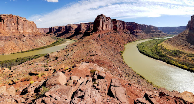
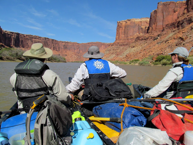
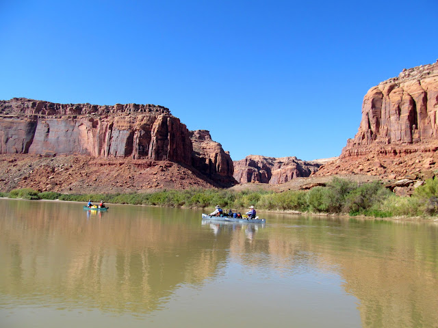
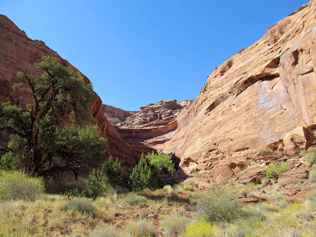
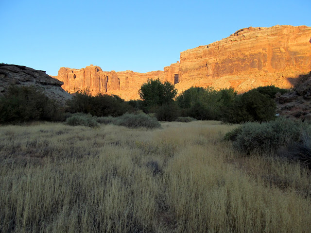
During the first week of October seven friends and I floated Labyrinth Canyon from Ruby Ranch to Mineral Bottom, which for most of us was our second trip through this stretch of the Green River. Our first trip was a near-disaster. On this trip we visited many of the spots we missed on the first trip, plus a few places that are worth visiting more than once. Unlike our last trip when the Green River increased in flow by over 6,000 CFS during the trip, this time it remained between 2,900 and 3,000 CFS the entire time.
Green River flow between 2,900 and 3,000 CFS for our trip
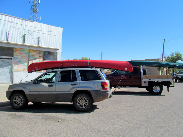
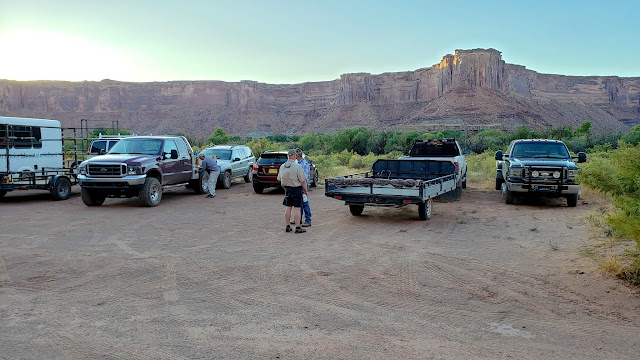
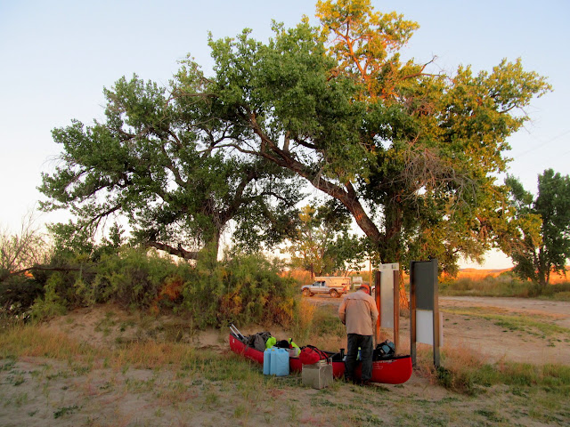
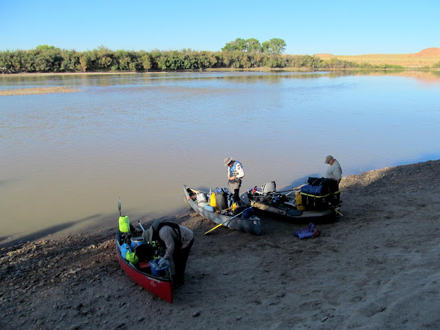
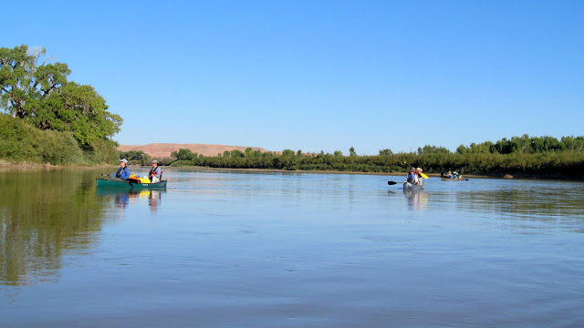
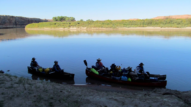
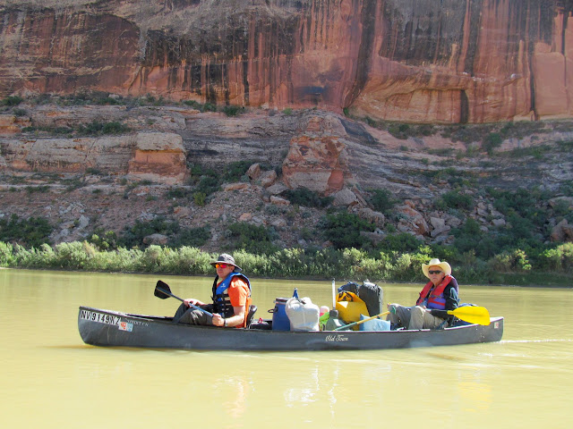
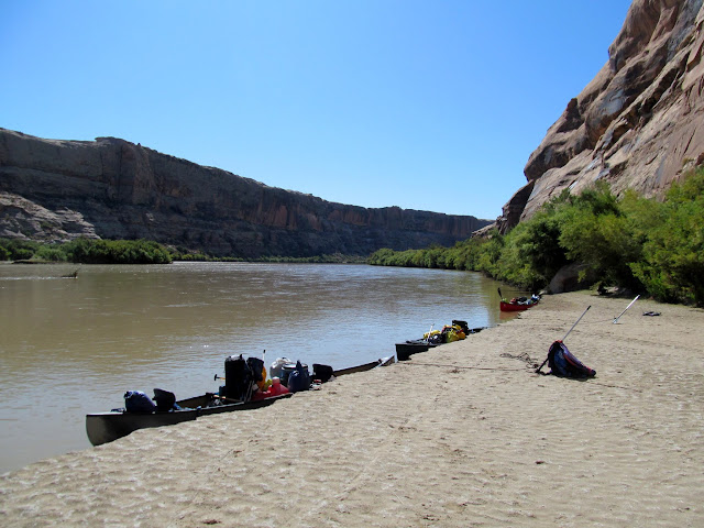
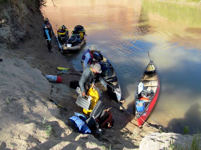
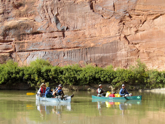
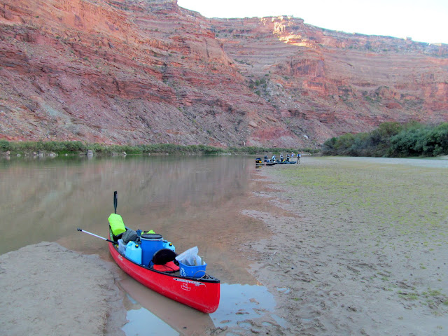
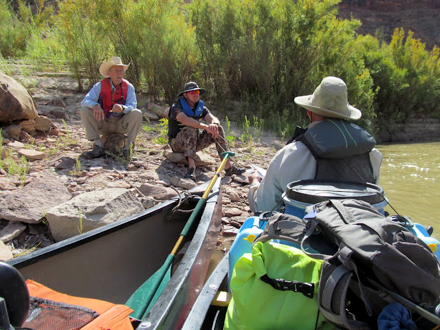
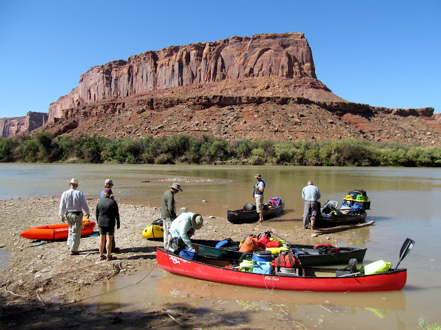
On Tuesday afternoon we all met at Ray's Tavern for lunch, then headed to Ruby Ranch and unloaded the canoes and gear. Everyone who drove hopped in our vehicles and met a friend, Scott, at the Floy exit on I-70, and he followed us to Mineral Bottom where we dropped our vehicles off. Scott then kindly drove everyone back to Ruby Ranch and then headed home while the rest of us set up camp. There were a lot of geese around Ruby Ranch and they kept me awake much of the night. I also heard some owls hooting during the night.
Parked at Ray's Tavern
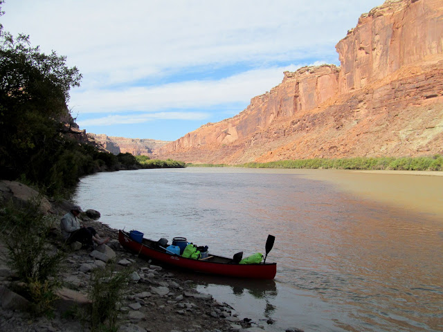
Leaving our vehicles at Mineral Bottom
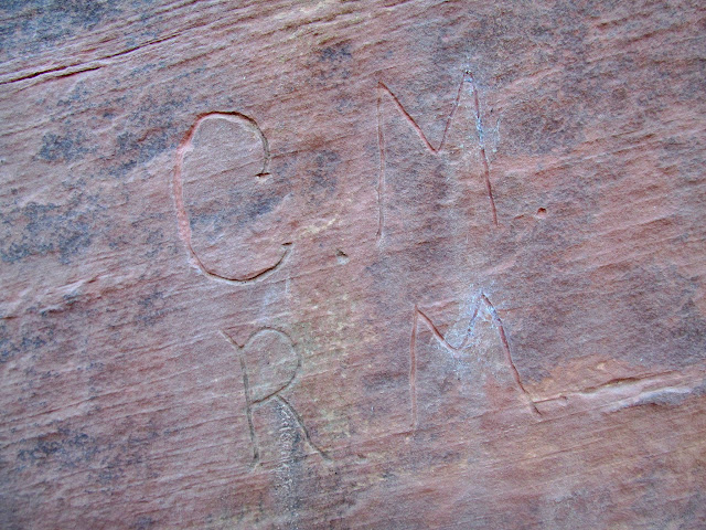
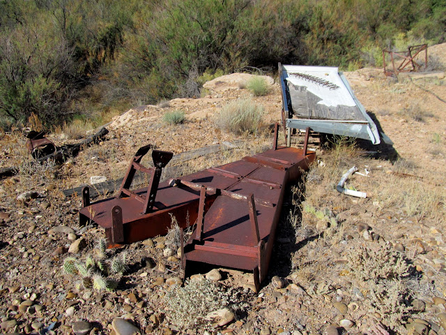
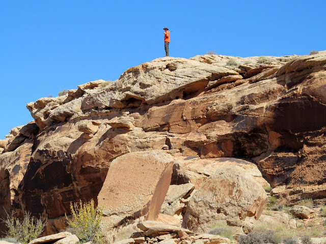
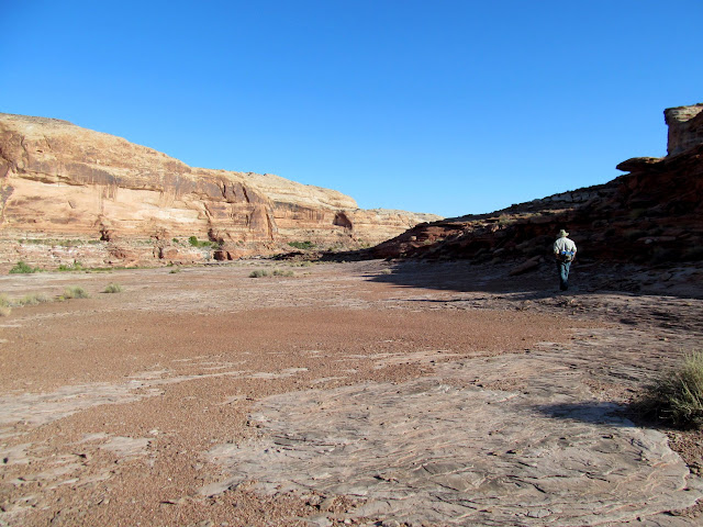
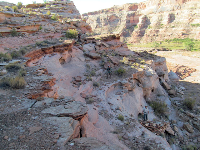
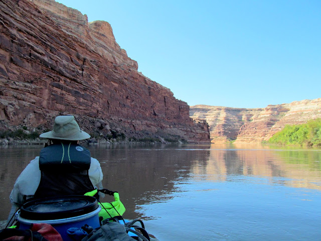
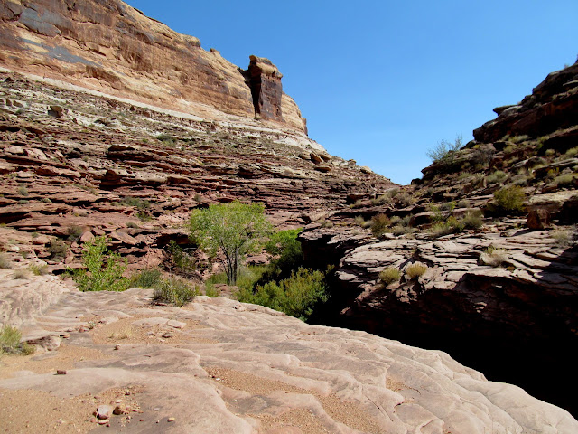
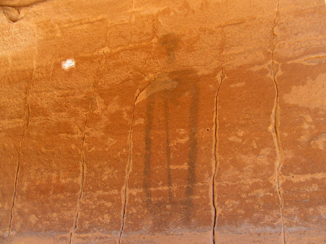
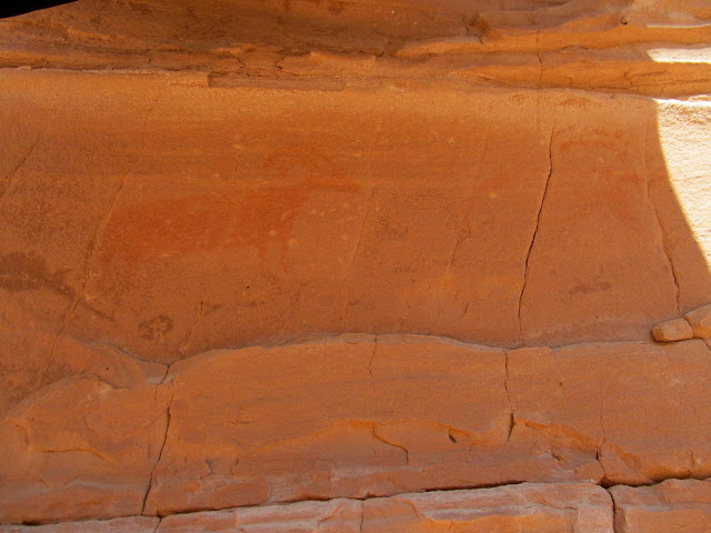
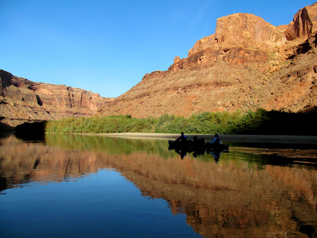
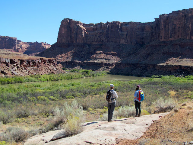
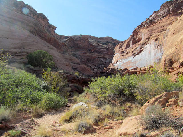
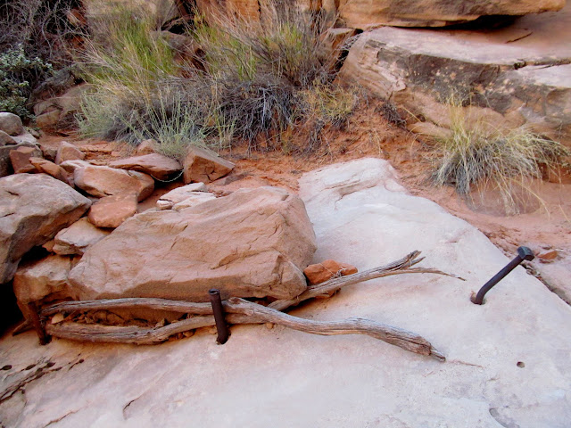
We were up before sunrise on Wednesday and got on the river by about 9AM. We floated a short while before reaching Red Wash. I thought the mouth of Red Wash looked like a good place to search for rock art or inscriptions, so Alan and I pulled the canoe up to the shore and I got out and started hiking. The rest of the group waited in the boats while I hiked up the canyon, and there I found some old looking but undated inscriptions by C.M. and R.M. I rejoined the group and we floated downstream to Placer Bottom where we checked out some mining equipment and petroglyphs.
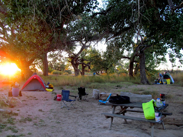
Morning at Ruby Ranch
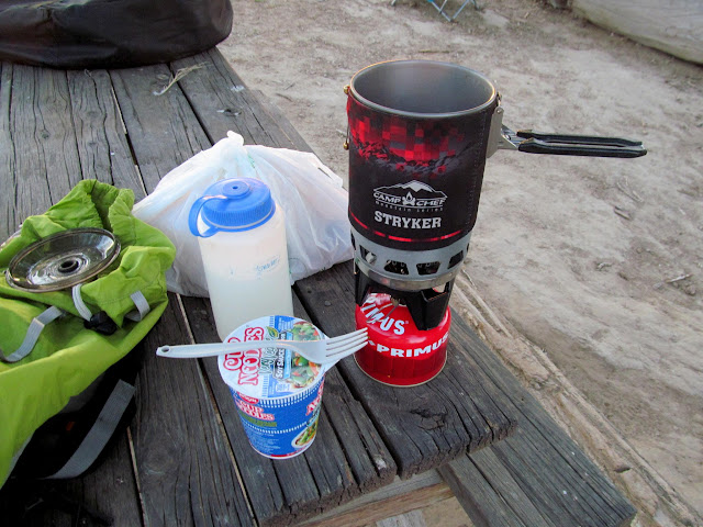
A little brekkie
Packing gear
Taking down camp
Almost ready to launch!
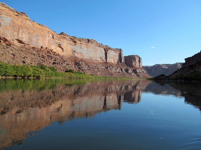
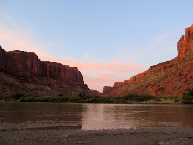
First morning on the Green River
C.M. and R.M. inscriptions in Red Wash
Part of the group waiting for me
Paul and Terri
Dirt biker across from Bull Bottom
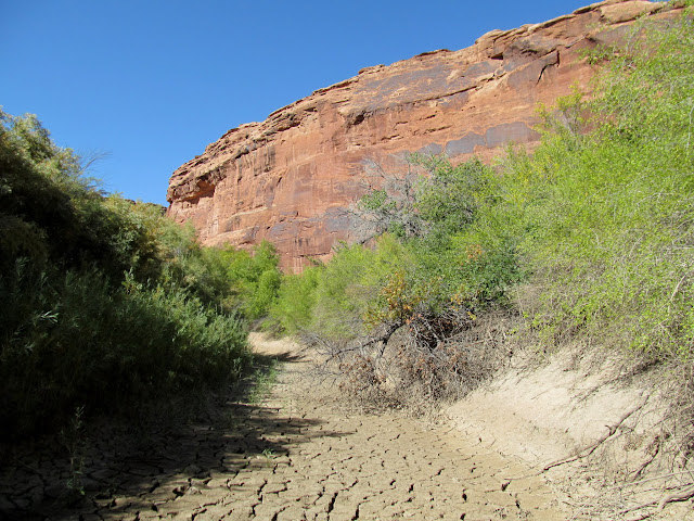
Here the canyon walls get taller
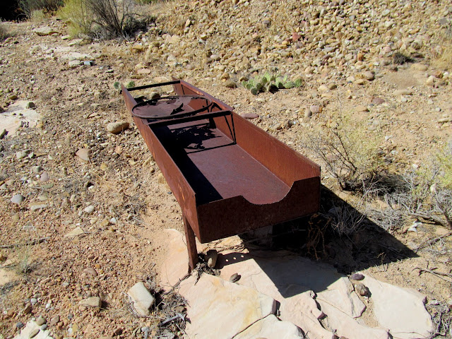
Placer Bottom mining equipment
Placer Bottom mining equipment
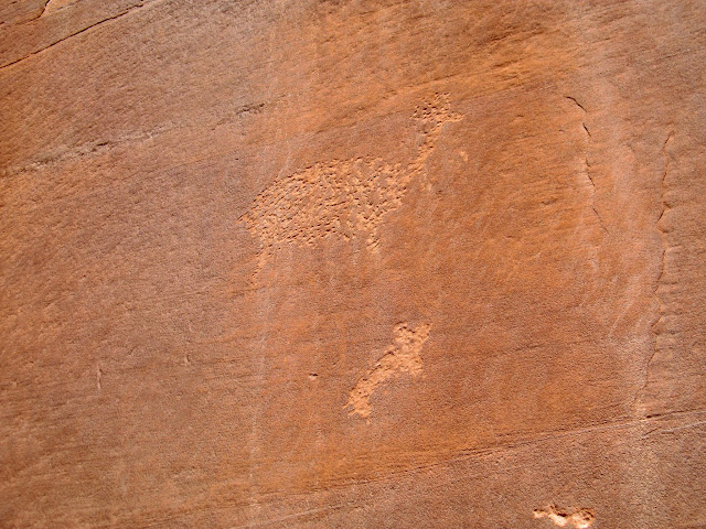
Placer Bottom petroglyph
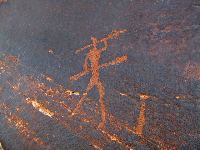
Placer Bottom petroglyphs
Placer Bottom mining equipment
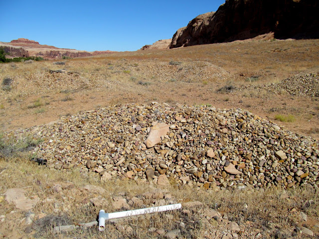
Tailings piles at Placer Bottom
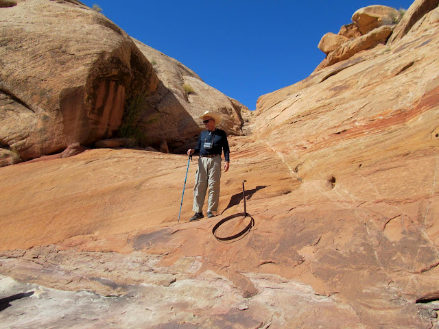
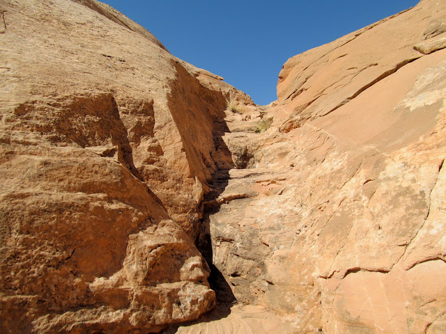
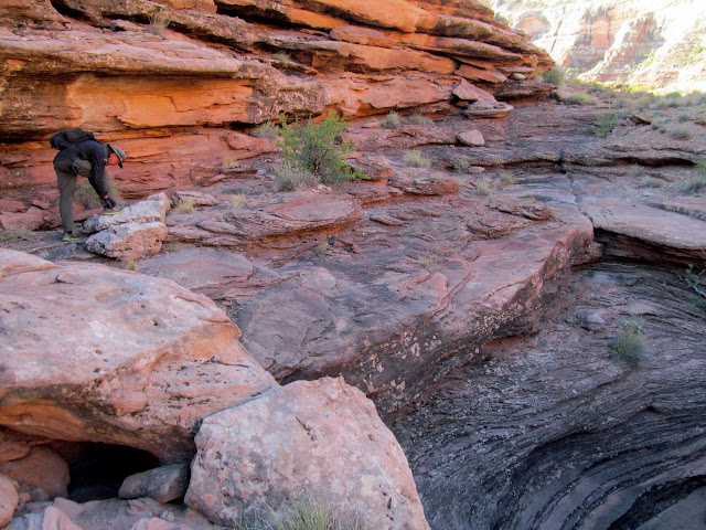
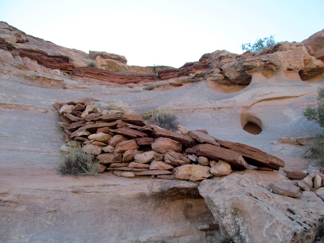
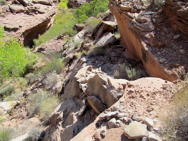
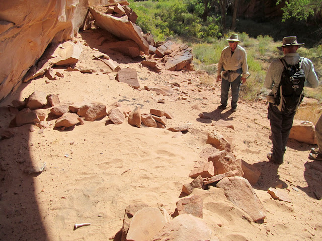
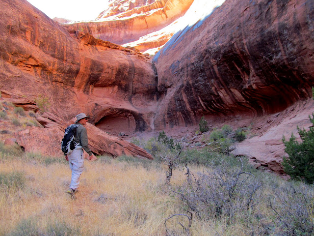
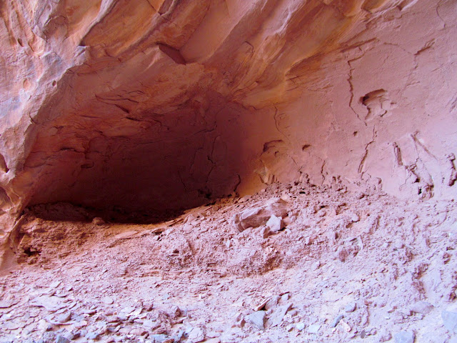
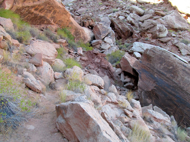
Our next stop was at Hell Hole where we spent quite a bit of time trying to locate a constructed stock trail. The group split up and several of us located the trail while the rest explored other areas. The constructed portion of the trail was maybe 300' long and had been blasted and chiseled through a weakness in the sandstone leading up onto the plateau east of Moonshine Wash.
Wade at Hell Hole
Lyman on the Hell Hole stock trail
Blasted and chiseled section of the Hell Hole Trail
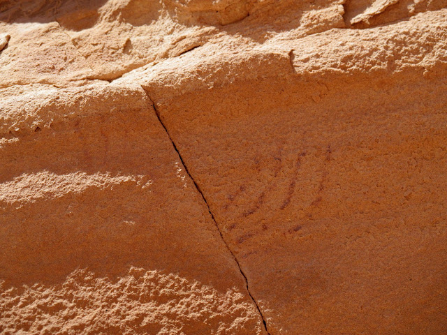
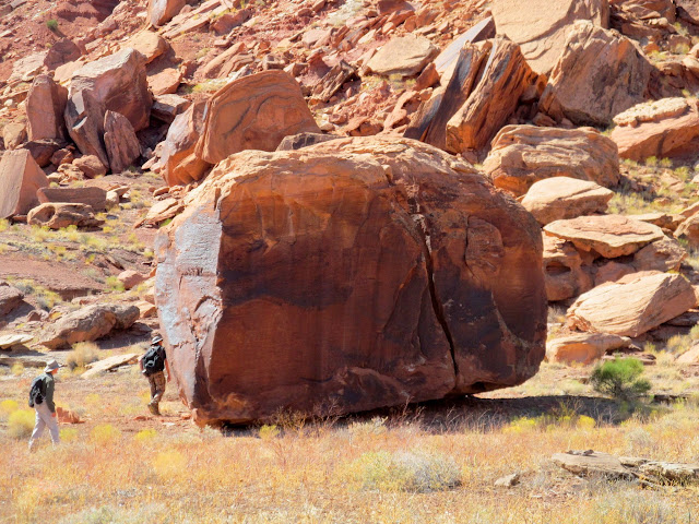
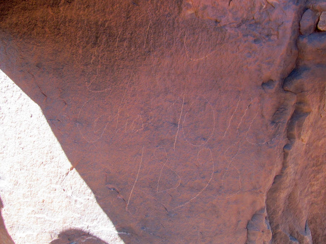
After a brief stop at the mouth of Three Canyon we landed just across the river from June's Bottom and searched for an inscription that we skipped on our previous trip. It turned out to be a very deep and enigmatic carving by Mike Keller, who also left his name and more carvings at Register Rock downstream from there. Even a month later I still can't figure out what it is that Mike carved in the rock.
Wade and Lyman floating below Trin Alcove Bottom
Boats moored across from June's Bottom
Wade looking for inscriptions
David Miller inscription
M. Keller inscription and some strange carvings
What is this?
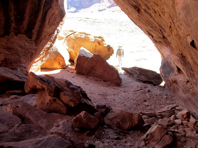
Nice shelter formed by a huge slab of rock
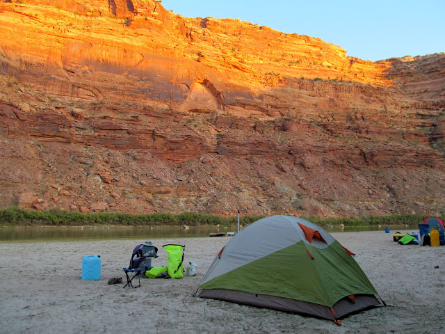
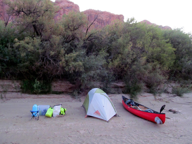
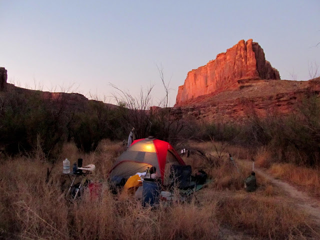
A couple more miles of floating brought us to our second camp of the trip at the mouth of F Canyon, so named because the canyon and its two forks form the shape of an F. We landed at about 5PM and turned in at 10PM. The inside of the rain fly on my tent got soaked during the night but this was the only night it had any moisture on it.
On the way to F Canyon
My camp at F Canyon
Crooked cottonwood tree and crescent moon
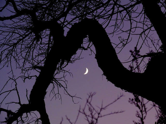
Crooked cottonwood at F Bottom
F Bottom before sunrise
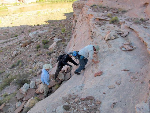
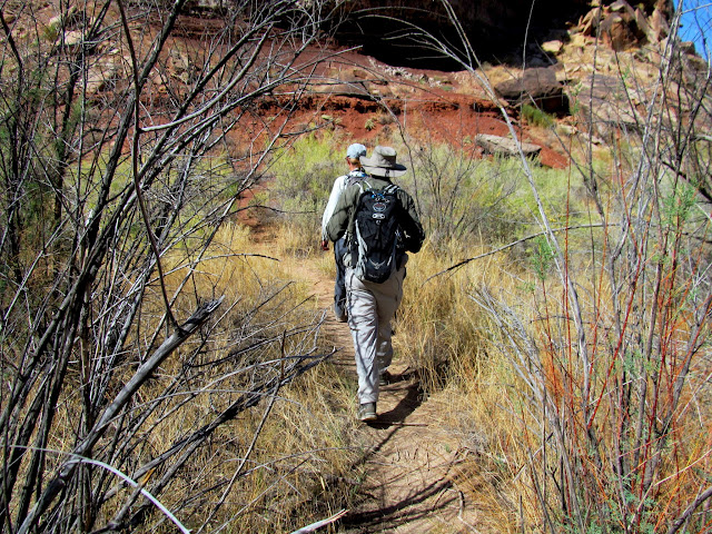
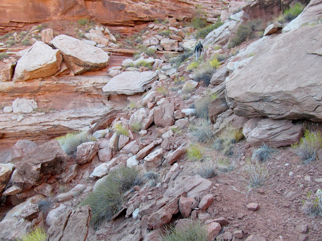
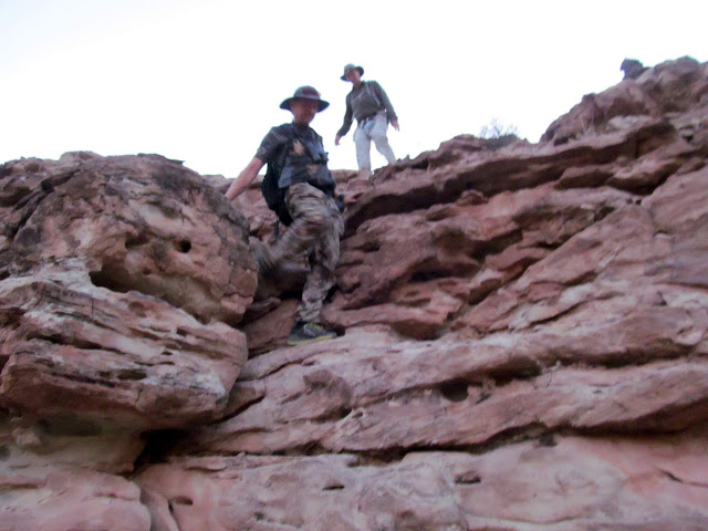
On Thursday morning four of us set out to find a stock trail that climbs up onto Tenmile Point from near the mouth of F Canyon. It took some searching but we found the trail, which today I can't imagine even sheep traversing. It took a bit of work for us to even climb above the heavily constructed portion.
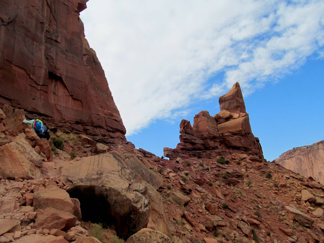
Hiking a stock trail from F Canyon up to Tenmile Point
Above the first cliff band
Constructed trail up to Tenmile Point
Climbing the trail
More signs of trail construction
Wade, me, and Alan on the trail
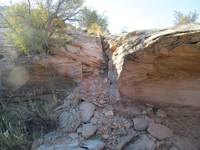
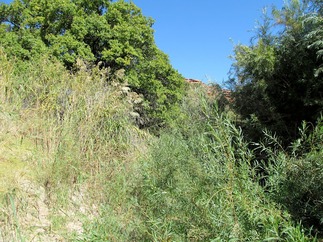
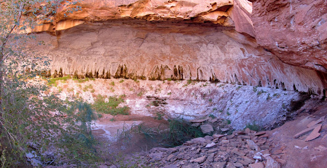
We rejoined the rest of the group and quickly loaded the canoes since we'd taken down camp before setting out on the hike. We hit the river and aimed toward Bull Hollow, where I'd read there was another stock trail. Bull Hollow held some unexpected surprises and turned out to be my favorite part of the trip. After an initial bushwhack to get into the canyon, it opened up and there were some alcoves on the on the south side that looked like they should hold some signs of either prehistoric or historic habitation, but we didn't see squat. We found a couple of constructed sections of trail in the bottom of the canyon that only bypassed some dryfalls, but nothing that climbed out of the canyon. There was poison ivy all along the canyon, but I forged ahead (wearing long pants) and never had any problems with it. Wade and I hiked about a mile up the canyon before turning back and rejoining the rest of the group.
Loading boats at F Canyon
Floating toward Bull Hollow
Some shwhackin' into Bull Hollow
Shallow alcove in Bull Hollow
Poison ivy
First short stretch of constructed trail in Bull Hollow
Hiking up Bull Hollow
Bull Hollow
Second stretch of constructed trail in Bull Hollow
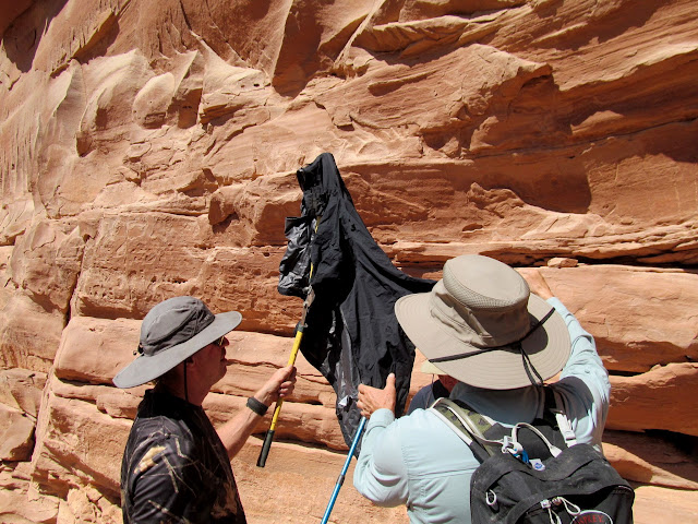
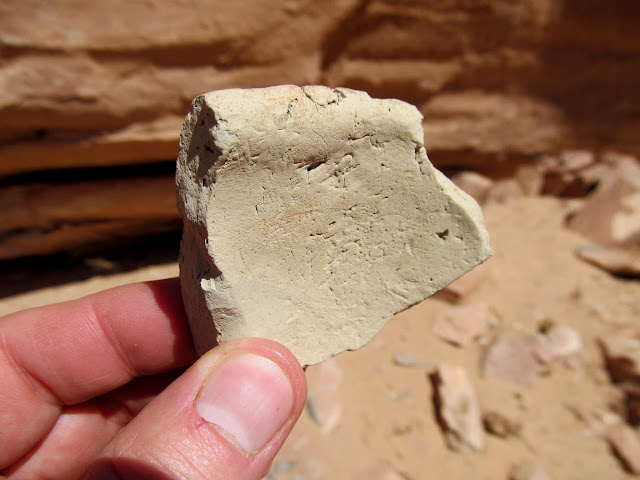
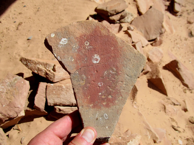
On my way back down the canyon I focused my attention on the north side near the mouth and spotted some faint Barrier Canyon Style pictographs. With the rock art in direct sunlight we rigged up a sun shade to make our photos turn out better. We also found some habitation structures, potsherds, painted metate fragments, and crude petroglyphs.
Bull Hollow pictographs
Rigging a sun shade to photograph some pictographs
Barrier Canyon Style pictograph in Bull Hollow
Bighorn sheep pictos in Bull Hollow
Crude potsherd
Portable pictograph
Black pigment on a metate
Broken metate
Metate with a circle of red pigment
Structure in Bull Hollow
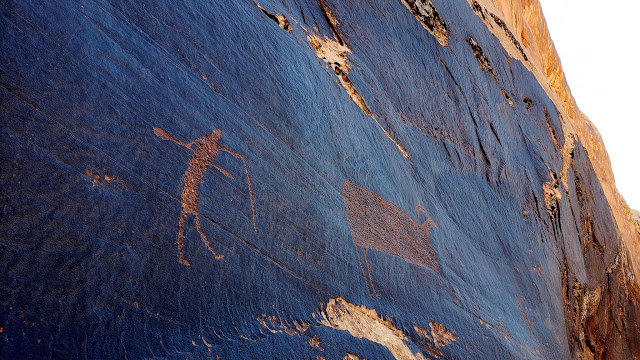
Bull Hollow petroglyphs
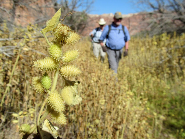
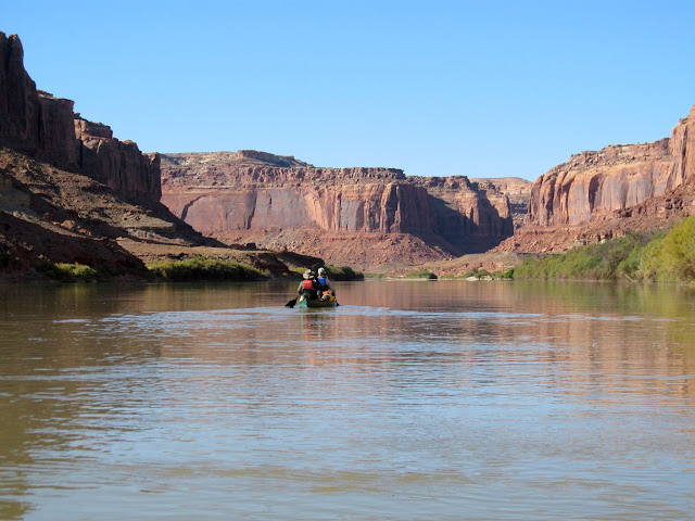
Next up was the mouth of Tenmile Canyon. We'd hoped to find some inscriptions there but heavy brush and cockleburs really made it difficult to get close to the cliffs. We gave up and returned to the river, floating downstream for quite a while before finding a place to camp on a sand bar below Hey Joe Canyon. It wasn't an ideal camp spot because it wasn't very high above the water level. We discussed it a while before settling in, but since the mishap on our previous trip was due to not tying the canoes up, we decided we could mitigate some of the risk this time. We all turned in at about 10PM but I stayed awake in my tent for another two hours listening to music and reading the Canyon Country Zephyr on my phone.
Reflection above Tenmile Canyon
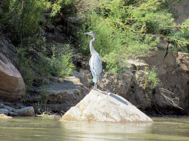
Blue heron
Mouth of tenmile canyon
Tenmile Bottom
Cockleburs in Tenmile Canyon
Back on the river
Camp below Hey Joe Canyon
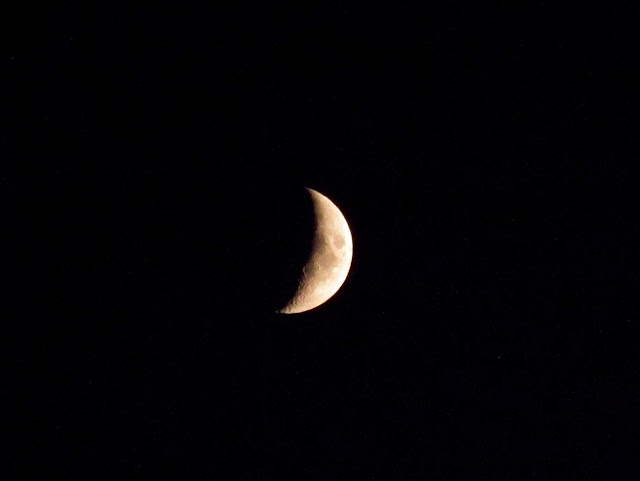
Crescent moon
We were up before 7AM on Friday and paddled our way toward Bowknot Bend. The morning started out calmly but as we hiked up to Bowknot Saddle a fierce wind had risen. We ate lunch on the west end of the saddle, mostly sheltered from the wind.
Ready to launch
Green River reflection
Lyman and Wade
Entering Bowknot Bend
Bowknot Bend landing
Almost to Bowknot Saddle
South end of Bowknot Bend
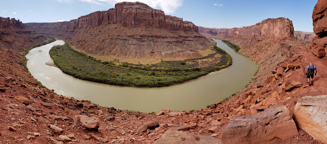
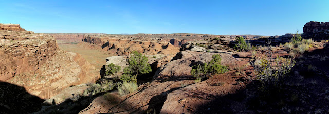
Bowknot Saddle panorama
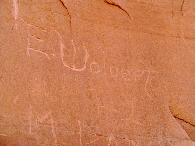
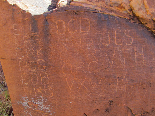
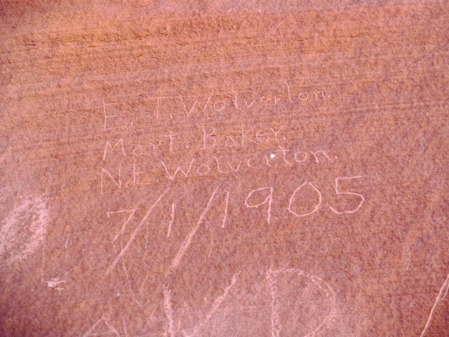
Edwin Thatcher Wolverton inscription from 1902
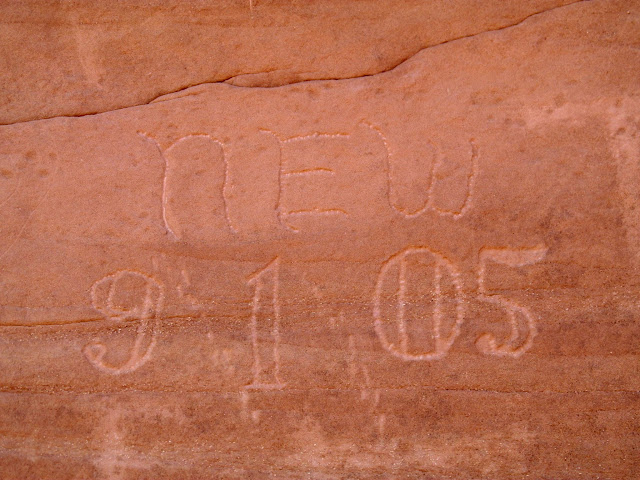
Norville Edwin Wolverton inscription from 1905
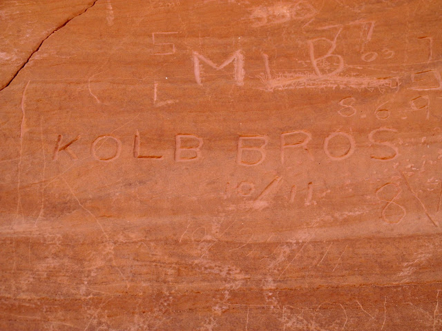
Kolb brothers inscription from 1911
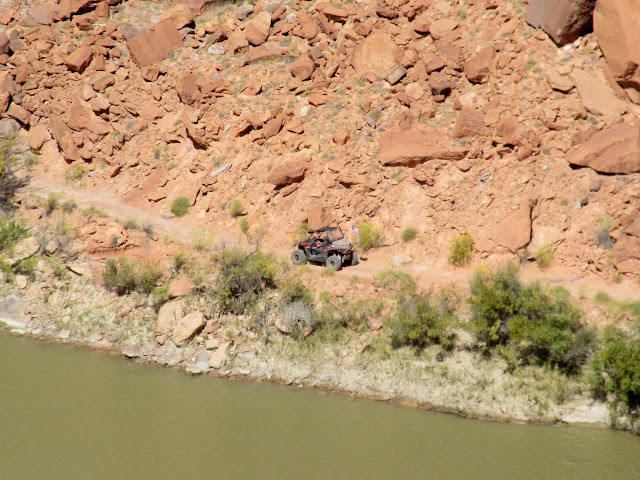
UTV on the road to Hey Joe Canyon
After hiking back down to the boats, Paul and Terri set off before the rest of the group. Those of us in the remaining canoes were worried about being in the water with such strong winds, which were lapping waves over the gunwales of my canoe just sitting on the shore. We waited quite a while until another group of canoes floated past and didn't seem to be having any troubles, so we hit the water and held our three canoes together for a short while before determining that we'd be okay separately. We only paddled about 2.5 miles before finding Paul and Terri on a sand bar just across from the mouth of Spring Canyon. The wind was blowing upstream so hard that they couldn't make any headway downstream, so we decided to make camp early right there. We ate some good food, including Green River cantaloupe and some pepperoncini, and turned in early at 8:30PM.
Waiting out the wind at Bowknot Bend
Holding three canoes together
Camp across from Spring Canyon
Evening view up Spring Canyon
Camp across from Spring Canyon
We'd hoped to camp at the mouth of Horseshoe Canyon that night, so to make up for our lack of progress on the river we arose at 6AM on Saturday morning. The wind had calmed and we were on the river early, though it was quite cold. We stopped at the upper end of Oak Bottom to see the Pathe-Bray Expedition "Lucky 13" inscription and it felt great to walk around a bit to warm up. We landed at the mouth of Horseshoe at about noon and shuttled some gear a few hundred feet up the canyon to claim our campsites.
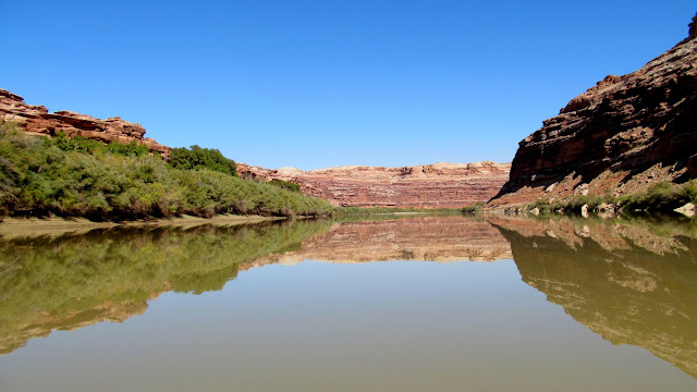
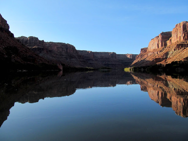
Reflection on the Green River around Bowknot Bend
Heart Rock
Still water around Bowknot Bend
Lucky 13 inscription from the Pathe-Bray Expedition
Approaching Twomile Canyon
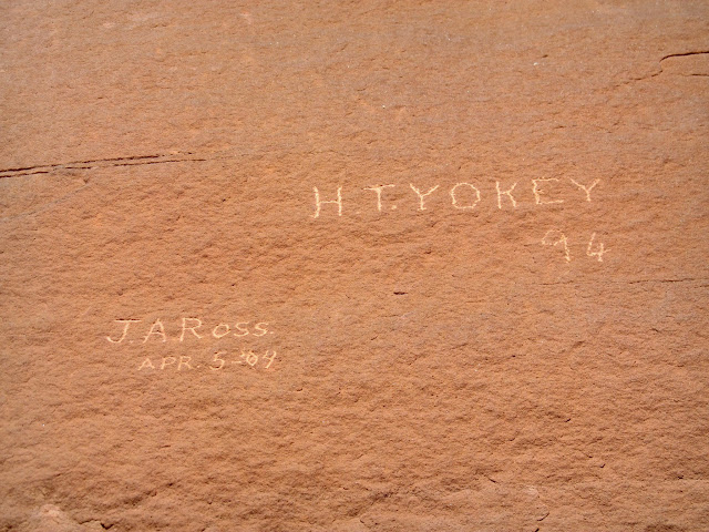
J.A. Ross 1904 and H.T. Yokey 1894 inscriptions below Oak Bottom
Passing the mouth of Twomile Canyon
Colonnade Arch
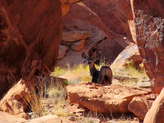
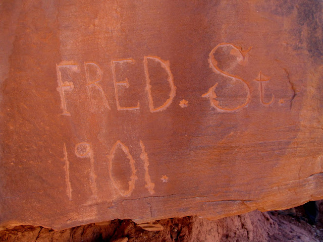
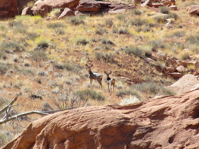
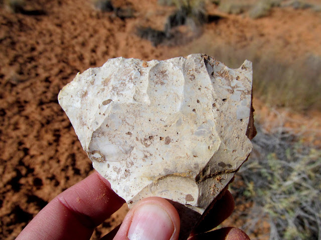
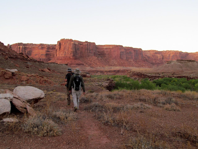
We soon set out for what I'd hoped would be the best part of the trip, a hike around the Frog, an abandoned meander of the Green River at the mouth of Horseshoe Canyon. For a couple of years I've been searching for a rumored Barrier Canyon Style pictograph panel inside an alcove near the mouth of Horseshoe Canyon, but we didn't find it on this trip. We did, however, find inscriptions from 1898 and 1901. We spooked some deer out of their shady hiding spot among the boulders in the Frog. Mark and I explored a side canyon that ended near an alcove that I hoped was hiding the BCS rock art, but it was a bust.
Hiking at the mouth of Horseshoe Canyon
Fence at the mouth of the Frog
Val and Terri at the mouth of the Frog
Mark and Wade checking out a huge boulder in the Frog
1898 inscription
Deer that I spooked from its shady hiding spot
Large boulder shelter
Fred St. 1901 inscription made with some sort of six-sided chisel or drill bit
Deer in the Frog
Crude stone tool
Small side canyon in the Frog
Seep and pool
A promising alcove
Alcove devoid of any signs of habitation
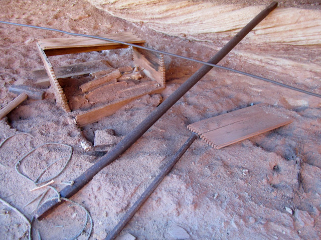
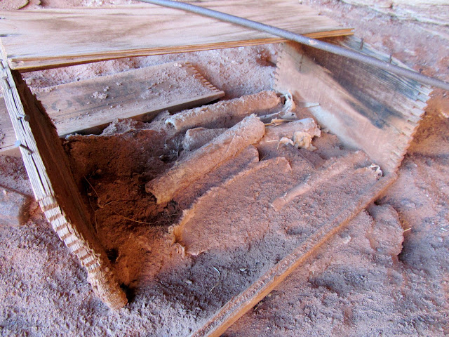
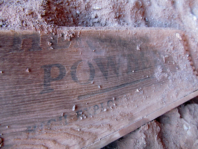
Next Wade, Mark, and I hiked up the Frog Trail while the rest of the group made their way back to camp. I had hiked down the upper end of the Frog Trail four years earlier, and this time I was able to almost join up where I'd left off then. The constructed sections were barely visible and I'd imagine much of the trail has washed out since it was abandoned in the 1940s. We reached the top of the trail and searched for an overhang that was supposed to shelter some old dynamite. It took several minutes of looking but Wade eventually found it and called Mark and me back. There it was, an old box of dynamite that I'd only seen photos of in a Mike Kelsey guidebook! It still amazes me the lengths to which old cowboys went to in order to graze and water their livestock.
Bottom of the Frog Trail
Construction along the Frog Trail
Upper end of the Frog Trail
Last stretch of constructed portion of the Frog Trail
Top of the Frog Trail
Dynamite and drilling tools
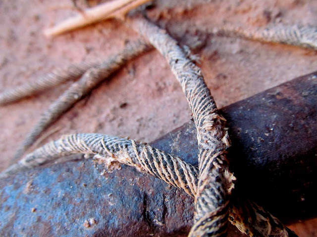
Dynamite fuse
Dynamite
Hercules Powder High Explosives Dangerous
Construction along the Frog Trail
The three of us hiked back down the Frog Trail and continued the loop back to Horseshoe Canyon. We picked up the footprints of the others and had to pass up a nice looking alcove due to the late hour. I wasn't expecting so much bushwhacking to get back into Horseshoe Canyon, and we ended up hiking a faint trail above the west side of the canyon all the way back to camp, with a somewhat sketchy downclimb just before entering camp.
A nice alcove that we didn't have time to explore
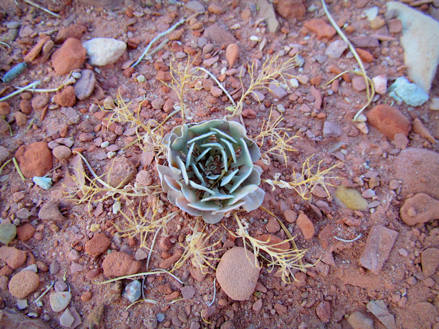
Succulent
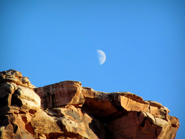
Half-moon
Leaving the Frog and entering Horseshoe Canyon
Trail above Horseshoe Canyon
Blurry descent into Horseshoe Canyon
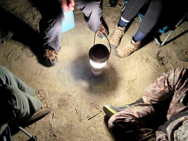
We didn't have a camp fire that evening because of all the dry weeds and brush in the area, but we did gather around a lantern for a while to bullshit and talk about what the two groups had seen while we were separated. I skipped dinner that night and instead ate my Hawaiian chicken the next morning. Before getting back on the river Sunday morning a few of us visited the excellent rock art at the mouth of the canyon.
Lantern in lieu of a camp fire
Horseshoe camp before sunrise
A big breakfast since I skipped dinner
Sunrise on the cliffs across from Horseshoe Canyon
Pictographs and 1892 inscription
Faint 1890 writing in pencil (D-Stretch enhanced)
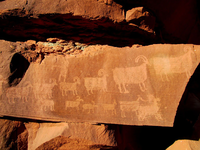
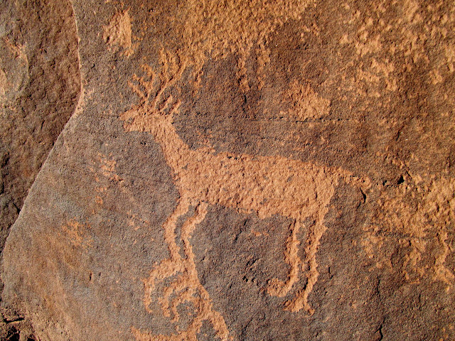
Petroglyphs in Horseshoe Canyon
Deer petroglyph
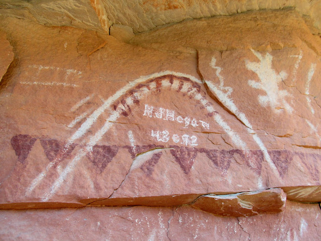
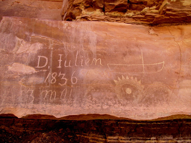
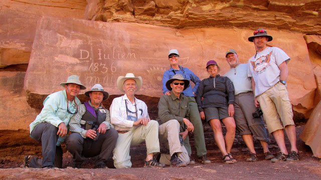
We were up before 7AM on Sunday and our only stop was at the mouth of Hell Roaring Canyon to visit the Denis Julien inscription. We took our only group photo of the trip there, then got back on the river toward Mineral Bottom. We landed at Mineral at 12:30PM and loaded our gear and boats onto the waiting vehicles, then made another lunch stop at Ray's Tavern in Green River before parting ways. Hopefully we can get this group together again each year for more river trips!
Denis Julien 1836 inscription
Wolverton and Baker inscriptions from 1905
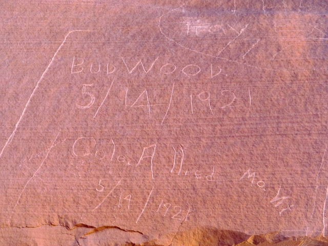
Bub Wood and Cole Allred inscriptions from 1921
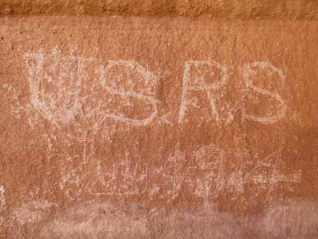
U.S. Reclamation Service inscription from 1914 (that some asshole tried to obliterate)
Group photo in Hell Roaring Canyon (photo by Alan)
Preparing for the last float of the trip
Approach to Mineral Bottom
Photo Gallery: Labyrinth Canyon II
During the first week of October seven friends and I floated Labyrinth Canyon from Ruby Ranch to Mineral Bottom, which for most of us was our second trip through this stretch of the Green River. Our first trip was a near-disaster. On this trip we visited many of the spots we missed on the first trip, plus a few places that are worth visiting more than once. Unlike our last trip when the Green River increased in flow by over 6,000 CFS during the trip, this time it remained between 2,900 and 3,000 CFS the entire time.
Green River flow between 2,900 and 3,000 CFS for our trip
On Tuesday afternoon we all met at Ray's Tavern for lunch, then headed to Ruby Ranch and unloaded the canoes and gear. Everyone who drove hopped in our vehicles and met a friend, Scott, at the Floy exit on I-70, and he followed us to Mineral Bottom where we dropped our vehicles off. Scott then kindly drove everyone back to Ruby Ranch and then headed home while the rest of us set up camp. There were a lot of geese around Ruby Ranch and they kept me awake much of the night. I also heard some owls hooting during the night.
Parked at Ray's Tavern
Leaving our vehicles at Mineral Bottom
We were up before sunrise on Wednesday and got on the river by about 9AM. We floated a short while before reaching Red Wash. I thought the mouth of Red Wash looked like a good place to search for rock art or inscriptions, so Alan and I pulled the canoe up to the shore and I got out and started hiking. The rest of the group waited in the boats while I hiked up the canyon, and there I found some old looking but undated inscriptions by C.M. and R.M. I rejoined the group and we floated downstream to Placer Bottom where we checked out some mining equipment and petroglyphs.
Morning at Ruby Ranch
A little brekkie
Packing gear
Taking down camp
Almost ready to launch!
First morning on the Green River
C.M. and R.M. inscriptions in Red Wash
Part of the group waiting for me
Paul and Terri
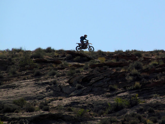
Dirt biker across from Bull Bottom
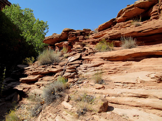
Here the canyon walls get taller
Placer Bottom mining equipment
Placer Bottom mining equipment
Placer Bottom petroglyph
Placer Bottom petroglyphs
Placer Bottom mining equipment
Tailings piles at Placer Bottom
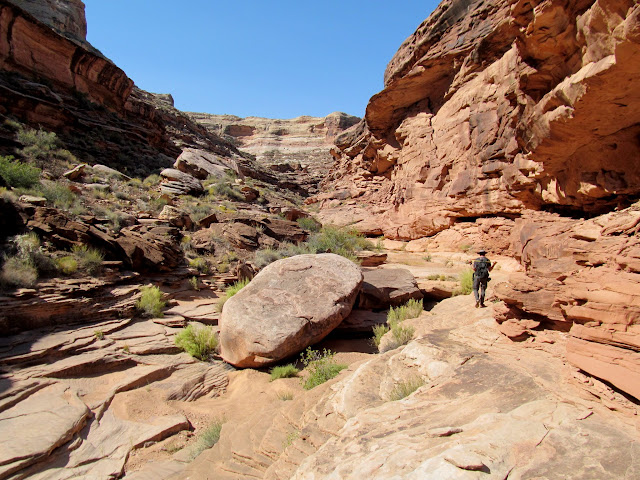
Our next stop was at Hell Hole where we spent quite a bit of time trying to locate a constructed stock trail. The group split up and several of us located the trail while the rest explored other areas. The constructed portion of the trail was maybe 300' long and had been blasted and chiseled through a weakness in the sandstone leading up onto the plateau east of Moonshine Wash.
Wade at Hell Hole
Lyman on the Hell Hole stock trail
Blasted and chiseled section of the Hell Hole Trail
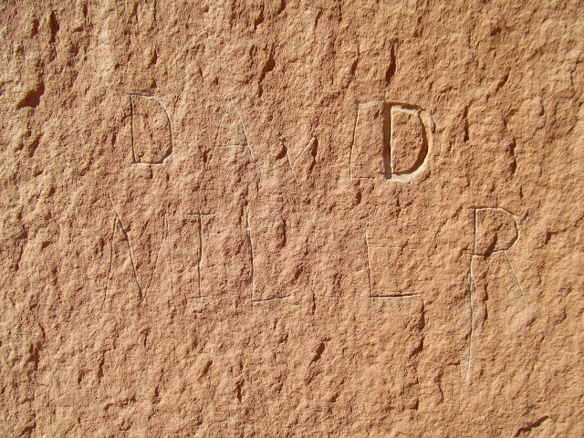
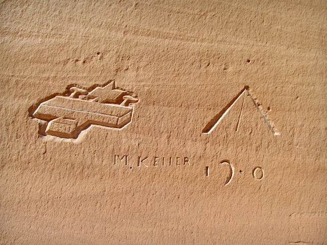
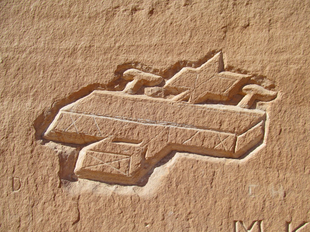
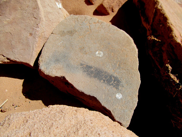
After a brief stop at the mouth of Three Canyon we landed just across the river from June's Bottom and searched for an inscription that we skipped on our previous trip. It turned out to be a very deep and enigmatic carving by Mike Keller, who also left his name and more carvings at Register Rock downstream from there. Even a month later I still can't figure out what it is that Mike carved in the rock.
Wade and Lyman floating below Trin Alcove Bottom
Boats moored across from June's Bottom
Wade looking for inscriptions
David Miller inscription
M. Keller inscription and some strange carvings
What is this?
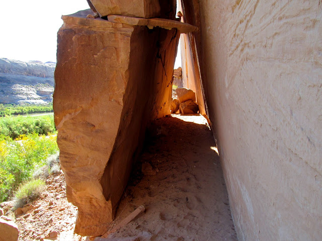
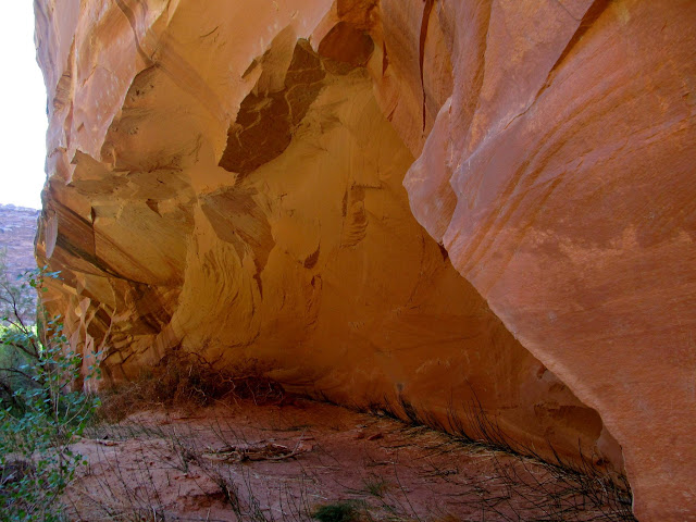
Nice shelter formed by a huge slab of rock
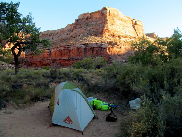
A couple more miles of floating brought us to our second camp of the trip at the mouth of F Canyon, so named because the canyon and its two forks form the shape of an F. We landed at about 5PM and turned in at 10PM. The inside of the rain fly on my tent got soaked during the night but this was the only night it had any moisture on it.
On the way to F Canyon
My camp at F Canyon
Crooked cottonwood tree and crescent moon
Crooked cottonwood at F Bottom
F Bottom before sunrise
On Thursday morning four of us set out to find a stock trail that climbs up onto Tenmile Point from near the mouth of F Canyon. It took some searching but we found the trail, which today I can't imagine even sheep traversing. It took a bit of work for us to even climb above the heavily constructed portion.
Hiking a stock trail from F Canyon up to Tenmile Point
Above the first cliff band
Constructed trail up to Tenmile Point
Climbing the trail
More signs of trail construction
Wade, me, and Alan on the trail
We rejoined the rest of the group and quickly loaded the canoes since we'd taken down camp before setting out on the hike. We hit the river and aimed toward Bull Hollow, where I'd read there was another stock trail. Bull Hollow held some unexpected surprises and turned out to be my favorite part of the trip. After an initial bushwhack to get into the canyon, it opened up and there were some alcoves on the on the south side that looked like they should hold some signs of either prehistoric or historic habitation, but we didn't see squat. We found a couple of constructed sections of trail in the bottom of the canyon that only bypassed some dryfalls, but nothing that climbed out of the canyon. There was poison ivy all along the canyon, but I forged ahead (wearing long pants) and never had any problems with it. Wade and I hiked about a mile up the canyon before turning back and rejoining the rest of the group.
Loading boats at F Canyon
Floating toward Bull Hollow
Some shwhackin' into Bull Hollow
Shallow alcove in Bull Hollow
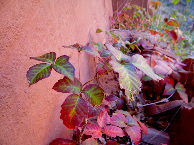
Poison ivy
First short stretch of constructed trail in Bull Hollow
Hiking up Bull Hollow
Bull Hollow
Second stretch of constructed trail in Bull Hollow
On my way back down the canyon I focused my attention on the north side near the mouth and spotted some faint Barrier Canyon Style pictographs. With the rock art in direct sunlight we rigged up a sun shade to make our photos turn out better. We also found some habitation structures, potsherds, painted metate fragments, and crude petroglyphs.
Bull Hollow pictographs
Rigging a sun shade to photograph some pictographs
Barrier Canyon Style pictograph in Bull Hollow
Bighorn sheep pictos in Bull Hollow
Crude potsherd
Portable pictograph
Black pigment on a metate
Broken metate
Metate with a circle of red pigment
Structure in Bull Hollow
Bull Hollow petroglyphs
Next up was the mouth of Tenmile Canyon. We'd hoped to find some inscriptions there but heavy brush and cockleburs really made it difficult to get close to the cliffs. We gave up and returned to the river, floating downstream for quite a while before finding a place to camp on a sand bar below Hey Joe Canyon. It wasn't an ideal camp spot because it wasn't very high above the water level. We discussed it a while before settling in, but since the mishap on our previous trip was due to not tying the canoes up, we decided we could mitigate some of the risk this time. We all turned in at about 10PM but I stayed awake in my tent for another two hours listening to music and reading the Canyon Country Zephyr on my phone.
Reflection above Tenmile Canyon
Blue heron
Mouth of tenmile canyon
Tenmile Bottom
Cockleburs in Tenmile Canyon
Back on the river
Camp below Hey Joe Canyon
Crescent moon
We were up before 7AM on Friday and paddled our way toward Bowknot Bend. The morning started out calmly but as we hiked up to Bowknot Saddle a fierce wind had risen. We ate lunch on the west end of the saddle, mostly sheltered from the wind.
Ready to launch
Green River reflection
Lyman and Wade
Entering Bowknot Bend
Bowknot Bend landing
Almost to Bowknot Saddle
South end of Bowknot Bend
Bowknot Saddle panorama
Edwin Thatcher Wolverton inscription from 1902
Norville Edwin Wolverton inscription from 1905
Kolb brothers inscription from 1911
UTV on the road to Hey Joe Canyon
After hiking back down to the boats, Paul and Terri set off before the rest of the group. Those of us in the remaining canoes were worried about being in the water with such strong winds, which were lapping waves over the gunwales of my canoe just sitting on the shore. We waited quite a while until another group of canoes floated past and didn't seem to be having any troubles, so we hit the water and held our three canoes together for a short while before determining that we'd be okay separately. We only paddled about 2.5 miles before finding Paul and Terri on a sand bar just across from the mouth of Spring Canyon. The wind was blowing upstream so hard that they couldn't make any headway downstream, so we decided to make camp early right there. We ate some good food, including Green River cantaloupe and some pepperoncini, and turned in early at 8:30PM.
Waiting out the wind at Bowknot Bend
Holding three canoes together
Camp across from Spring Canyon
Evening view up Spring Canyon
Camp across from Spring Canyon
We'd hoped to camp at the mouth of Horseshoe Canyon that night, so to make up for our lack of progress on the river we arose at 6AM on Saturday morning. The wind had calmed and we were on the river early, though it was quite cold. We stopped at the upper end of Oak Bottom to see the Pathe-Bray Expedition "Lucky 13" inscription and it felt great to walk around a bit to warm up. We landed at the mouth of Horseshoe at about noon and shuttled some gear a few hundred feet up the canyon to claim our campsites.
Reflection on the Green River around Bowknot Bend
Heart Rock
Still water around Bowknot Bend
Lucky 13 inscription from the Pathe-Bray Expedition
Approaching Twomile Canyon
J.A. Ross 1904 and H.T. Yokey 1894 inscriptions below Oak Bottom
Passing the mouth of Twomile Canyon
Colonnade Arch
We soon set out for what I'd hoped would be the best part of the trip, a hike around the Frog, an abandoned meander of the Green River at the mouth of Horseshoe Canyon. For a couple of years I've been searching for a rumored Barrier Canyon Style pictograph panel inside an alcove near the mouth of Horseshoe Canyon, but we didn't find it on this trip. We did, however, find inscriptions from 1898 and 1901. We spooked some deer out of their shady hiding spot among the boulders in the Frog. Mark and I explored a side canyon that ended near an alcove that I hoped was hiding the BCS rock art, but it was a bust.
Hiking at the mouth of Horseshoe Canyon
Fence at the mouth of the Frog
Val and Terri at the mouth of the Frog
Mark and Wade checking out a huge boulder in the Frog
1898 inscription
Deer that I spooked from its shady hiding spot
Large boulder shelter
Fred St. 1901 inscription made with some sort of six-sided chisel or drill bit
Deer in the Frog
Crude stone tool
Small side canyon in the Frog
Seep and pool
A promising alcove
Alcove devoid of any signs of habitation
Next Wade, Mark, and I hiked up the Frog Trail while the rest of the group made their way back to camp. I had hiked down the upper end of the Frog Trail four years earlier, and this time I was able to almost join up where I'd left off then. The constructed sections were barely visible and I'd imagine much of the trail has washed out since it was abandoned in the 1940s. We reached the top of the trail and searched for an overhang that was supposed to shelter some old dynamite. It took several minutes of looking but Wade eventually found it and called Mark and me back. There it was, an old box of dynamite that I'd only seen photos of in a Mike Kelsey guidebook! It still amazes me the lengths to which old cowboys went to in order to graze and water their livestock.
Bottom of the Frog Trail
Construction along the Frog Trail
Upper end of the Frog Trail
Last stretch of constructed portion of the Frog Trail
Top of the Frog Trail
Dynamite and drilling tools
Dynamite fuse
Dynamite
Hercules Powder High Explosives Dangerous
Construction along the Frog Trail
The three of us hiked back down the Frog Trail and continued the loop back to Horseshoe Canyon. We picked up the footprints of the others and had to pass up a nice looking alcove due to the late hour. I wasn't expecting so much bushwhacking to get back into Horseshoe Canyon, and we ended up hiking a faint trail above the west side of the canyon all the way back to camp, with a somewhat sketchy downclimb just before entering camp.
A nice alcove that we didn't have time to explore
Succulent
Half-moon
Leaving the Frog and entering Horseshoe Canyon
Trail above Horseshoe Canyon
Blurry descent into Horseshoe Canyon
We didn't have a camp fire that evening because of all the dry weeds and brush in the area, but we did gather around a lantern for a while to bullshit and talk about what the two groups had seen while we were separated. I skipped dinner that night and instead ate my Hawaiian chicken the next morning. Before getting back on the river Sunday morning a few of us visited the excellent rock art at the mouth of the canyon.
Lantern in lieu of a camp fire
Horseshoe camp before sunrise
A big breakfast since I skipped dinner
Sunrise on the cliffs across from Horseshoe Canyon
Pictographs and 1892 inscription
Faint 1890 writing in pencil (D-Stretch enhanced)
Petroglyphs in Horseshoe Canyon
Deer petroglyph
We were up before 7AM on Sunday and our only stop was at the mouth of Hell Roaring Canyon to visit the Denis Julien inscription. We took our only group photo of the trip there, then got back on the river toward Mineral Bottom. We landed at Mineral at 12:30PM and loaded our gear and boats onto the waiting vehicles, then made another lunch stop at Ray's Tavern in Green River before parting ways. Hopefully we can get this group together again each year for more river trips!
Denis Julien 1836 inscription
Wolverton and Baker inscriptions from 1905
Bub Wood and Cole Allred inscriptions from 1921
U.S. Reclamation Service inscription from 1914 (that some asshole tried to obliterate)
Group photo in Hell Roaring Canyon (photo by Alan)
Preparing for the last float of the trip
Approach to Mineral Bottom
Photo Gallery: Labyrinth Canyon II


")