- Joined
- Feb 15, 2020
- Messages
- 579
I'd put together a little "bonus" Wind River trip when laying out my longer trip coming up this September and wasn't sure when/if I'd get a chance to do it. When my wife/kids ended up going out of town for a long weekend, I figured I should take advantage and see what I could do. It was a wonderful trip, though it'd probably be better suited for later in the year (less water/bugs) and another couple of days/nights would've made for a much more relaxing experience; I also had to cut out a portion I wanted to do through the Dry Creek Basin due to my time constraints.
The views started out a little hazy and got worse throughout the trip - fire season has arrived. Bugs were terrible through the low, wet, and more protected portions, but that was to be expected and a decent wind kept them away in most open spaces. I lucked out with weather overall though; Horse Ridge is very exposed and tough to bail from, but I was able to take my time through that section with clear skies overhead all day.
In total, the trip ended up being ~48 miles and 13,300' elevation gain in 3 days/2 nights.
Day 1: Glacier Trail TH to Ink Wells (14.27mi - +5,496'/-3,009')
I hit the trail around 7AM and the weather was impeccable - there was a light haze everywhere on the horizon, but nothing to complain about.
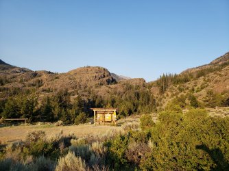
The trail up to Goat Flat/Arrow Mountain was fairly unassuming, but there was just the right amount of wind to make for very comfortable walking. I hadn't slept well the previous night, so at one point I stepped off trail a took a little nap.
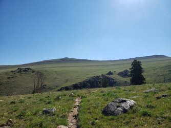
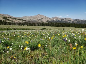
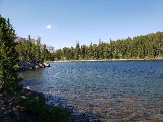
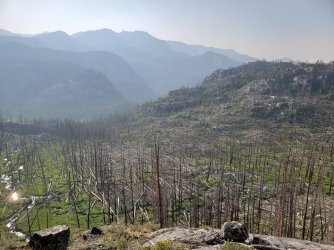
After descending a bit through a small burn scar, the trail passes a number of very nice lakes (Phillips, Double, Star, Honeymoon). When I was returning on Day 3 the fish at Double Lake were incredibly active - I wished I'd had my rod and a little more time.
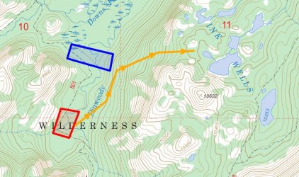
My goal at this point was to get up to Horse Ridge and I wanted to avoid going all the way to the bridge at the Ink Wells junction - this made for an interesting little adventure getting across Dinwoody Creek. I knew there was a poorly maintained Forest Service trail that roughly followed the Ink Wells drainage up to Scenic Pass, but I didn't have much luck locating it - based on the map location, I don't think I would've wanted to cross there anyway. I went upstream into Downs Fork Meadows until I found a section where the creek split into two slow moving sections. The first I was able to cross easily in waist deep water, but the second involved a few feet of swimming. Fortunately it was still quite sunny and I found a nice slab above the meadows to relax and dry out for a bit.
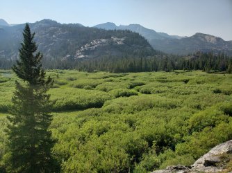
From here to Ink Wells travel was less than ideal - lots of blowdowns and standing water with no clear direction. I decided to aim for the lowest drainage to the Ink Wells area and ended up finding a few pretty good ramps. Mosquitos at Ink Wells were terrible, but I was ready for some sleep anyway so I passed right out.
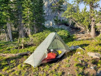
Day 2: Ink Wells to Dinwoody Creek via Horse Ridge/Mount Febbas (12.22mi - +4,083'/-3,439')
Today was the day I was excited for and my optimism was rewarded. It took a little more bushwhacking out of the Ink Wells area, but as soon as I broke the treeline the views were expansive and the breeze kept the bugs/heat at bay.
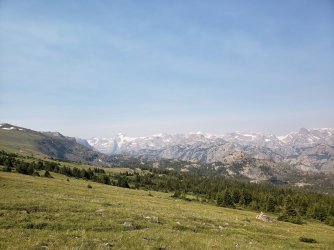
The travel was very straightforward and the undulations in the ridge gave alternating views of the Dinwoody Creek and Dry Creek drainages. As elevation increased the vegetation naturally gave way to more rock and eventually some ice. I was occasionally spotted by a large herd of elk - primarily cows and calves - that tended to stay one rise away from me.
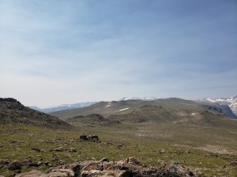
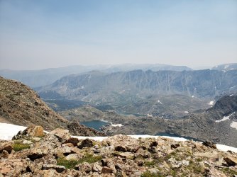
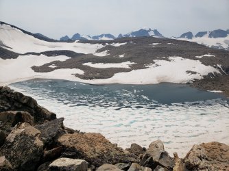
Noel (or Knoll) Lake at 12,165' was surprisingly well sheltered on three sides - you could probably make a nice camp there in good weather. Horse Ridge in general is very exposed with pretty poor bailout options, so probably not the best idea without a reliable forecast in hand.
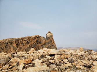
Chimney Rock
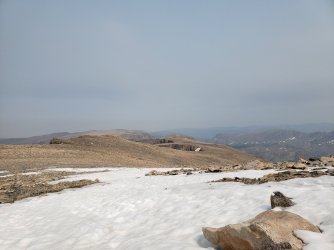
Looking down the eastern arm of Horse Ridge appeared to be more of the same, but I would've liked to have gotten a better look at the North Fork Bull Lake Creek drainage - the day was wearing on however and I was still planning to get down to Dinwoody Creek for the night.
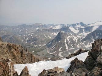
The panoramic view of the Continental Divide from Mount Febbas was astounding.

By the way if anyone wants to jog up there and correct my entry in the summit register, I'd be much obliged. I just looked at my picture and apparently I thought it was September... The tiny notebook register was placed there in 1996 and only contains a couple signatures per year - only one from last year and mine was the first of 2021. I'm sure there are parties that don't bother signing, but it was certainly a lot smaller than most registers I see these days. I guess most people who tackle the long approach are focused on Gannett.
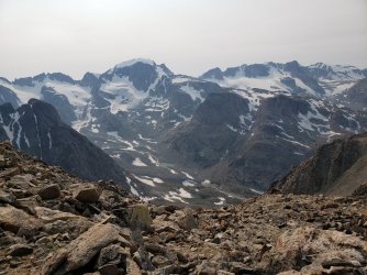
Getting down was a fun adventure in low Class 3 terrain and "scree skiing", but not too bad overall. I was happy to be going down and not up and appreciative of the beta I'd received from a friend that climbed up this way a couple years ago.
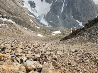
A quick shot of the northwest side of Blaurock Pass which I should (hopefully) be tackling on my route later this year.
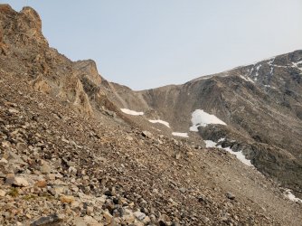
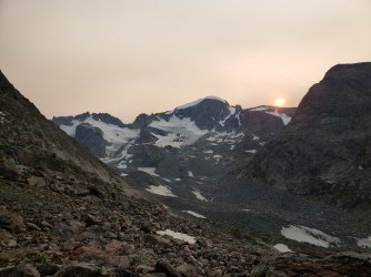
Down in the basin looking at the appropriately named Heap Steep Glacier.
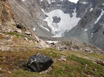
The sun setting over Gannett with no clouds, but plenty of smoky haze...
Day 3: Return via Glacier Trail (21.81mi - +3,719'/-6,850')
The smoke only got worse from there. The views down the Glacier Trail remained fantastic however.
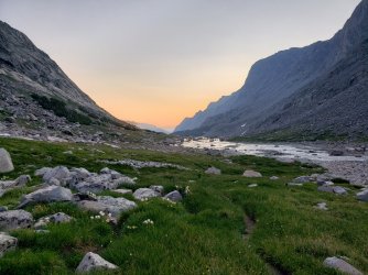
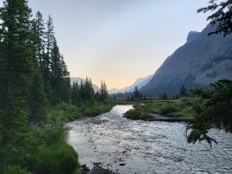
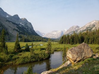
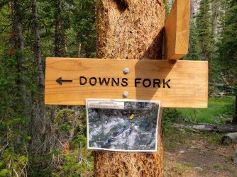
New trail routing for Downs Fork bridge, if anyone is interested.
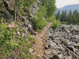
Had a weasel cross my path as I continued down the trail - it's been a while since I've seen any mustelids on trail so it was a pleasant surprise.
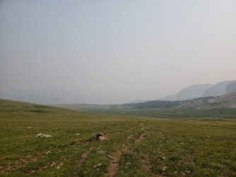
Back on Goat Flat and the smoke just continues to get worse - I could smell it pretty strongly at this point.
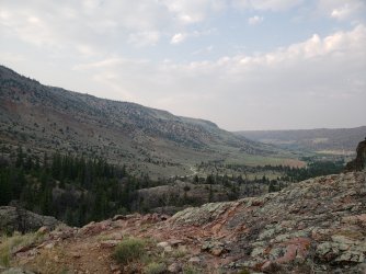
The welcome sight of my truck (still a mile away) at the end of a long day...
It was a fantastic trip and one I feel very lucky to have squeezed in. At this point my summer trip schedule is pretty locked in, so it's great to sneak an extra one in when the opportunity presents itself.
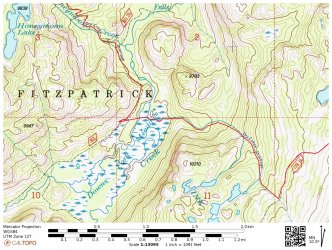
Click here to view on CalTopo
The views started out a little hazy and got worse throughout the trip - fire season has arrived. Bugs were terrible through the low, wet, and more protected portions, but that was to be expected and a decent wind kept them away in most open spaces. I lucked out with weather overall though; Horse Ridge is very exposed and tough to bail from, but I was able to take my time through that section with clear skies overhead all day.
In total, the trip ended up being ~48 miles and 13,300' elevation gain in 3 days/2 nights.
Day 1: Glacier Trail TH to Ink Wells (14.27mi - +5,496'/-3,009')
I hit the trail around 7AM and the weather was impeccable - there was a light haze everywhere on the horizon, but nothing to complain about.

The trail up to Goat Flat/Arrow Mountain was fairly unassuming, but there was just the right amount of wind to make for very comfortable walking. I hadn't slept well the previous night, so at one point I stepped off trail a took a little nap.


After descending a bit through a small burn scar, the trail passes a number of very nice lakes (Phillips, Double, Star, Honeymoon). When I was returning on Day 3 the fish at Double Lake were incredibly active - I wished I'd had my rod and a little more time.

My goal at this point was to get up to Horse Ridge and I wanted to avoid going all the way to the bridge at the Ink Wells junction - this made for an interesting little adventure getting across Dinwoody Creek. I knew there was a poorly maintained Forest Service trail that roughly followed the Ink Wells drainage up to Scenic Pass, but I didn't have much luck locating it - based on the map location, I don't think I would've wanted to cross there anyway. I went upstream into Downs Fork Meadows until I found a section where the creek split into two slow moving sections. The first I was able to cross easily in waist deep water, but the second involved a few feet of swimming. Fortunately it was still quite sunny and I found a nice slab above the meadows to relax and dry out for a bit.

From here to Ink Wells travel was less than ideal - lots of blowdowns and standing water with no clear direction. I decided to aim for the lowest drainage to the Ink Wells area and ended up finding a few pretty good ramps. Mosquitos at Ink Wells were terrible, but I was ready for some sleep anyway so I passed right out.


Day 2: Ink Wells to Dinwoody Creek via Horse Ridge/Mount Febbas (12.22mi - +4,083'/-3,439')
Today was the day I was excited for and my optimism was rewarded. It took a little more bushwhacking out of the Ink Wells area, but as soon as I broke the treeline the views were expansive and the breeze kept the bugs/heat at bay.

The travel was very straightforward and the undulations in the ridge gave alternating views of the Dinwoody Creek and Dry Creek drainages. As elevation increased the vegetation naturally gave way to more rock and eventually some ice. I was occasionally spotted by a large herd of elk - primarily cows and calves - that tended to stay one rise away from me.


Noel (or Knoll) Lake at 12,165' was surprisingly well sheltered on three sides - you could probably make a nice camp there in good weather. Horse Ridge in general is very exposed with pretty poor bailout options, so probably not the best idea without a reliable forecast in hand.

Chimney Rock

Looking down the eastern arm of Horse Ridge appeared to be more of the same, but I would've liked to have gotten a better look at the North Fork Bull Lake Creek drainage - the day was wearing on however and I was still planning to get down to Dinwoody Creek for the night.


The panoramic view of the Continental Divide from Mount Febbas was astounding.

By the way if anyone wants to jog up there and correct my entry in the summit register, I'd be much obliged. I just looked at my picture and apparently I thought it was September... The tiny notebook register was placed there in 1996 and only contains a couple signatures per year - only one from last year and mine was the first of 2021. I'm sure there are parties that don't bother signing, but it was certainly a lot smaller than most registers I see these days. I guess most people who tackle the long approach are focused on Gannett.

Getting down was a fun adventure in low Class 3 terrain and "scree skiing", but not too bad overall. I was happy to be going down and not up and appreciative of the beta I'd received from a friend that climbed up this way a couple years ago.

A quick shot of the northwest side of Blaurock Pass which I should (hopefully) be tackling on my route later this year.

Down in the basin looking at the appropriately named Heap Steep Glacier.

The sun setting over Gannett with no clouds, but plenty of smoky haze...

Day 3: Return via Glacier Trail (21.81mi - +3,719'/-6,850')
The smoke only got worse from there. The views down the Glacier Trail remained fantastic however.


New trail routing for Downs Fork bridge, if anyone is interested.

Had a weasel cross my path as I continued down the trail - it's been a while since I've seen any mustelids on trail so it was a pleasant surprise.

Back on Goat Flat and the smoke just continues to get worse - I could smell it pretty strongly at this point.

The welcome sight of my truck (still a mile away) at the end of a long day...

It was a fantastic trip and one I feel very lucky to have squeezed in. At this point my summer trip schedule is pretty locked in, so it's great to sneak an extra one in when the opportunity presents itself.
Click here to view on CalTopo
Last edited:

