- Joined
- Aug 9, 2007
- Messages
- 12,967
June 2005
My brother, Steve, has been preparing for a 50 mile hike with the boy scouts and I have been helping him in gear selection and on this warm up trip. I've never taken a trip like this with a family member before, at least not that I was old enough to remember. So I was really excited to get out and spend some time with my bro.
The route for this trip is a point-to-point that begins at the High Creek trailhead and ends at the Cherry Creek trailhead which is the drainage immediately south of High Creek. To get from High Creek to Cherry Peak we will hike top the top of Cherry Peak. Cherry Peak is an awesome rocky peak in the Naomi Wilderness. The face of it is roughly 2000' of sheer cliffs. We hurried up the first few miles to spend the night in the meadow just below the peak.
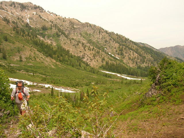
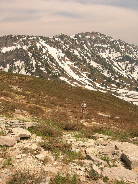
The next morning we had breakfast and then began the hike up to Cherry Peak. There is a lot of elevation gain in this portion of the hike. This is Steve as we are leaving the meadow.
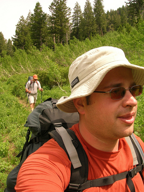
Selfie while hiking.
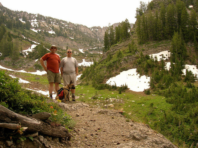
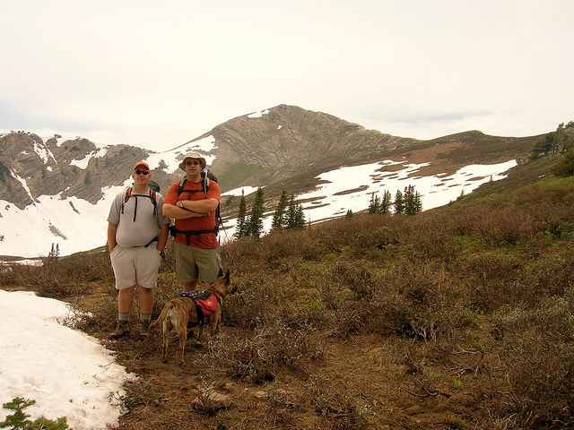
Group shot at one of the breaks we took on the climb up to High Creek Lake.
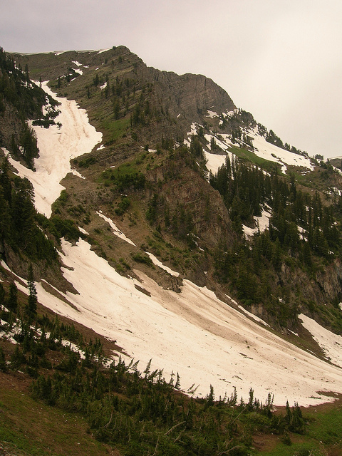
This gully down Cherry Peak is called "Z Gully". It's very popular with skiers in the winter time. I've even run into people hiking the trail in May and June on their way to ski this line.
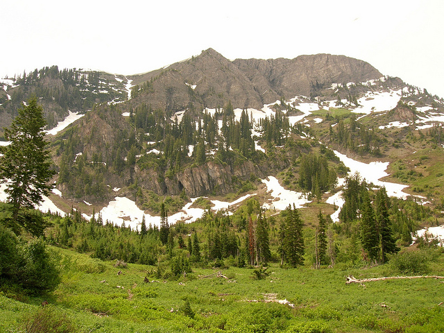
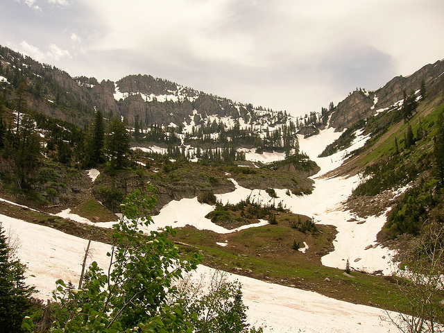
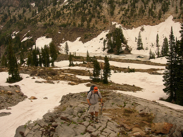
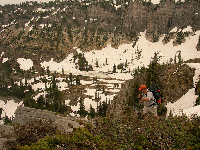
Looking up the valley towards High Creek Lake. It sits on the shelf just below the cliff bands at the top.
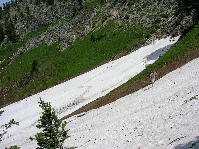
It was a very heavy snow year so there was still a lot in the mountains. I had been here about the same time last year and there was almost none at all. This is Steve negotiating some slide trails. These are tricky because if you don't kick in your foot well you'll slide all the way down them.
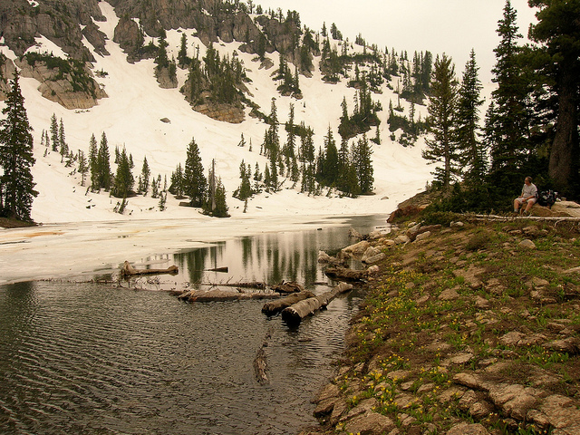
High Creek Lake still partially frozen over. Last year at this time it was so warm that I almost could have gone for a swim.
Steve hoofing it out of High Creek Lake towards the saddle dividing Cherry Peak and Naomi Peak.
Posing on the saddle with the back side of Cherry Peak in the background. The route we will take is straight up the ridge on the right.
Steve hiking the saddle with High Creek Lake in the background
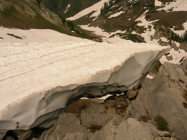
Some of the cornices were just barely hanging on. I had to keep yelling at Nikita to keep her off of them.
Steve hiking the saddle with Naomi Peak in the background. At 9980', Naomi is the tallest mountain in the Bear River Range.
A rather intimidating shot of the route we are about to take. Despite it's look it is actually very easy and highly enjoyable.
Nikita and I on the ridge.
This is a cool shot of the trail. Notice Steve in the picture to give scale to how large these snow drifts really are. You can also see the trail we came up early in the day about 2000' below on the left.
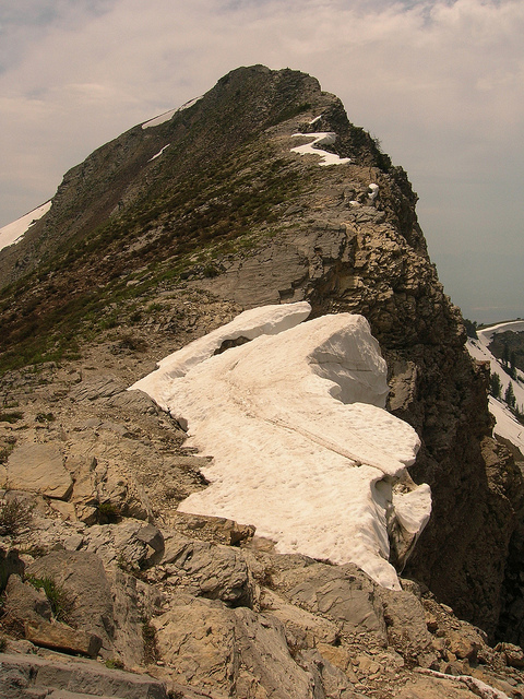
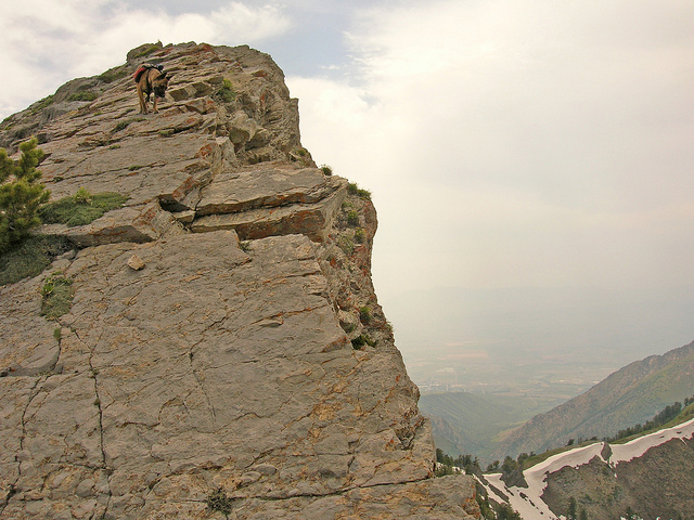
Nikita just below the summit of Cherry Peak. This shot is just mind-numbing to me, so surreal. It was all cliff for the last hundred yards or so.
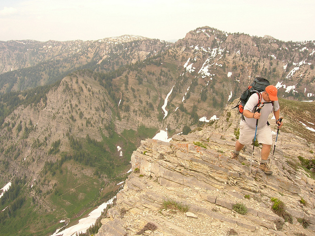
Steve pushing the last few hundred feet.
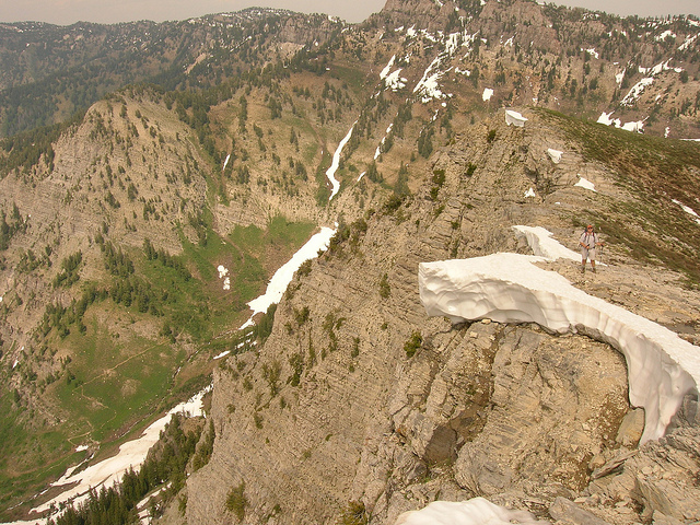
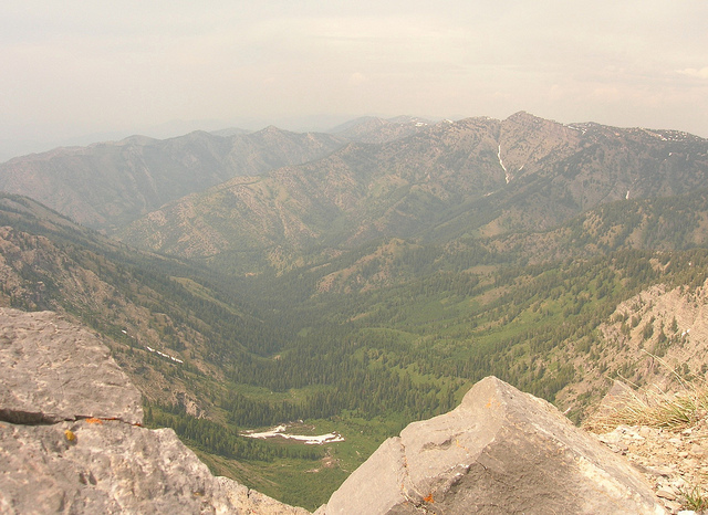
The view back down High Creek from the summit of Cherry Peak.
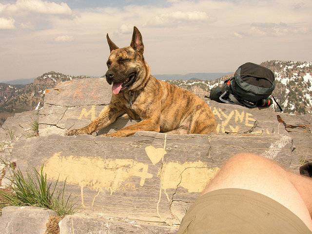
Nikita on top of Cherry Peak
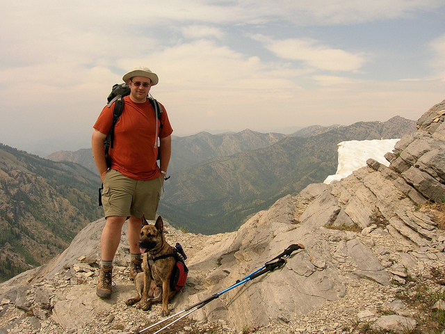
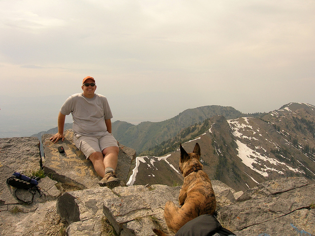
Steve and Nikita on Cherry Peak, Cache Valley in the distant background.
After we left the summit the plan was to hike into Cherry Creek to camp. I had this great idea to take the fast track down a couloir on the south west face of the peak. I figured there would be a lot of snow in the trees where the trail was going to take us. We hiked down a ways until we made it to a spot where we had to down climb between a cliff and a snow drift. This of course involved removing our packs. Somewhere in the process I inadvertently sent Steve's backpack rolling down the mountain. We found it something like five or six hundred feet down the chute we were in. I felt awful. His pack was torn up a bit and all of his food was blown open inside.
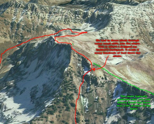
I got my share of the damage though. Midway through the down climb I handed Steve my new digital camera and asked him to put it in his pack so that I didn't damage it while I was climbing down. So when we found his pack and pulled it out the screen was smashed. RIP Digital Camera #1. Awww.. This also explains why the pictures for this trip end on the summit. The rest of the hike down was brutal. It took forever to make it down our improvised route to the canyon floor. Below is a Google Earth image of Cherry Peak. The red line is the route we including the improvised route down the summit. The green line is where we should have gone.
The next day we hiked the remainder of the distance out of Cherry Creek where we had spotted a car a few days earlier. It was a really fun route but next time we'll wait until there is a little less snow and we'll stick to the established route.
My brother, Steve, has been preparing for a 50 mile hike with the boy scouts and I have been helping him in gear selection and on this warm up trip. I've never taken a trip like this with a family member before, at least not that I was old enough to remember. So I was really excited to get out and spend some time with my bro.
The route for this trip is a point-to-point that begins at the High Creek trailhead and ends at the Cherry Creek trailhead which is the drainage immediately south of High Creek. To get from High Creek to Cherry Peak we will hike top the top of Cherry Peak. Cherry Peak is an awesome rocky peak in the Naomi Wilderness. The face of it is roughly 2000' of sheer cliffs. We hurried up the first few miles to spend the night in the meadow just below the peak.
The next morning we had breakfast and then began the hike up to Cherry Peak. There is a lot of elevation gain in this portion of the hike. This is Steve as we are leaving the meadow.
Selfie while hiking.
Group shot at one of the breaks we took on the climb up to High Creek Lake.
This gully down Cherry Peak is called "Z Gully". It's very popular with skiers in the winter time. I've even run into people hiking the trail in May and June on their way to ski this line.
Looking up the valley towards High Creek Lake. It sits on the shelf just below the cliff bands at the top.
It was a very heavy snow year so there was still a lot in the mountains. I had been here about the same time last year and there was almost none at all. This is Steve negotiating some slide trails. These are tricky because if you don't kick in your foot well you'll slide all the way down them.
High Creek Lake still partially frozen over. Last year at this time it was so warm that I almost could have gone for a swim.
Steve hoofing it out of High Creek Lake towards the saddle dividing Cherry Peak and Naomi Peak.
Posing on the saddle with the back side of Cherry Peak in the background. The route we will take is straight up the ridge on the right.
Steve hiking the saddle with High Creek Lake in the background
Some of the cornices were just barely hanging on. I had to keep yelling at Nikita to keep her off of them.
Steve hiking the saddle with Naomi Peak in the background. At 9980', Naomi is the tallest mountain in the Bear River Range.
A rather intimidating shot of the route we are about to take. Despite it's look it is actually very easy and highly enjoyable.
Nikita and I on the ridge.
This is a cool shot of the trail. Notice Steve in the picture to give scale to how large these snow drifts really are. You can also see the trail we came up early in the day about 2000' below on the left.
Nikita just below the summit of Cherry Peak. This shot is just mind-numbing to me, so surreal. It was all cliff for the last hundred yards or so.
Steve pushing the last few hundred feet.
The view back down High Creek from the summit of Cherry Peak.
Nikita on top of Cherry Peak
Steve and Nikita on Cherry Peak, Cache Valley in the distant background.
After we left the summit the plan was to hike into Cherry Creek to camp. I had this great idea to take the fast track down a couloir on the south west face of the peak. I figured there would be a lot of snow in the trees where the trail was going to take us. We hiked down a ways until we made it to a spot where we had to down climb between a cliff and a snow drift. This of course involved removing our packs. Somewhere in the process I inadvertently sent Steve's backpack rolling down the mountain. We found it something like five or six hundred feet down the chute we were in. I felt awful. His pack was torn up a bit and all of his food was blown open inside.
I got my share of the damage though. Midway through the down climb I handed Steve my new digital camera and asked him to put it in his pack so that I didn't damage it while I was climbing down. So when we found his pack and pulled it out the screen was smashed. RIP Digital Camera #1. Awww.. This also explains why the pictures for this trip end on the summit. The rest of the hike down was brutal. It took forever to make it down our improvised route to the canyon floor. Below is a Google Earth image of Cherry Peak. The red line is the route we including the improvised route down the summit. The green line is where we should have gone.
The next day we hiked the remainder of the distance out of Cherry Creek where we had spotted a car a few days earlier. It was a really fun route but next time we'll wait until there is a little less snow and we'll stick to the established route.