Our Holy Cross trip was the beginning of July in 2018. We were with friends and parked one car at the end (Fall Creek TH) and started at Cross Creek TH. Cross Creek is lower than Fall Creek, so we gained a lot of elevation. Apparently a lot of people do it in the opposite direction, but it worked ok for us with our 50+ year old knees and for acclimating to the altitude. Here's our route:
Click here to view on CalTopo. As you'll see, it's not a lot of miles for 5 days - we got a late start on day 1, and one person in our group wasn't feeling well so our pace was quite slow part of the time (and our regular pace isn't fast anyway). If you wanted to ascend Mt of the Holy Cross, you would do it differently.
Day 1 - The trail is mostly in the woods going south near Cross Creek. We camped in the woods somewhere.
View attachment 110229
Day 2 - Things opened up a bit and we had some big views with more varied scenery. We camped close to the southern end of the Cross Creek trail before it turns east and heads up.
View attachment 110227 View attachment 110226 View attachment 110220 View attachment 110225.
View attachment 110219
Day 3 - We went up to the Missouri Lakes junction, dropped our packs, went down into the Missouri Lakes and explored there for awhile (which we really liked), then came back up and got our packs, then went up Fancy Pass, then down to Fancy Lake where we camped for the night. Behind our camp was a ridge with fabulous views of peaks to the east.
View attachment 110218
View from southern end of Cross Creek as you're heading up
View attachment 110224
Treasure Vault Lake
View attachment 110216
One of the Missouri Lakes
View attachment 110214
View from Fancy Pass
View attachment 110213
Fancy Lake
View attachment 110223
Ridge behind Fancy Lake
Day 4 - We went through Holy Cross City, which was kind of intriguing, then up French Creek past Seven Sisters Lakes (beautiful), then up the pass and camped a little bit below the pass. Gorgeous!
View attachment 110212 View attachment 110211 View attachment 110209 View attachment 110210
View attachment 110208 View attachment 110222
Day 5 - We went down, then up the spur to Tuhare Lakes, but we couldn't get to the upper, bigger lake - it was too snowy for us to cross one part that seemed dicey, and there were rocks that were too big for us to get around. Then we came back down and made our way to the Fall Creek TH just as storms were rolling in.
View attachment 110207 View attachment 110206
View attachment 110205
View attachment 110204
Lower Tuhare Lake
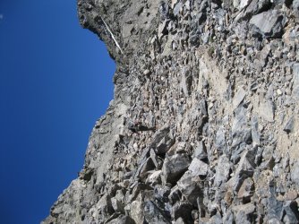
View attachment 110203
Upper Tuhare Lake is behind the big rocks in the foreground. We couldn't get to it or even see it, but the map shows that it's much bigger than the lower one.
We loved this trip!