SteveR
Member
- Joined
- Sep 22, 2016
- Messages
- 1,012
Summer has finally arrived in Southern Alberta, and with most of the sub-alpine and alpine trails in the provincial and national parks being at least somewhat snowbound on the first weekend of June- a great choice for a hike would be one of the higher foothills areas to the south of Calgary, where open ridges rise between the ranching country to the east, and the front ranges of the Rockies to the west.
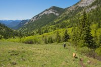
After dropping a shuttle vehicle a few km down the highway, we left the Highwood River Valley behind on the trail up Gunnery Creek. Yes- off leash dogs are allowed here, although we exercise a lot of caution in doing so, as this is definitely grizzly bear territory.
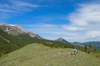
After reaching Gunnery Pass- the route heads south, off trail along an open ridge.
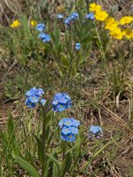
The alpines are flowering profusely in this zone, where the snow does not lie as deeply as further west, and spring arrives much earlier.
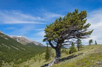
An enduring testament to the chinook winds that can sweep though the foothills. Not today though- it is perfect out.
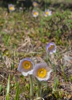
Some of the first harbingers of spring, the "Prairie Crocus" were still hanging on at this higher elevation.
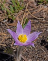
A particularly vivid one.
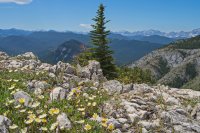
From lunch at the end of the first ridge- a view west to the peaks of the divide along the Alberta-British Columbia border.
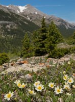
Mountain Avens dot the rocky terrain.
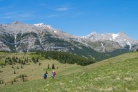
Dropping off the ridge (out of sight to the left) down to Grass Pass at centre, we then traversed the next ridge out to Fir Creek Point. If anyone has read the books of Raymond Patterson- they will recognize this place from his accounts of early ranching days in the area.
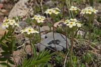
Rock Jasmine were out in full force.
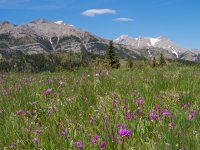
Shooting Stars at the Fir Creek Point meadows.
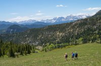
Dropping off the end of the ridge, where we will swing around to the left and descend a cattle/horse trail into Fir Creek, and an easy valley bottom exit out to highway, several km east of our starting point.
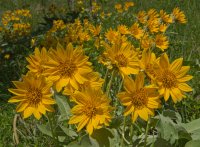
On open side slopes above Fir Creek- a spectacular blooming of Balsam Root dominated the abundant wildflower display.
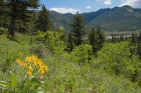
Almost done. At 12 km and 600 m elevation gain, this was an easy but very rewarding conditioner for the upcoming hiking season.

After dropping a shuttle vehicle a few km down the highway, we left the Highwood River Valley behind on the trail up Gunnery Creek. Yes- off leash dogs are allowed here, although we exercise a lot of caution in doing so, as this is definitely grizzly bear territory.

After reaching Gunnery Pass- the route heads south, off trail along an open ridge.

The alpines are flowering profusely in this zone, where the snow does not lie as deeply as further west, and spring arrives much earlier.

An enduring testament to the chinook winds that can sweep though the foothills. Not today though- it is perfect out.

Some of the first harbingers of spring, the "Prairie Crocus" were still hanging on at this higher elevation.

A particularly vivid one.

From lunch at the end of the first ridge- a view west to the peaks of the divide along the Alberta-British Columbia border.

Mountain Avens dot the rocky terrain.

Dropping off the ridge (out of sight to the left) down to Grass Pass at centre, we then traversed the next ridge out to Fir Creek Point. If anyone has read the books of Raymond Patterson- they will recognize this place from his accounts of early ranching days in the area.

Rock Jasmine were out in full force.

Shooting Stars at the Fir Creek Point meadows.

Dropping off the end of the ridge, where we will swing around to the left and descend a cattle/horse trail into Fir Creek, and an easy valley bottom exit out to highway, several km east of our starting point.

On open side slopes above Fir Creek- a spectacular blooming of Balsam Root dominated the abundant wildflower display.

Almost done. At 12 km and 600 m elevation gain, this was an easy but very rewarding conditioner for the upcoming hiking season.
