- Joined
- Dec 11, 2015
- Messages
- 2,073
It was my last free weekend before the kid's hockey started so I took the opportunity to head to the Alaska Range to complete a hike to Gulkana Glacier. I've been driving by this glacier for almost 20 years and always thought that I should hike up to it. After an unsuccessful attempt this summer with the family due to high water, this weekend seemed like the perfect opportunity. The last few weeks have been mostly wet weather, I lucked out on this weekend.
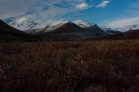
The view up the valley from near where I camped. I rolled in around 6 pm Saturday evening.
I decided to limber up the legs and give the dogs some exercise so I hiked up an ATV trail for a few miles that evening. The rock outcrop to the right are called The Hoodoos.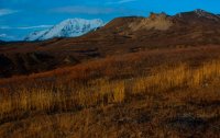
Willow enjoying some muddy water along the trail.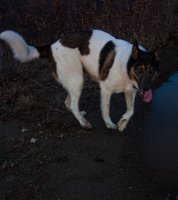
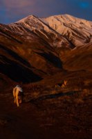
It was a beautiful evening in all directions. The valley (West Gulkana Glacier) that I really wanted to hike is the one towards the left in this picture but the glacial creeks prevented me from reaching it; next time. For reference, the moraine that runs left to right through the heart of the photo is about 600 feet high.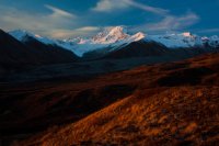
The view to the northeast. Willow and Alice loved the cool temps and the hike after 3 hours in the van.
Sunset over Summit Lake.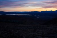
I woke up at 7 am to 24 degrees and clear skies. I let the dogs out to grab some water from the adjacent stream which was now frozen. They were not amused so I poured them some water. By 800 the sun was lighting up the mountains.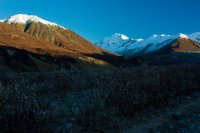
A view of our "trail". The road peters out into a true trail in about a mile. The ravine to the left is the creek that drains the West Gulkana Glacier. Alice is almost 15 years old and was fairly sore from the previous evening hike so I left her in the van to rest. Willow's head practically exploded with excitement as we started the hike.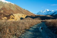
As we continue up the road, the views start to open up.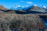
The suspension bridge that takes you over College Creek which drains College Glacier to the east. We tried to take the dogs over this bridge earlier this summer with no luck and the creek was running too high for the dogs to cross so we turned around. Today, as expected, the creek was way down so Willow quickly figured out to let me use the bridge and she bounded across the creek.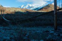
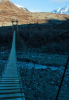
A straight-on view of the bridge, it is about 60-70 yards across.
A view of the mountains to the west.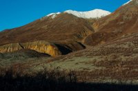
The first decent view up to the Gulkana Glacier.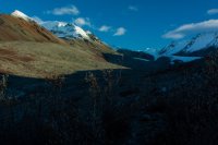
The trail to the glacier is in surprisingly good shape. Further up near the glacier, people have even cleared areas to pitch 5-6 tents between the rocks.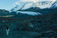
A closer view of the lateral moraine.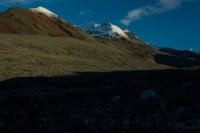
The valley really opens up as you approach the glacier. There's no shortage of scenery either.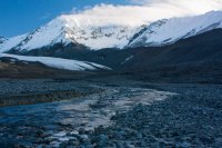
This ice is actually from the eastern lateral moraine. The easiest way to the foot of the glacier is through the middle ice tunnel. The ice face is about 40 feet high.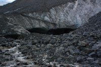
A view of the tunnel. Willow had no qualms about hiking through here. The tunnel was about 80 feet long.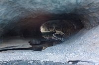
Once through the tunnel, the foot of a section of the glacier is a few yards away.
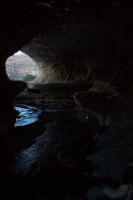
Here is the upstream tunnel opening. It's hard to tell but under all the rocks in the foreground is the glacier.
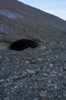
A view up to the main part of the glacier.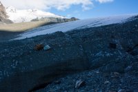
Willow really seemed to enjoy walking on the snow & ice, compared to the sharp rocks.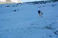
Another view up glacier. The rocks make travel up the glacier much easier and safer.
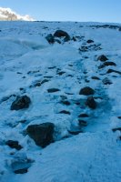
The view down glacier and out into the valley. The snow-capped Alaska Range is stunning.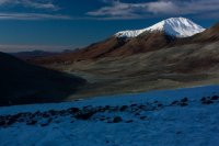
Willow taking in the sights. The glacier at this point is actually really safe with no crevasses in the area and most of the slopes are pretty gentle. I brought my ice axe but never used it.
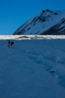
The view to the west. I'm still waiting for the sun to warm things up a bit.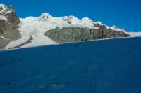
Another view down glacier.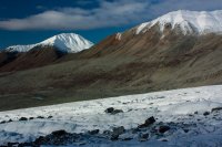
The view towards the upper glacier. The glacier tops out about 2 1/2 miles north.
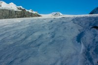
A view of the glacier in full sun. It took me about an hour to hike down to this point. I skipped the ice tunnel after finding a decent spot to cross the creek just downstream of it.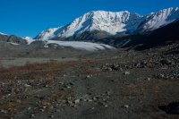
A view of the upper glacier (left) & surrounding mountains. Some days it really is hard to beat living up here. It was 42 degrees when I reached the van.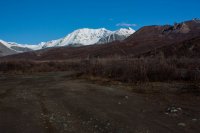
The drive to Fairbanks through the Alaska Range was awesome. This is the south end of Rainbow Ridge along the Richardson Highway through a cracked windshield.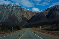
The confluence of Phelan Creek and the Delta River and unnamed peaks of the Alaska Range.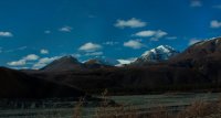
Mt. Silvertip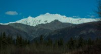
The view up the valley from near where I camped. I rolled in around 6 pm Saturday evening.

I decided to limber up the legs and give the dogs some exercise so I hiked up an ATV trail for a few miles that evening. The rock outcrop to the right are called The Hoodoos.

Willow enjoying some muddy water along the trail.

It was a beautiful evening in all directions. The valley (West Gulkana Glacier) that I really wanted to hike is the one towards the left in this picture but the glacial creeks prevented me from reaching it; next time. For reference, the moraine that runs left to right through the heart of the photo is about 600 feet high.

The view to the northeast. Willow and Alice loved the cool temps and the hike after 3 hours in the van.

Sunset over Summit Lake.

I woke up at 7 am to 24 degrees and clear skies. I let the dogs out to grab some water from the adjacent stream which was now frozen. They were not amused so I poured them some water. By 800 the sun was lighting up the mountains.

A view of our "trail". The road peters out into a true trail in about a mile. The ravine to the left is the creek that drains the West Gulkana Glacier. Alice is almost 15 years old and was fairly sore from the previous evening hike so I left her in the van to rest. Willow's head practically exploded with excitement as we started the hike.

As we continue up the road, the views start to open up.

The suspension bridge that takes you over College Creek which drains College Glacier to the east. We tried to take the dogs over this bridge earlier this summer with no luck and the creek was running too high for the dogs to cross so we turned around. Today, as expected, the creek was way down so Willow quickly figured out to let me use the bridge and she bounded across the creek.

A straight-on view of the bridge, it is about 60-70 yards across.

A view of the mountains to the west.

The first decent view up to the Gulkana Glacier.

The trail to the glacier is in surprisingly good shape. Further up near the glacier, people have even cleared areas to pitch 5-6 tents between the rocks.

A closer view of the lateral moraine.

The valley really opens up as you approach the glacier. There's no shortage of scenery either.

This ice is actually from the eastern lateral moraine. The easiest way to the foot of the glacier is through the middle ice tunnel. The ice face is about 40 feet high.

A view of the tunnel. Willow had no qualms about hiking through here. The tunnel was about 80 feet long.

Once through the tunnel, the foot of a section of the glacier is a few yards away.

Here is the upstream tunnel opening. It's hard to tell but under all the rocks in the foreground is the glacier.

A view up to the main part of the glacier.

Willow really seemed to enjoy walking on the snow & ice, compared to the sharp rocks.

Another view up glacier. The rocks make travel up the glacier much easier and safer.

The view down glacier and out into the valley. The snow-capped Alaska Range is stunning.

Willow taking in the sights. The glacier at this point is actually really safe with no crevasses in the area and most of the slopes are pretty gentle. I brought my ice axe but never used it.

The view to the west. I'm still waiting for the sun to warm things up a bit.

Another view down glacier.

The view towards the upper glacier. The glacier tops out about 2 1/2 miles north.

A view of the glacier in full sun. It took me about an hour to hike down to this point. I skipped the ice tunnel after finding a decent spot to cross the creek just downstream of it.

A view of the upper glacier (left) & surrounding mountains. Some days it really is hard to beat living up here. It was 42 degrees when I reached the van.

The drive to Fairbanks through the Alaska Range was awesome. This is the south end of Rainbow Ridge along the Richardson Highway through a cracked windshield.

The confluence of Phelan Creek and the Delta River and unnamed peaks of the Alaska Range.

Mt. Silvertip

Last edited:
