Udink
Still right here.
- Joined
- Jan 17, 2012
- Messages
- 1,748
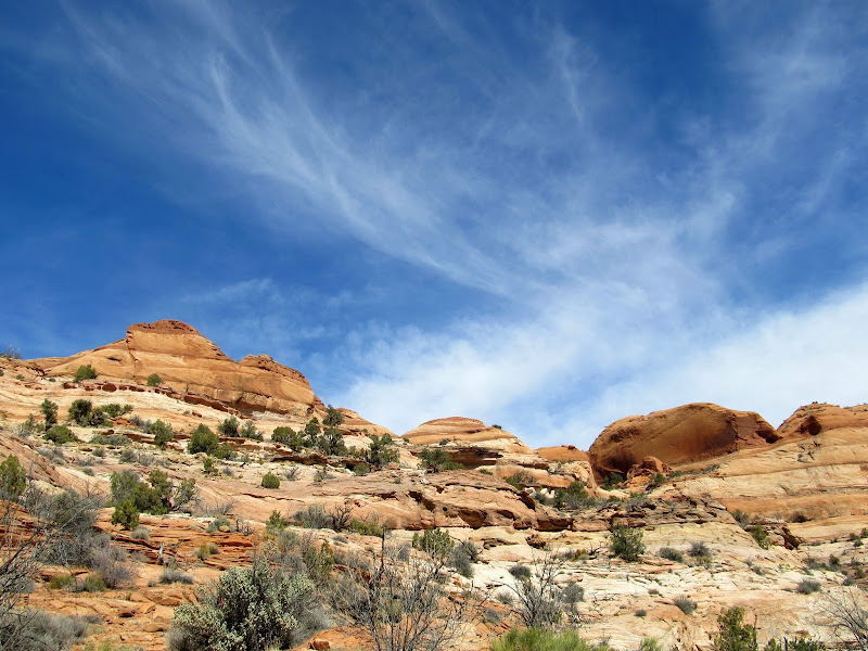
This trip was supposed to be a number of different things. I'd been planning a trip with some friends to Anderson Bottom on the Green River in Canyonlands National Park since January for the weekend of March 16th, but I got cold feet due to some trust issues with my Jeep and worries about road conditions on the Flint Trail. Perhaps I made the right call--they rode in on their dirt bikes and found snow and mud on the switchbacks, and no full-sized vehicles had been down them yet this season. Since I already had the time off work, I instead planned a long trip to the Grand Staircase-Escalante National Monument. I'd never been there except for a brief drive-through on the Burr Trail a couple of years ago. My itinerary was a little ambitious, but it seemed doable. I had five full days and I wanted to hike Phipps Wash to Phipps Arch on the first day, see the Zebra and Tunnel slots on the second, EscaVolcano on day three, Dry Fork slots on the fourth, and finally visit Willow Gulch. It all proved to be too much for me.
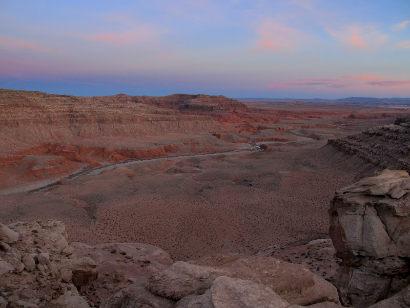
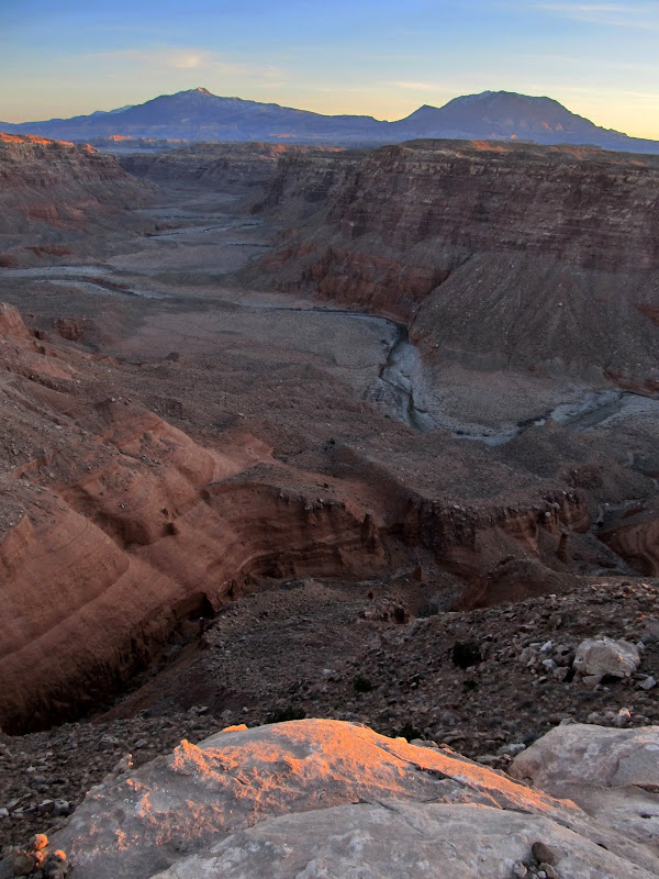
Just off Highway 24
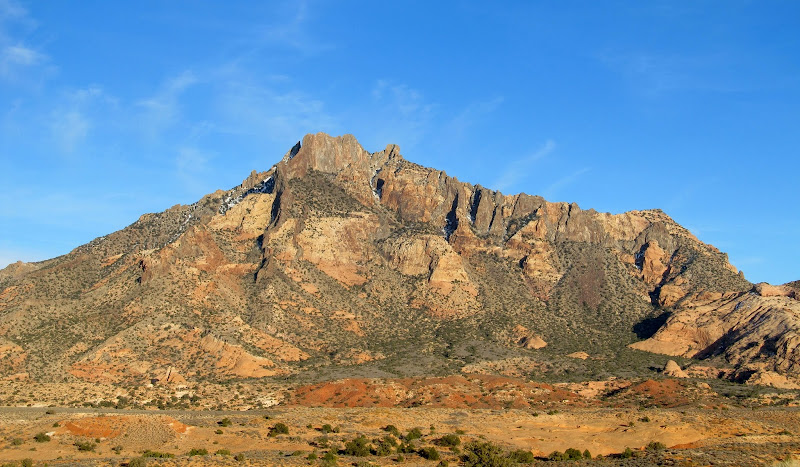
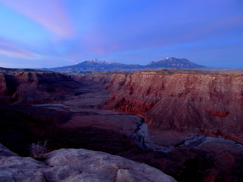
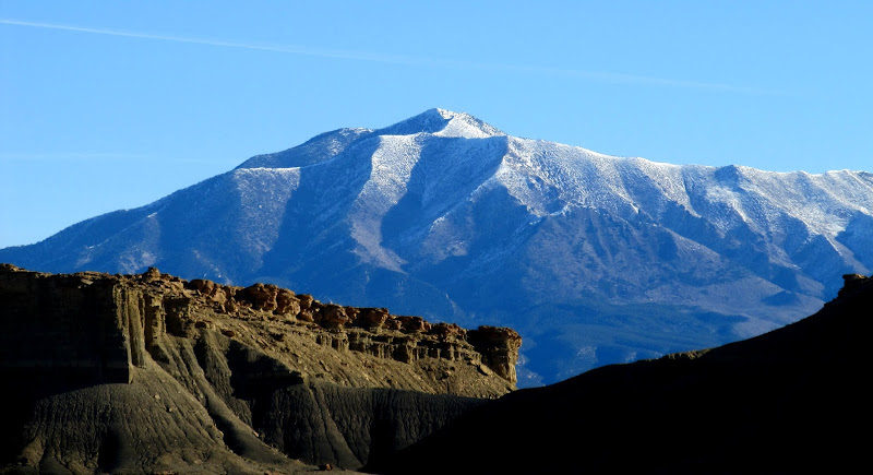
I took the long way to the GSENM area on Tuesday, March 16, after work. I had never driven Highway 276 and so I wanted to take it to the Burr Trail then cut across Capitol Reef to the town of Boulder. I found a few geocaches on the way and stopped several times to admire the Henry Mountains. Mts. Holmes and Ellsworth were of particular interest because for a few years I've dreamt of summiting them. I got to the Burr Trail at sunset and started driving north while looking for a place to camp just outside of Glen Canyon National Recreation Area. The light was amazing on the cliffs above Bullfrog Creek. I was left wishing my camera could capture it accurately. I found a spot to camp just before full dark right on the canyon rim above Bullfrog Creek. The first thing I did was grab the tripod and take a 15-second exposure of the canyon with the Henrys in the distance in the last light of day. I set up the tent and used my backpacking stove to heat up a can of dinner. I read a few articles in Discover Magazine before nodding off.
Mt. Holmes
Mt. Pennell (distant left) and Mt. Hillers (right)
Mt. Ellsworth
Mt. Pennell, Mt. Hillers, and Mt. Ellsworth
View up Bullfrog Creek toward Mt. Pennell
Bullfrog Creek
View from my camp at Bullfrog Creek Overlook
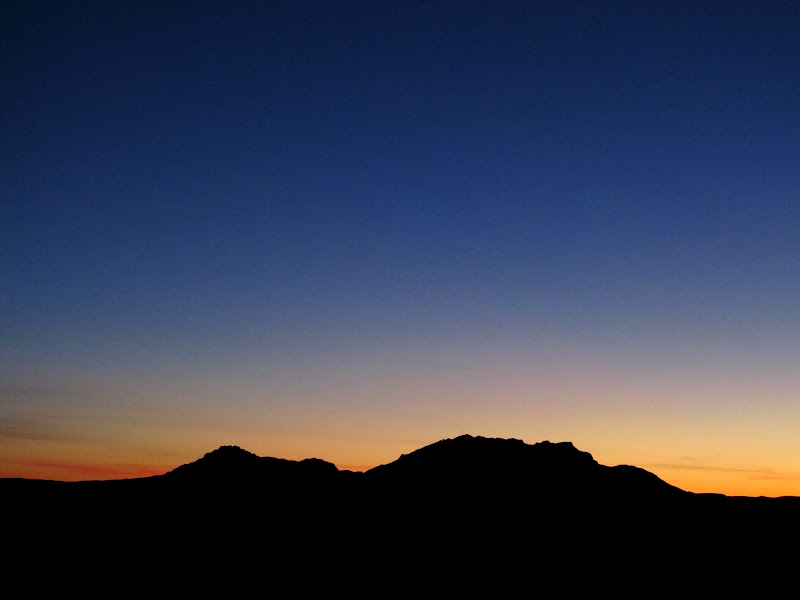
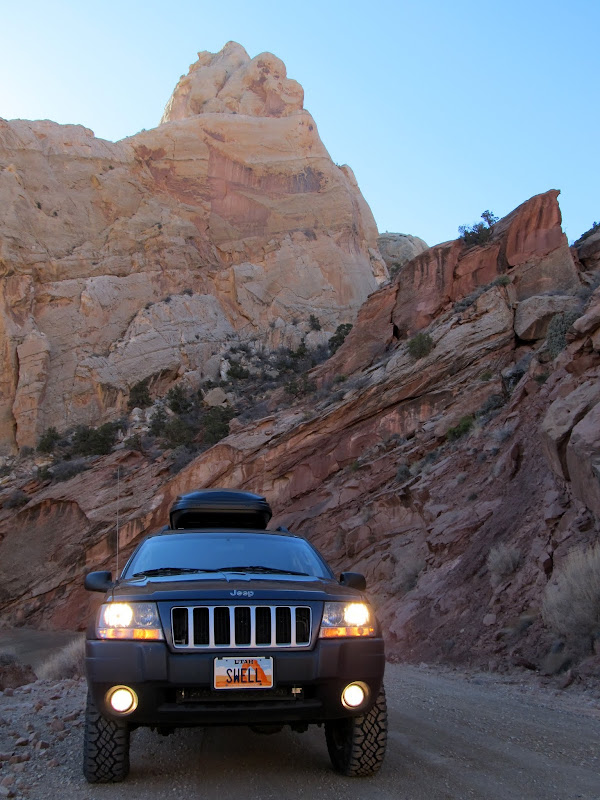
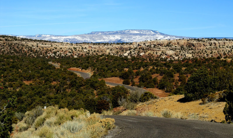
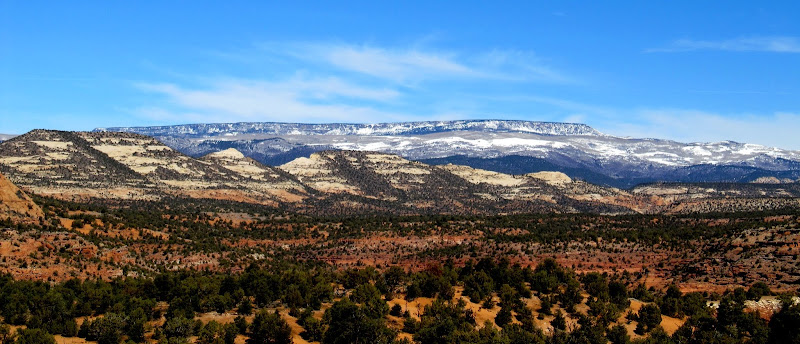
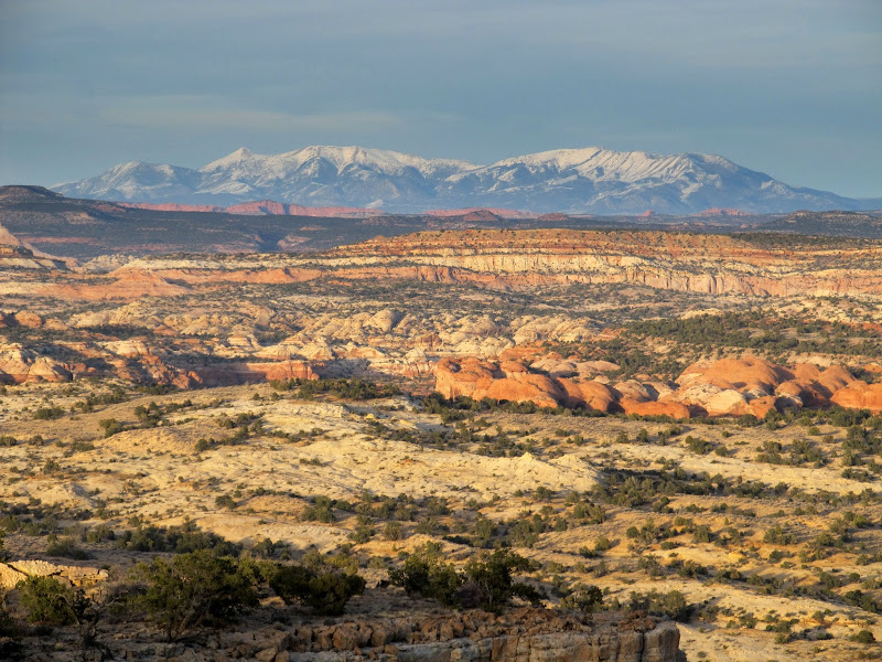
I arose before sunrise on Wednesday and exited the tent to snap a few photos before breakfast. Since I'd just be setting up camp again that evening, I folded the tent and air mattress into my sleeping bag and tossed it in the Jeep before hitting the road. I continued up the Burr Trail, making a quick side trip to the Halls Creek Overlook before continuing through Capitol Reef. In Boulder, I stopped at Hills & Hollows and topped off the fuel tank and got some good advice from intuitive cat about where to start the Phipps Wash hike. I thoroughly enjoyed the drive south on Highway 12. I'd only driven that highway to the north of Boulder before.
Sunrise beyond the Henrys
Sunrise at camp at Bullfrog Creek Overlook
Bullfrog Creek
Halls Creek Overlook north panorama
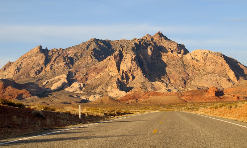
Mt. Pennell
Jeep on the Burr Trail switchbacks
Burr Trail just west of Capitol Reef National Park with Boulder Mountain in the background
View north-ish from Steep Creek Bench
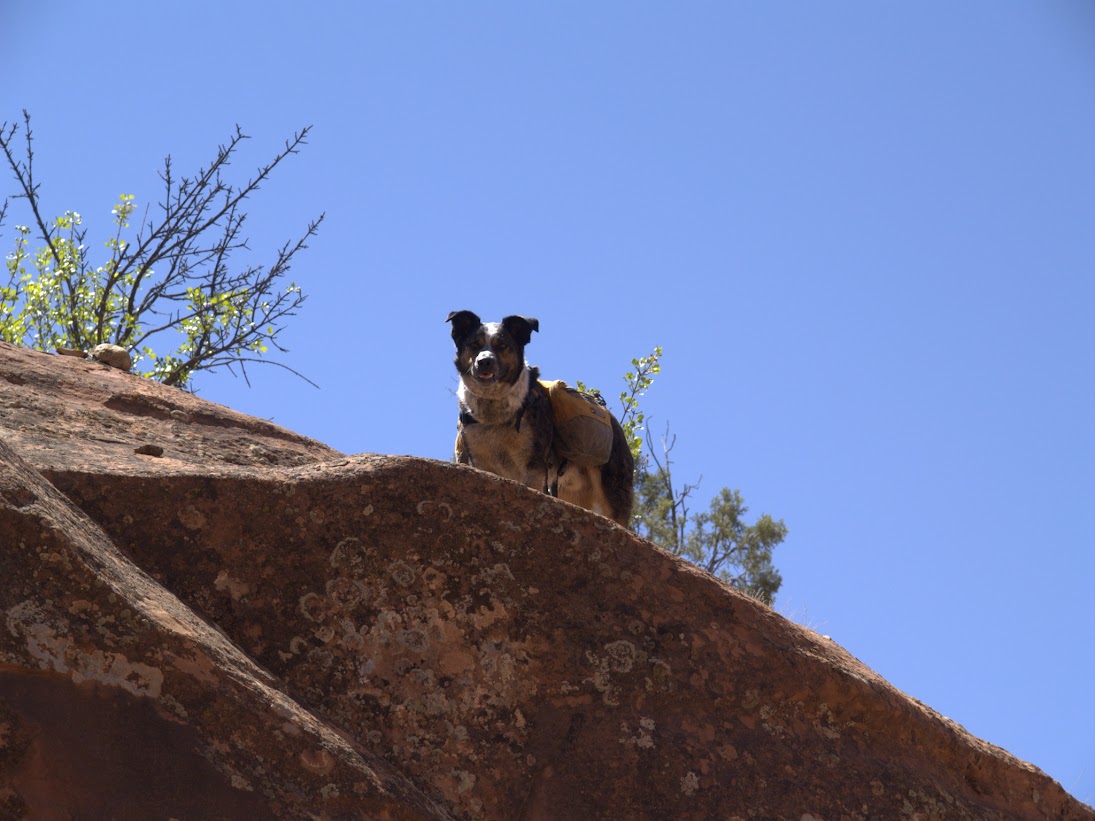
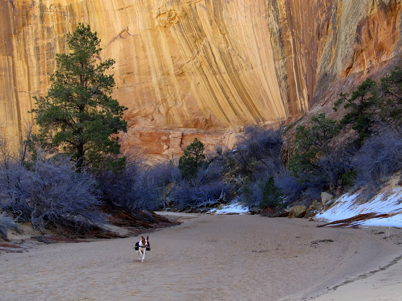
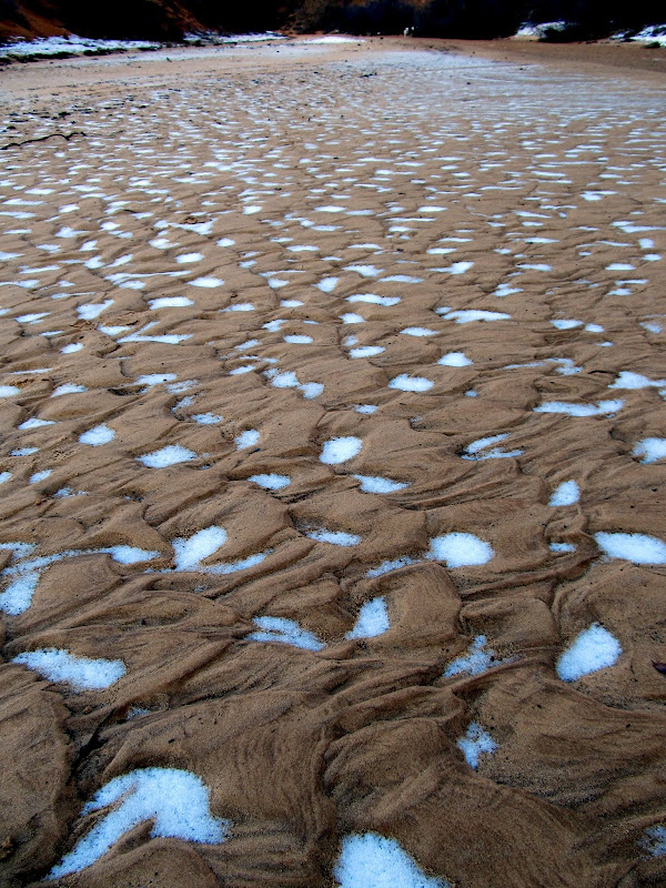
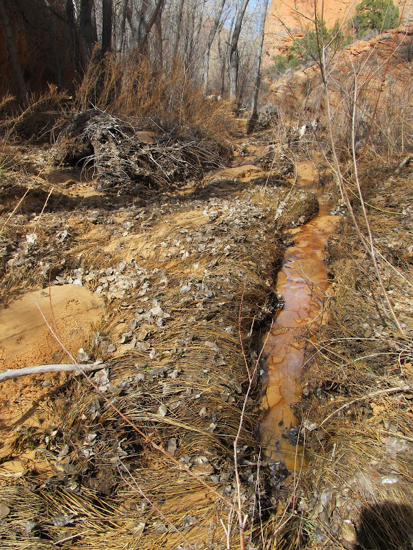
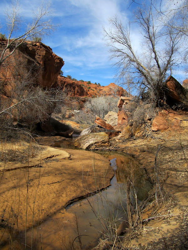
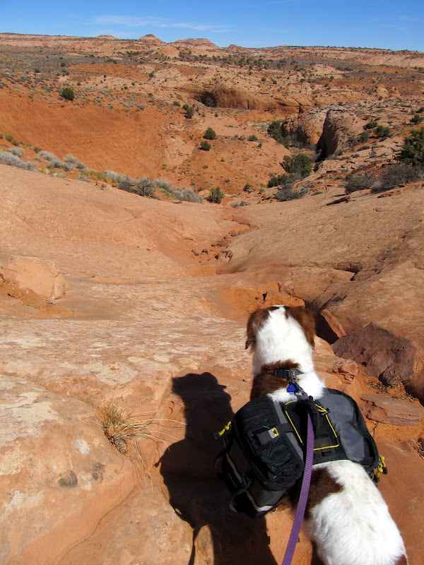
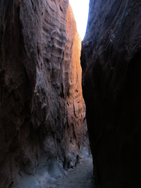
I parked at a small pullout along the highway, west of Phipps Wash, and started hiking down the slickrock. The approach was a little longer from the highway but there was less elevation loss/gain from there. There were many full potholes in the side canyon approaching Phipps. Torrey didn't need a drink from the water in her pack for the entire hike. I bypassed numerous small dryfalls, and one final large dryfall before reaching Phipps Wash. Once in Phipps I turned and followed the wash downstream to the north. I ran into a section that's perpetually shaded this time of year where the sand was frozen solid with skiffs of snow trapped in the ripples. I ran into a German couple (judging from their accents) who spoke English very well hiking the opposite direction. They'd made it almost to the Phipps Arch but couldn't make the final climb up to see it. About three miles into the hike a spring sprung from the bottom of the wash, and from that point on there was a small, continuous flow of water that sometimes presented an obstacle to travel--I didn't want to get my brand-new shoes wet.
My parking spot on UT-12 for the hike through Phipps Wash
Side canyon leading to Phipps Wash
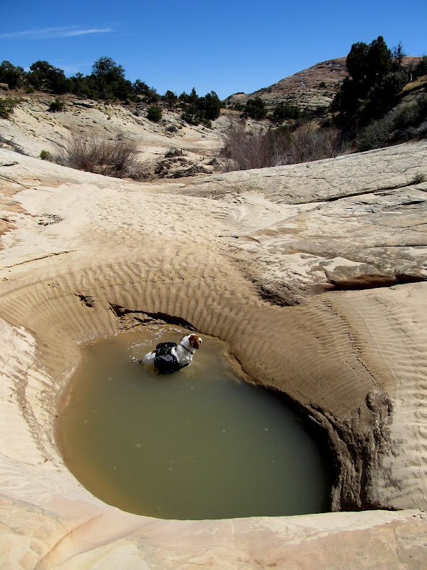
There were potholes-a-plenty, so Torrey kept cool
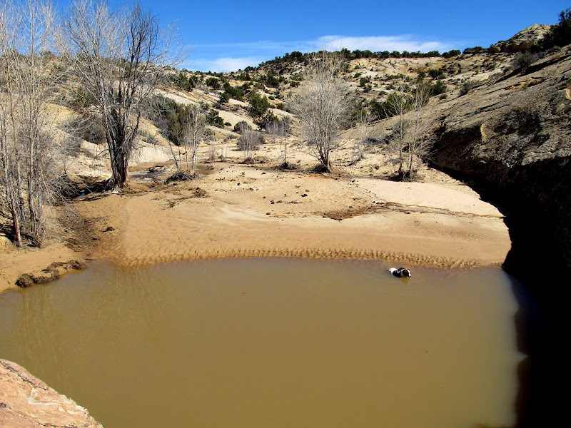
Big pool on the way to Phipps Wash
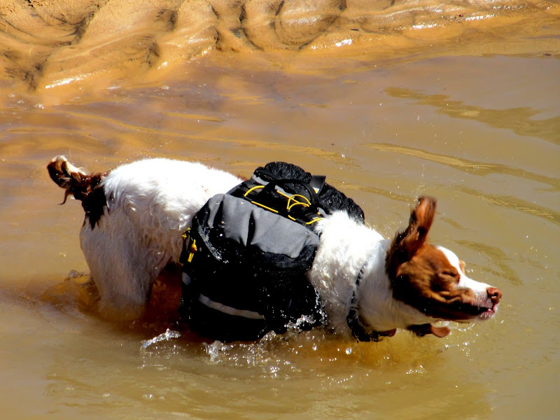
Torrey shaking off
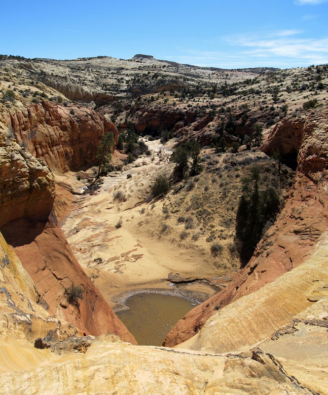
Big dryfall just before reaching Phipps Wash
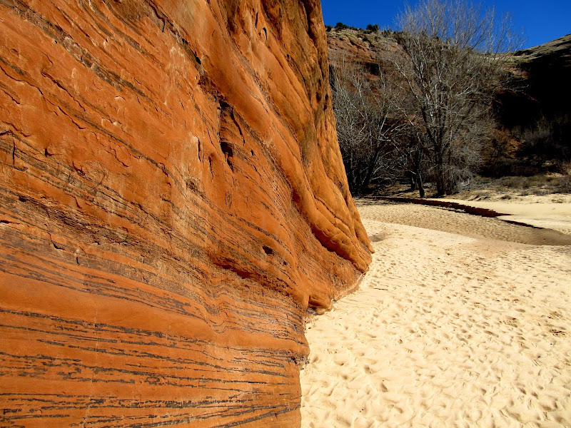
Phipps Wash
Frozen sand and snow
Phipps Wash
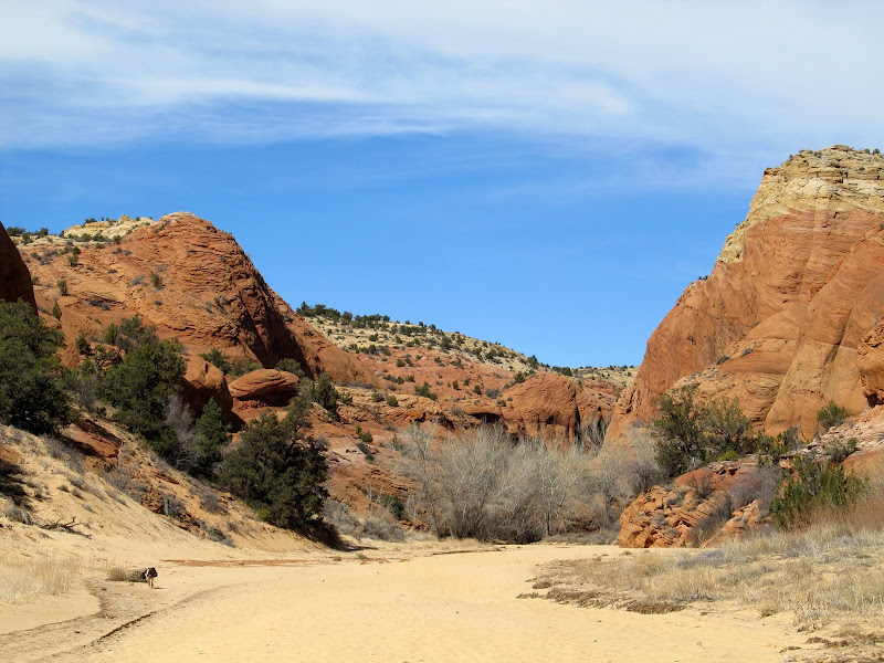
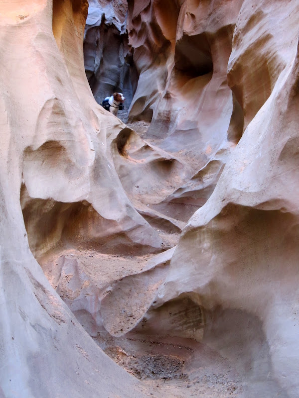
There were a lot of trees and brush after encountering the spring, but hiking wasn't overly difficult. I reached the small side canyon just south of Phipps Arch and began ascending out of the canyon toward the arch. I helped Torrey up a couple of ledges but at what appeared to be the last ledge before getting to the arch I had a problem. I was able to stand on a log propped up against the cliff below the ledge and lift Torrey over my head, but I couldn't lift myself up. Getting myself up the ledge required an awkward climbing move with nothing much to hold on to, and I didn't dare try it. I had to heft Torrey back down before scouting around for another route up. I didn't find one. I now have a nagging feeling that I didn't try hard enough, but turning around wasn't a difficult decision at the time. I wearily trudged back up Phipps Wash toward the highway. It felt hot but it couldn't have been more than about 70 degrees. What was this I was feeling? Fatigue? I was pretty beat when I got back to the Jeep, not realizing I'd hiked 9.6 miles. I hadn't precisely measured out the hike beforehand and was thinking it would only be about six miles long. Still, it was apparent I'd gotten out of shape this winter season.
Phipps Wash where a spring appears, and the water flowed continuously beyond this point
Phipps Wash
A tiny frozen sand arch
Looking up at the climb to Phipps Arch
Torrey scrambling up the ledges
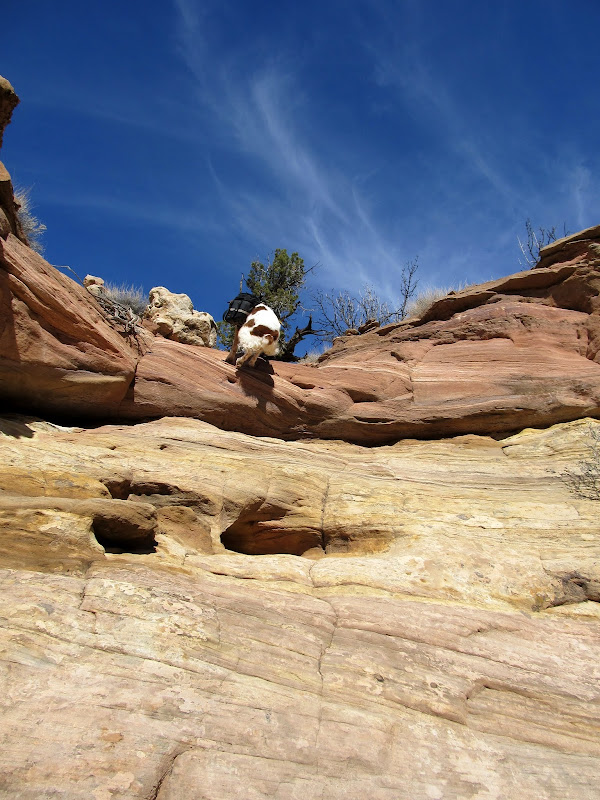
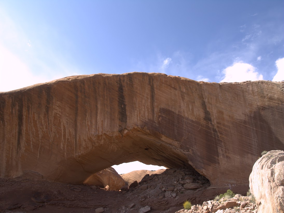
Final obstacle to reaching Phipps Arch, which I couldn't climb
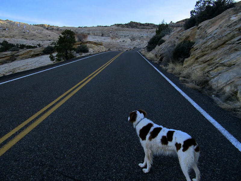
Walking along Highway 12 to the Jeep
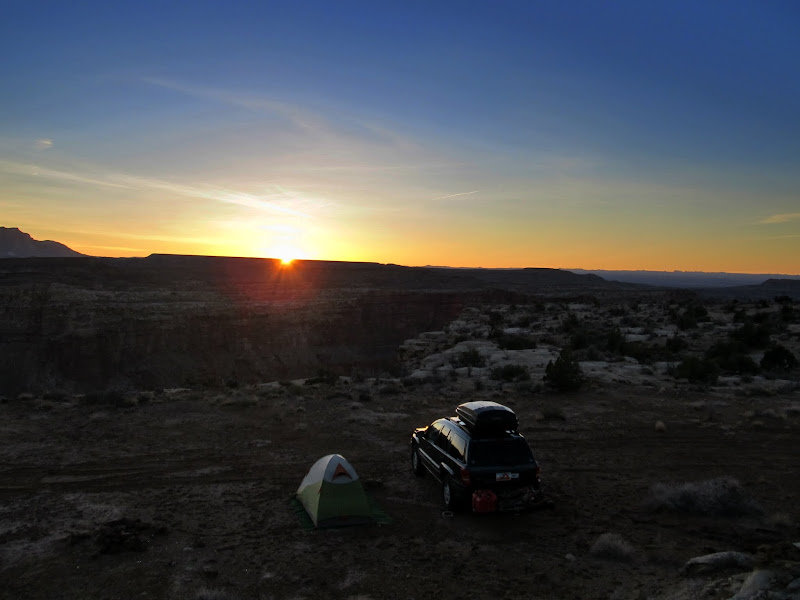
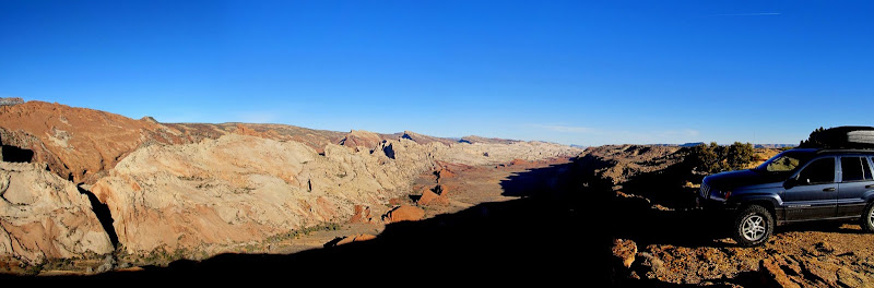
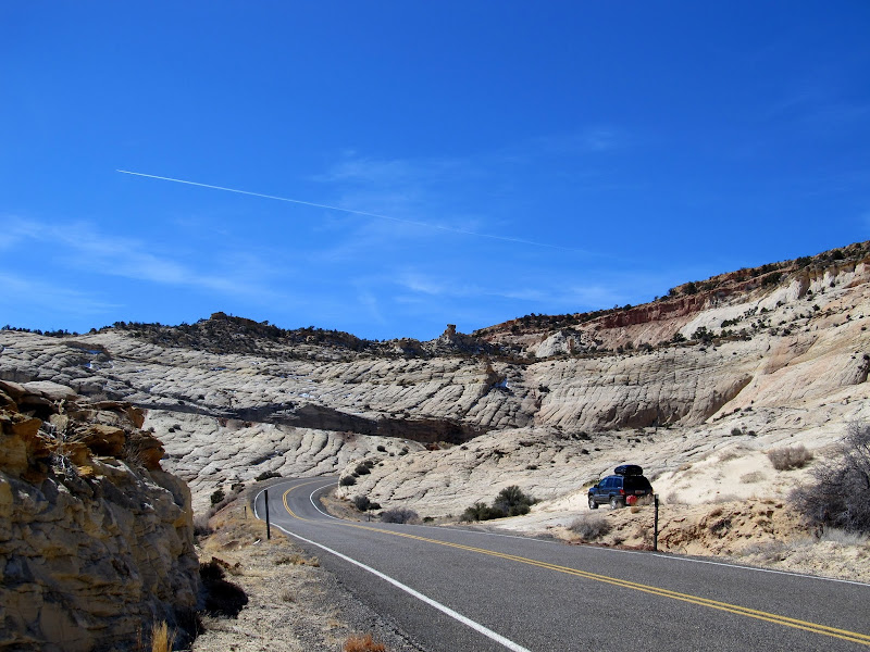
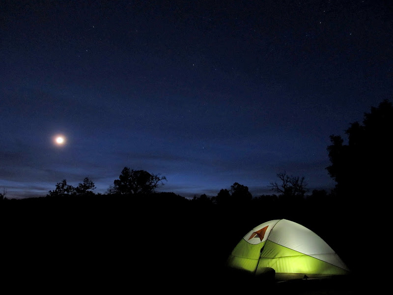
I got cell service just as I returned to the Jeep and I had a few texts waiting. One of them was from Nick, saying, "We meet again! Tagged ya!" I assumed that meant he'd slapped a BCP sticker on the Jeep on his way to Llewellyn Gulch, but I looked all over and couldn't find it. I drove a short distance to the Spencer Flat road and found a spot to camp at the place where I'd originally planned to start the Phipps Wash hike. Boy, am I glad I didn't start from there--the initial drop into the wash was tall and steep. The view was great, though, as the sun went down. My camp routine was the same as the previous evening's: photos, tent, dinner, read, sleep. I didn't sleep well and woke up with a headache and still-sore muscles and joints from the Phipps Wash hike. I packed up camp and decided to continue to my next destination along the Hole in the Rock Road. I spent a little extra time driving around Escalante 'cause I'd never been there before.
View from Old Sheffield Road on the way to camp
My tent and the moon
Driving down HITRR, I made a brief stop at Devil's Garden. There were three vehicles there but I only saw one person while exploring the rock formations. It was a nice enough place, but I think the few photos I've seen of it covered it well enough.") I stopped for lunch and was sitting in the driver's seat eating when I spotted Nick's BCP sticker wedged under the windshield wiper!
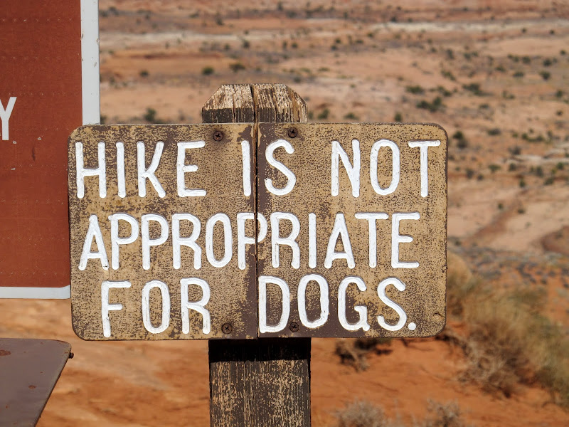
I stopped for lunch and was sitting in the driver's seat eating when I spotted Nick's BCP sticker wedged under the windshield wiper!  With my headache still not quite gone, I decided next to hike the Dry Fork slots since the approach is very short. I arrived at the trailhead and was surprised to see a shload of cars there. I readied myself and Torrey for the hike and chuckled at the sign at the trailhead.
Metate Arch in Devil's Garden
Devil's Garden
Dry Fork trailhead
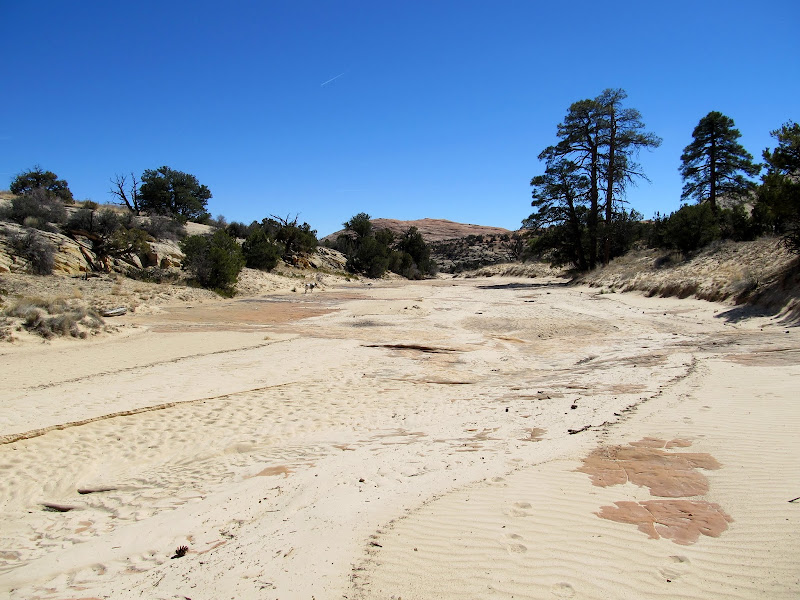
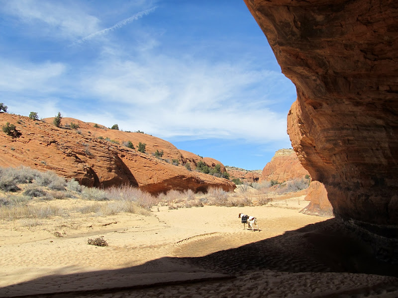
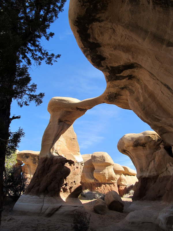
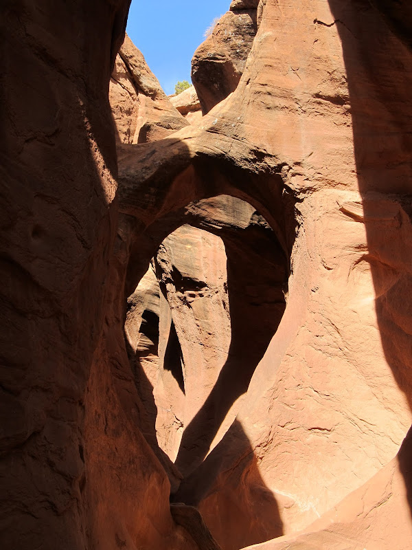
The descent into Dry Fork of Coyote Gulch was short and easy. I hiked all the way up the Dry Fork slot, encountering a group of six or so people coming down. I let Torrey off her leash then and let her run ahead of me. I didn't know how long the narrows would last and was surprised that they kept going for about 0.9 miles. Near the end of the narrows I ran into a friendly couple with a kid and a big Great Pyrenees/Border Collie mix named Winston. Torrey only needed help up one spot going up the slot, and I carried her pack after that point so she could scramble up the few remaining easy obstacles on her own. I rested for a while after descending back out of the canyon, the made an attempt at the Peek-a-Boo slot. I hadn't done any research on these canyons and had no idea the initial climb up the canyon was so difficult. I got Torrey up the first ledge and climbed up to the second ledge myself when I heard some people descending the canyon. I didn't want to be there struggling to get my dog up while somebody was coming down, so I snapped a quick photo of the double arch just above the climb then went back to the bottom. At that point I was done. I wasn't feeling up to doing any of the other hikes I'd planned and I didn't think I'd feel better the next day, so I hung my head low and hiked back to the Jeep (where there where two shloads of cars now) and started the long drive home.
Route into Dry Fork
Dry Fork Slot
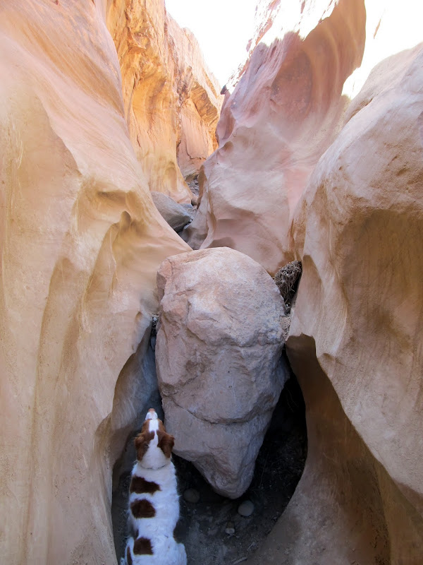
Dry Fork Slot, with Torrey impatiently waiting for me to lift her up
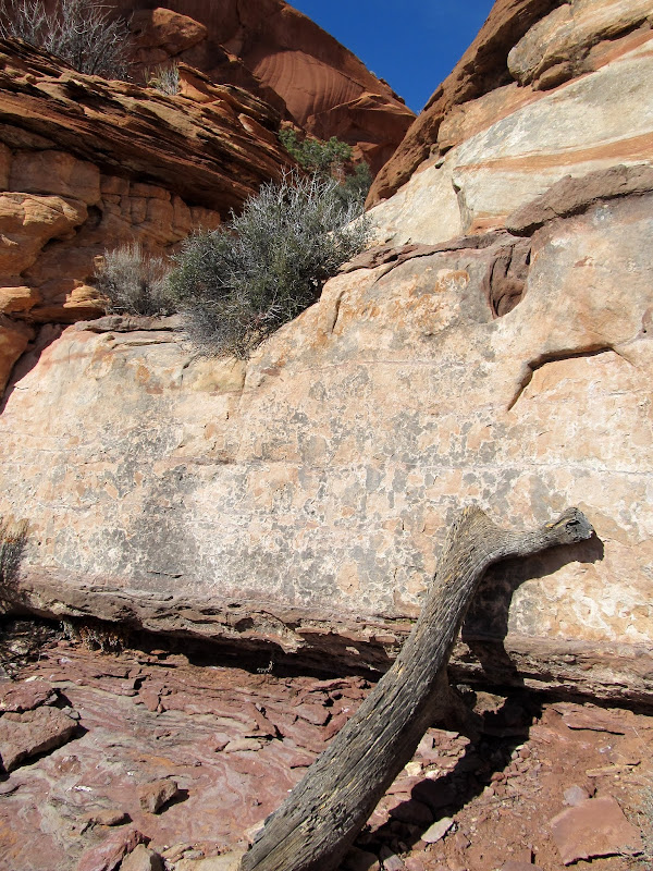
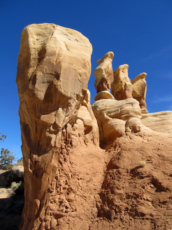
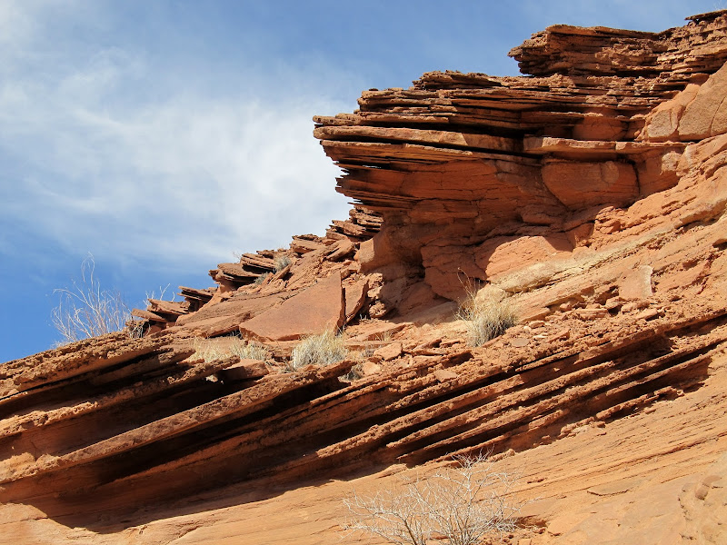
Rock layers near the head of Dry Fork Slot
Arches in Peek-a-Boo
Full photo gallery:
https://picasaweb.google.com/Dennis.Udink/GSENM
Map + KMZ:
[parsehtml]<iframe width="640" height="480" frameborder="0" scrolling="no" marginheight="0" marginwidth="0" src="https://maps.google.com/maps?q=http:%2F%2Fudink.org%2Fgeo%2FGSENM.kmz&hl=en&sll=39.499761,-111.547028&sspn=4.907901,10.821533&t=h&ie=UTF8&ll=37.963689,-111.088257&spn=1.03939,1.757813&z=9&output=embed"></iframe><br /><small><a href="https://maps.google.com/maps?q=http:%2F%2Fudink.org%2Fgeo%2FGSENM.kmz&hl=en&sll=39.499761,-111.547028&sspn=4.907901,10.821533&t=h&ie=UTF8&ll=37.963689,-111.088257&spn=1.03939,1.757813&z=9&source=embed" style="color:#0000FF;text-align:left">View Larger Map</a></small>[/parsehtml]http://udink.org/geo/GSENM.kmz
Featured image for home page:

Just off Highway 24
I took the long way to the GSENM area on Tuesday, March 16, after work. I had never driven Highway 276 and so I wanted to take it to the Burr Trail then cut across Capitol Reef to the town of Boulder. I found a few geocaches on the way and stopped several times to admire the Henry Mountains. Mts. Holmes and Ellsworth were of particular interest because for a few years I've dreamt of summiting them. I got to the Burr Trail at sunset and started driving north while looking for a place to camp just outside of Glen Canyon National Recreation Area. The light was amazing on the cliffs above Bullfrog Creek. I was left wishing my camera could capture it accurately. I found a spot to camp just before full dark right on the canyon rim above Bullfrog Creek. The first thing I did was grab the tripod and take a 15-second exposure of the canyon with the Henrys in the distance in the last light of day. I set up the tent and used my backpacking stove to heat up a can of dinner. I read a few articles in Discover Magazine before nodding off.
Mt. Holmes
Mt. Pennell (distant left) and Mt. Hillers (right)
Mt. Ellsworth
Mt. Pennell, Mt. Hillers, and Mt. Ellsworth
View up Bullfrog Creek toward Mt. Pennell
Bullfrog Creek
View from my camp at Bullfrog Creek Overlook
I arose before sunrise on Wednesday and exited the tent to snap a few photos before breakfast. Since I'd just be setting up camp again that evening, I folded the tent and air mattress into my sleeping bag and tossed it in the Jeep before hitting the road. I continued up the Burr Trail, making a quick side trip to the Halls Creek Overlook before continuing through Capitol Reef. In Boulder, I stopped at Hills & Hollows and topped off the fuel tank and got some good advice from intuitive cat about where to start the Phipps Wash hike. I thoroughly enjoyed the drive south on Highway 12. I'd only driven that highway to the north of Boulder before.
Sunrise beyond the Henrys
Sunrise at camp at Bullfrog Creek Overlook
Bullfrog Creek
Halls Creek Overlook north panorama
Mt. Pennell
Jeep on the Burr Trail switchbacks
Burr Trail just west of Capitol Reef National Park with Boulder Mountain in the background
View north-ish from Steep Creek Bench
I parked at a small pullout along the highway, west of Phipps Wash, and started hiking down the slickrock. The approach was a little longer from the highway but there was less elevation loss/gain from there. There were many full potholes in the side canyon approaching Phipps. Torrey didn't need a drink from the water in her pack for the entire hike. I bypassed numerous small dryfalls, and one final large dryfall before reaching Phipps Wash. Once in Phipps I turned and followed the wash downstream to the north. I ran into a section that's perpetually shaded this time of year where the sand was frozen solid with skiffs of snow trapped in the ripples. I ran into a German couple (judging from their accents) who spoke English very well hiking the opposite direction. They'd made it almost to the Phipps Arch but couldn't make the final climb up to see it. About three miles into the hike a spring sprung from the bottom of the wash, and from that point on there was a small, continuous flow of water that sometimes presented an obstacle to travel--I didn't want to get my brand-new shoes wet.
My parking spot on UT-12 for the hike through Phipps Wash
Side canyon leading to Phipps Wash
There were potholes-a-plenty, so Torrey kept cool
Big pool on the way to Phipps Wash
Torrey shaking off
Big dryfall just before reaching Phipps Wash
Phipps Wash
Frozen sand and snow
Phipps Wash
There were a lot of trees and brush after encountering the spring, but hiking wasn't overly difficult. I reached the small side canyon just south of Phipps Arch and began ascending out of the canyon toward the arch. I helped Torrey up a couple of ledges but at what appeared to be the last ledge before getting to the arch I had a problem. I was able to stand on a log propped up against the cliff below the ledge and lift Torrey over my head, but I couldn't lift myself up. Getting myself up the ledge required an awkward climbing move with nothing much to hold on to, and I didn't dare try it. I had to heft Torrey back down before scouting around for another route up. I didn't find one. I now have a nagging feeling that I didn't try hard enough, but turning around wasn't a difficult decision at the time. I wearily trudged back up Phipps Wash toward the highway. It felt hot but it couldn't have been more than about 70 degrees. What was this I was feeling? Fatigue? I was pretty beat when I got back to the Jeep, not realizing I'd hiked 9.6 miles. I hadn't precisely measured out the hike beforehand and was thinking it would only be about six miles long. Still, it was apparent I'd gotten out of shape this winter season.
Phipps Wash where a spring appears, and the water flowed continuously beyond this point
Phipps Wash
A tiny frozen sand arch
Looking up at the climb to Phipps Arch
Torrey scrambling up the ledges
Final obstacle to reaching Phipps Arch, which I couldn't climb
Walking along Highway 12 to the Jeep
I got cell service just as I returned to the Jeep and I had a few texts waiting. One of them was from Nick, saying, "We meet again! Tagged ya!" I assumed that meant he'd slapped a BCP sticker on the Jeep on his way to Llewellyn Gulch, but I looked all over and couldn't find it. I drove a short distance to the Spencer Flat road and found a spot to camp at the place where I'd originally planned to start the Phipps Wash hike. Boy, am I glad I didn't start from there--the initial drop into the wash was tall and steep. The view was great, though, as the sun went down. My camp routine was the same as the previous evening's: photos, tent, dinner, read, sleep. I didn't sleep well and woke up with a headache and still-sore muscles and joints from the Phipps Wash hike. I packed up camp and decided to continue to my next destination along the Hole in the Rock Road. I spent a little extra time driving around Escalante 'cause I'd never been there before.
View from Old Sheffield Road on the way to camp
My tent and the moon
Driving down HITRR, I made a brief stop at Devil's Garden. There were three vehicles there but I only saw one person while exploring the rock formations. It was a nice enough place, but I think the few photos I've seen of it covered it well enough.
I stopped for lunch and was sitting in the driver's seat eating when I spotted Nick's BCP sticker wedged under the windshield wiper! With my headache still not quite gone, I decided next to hike the Dry Fork slots since the approach is very short. I arrived at the trailhead and was surprised to see a shload of cars there. I readied myself and Torrey for the hike and chuckled at the sign at the trailhead.Metate Arch in Devil's Garden
Devil's Garden
Dry Fork trailhead
The descent into Dry Fork of Coyote Gulch was short and easy. I hiked all the way up the Dry Fork slot, encountering a group of six or so people coming down. I let Torrey off her leash then and let her run ahead of me. I didn't know how long the narrows would last and was surprised that they kept going for about 0.9 miles. Near the end of the narrows I ran into a friendly couple with a kid and a big Great Pyrenees/Border Collie mix named Winston. Torrey only needed help up one spot going up the slot, and I carried her pack after that point so she could scramble up the few remaining easy obstacles on her own. I rested for a while after descending back out of the canyon, the made an attempt at the Peek-a-Boo slot. I hadn't done any research on these canyons and had no idea the initial climb up the canyon was so difficult. I got Torrey up the first ledge and climbed up to the second ledge myself when I heard some people descending the canyon. I didn't want to be there struggling to get my dog up while somebody was coming down, so I snapped a quick photo of the double arch just above the climb then went back to the bottom. At that point I was done. I wasn't feeling up to doing any of the other hikes I'd planned and I didn't think I'd feel better the next day, so I hung my head low and hiked back to the Jeep (where there where two shloads of cars now) and started the long drive home.
Route into Dry Fork
Dry Fork Slot
Dry Fork Slot, with Torrey impatiently waiting for me to lift her up
Rock layers near the head of Dry Fork Slot
Arches in Peek-a-Boo
Full photo gallery:
https://picasaweb.google.com/Dennis.Udink/GSENM
Map + KMZ:
[parsehtml]<iframe width="640" height="480" frameborder="0" scrolling="no" marginheight="0" marginwidth="0" src="https://maps.google.com/maps?q=http:%2F%2Fudink.org%2Fgeo%2FGSENM.kmz&hl=en&sll=39.499761,-111.547028&sspn=4.907901,10.821533&t=h&ie=UTF8&ll=37.963689,-111.088257&spn=1.03939,1.757813&z=9&output=embed"></iframe><br /><small><a href="https://maps.google.com/maps?q=http:%2F%2Fudink.org%2Fgeo%2FGSENM.kmz&hl=en&sll=39.499761,-111.547028&sspn=4.907901,10.821533&t=h&ie=UTF8&ll=37.963689,-111.088257&spn=1.03939,1.757813&z=9&source=embed" style="color:#0000FF;text-align:left">View Larger Map</a></small>[/parsehtml]http://udink.org/geo/GSENM.kmz
Featured image for home page: