Udink
Still right here.
- Joined
- Jan 17, 2012
- Messages
- 1,748
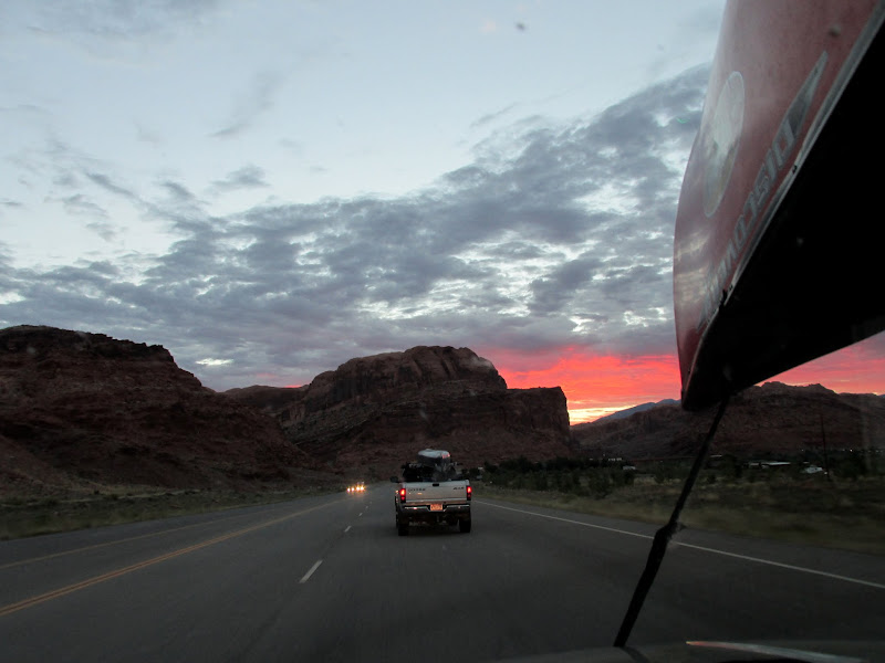
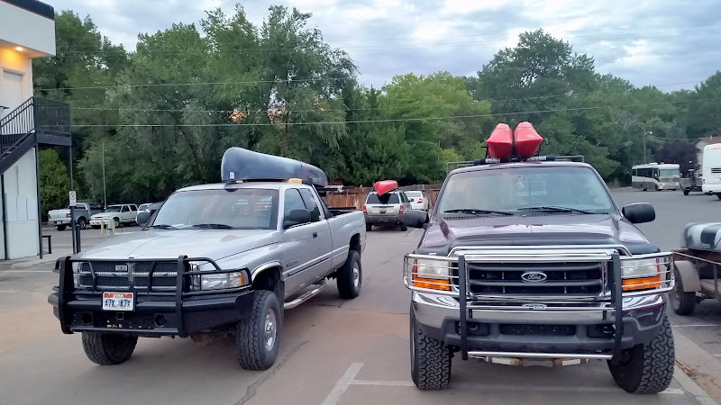
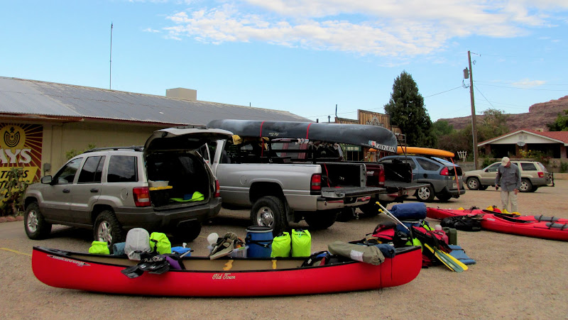
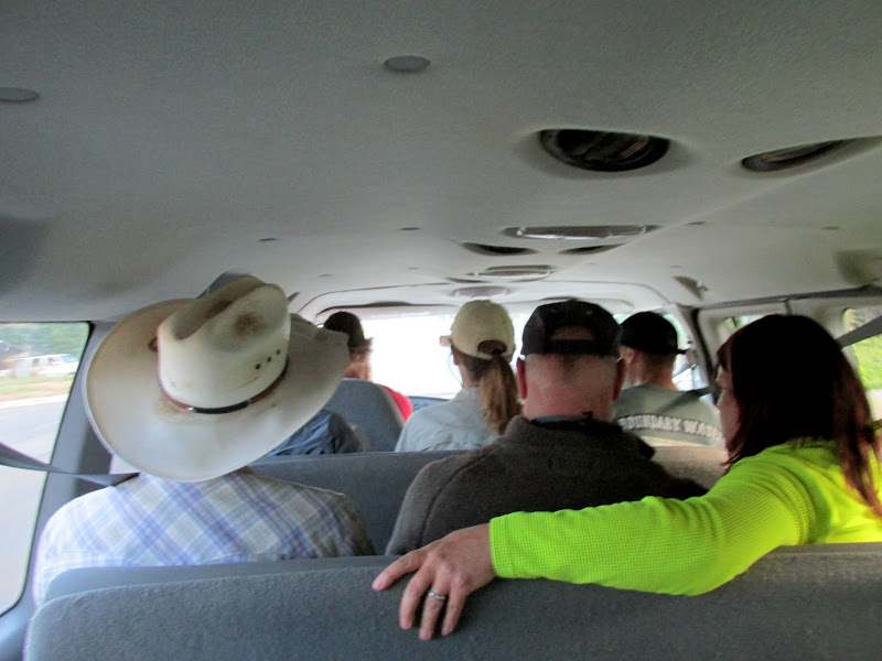
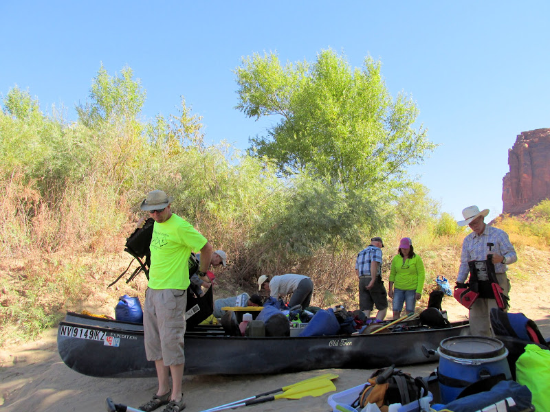
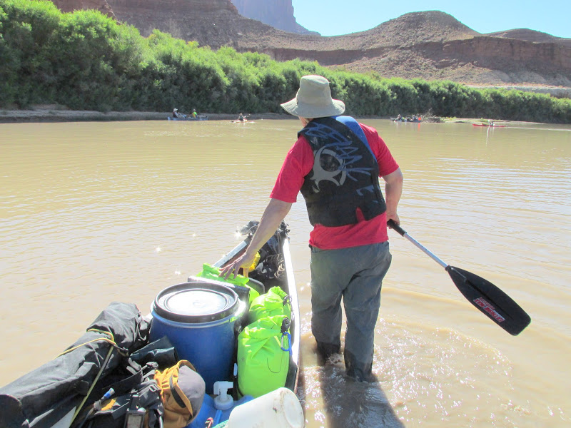
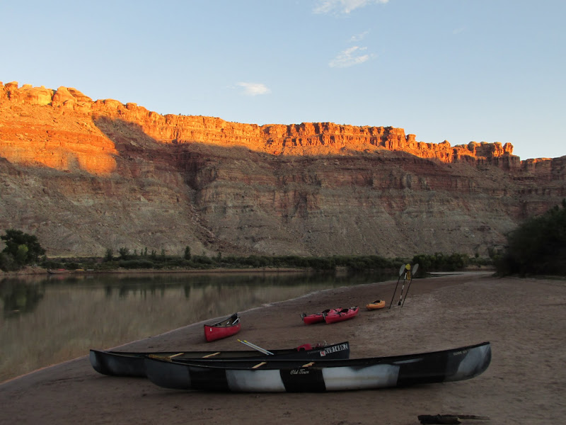
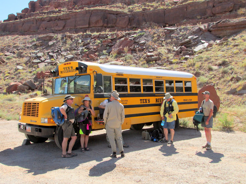
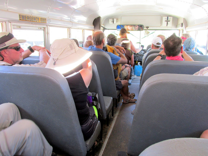
Five days, four nights, nine friends, three canoes, three kayaks, 54 paddling miles, 49 jet boat miles. Historic relics and inscriptions, Indian ruins and rock art, wildlife, reflections, discovery. I would say that this was the trip of a lifetime, except that I foresee myself doing it again a few more times during my life. Planning for this trip began nearly a year ago. Our core group--Wade, Alan, Paul, Lyman, and myself--I think we'd talked casually about doing something like this, but Wade took the helm and figured out the regulations, gear requirements, and shuttle options, then we committed to the idea and made reservations and a deposit for the shuttle service. The group membership for the trip changed a couple of times over the months, but early last Wednesday morning nine of us ended up meeting at Moab Diner for breakfast. Alan and I took my Jeep and canoe while Alan's friend, Greg, followed in his car with a kayak on top. We caught up to Wade and Lyman, who would be together in Wade's canoe, on US-191 before getting to Moab. At the restaurant we met Paul and his wife Terri who were sharing a canoe, and Mark and Valerie (Lyman's sister) who were each taking a kayak. After breakfast we convoyed to Tex's Riverways where we loaded our boats and gear into a trailer and then hopped in the shuttle van for the trip to Mineral Bottom.
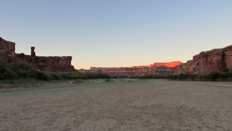
Following Wade and Lyman into a colorful sunrise at Moab
Parked at Moab Diner for breakfast
Sorting and loading gear at Tex's Riverways
Shuttle van to Mineral Bottom
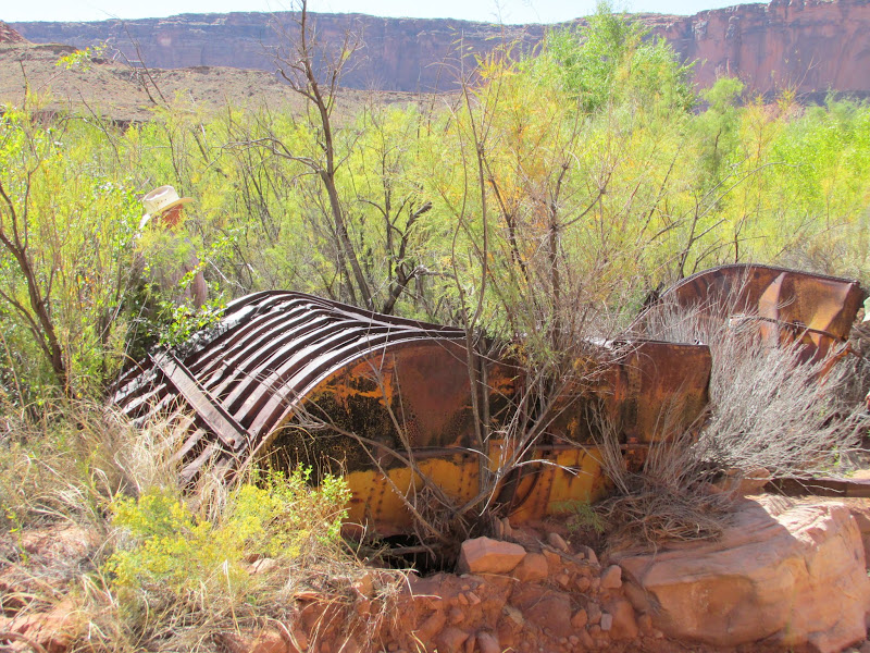
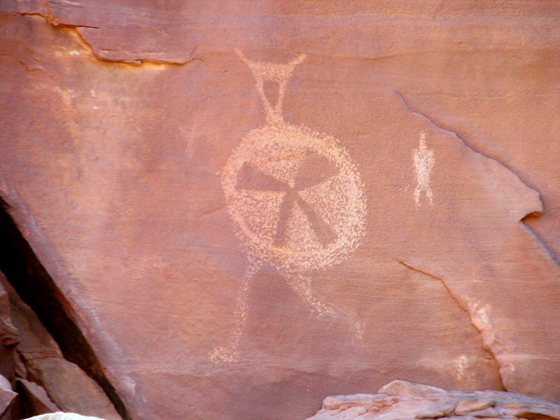
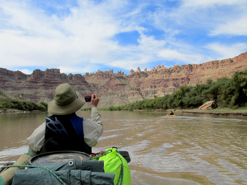
There were a couple of groups ahead of ours on the boat ramp at Mineral Bottom. As we loaded gear into the boats while waiting for our turn to launch, a ranger from the Park Service arrived on a sweet Suzuki DR-Z400 and gave us a briefing on safety and river regulations--much the same as we'd already received at Tex's. Shortly after 11:30AM we were all on the water. Woodruff Bottom was supposed to be our first stop but the tamarisk seemed impenetrable, so we continued floating downstream. Just below Woodruff Bottom we landed to check out an old metal barge, then at Horsethief Canyon we stopped again for some petroglyphs.
Packing gear at the Mineral Bottom boat ramp
NPS DR-Z400
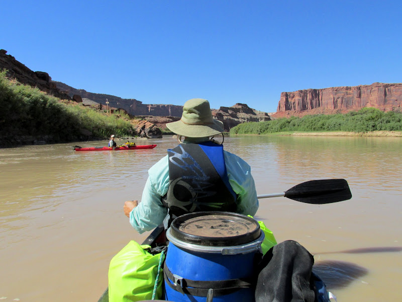
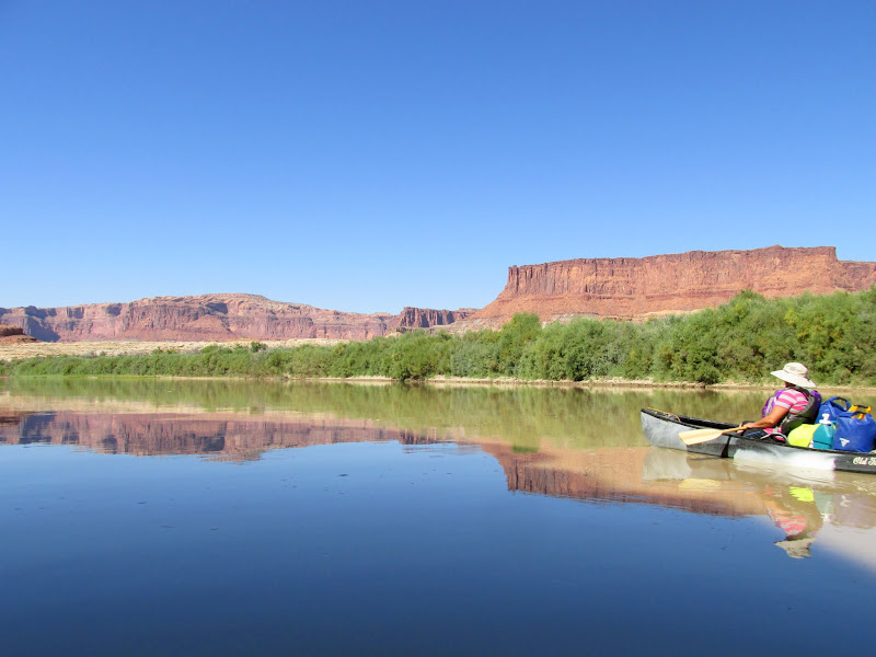
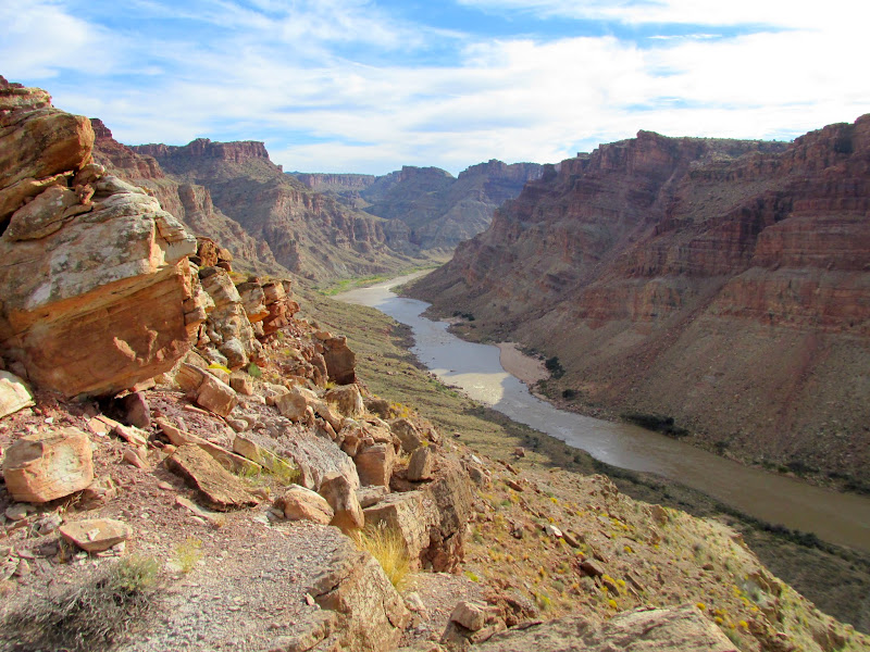
My view for much of the week
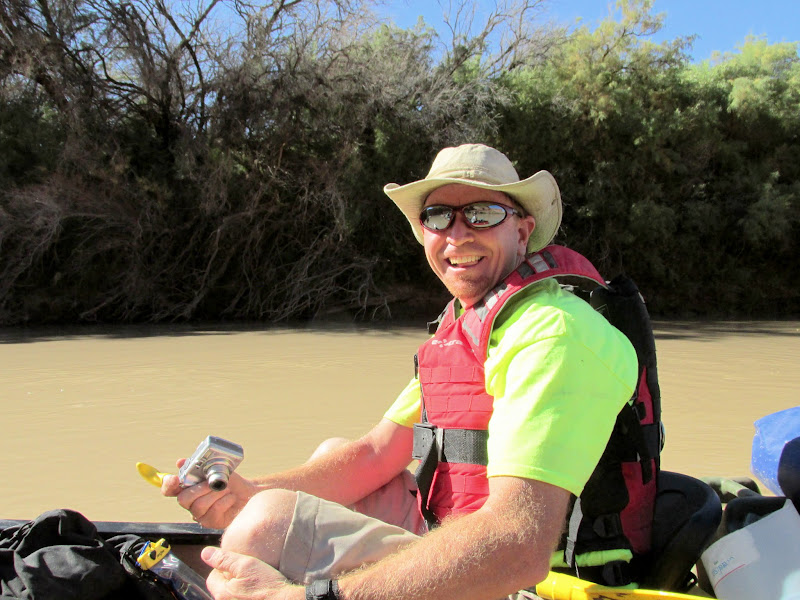
Wade and Lyman

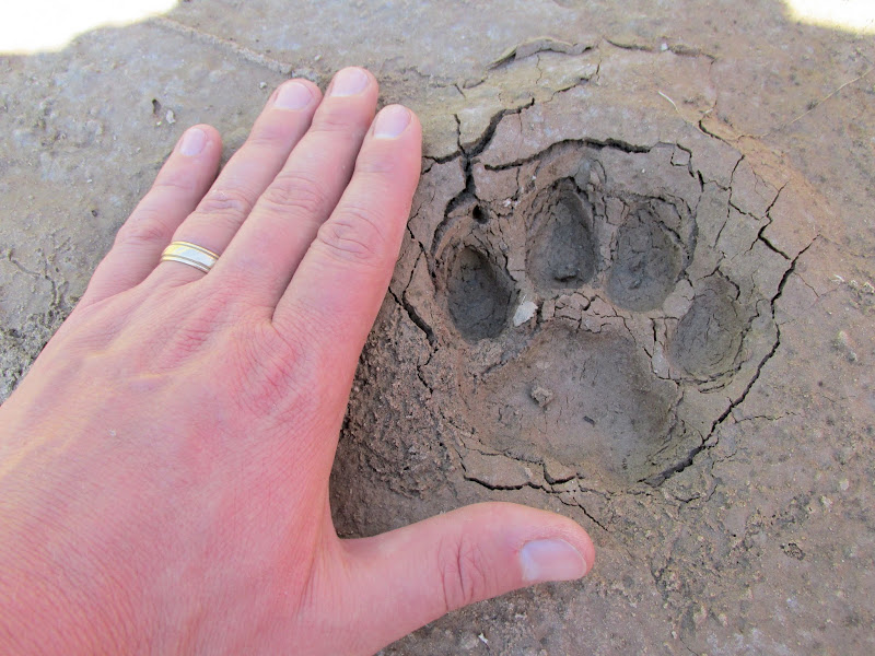
Kitten track
Wreckage of a barge across the river from Point Bottom
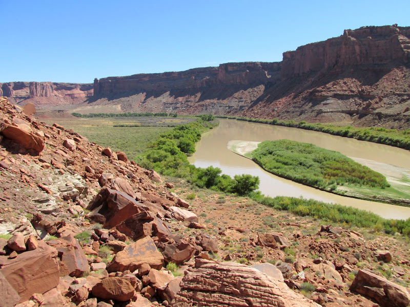
View upstream from below Woodruff Bottom
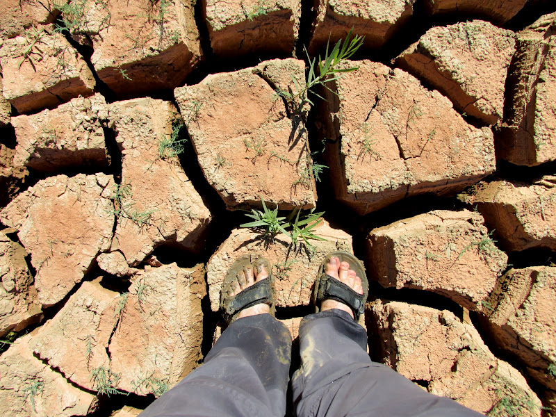
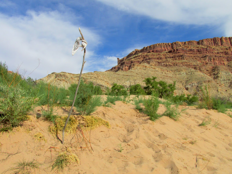
Deep mud cracks
Mouth of Horsethief Canyon
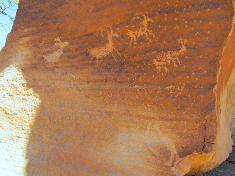
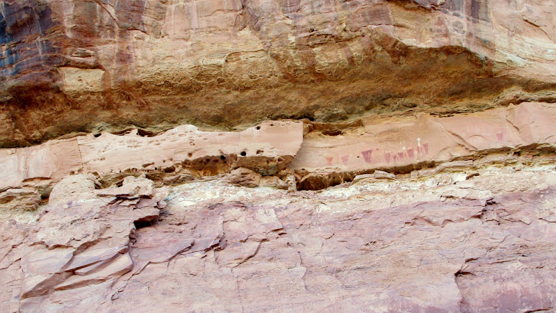
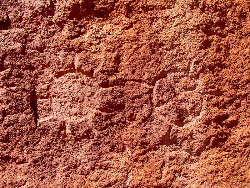
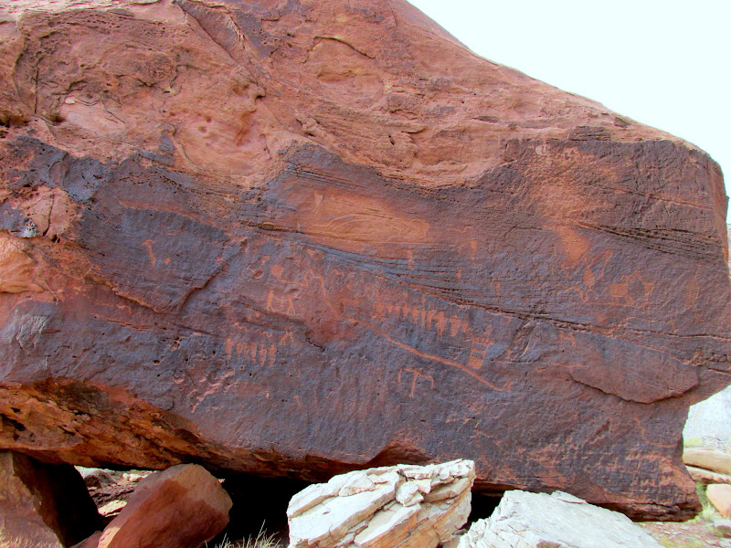
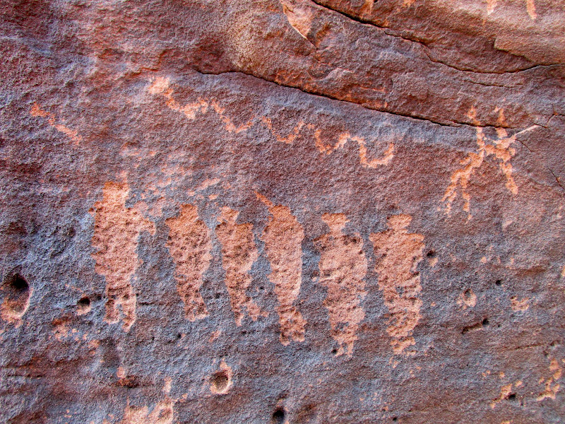
Bighorn sheep petroglyphs and an archer at the lower-right
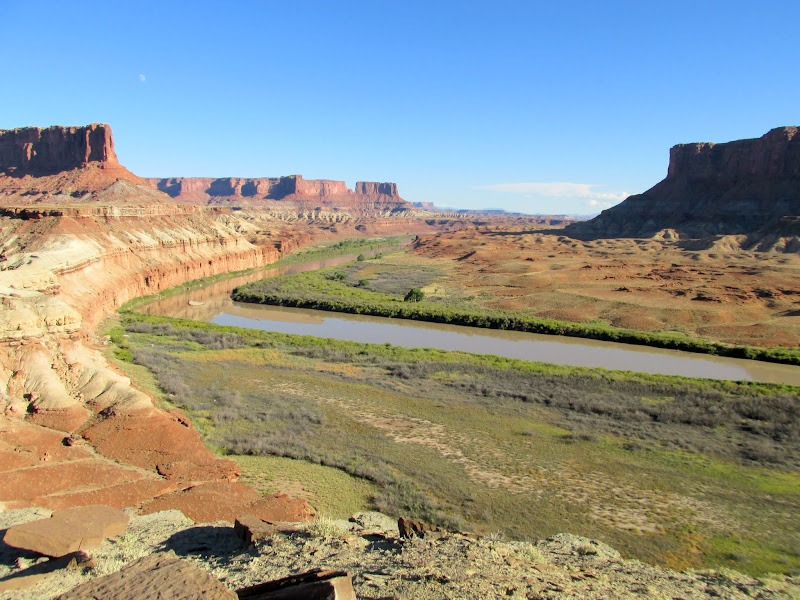
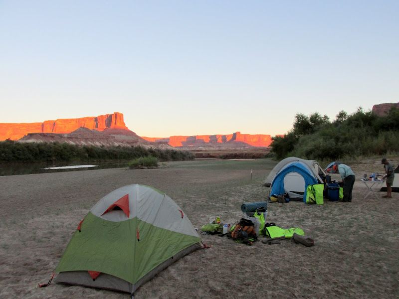
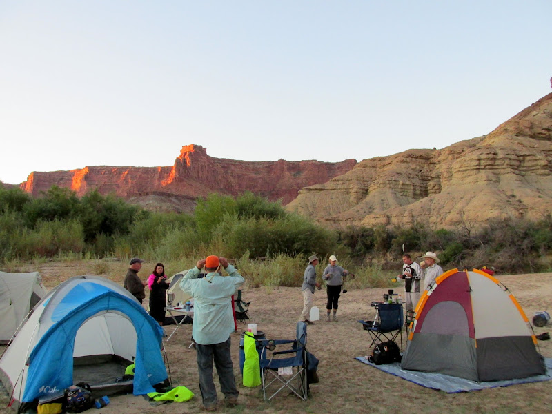
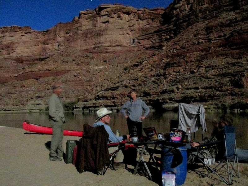
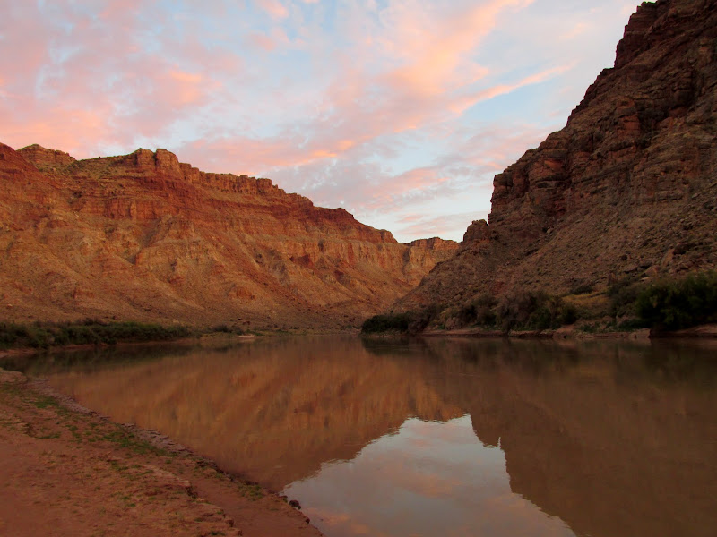
As our group approached Fort Bottom we passed two groups who launched ahead of us that had already stopped for the evening. We landed just below them and hiked to the Walker Cabin and the moqui fort. Back on the river we floated downstream and stopped at the first good campsite we found, on a sandbar in the middle of the river. The sun had already set behind the high cliffs above camp. We set up tents and fixed dinner while watching the cliffs to the east glow a bright pinkish-orange.
Wade is giddy to be on the river
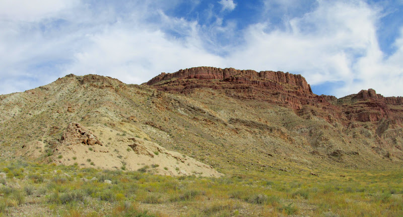
Cliffs below Bighorn Mesa
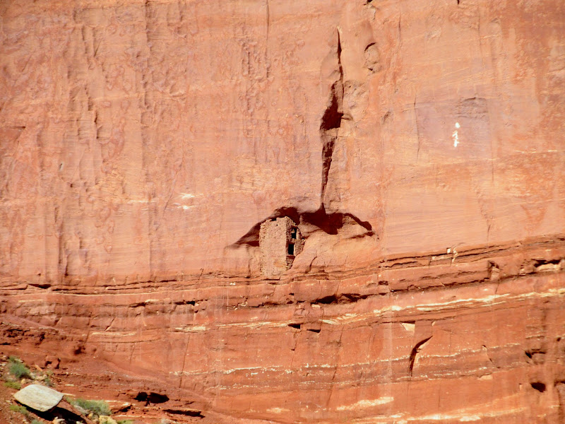
Cabin at Fort Bottom
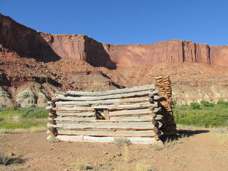
Cabin at Fort Bottom
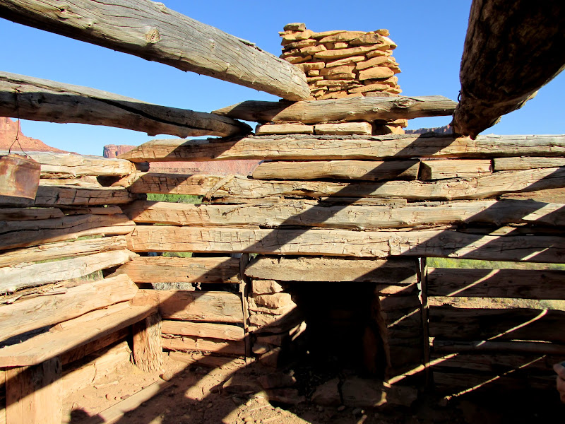
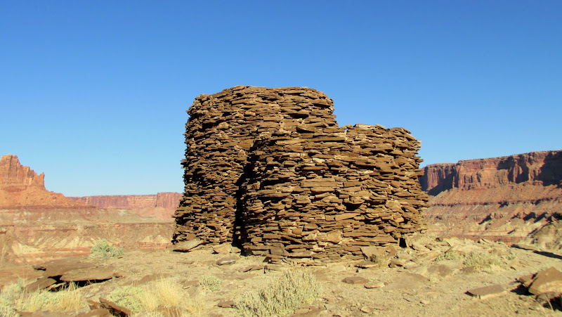
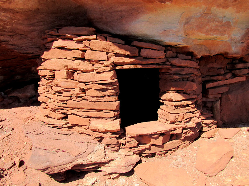
Moqui fort at Fort Bottom
Downstream end of Fort Bottom
Sunset at camp 1, on a sandbar just below Fort Bottom
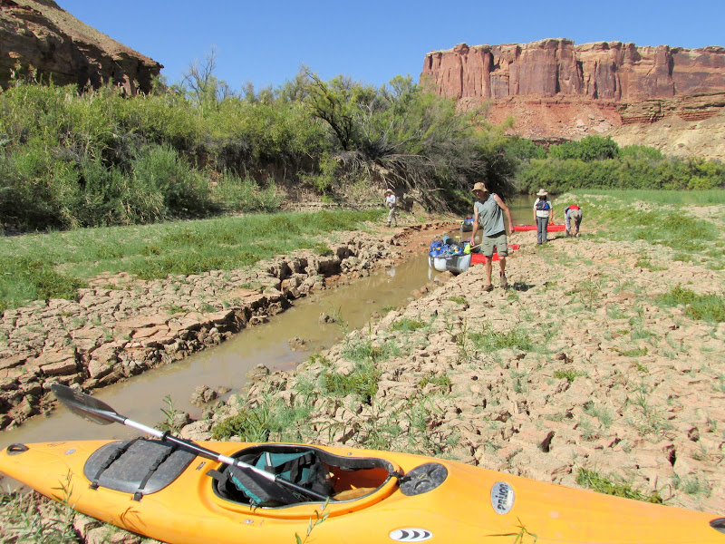
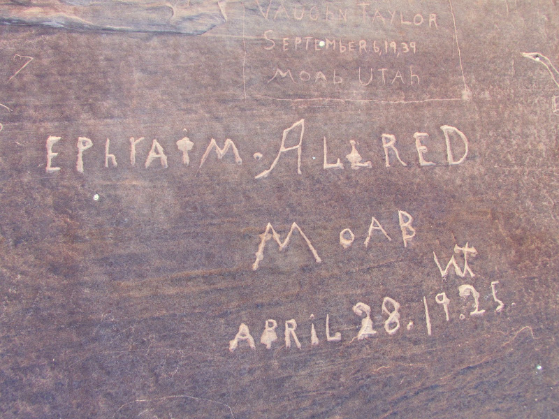
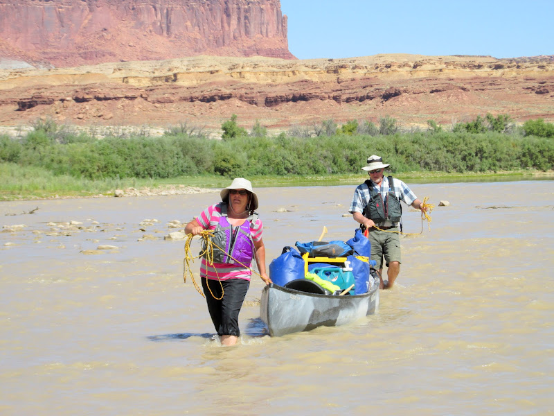
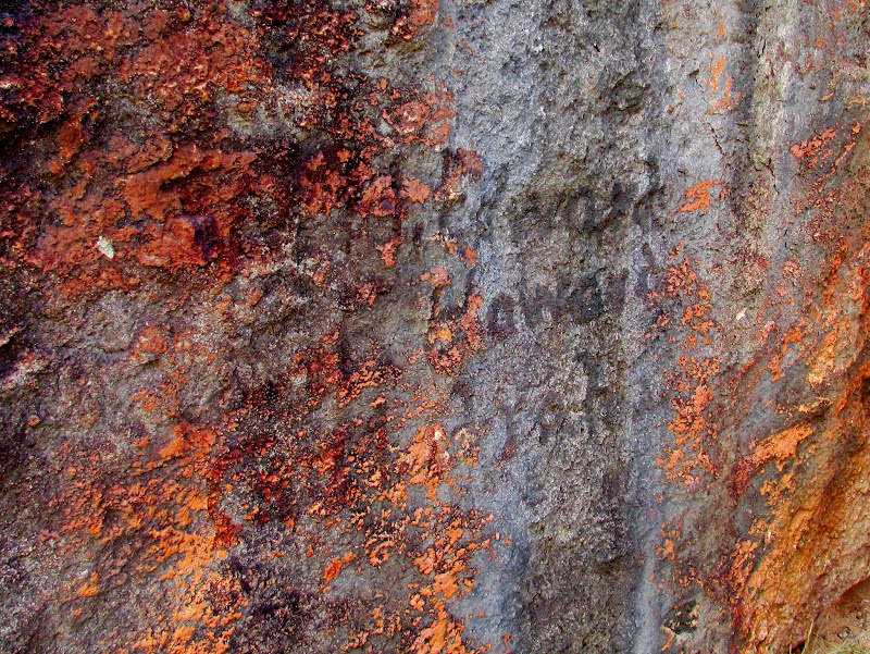
The humidity on the sandbar soaked the tents and gear overnight--it might as well have rained. It took a while to get on the river because we waited for things to dry out before packing them away. Once on the water we attempted to land at the lower end of Potato Bottom but found a wall of willows and tamarisk that prevented us from getting beyond the river bank. The load in mine and Alan's canoe was a little unbalanced and when I attempted to get back in it began to capsize. Events seemed to happen in slow-motion as I realized that the boat was tipping over. I watched water start to flow over the gunwhale, then I instinctively jumped in the water to keep the boat from going all the way over. My GPS got soaked and gave me problems until the next afternoon when it finally dried out, but my camera was in a dry box and my phone is waterproof so they both came out unscathed. Later we reorganized the gear in the canoe and corrected the list. Downstream, at Beaver Bottom, we found some 1920s inscriptions but failed to find some from the late 1800s that are somewhere in the area. In a few places the canoes hit shallow water which required getting out to walk alongside, or even dragging the boats across the submerged sandbar. We made one more stop before lunch at the upper end of Unknown Bottom to view some inscriptions from the early 1900s.
Coffee and breakfast on day 2
Walking the canoe through shallow water
Near Beaver Bottom, with Buttes of the Cross in the distance
Ephraim Allred inscription at Beaver Bottom
Nearing Millard Canyon
Walking the canoe in rocky, shallow water at Millard Canyon
Huge rock at the upper end of Unknown Bottom
Lyman and Wade coming in for a landing
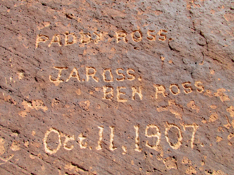
J.A. Ross, Ben Ross, Oct. 11, 1907; Paddy Ross was the name of their boat
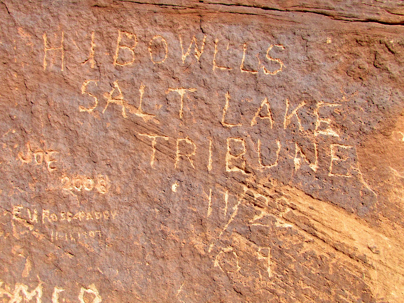
H.I. Bowlls, Salt Lake Tribune, 11/22/1909
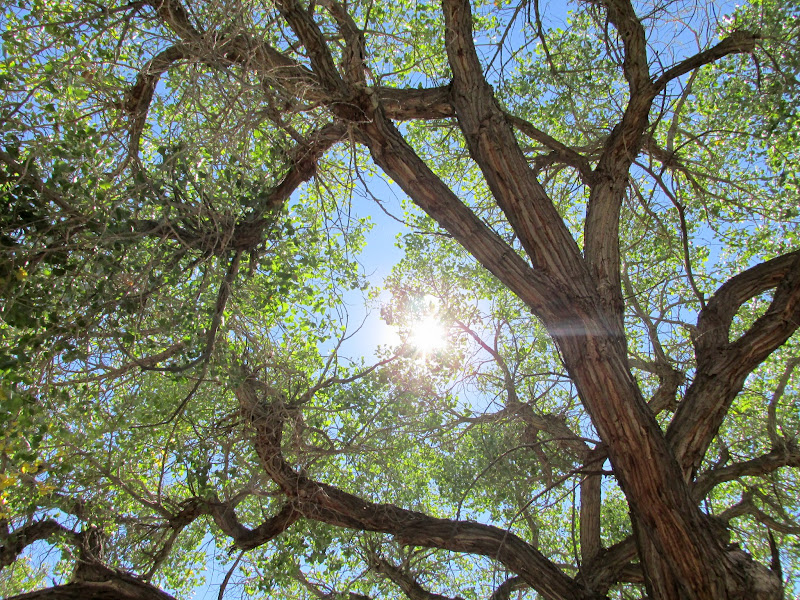
Lunch under the shade of a magnificent cottonwood tree at Unknown Bottom
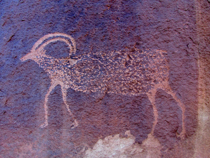
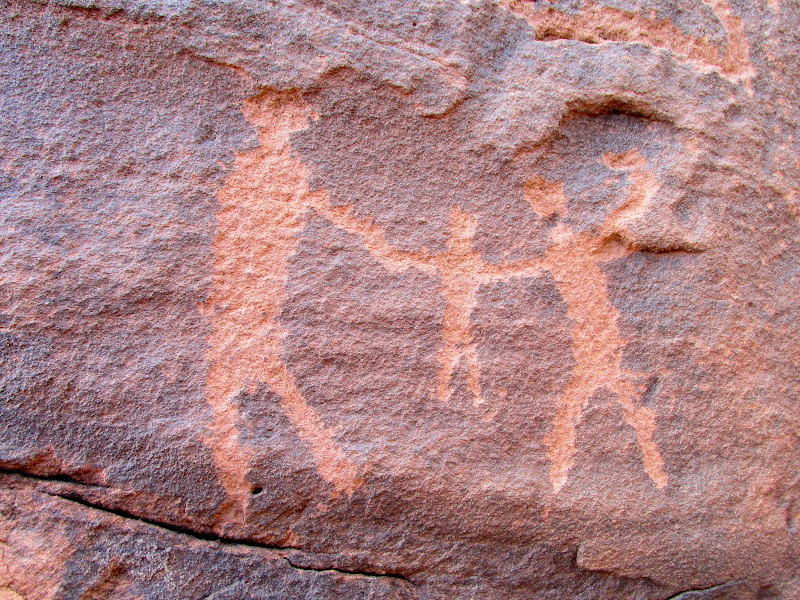
Across the river, at Anderson Bottom, the group hiked around and looked at rock art, a granary, and some cowboy inscriptions, and a few got some water at a spring there. Our last stop before camp was at Valentine Bottom. After finding a break in the tamarisk, we hiked along the cliffs looking for some rock art, granaries, and inscriptions. The pictographs and granaries were high on an inaccessible cliff, and were quite amazing. Unfortunately my camera was having issues focusing while zoomed in, so I couldn't get any close-ups of the rock art. There was supposedly an old rowboat somewhere under a cottonwood tree on Valentine Bottom. It seemed that it would be difficult to find but Lyman began searching and managed to walk right up to it. The boat dates to the 1930s when the Chaffin family was running cattle in the area. A very short distance downstream from our landing spot for Valentine Bottom, we found another sandbar island for the second night's camp.
Landing spot at Anderson Bottom
Anderson Bottom petroglyphs
Walking the boats through shallow water
Landing at Valentine Bottom
Valentine Bottom sheep petroglyph
Two granaries (far left) and pictographs at Valentine Bottom
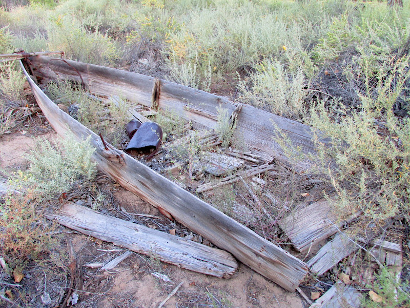
1930s vintage rowboat at Valentine Bottom
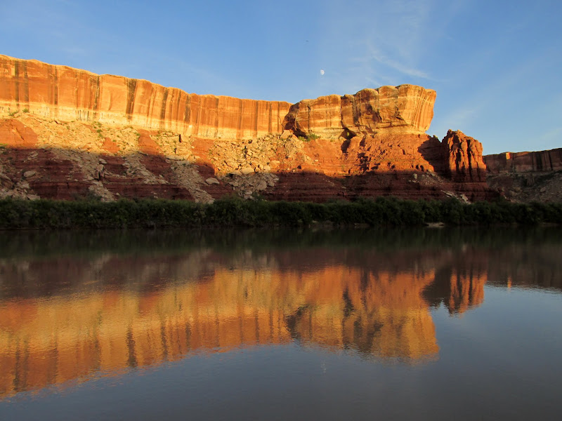
White Rim reflection
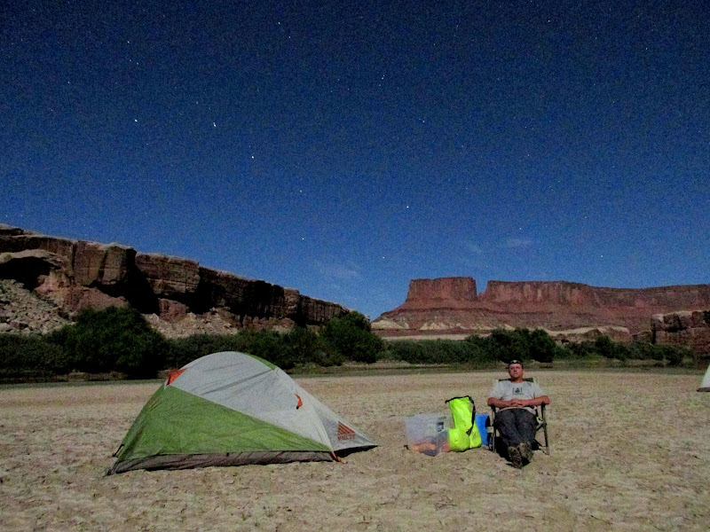
Moonlight selfie
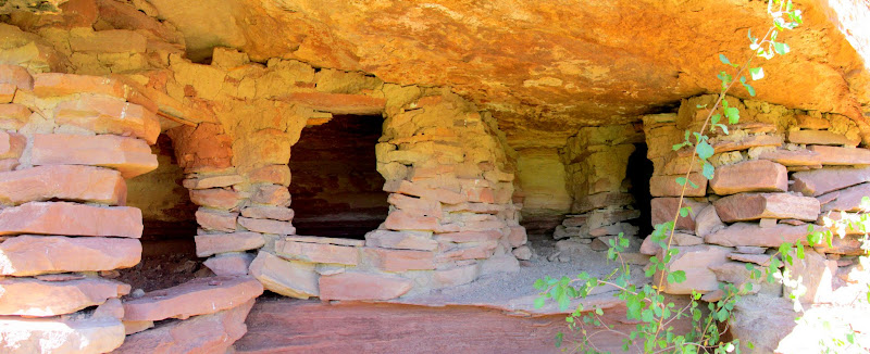
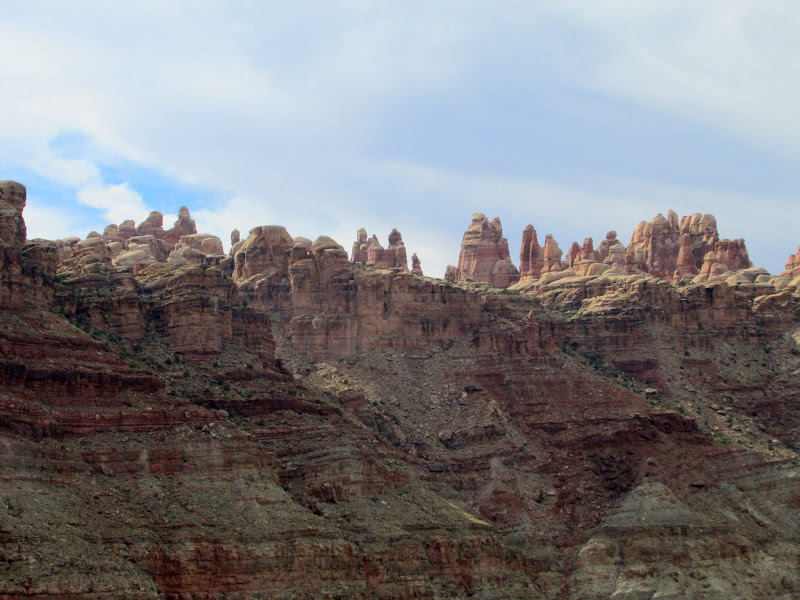
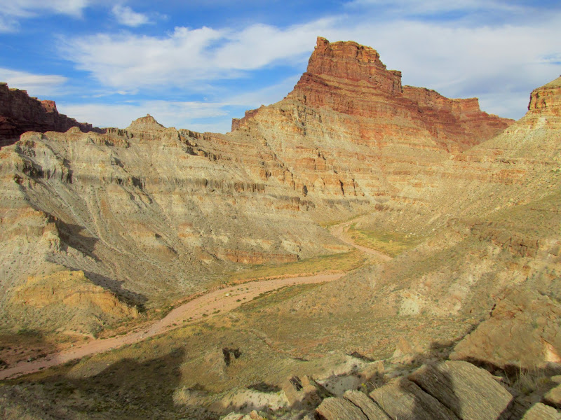
Day three consisted of a lot of hiking around Turk's Head in the morning and then a long, hot stretch of paddling in the afternoon. Turk's Head was a big highlight of the trip. There were many well-preserved granaries, a little bit of rock art (and I'm sure there's some that we missed), and a couple of inscriptions. Just downstream from Turk's Head was a painted 1909 USGS inscription overlaid on top of some inscribed writings from 1904. We put on a lot of miles that afternoon and I found myself often wetting my hat in the river or splashing water onto myself to keep cool. Camp that night was on the right bank of the river about 1.5 miles below Jasper Canyon.
Sunrise on day 3
Cliff dwelling upstream from Tuxedo Bottom
Three canoes floating together so we can formulate a plan
Bushwhacking to Turk's Head
Turk's Head
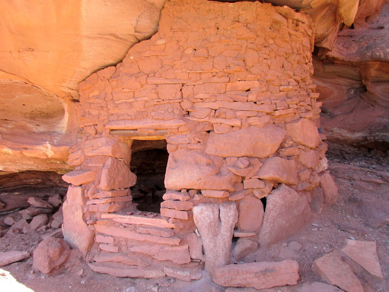
Turk's Head granary
Turk's Head granary
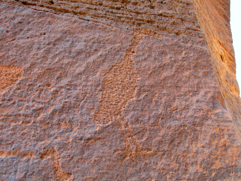
Turk's Head petroglyph
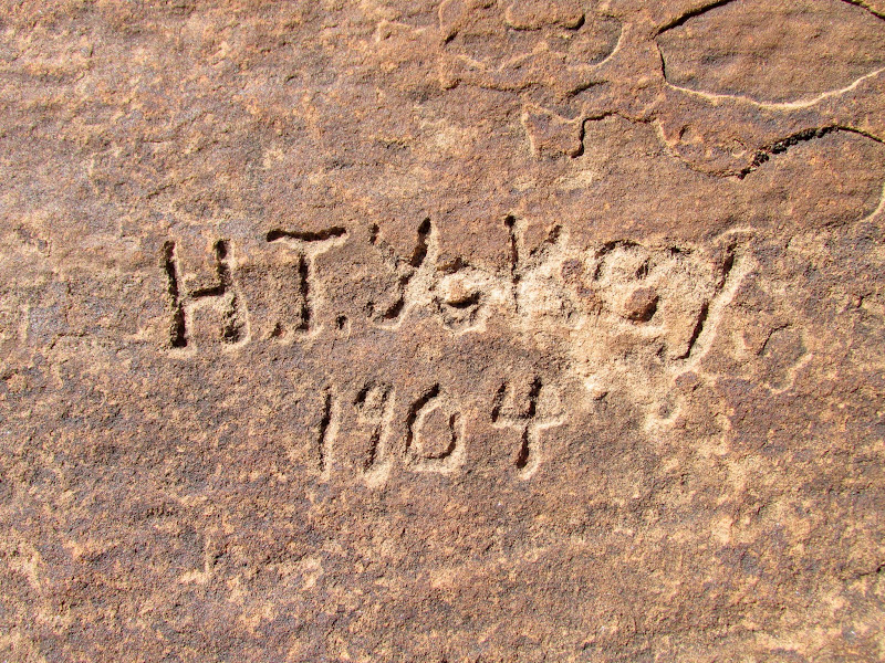
H.T. Yokey 1904
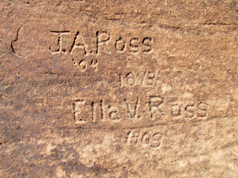
J.A. and Ella Ross
Turk's Head granaries
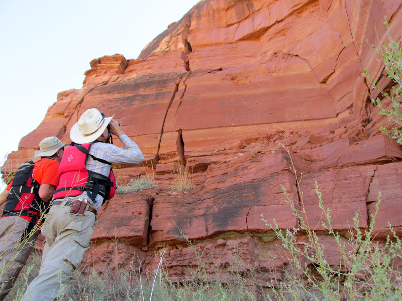
Peering up at a painted inscription
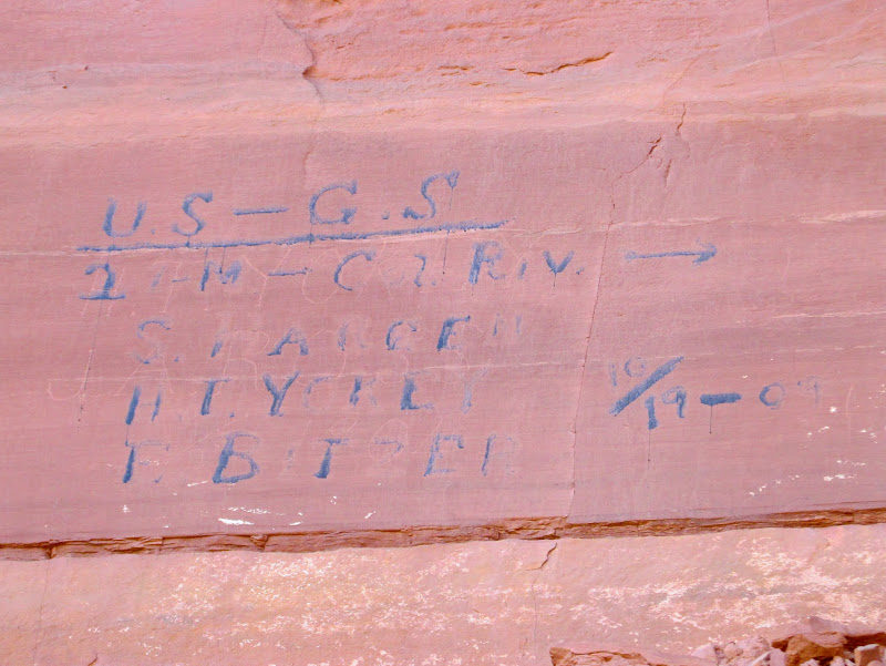
USGS, 21 miles to Colorado River, S. Hargen, H.T. Yokey, E. Bitzer, 10/19/1909 (overlaid on top of H.T. Yokey, J.A. Ross, 1904 inscription)
Lyman contemplating the meaning of life (or maybe just cleaning his sunglasses)
Upstream from Horse Canyon
Camp 3, about halfway between Jasper and Stove canyons
Late evening at camp
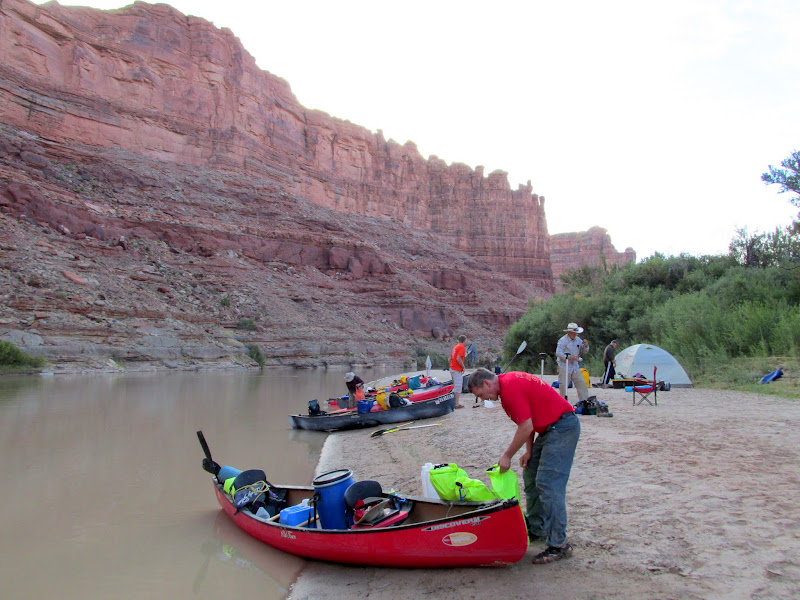
Camping on the river bank instead of a sandbar island was much less humid and made for quicker take-down of camp on day four. In order to make our jet boat pick-up but still have time to do some hiking near Spanish Bottom, we had another long float/paddle in the morning. However, the earlier start and cool morning shade provided by the tall canyon walls made for a relaxing trip. At the Confluence of the Green River and Colorado River, on the north side, we searched for a 1911 inscription by the Kolb brothers. It has faded so badly that we almost missed it. Lower Red Lake Canyon camp was available so we dropped our gear there, paddled across to Spanish Bottom, and split up into two groups. Alan and I stayed down low and searched for an inscription while the rest of the group hiked up to the Doll House. We found the inscription boulder that once had "1st Steamer, Major Powell" painted in 12" tall letters, along with the names of three crew members from the Major Powell, supposedly the first powered boat to navigate the Green and Colorado rivers in 1893. The paint had so badly faded that it took us a while staring at the boulder to recognize what we were looking at.
Packing up to leave on day 4
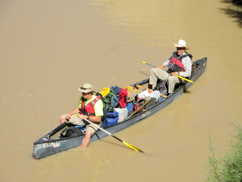
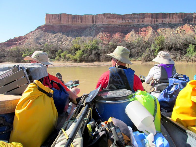
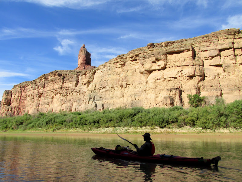
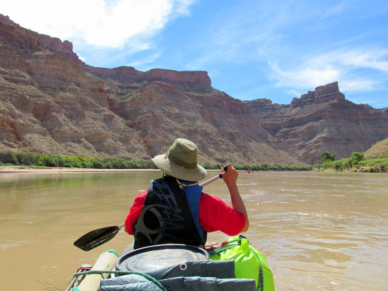
Mark paddling, roughly two miles above the Confluence
The Confluence is in sight
Barely readable Kolb inscription from 1911
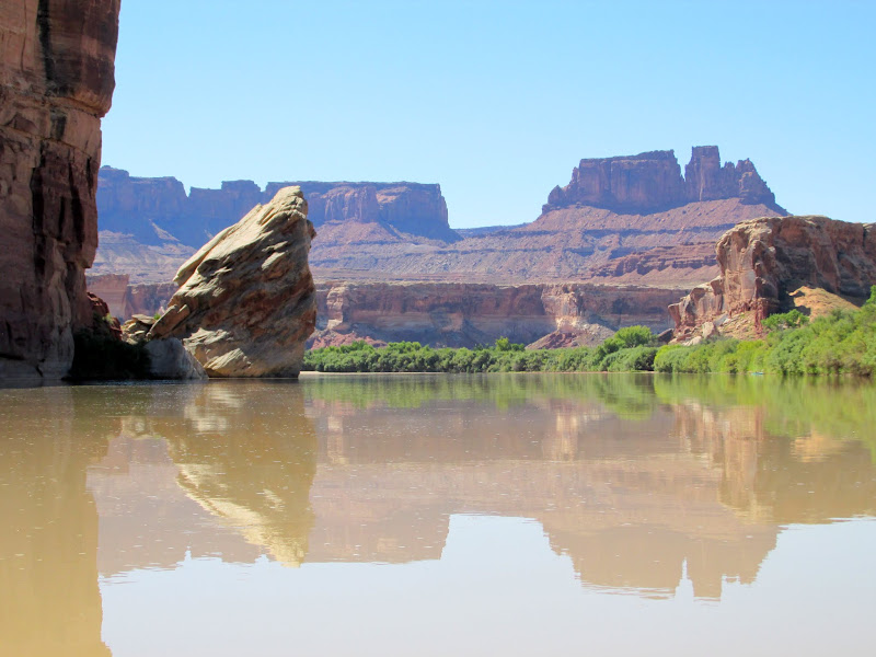
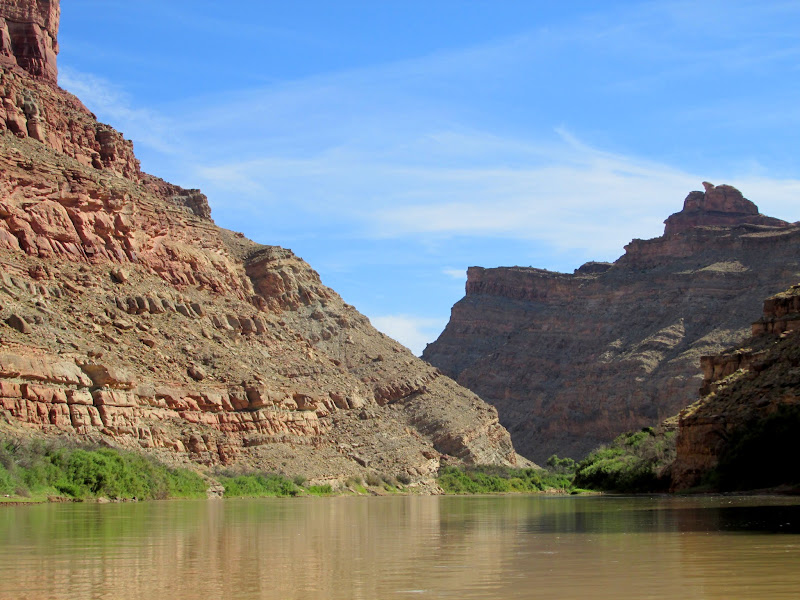
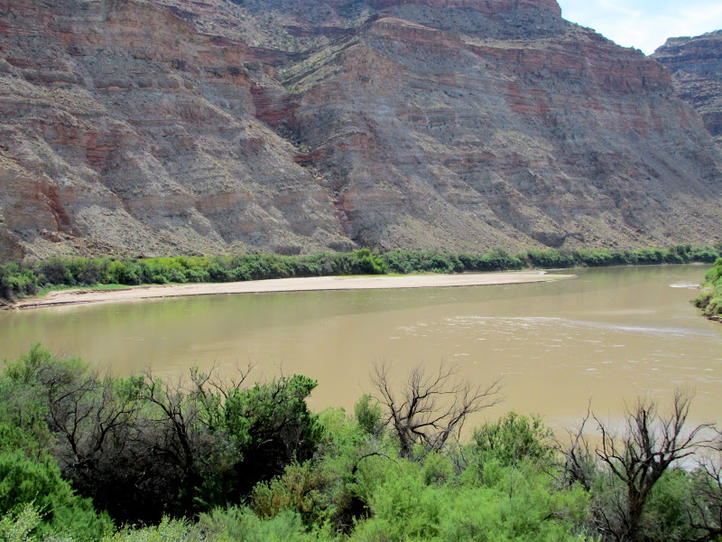
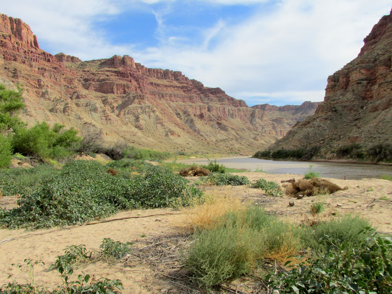
The Confluence of the Colorado River (left) and Green River (right)
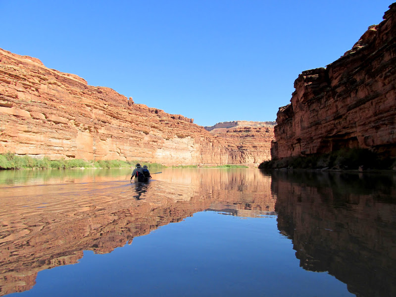
Paddling in both rivers at once
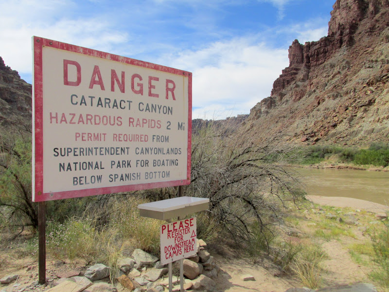
Dangerous sign
The Doll House within view above Spanish Bottom
Trail downstream from Spanish Bottom
The very faint "Powell" portion of the 1893 Major Powell inscription
Edwards, Howard, and Graham names at the Major Powell inscription
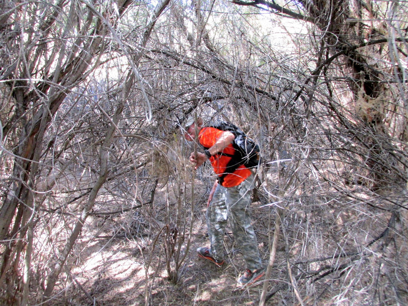
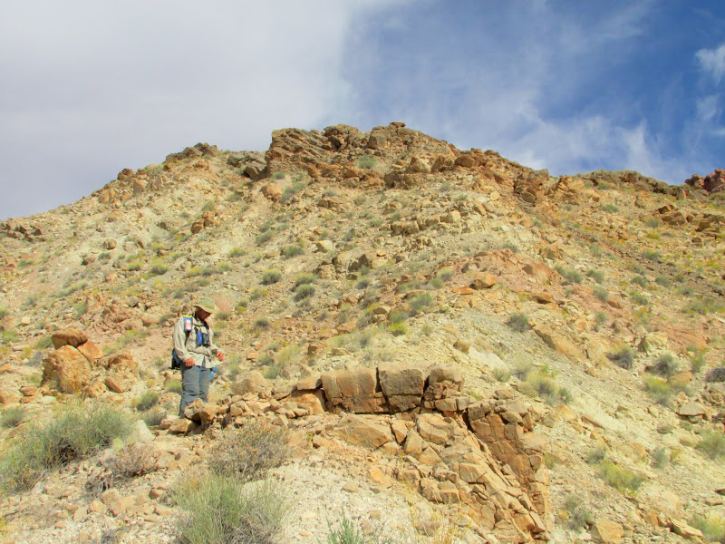
The wind picked up and, from across the river, Alan and I watched some of our camp gear get rearranged on the beach--luckily none of it was lost. We paddled back to camp and secured things and then began a hike up to a Denis Julien inscription from 1836. The authenticity of this inscription is in question by scholars/enthusiasts due to its location high above the river and the very faint way in which it was inscribed, unlike Julien's many other inscriptions that are roughly at river level and deeply inscribed/pecked. It took Alan and I about an hour of steep, rough climbing to reach the Julien boulder. About all I could make out was the first name and the year--the rest is faint and illegible. On one side of the boulder is a rather nice petroglyph panel, and underneath is possibly a shelter of some sort. I think the petroglyphs may lend some authenticity to the Julien inscription--one might wonder what he was doing so high above the river, but obviously an earlier culture had a reason to be there as well. There is a great view of the first several rapids in Cataract Canyon from this spot, which could explain why Julien climbed up, and may also lend credence to the belief by some that he had a boat on the Green River. We descended back to camp and made it back before the rest of the group.
Groover key
Groover
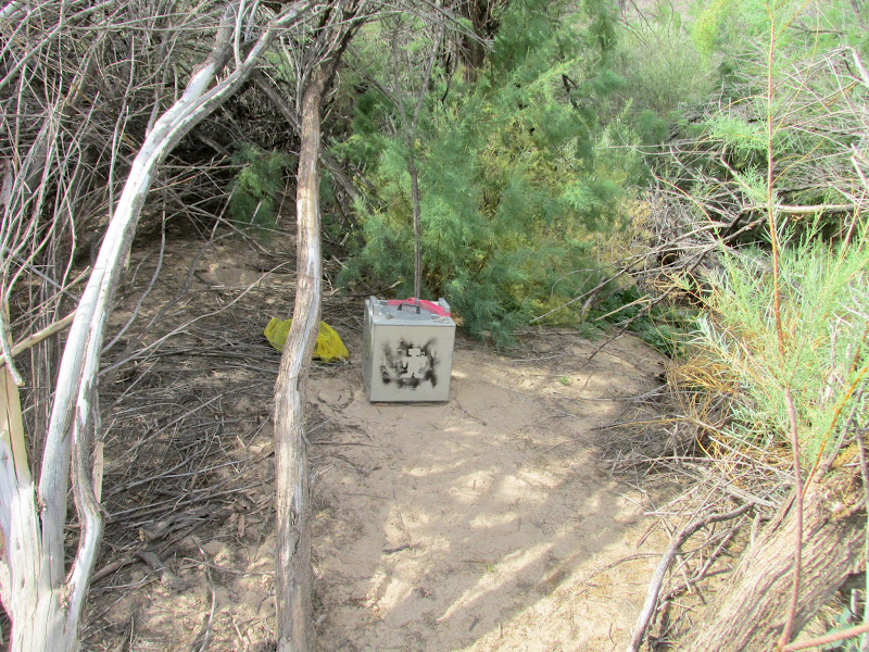
Groover view
Cliffs above Lower Red Lake Canyon
Alan on the climb up to the Denis Julien inscription
Doll House
Faint Denis Julien inscription from 1836
Petroglyphs on the Julien boulder
Six figures
Mom, dad, and child
Heron
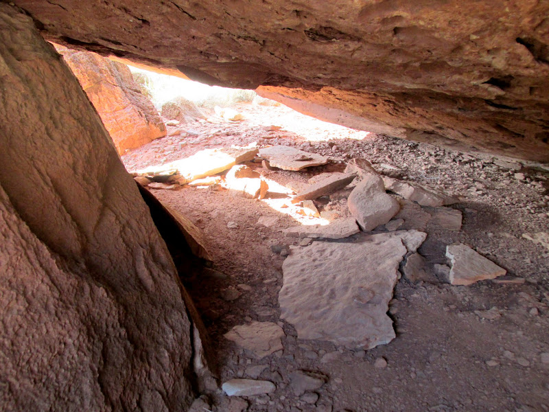
Shelter under the petroglyph boulder
Cataract Canyon
Lower Red Lake Canyon
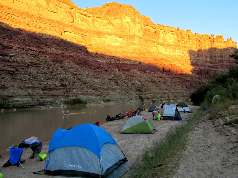
Sunset light on the cliffs
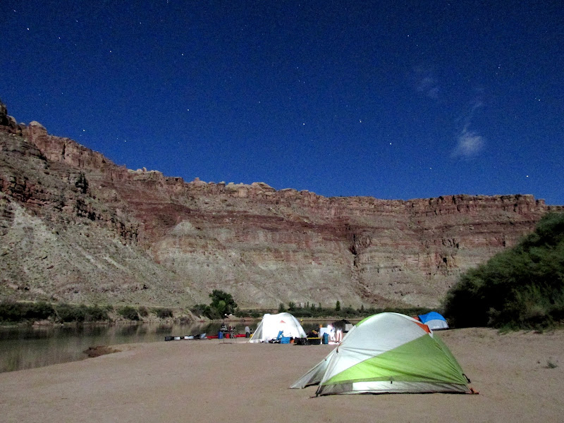
Camp 4 with tents alight
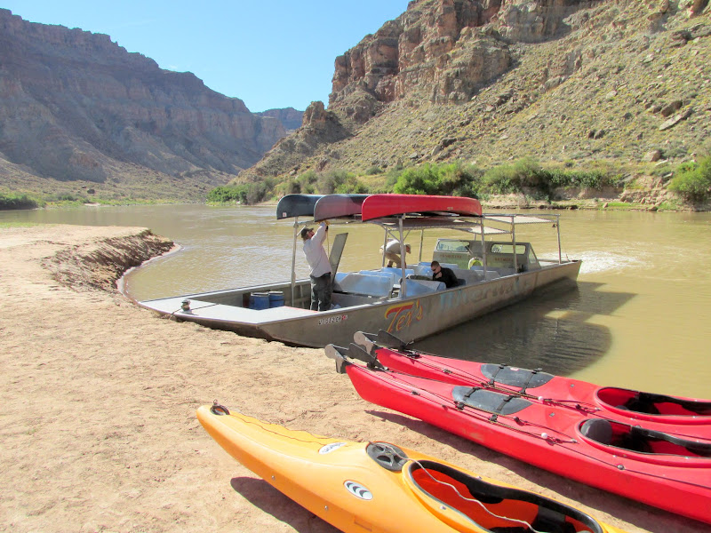
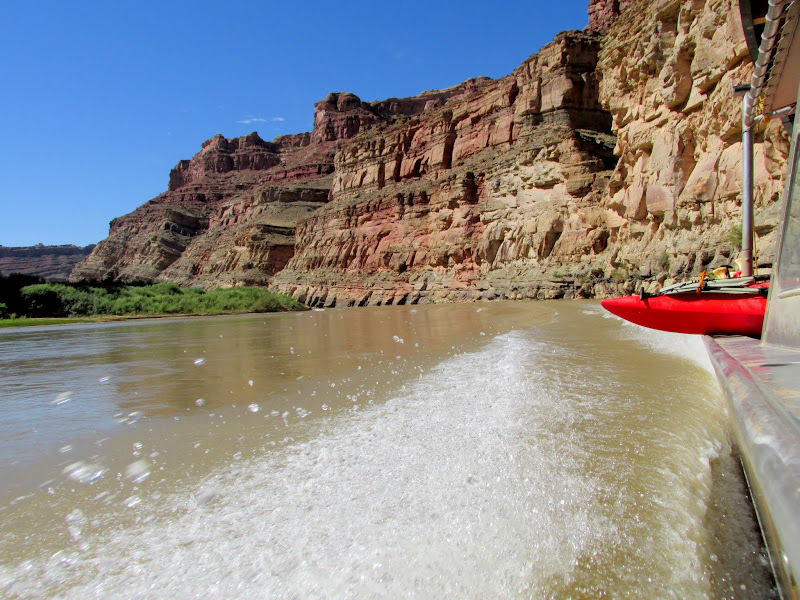
The morning of day five was leisurely for most. Wade and Lyman got up early and hiked up to the Julien inscription, but the rest of us took down camp and sat in the shade while awaiting the jet boat. I began to wonder which would happen first: our shade disappearing, or the jet boat arriving. The jet boat barely beat out the sun, and we orderly handed our gear and boats over to the guys from Tex's for loading. We were the first to be picked up, and there were several more stops between Spanish Bottom and the Confluence until the boat was full. Doing 30 MPH in a boat full of strangers was quite a change of pace from the previous several days. In two hours we reached the Potash boat ramp where we boarded a bus for the short drive to Moab.
Sunrise on day 5
Spanish Bottom reflection
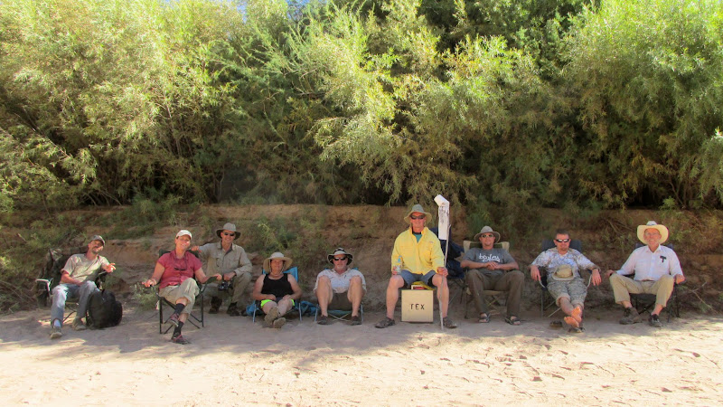
Group photo on our last day; L-R: Greg, Valerie, Mark, Terri, Paul, Alan, me, Wade, and Lyman
Jet boat pickup
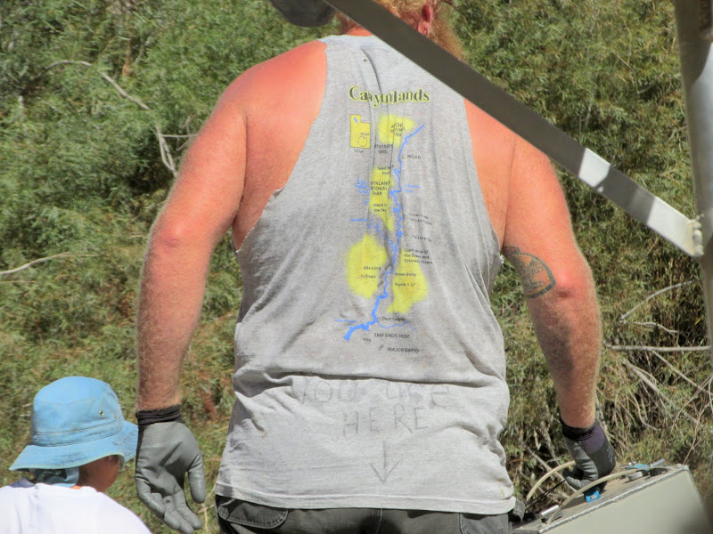
You are here (apparently the Grand Canyon)
Jet boat up the Colorado River
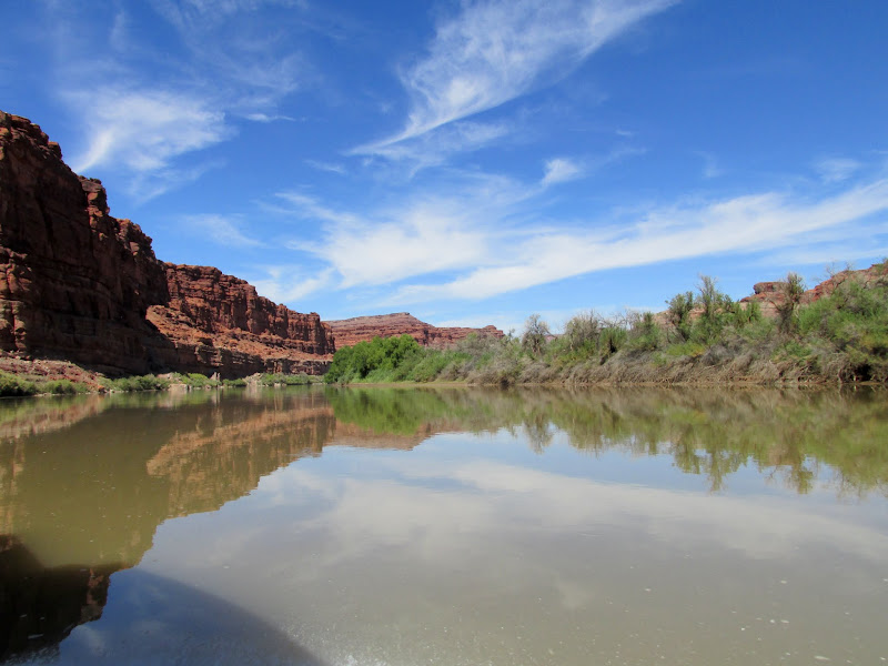
Colorado River reflections
Anticline Canyon
Waitin' at the bus stop
At the back of the bus for the drive to Moab
I bought a canoe two freakin' years ago for a trip just such as this, and all I'd used it for was short, casual paddling around lakes. Now that I've seriously gotten my feet wet (oh, so punny) I really hope to do more river runs along both the Green and Colorado. Even in the unlikely event I don't make it out on the river again, this trip would make for a perfectly memorable first and last outing. We had a great group of people, some of whom I hadn't met before but we all fit in well. The weather was nearly perfect, river conditions were good, and campsites were easy to come by. We did, unfortunately, have to pass up many sites that we'd hoped to visit due to time constraints, but I think there's an easy remedy for that...
Photo Gallery: Green River through Labyrinth and Stillwater Canyons (150 photos)
Featured image for home page:

Following Wade and Lyman into a colorful sunrise at Moab
Parked at Moab Diner for breakfast
Sorting and loading gear at Tex's Riverways
Shuttle van to Mineral Bottom
There were a couple of groups ahead of ours on the boat ramp at Mineral Bottom. As we loaded gear into the boats while waiting for our turn to launch, a ranger from the Park Service arrived on a sweet Suzuki DR-Z400 and gave us a briefing on safety and river regulations--much the same as we'd already received at Tex's. Shortly after 11:30AM we were all on the water. Woodruff Bottom was supposed to be our first stop but the tamarisk seemed impenetrable, so we continued floating downstream. Just below Woodruff Bottom we landed to check out an old metal barge, then at Horsethief Canyon we stopped again for some petroglyphs.
Packing gear at the Mineral Bottom boat ramp
NPS DR-Z400
My view for much of the week
Wade and Lyman
Kitten track
Wreckage of a barge across the river from Point Bottom
View upstream from below Woodruff Bottom
Deep mud cracks
Mouth of Horsethief Canyon
Bighorn sheep petroglyphs and an archer at the lower-right
As our group approached Fort Bottom we passed two groups who launched ahead of us that had already stopped for the evening. We landed just below them and hiked to the Walker Cabin and the moqui fort. Back on the river we floated downstream and stopped at the first good campsite we found, on a sandbar in the middle of the river. The sun had already set behind the high cliffs above camp. We set up tents and fixed dinner while watching the cliffs to the east glow a bright pinkish-orange.
Wade is giddy to be on the river
Cliffs below Bighorn Mesa
Cabin at Fort Bottom
Cabin at Fort Bottom
Moqui fort at Fort Bottom
Downstream end of Fort Bottom
Sunset at camp 1, on a sandbar just below Fort Bottom
The humidity on the sandbar soaked the tents and gear overnight--it might as well have rained. It took a while to get on the river because we waited for things to dry out before packing them away. Once on the water we attempted to land at the lower end of Potato Bottom but found a wall of willows and tamarisk that prevented us from getting beyond the river bank. The load in mine and Alan's canoe was a little unbalanced and when I attempted to get back in it began to capsize. Events seemed to happen in slow-motion as I realized that the boat was tipping over. I watched water start to flow over the gunwhale, then I instinctively jumped in the water to keep the boat from going all the way over. My GPS got soaked and gave me problems until the next afternoon when it finally dried out, but my camera was in a dry box and my phone is waterproof so they both came out unscathed. Later we reorganized the gear in the canoe and corrected the list. Downstream, at Beaver Bottom, we found some 1920s inscriptions but failed to find some from the late 1800s that are somewhere in the area. In a few places the canoes hit shallow water which required getting out to walk alongside, or even dragging the boats across the submerged sandbar. We made one more stop before lunch at the upper end of Unknown Bottom to view some inscriptions from the early 1900s.
Coffee and breakfast on day 2
Walking the canoe through shallow water
Near Beaver Bottom, with Buttes of the Cross in the distance
Ephraim Allred inscription at Beaver Bottom
Nearing Millard Canyon
Walking the canoe in rocky, shallow water at Millard Canyon
Huge rock at the upper end of Unknown Bottom
Lyman and Wade coming in for a landing
J.A. Ross, Ben Ross, Oct. 11, 1907; Paddy Ross was the name of their boat
H.I. Bowlls, Salt Lake Tribune, 11/22/1909
Lunch under the shade of a magnificent cottonwood tree at Unknown Bottom
Across the river, at Anderson Bottom, the group hiked around and looked at rock art, a granary, and some cowboy inscriptions, and a few got some water at a spring there. Our last stop before camp was at Valentine Bottom. After finding a break in the tamarisk, we hiked along the cliffs looking for some rock art, granaries, and inscriptions. The pictographs and granaries were high on an inaccessible cliff, and were quite amazing. Unfortunately my camera was having issues focusing while zoomed in, so I couldn't get any close-ups of the rock art. There was supposedly an old rowboat somewhere under a cottonwood tree on Valentine Bottom. It seemed that it would be difficult to find but Lyman began searching and managed to walk right up to it. The boat dates to the 1930s when the Chaffin family was running cattle in the area. A very short distance downstream from our landing spot for Valentine Bottom, we found another sandbar island for the second night's camp.
Landing spot at Anderson Bottom
Anderson Bottom petroglyphs
Walking the boats through shallow water
Landing at Valentine Bottom
Valentine Bottom sheep petroglyph
Two granaries (far left) and pictographs at Valentine Bottom
1930s vintage rowboat at Valentine Bottom
White Rim reflection
Moonlight selfie
Day three consisted of a lot of hiking around Turk's Head in the morning and then a long, hot stretch of paddling in the afternoon. Turk's Head was a big highlight of the trip. There were many well-preserved granaries, a little bit of rock art (and I'm sure there's some that we missed), and a couple of inscriptions. Just downstream from Turk's Head was a painted 1909 USGS inscription overlaid on top of some inscribed writings from 1904. We put on a lot of miles that afternoon and I found myself often wetting my hat in the river or splashing water onto myself to keep cool. Camp that night was on the right bank of the river about 1.5 miles below Jasper Canyon.
Sunrise on day 3
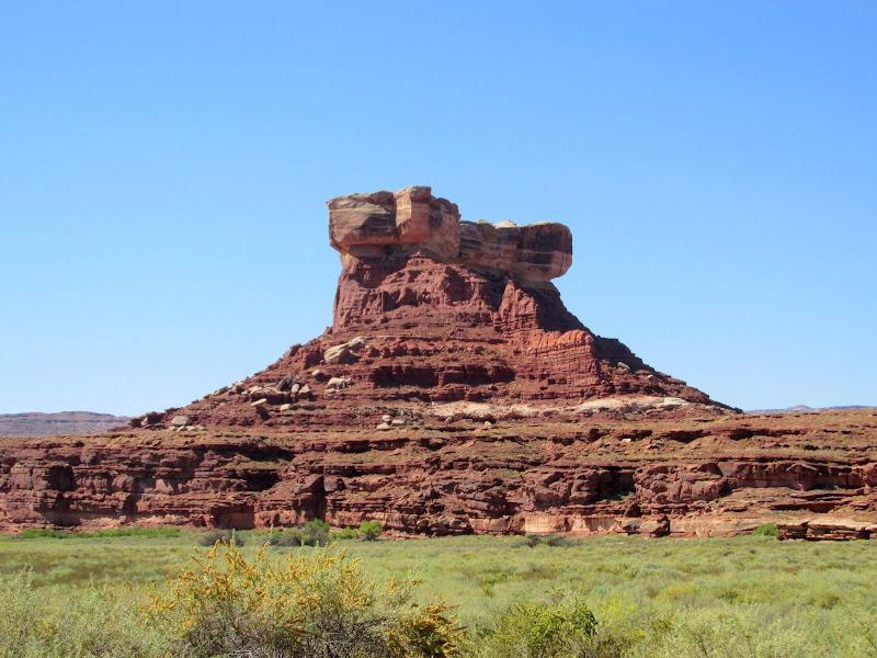
Cliff dwelling upstream from Tuxedo Bottom
Three canoes floating together so we can formulate a plan
Bushwhacking to Turk's Head
Turk's Head
Turk's Head granary
Turk's Head granary
Turk's Head petroglyph
H.T. Yokey 1904
J.A. and Ella Ross
Turk's Head granaries
Peering up at a painted inscription
USGS, 21 miles to Colorado River, S. Hargen, H.T. Yokey, E. Bitzer, 10/19/1909 (overlaid on top of H.T. Yokey, J.A. Ross, 1904 inscription)
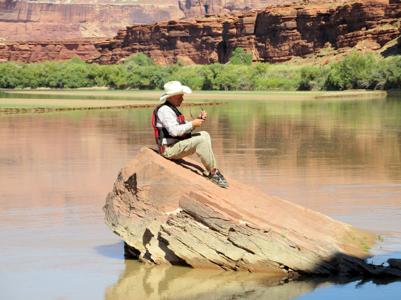
Lyman contemplating the meaning of life (or maybe just cleaning his sunglasses)
Upstream from Horse Canyon
Camp 3, about halfway between Jasper and Stove canyons
Late evening at camp
Camping on the river bank instead of a sandbar island was much less humid and made for quicker take-down of camp on day four. In order to make our jet boat pick-up but still have time to do some hiking near Spanish Bottom, we had another long float/paddle in the morning. However, the earlier start and cool morning shade provided by the tall canyon walls made for a relaxing trip. At the Confluence of the Green River and Colorado River, on the north side, we searched for a 1911 inscription by the Kolb brothers. It has faded so badly that we almost missed it. Lower Red Lake Canyon camp was available so we dropped our gear there, paddled across to Spanish Bottom, and split up into two groups. Alan and I stayed down low and searched for an inscription while the rest of the group hiked up to the Doll House. We found the inscription boulder that once had "1st Steamer, Major Powell" painted in 12" tall letters, along with the names of three crew members from the Major Powell, supposedly the first powered boat to navigate the Green and Colorado rivers in 1893. The paint had so badly faded that it took us a while staring at the boulder to recognize what we were looking at.
Packing up to leave on day 4
Mark paddling, roughly two miles above the Confluence
The Confluence is in sight
Barely readable Kolb inscription from 1911
The Confluence of the Colorado River (left) and Green River (right)
Paddling in both rivers at once
Dangerous sign
The Doll House within view above Spanish Bottom
Trail downstream from Spanish Bottom
The very faint "Powell" portion of the 1893 Major Powell inscription
Edwards, Howard, and Graham names at the Major Powell inscription
The wind picked up and, from across the river, Alan and I watched some of our camp gear get rearranged on the beach--luckily none of it was lost. We paddled back to camp and secured things and then began a hike up to a Denis Julien inscription from 1836. The authenticity of this inscription is in question by scholars/enthusiasts due to its location high above the river and the very faint way in which it was inscribed, unlike Julien's many other inscriptions that are roughly at river level and deeply inscribed/pecked. It took Alan and I about an hour of steep, rough climbing to reach the Julien boulder. About all I could make out was the first name and the year--the rest is faint and illegible. On one side of the boulder is a rather nice petroglyph panel, and underneath is possibly a shelter of some sort. I think the petroglyphs may lend some authenticity to the Julien inscription--one might wonder what he was doing so high above the river, but obviously an earlier culture had a reason to be there as well. There is a great view of the first several rapids in Cataract Canyon from this spot, which could explain why Julien climbed up, and may also lend credence to the belief by some that he had a boat on the Green River. We descended back to camp and made it back before the rest of the group.
Groover key
Groover
Groover view
Cliffs above Lower Red Lake Canyon
Alan on the climb up to the Denis Julien inscription
Doll House
Faint Denis Julien inscription from 1836
Petroglyphs on the Julien boulder
Six figures
Mom, dad, and child
Heron
Shelter under the petroglyph boulder
Cataract Canyon
Lower Red Lake Canyon
Sunset light on the cliffs
Camp 4 with tents alight
The morning of day five was leisurely for most. Wade and Lyman got up early and hiked up to the Julien inscription, but the rest of us took down camp and sat in the shade while awaiting the jet boat. I began to wonder which would happen first: our shade disappearing, or the jet boat arriving. The jet boat barely beat out the sun, and we orderly handed our gear and boats over to the guys from Tex's for loading. We were the first to be picked up, and there were several more stops between Spanish Bottom and the Confluence until the boat was full. Doing 30 MPH in a boat full of strangers was quite a change of pace from the previous several days. In two hours we reached the Potash boat ramp where we boarded a bus for the short drive to Moab.
Sunrise on day 5
Spanish Bottom reflection
Group photo on our last day; L-R: Greg, Valerie, Mark, Terri, Paul, Alan, me, Wade, and Lyman
Jet boat pickup
You are here (apparently the Grand Canyon)
Jet boat up the Colorado River
Colorado River reflections
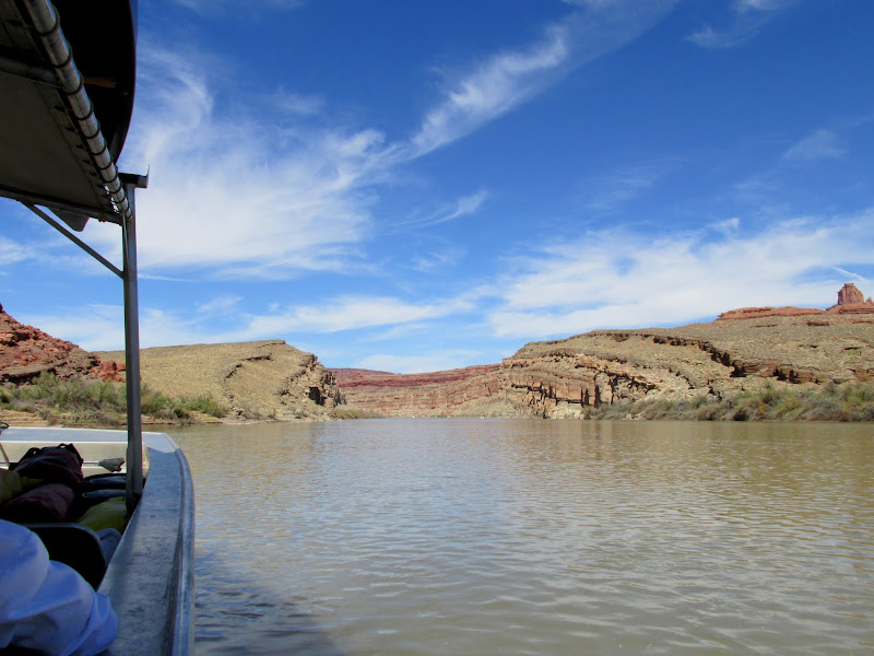
Anticline Canyon
Waitin' at the bus stop
At the back of the bus for the drive to Moab
I bought a canoe two freakin' years ago for a trip just such as this, and all I'd used it for was short, casual paddling around lakes. Now that I've seriously gotten my feet wet (oh, so punny) I really hope to do more river runs along both the Green and Colorado. Even in the unlikely event I don't make it out on the river again, this trip would make for a perfectly memorable first and last outing. We had a great group of people, some of whom I hadn't met before but we all fit in well. The weather was nearly perfect, river conditions were good, and campsites were easy to come by. We did, unfortunately, have to pass up many sites that we'd hoped to visit due to time constraints, but I think there's an easy remedy for that...
Photo Gallery: Green River through Labyrinth and Stillwater Canyons (150 photos)
Featured image for home page:
")
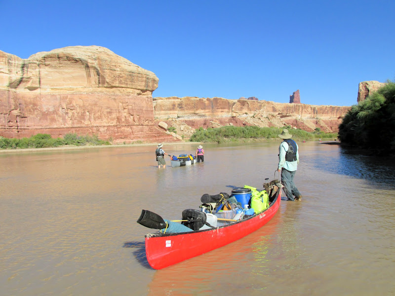
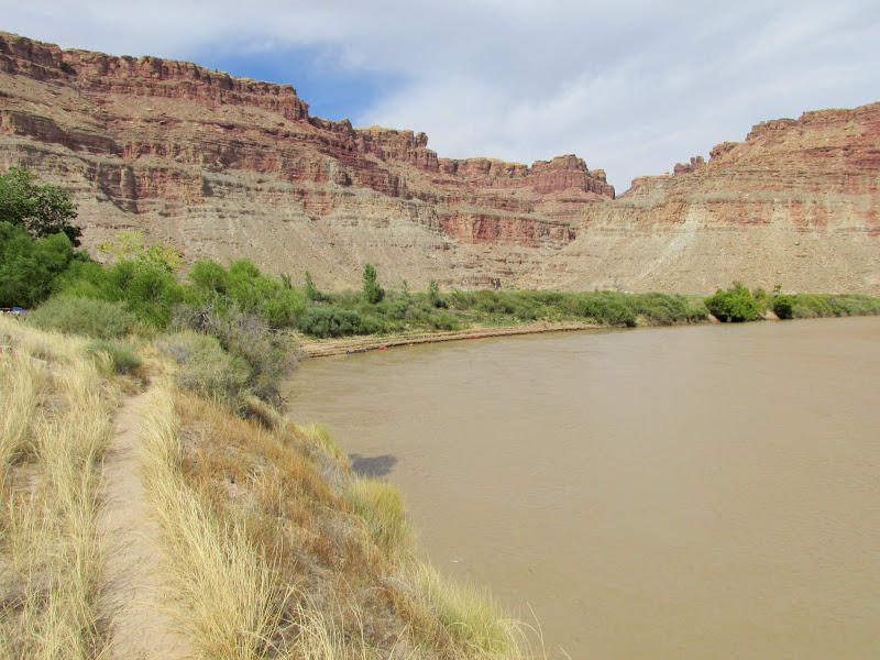
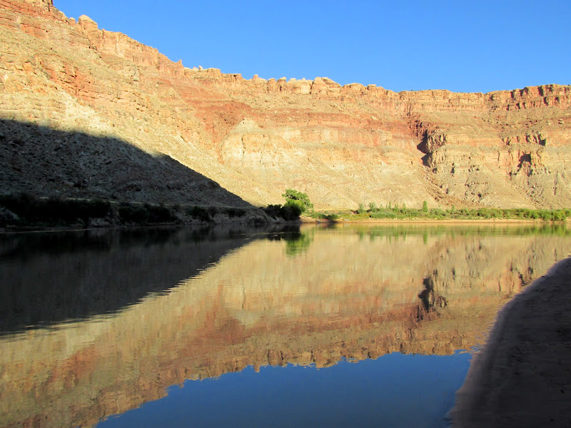
 The flow was between 2,400 and 2,500 CFS on this trip. I think just a little more flow would be better. We had to do quite a bit of paddling to make headway in some spots, and in others it was shallow enough that we had to get out of the canoes and walk (the kayaks didn't really have that problem). However, the availability of camp sites was quite nice, and landing on the banks (or even paddling upstream after passing a good landing spot) was always pretty easy.