- Joined
- Dec 23, 2013
- Messages
- 4,305
I hiked with four others from the Wasatch Mountain Club this weekend to Grandview Peak which is located on the upper north side of City Creek Canyon.
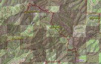
Map of route
The Trailhead we chose is located where the Mormon Pioneer Trail crosses the East Canyon Road. We began hiking at 8:30 in the morning and soon came to the Affleck Park Campground. We hiked a short distance through the campground before turning west and heading up what looked like an old jeep road towards the trail junction with the trail that comes out of Killyon Canyon and another that heads north from Little Mountain.
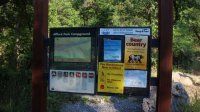
Affleck Park information sign
Once at the trail intersection, we proceeded north to gain the ridge and then northwest along the ridge until the junction with the trail that goes to the top of Lookout Peak.
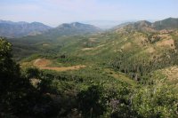
A look down Emigration Canyon just after the trail junction
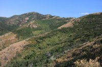
Gaining the ridge
We then made our way across the northeast slope of Lookout Peak before gaining the ridge that runs to the north of the peak. This part of the trail runs through aspen groves and a few small meadows with wildflowers and was quite nice.
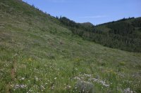
Hiking through a meadow
Once we regained the ridge, we were able to see Grandview Peak for the first time through the trees.
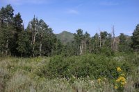
Our first glimpse of Grandview Peak
We continued along the ridge until we came to the junction of the trail from Big Mountain. At this point we turned west and dropped down to a little saddle that is the head of City Creek Canyon.
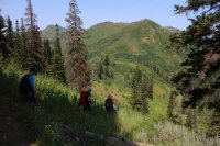
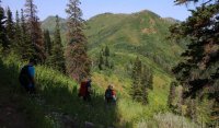
Hiking down to the saddle that defines the head of City Creek Canyon. We will regain the ridge directly in front of us to continue on to Grandview.
Once at the saddle, the trail began to switchback up to the top of the ridge and we could get a good view of Grandview.
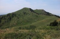
Grandview Peak
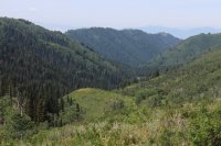
Looking down City Creek Canyon
At this point we just followed the ridge to the peak.
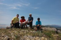
The group on top of Grandview
Once at the top we ate lunch and I took some pictures before we retraced our footsteps back to the trailhead. By the way, the peak is aptly named because you indeed get a "grand view" any direction you look; although on this day smoke from distance fires increased the haziness of the views.
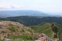
Looking south from the top of Grandview Peak
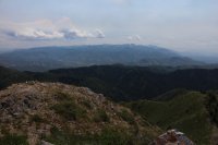
Same shot with less exposure
Overall, I think this is a nice hike albeit a long one. It took us about nine and a half hours to complete, including lunch on top. The round trip distance is eighteen miles with a bit of up and down to it, but there is nothing technical about the route. There are a couple of steep sections and you are in the sun most of the time which made for a very hot hike. So bring plenty of water and food if you want to attempt this in the summer months.
Featured image for home page:

Map of route
The Trailhead we chose is located where the Mormon Pioneer Trail crosses the East Canyon Road. We began hiking at 8:30 in the morning and soon came to the Affleck Park Campground. We hiked a short distance through the campground before turning west and heading up what looked like an old jeep road towards the trail junction with the trail that comes out of Killyon Canyon and another that heads north from Little Mountain.

Affleck Park information sign
Once at the trail intersection, we proceeded north to gain the ridge and then northwest along the ridge until the junction with the trail that goes to the top of Lookout Peak.

A look down Emigration Canyon just after the trail junction

Gaining the ridge
We then made our way across the northeast slope of Lookout Peak before gaining the ridge that runs to the north of the peak. This part of the trail runs through aspen groves and a few small meadows with wildflowers and was quite nice.

Hiking through a meadow
Once we regained the ridge, we were able to see Grandview Peak for the first time through the trees.

Our first glimpse of Grandview Peak
We continued along the ridge until we came to the junction of the trail from Big Mountain. At this point we turned west and dropped down to a little saddle that is the head of City Creek Canyon.

Hiking down to the saddle that defines the head of City Creek Canyon. We will regain the ridge directly in front of us to continue on to Grandview.
Once at the saddle, the trail began to switchback up to the top of the ridge and we could get a good view of Grandview.

Grandview Peak

Looking down City Creek Canyon
At this point we just followed the ridge to the peak.

The group on top of Grandview
Once at the top we ate lunch and I took some pictures before we retraced our footsteps back to the trailhead. By the way, the peak is aptly named because you indeed get a "grand view" any direction you look; although on this day smoke from distance fires increased the haziness of the views.

Looking south from the top of Grandview Peak

Same shot with less exposure
Overall, I think this is a nice hike albeit a long one. It took us about nine and a half hours to complete, including lunch on top. The round trip distance is eighteen miles with a bit of up and down to it, but there is nothing technical about the route. There are a couple of steep sections and you are in the sun most of the time which made for a very hot hike. So bring plenty of water and food if you want to attempt this in the summer months.
Featured image for home page:

