Udink
Still right here.
- Joined
- Jan 17, 2012
- Messages
- 1,748
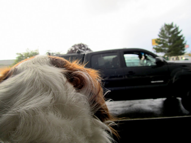
Friday I got a last-minute invite from @Bill to head out to the Wedge to drink beer, ride bikes, and shoot sunset/lightning/sunrise. As soon as I got off work I showered, threw some gear in the Jeep, and met Bill just as he was finishing up some grocery shopping in Price. He had his dog, Moki, and I brought only Torrey, leaving Boulder at home with Traci. I followed Bill south on UT-10 while keeping an eye on a nice rainbow forming to the east. Just after passing Paint Road, Bill hit the brakes and turned around to get some photos there with the rainbow in the background.
Torrey and Moki getting acquainted in Price before heading down to the Wedge
Paint Road rainbow
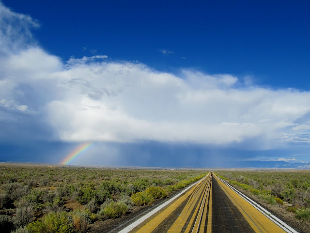
Paint Road
Rainbow
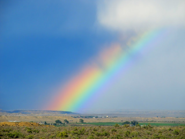
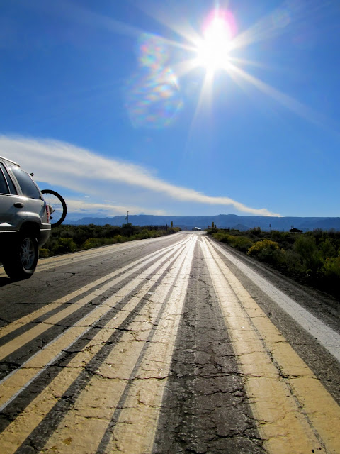
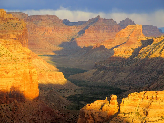
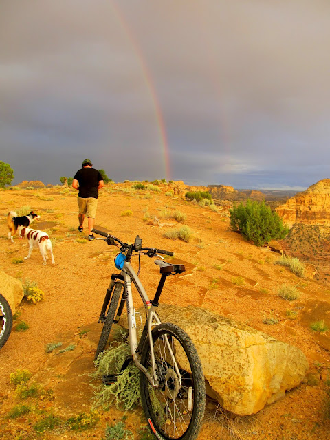
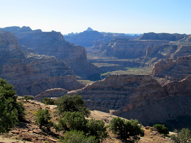
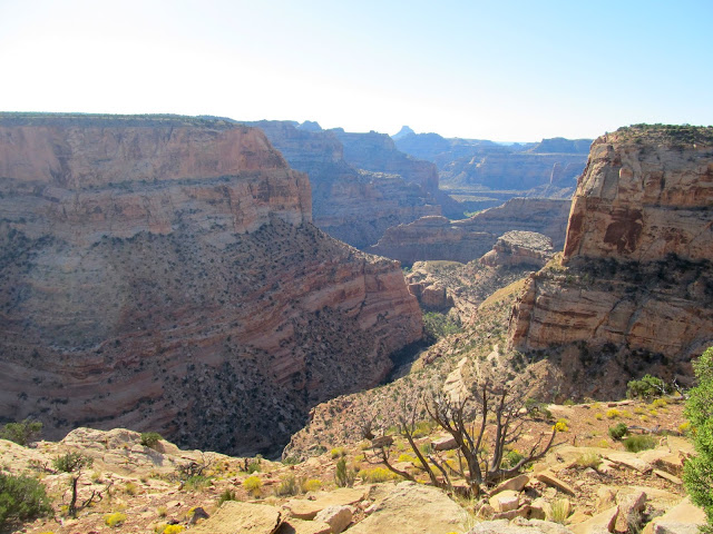
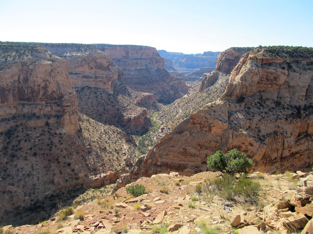
We cruised out to the Wedge and had dull gray skies for most of the drive. One of the best camp spots at the Wedge Overlook was empty so we grabbed it and then hopped on our mountain bikes for a ride along the rim of the Little Grand Canyon. The sun poked out of the clouds near the horizon and lit everything up nicely. Another rainbow appeared to the east shortly before it rained on us. We hurried back to the camp spot but when we got there the rain had pretty much stopped.
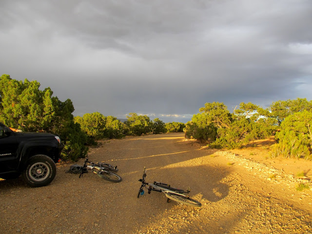
Ready for a short ride at the Wedge Overlook
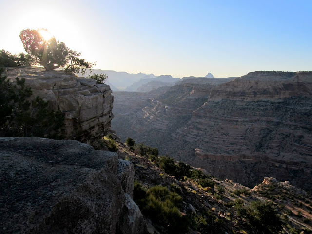
Little Grand Canyon
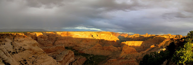
Wedge panorama
Rainbow at the Wedge Overlook
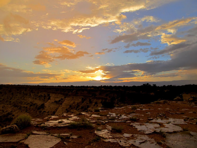
Sunset
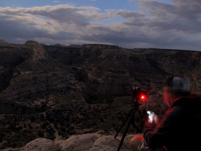
Around a campfire we ate, drank, bullshitted, and occasionally walked a short distance to the canyon rim for some night photos. There was lightning far off on the south horizon but, to our disappointment, it never got close enough to photograph. It was around 11:00 when we started setting up tents and midnight when we turned in for the night.
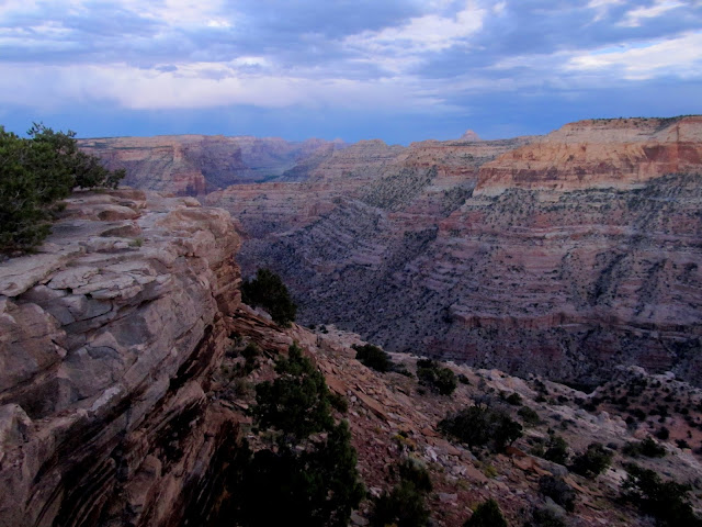
Little Grand Canyon
Bill taking a photo
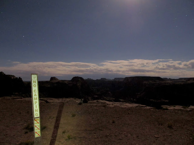
No Camping
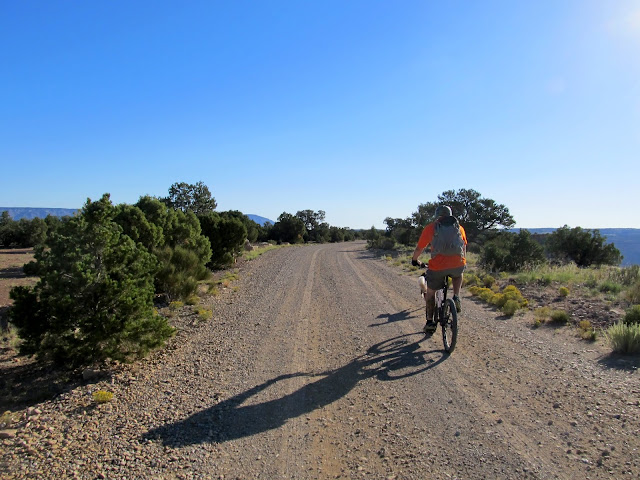
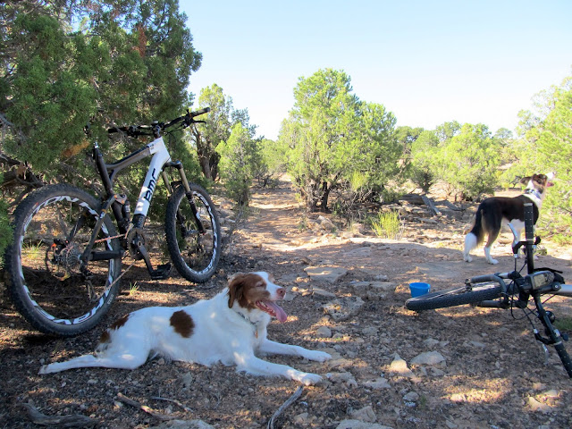
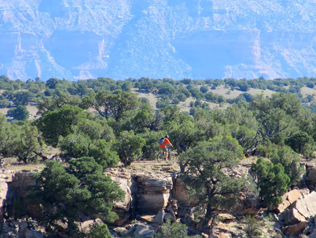
A little after 7:00AM we rose and slowly packed up camp while eating breakfast. By 9:00 we were riding east on the gravel road toward the singletrack that winds around the rim of Good Water Canyon. The trail had recently had some work done on it, and it was very similar in difficulty to the trails I'm used to riding near Price. The dogs had no problem keeping up. With Torrey's propensity toward alwaying being in the lead, I rarely saw her for much of the ride because I was bringing up the rear.
Morning at the Wedge Overlook
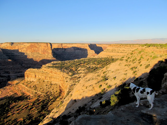
Little Grand Canyon morning
Riding toward the start of the singletrack
Good Water Rim Trail
Little Grand Canyon
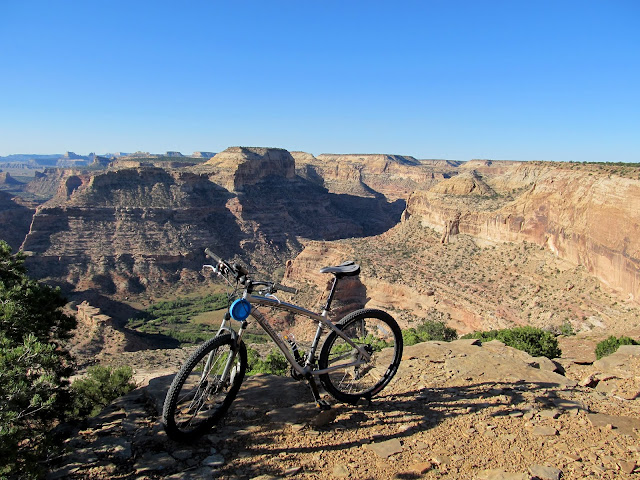
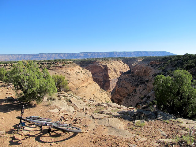
Good Water Canyon
Good Water Canyon
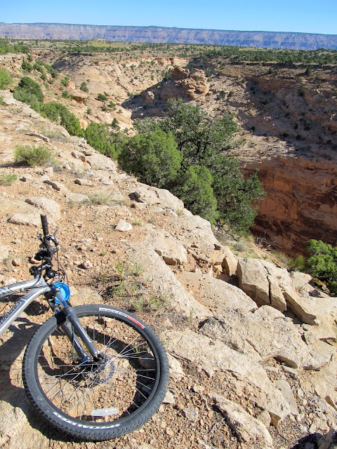
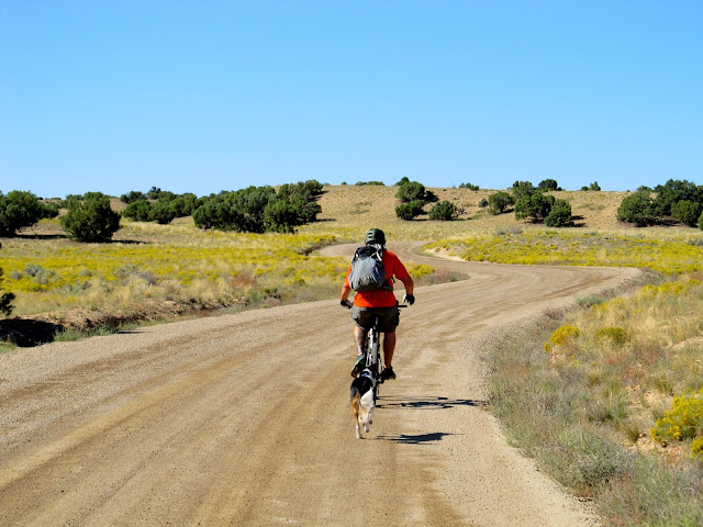
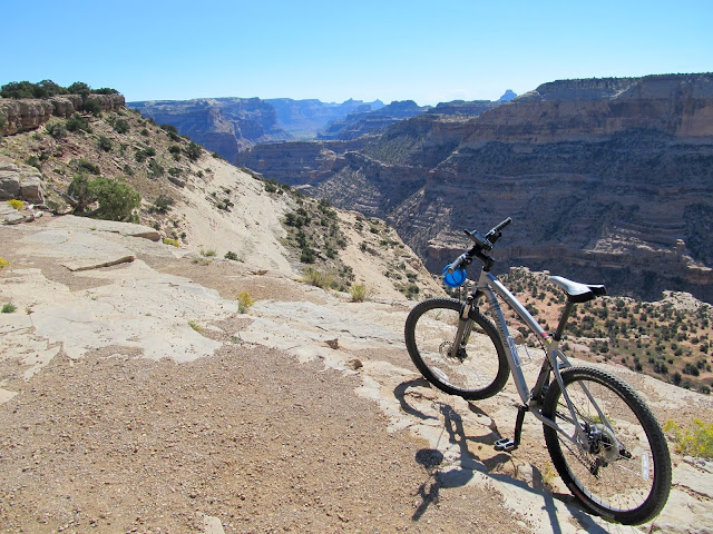
We rode about seven miles of singletrack, then jumped on the main gravel road and followed it back to camp for a total of about 10 miles. For such a short trip--I was only gone from home for about 20 hours--it was packed with fun.
Stopped to let the doggies rest
Bill
Good Water Canyon
Good Water Canyon
Riding the road back to the Wedge Overlook
Back at the Wedge Overlook
Seepage from where a tree reached out and got me
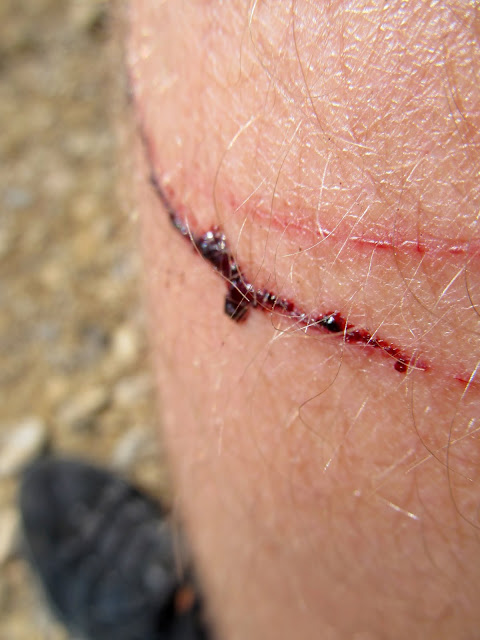
Photo Gallery: Good Water Rim @ the Wedge
GPS Tracklog and Photo Waypoints:
[Google Earth KMZ] [Google Maps] [Gmap4 Topo]
Featured image for home page:

Torrey and Moki getting acquainted in Price before heading down to the Wedge
Paint Road rainbow
Paint Road
Rainbow
We cruised out to the Wedge and had dull gray skies for most of the drive. One of the best camp spots at the Wedge Overlook was empty so we grabbed it and then hopped on our mountain bikes for a ride along the rim of the Little Grand Canyon. The sun poked out of the clouds near the horizon and lit everything up nicely. Another rainbow appeared to the east shortly before it rained on us. We hurried back to the camp spot but when we got there the rain had pretty much stopped.
Ready for a short ride at the Wedge Overlook
Little Grand Canyon
Wedge panorama
Rainbow at the Wedge Overlook
Sunset
Around a campfire we ate, drank, bullshitted, and occasionally walked a short distance to the canyon rim for some night photos. There was lightning far off on the south horizon but, to our disappointment, it never got close enough to photograph. It was around 11:00 when we started setting up tents and midnight when we turned in for the night.
Little Grand Canyon
Bill taking a photo
No Camping
A little after 7:00AM we rose and slowly packed up camp while eating breakfast. By 9:00 we were riding east on the gravel road toward the singletrack that winds around the rim of Good Water Canyon. The trail had recently had some work done on it, and it was very similar in difficulty to the trails I'm used to riding near Price. The dogs had no problem keeping up. With Torrey's propensity toward alwaying being in the lead, I rarely saw her for much of the ride because I was bringing up the rear.
Morning at the Wedge Overlook
Little Grand Canyon morning
Riding toward the start of the singletrack
Good Water Rim Trail
Little Grand Canyon
Good Water Canyon
Good Water Canyon
We rode about seven miles of singletrack, then jumped on the main gravel road and followed it back to camp for a total of about 10 miles. For such a short trip--I was only gone from home for about 20 hours--it was packed with fun.
Stopped to let the doggies rest
Bill
Good Water Canyon
Good Water Canyon
Riding the road back to the Wedge Overlook
Back at the Wedge Overlook
Seepage from where a tree reached out and got me
Photo Gallery: Good Water Rim @ the Wedge
GPS Tracklog and Photo Waypoints:
[Google Earth KMZ] [Google Maps] [Gmap4 Topo]
Featured image for home page: