tennistime99
Member
- Joined
- Jan 16, 2018
- Messages
- 134
A quick trip report for an in and out hike I took yesterday….
Just to whet the appetite, Mt. Rainier comes into full windshield view as you near the trail head on FR59:

At the trail head ready to hit the trail:

After a short uphill hike that gets the blood pumping right off the get-go you pass the “Entering Glacier View Wilderness” sign and come to the junction between the trail to Glacier View (left) and the trail heading towards Goat Lake, Gobblers Knob and beyond (right):

From here you follow along a ridge for a ways before descending, there is a well worn trail to the right at the start of the descent with a large broken tree across it, but this is NOT the trail, veer left towards Beljica Meadows. Does anyone else dwell on the downhill sections knowing you have to come back up them later?
A beautiful walk in the woods:

Beljica Meadows with Mt. Beljica in the background:

If “Beljica” seems like a strange name, even for an area heavily influenced with Native American names, it’s because it’s an acronym. It is the first letter from the children’s names of two men who climbed the mountain in 1897 (Burgon, Elizabeth, Lucy, Jessie, Isabel, Clara and Alex). Credit for this info goes to THIS SITE.
Another trail junction brings you to the Mount Beljica / Lake Christine trail (Trail# 249), I turned left to continue towards Gobblers Knob (Trial# 248). The sign for trail #248 is tricky to see when you are hiking in due to it’s placement behind you, most likely so it can be seen better when hiking down.


The trail continues uphill and then takes a slight descent through an open area in the dense woods, I’m not sure if this is from an old cut or if it’s natural.

Along the way there is a tree that decided to do it’s own thing, I’m sure it’s parents were appalled! ;-)

Finally at around 2.95 miles by my phone app (with some diddling around taking pictures at the lake so take that with a grain of salt) you arrive at Goat Lake. A beautiful blue/green lake with plenty of jumping fish, and an extremely vocal owl while I was there. There are great campsites along the shores, I stopped for lunch at a huge spot that to me is the best.
Goat Lake:


Huge camp area with old fire pit. I would love to know the history of this spot as the fire pit is cement with eye rings for a grill grate. There is also the remains of an old pit toilet structure not far away. There is no evidence of a road having been here but maybe it was an old shelter or patrol cabin?


Hard to tell in the photo, but this pit has square corners and some of the wood is still tight together forming a wall:

Time to fire up the fancy feast stove and make lunch! Everything tastes better in the woods:

Chilling out in the hammock waiting for the water to boil, not a bad view if I do say so myself: =)

I had a group arrive while I was sitting in the hammock eating lunch and let them know I was not staying the night, so they were welcome to set up. After a short chat I hit the trail via a cross trail from the camp to the main trail.
Back on the trail:

The trail climbs for quite a bit up and out of the Goat Lake area, definitely glad I had a short break and some food. Shortly after leaving the camp you exit Glacier View Wilderness and enter Mt. Rainier National Park:


Do this, don’t do that. Can’t you read the signs??

Some friendlier and more helpful trail signage:

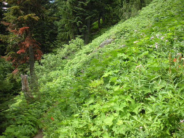
Plenty of left over wild flowers as you cross a steep slope. The overgrowth completely obscures the trail if you catch the lighting just right. On the way down I had to push plants to the side with my trekking poles to make sure I wasn’t going off trail, there was a pretty good drop off the downhill side if you missed and plenty of rocks and drops:


More signs… you can continue straight down to Lake George or turn left as I did to make the short climb to Gobblers Knob:


The climb as you head up towards Gobblers Knob:

The views really start to open up, unfortunately the clouds started to gather around Mt. Rainier. There were even some afternoon thunder and lightning storms close to the mountain. On a clearer day you can not only get an unparalleled view of Mt. Rainier but you can also see Mt. Adams and Mt. St. Helens. Having never hiked this trail before there may be more to see that I don’t know about.


Looking up the trail to my destination. The lookout tower on top of Gobblers Knob:

View of Tahoma Creek coming straight from the glacier:


After a short but steep rocky climb you’re on the summit with 360 views.


Puyallup River (left) and Tahoma Creek (right):

Looking back down towards Goat Lake where I had lunch:

Mount Rainier hiding behind her gathered up skirts:

Inside the tower:


All in all a beautiful hike with maybe a dozen people seen at most over the nearly 9 miles hiked. When I arrived at Goat Lake there were no camps set up at all, but at least 2 when I left. I think if you arrive early Saturday or late Friday you get your choice of camp spots. As for the road to the trail head, I’d recommend a high clearance vehicle with AWD or a car you really don’t care about. It’s not the worst I’ve driven, but it’s something to think about.
Thanks for reading if you made it through. lol
Just to whet the appetite, Mt. Rainier comes into full windshield view as you near the trail head on FR59:
At the trail head ready to hit the trail:
After a short uphill hike that gets the blood pumping right off the get-go you pass the “Entering Glacier View Wilderness” sign and come to the junction between the trail to Glacier View (left) and the trail heading towards Goat Lake, Gobblers Knob and beyond (right):
From here you follow along a ridge for a ways before descending, there is a well worn trail to the right at the start of the descent with a large broken tree across it, but this is NOT the trail, veer left towards Beljica Meadows. Does anyone else dwell on the downhill sections knowing you have to come back up them later?
A beautiful walk in the woods:
Beljica Meadows with Mt. Beljica in the background:
If “Beljica” seems like a strange name, even for an area heavily influenced with Native American names, it’s because it’s an acronym. It is the first letter from the children’s names of two men who climbed the mountain in 1897 (Burgon, Elizabeth, Lucy, Jessie, Isabel, Clara and Alex). Credit for this info goes to THIS SITE.
Another trail junction brings you to the Mount Beljica / Lake Christine trail (Trail# 249), I turned left to continue towards Gobblers Knob (Trial# 248). The sign for trail #248 is tricky to see when you are hiking in due to it’s placement behind you, most likely so it can be seen better when hiking down.
The trail continues uphill and then takes a slight descent through an open area in the dense woods, I’m not sure if this is from an old cut or if it’s natural.
Along the way there is a tree that decided to do it’s own thing, I’m sure it’s parents were appalled! ;-)
Finally at around 2.95 miles by my phone app (with some diddling around taking pictures at the lake so take that with a grain of salt) you arrive at Goat Lake. A beautiful blue/green lake with plenty of jumping fish, and an extremely vocal owl while I was there. There are great campsites along the shores, I stopped for lunch at a huge spot that to me is the best.
Goat Lake:
Huge camp area with old fire pit. I would love to know the history of this spot as the fire pit is cement with eye rings for a grill grate. There is also the remains of an old pit toilet structure not far away. There is no evidence of a road having been here but maybe it was an old shelter or patrol cabin?
Hard to tell in the photo, but this pit has square corners and some of the wood is still tight together forming a wall:
Time to fire up the fancy feast stove and make lunch! Everything tastes better in the woods:
Chilling out in the hammock waiting for the water to boil, not a bad view if I do say so myself: =)
I had a group arrive while I was sitting in the hammock eating lunch and let them know I was not staying the night, so they were welcome to set up. After a short chat I hit the trail via a cross trail from the camp to the main trail.
Back on the trail:
The trail climbs for quite a bit up and out of the Goat Lake area, definitely glad I had a short break and some food. Shortly after leaving the camp you exit Glacier View Wilderness and enter Mt. Rainier National Park:
Do this, don’t do that. Can’t you read the signs??
Some friendlier and more helpful trail signage:
Plenty of left over wild flowers as you cross a steep slope. The overgrowth completely obscures the trail if you catch the lighting just right. On the way down I had to push plants to the side with my trekking poles to make sure I wasn’t going off trail, there was a pretty good drop off the downhill side if you missed and plenty of rocks and drops:
More signs… you can continue straight down to Lake George or turn left as I did to make the short climb to Gobblers Knob:
The climb as you head up towards Gobblers Knob:
The views really start to open up, unfortunately the clouds started to gather around Mt. Rainier. There were even some afternoon thunder and lightning storms close to the mountain. On a clearer day you can not only get an unparalleled view of Mt. Rainier but you can also see Mt. Adams and Mt. St. Helens. Having never hiked this trail before there may be more to see that I don’t know about.
Looking up the trail to my destination. The lookout tower on top of Gobblers Knob:
View of Tahoma Creek coming straight from the glacier:
After a short but steep rocky climb you’re on the summit with 360 views.
Puyallup River (left) and Tahoma Creek (right):
Looking back down towards Goat Lake where I had lunch:
Mount Rainier hiding behind her gathered up skirts:
Inside the tower:
All in all a beautiful hike with maybe a dozen people seen at most over the nearly 9 miles hiked. When I arrived at Goat Lake there were no camps set up at all, but at least 2 when I left. I think if you arrive early Saturday or late Friday you get your choice of camp spots. As for the road to the trail head, I’d recommend a high clearance vehicle with AWD or a car you really don’t care about. It’s not the worst I’ve driven, but it’s something to think about.
Thanks for reading if you made it through. lol
Last edited:
")