chandlerwest
Member
- Joined
- Feb 7, 2015
- Messages
- 550
It's time for our annual June trip to Glacier National Park. As some of you may recall, in Aug/Sept 2017 the Sprague Fire burnt vast areas and substantially damaged the historic Sperry Chalet. During the summers of 2016 and 2017 @Jeffrey Chandler and I had essentially hiked every mile of trail within the fire zone. The first thing we wanted to do was get up into the fire zone and assess the damage.
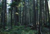
We started out in the mystical forest near Lake McDonald Lodge. I was on pins and needles a year ago hoping that the fire wouldn't get to these magical woods.
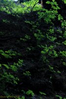
It wasn't long before we hit the edge of the fire area. Jeff spotted this green life against the black soil.
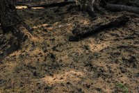
The ground and trail was covered by a blanket of needles.
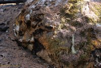
This is a huge moss covered rock that has been burnt.
We were pleasantly surprised that we had a canopy. The forest wasn't completely destroyed to the ground as it seemed to be in the 2015 Reynold's Creek fire on the east side of the park.
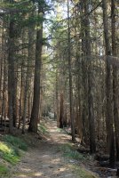
Burn to the left. Burn to the right. Greenway cutting through it!
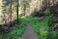
We finally had some openings across the valley and could see the mosaic burn pattern.
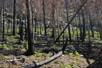
Looking into the forest you could see the renewal of life. You could see into the forest now to once hidden rock ledges and walls.
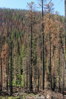
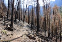
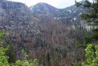
The farther up the valley you get that the devastation comes more apparent. Looking across to the wall that the fire went up like a chimney and escaped into the Lincoln Drainage.
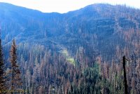
We lost our canopy.
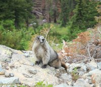
This marmot probably waited the fire out safely underground.
The scaffold remains of Sperry Chalet. The main building built in the 1920's was completely gutted with only the rock outside walls remaining. Before snow hit they reinforced the walls to facilitate surviving the winter. They plan to rebuild the structure during the summers of 2018 and 2019.
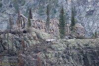
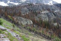
The fire in this upper basin, below the Chalet was complete. I could imagine the terror of the handful of people tasked to save the complex looking down on it when it was ablaze.
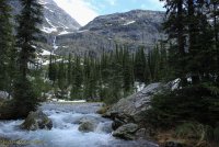
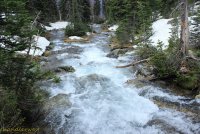
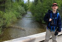
To get up to the Chalet would require strenuous trudging uphill in snow and we were both good with skipping that. So we had lunch on the bridge crossing Sprague Creek, which @Jeffrey Chandler declared "freakin' beautiful" at the top of his lungs.
Glacier lilies.
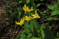
There was a bit of wet weather on the way out but that just added to the stark beauty of the landscape.
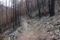
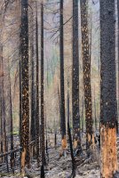
This captures why I was afraid for this area. I know it has to burn eventually. Hopefully after I am dead.
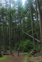
The next day was a rainy day, but by 2:00 we decided to go to Avalanche Lake. This is a short hike through another tremendous forest that is made all the more brilliant by a dark overcast day. The rains seemed to bring the waterfalls alive, along with a dusting of snow up high.
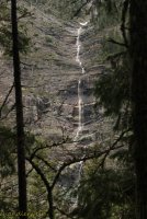
I love this spill over channel that only gets used in early season. This channel has happened in recent history.....during my time in the park.
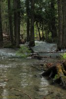
Got to love the ferns popping out of the dark background.
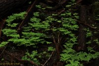
There was quite the animated discussion while going through this section. It seemed like a Very good year for the lichen/moss growth on the trees. There is a perceived luminescence about it. As if it would glow at night. Jeff said......like in Avatar. We both decided that we didn't need to come back at night to confirm this. It was best to simply "know" that it glows.
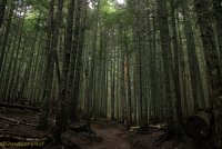
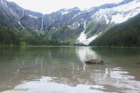
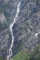
Good ole Avalanche Lake. This trail is probably the 2nd most popular in the park (after Hidden Lake). With its waterfalls that spring from Sperry Glacier above and its reflections.
Jeff goes "Dad" and points behind us. Mt. Cannon was breaking out in glory with its dusting of new snow. I want to remember that I gave him a high five for this catch!
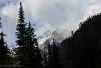
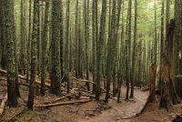
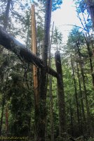
This was our Bigfoot sighting. How can something like this simply happen in nature?!! Ha! We are thinking a tree snapped off then the top half split the neighboring tree then balanced itself in the wedge.
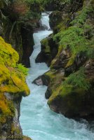
Avalanche Gorge
On the drive out we were fortunate that this black bear "lumbered" out of the ditch and into the woods
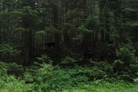
After two days of intermittent rains we had a window of clear weather to.......................do some adventurous exploration. A problem with Glacier in June after a couple days of rain this translates into WIND. Especially on the east side. We decided to explore the Appistoki Basin in the Two Medicine Valley. This is a treeless drainage (Did somebody say Wind?). It was a crusty morning with snow and ice and once again.....wind.
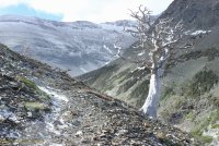
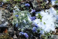
We had a passive goal of getting above a waterfall at the head of the valley but knew there had to be some sort of barrier before there. @Jeffrey Chandler waiting out a wind gust. Or maybe just waiting for me to catch my old butt up. No....it was a wind gust.
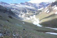
We got to a side drainage that was mostly a snow bridge over the creek. I felt confident about one crossing but Jeff hated it. He felt confident about another spot but I didn't like that. It was decided "what different would we see if we went on?" We didn't see us getting up to the basin above the waterfall so we heading back out. Did I say it was cold and Windy.
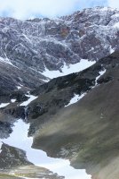
Have I ever mentioned my relationship with Rising Wolf Mountain. For decades I admired to the point of worshiping this mountain. It is such a huge mass of mountain! You can circumnavigate it on a trail which.....is so cool. A couple years back I hear....."you know---that summit we see is a false summit." I went " get out of here, no way." With research I could not deny his claim. For decades I had worship on my knees to a false god. The true summit is the tall Thing on the far left. (This only adds to my mythology of Rising Wolf Mountain.) Check out that mountain in the far distance. It remained shrouded in blowing snow most of our day.
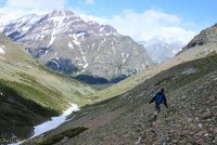
Then there is the obligatory visit to Running Eagle Falls. I believe that a great addition to the park would be trail the leads to the spot in the creek where in the late summer ALL this water goes underground to emerge from the bottom opening.
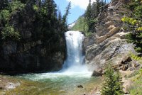
This stretch of creek stood out because it isn't red/earth tones.
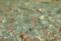
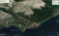
The crux of our week was a climb of Otokomi Mountain. 3,400 feet of talus slopes. We weren't sure how it would go but we enthusiastically took off. This Google Earth screenshot comes close to our day. We became a victim of (lets say it all together) WIND. Sure the rocks were an absolute bitch but in the end it was the Wind.
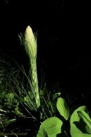
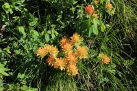
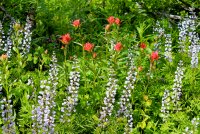
A quiet interlude, as we walked the 1.5 miles on the trail. Beargrass and Indian Paintbrush.
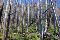
This climb through the forest was the fun part.
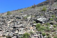
Then there is the 1,500 vertical feet of talus slope of every size imaginable. Of pitches from "okay" to "oh Geez Man". On the lower slope there were the wind gust that would rip at you so the only defense was to steel yourself until it hopefully passed. I lost count of the number of times I cussed out the wind. Once a scream of "JESUS CHRIST" came through the gale from Jeff.
Mt. Siyeh shows itself up the drainage. It is so huge that it is actually a couple drainages over.
That is Jeff up ahead. It was next to impossible to communicate because of the wind. At one point I got the thought in my head that my glasses could be ripped off head and be in St. Mary Lake before I realized that they were gone. So I put them in my bag. They were snot encrusted any way.
Through the wind I heard "DAD". I looked up and saw Jeff animatedly point behind me. I turn to see a grizzly bear below me in the area we had just travailed. It bounced around unsure of which direction it wanted to go. I didn't care for its indecision because that meant the all options were still on the table. It finally bounded off to the north. The whole encounter lasted maybe 15 seconds. In that time I thought, "what beautiful red fir blowing in the wind" "he could be bigger" "why would he want to come up this slope to us" "bear spray is useless in this wind". Neither of us got a photo of it. We sat down and got our stories straight like we were witnesses to a crime. Jeff thought the bear was 20 feet below me. I said "no way!!!!!" Jeff was above me and the bear was below me on a strong pitch so perspective had to have been skewed. (We were measuring distances out on a trail a couple days later trying to get our story right.) I think we have settled on 50-100 feet. Anyway.....it was exciting!
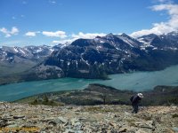
The Goat Lake Basin. If we had made it to the summit we would have been able to look directly into this. The lake would have been frozen but it would have been marvelous.
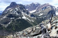
We got together again to discuss what we should do. Jeff was feeling the effects of the climb. I was in denial. I felt pretty good. I attributed this to constantly having to brace against the wind or forestall a slip on the rocks so my cardio was keeping pretty well in check. But we agreed that our wind had turned into a sustained wind that would only get worse once we hit the higher ridgeline. And the terrain looked the same ahead for the immediate future. So we decided to call it a day.....(damn we still had to get off this mountain. and rocks slide more going down.) I looked around and realized that we actually HAD made it to the ridgeline. I said "I'm going over there". Jeff took this picture half expecting me to be carried over the edge by the wind.
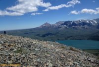
I waived for him to follow and we got to share a half hug at the top of our world!!
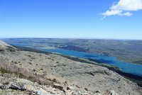
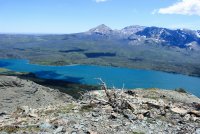
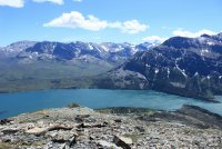
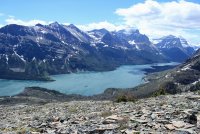
Mt. Jackson and Gunsight Pass way in the distance. Then Little Chief Mountain.
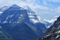
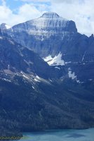
Silver Dollar Beach. When I walked the South St. Mary Trail a few years ago it was 9 miles from either trailhead with no obvious/nice way to get to it.
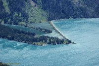
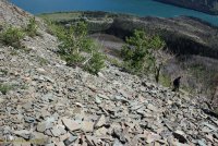
Down we go on legs that are sure to get more rubbery.
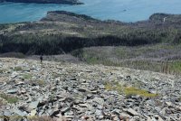
That speck is Wild Goose Island. Probably the most photographed place in the park. But rarely from this perspective.
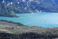
Like going downhill on fine china
We get back to the trail and start to discuss our vision problems. Coming down I had taken my glasses out of my bag but I saw no better. They were dried snot encrusted so I tried to clean them but doing this with a sweaty shirt didn't really work so I gave up on them. We got back to the trail and used water and I tried to find a dry cloth to wipe and it really didn't matter. Jeff had been talking about "sun burned eyes" and I had sort of dismissed it. But I was beginning to understand. My eye sight was like I was in a dream sequence on TV. In a clouded tunnel. We laughed a lot about walking down the trail blind. How I got this flower in focus is a miracle.
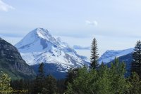
Then I when I jumped behind the wheel of the car...........we laughed a lot. I could see, sort of, kinda okay. It was just messed up!!!! This Mt. Jackson in the late afternoon sun.
On the way back to the cabin we got this view of the back side of Otokomi Mountain. Using Google Earth and my photos we are confident that we got to the left snow field just above the teepee. We believe we were 1 miles and 1,000 vertical feet from the true summit.
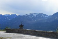
The next day was a chill day. Jeff finally humored me with a hike to Howe Lake. It has always been on my short list but the North Fork area of Glacier held no pull on him. The trailhead is 5 miles up the Inside North Fork Road.
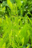
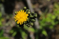
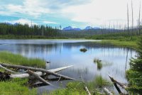
"There dad you got to Howe Lake!" I said "This picture made it all worth it!"
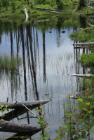
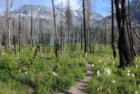
On the way out Jeff's opinion seemed to transform. He started to recognize the bio diversity. We walked through a Larch forest. A deciduous conifer. Needles turn yellow in the autumn and fall off.
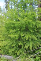
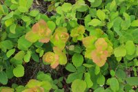
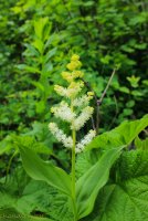
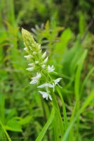
I am going the let this White Bog Orchid represent the contributing character of our week. Maybe played even a larger roll than the Wind. You are walking down the trail and there are mosquitoes. But you are walking and they are trying to keep up. But when you stop to take a picture they swarm around your head like in a cartoon. These photos exact a heavy toll. My goal was to simply handle the mosquitoes better than Jeff. Which.....was pretty easy to do! This Bog Orchid is really small so it took a bit longer to get in focus and the swarm was happening. One got behind my glasses and I could feel each of its legs walking on my eyebrow. I finally get the shot taken and animatedly went berserk. Have I conveyed that we had a fun time on this trip?
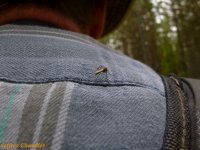
We then drove to the north end of the Inside the North Fork Road when we could drive down it 8 miles to Logging Creek. By this time Jeff was full blown into the day! This was the start of the Hidden Meadow Trail. Jeff took the shot of a dinosaur on my back.
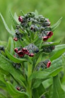
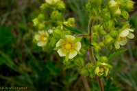
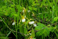
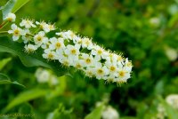
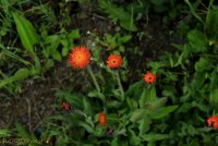
This flower has created quite a dialog on my Facebook post with family trying to figure out what it is. When I saw it, I took a step back because it seemed "different". I think it is Houndstongue. A toxic weed that "should be eradicated if seen". Is that cool or what?!
Hidden Meadow had a little lake and wildflowers included the red Prairie Smokes which I don't remember seeing in such abundance or in this crazy stage.
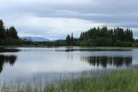
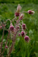
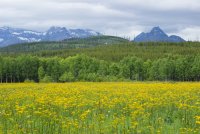
Then there was a short hike to Covey Meadow where Jeff swallowed the hook. Wildflowers, aspen trees, jagged North Fork mountains. Only an elk could make the view better.
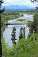
The Polebridge........bridge. The North Fork of the Flathead River.
The Livingston Range from the drive back to the cabin.
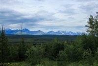
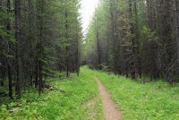
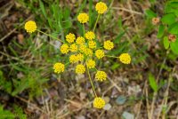
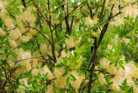
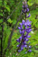
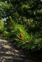
Driving back Jeff came up with what we would do on our last day. The Inside the North Fork Road is a 28 mile, single track road. An array of fires have gone through the area over the last century so the eco system is constantly changing at the whim of the fires and subsequent regrowth. The Road is open 6 miles on the south end and 8 miles from the north end. The middle third has been closed for construction for at least 3 years. We should hike that section Jeff said. Hearing those words from him.........lets just say I Never thought I would hear those words from him. We researched how long the section was and knew it was too long to day hike from one location. I suggested we start from opposite ends and swap the car keys along the way. He expressed doubt about driving a couple narrow cliff areas and I then became nervous about him driving. Who would wants a novice to meet a large pickup on a blind curve with a hundred foot drop on one side when the road width is 2 inches wider than the truck. So we started at Camas Creek on the south end and walked until we decided to turn around. I decided to document every wildflower we came across. A rough count was 30 wildflowers. Probably that many species of trees.
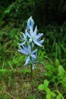
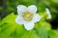
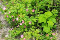
We located the unmarked trailhead for the Dutch Creek Drainage. The 10 mile trail is still official but is slowly being reclaimed by the land.
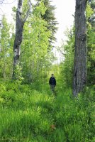
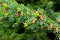
We came across a grove of Ponderosa Pines which I stood in awe. They aren't something you "just see" in Glacier. The 2nd picture is a completely different type of forest across the road from the Ponderosa
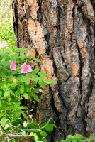
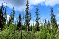
Our turnaround point was Anaconda Creek. The only word I have for Jeff's reaction to being there is "cute". It was as if he had found Eldorado. Or a land before time. He started calculating how few people would bother to get here with the road closed. That this drainage once had a trail into it "it is on your 1968 map" but this access has vanished decades ago. I asked him if he wanted to drink from the holy waters. Standing on the bridge warranted another half hug!!!!!!!
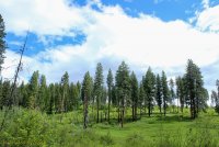
A hillside of Ponderosa
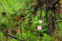
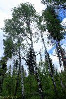
Walking the road Jeff said "if you would have said a week ago that we would be doing this I would have thought you crazy!" Less than a quarter mile from the car it started to pea size hail on us. We could do nothing but laugh!
Thank you for the time it took to get through this!
@chandlerwest and @Jeffrey Chandler
We started out in the mystical forest near Lake McDonald Lodge. I was on pins and needles a year ago hoping that the fire wouldn't get to these magical woods.

It wasn't long before we hit the edge of the fire area. Jeff spotted this green life against the black soil.

The ground and trail was covered by a blanket of needles.

This is a huge moss covered rock that has been burnt.

We were pleasantly surprised that we had a canopy. The forest wasn't completely destroyed to the ground as it seemed to be in the 2015 Reynold's Creek fire on the east side of the park.

Burn to the left. Burn to the right. Greenway cutting through it!

We finally had some openings across the valley and could see the mosaic burn pattern.

Looking into the forest you could see the renewal of life. You could see into the forest now to once hidden rock ledges and walls.

The farther up the valley you get that the devastation comes more apparent. Looking across to the wall that the fire went up like a chimney and escaped into the Lincoln Drainage.

We lost our canopy.


This marmot probably waited the fire out safely underground.

The scaffold remains of Sperry Chalet. The main building built in the 1920's was completely gutted with only the rock outside walls remaining. Before snow hit they reinforced the walls to facilitate surviving the winter. They plan to rebuild the structure during the summers of 2018 and 2019.

The fire in this upper basin, below the Chalet was complete. I could imagine the terror of the handful of people tasked to save the complex looking down on it when it was ablaze.

To get up to the Chalet would require strenuous trudging uphill in snow and we were both good with skipping that. So we had lunch on the bridge crossing Sprague Creek, which @Jeffrey Chandler declared "freakin' beautiful" at the top of his lungs.


Glacier lilies.

There was a bit of wet weather on the way out but that just added to the stark beauty of the landscape.


This captures why I was afraid for this area. I know it has to burn eventually. Hopefully after I am dead.

The next day was a rainy day, but by 2:00 we decided to go to Avalanche Lake. This is a short hike through another tremendous forest that is made all the more brilliant by a dark overcast day. The rains seemed to bring the waterfalls alive, along with a dusting of snow up high.

I love this spill over channel that only gets used in early season. This channel has happened in recent history.....during my time in the park.

Got to love the ferns popping out of the dark background.

There was quite the animated discussion while going through this section. It seemed like a Very good year for the lichen/moss growth on the trees. There is a perceived luminescence about it. As if it would glow at night. Jeff said......like in Avatar. We both decided that we didn't need to come back at night to confirm this. It was best to simply "know" that it glows.

Good ole Avalanche Lake. This trail is probably the 2nd most popular in the park (after Hidden Lake). With its waterfalls that spring from Sperry Glacier above and its reflections.


Jeff goes "Dad" and points behind us. Mt. Cannon was breaking out in glory with its dusting of new snow. I want to remember that I gave him a high five for this catch!


This was our Bigfoot sighting. How can something like this simply happen in nature?!! Ha! We are thinking a tree snapped off then the top half split the neighboring tree then balanced itself in the wedge.

Avalanche Gorge

On the drive out we were fortunate that this black bear "lumbered" out of the ditch and into the woods

After two days of intermittent rains we had a window of clear weather to.......................do some adventurous exploration. A problem with Glacier in June after a couple days of rain this translates into WIND. Especially on the east side. We decided to explore the Appistoki Basin in the Two Medicine Valley. This is a treeless drainage (Did somebody say Wind?). It was a crusty morning with snow and ice and once again.....wind.


We had a passive goal of getting above a waterfall at the head of the valley but knew there had to be some sort of barrier before there. @Jeffrey Chandler waiting out a wind gust. Or maybe just waiting for me to catch my old butt up. No....it was a wind gust.

We got to a side drainage that was mostly a snow bridge over the creek. I felt confident about one crossing but Jeff hated it. He felt confident about another spot but I didn't like that. It was decided "what different would we see if we went on?" We didn't see us getting up to the basin above the waterfall so we heading back out. Did I say it was cold and Windy.

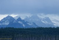
Have I ever mentioned my relationship with Rising Wolf Mountain. For decades I admired to the point of worshiping this mountain. It is such a huge mass of mountain! You can circumnavigate it on a trail which.....is so cool. A couple years back I hear....."you know---that summit we see is a false summit." I went " get out of here, no way." With research I could not deny his claim. For decades I had worship on my knees to a false god. The true summit is the tall Thing on the far left. (This only adds to my mythology of Rising Wolf Mountain.) Check out that mountain in the far distance. It remained shrouded in blowing snow most of our day.

Then there is the obligatory visit to Running Eagle Falls. I believe that a great addition to the park would be trail the leads to the spot in the creek where in the late summer ALL this water goes underground to emerge from the bottom opening.

This stretch of creek stood out because it isn't red/earth tones.

The crux of our week was a climb of Otokomi Mountain. 3,400 feet of talus slopes. We weren't sure how it would go but we enthusiastically took off. This Google Earth screenshot comes close to our day. We became a victim of (lets say it all together) WIND. Sure the rocks were an absolute bitch but in the end it was the Wind.

A quiet interlude, as we walked the 1.5 miles on the trail. Beargrass and Indian Paintbrush.


This climb through the forest was the fun part.

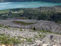
Then there is the 1,500 vertical feet of talus slope of every size imaginable. Of pitches from "okay" to "oh Geez Man". On the lower slope there were the wind gust that would rip at you so the only defense was to steel yourself until it hopefully passed. I lost count of the number of times I cussed out the wind. Once a scream of "JESUS CHRIST" came through the gale from Jeff.


Mt. Siyeh shows itself up the drainage. It is so huge that it is actually a couple drainages over.

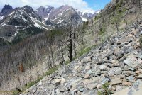
That is Jeff up ahead. It was next to impossible to communicate because of the wind. At one point I got the thought in my head that my glasses could be ripped off head and be in St. Mary Lake before I realized that they were gone. So I put them in my bag. They were snot encrusted any way.


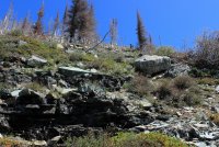
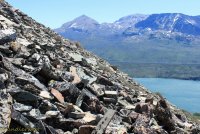
Through the wind I heard "DAD". I looked up and saw Jeff animatedly point behind me. I turn to see a grizzly bear below me in the area we had just travailed. It bounced around unsure of which direction it wanted to go. I didn't care for its indecision because that meant the all options were still on the table. It finally bounded off to the north. The whole encounter lasted maybe 15 seconds. In that time I thought, "what beautiful red fir blowing in the wind" "he could be bigger" "why would he want to come up this slope to us" "bear spray is useless in this wind". Neither of us got a photo of it. We sat down and got our stories straight like we were witnesses to a crime. Jeff thought the bear was 20 feet below me. I said "no way!!!!!" Jeff was above me and the bear was below me on a strong pitch so perspective had to have been skewed. (We were measuring distances out on a trail a couple days later trying to get our story right.) I think we have settled on 50-100 feet. Anyway.....it was exciting!

The Goat Lake Basin. If we had made it to the summit we would have been able to look directly into this. The lake would have been frozen but it would have been marvelous.

We got together again to discuss what we should do. Jeff was feeling the effects of the climb. I was in denial. I felt pretty good. I attributed this to constantly having to brace against the wind or forestall a slip on the rocks so my cardio was keeping pretty well in check. But we agreed that our wind had turned into a sustained wind that would only get worse once we hit the higher ridgeline. And the terrain looked the same ahead for the immediate future. So we decided to call it a day.....(damn we still had to get off this mountain. and rocks slide more going down.) I looked around and realized that we actually HAD made it to the ridgeline. I said "I'm going over there". Jeff took this picture half expecting me to be carried over the edge by the wind.

I waived for him to follow and we got to share a half hug at the top of our world!!


Mt. Jackson and Gunsight Pass way in the distance. Then Little Chief Mountain.


Silver Dollar Beach. When I walked the South St. Mary Trail a few years ago it was 9 miles from either trailhead with no obvious/nice way to get to it.

Down we go on legs that are sure to get more rubbery.

That speck is Wild Goose Island. Probably the most photographed place in the park. But rarely from this perspective.

Like going downhill on fine china

We get back to the trail and start to discuss our vision problems. Coming down I had taken my glasses out of my bag but I saw no better. They were dried snot encrusted so I tried to clean them but doing this with a sweaty shirt didn't really work so I gave up on them. We got back to the trail and used water and I tried to find a dry cloth to wipe and it really didn't matter. Jeff had been talking about "sun burned eyes" and I had sort of dismissed it. But I was beginning to understand. My eye sight was like I was in a dream sequence on TV. In a clouded tunnel. We laughed a lot about walking down the trail blind. How I got this flower in focus is a miracle.


Then I when I jumped behind the wheel of the car...........we laughed a lot. I could see, sort of, kinda okay. It was just messed up!!!! This Mt. Jackson in the late afternoon sun.

On the way back to the cabin we got this view of the back side of Otokomi Mountain. Using Google Earth and my photos we are confident that we got to the left snow field just above the teepee. We believe we were 1 miles and 1,000 vertical feet from the true summit.

The next day was a chill day. Jeff finally humored me with a hike to Howe Lake. It has always been on my short list but the North Fork area of Glacier held no pull on him. The trailhead is 5 miles up the Inside North Fork Road.


"There dad you got to Howe Lake!" I said "This picture made it all worth it!"

On the way out Jeff's opinion seemed to transform. He started to recognize the bio diversity. We walked through a Larch forest. A deciduous conifer. Needles turn yellow in the autumn and fall off.


I am going the let this White Bog Orchid represent the contributing character of our week. Maybe played even a larger roll than the Wind. You are walking down the trail and there are mosquitoes. But you are walking and they are trying to keep up. But when you stop to take a picture they swarm around your head like in a cartoon. These photos exact a heavy toll. My goal was to simply handle the mosquitoes better than Jeff. Which.....was pretty easy to do! This Bog Orchid is really small so it took a bit longer to get in focus and the swarm was happening. One got behind my glasses and I could feel each of its legs walking on my eyebrow. I finally get the shot taken and animatedly went berserk. Have I conveyed that we had a fun time on this trip?

We then drove to the north end of the Inside the North Fork Road when we could drive down it 8 miles to Logging Creek. By this time Jeff was full blown into the day! This was the start of the Hidden Meadow Trail. Jeff took the shot of a dinosaur on my back.


This flower has created quite a dialog on my Facebook post with family trying to figure out what it is. When I saw it, I took a step back because it seemed "different". I think it is Houndstongue. A toxic weed that "should be eradicated if seen". Is that cool or what?!

Hidden Meadow had a little lake and wildflowers included the red Prairie Smokes which I don't remember seeing in such abundance or in this crazy stage.


Then there was a short hike to Covey Meadow where Jeff swallowed the hook. Wildflowers, aspen trees, jagged North Fork mountains. Only an elk could make the view better.

The Polebridge........bridge. The North Fork of the Flathead River.

The Livingston Range from the drive back to the cabin.

Driving back Jeff came up with what we would do on our last day. The Inside the North Fork Road is a 28 mile, single track road. An array of fires have gone through the area over the last century so the eco system is constantly changing at the whim of the fires and subsequent regrowth. The Road is open 6 miles on the south end and 8 miles from the north end. The middle third has been closed for construction for at least 3 years. We should hike that section Jeff said. Hearing those words from him.........lets just say I Never thought I would hear those words from him. We researched how long the section was and knew it was too long to day hike from one location. I suggested we start from opposite ends and swap the car keys along the way. He expressed doubt about driving a couple narrow cliff areas and I then became nervous about him driving. Who would wants a novice to meet a large pickup on a blind curve with a hundred foot drop on one side when the road width is 2 inches wider than the truck. So we started at Camas Creek on the south end and walked until we decided to turn around. I decided to document every wildflower we came across. A rough count was 30 wildflowers. Probably that many species of trees.


We located the unmarked trailhead for the Dutch Creek Drainage. The 10 mile trail is still official but is slowly being reclaimed by the land.


We came across a grove of Ponderosa Pines which I stood in awe. They aren't something you "just see" in Glacier. The 2nd picture is a completely different type of forest across the road from the Ponderosa


Our turnaround point was Anaconda Creek. The only word I have for Jeff's reaction to being there is "cute". It was as if he had found Eldorado. Or a land before time. He started calculating how few people would bother to get here with the road closed. That this drainage once had a trail into it "it is on your 1968 map" but this access has vanished decades ago. I asked him if he wanted to drink from the holy waters. Standing on the bridge warranted another half hug!!!!!!!


A hillside of Ponderosa


Walking the road Jeff said "if you would have said a week ago that we would be doing this I would have thought you crazy!" Less than a quarter mile from the car it started to pea size hail on us. We could do nothing but laugh!
Thank you for the time it took to get through this!
@chandlerwest and @Jeffrey Chandler
Last edited:
