- Joined
- Aug 21, 2018
- Messages
- 694
If you read trip reports you have no doubt looked over the fine perspectives of @Bob and @scatman regarding our August 2025 adventure. You will also know that no one fell into a creek, no bones were broken, and we all made it out to tell our stories. If a little redundancy and awareness of our lower levels of misery are not discouragements, I hope you will read my account(s) of how things unfolded as well.
After the Hidden Creek trip of 2024 Bob started a discussion about what adventure our group might want to tackle next. There was talk of walking atop Yellowstone's Trident, but scheduling conflicts and time constraints kept that goal on the to do list. One by one the eligible participants whittled down to Bob, Hugh, and myself. Bob suggested some routes and I thought a relaxed, leisurely stroll along the Gallatin Crest sounded interesting. Somehow that morphed into the Gallatin Crest combined with Yellowstone's Sky Rim and Specimen Creek trails. . . Sky Rim had always been on my Yellowstone wish list, so I gladly traded "leisurely" for "ups and downs," and our plan was in place.
Day One: Friday, August 8, 2025
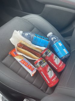
I flew into Bozeman on Friday, snagged the rental car (Dodge Hornet, not necessarily my favorite), and drove to the Specimen Creek Trailhead in Yellowstone National Park via the Gallatin Gateway. In order to fit reasonable hiking days in the time I had available we planned to hike a couple miles the day of my arrival. I usually stop in Bozeman for a late lunch/early dinner on Yellowstone trips but to be at the trailhead on time I darted in/out of a gas station for what some might consider questionable dietary choices.
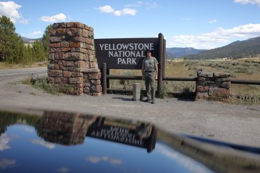
I did take a few minutes to stop at my favorite park boundary sign for a picture.
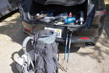
Then skedaddled down to the Specimen Creek Trailhead arriving just before the 4pm target time. I was midway thru organizing my pack when some familiar faces showed up.
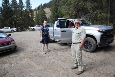
We decided to start our trip with a drive up the Portal Creek Road (a real tooth rattler!) and hike up to Windy Pass for our first night. This cut out the Northern portion of the Gallatin Crest, but it allowed enough time to cover Sky Rim/Specimen Creek. A big thank you to Bob for driving us up there and an even bigger thank you to Mrs. Bob for driving the truck back out.
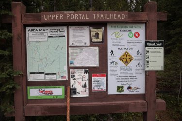
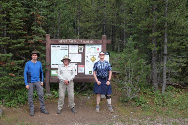
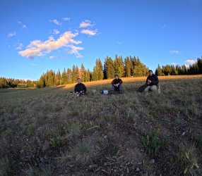
Some clean and crisp dudes at the Upper Portal Trailhead looking for adventure.
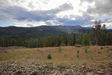
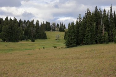
Views opened up at we climbed towards Windy Pass.
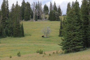
We were surprised to see this moose near the pass.
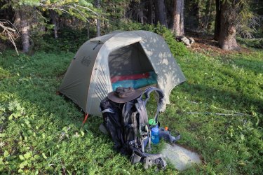
We quickly found a place to set up camp and cooked some dinner as the sun set/cool air crept in.
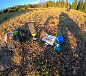
The first night's dinner was a Tuscan Sausage Pasta from Beyond Outdoor Meals. I had not tried this brand before but found it to be quite tasty. It was superior to the gas station hot dog/Payday bar I ate earlier anyway.
Day Two: Saturday, August 9, 2025

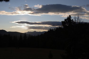
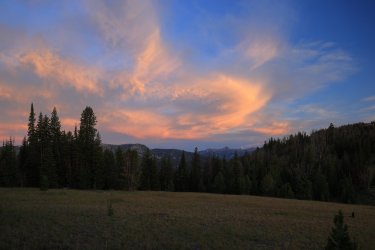
I was still on Eastern Time, so I was up early to gaze at pastel skies.
We nibbled some breakfast and then set off towards the actual ridge/crest trail. We chose to camp lower on the ridge/close to a water source for the night.
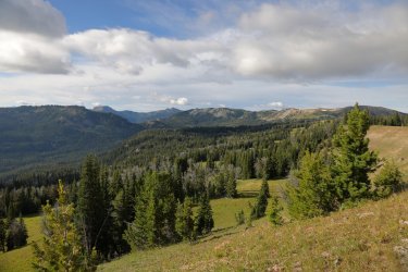
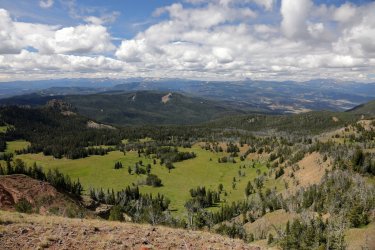
Views start to open up between the trees.
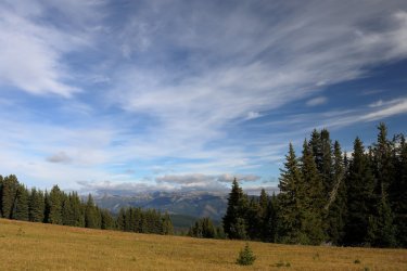
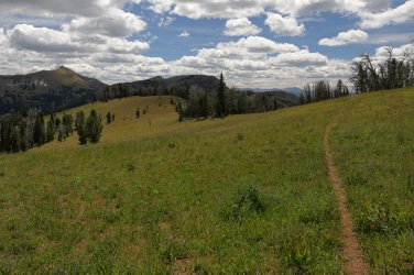
The initial trail offered easy walking with subtle elevation gains/losses.
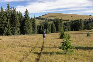
Bob said this would have been the view if we had hiked a little farther the first night/camped up on the ridge.
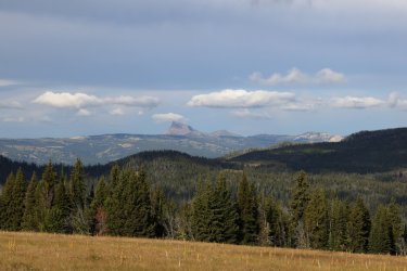
The Sphinx and Helmet would be visible all morning to the West.
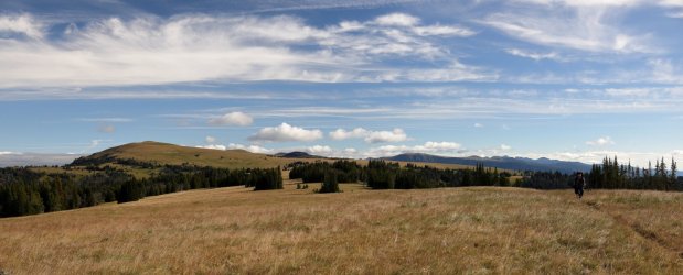
I thought the wide views lent themselves well to panicoramicas.
A little Bob for some scale.
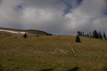
The easy walking is about to come to an end. The first big hill of the day lies ahead of us -- we would be walking up the ridge to the right of the snow.
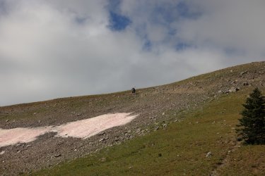
Hugh about to kick it in high gear. In a matter of moments, he will zoom by me and scamper up that first big hill.
And there he goes! I think that might be Eaglehead Mountain.
Hugh's hillside hiking prowess is a sight to behold. Like a graceful gazelle hauling a 60 pound pack, he zigged and zagged his way to the top in tens of minutes. I had to zoom in -- I think he might be taunting Bob and I!
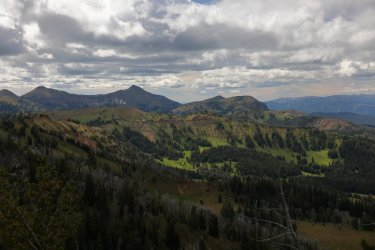
Visibility was kind to us on this day. This view was one of my favorites from the trip.
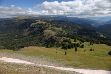
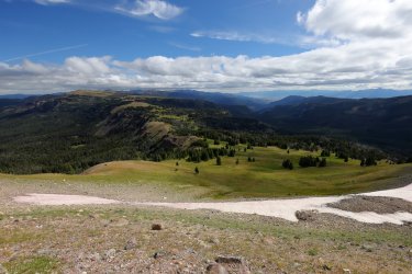
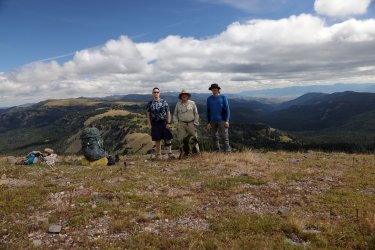
Three of us at the top. After a snack and some fresh sunscreen we kept moving forward/Southward. Obviously Bob's new hat had no negative effects on his fine head of hair.
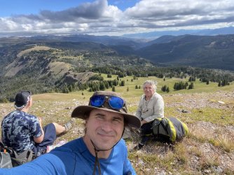
I think I had been distracted by a butterfly for a bit while Hugh and Bob kept walking. We were about to climb the next hill and encounter a change in geology with those lighter colored rocks.
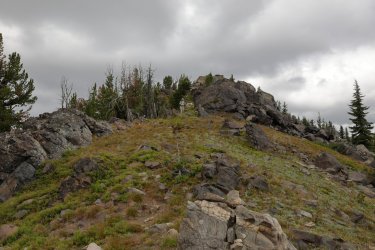
The lighter colored rocks were very different from the surrounding terrain. Might have to get out my geology book to investigate the rocks origin.
Ramshorn Peak visible in the distance. I thought the rock bands above Onion Basin had an attractive quality to them -- they get washed out in the resized image.
Bob emerging from the rocks.
Looking ahead to Hugh and the path forward.
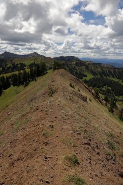
Definitely on the crest part of the Gallatin Crest Trail.
Onion Basin below. I don't recall catching the scent of onions and we were obviously too far away to see any. It looks like an inviting place where a hiker could camp for a night or three.
The trail was very cresty on this portion. The steep sides did not bother me (fear of heights!) because even if I tripped/fell I could see where I might just roll till I hit the bottom (or a tree, or a rock). It is the steep drop offs where I cannot see the bottom that get me. . . luckily none of that on this trail, right?
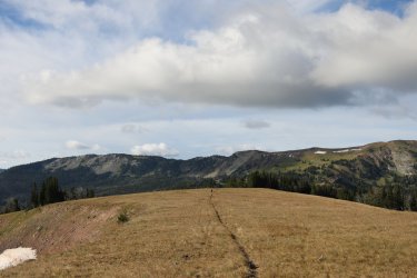
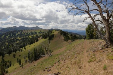
Looks like another hill to climb in our future. There was a lot of up and down on this day. . . but that is what mountains do.
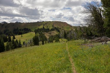
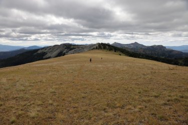
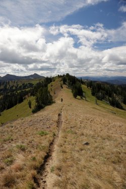
One of the things I really liked about this trip was being able to see -- both ahead and behind us -- where we would be going or where we had been. The trail was often visible for quite a distance and even when it was not you could look back and know you just crossed all those ridges. Bob is in this next picture -- find him for five bonus points!
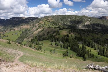
Heading down from another high spot. While Hugh excelled on the uphill portions, I was rather speedy on the downhills. Bob was always balanced and consistent, powered by a steady diet of trailside naps.
Ramshorn Peak getting closer, bathed in the warm glow of early afternoon sunlight.
Looking back towards Bob and Hugh.
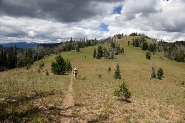
I don't think we had to climb the ridge ahead in this picture, I think the trail wound its way somewhere to the left.
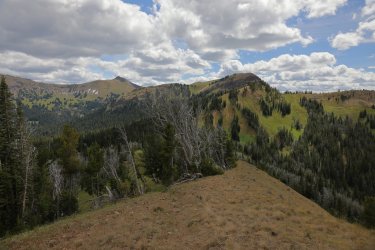
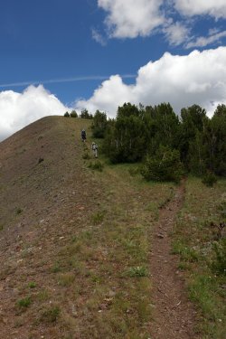
There were still parts that climbed uphill though. I can see by the look on Hugh's face that it will not be long before he overtakes me.
Getting closer to working our way around Fortress Mountain.
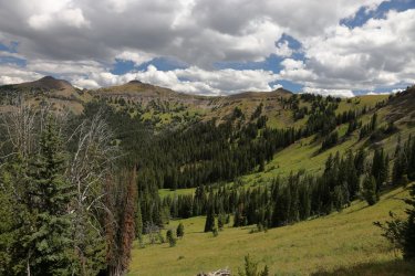
Beginning the descent from the pass near the start of Fortress Mountain. Not far from here we crossed paths with two youths on dirt bikes making their way up the trail.
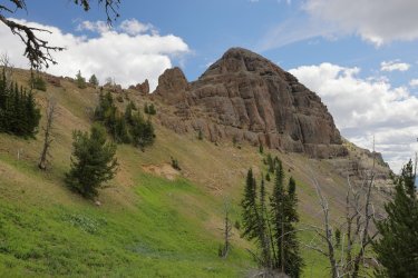
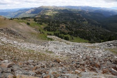
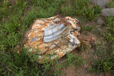
The piece of petrified wood that Bob and Hugh put in my pack to try and slow me down.  Actually, there were many large chunks just like this at the base of the crumbling hillside. Cool stuff!
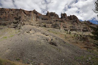
Looks fortress like, I can see how the mountain received it's name.
We began to drop in elevation on the approach to Ramshorn Lake. We would have to leave the lofty, ridgeline views behind for the night.
Bob and Hugh are ahead of me in this picture. Temperatures were rising so I stopped to take off my long-sleeved shirt, when I looked up they were specks on the trail.
Classic Bob, partaking in one of those energy booting naps mentioned earlier.
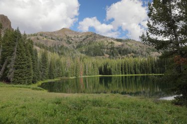
Ramshorn Lake! There were a number of people enjoying the surroundings of the lake. This would be the most peopley part of the entire trip (it was the weekend). One group already claimed the campsite Bob had picked out for us, so we settled on a respectable sight with this view of the lake.
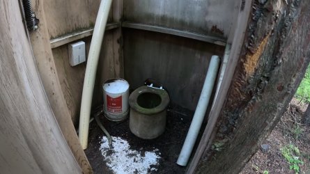
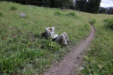
Hugh was excited about the outhouse he spotted in the trees. He put it to use and declared it functional. I walked over and investigated with the GoPro, here is a frame I pulled from the video clip. I elected not to utilize the outhouse; I was concerned the life form on the seat could result in some sort of rash.
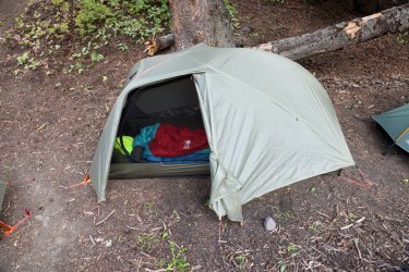
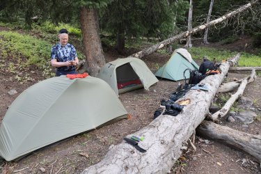
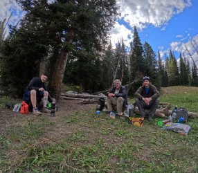
Home for the night. The available ground space meant tents in close proximity for night number two.
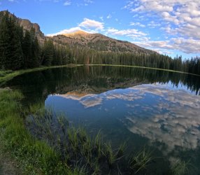
Some nice lighting and reflection on the lake as the sun set behind us.
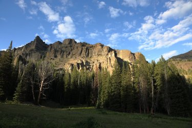
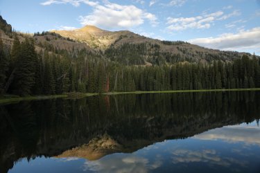
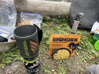
Tonight's dinner was another brand I had not tried before -- Bighorn Mountain Food. Their meals are a little pricier than the Mountain House that Bob loves, but the Carbonara Pasta was delicious and still cost less than that gas station hot dog/candy bar.
It was a long day, but a good day, and I think we all turned in early on night two. Tomorrow we started out with a climb back up to the high ground so we wanted to make sure our batteries were charged.
My trip reports tend to be a little longer/picture heavy, so I'll break this one down into two parts. If what you have read/seen intrigues you keep an eye out for part two: Bob, Hugh, and I skirt the edge of Yellowstone Park and tackle the Sky Rim Trail. We tackle more ups and downs, dance with potential dehydration, and hike a ridge line that made me nervous -- there will be video footage to prove it!
Thanks for Reading Part One!
After the Hidden Creek trip of 2024 Bob started a discussion about what adventure our group might want to tackle next. There was talk of walking atop Yellowstone's Trident, but scheduling conflicts and time constraints kept that goal on the to do list. One by one the eligible participants whittled down to Bob, Hugh, and myself. Bob suggested some routes and I thought a relaxed, leisurely stroll along the Gallatin Crest sounded interesting. Somehow that morphed into the Gallatin Crest combined with Yellowstone's Sky Rim and Specimen Creek trails. . . Sky Rim had always been on my Yellowstone wish list, so I gladly traded "leisurely" for "ups and downs," and our plan was in place.
Day One: Friday, August 8, 2025
I flew into Bozeman on Friday, snagged the rental car (Dodge Hornet, not necessarily my favorite), and drove to the Specimen Creek Trailhead in Yellowstone National Park via the Gallatin Gateway. In order to fit reasonable hiking days in the time I had available we planned to hike a couple miles the day of my arrival. I usually stop in Bozeman for a late lunch/early dinner on Yellowstone trips but to be at the trailhead on time I darted in/out of a gas station for what some might consider questionable dietary choices.
I did take a few minutes to stop at my favorite park boundary sign for a picture.
Then skedaddled down to the Specimen Creek Trailhead arriving just before the 4pm target time. I was midway thru organizing my pack when some familiar faces showed up.
We decided to start our trip with a drive up the Portal Creek Road (a real tooth rattler!) and hike up to Windy Pass for our first night. This cut out the Northern portion of the Gallatin Crest, but it allowed enough time to cover Sky Rim/Specimen Creek. A big thank you to Bob for driving us up there and an even bigger thank you to Mrs. Bob for driving the truck back out.
Some clean and crisp dudes at the Upper Portal Trailhead looking for adventure.
Views opened up at we climbed towards Windy Pass.
We were surprised to see this moose near the pass.
We quickly found a place to set up camp and cooked some dinner as the sun set/cool air crept in.
The first night's dinner was a Tuscan Sausage Pasta from Beyond Outdoor Meals. I had not tried this brand before but found it to be quite tasty. It was superior to the gas station hot dog/Payday bar I ate earlier anyway.
Day Two: Saturday, August 9, 2025
Today the goal was to hike from our camp near Windy Pass to the next reliable water source -- Ramshorn Lake. Ramshorn Lake could also be a bailout point if bad weather rolled in, an injury occurred, or if we simply grew tired of each other's company. Unlikely, but it is good to have options. I was still on Eastern Time, so I was up early to gaze at pastel skies.
We nibbled some breakfast and then set off towards the actual ridge/crest trail. We chose to camp lower on the ridge/close to a water source for the night.
Views start to open up between the trees.

The initial trail offered easy walking with subtle elevation gains/losses.

Bob said this would have been the view if we had hiked a little farther the first night/camped up on the ridge.
The Sphinx and Helmet would be visible all morning to the West.
I thought the wide views lent themselves well to panicoramicas.
A little Bob for some scale.
The easy walking is about to come to an end. The first big hill of the day lies ahead of us -- we would be walking up the ridge to the right of the snow.
Hugh about to kick it in high gear. In a matter of moments, he will zoom by me and scamper up that first big hill.
And there he goes! I think that might be Eaglehead Mountain.
Hugh's hillside hiking prowess is a sight to behold. Like a graceful gazelle hauling a 60 pound pack, he zigged and zagged his way to the top in tens of minutes. I had to zoom in -- I think he might be taunting Bob and I!
Visibility was kind to us on this day. This view was one of my favorites from the trip.

I took a minute to swap over to the wide angle lens. This one has "lobby wall potential." (I enlarge images I like and place them in my waiting/exam rooms at my office. The clients seem to like them.  )
)

Three of us at the top. After a snack and some fresh sunscreen we kept moving forward/Southward. Obviously Bob's new hat had no negative effects on his fine head of hair.


I think I had been distracted by a butterfly for a bit while Hugh and Bob kept walking. We were about to climb the next hill and encounter a change in geology with those lighter colored rocks.
The lighter colored rocks were very different from the surrounding terrain. Might have to get out my geology book to investigate the rocks origin.
Ramshorn Peak visible in the distance. I thought the rock bands above Onion Basin had an attractive quality to them -- they get washed out in the resized image.
Bob emerging from the rocks.
Looking ahead to Hugh and the path forward.
Definitely on the crest part of the Gallatin Crest Trail.
Onion Basin below. I don't recall catching the scent of onions and we were obviously too far away to see any. It looks like an inviting place where a hiker could camp for a night or three.
The trail was very cresty on this portion. The steep sides did not bother me (fear of heights!) because even if I tripped/fell I could see where I might just roll till I hit the bottom (or a tree, or a rock). It is the steep drop offs where I cannot see the bottom that get me. . . luckily none of that on this trail, right?
Looks like another hill to climb in our future. There was a lot of up and down on this day. . . but that is what mountains do.

One of the things I really liked about this trip was being able to see -- both ahead and behind us -- where we would be going or where we had been. The trail was often visible for quite a distance and even when it was not you could look back and know you just crossed all those ridges. Bob is in this next picture -- find him for five bonus points!

Ramshorn Peak getting closer, bathed in the warm glow of early afternoon sunlight.
Looking back towards Bob and Hugh.

I don't think we had to climb the ridge ahead in this picture, I think the trail wound its way somewhere to the left.

There were still parts that climbed uphill though. I can see by the look on Hugh's face that it will not be long before he overtakes me.
Getting closer to working our way around Fortress Mountain.

Beginning the descent from the pass near the start of Fortress Mountain. Not far from here we crossed paths with two youths on dirt bikes making their way up the trail.

Looks fortress like, I can see how the mountain received it's name.
We began to drop in elevation on the approach to Ramshorn Lake. We would have to leave the lofty, ridgeline views behind for the night.
Bob and Hugh are ahead of me in this picture. Temperatures were rising so I stopped to take off my long-sleeved shirt, when I looked up they were specks on the trail.
Classic Bob, partaking in one of those energy booting naps mentioned earlier.

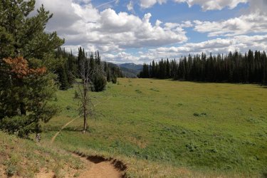
Ramshorn Lake! There were a number of people enjoying the surroundings of the lake. This would be the most peopley part of the entire trip (it was the weekend). One group already claimed the campsite Bob had picked out for us, so we settled on a respectable sight with this view of the lake.

Home for the night. The available ground space meant tents in close proximity for night number two.
Some nice lighting and reflection on the lake as the sun set behind us.


Tonight's dinner was another brand I had not tried before -- Bighorn Mountain Food. Their meals are a little pricier than the Mountain House that Bob loves, but the Carbonara Pasta was delicious and still cost less than that gas station hot dog/candy bar.


It was a long day, but a good day, and I think we all turned in early on night two. Tomorrow we started out with a climb back up to the high ground so we wanted to make sure our batteries were charged.
My trip reports tend to be a little longer/picture heavy, so I'll break this one down into two parts. If what you have read/seen intrigues you keep an eye out for part two: Bob, Hugh, and I skirt the edge of Yellowstone Park and tackle the Sky Rim Trail. We tackle more ups and downs, dance with potential dehydration, and hike a ridge line that made me nervous -- there will be video footage to prove it!
Thanks for Reading Part One!


