- Joined
- Dec 23, 2013
- Messages
- 4,285
Yesterday was the perfect day. You all know what I am talking about. You get a good night's sleep, when you wake your body (knees, hips, and feet) is feeling good, and the weather outside just invites you to be hiking.
I woke up early and drove out to Antelope Island to see if I could summit Frary, and on my way back down I decided to take the little detour over to Dooley Knob and sit up top and enjoy the views.
The temperature at my house said that it was 41 degrees when I left, but when I arrived at the trailhead on the island it was 32. It didn't stay cold for long once the sun popped up over the Wasatch Front though. It was just right as far as I was concerned, and I felt great heading up the hill and all the way to the top. On my way down, it did start to warm up a bit as I think we were close to 70 degrees in the afternoon. The Sube said 65 when I got back to the trailhead.
Funny, today my knees are a little sore, and my fourth toe on my right foot is a bit painful, and I have a slight overall tiredness to my body, but I'll take that perfect day, knowing that they seem to get further and further apart the older I get. It's too bad that I can't wrap that day up, and then unwrap it when I need it.
Anyway, here are some shots of the hike.
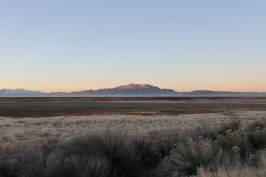
View of Frary Peak from the northern causeway on my way to the trailhead
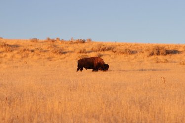
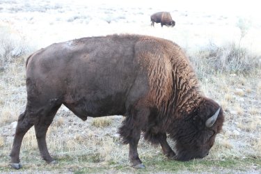
Lucky enough to run into some bulls near the intersection to Garr Ranch
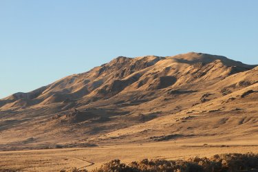
Frary Peak - almost at the trailhead
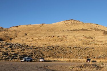
At the trailhead. Looking up at the east side of Dooley Knob (elevation 5278)
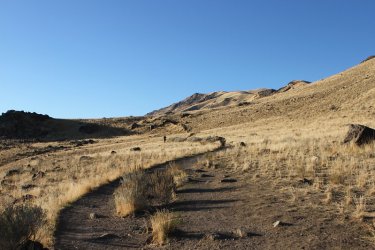
It was the guy up ahead's first time to hike up Frary. He was one of two people I saw on my way up. I ran into a lot more on my
way back down.
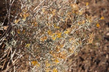
There were a few blooms on the rabbitbrush out on the island
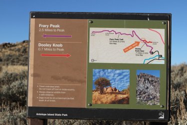
Junction sign for Dooley
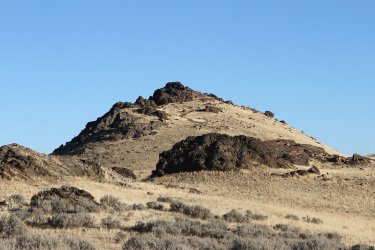
Dooley Knob
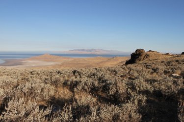
High enough now to get a view to the north towards Buffalo Point
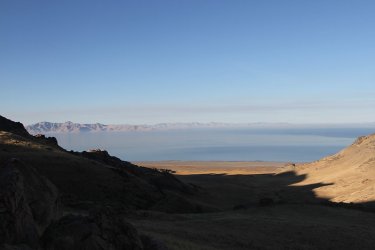
And to the west
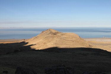
Sun hitting Elephant Head
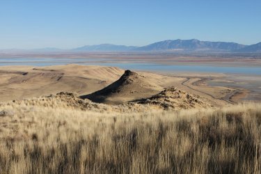
Dooley Knob, and the approach road to the trailhead
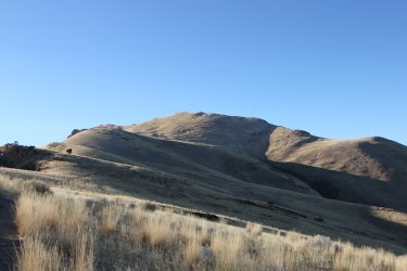
The trail is going to make its way up the draw to the top of the ridge
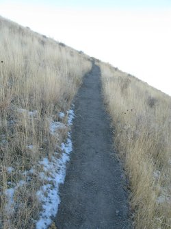
Up, up and away
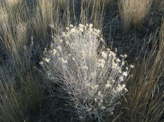
Early morning sun on the rabbitbrush makes it look slightly angelic
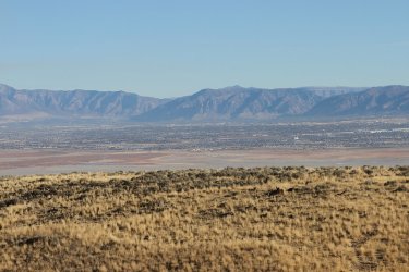
View across the lake towards Ogden
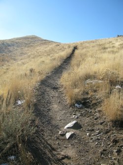
Almost to the top of the ridge.
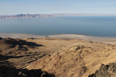
On the ridge now with a view down into Red Rocks Canyon
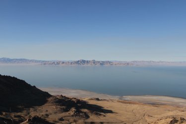
Stansbury Island to the west
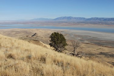
View to the north from the ridge towards the Northern Wasatch and the Wellsville Range
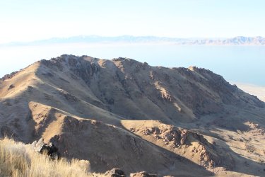
Sub-ridge heading off to the west of the main Frary Peak ridge
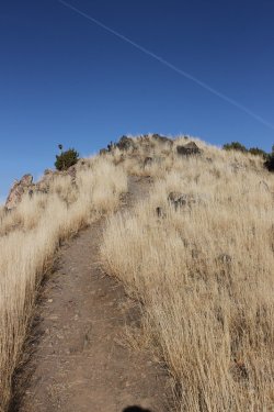
Almost there
Views from the top. I stopped for an early lunch and to take quite a few pictures.
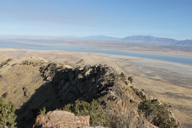
Ridge heading north from the summit
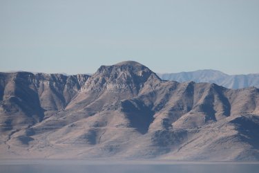
Castle Rock - the high point of Stansbury Island
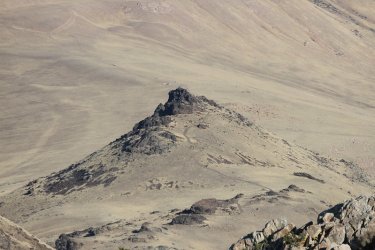
Zoomed in on Dooley. Still contemplating if I want to go up it on my way down from Frary.
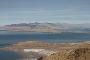
Zoomed in on Fremont Island to the north with the Promontory Range beyond
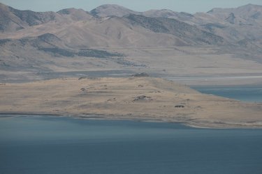
Zoomed in even more on Fremont. The high point of the island (dark rock right of center) is where Kit Carson carved a cross when
exploring the island
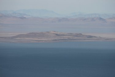
Zoomed in on Carrington Island to the west, which was used as a bombing range during WWII
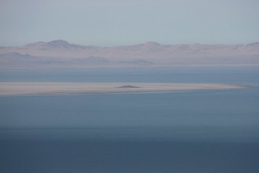
Hat Island to the west and north of Carrington. Pelicans used to nest on this island before the lake level dropped, allowing coyotes
to reach the island.
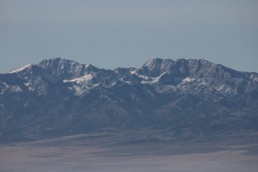
Zoomed in on Deseret Peak in the Stansbury Range
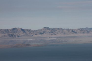
The Lakeside Mountains to the west, with Craner Peak and Black Mountain being the two highest peaks in the range. The Amax
Magnesium plant can also be seen just below Black Mountain
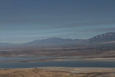
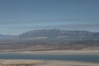
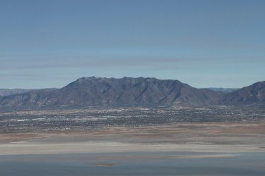
Views of the northern Wasatch
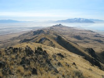
View down the southern spine of Antelope Island
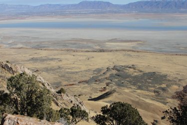
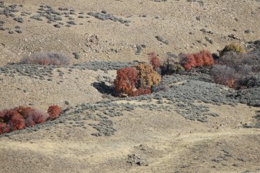
And a few autumn colors below on the east side of the island
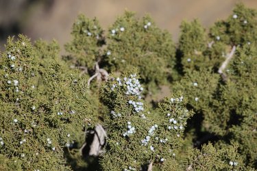
Some juniper berries up top
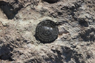
The Antelope Benchmark
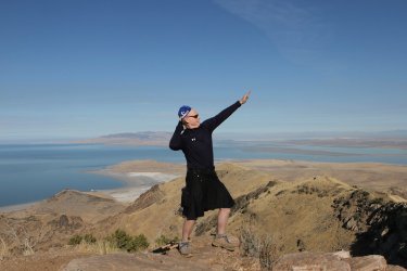
The summit pose. The lady that took this shot complimented me on the pose. @Rockskipper, I think we can drop the bikini
part and just call it "The Pose." What say you?
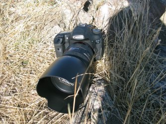
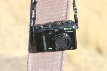
My two cameras for this hike were the Canon EOS 7D, and the Canon PowerShot G9
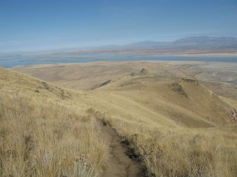
Heading back down
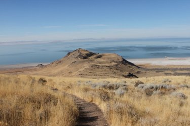
Another shot of Elephants Head, this time in complete sunlight. You can just make out the end of the trunk on the left side, trying
to reach the lake.
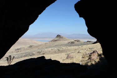
Should I hike up it?
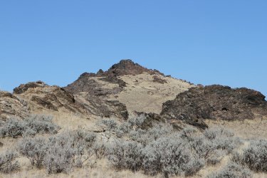
Heading up Dooley Knob. Speaking of Dooley Skipper, the last location that I've got for him was when you told me he was
hanging out near Flagg Ranch and the Grassy Lake Road. Any updates? Do you think you can send him home?
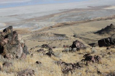
Trailhead down below
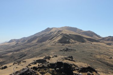
View of Frary from Dooley
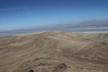
Beacon Knob to the north of Dooley
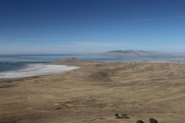
Buffalo Point from Dooley
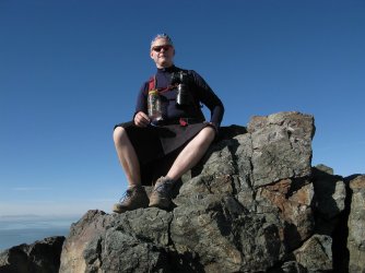
After enjoying the view for a few minutes, some older ladies approached the high point, and I asked if one of them cold take my
picture and then I'd give up my rock so that they could enjoy the views. After taking this shot, and giving up my perch, one of the
ladies said that she loved my hiking skirt. I laughed out loud and thanked her of course, and proceeded to chuckle to myself
all the way back to the trailhead. Hiking Skirt!
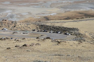
Heading down to the trailhead.
Only one way to end a perfect day, so when I got home I sent Sheila a message and said, "Let's go get nachos!"
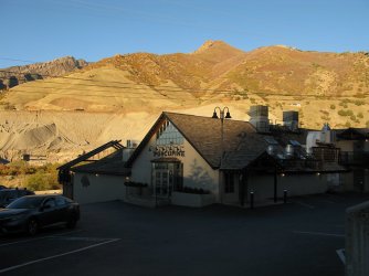
So I picked her up from work and off to the Porcupine we went.
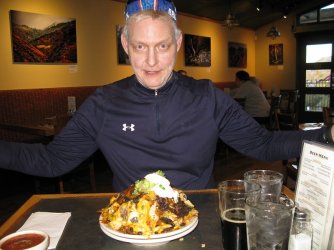
Nachos and a pumpkin, chocolate chip stout, brewed by Red Rocks Brewery. I look kind of crazed with the red eyes.
The End of a Perfect Day
I woke up early and drove out to Antelope Island to see if I could summit Frary, and on my way back down I decided to take the little detour over to Dooley Knob and sit up top and enjoy the views.
The temperature at my house said that it was 41 degrees when I left, but when I arrived at the trailhead on the island it was 32. It didn't stay cold for long once the sun popped up over the Wasatch Front though. It was just right as far as I was concerned, and I felt great heading up the hill and all the way to the top. On my way down, it did start to warm up a bit as I think we were close to 70 degrees in the afternoon. The Sube said 65 when I got back to the trailhead.
Funny, today my knees are a little sore, and my fourth toe on my right foot is a bit painful, and I have a slight overall tiredness to my body, but I'll take that perfect day, knowing that they seem to get further and further apart the older I get. It's too bad that I can't wrap that day up, and then unwrap it when I need it.
Anyway, here are some shots of the hike.

View of Frary Peak from the northern causeway on my way to the trailhead


Lucky enough to run into some bulls near the intersection to Garr Ranch

Frary Peak - almost at the trailhead

At the trailhead. Looking up at the east side of Dooley Knob (elevation 5278)

It was the guy up ahead's first time to hike up Frary. He was one of two people I saw on my way up. I ran into a lot more on my
way back down.

There were a few blooms on the rabbitbrush out on the island

Junction sign for Dooley

Dooley Knob

High enough now to get a view to the north towards Buffalo Point

And to the west

Sun hitting Elephant Head

Dooley Knob, and the approach road to the trailhead

The trail is going to make its way up the draw to the top of the ridge

Up, up and away

Early morning sun on the rabbitbrush makes it look slightly angelic

View across the lake towards Ogden

Almost to the top of the ridge.

On the ridge now with a view down into Red Rocks Canyon

Stansbury Island to the west

View to the north from the ridge towards the Northern Wasatch and the Wellsville Range

Sub-ridge heading off to the west of the main Frary Peak ridge

Almost there
Views from the top. I stopped for an early lunch and to take quite a few pictures.

Ridge heading north from the summit

Castle Rock - the high point of Stansbury Island

Zoomed in on Dooley. Still contemplating if I want to go up it on my way down from Frary.

Zoomed in on Fremont Island to the north with the Promontory Range beyond

Zoomed in even more on Fremont. The high point of the island (dark rock right of center) is where Kit Carson carved a cross when
exploring the island

Zoomed in on Carrington Island to the west, which was used as a bombing range during WWII

Hat Island to the west and north of Carrington. Pelicans used to nest on this island before the lake level dropped, allowing coyotes
to reach the island.

Zoomed in on Deseret Peak in the Stansbury Range

The Lakeside Mountains to the west, with Craner Peak and Black Mountain being the two highest peaks in the range. The Amax
Magnesium plant can also be seen just below Black Mountain


Views of the northern Wasatch

View down the southern spine of Antelope Island


And a few autumn colors below on the east side of the island

Some juniper berries up top

The Antelope Benchmark

The summit pose. The lady that took this shot complimented me on the pose.
part and just call it "The Pose." What say you?


My two cameras for this hike were the Canon EOS 7D, and the Canon PowerShot G9

Heading back down

Another shot of Elephants Head, this time in complete sunlight. You can just make out the end of the trunk on the left side, trying
to reach the lake.

Should I hike up it?

Heading up Dooley Knob. Speaking of Dooley Skipper, the last location that I've got for him was when you told me he was
hanging out near Flagg Ranch and the Grassy Lake Road. Any updates? Do you think you can send him home?

Trailhead down below

View of Frary from Dooley

Beacon Knob to the north of Dooley

Buffalo Point from Dooley

After enjoying the view for a few minutes, some older ladies approached the high point, and I asked if one of them cold take my
picture and then I'd give up my rock so that they could enjoy the views. After taking this shot, and giving up my perch, one of the
ladies said that she loved my hiking skirt.
all the way back to the trailhead. Hiking Skirt!

Heading down to the trailhead.
Only one way to end a perfect day, so when I got home I sent Sheila a message and said, "Let's go get nachos!"

So I picked her up from work and off to the Porcupine we went.

Nachos and a pumpkin, chocolate chip stout, brewed by Red Rocks Brewery. I look kind of crazed with the red eyes.
The End of a Perfect Day
