John Morrow
Member
- Joined
- May 22, 2015
- Messages
- 1,138
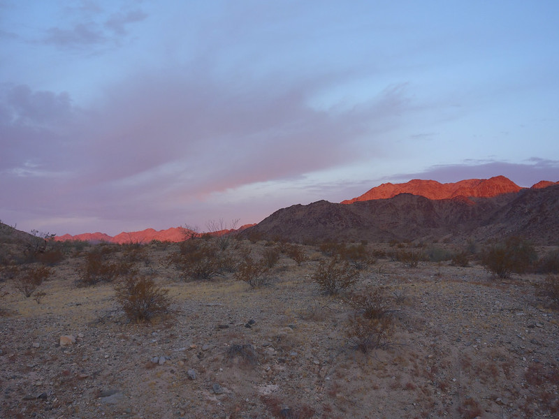
After freezing my kiester at 4000ft in Mojave National Preserve, I really had no clear idea of what I wanted to do next. Covid killed my usual holiday plans so I was beginning to think I was in it for the long haul down here in the desert. At least by my standards. When temps get into the low 20s and my water bottle freezes solid outside of the tent, it is time to lower my base elevation. Corn Springs, with its rock art and hiking potential, had been on my radar. A longish drive, yet lower in altitude and latitude, and surrounded by the Chuckwalla Mountains Wilderness, made the drive worthwhile. Plus, I'd be quite close to Joshua Tree National Park.
The petroglyphs are fantastic. The site is considered to be on a prehistoric migration/trade route from the Colorado River used by the tribes such as the Chemehuevi inhabiting the lower river corridor. Typical elaborate geometric abstract style of those tribes.
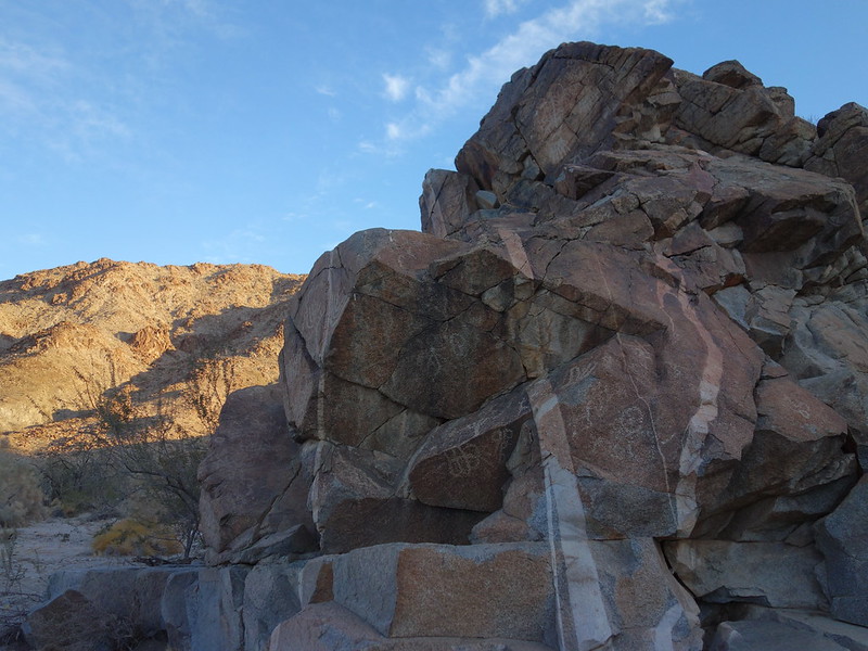
DSC05939 by John Morrow, on Flickr
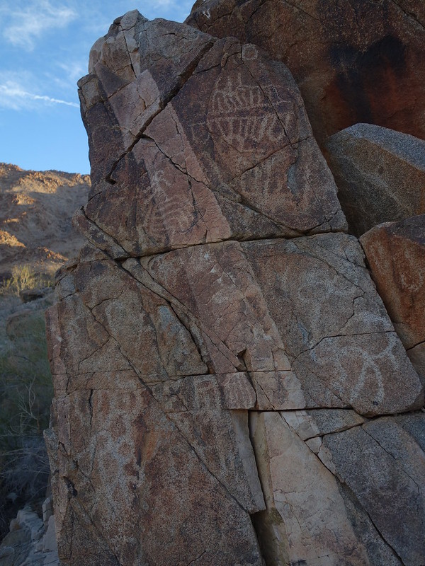
DSC05956 by John Morrow, on Flickr
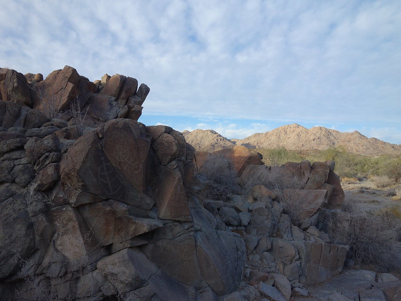
DSC05997 by John Morrow, on Flickr
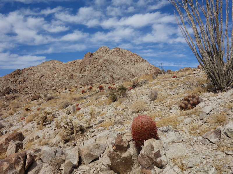
My goal was to find a few summits that I could link with some enjoyable ridgerunning and have some big views of future potential trips.
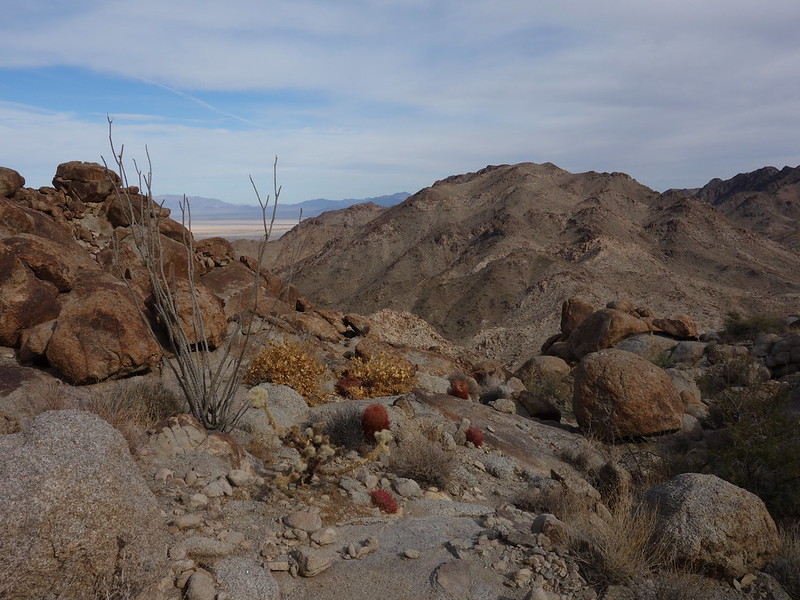
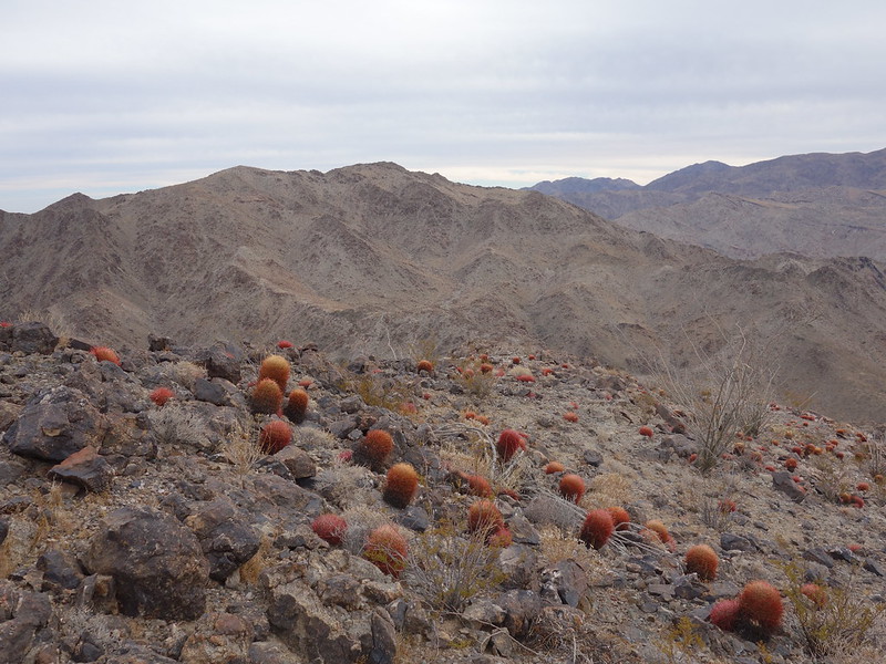
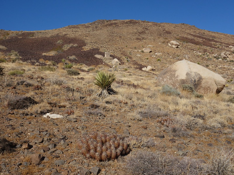
I chose a couple unnamed peaks leading to a known and oft scrambled benchmark. Fine scrambling on the southeast ridge of Peak 2827 led to a long ridgewalk over Peak 2927 and then onto Corn Benchmark 3149' After the summits I descended a west ridge of Corn BM to a really nice waterpolished canyon trending south back to my start about 2 miles west of the campground (good road for decent clearance passenger vehicles).
first sun by John Morrow, on Flickr
ridge looks nice by John Morrow, on Flickr
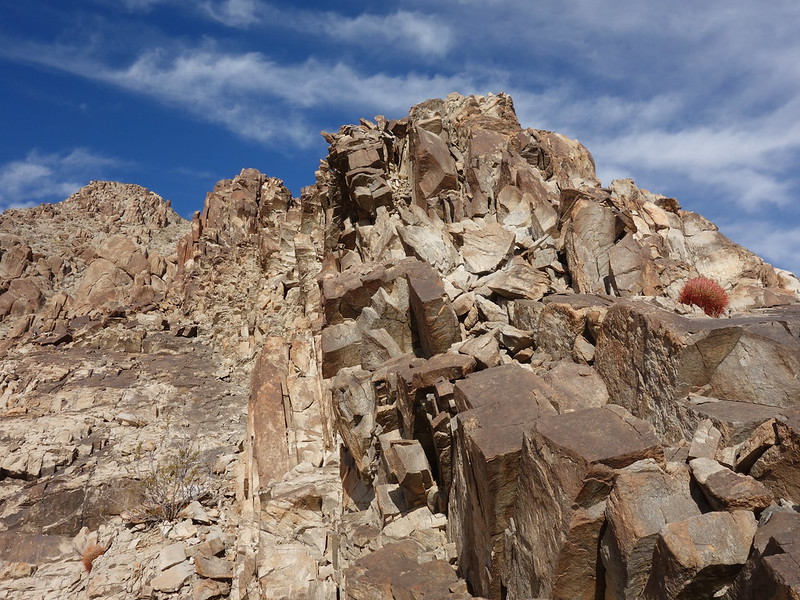
granitic solid by John Morrow, on Flickr
On to Peak 2927 by John Morrow, on Flickr
Corn Benchmark next by John Morrow, on Flickr
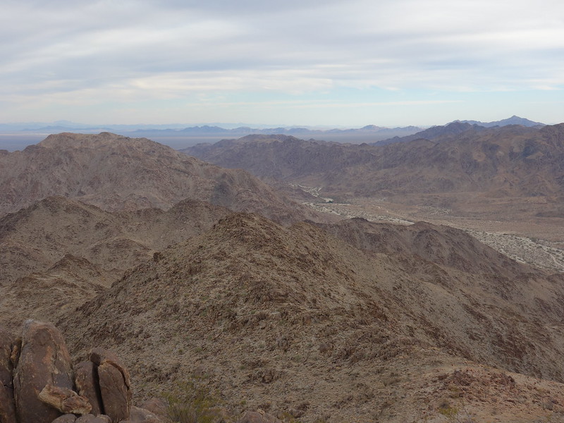
Corn Springs below by John Morrow, on Flickr
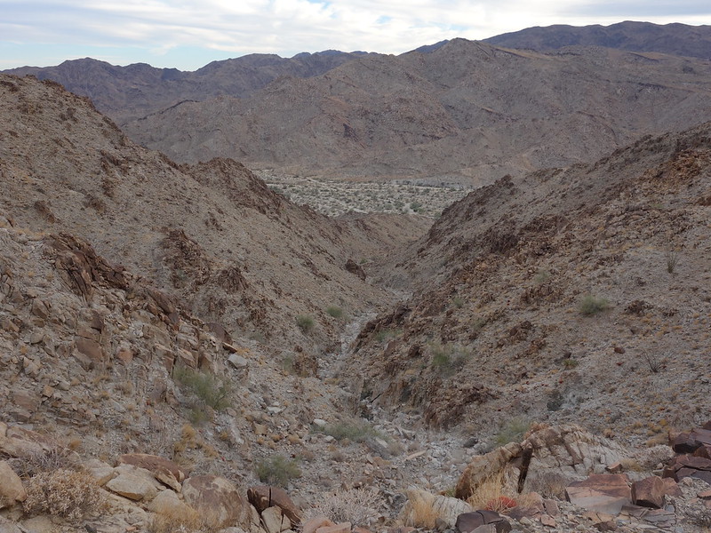
unnamed canyon descent by John Morrow, on Flickr
After a taste of the Chuckwalla Mountains I decided to save other explorations for another trip and move on to Joshua Tree.
In Jtree I did mostly either trail hikes or easy crosscountry walks up easy summits.
CA State reclosed campgrounds so I was left to fend for myself. However, JTree NP has a great rule that backpack camping is allowed just one mile from any road.
After wasting most of the day getting oriented to the park on drives and picnicking I managed to get up Mount Inspiration for the sunset. An easy trail mile from Keys View parking.
crazy rays by John Morrow, on Flickr
Setting sun on Inspiration Point by John Morrow, on Flickr
Time to find a camp so I drove in the dark to Pleasant Valley and backpacked a dark mile along the dry lake to a fine camp. Against my better judgement I found myself above 3000 feet again and a cold below freezing night ensued. Low 20s cold.
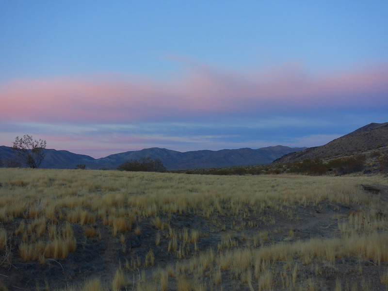
1 mile backpack by John Morrow, on Flickr
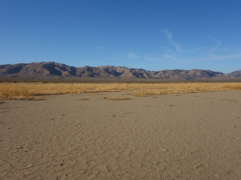
dry lake JTree style by John Morrow, on Flickr
Returning to my car, I drove the Geology Loop (High Clearance required!) and moved up the road to a parking pullout for an easy walk up Malapai Butte.
Up Malapai Butte by John Morrow, on Flickr
return from the Butte by John Morrow, on Flickr
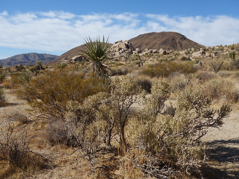
Lots of daylight left, and less energy, left me seeking one more easy hike. Something called Negro Hill fit the bill. By walking it from the east and descending north gave me a nice loop through Joshua Tree forest.
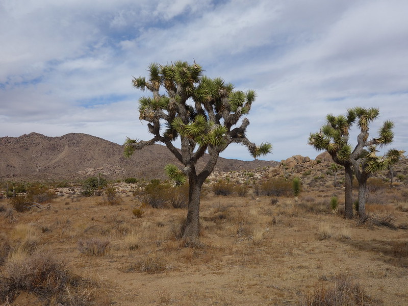
ubiquitous by John Morrow, on Flickr
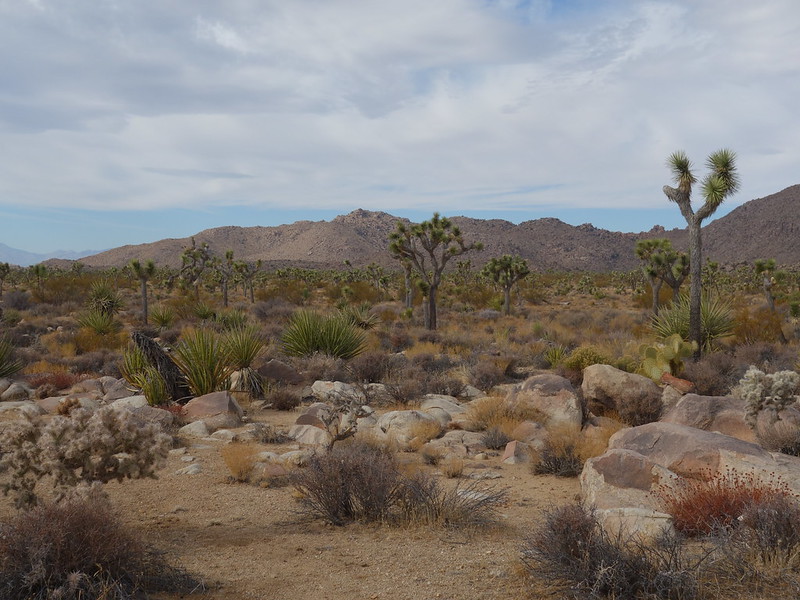
typical JTree scenery by John Morrow, on Flickr
Though I left tons to do in JTree, I wasn't looking forward to more cold camping and backpacking to find a site. So back all the way to the Colorado River I went. Wasting gas and wearing tires...by my standards, but it was pulling me there.
The petroglyphs are fantastic. The site is considered to be on a prehistoric migration/trade route from the Colorado River used by the tribes such as the Chemehuevi inhabiting the lower river corridor. Typical elaborate geometric abstract style of those tribes.
DSC05939 by John Morrow, on Flickr
DSC05956 by John Morrow, on Flickr
DSC05997 by John Morrow, on Flickr
My goal was to find a few summits that I could link with some enjoyable ridgerunning and have some big views of future potential trips.
I chose a couple unnamed peaks leading to a known and oft scrambled benchmark. Fine scrambling on the southeast ridge of Peak 2827 led to a long ridgewalk over Peak 2927 and then onto Corn Benchmark 3149' After the summits I descended a west ridge of Corn BM to a really nice waterpolished canyon trending south back to my start about 2 miles west of the campground (good road for decent clearance passenger vehicles).
first sun by John Morrow, on Flickr
ridge looks nice by John Morrow, on Flickr
granitic solid by John Morrow, on Flickr
On to Peak 2927 by John Morrow, on Flickr
Corn Benchmark next by John Morrow, on Flickr
Corn Springs below by John Morrow, on Flickr
unnamed canyon descent by John Morrow, on Flickr
After a taste of the Chuckwalla Mountains I decided to save other explorations for another trip and move on to Joshua Tree.
In Jtree I did mostly either trail hikes or easy crosscountry walks up easy summits.
CA State reclosed campgrounds so I was left to fend for myself. However, JTree NP has a great rule that backpack camping is allowed just one mile from any road.
After wasting most of the day getting oriented to the park on drives and picnicking I managed to get up Mount Inspiration for the sunset. An easy trail mile from Keys View parking.
crazy rays by John Morrow, on Flickr
Setting sun on Inspiration Point by John Morrow, on Flickr
Time to find a camp so I drove in the dark to Pleasant Valley and backpacked a dark mile along the dry lake to a fine camp. Against my better judgement I found myself above 3000 feet again and a cold below freezing night ensued. Low 20s cold.
1 mile backpack by John Morrow, on Flickr
dry lake JTree style by John Morrow, on Flickr
Returning to my car, I drove the Geology Loop (High Clearance required!) and moved up the road to a parking pullout for an easy walk up Malapai Butte.
Up Malapai Butte by John Morrow, on Flickr
return from the Butte by John Morrow, on Flickr
Lots of daylight left, and less energy, left me seeking one more easy hike. Something called Negro Hill fit the bill. By walking it from the east and descending north gave me a nice loop through Joshua Tree forest.
ubiquitous by John Morrow, on Flickr
typical JTree scenery by John Morrow, on Flickr
Though I left tons to do in JTree, I wasn't looking forward to more cold camping and backpacking to find a site. So back all the way to the Colorado River I went. Wasting gas and wearing tires...by my standards, but it was pulling me there.
Last edited: