IntrepidXJ
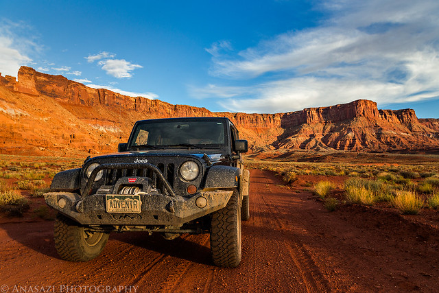
ADVENTR
- Joined
- Jan 17, 2012
- Messages
- 3,493
Tuesday, October 8, 2013
The Original Trip Report on ADVENTR.CO
Last November I took a day trip down to Fable Valley in search of a specific pictograph panel. I found a lot of cool stuff that day, but not the panel I was looking for. I returned again with Marty this morning to search for that same rock art panel and had much better luck.
What an amazing pictograph panel! Like a few other panels I have seen, all of the figures painted here are connected to each other by a line. I'm glad I was finally able to find it.

Daisy Chain Panel by IntrepidXJ, on Flickr
A separate anthropomorph found on the far right side of the alcove.

Anthropomorph by IntrepidXJ, on Flickr
A closer look at the three similar figures on the right.

Three by IntrepidXJ, on Flickr
If you look at the very lower left of this photo, you will see a few painted white dots which are pretty common in the rock art of this area.

Daisy Chain by IntrepidXJ, on Flickr
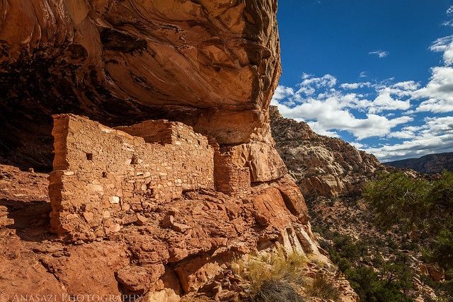
After visiting the panel above, we wandered down the canyon a little way to visit this small granary that we spotted.

Ledge Granary by IntrepidXJ, on Flickr
Leaving Fable Valley on the old closed road.

Road Closed by IntrepidXJ, on Flickr
Marty thought he might have a little trouble getting back to the main road since his low range stopped working in his Jeep, but he had no issues. Beef Basin is in the distance in the background.
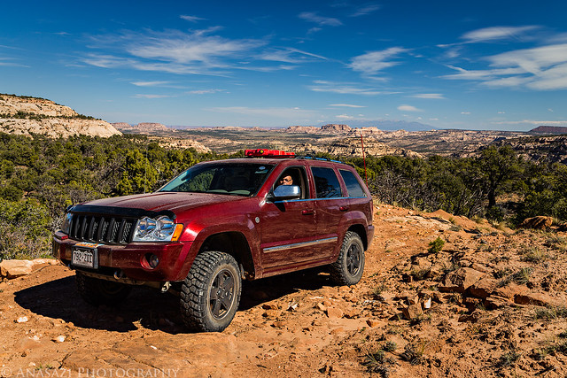
Leaving by IntrepidXJ, on Flickr
While driving back to North Long Point we were flagged down by this red rental pickup truck with a flat tire. They were a couple of college students from up near Salt Lake that were doing some field work out here. The school had rented them the pickup truck to use for the project. They had a spare tire under the truck, but unfortunately the truck did not have a lug wrench or jack so they couldn't retrieve it or install it. Luckily, Marty and I had enough tools with us so we were able to figure out a way to help them out. We were able to lower the tire using the handle of my factory jack and then we used my jack to raise the truck. My factory lug wrench didn't fit their wheel nuts but Marty had a four-way wrench that did. After replacing the tire with the spare I even went ahead and plugged the hole in their bad tire and filled it with air again...just in case they needed it.
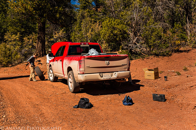
Rescue by IntrepidXJ, on Flickr
After driving fast on some more dusty backroads we eventually reached the highway again. Marty headed back home and I went to Monticello to fill up my Jeep and grab a quick dinner before starting my drive to Moab via Lockhart Basin.
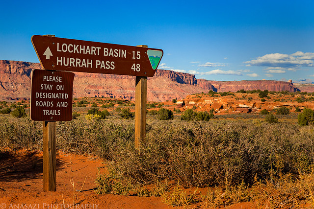
Lockhart Basin Sign by IntrepidXJ, on Flickr
Driving under the canyon rims.
Lockhart Basin Road by IntrepidXJ, on Flickr
View across Canyonlands.
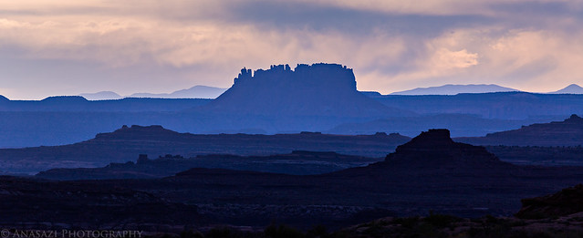
Blue Desert by IntrepidXJ, on Flickr
Beautiful light and a great sky over the sandstone of Lockhart Basin.
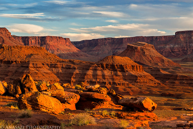
Layers of Sandstone by IntrepidXJ, on Flickr
Light on the Cliff by IntrepidXJ, on Flickr
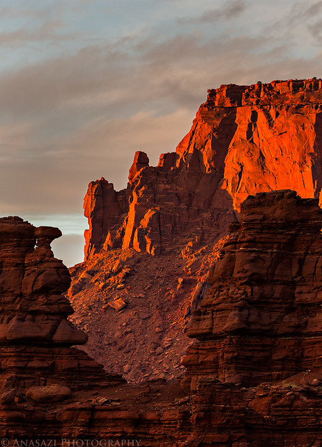
A very nice view of Lockhart Basin as the sun gets low in the sky.
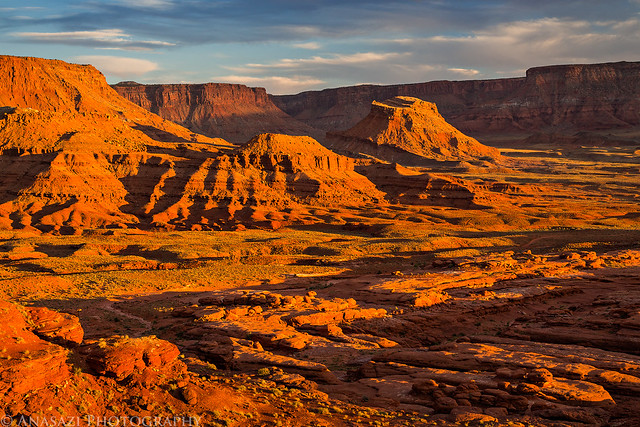
Lockhart Basin Sunset by IntrepidXJ, on Flickr
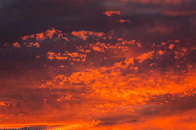
As sunset was approaching, I could tell is was going to be amazing. There were so many different kinds of clouds and colors in the sky that I decided to take a few photos of them.
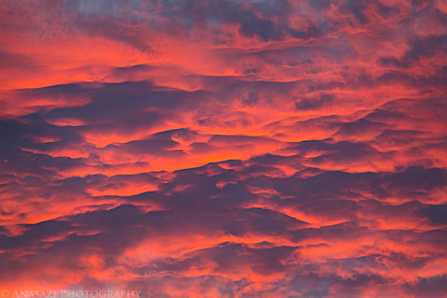
Clouds by IntrepidXJ, on Flickr
Clouds II by IntrepidXJ, on Flickr
Clouds III by IntrepidXJ, on Flickr
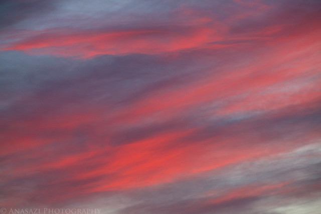
Painted Sky by IntrepidXJ, on Flickr
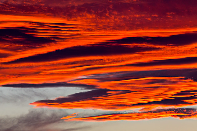
Here are all those different clouds combined into one spectacular sunset! This has got to be one of the best sunset displays I have ever seen.
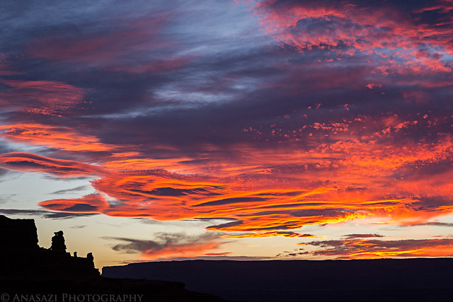
Amazing Sky by IntrepidXJ, on Flickr
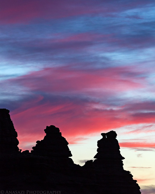
Hoodoo Sunset by IntrepidXJ, on Flickr
After the sun was down I kept driving, looking for a place to camp for the night. I came across a really nice spot with a great view shortly after sunset, but it was filled with a commercial group of mountain bikers. I'm guessing that since the White Rim trail was closed because of the government shutdown they decided to take their clients across the river to Lockhart Basin instead. I kept driving until just before twilight was over before I came across a short spur road that led to a nice place to camp. I quickly setup my tentcot, read for a little bit and then got to sleep so I could be up for the sunrise.
>> Fable Valley to Lockhart Basin Photo Gallery
Featured image for home page:

The Original Trip Report on ADVENTR.CO
Last November I took a day trip down to Fable Valley in search of a specific pictograph panel. I found a lot of cool stuff that day, but not the panel I was looking for. I returned again with Marty this morning to search for that same rock art panel and had much better luck.
What an amazing pictograph panel! Like a few other panels I have seen, all of the figures painted here are connected to each other by a line. I'm glad I was finally able to find it.
Daisy Chain Panel by IntrepidXJ, on Flickr
A separate anthropomorph found on the far right side of the alcove.
Anthropomorph by IntrepidXJ, on Flickr
A closer look at the three similar figures on the right.
Three by IntrepidXJ, on Flickr
If you look at the very lower left of this photo, you will see a few painted white dots which are pretty common in the rock art of this area.
Daisy Chain by IntrepidXJ, on Flickr
After visiting the panel above, we wandered down the canyon a little way to visit this small granary that we spotted.
Ledge Granary by IntrepidXJ, on Flickr
Leaving Fable Valley on the old closed road.
Road Closed by IntrepidXJ, on Flickr
Marty thought he might have a little trouble getting back to the main road since his low range stopped working in his Jeep, but he had no issues. Beef Basin is in the distance in the background.
Leaving by IntrepidXJ, on Flickr
While driving back to North Long Point we were flagged down by this red rental pickup truck with a flat tire. They were a couple of college students from up near Salt Lake that were doing some field work out here. The school had rented them the pickup truck to use for the project. They had a spare tire under the truck, but unfortunately the truck did not have a lug wrench or jack so they couldn't retrieve it or install it. Luckily, Marty and I had enough tools with us so we were able to figure out a way to help them out. We were able to lower the tire using the handle of my factory jack and then we used my jack to raise the truck. My factory lug wrench didn't fit their wheel nuts but Marty had a four-way wrench that did. After replacing the tire with the spare I even went ahead and plugged the hole in their bad tire and filled it with air again...just in case they needed it.
Rescue by IntrepidXJ, on Flickr
After driving fast on some more dusty backroads we eventually reached the highway again. Marty headed back home and I went to Monticello to fill up my Jeep and grab a quick dinner before starting my drive to Moab via Lockhart Basin.
Lockhart Basin Sign by IntrepidXJ, on Flickr
Driving under the canyon rims.
Lockhart Basin Road by IntrepidXJ, on Flickr
View across Canyonlands.
Blue Desert by IntrepidXJ, on Flickr
Beautiful light and a great sky over the sandstone of Lockhart Basin.
Layers of Sandstone by IntrepidXJ, on Flickr
Light on the Cliff by IntrepidXJ, on Flickr
A very nice view of Lockhart Basin as the sun gets low in the sky.
Lockhart Basin Sunset by IntrepidXJ, on Flickr
As sunset was approaching, I could tell is was going to be amazing. There were so many different kinds of clouds and colors in the sky that I decided to take a few photos of them.
Clouds by IntrepidXJ, on Flickr
Clouds II by IntrepidXJ, on Flickr
Clouds III by IntrepidXJ, on Flickr
Painted Sky by IntrepidXJ, on Flickr
Here are all those different clouds combined into one spectacular sunset! This has got to be one of the best sunset displays I have ever seen.
Amazing Sky by IntrepidXJ, on Flickr
Hoodoo Sunset by IntrepidXJ, on Flickr
After the sun was down I kept driving, looking for a place to camp for the night. I came across a really nice spot with a great view shortly after sunset, but it was filled with a commercial group of mountain bikers. I'm guessing that since the White Rim trail was closed because of the government shutdown they decided to take their clients across the river to Lockhart Basin instead. I kept driving until just before twilight was over before I came across a short spur road that led to a nice place to camp. I quickly setup my tentcot, read for a little bit and then got to sleep so I could be up for the sunrise.
>> Fable Valley to Lockhart Basin Photo Gallery
Featured image for home page:
")