piper01
Member
- Joined
- Oct 27, 2013
- Messages
- 182
This trip report (and others, hopefully to come, from the same trip) are from a year ago...it's taking me awhile to sort and edit pictures.
***
April 9-10, 2015
Last April, I had the opportunity to take a 3 week roadtrip. Where was I going? Southern Utah, naturally. But since that's a solid 3 day drive from Houston, I divided the travel time and spent several days exploring central/NW New Mexico first.
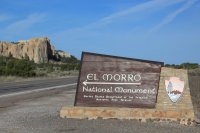
My first stop was El Morro Natl Monument, a sandstone bluff that sheltered a reliable water hole at its base. Travelers stopping for a drink carved carved messages recording their passage in the rock, spanning from Ancestral Puebloans, to Spanish conquistadors, then American explorers and emigrants. I arrived at the Monument about an hour before closing, giving me just enough time to walk the paved 1/2 mile Inscription Trail and read some of the messages.
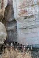
The watering hole fills from water draining down the rock from above.
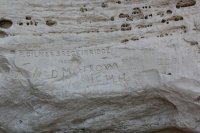
Breckinridge passed through here in 1859 with 25 camels, as part of an Army experiment.
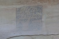
1709 inscription by Ramon Garcia Jurado. The Spanish inscriptions tended to be in ornate script and commonly included the phrase, "paso por aquy"
Afternoon sunlight on the rock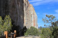
A record of some of the earlier travelers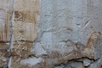
"The Ensign Don Joseph de Payba Basconzelos passed through here on the 18th of February 1726, the year he returned at his own expense the members of the council to the Kingdom of New Mexico"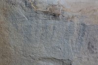
"Governor Juan de Ornate passed through here from the discovery of the Sea of the South on the 16th of April, 1605" With all the available open space on the rock, of course he had to write his message on top of an existing petroglyph.
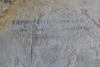
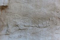
American cavalrymen visited in 1866
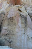
American settlers, mid to late 1800s
I had hoped to hike the longer trail across the top of the mesa to visit some of the Indian ruins there, but I didn't have enough time before the gates closed for the night. I decided I would save that hike for first thing in the morning when the monument opened.
I settled in for the night at the free 9-site campground outside the monument's gates, with 2 or 3 other quiet group of campers. It was fairly basic with picnic tables and a pit toilet, but that's all I needed for the night. My site provided a nice view of a mesa to the east lit up around sunset.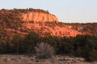
By 8am, I was waiting for the gates to open so I could get my other hike in. Oops! I hadn't checked their hours; they didn't open until 9. I wasn't going to twiddle my thumbs for an hour, so I decided to skip it and headed back out the main road to my next destination- the volcanic landscape of El Malpais National Monument.
I had picked out Big Skylight Cave and Giant Ice Cave to explore. My first stop was the visitor center to pick up a free cave permit and to get my boots disinfected (to stop the spread of disease among bats). Then I was off for the 8 mile drive down the unpaved Chain of Craters Scenic Backway. When the road's in good condition, a sedan should be able to make it, though a few ruts were made easier by the higher clearance of my small SUV.
Oh look- a volcano!
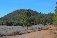
The trailhead had some nice spots for camping, with a backcountry permit of course. I had the trail all to myself that day, which I suspect is not uncommon.
The "cave" is a collapsed lava tube, with several features to visit along its length. It's about a 1/2 mile hike out to the view point of the caves, then several miles exploring down to them and around the area. I spent a half day here.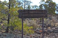
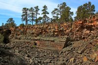
Beginning the clamber down into the collapse feature. Look at those lovely parallel lava flows on the opposite wall! My first destination, Big Skylight Cave, is at the far end of the trench to the left. My second destination, Ice Cave, is closer to the right.
Pausing to admire some beautiful lichen, while carefully picking my way through the boulder field to Big Skylight Cave. I was glad I brought gloves- lava is rough on soft skin.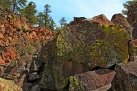
Halfway there! Looking under the lava bridge toward Big Skylight Cave.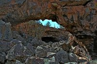
Getting closer...looking behind me at the lava bridge from the other side.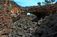
Finally here! Light from the skylight streams into the cave, supporting a "garden" of life. Be careful not to walk across it.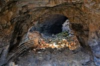
Parallel ridges of Lava flows. It's hard to convey the size of them without anything in the picture for scale. Maybe 10 feet thick here?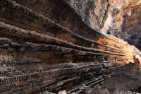
Looking up through the skylight.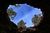
Just past the skylight, going into the darkness of the cave.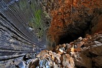
It's dark in here! Looking back toward the skylight.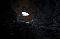
I only went as far back in the cave as this first bend in the lava tube, where I could just barely see without any artificial light. My puny little headlamp illuminated very little in that huge space.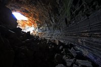
Back where I started. Climbing out of the trench after visiting the much-shallower second cave in the trench (Giant Ice Cave) to see the puddle of ice still frozen in the cool back, beyond the reach of sunlight.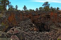
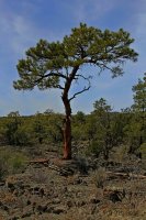
I hiked around up top for while, no destination, just looking around. It's amazing how trees can thrive in the lava field.
Caterpillar Collapse, more collapsed lava tube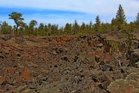
Looking back at Big Skylight Cave from on top of the lava bridge.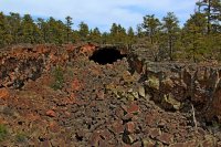
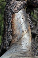
Silvery branch.
Hmmm, I hope I can find a cairn (or 5) to mark the way to the trailhead.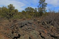
Post hike, driving back out to the main road. I saw this bird soaring over where the lava ridge just stops and opens up into a small valley.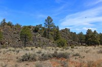
Oh look- another volcano! Hence the name, Chain of Craters.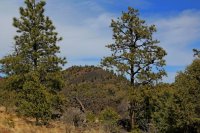
And that was it. Onward to the highway to drive to my next destination- the Bisti Badlands Wilderness Area.
***
April 9-10, 2015
Last April, I had the opportunity to take a 3 week roadtrip. Where was I going? Southern Utah, naturally. But since that's a solid 3 day drive from Houston, I divided the travel time and spent several days exploring central/NW New Mexico first.
My first stop was El Morro Natl Monument, a sandstone bluff that sheltered a reliable water hole at its base. Travelers stopping for a drink carved carved messages recording their passage in the rock, spanning from Ancestral Puebloans, to Spanish conquistadors, then American explorers and emigrants. I arrived at the Monument about an hour before closing, giving me just enough time to walk the paved 1/2 mile Inscription Trail and read some of the messages.

The watering hole fills from water draining down the rock from above.

Breckinridge passed through here in 1859 with 25 camels, as part of an Army experiment.

1709 inscription by Ramon Garcia Jurado. The Spanish inscriptions tended to be in ornate script and commonly included the phrase, "paso por aquy"

Afternoon sunlight on the rock

A record of some of the earlier travelers

"The Ensign Don Joseph de Payba Basconzelos passed through here on the 18th of February 1726, the year he returned at his own expense the members of the council to the Kingdom of New Mexico"

"Governor Juan de Ornate passed through here from the discovery of the Sea of the South on the 16th of April, 1605" With all the available open space on the rock, of course he had to write his message on top of an existing petroglyph.

American cavalrymen visited in 1866

American settlers, mid to late 1800s

I had hoped to hike the longer trail across the top of the mesa to visit some of the Indian ruins there, but I didn't have enough time before the gates closed for the night. I decided I would save that hike for first thing in the morning when the monument opened.
I settled in for the night at the free 9-site campground outside the monument's gates, with 2 or 3 other quiet group of campers. It was fairly basic with picnic tables and a pit toilet, but that's all I needed for the night. My site provided a nice view of a mesa to the east lit up around sunset.

By 8am, I was waiting for the gates to open so I could get my other hike in. Oops! I hadn't checked their hours; they didn't open until 9. I wasn't going to twiddle my thumbs for an hour, so I decided to skip it and headed back out the main road to my next destination- the volcanic landscape of El Malpais National Monument.
I had picked out Big Skylight Cave and Giant Ice Cave to explore. My first stop was the visitor center to pick up a free cave permit and to get my boots disinfected (to stop the spread of disease among bats). Then I was off for the 8 mile drive down the unpaved Chain of Craters Scenic Backway. When the road's in good condition, a sedan should be able to make it, though a few ruts were made easier by the higher clearance of my small SUV.
Oh look- a volcano!

The trailhead had some nice spots for camping, with a backcountry permit of course. I had the trail all to myself that day, which I suspect is not uncommon.
The "cave" is a collapsed lava tube, with several features to visit along its length. It's about a 1/2 mile hike out to the view point of the caves, then several miles exploring down to them and around the area. I spent a half day here.

Beginning the clamber down into the collapse feature. Look at those lovely parallel lava flows on the opposite wall! My first destination, Big Skylight Cave, is at the far end of the trench to the left. My second destination, Ice Cave, is closer to the right.

Pausing to admire some beautiful lichen, while carefully picking my way through the boulder field to Big Skylight Cave. I was glad I brought gloves- lava is rough on soft skin.

Halfway there! Looking under the lava bridge toward Big Skylight Cave.

Getting closer...looking behind me at the lava bridge from the other side.

Finally here! Light from the skylight streams into the cave, supporting a "garden" of life. Be careful not to walk across it.

Parallel ridges of Lava flows. It's hard to convey the size of them without anything in the picture for scale. Maybe 10 feet thick here?

Looking up through the skylight.

Just past the skylight, going into the darkness of the cave.

It's dark in here! Looking back toward the skylight.

I only went as far back in the cave as this first bend in the lava tube, where I could just barely see without any artificial light. My puny little headlamp illuminated very little in that huge space.

Back where I started. Climbing out of the trench after visiting the much-shallower second cave in the trench (Giant Ice Cave) to see the puddle of ice still frozen in the cool back, beyond the reach of sunlight.

I hiked around up top for while, no destination, just looking around. It's amazing how trees can thrive in the lava field.

Caterpillar Collapse, more collapsed lava tube

Looking back at Big Skylight Cave from on top of the lava bridge.

Silvery branch.

Hmmm, I hope I can find a cairn (or 5) to mark the way to the trailhead.

Post hike, driving back out to the main road. I saw this bird soaring over where the lava ridge just stops and opens up into a small valley.

Oh look- another volcano! Hence the name, Chain of Craters.

And that was it. Onward to the highway to drive to my next destination- the Bisti Badlands Wilderness Area.
