Navigation
Install the app
How to install the app on iOS
Follow along with the video below to see how to install our site as a web app on your home screen.
Note: This feature may not be available in some browsers.
More options
You are using an out of date browser. It may not display this or other websites correctly.
You should upgrade or use an alternative browser.
You should upgrade or use an alternative browser.
Days of Old
- Thread starter Carcass
- Start date
Udink
Still right here.
- Joined
- Jan 17, 2012
- Messages
- 1,741
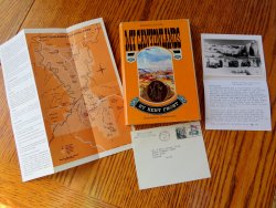
A few years ago I ordered a used copy of My Canyonlands by Kent Frost. It arrived with some neat memorabilia that wasn't mentioned in the online listing when I bought it.
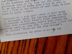
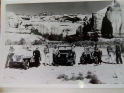
Inside was a letter from Merrill A. Miller from Sierra Madre, California, postmarked in 1971, to Dr. & Mrs. George Plain of South Bend, Indiana. Enclosed was a September 1953 photo of Kent Frost's first commercial jeep trip into Canyonlands National Park, in Salt Creek. The back of the photo lists the people from L-R: Sally Borden, Naomi Heald, Tad Nichols, Kent Frost, Fern Frost, Mary Beckwith, Frank Wright, Joe Muench, and Merrill Miller.
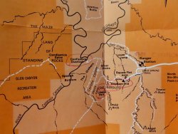
Also in the book was a 1970 brochure for Canyonlands National Park, printed before the Maze District was added to the park the following year.
I was happy to pay $15 for just the book, but the stuff inside was a nice bonus!


- Joined
- Mar 4, 2018
- Messages
- 171
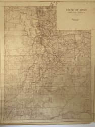
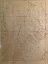
I have a road map published in 1958. Of course roadmaps were not meant to show all the details but it is interesting to see the way it was back then pre Lake Powell. On my screen it helps to zoom in a little. Does anyone know why the Utah/Colorado border slants or shifts near La Sal ? That has been bugging me for years.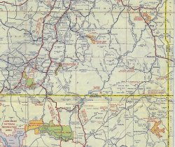

Last edited:
mike_offerman
Member
- Joined
- Feb 8, 2012
- Messages
- 564
- Joined
- Aug 8, 2016
- Messages
- 2,078
I have a road map published in 1958. Of course roadmaps were not meant to show all the details but it is interesting to see the way it was back then pre Lake Powell. On my screen it helps to zoom in a little. Does anyone know why the Utah/Colorado border slants or shifts near La Sal ? That has been bugging me for years.View attachment 87784
That *is* very curious. I had no idea. It's also curious that the town marked as "Paradox" seems to be right in line with the border below. Coincidence?
IntrepidXJ
ADVENTR
- Joined
- Jan 17, 2012
- Messages
- 3,489
It's also curious that the town marked as "Paradox" seems to be right in line with the border below. Coincidence?
The town is to the right of the name, about where the last 'O' in Montrose is. I don't believe it's marked on the state line.
- Joined
- Aug 8, 2016
- Messages
- 2,078
The town is to the right of the name, about where the last 'O' in Montrose is. I don't believe it's marked on the state line.
yeah that's what I mean. The town is located such that if the border with Colorado continued directly north rather than jog to the west Paradox would be a border town.
- Joined
- Aug 8, 2016
- Messages
- 2,078
- Joined
- May 19, 2012
- Messages
- 2,017
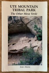
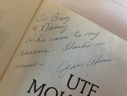
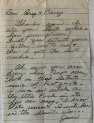
In 1988 we were backpacking down Collins Spring into Grand Gulch. We were living in San Diego, and I had borrowed my Dad's beat up Volvo station wagon to drive to Utah. When we arrived at the trailhead there was a woman there who was pretty glad to see us. She introduced herself, her name was Jean Akens, and she ran the Edge of the Cedars Museum in Blanding. She said she had been there for a couple of days as her truck would not start, she waiting for someone to show up. She was about out of food, and was getting ready to hike the 7 miles back to hwy 95, which she wasn't psyched to do. She asked us if we would loan her my car to drive back to Blanding to get a mechanic, and I said ok. A week later we came back to the trailhead to happily find the Volvo, with this book on the front seat. I was jonseing for the Famous Amos chocolate chip cookie I had left, but she ate it.


- Joined
- Mar 4, 2018
- Messages
- 171
Thank You @Perry . Now I can sleep at night. My construction background makes me notice things like that. If I was in charge I would have made them correct that error.
- Joined
- May 19, 2012
- Messages
- 2,017
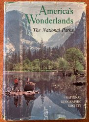
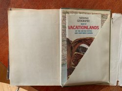
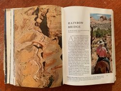
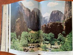
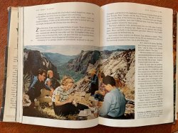
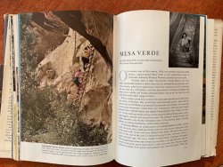
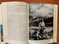
A book my Grandmother gave me from 1958. Lot's of happy white people enjoying our national treasures. Cool cars, cowboy hats and checkered flannel shirts. I did not not try to open up the maps in the folder in the back, as they are 61 years old. It's one of my favorite books.
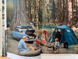
This looks a little sketchy:
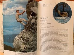
My mom used to wear a kind of big bandana on her head like that:


This looks a little sketchy:


My mom used to wear a kind of big bandana on her head like that:

Miya
Because I am able.
- Joined
- Dec 31, 2017
- Messages
- 1,404
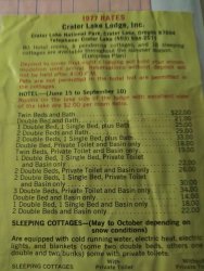
Ooooooooh look at those prices!!Crater Lake Lodge Rates .... 1977
View attachment 87870
Don't like ads? Become a BCP Supporting Member and kiss them all goodbye. Click here for more info.

