- Joined
- Aug 8, 2016
- Messages
- 2,078
As some of you may know from a previous trip report I had made an attempt to reach Thurston Peak but got turned back by a scary snow field. Now that all the snow is gone up high I decided to make another attempt at it last Saturday. It was a very strenuous hike with an almost 5,000 ft elevation gain in less than five miles. I paid the price with burning thigh muscles and screaming knees but I did it!
For those who want some live action here is a video of the trip, otherwise read on...
I started at the trail head for the Adams Canyon trail at the foot of the Wasatch Range in Layton, UT. This is an extremely busy trail head as it provides access to not only the Adams Canyon and Adams Cabin trails but also the very popular Bonneville Shoreline trail. I arrived ready to head up at about 6:30 am.
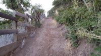
The lower part of the trail begins along several erosion-stabilized switch backs...
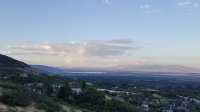
Beautiful early morning view of the valley...
Upon crossing the Bonneville Shoreline Trail my route would be the Adams Cabin trail following the ridge line from here on up. Adams Canyon would be off to the south...
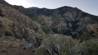
The views get better and better as we climb higher. Here is a good view of Mt Ogden and Ben Lomond further to the north...
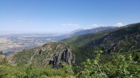
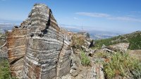
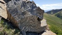
Some really fascinating rocks along the way...
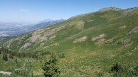
The route to Thurston Peak takes off to the north from the upper end of the Adams Cabin trail. From this point on there would be little to no trail. The rest of the way up required route finding along either side of the prominent ridge line. This would continue until crossing the Great Western Trail just below the summit. Here is the view down the canyon just to the north...
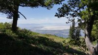
The view from a really nice camping spot in this same area...
So after a really long haul I finally made it up the summit!
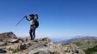
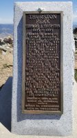
There is a plaque on the summit documenting the origin of the name...
Thurston Peak is by no means a very high destination but it was very compelling for me to be able to look down into the valley and into the area where I live. Beautiful views in all directions on this day.
Farmington Bay (currently dry) in front of Antelope Island. Immediately behind Antelope Island is Stansbury Island. The Oquirrh Mountains are in the upper left...
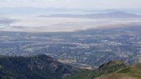
Here we can see Hill Air Force Base middle, right. Up from there is Freemont Island and just behind to it's right is the southern tip of the Promontory Mountains...
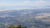
To the north are Mount Ogden and further north and just left of center are Ben Lomond and Willard Peaks...
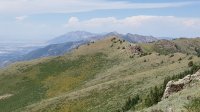
To the south we see Francis Peak with its radar domes. Behind in the distance are the more familiar peaks of the Wasatch in the Salt Lake area. The more prominent one on the right of the ridge is Lone Peak...
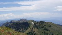
And my favorite, looking down into my home town of Morgan in the Morgan Valley. Note the clouds over the Uintas in the back ...
...
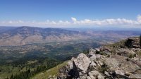
It was a very satisfying trip for me but brutal on my knees coming down. After getting home and reviewing my tracks this graph told the story for my knees...

For those who want some live action here is a video of the trip, otherwise read on...
I started at the trail head for the Adams Canyon trail at the foot of the Wasatch Range in Layton, UT. This is an extremely busy trail head as it provides access to not only the Adams Canyon and Adams Cabin trails but also the very popular Bonneville Shoreline trail. I arrived ready to head up at about 6:30 am.
The lower part of the trail begins along several erosion-stabilized switch backs...

Beautiful early morning view of the valley...

Upon crossing the Bonneville Shoreline Trail my route would be the Adams Cabin trail following the ridge line from here on up. Adams Canyon would be off to the south...

The views get better and better as we climb higher. Here is a good view of Mt Ogden and Ben Lomond further to the north...

Some really fascinating rocks along the way...


The route to Thurston Peak takes off to the north from the upper end of the Adams Cabin trail. From this point on there would be little to no trail. The rest of the way up required route finding along either side of the prominent ridge line. This would continue until crossing the Great Western Trail just below the summit. Here is the view down the canyon just to the north...

The view from a really nice camping spot in this same area...

So after a really long haul I finally made it up the summit!

There is a plaque on the summit documenting the origin of the name...

Thurston Peak is by no means a very high destination but it was very compelling for me to be able to look down into the valley and into the area where I live. Beautiful views in all directions on this day.
Farmington Bay (currently dry) in front of Antelope Island. Immediately behind Antelope Island is Stansbury Island. The Oquirrh Mountains are in the upper left...

Here we can see Hill Air Force Base middle, right. Up from there is Freemont Island and just behind to it's right is the southern tip of the Promontory Mountains...

To the north are Mount Ogden and further north and just left of center are Ben Lomond and Willard Peaks...

To the south we see Francis Peak with its radar domes. Behind in the distance are the more familiar peaks of the Wasatch in the Salt Lake area. The more prominent one on the right of the ridge is Lone Peak...

And my favorite, looking down into my home town of Morgan in the Morgan Valley. Note the clouds over the Uintas in the back

It was a very satisfying trip for me but brutal on my knees coming down. After getting home and reviewing my tracks this graph told the story for my knees...

Last edited:
