- Joined
- May 31, 2015
- Messages
- 3,322
9-4-2015 to 9-5-2015
I had been planning a trip for Labor Day weekend for more than a month. The trip was originally planned to be in the Northern Winds with 5 or 6 people for 3 days and 2 nights. My focus then shifted to the more popular areas accessed through Elkhart Park. The goal was either Cook Lakes or Titcomb Basin. It turned out people didn't want to be gone all weekend, so the location changed to the Uintas for an overnighter. And it ended up being just me and a friend. I was kind of disappointed by all the changes initially, but the trip turned out great.
We took off from Salt Lake City in the early afternoon and headed up. The parking lot for the Crystal Lake TH had quite a few cars, but there were still plenty of spaces. We started off, and we wouldn't realize this until later, but we started at the wrong trailhead. Our destination was Meadow Lake, and we started from the trailhead leading to Cliff, Watson and Clyde Lakes because I hadn't studied the maps carefully enough before we set off.
We started out and didn't see anyone for a while. We passed Cliff and Watson and were impressed by how many lakes are up there. Then, a guy out dayhiking passed by us and asked if he was headed toward Cliff Lake. We told him he was, and he asked where we were headed. We let him know we were shooting for the Notch and then down to Meadow Lake. He had just hiked to the Notch and said there was no real trail to get up there, and he gave us some vague directions. Awesome. It turns out he had made the same mistake as us in starting at the wrong trailhead. Haha.
I realized I had forgotten my camera, so all my pictures were taken on my phone (GS6). I was pleasantly surprised by how they turned out.
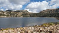
Cliff Lake
![1441568565895[1].jpg 1441568565895[1].jpg](https://backcountrypost.com/data/attachments/34/34215-8cf0aad70b10dfdc5a02e7eea4a74e5a.jpg)
Watson Lake?
![1441569164577[1].jpg 1441569164577[1].jpg](https://backcountrypost.com/data/attachments/34/34217-732f607cb77d097ab0969927bc269de4.jpg)
Daniel nearing the end of the trail.
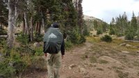
Clyde Lake
![1441569090818[1].jpg 1441569090818[1].jpg](https://backcountrypost.com/data/attachments/34/34218-1f05efe265f98c0f4c004e5dbd6ebe58.jpg)
When we reached the end of the trail at Clyde, we looked around for where we could go. I went up and checked out Booker Lake really quickly, then we headed up South of John Lake and North of Twin Lakes, I assume. The bushwhacking wasn't too bad. After a bit, we reached a spot where we had to just go straight up the rocks. Eventually, we got to the top. We came up about 300 feet West of the trail that we should've been on all along. At this point in time, we had no idea what we had done wrong or where we had lost the trail. So we walked over to it and followed it down to Ibantik.
View South from the Notch.
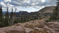
Happy we found the trail, but satisfied with our alternate route.
Headed down toward Ibantik.
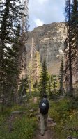
We were trying to beat the sunset, so we booked it down to Meadow Lake. We saw a few groups camped at Ibantik and, at the trail junction to Meadow, we passed another group headed to Ibantik. We got to Meadow and we had the place all to ourselves. Great deal.
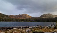
Meadow Lake, looking toward the Notch.
![1441568996719[1].jpg 1441568996719[1].jpg](https://backcountrypost.com/data/attachments/34/34223-995761f15556f975bbf623683790431e.jpg)
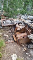
We found a campsite on the West side of the dam, and it was quite interesting. I've been meaning to look it up. There was an old, seemingly unfinished cabin with lots of rusted out metal stuff. We identified an old bed frame and maybe a stove? Anyway, if any of you know about that what the cabin was used or intended for, let me know!
![1441569223547[1].jpg 1441569223547[1].jpg](https://backcountrypost.com/data/attachments/34/34225-a8908a009bf80faf0cecbaf4e13075f8.jpg)
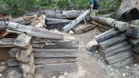
After we had set up our tents, it got really windy and started to rain. Fortunately, there was a giant sheet of metal set on top of some rocks and logs, and it served as a perfect windbreak and shelter for our stoves as we got dinner ready.
![1441568949371[1].jpg 1441568949371[1].jpg](https://backcountrypost.com/data/attachments/34/34224-b5a6ade8258ba5600f8cc4fce4a34926.jpg)
It got dark pretty quickly, and the wind kept up all night and through the next morning. I still managed to sleep through a lot of it, so that was nice.
In the morning, I took a few more pictures of the lake and a little pond below the dam. It was cool being the only people out there.
The wind had whipped up some foam on the shore.
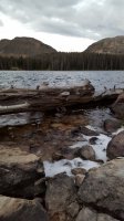
Pond below
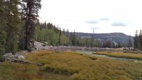
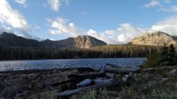
We packed up and headed out. We cruised up by Ibantik and up to the Notch.
Ibantik Lake
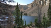
Morning view from the Notch.
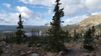
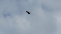
At the Notch, the wind was almost unbearable. We saw a large bird up there trying to fly into the wind, but it wasn't making much progress. It looked like a bald eagle initially, but now I'm thinking it may have been a golden eagle or some kind of hawk because its head doesn't appear to be white in any of the pictures I took. It sure was big for a hawk though. I tried to take a few pictures, but they probably are no good for identification purposes. Gotta love that digital zoom on phone cameras.
We enjoyed the luxury of having a trail to follow on the way down, but the views were definitely not as good as they were on our hike up. So in my eyes, bushwhacking ended up being very worth it. We passed 4 or 5 groups headed over to Ibantik Lake, but none headed to Meadow. Also, every group pronounced "Ibantik" differently, so I still have no idea how to say it.
We passed the final little bit down by Wall Lake and Lily Lakes, and then we got to the parking lot. We made it back in under 2 hours, so we were happy about that. We also realized then that there were, in fact, two trailheads at the parking lot. In spite of that blunder, we were very happy about the route we had taken.
Wall Lake
Featured image for home page:
I had been planning a trip for Labor Day weekend for more than a month. The trip was originally planned to be in the Northern Winds with 5 or 6 people for 3 days and 2 nights. My focus then shifted to the more popular areas accessed through Elkhart Park. The goal was either Cook Lakes or Titcomb Basin. It turned out people didn't want to be gone all weekend, so the location changed to the Uintas for an overnighter. And it ended up being just me and a friend. I was kind of disappointed by all the changes initially, but the trip turned out great.
We took off from Salt Lake City in the early afternoon and headed up. The parking lot for the Crystal Lake TH had quite a few cars, but there were still plenty of spaces. We started off, and we wouldn't realize this until later, but we started at the wrong trailhead. Our destination was Meadow Lake, and we started from the trailhead leading to Cliff, Watson and Clyde Lakes because I hadn't studied the maps carefully enough before we set off.
We started out and didn't see anyone for a while. We passed Cliff and Watson and were impressed by how many lakes are up there. Then, a guy out dayhiking passed by us and asked if he was headed toward Cliff Lake. We told him he was, and he asked where we were headed. We let him know we were shooting for the Notch and then down to Meadow Lake. He had just hiked to the Notch and said there was no real trail to get up there, and he gave us some vague directions. Awesome. It turns out he had made the same mistake as us in starting at the wrong trailhead. Haha.
I realized I had forgotten my camera, so all my pictures were taken on my phone (GS6). I was pleasantly surprised by how they turned out.
Cliff Lake
![1441568565895[1].jpg 1441568565895[1].jpg](https://backcountrypost.com/data/attachments/34/34215-8cf0aad70b10dfdc5a02e7eea4a74e5a.jpg)
Watson Lake?
![1441569164577[1].jpg 1441569164577[1].jpg](https://backcountrypost.com/data/attachments/34/34217-732f607cb77d097ab0969927bc269de4.jpg)
Daniel nearing the end of the trail.

Clyde Lake
![1441569090818[1].jpg 1441569090818[1].jpg](https://backcountrypost.com/data/attachments/34/34218-1f05efe265f98c0f4c004e5dbd6ebe58.jpg)
When we reached the end of the trail at Clyde, we looked around for where we could go. I went up and checked out Booker Lake really quickly, then we headed up South of John Lake and North of Twin Lakes, I assume. The bushwhacking wasn't too bad. After a bit, we reached a spot where we had to just go straight up the rocks. Eventually, we got to the top. We came up about 300 feet West of the trail that we should've been on all along. At this point in time, we had no idea what we had done wrong or where we had lost the trail. So we walked over to it and followed it down to Ibantik.
View South from the Notch.

Happy we found the trail, but satisfied with our alternate route.

Headed down toward Ibantik.

We were trying to beat the sunset, so we booked it down to Meadow Lake. We saw a few groups camped at Ibantik and, at the trail junction to Meadow, we passed another group headed to Ibantik. We got to Meadow and we had the place all to ourselves. Great deal.
Meadow Lake, looking toward the Notch.
![1441568996719[1].jpg 1441568996719[1].jpg](https://backcountrypost.com/data/attachments/34/34223-995761f15556f975bbf623683790431e.jpg)
We found a campsite on the West side of the dam, and it was quite interesting. I've been meaning to look it up. There was an old, seemingly unfinished cabin with lots of rusted out metal stuff. We identified an old bed frame and maybe a stove? Anyway, if any of you know about that what the cabin was used or intended for, let me know!
![1441569223547[1].jpg 1441569223547[1].jpg](https://backcountrypost.com/data/attachments/34/34225-a8908a009bf80faf0cecbaf4e13075f8.jpg)


After we had set up our tents, it got really windy and started to rain. Fortunately, there was a giant sheet of metal set on top of some rocks and logs, and it served as a perfect windbreak and shelter for our stoves as we got dinner ready.
![1441568949371[1].jpg 1441568949371[1].jpg](https://backcountrypost.com/data/attachments/34/34224-b5a6ade8258ba5600f8cc4fce4a34926.jpg)
It got dark pretty quickly, and the wind kept up all night and through the next morning. I still managed to sleep through a lot of it, so that was nice.
In the morning, I took a few more pictures of the lake and a little pond below the dam. It was cool being the only people out there.
The wind had whipped up some foam on the shore.

Pond below


We packed up and headed out. We cruised up by Ibantik and up to the Notch.
Ibantik Lake

Morning view from the Notch.

At the Notch, the wind was almost unbearable. We saw a large bird up there trying to fly into the wind, but it wasn't making much progress. It looked like a bald eagle initially, but now I'm thinking it may have been a golden eagle or some kind of hawk because its head doesn't appear to be white in any of the pictures I took. It sure was big for a hawk though. I tried to take a few pictures, but they probably are no good for identification purposes. Gotta love that digital zoom on phone cameras.

We enjoyed the luxury of having a trail to follow on the way down, but the views were definitely not as good as they were on our hike up. So in my eyes, bushwhacking ended up being very worth it. We passed 4 or 5 groups headed over to Ibantik Lake, but none headed to Meadow. Also, every group pronounced "Ibantik" differently, so I still have no idea how to say it.
We passed the final little bit down by Wall Lake and Lily Lakes, and then we got to the parking lot. We made it back in under 2 hours, so we were happy about that. We also realized then that there were, in fact, two trailheads at the parking lot. In spite of that blunder, we were very happy about the route we had taken.
Wall Lake

Featured image for home page:

Attachments
Last edited by a moderator:

![1441568759788[1].jpg](/data/attachments/34/34216-78e230e79db67199cd99a14979926d44.jpg)
