piper01
Member
- Joined
- Oct 27, 2013
- Messages
- 182
April 11-12, 2015
***
[Part 3 (of 4) of the NM portion of my roadtrip last spring. Previous days can be found here and here]
***
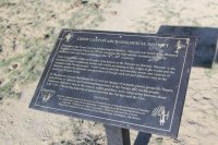
After leaving the Bisti Badlands, I headed north through Farmington, then south-east to my next stop: the Crow Canyon petroglyphs and the "Defensive Structures of the Dinetah," Navajo rock art and defensive construction from the 16-18th centuries. Note that this area is located on BLM land in the center of the San Juan gas field, so all side roads ended at/ trail heads began at a well pad. If you're looking for pristine canyons, this is not the place for you.
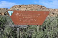
Arriving in the late afternoon, and with 3 areas of petroglyphs to explore, I decided to visit the first two that day and save the furthest panel for the next morning.
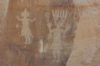
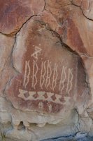
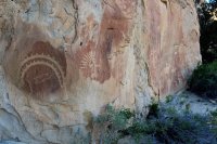
The "Main Panel" was a few minutes' walk from where I parked, about a half-mile roundtrip. It contained many human figures, and in my opinion, was the best panel of the three.
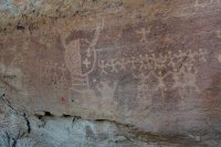
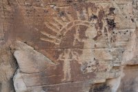
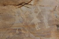
And also some birds.
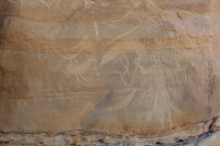
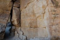
The figures in context. The uppermost panels were out of reach. I wonder what the creators stood on while making them?
A series of bows
Close-up:
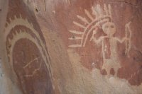
The corn plant on the left caught my attention.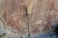
Cowboys (or sheep herders?) from the early 1900s recorded their presence in the area, too. I found it interesting that this man carved his name in the coarse conglomeratic sandstone, rather in the finer-grained layer directly below.
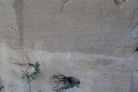
Next I visited the "Big Warrior Panel," a mile drive further along the road.
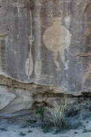
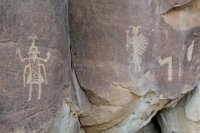
With the sun low on the horizon, I drove the remaining mile to the end of the road, where the trailhead for the final panel was located. Since this was a longer hike (~1.8 mi roundtrip) than the previous two stops, I decided to save it for the morning. My options for camping were limited: in a gap in the sagebrush on the banks of the sandy wash (with the local inhabitants for company), or at the trailhead, which was also a well pad.
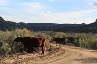
The trailhead had a decent previously-used spot available, so that became home for the night. I did, however, observe some safety precautions camping so close to an active wellhead; I made sure to back into my spot for a hasty exit, if needed, and made sure not to park in alignment with any valves that may shoot off at high pressure. If I looked in the other direction, the view from camp was actually rather nice.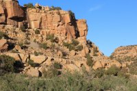
I played around with some star shots, to the tune of two owls hooting at each other across the canyon. Here's my favorite constellation, the Big Dipper (because it's one of the few I can actually recognize).
Morning dawned bright and pleasantly warm, a great day for being outside. After a leisurely breakfast and packing up camp, I began the easy hike to the "44 Panel," spotting a small figure in the rock along the way.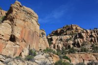
I see how the panel derived its name.
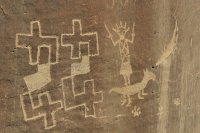
Elk-hunting scene
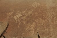
The remainder of the panel to the right.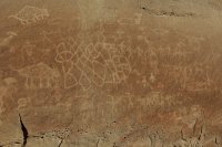
The hike back to the trailhead
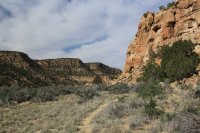
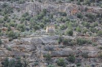
Returning to my vehicle, I backtracked a few tenths of a mile down to road to visit the Crow Canyon defensive structure, or pueblito. I had missed seeing it the prior evening, more focused on finding a campsite than in looking up. Not a pretty photo with the direction of the sun, but best I have for showing context:
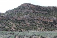
Zoomed in, on the climb up
The occupants had a great view of the canyon from the pueblito, about 300 feet above the canyon floor.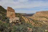
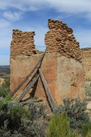
And one more shot. There were also stone remains outlining a few other rooms nearby, on ground-level rather than on a boulder.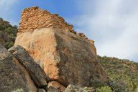
I spent several hours visiting 4 other pueblitos on the area, though most of that time was spent driving from one to the next, which quickly became tedious. If I was re-doing this trip, I probably would just visit the rock art and the first pueblito, then skip the rest. I did encounter one unexpected sight that made me do a double take; as I passed a house and corrals at the old Largo school, I saw what looked to be a zebra(!) mixed in with the horses, though I didn't get a close enough look to be absolutely certain.
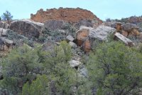
The view of "Hooded Fireplace" ruin, as approached from below. It didn't have nearly as commanding a view as the Crow Canyon pueblito.
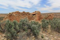
View from the mesa top of the multiple rooms.
The hooded fireplace, a style of construction introduced to the southwest by the Spanish.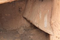
Many of the rooms had a collapsed wall or roof, but this one was still nearly complete.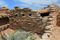
Next stop, the "Largo School Ruin" overlooking the wash (and a modern oil well) below. This ruin wasn't very impressive, so I didn't take many photos.
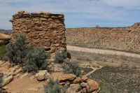
Stop 4, "Tapacito Ruin," was unusual for being a non-defensive site built on an open area. The thick dirt roof looks like it provided good insulation.
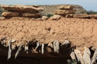
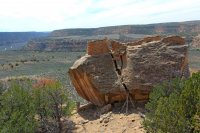
Finally, I reached my last, and arguably the most impressive, structure of this trip segment, "Split Rock Ruin."
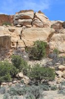
Climbing up to the split rock level.
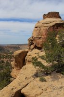
The view from behind. The occupants must have had an interesting climb up the tree limbs to reach the split in the rock, followed by a scramble up the crack to reach the room(s) at the top.
And that was all my stops for this area. Next, onward to Chaco Culture National Historic Park (trip report coming soon...ish), to round out my time in NW New Mexico.
***
[Part 3 (of 4) of the NM portion of my roadtrip last spring. Previous days can be found here and here]
***
After leaving the Bisti Badlands, I headed north through Farmington, then south-east to my next stop: the Crow Canyon petroglyphs and the "Defensive Structures of the Dinetah," Navajo rock art and defensive construction from the 16-18th centuries. Note that this area is located on BLM land in the center of the San Juan gas field, so all side roads ended at/ trail heads began at a well pad. If you're looking for pristine canyons, this is not the place for you.

Arriving in the late afternoon, and with 3 areas of petroglyphs to explore, I decided to visit the first two that day and save the furthest panel for the next morning.

The "Main Panel" was a few minutes' walk from where I parked, about a half-mile roundtrip. It contained many human figures, and in my opinion, was the best panel of the three.


And also some birds.

The figures in context. The uppermost panels were out of reach. I wonder what the creators stood on while making them?


A series of bows


Close-up:

The corn plant on the left caught my attention.

Cowboys (or sheep herders?) from the early 1900s recorded their presence in the area, too. I found it interesting that this man carved his name in the coarse conglomeratic sandstone, rather in the finer-grained layer directly below.

Next I visited the "Big Warrior Panel," a mile drive further along the road.


With the sun low on the horizon, I drove the remaining mile to the end of the road, where the trailhead for the final panel was located. Since this was a longer hike (~1.8 mi roundtrip) than the previous two stops, I decided to save it for the morning. My options for camping were limited: in a gap in the sagebrush on the banks of the sandy wash (with the local inhabitants for company), or at the trailhead, which was also a well pad.

The trailhead had a decent previously-used spot available, so that became home for the night. I did, however, observe some safety precautions camping so close to an active wellhead; I made sure to back into my spot for a hasty exit, if needed, and made sure not to park in alignment with any valves that may shoot off at high pressure. If I looked in the other direction, the view from camp was actually rather nice.

I played around with some star shots, to the tune of two owls hooting at each other across the canyon. Here's my favorite constellation, the Big Dipper (because it's one of the few I can actually recognize).

Morning dawned bright and pleasantly warm, a great day for being outside. After a leisurely breakfast and packing up camp, I began the easy hike to the "44 Panel," spotting a small figure in the rock along the way.

I see how the panel derived its name.

Elk-hunting scene

The remainder of the panel to the right.

The hike back to the trailhead

Returning to my vehicle, I backtracked a few tenths of a mile down to road to visit the Crow Canyon defensive structure, or pueblito. I had missed seeing it the prior evening, more focused on finding a campsite than in looking up. Not a pretty photo with the direction of the sun, but best I have for showing context:

Zoomed in, on the climb up

The occupants had a great view of the canyon from the pueblito, about 300 feet above the canyon floor.


And one more shot. There were also stone remains outlining a few other rooms nearby, on ground-level rather than on a boulder.

I spent several hours visiting 4 other pueblitos on the area, though most of that time was spent driving from one to the next, which quickly became tedious. If I was re-doing this trip, I probably would just visit the rock art and the first pueblito, then skip the rest. I did encounter one unexpected sight that made me do a double take; as I passed a house and corrals at the old Largo school, I saw what looked to be a zebra(!) mixed in with the horses, though I didn't get a close enough look to be absolutely certain.
The view of "Hooded Fireplace" ruin, as approached from below. It didn't have nearly as commanding a view as the Crow Canyon pueblito.

View from the mesa top of the multiple rooms.

The hooded fireplace, a style of construction introduced to the southwest by the Spanish.

Many of the rooms had a collapsed wall or roof, but this one was still nearly complete.

Next stop, the "Largo School Ruin" overlooking the wash (and a modern oil well) below. This ruin wasn't very impressive, so I didn't take many photos.

Stop 4, "Tapacito Ruin," was unusual for being a non-defensive site built on an open area. The thick dirt roof looks like it provided good insulation.

Finally, I reached my last, and arguably the most impressive, structure of this trip segment, "Split Rock Ruin."

Climbing up to the split rock level.

The view from behind. The occupants must have had an interesting climb up the tree limbs to reach the split in the rock, followed by a scramble up the crack to reach the room(s) at the top.

And that was all my stops for this area. Next, onward to Chaco Culture National Historic Park (trip report coming soon...ish), to round out my time in NW New Mexico.
Last edited:
