- Joined
- Feb 21, 2024
- Messages
- 126
At just over 235,000 acres, the Flat Tops Wilderness ranks as the 3rd largest wilderness area in Colorado. The eastern portion of it is accessed via the Flat Tops Trail out of Yampa along CO-131 north of Vail, and I'd seen the massive White River Plateau from that state highway multiple times. I'd seen it on the way up to Dinosaur National Monument to its west, to Steamboat and the Mount Zirkel Wilderness to its north, and even from its west along CO-13 south of Meeker on a circuitous drive up to Jackson via Vail just last summer.
Still, I'd somehow never ventured into the Flat Tops in the 15 years I'd been a Colorado resident, and I managed to change that - albeit briefly - during the first week of June this year.
I had a very, very tight window during the first week of the month where I could get up into the hills somewhere, and this year's dismal snowpack and rapidly approaching fire season kept me on my toes in terms of trip planning in the weeks running up to said window. I considered heading south to the Sangres, and initially aimed to head west to the Weminuche, but both had terrifyingly dried out already by May's end, and I hesitated to run the risk of heading that far away to places with conditions inching towards potential trouble.
The Flat Tops, though, had actually held on to some snow in the canyon-like walls underneath the 12,000 foot plateau, their north-facing sides too steep to see much sun (and the south-facing sides steep enough to not see enough of it). So, to the Flat Tops I finally went.
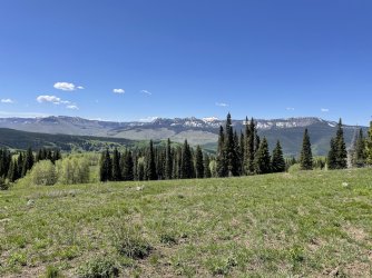
Looking south from the Flat Tops Trail driving in, with The Amphitheatre and Trappers Lake tucked into the basin on the left side. Marvine Lakes, where I'd be hiking to, are effectively wrapped around the far right side in this picture.
I had originally planned on driving across the norhthern section along the gravel road/trail to Marvine TH and spending three days trekking up, over, and back down around Big Marvine Peak. It was a route that would end up being roughly ~24 miles and would take me past Marvine Lakes and Twin Lakes, under the tip of Trappers Peak (11,975 ft), and back down East Marvine Creek past Guthrie Lake to the car. Google Earth suggested that the top of the plateau would actually be devoid of snow already (it gets plenty of sun), but most of the routes to get up top there were still very much holding snow, meaning the route up past Marvine Lakes to its intersection with the Oyster Lake Trail had a decent chance of being not just covered, but pretty deep.
Marvine Lakes, though, sat at a little over 9,300 feet (and between 6 and 7 miles in up the Marvine Trail), and I knew getting there on Day 1 would be snow-free and not an issue. It would be on Day 2 that the climb up the tighter canyon might get tricky - that climbed quickly up to nearly 11,00 feet in just a couple miles - so I opted to pack for the longer trip, head in, and see how things played out.
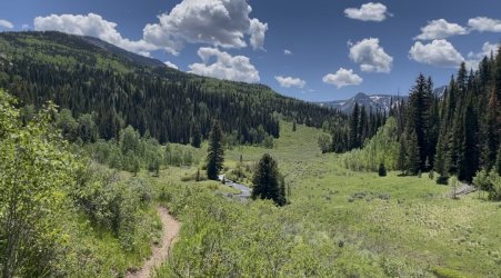
Looking south down the trail alongside Marvine Creek
I'd be following Marvine Creek for the entire day, hugging it just above a small bank for most of the first ~4 miles. That was a good thing, too, as temperatures that day began to soar into the mid-80's with little in the way of protection from the sun until much later in the afternoon. The cool water became a life-saver on several occasions as the trail crossed it conveniently to a) limit the amount of water I needed to carry and b) provide ample chances for quick-splash cooldowns. It was also a fly-fisherman's paradise, though I'd only brought an extremely limited spin-fishing setup with spoons for the larger lakes above.
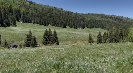
Huge meadows alongside Marvine Creek
I should point out that the exposure on the trail was due to the insane size of the meadows up here. The White River elk herd numbers somewhere between 30 and 40 thousand head, and I'd seen a handful of them on the drive in and during a quick hike around Trappers Lake the day before. When I reached these ones in particular, it became pretty obvious how it could support such a large number. I similarly began to notice just how green and lush the pine forests were compared to the parts of Colorado that had been hit by mountain pine beetles over the last generation. I couldn't help but wonder just how much the health of the entire ecosystem up here was due to this forest being healthier and heartier than so many other parts of the state.
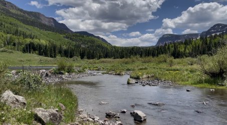
Marvine Creek pouring out of Slide Lake through a pretty impactful beaver dam.
When I reached Slide Lake (about 4 miles in), I saw a pair of guys fly-fishing the far shore. The parking lot at the TH wasn't packed, by any means, but there were a handful of cars there. There were also two separate THs leaving out of the same lot, so I wasn't sure if I'd see anyone on the way up. These were the first of several, however. This crossing ended up being nearly knee-deep and was the deepest of the trip, but the trail fortunately reached that pine grove in the above pic quickly and some much needed shade was in store for the push up to the larger Marvine Lakes.
I even managed to cross paths with a moose, though the only shots I got were rather poor. You can barely make out its antlers through the clearing in the center-right of this picture. He was roughly 40-50 yards away across a marshy flat area.
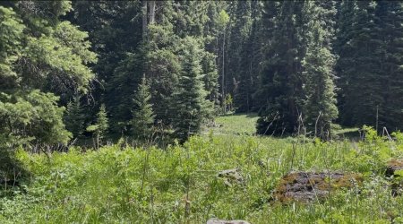
Moose
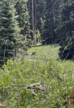
Slightly improved Moose-vision
About a half-mile below lower Marvine Lake, the area flattened out into a fine, wide meadow. It was there that you could truly see evidence of the oft-heavy use of this area by outfitters. There were use trails leading away from the main trail in most every direction, and one outfitter camp was already set up for the season (though they were not there that day). As I continued up towards the foot of the lower lake, there were also two pretty established campgrounds, one with several tents set up (though nobody seemed to be in-camp at that moment I passed by).
I'd intended to camp either in the sliver of land between the upper and lower lakes, or even potentially cruise around the upper one and camp closer towards the path up and out I would take the next morning. So, this was far from a problem for the time being.
There was a narrow crossing of Marvine Creek one final time before a quick climb up to lake-level, at which point the beauty of this lake basin truly opened up.
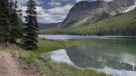
Lower Marvine Lake, looking up towards the Upper Lake
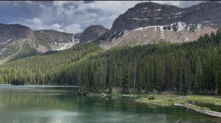
The high walls (with snow) flanking the southern banks of Lower Marvine Lake
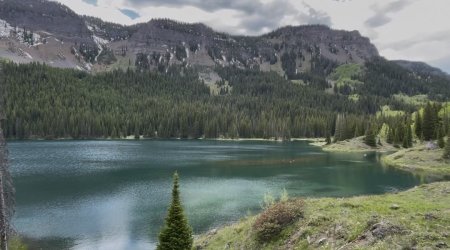
Looking back down Lower Marvine Lake after walking about half-way up it. The trail here is on my right (along the north shore of the lake).
As I walked the shore towards the upper lake, I ran into a trio of guys with fishing rods who were hiking back down the opposite direction. It took me a quick second (since I was a hot mess and exhausted after that day), but I eventually recognized one of them from a YouTube channel I'd watched in the run-up to this trip. He's put together footage of several successful fishing trips in this area, and I actually gleaned a lot of important info from those before deciding on this route. He and his crew had just turned back after trying to hike up to the plateau where I had intended to climb through the next day as they'd been post-holing into nearly waist-deep snow during the sections above 10,000 feet.
It was their camp at the foot of the lake that I'd passed earlier. They had intended to day hike up to fish Twin Lakes and then return to base camp, but that plan was obviously foiled.
The wheels in my tired brain began turning, and it quickly became evident that maybe hiking solo up through that section tomorrow wasn't something that really piqued my interest anymore. Considering I had talked to a ranger the previous evening about how Wall Lake - also on top of the plateau - still had a lot of ice on it in sections, maybe the conditions just weren't clear enough to warrant the risk.
I thanked them for the info and decided I'd simply find a good, solid spot to enjoy a great evening. It was about 5 PM when I began looking for spots, and given that it was nearing the longest days of the year, I knew I had nearly 4 hours to rest, cool down, relax a little, and maybe even catch a fish. Let's just say I managed to accomplish the first three of those things in spades.
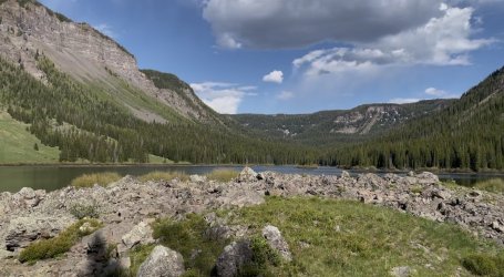
Upper Marvine Lake
I found an established site up on the banks in between the upper and lower lake and settled in. It had the perfect mix of shade and flat ground, with access to the outlet stream that drained the upper lake into the lower in close proximity to guarantee consistent water for the rest of the day.
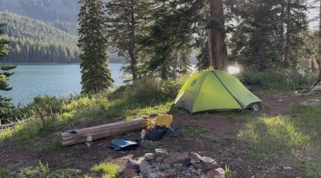
Camp off the southwest shore of Lower Marvine Lake
I tried my hand at some fishing after dinner. Though I had seen ample brookies in the lower pools amid the beaver-dammed ponds as well as in the outlet stream, I couldn't manage to get them to garner any real interest in the spoons and panther martins I'd brought as my bait. They began rising after 7 PM, and there was clearly a fly hatch that was buzzing around the entire basin. Fortunately, those flies bit me about as often as the fish bit my spoons, and the mosquitoes were actually no problem at all. It made for a pretty glorious evening even though I knew instead of extending my trip the next day I'd simply be hiking back down to the car.
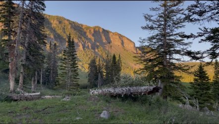
Alpenglow looking up-canyon over Upper Marvine Lake
Just before I planned to turn in for the night, a cow elk came bounding down the trail above me before slamming on the brakes once it saw me in camp. It retreated up the ridge, paused, and let out a mighty bark to presumably let the rest of the herd in the area know I was down there.
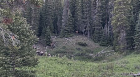
Barkin' elk at center, roughly 70 or so yards away.
It was a bark I'd hear about a dozen times over the course of the night, which was pretty special.
The next day featured nothing too outlandish. It was a straightforward 6.8 mile hike back down to the car, one I got up early to accomplish given how hot the previous day's sun got during the afternoon. I did manage to cross paths with an eight-person crew on horseback hiking up to the outfitter camp - it was a Friday, and I'm glad I got up there on a Thursday - as well as two separate twosomes who were heading up to fish the lakes. The lakes are quite big by Colorado standards, though, and do accommodate that number of people without feeling like you're too crowded out. Once I got to my camp the previous night, I didn't see or even hear any of the others that I knew were camped somewhere in the basin.
Colorado is on fire exactly one month later, and it's painful to watch. I'm glad I got the chance to at least do some minor exploring in a new part of the state before things turned into a fiery hell, but it's a lesson to note just how quickly things can go from trail too snowy to comfortably cross to whole state either on fire or on-notice.
If video is more your medium, I put together one of this trip, too.
Still, I'd somehow never ventured into the Flat Tops in the 15 years I'd been a Colorado resident, and I managed to change that - albeit briefly - during the first week of June this year.
I had a very, very tight window during the first week of the month where I could get up into the hills somewhere, and this year's dismal snowpack and rapidly approaching fire season kept me on my toes in terms of trip planning in the weeks running up to said window. I considered heading south to the Sangres, and initially aimed to head west to the Weminuche, but both had terrifyingly dried out already by May's end, and I hesitated to run the risk of heading that far away to places with conditions inching towards potential trouble.
The Flat Tops, though, had actually held on to some snow in the canyon-like walls underneath the 12,000 foot plateau, their north-facing sides too steep to see much sun (and the south-facing sides steep enough to not see enough of it). So, to the Flat Tops I finally went.
Looking south from the Flat Tops Trail driving in, with The Amphitheatre and Trappers Lake tucked into the basin on the left side. Marvine Lakes, where I'd be hiking to, are effectively wrapped around the far right side in this picture.
I had originally planned on driving across the norhthern section along the gravel road/trail to Marvine TH and spending three days trekking up, over, and back down around Big Marvine Peak. It was a route that would end up being roughly ~24 miles and would take me past Marvine Lakes and Twin Lakes, under the tip of Trappers Peak (11,975 ft), and back down East Marvine Creek past Guthrie Lake to the car. Google Earth suggested that the top of the plateau would actually be devoid of snow already (it gets plenty of sun), but most of the routes to get up top there were still very much holding snow, meaning the route up past Marvine Lakes to its intersection with the Oyster Lake Trail had a decent chance of being not just covered, but pretty deep.
Marvine Lakes, though, sat at a little over 9,300 feet (and between 6 and 7 miles in up the Marvine Trail), and I knew getting there on Day 1 would be snow-free and not an issue. It would be on Day 2 that the climb up the tighter canyon might get tricky - that climbed quickly up to nearly 11,00 feet in just a couple miles - so I opted to pack for the longer trip, head in, and see how things played out.
Looking south down the trail alongside Marvine Creek
I'd be following Marvine Creek for the entire day, hugging it just above a small bank for most of the first ~4 miles. That was a good thing, too, as temperatures that day began to soar into the mid-80's with little in the way of protection from the sun until much later in the afternoon. The cool water became a life-saver on several occasions as the trail crossed it conveniently to a) limit the amount of water I needed to carry and b) provide ample chances for quick-splash cooldowns. It was also a fly-fisherman's paradise, though I'd only brought an extremely limited spin-fishing setup with spoons for the larger lakes above.
Huge meadows alongside Marvine Creek
I should point out that the exposure on the trail was due to the insane size of the meadows up here. The White River elk herd numbers somewhere between 30 and 40 thousand head, and I'd seen a handful of them on the drive in and during a quick hike around Trappers Lake the day before. When I reached these ones in particular, it became pretty obvious how it could support such a large number. I similarly began to notice just how green and lush the pine forests were compared to the parts of Colorado that had been hit by mountain pine beetles over the last generation. I couldn't help but wonder just how much the health of the entire ecosystem up here was due to this forest being healthier and heartier than so many other parts of the state.
Marvine Creek pouring out of Slide Lake through a pretty impactful beaver dam.
When I reached Slide Lake (about 4 miles in), I saw a pair of guys fly-fishing the far shore. The parking lot at the TH wasn't packed, by any means, but there were a handful of cars there. There were also two separate THs leaving out of the same lot, so I wasn't sure if I'd see anyone on the way up. These were the first of several, however. This crossing ended up being nearly knee-deep and was the deepest of the trip, but the trail fortunately reached that pine grove in the above pic quickly and some much needed shade was in store for the push up to the larger Marvine Lakes.
I even managed to cross paths with a moose, though the only shots I got were rather poor. You can barely make out its antlers through the clearing in the center-right of this picture. He was roughly 40-50 yards away across a marshy flat area.
Moose
Slightly improved Moose-vision
About a half-mile below lower Marvine Lake, the area flattened out into a fine, wide meadow. It was there that you could truly see evidence of the oft-heavy use of this area by outfitters. There were use trails leading away from the main trail in most every direction, and one outfitter camp was already set up for the season (though they were not there that day). As I continued up towards the foot of the lower lake, there were also two pretty established campgrounds, one with several tents set up (though nobody seemed to be in-camp at that moment I passed by).
I'd intended to camp either in the sliver of land between the upper and lower lakes, or even potentially cruise around the upper one and camp closer towards the path up and out I would take the next morning. So, this was far from a problem for the time being.
There was a narrow crossing of Marvine Creek one final time before a quick climb up to lake-level, at which point the beauty of this lake basin truly opened up.
Lower Marvine Lake, looking up towards the Upper Lake
The high walls (with snow) flanking the southern banks of Lower Marvine Lake
Looking back down Lower Marvine Lake after walking about half-way up it. The trail here is on my right (along the north shore of the lake).
As I walked the shore towards the upper lake, I ran into a trio of guys with fishing rods who were hiking back down the opposite direction. It took me a quick second (since I was a hot mess and exhausted after that day), but I eventually recognized one of them from a YouTube channel I'd watched in the run-up to this trip. He's put together footage of several successful fishing trips in this area, and I actually gleaned a lot of important info from those before deciding on this route. He and his crew had just turned back after trying to hike up to the plateau where I had intended to climb through the next day as they'd been post-holing into nearly waist-deep snow during the sections above 10,000 feet.
It was their camp at the foot of the lake that I'd passed earlier. They had intended to day hike up to fish Twin Lakes and then return to base camp, but that plan was obviously foiled.
The wheels in my tired brain began turning, and it quickly became evident that maybe hiking solo up through that section tomorrow wasn't something that really piqued my interest anymore. Considering I had talked to a ranger the previous evening about how Wall Lake - also on top of the plateau - still had a lot of ice on it in sections, maybe the conditions just weren't clear enough to warrant the risk.
I thanked them for the info and decided I'd simply find a good, solid spot to enjoy a great evening. It was about 5 PM when I began looking for spots, and given that it was nearing the longest days of the year, I knew I had nearly 4 hours to rest, cool down, relax a little, and maybe even catch a fish. Let's just say I managed to accomplish the first three of those things in spades.
Upper Marvine Lake
I found an established site up on the banks in between the upper and lower lake and settled in. It had the perfect mix of shade and flat ground, with access to the outlet stream that drained the upper lake into the lower in close proximity to guarantee consistent water for the rest of the day.
Camp off the southwest shore of Lower Marvine Lake
I tried my hand at some fishing after dinner. Though I had seen ample brookies in the lower pools amid the beaver-dammed ponds as well as in the outlet stream, I couldn't manage to get them to garner any real interest in the spoons and panther martins I'd brought as my bait. They began rising after 7 PM, and there was clearly a fly hatch that was buzzing around the entire basin. Fortunately, those flies bit me about as often as the fish bit my spoons, and the mosquitoes were actually no problem at all. It made for a pretty glorious evening even though I knew instead of extending my trip the next day I'd simply be hiking back down to the car.
Alpenglow looking up-canyon over Upper Marvine Lake
Just before I planned to turn in for the night, a cow elk came bounding down the trail above me before slamming on the brakes once it saw me in camp. It retreated up the ridge, paused, and let out a mighty bark to presumably let the rest of the herd in the area know I was down there.
Barkin' elk at center, roughly 70 or so yards away.
It was a bark I'd hear about a dozen times over the course of the night, which was pretty special.
The next day featured nothing too outlandish. It was a straightforward 6.8 mile hike back down to the car, one I got up early to accomplish given how hot the previous day's sun got during the afternoon. I did manage to cross paths with an eight-person crew on horseback hiking up to the outfitter camp - it was a Friday, and I'm glad I got up there on a Thursday - as well as two separate twosomes who were heading up to fish the lakes. The lakes are quite big by Colorado standards, though, and do accommodate that number of people without feeling like you're too crowded out. Once I got to my camp the previous night, I didn't see or even hear any of the others that I knew were camped somewhere in the basin.
Colorado is on fire exactly one month later, and it's painful to watch. I'm glad I got the chance to at least do some minor exploring in a new part of the state before things turned into a fiery hell, but it's a lesson to note just how quickly things can go from trail too snowy to comfortably cross to whole state either on fire or on-notice.
If video is more your medium, I put together one of this trip, too.
Last edited: