
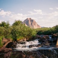
hayden
New Member
- Joined
- Mar 20, 2025
- Messages
- 4
Day 1 - Chepeta Lake to Fox Lake (9.4 miles)
Day 2 - Fox Lake to Painter Basin (11.8 miles)
Day 3 - Painter Basin to Oweep Creek Basin (15.2 miles)
Day 4 - Porcupine Basin to Fork Lake Drainage (9.9 miles)
Day 5 - Lake Fork Drainage to Moon Lake (9.8 miles)
Total Mileage - 56.1 miles
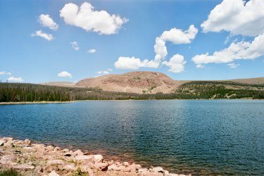
Chepeta Lake
Day 1
My dad dropped me off at Chepeta Lake on June 23rd. I had food for 7 days, and a pack weight of about 35 pounds (without water). I was behind schedule due to Apple Maps taking us on the wrong road, leading to a 2.5-hour detour. The first few hours were uneventful, and I was already hiking over the first pass of the trip in no time.
North Pole Pass was deceiving, as you think you can see the top of the pass upon approach, but come to find out, it’s almost like a big rolling hill, without a prominent ridge. It took much longer to hike over, leading to some anxiety from the storm that was on my heels. After coming down the pass, I saw a Moose munching on some good grass, paying no mind to me. This was the first of many wildlife encounters I would have.
My original plan for the day was to hike to Kidney Lakes and camp there for the night. With the late start, I ran out of time and had to pitch my tent at Fox Lake. The smoke from the Iron and Bonnevile fires began to blow in and made for an eerie sight on the lake. I camped behind the old cabin, using it as a windbreak. The wind picked up, and it began to rain just as I zipped up my tent for the night.
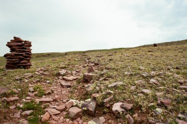
Cairns leading up to North Pole Pass
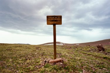
North Pole Pass
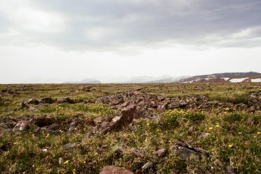
Uinta Mountains from North Pole Pass
Day 2
I packed up my camp, doing a quick sweep, making sure not to leave anything behind! The smoke had definitely thinned out, making for a beautiful morning on the lake. I had almost 12 miles to hike, and had to make up for some lost time, so I quickly got to hiking. Not a single pass was on the itinerary today, making for a nice stroll in the woods with plenty of river crossings along the way.
I came upon Kidney Lakes, and it was a good thing that I didn’t camp there the previous night, as there were many mosquitoes! I didn’t notice them at first because of the wind. But as soon as they saw me, they took flight! I didn’t stick around. It was a pretty area, and I saw two more moose cooling off in the stream that came out of Kidney Lakes. There weren’t many notable views for a while, as I was mostly walking through the woods. Several hours passed as I kept hiking.
Finally, out of the woods, I could see Kings Peak; it was magnificent. It was windy in the basin, and every windbreak I could find was teeming with mosquitoes taking shelter. I was not interested in getting eaten alive by the blood-sucking flies, so I decided to take shelter in a small ravine. I knew I had a big day tomorrow as I’d be summiting King’s Peak, so I quickly ate dinner and lay down for the night. However, a storm blew through that night, and the wind and lightning kept me up for a few hours.
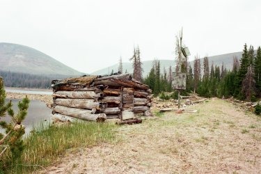
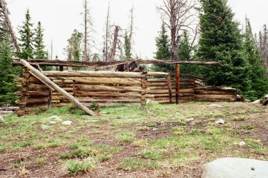
Old structures near Fox Lake
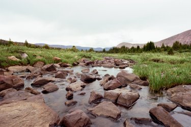
River crossing near Painter Basin
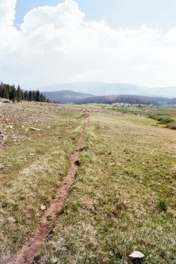
Trail leading into Painter Basin
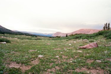
Looking east from Painter Basin
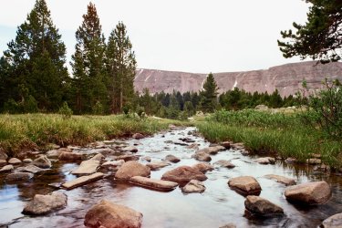
Creek in Painter Basin
Day 3
I woke up to find the wind had not died down, but it kept the bugs away, so I was ok with it. As I approached Anderson Pass, I began to see little black dots on Gunsight Pass, people! This was the first time I had seen anyone since I was dropped off at Chepeta Lake. I had expected to see people in this area, as King’s Peak is a popular hike. I didn’t expect to see as many people as I did on a Friday morning, though! I saw about 50 people either at the summit or trying to make it up Anderson Pass. It was odd being alone for almost three days, then being surrounded by so many hikers.
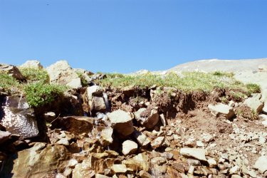
I ditched my pack at Anderson Pass and began to hike up the ridge to the summit. This was the first time summiting King’s Peak, and I didn’t know what to expect. I had summited many peaks in the past, but none had been as difficult as King’s Peak. The constant boulder hopping and trail finding were exhausting. The views were absolutely breathtaking at the top! You were truly in the middle of nowhere, not a single sign of civilization in sight.
After making it down the summit back on Anderson Pass, I picked up my pack. It was nice to have a break from the 30lb pack, although it felt like 50lb on my sore shoulders. Almost everyone summiting that day came from Henry Fork basin, so I was alone except for 5 hikers who were doing a loop around King’s Peak and Red Castle. I met them in the Yellowstone Creek Basin and had a quick chat with them before continuing on the trail.
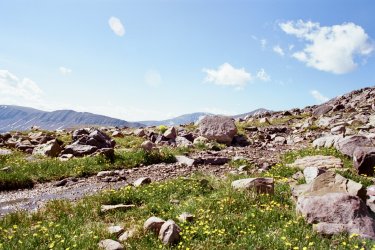
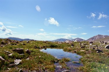
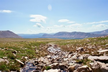
This was my favorite part of the entire hike. The mountains were so large, and the valleys were so wide. Above timberline, you could see for miles, and the clear skies made for a perfect day. The ever-present wind kept the bugs away and me cool. The other group of hikers caught up to me at the fork in the trail where we parted ways, and I was alone once again. I had plenty of time left in the day and took my time, letting my mind wander. Tungsten Pass was fairly easy compared to Anderson and Porcupine Pass. Looking down at Tungsten and North Star Lake, I was excited to enter the basin. Many unnamed lakes in this basin were just as beautiful as any other lake in the Uintas; the high alpine setting above timberline made for clean lakes free of big animals and deadfall in the water. I was lucky to experience this section with no interruptions from the weather and fellow backpackers.
I had one other pass to hike over to get to any meaningful shelter from the wind and potential lightning overnight. That was the one thing I was most worried about; I did not want to get caught in a big storm overnight, with no tree cover to stave off lightning strikes. I quickly made it over Porcupine Pass and looked down into the Oweep Creek Basin where I’d spend the night. I still had a way to go because much of the basin was still above timberline.
I knew I’d be getting into camp late, but I was happy with the progress I had made that day. I encountered four elk as I neared timberline, the first Elk I had seen on the trip. I wasted no time setting up my tent and eating dinner. As I lay in my tent, reflecting on the events of the day, I couldn’t help but feel a twinge of homesickness thinking about how most of the hikers I had encountered that day were home with their families. I missed my wife and son.
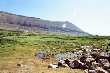
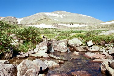
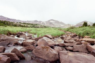
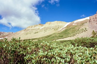
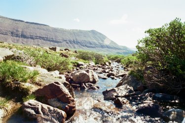
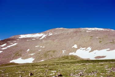
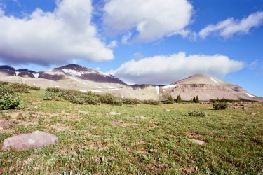
Looking up at King's Peak from Painter Basin
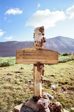
Sign at the trail junction in Painter Basin
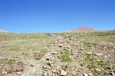
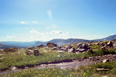
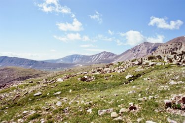
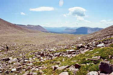
Heading up towards Anderson Pass
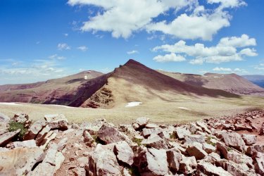

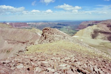
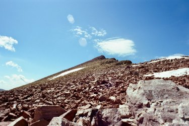
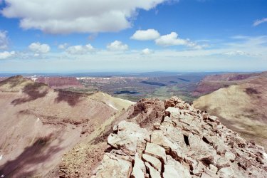
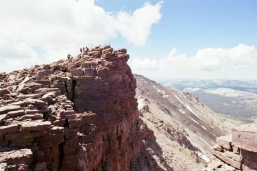
Reaching the summit of King's Peak
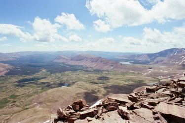
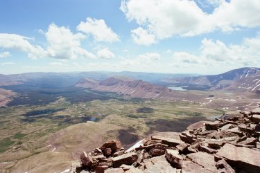
Views from the summit
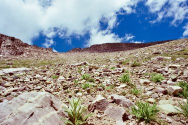
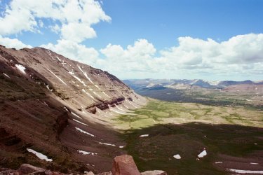
Looking at the other side of Anderson Pass
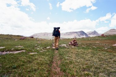
Walking into Yellowstone Creek Basin
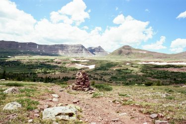
Looking out towards Yellowstone Creek Basin
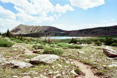
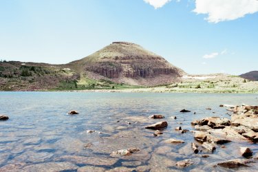
Un-named lake near Tungsten Pass
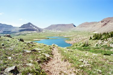
Tungsten Lake
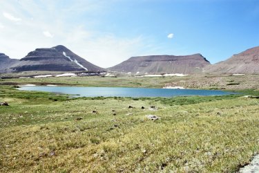
North Star Lake
Day 4
I had a decision to make today. I could either risk it going over Dead Horse Pass (previous hikers posted on Facebook stating it was still early in the season and the pass was treacherous), take a detour that added ten miles to an already tight schedule, or bail at Moon Lake, which was one of the last possible points. I wanted to keep going, but the weather was not in my favor. The forecast predicted a cold front moving in Sunday night, bringing the low to about 20 degrees Fahrenheit. This meant that the remainder of my hike would possibly be covered in snow, making the trail impossible to see, and the deadfall and cold weather made it seem like one of the stupidest decisions I could make. I reflected on people who get lost or die while out alone in the wilderness, and could see how my decision to continue could very well put me in one of those positions.
I ultimately made the choice to bail at Moon Lake, taking the direct route from Lake Fork drainage. This cut my hike short by about two days, but my ultimate goal was to get home safe to see my kid, no matter what. I contacted my dad to let him know I had to change my plans so he could come pick me up at Moon Lake.
I passed the beautiful lake with no name and entered Lambert Meadows. I was back in the woods, feeling a bit of reprieve from the wind. I only encountered one other hiker for the remainder of the trip; he was fast-packing towards Red Castle. I’m not sure if he bailed or made it out before the weather hit.
The massive fire that burned through the Lake Fork drainage in 2020 and the lack of trail maintenance made for a difficult hike down. There weren’t many viable camping spots in the drainage, and any flat spots were covered by downed, charred trees. I managed to hike off the trail for a bit and found a spot just big enough for my tent. It was only about 5 o’clock when I made camp, but I was tired and headed to bed early.
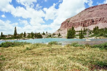
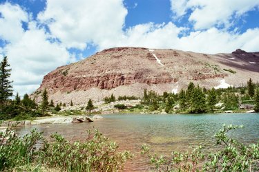
Unnamed Lake east near Lambert Meadows
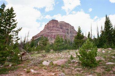
Mountain rising above Lambert Meadows
Day 5
I woke up late, once again, and had to hurry to take down my camp so that I could rendezvous at Moon Lake on time. I imagine this isn’t a popular spot for hiking, as I ran into much wildlife. I spooked a faun, a few deer, and two Elk along this last stretch of trail, and I was the only one in the entire drainage to enjoy the sight.
As you hike further down the drainage, the river starts to cut deep, but the trail keeps you above it much of the way. I made good time coming down, favoring my right pinky toe as a blister had begun to form the previous day. I finally saw the beginning of Moon Lake. As I hiked along, I began to see cars camped along the beach. It was a weird sight to see after five days in the wilderness.
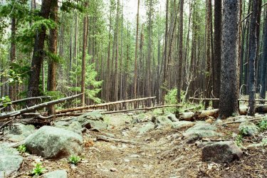
Burn section from 2020
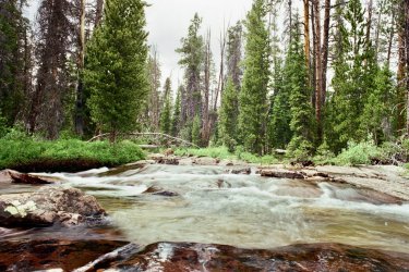
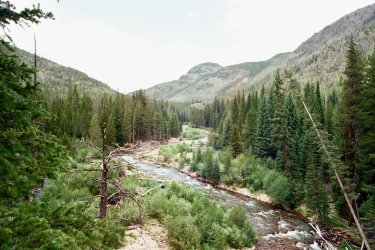
Lake Fork River leading into Moon Lake
Overall, my feet had fared pretty well. They were sore from the long days, but I had done the proper care before the hike started, so blisters were kept at bay (well, most of them). I also chose to wear my hiking boots, which had a Gore-Tex lining and were waterproof. There were countless bogs I walked through and many stream crossings, but my feet stayed dry. The extra ankle support was important while coming over the passes, hiking on loose rock.
I wore a long-sleeved shirt that kept the sun off my arms (but not my hands, which got pretty sunburned). The hat and buff combo was a must for keeping the sun off my face and ears, and long hiking pants for my legs.
I also brought hiking poles, which helped while hiking and also helped pitch my tent during windy conditions. I could insert them into my tent alongside the tent poles as added support.
I packed as lightly as I could, but I realized I packed too much food. I expected to hike more miles and thought I’d be hungrier. If I were to do it again, I think I could get away with almost halving my food bag. I brought in about 4,000 calories a day and only ate about 2,500 calories. My food bag weighed about 17 lbs, which almost doubled my entire pack weight.
My backpack was filled to the brim, with it only being a 35-liter pack. I loved my pack, though. On previous backpacking trips, I brought an Osprey pack, which held weight beautifully, but after the second day of hiking, my hips were chafed, and I could no longer wear the hip belt.
This new backpack doesn’t have a hip belt, and all the weight is on my shoulders. But I think for me that’s worth the trade-off.
My sleeping bag was a 20-degree Fahrenheit sleeping bag, but I sleep cold, so I needed one that was a bit “overkill” for summer trips. Although it would have been at its limit if I had stayed through that storm!
I brought along a heavy 35mm film camera from the 80’s. It takes beautiful pictures with the 24mm lens. I hope you photographers can appreciate that and enjoy the pictures!
My favorite part of the trip was between Painter Basin and Oweep Creek Basin. Being out of the woods, where all the deadfall had been, was a relief. The only downside to being above timberline is the added weather exposure and constant wind. The views were spectacular, though!
Thanks for taking the time to read this. I hope you enjoyed my trail report!
Day 2 - Fox Lake to Painter Basin (11.8 miles)
Day 3 - Painter Basin to Oweep Creek Basin (15.2 miles)
Day 4 - Porcupine Basin to Fork Lake Drainage (9.9 miles)
Day 5 - Lake Fork Drainage to Moon Lake (9.8 miles)
Total Mileage - 56.1 miles
Chepeta Lake
Day 1
My dad dropped me off at Chepeta Lake on June 23rd. I had food for 7 days, and a pack weight of about 35 pounds (without water). I was behind schedule due to Apple Maps taking us on the wrong road, leading to a 2.5-hour detour. The first few hours were uneventful, and I was already hiking over the first pass of the trip in no time.
North Pole Pass was deceiving, as you think you can see the top of the pass upon approach, but come to find out, it’s almost like a big rolling hill, without a prominent ridge. It took much longer to hike over, leading to some anxiety from the storm that was on my heels. After coming down the pass, I saw a Moose munching on some good grass, paying no mind to me. This was the first of many wildlife encounters I would have.
My original plan for the day was to hike to Kidney Lakes and camp there for the night. With the late start, I ran out of time and had to pitch my tent at Fox Lake. The smoke from the Iron and Bonnevile fires began to blow in and made for an eerie sight on the lake. I camped behind the old cabin, using it as a windbreak. The wind picked up, and it began to rain just as I zipped up my tent for the night.
Cairns leading up to North Pole Pass
North Pole Pass
Uinta Mountains from North Pole Pass
Day 2
I packed up my camp, doing a quick sweep, making sure not to leave anything behind! The smoke had definitely thinned out, making for a beautiful morning on the lake. I had almost 12 miles to hike, and had to make up for some lost time, so I quickly got to hiking. Not a single pass was on the itinerary today, making for a nice stroll in the woods with plenty of river crossings along the way.
I came upon Kidney Lakes, and it was a good thing that I didn’t camp there the previous night, as there were many mosquitoes! I didn’t notice them at first because of the wind. But as soon as they saw me, they took flight! I didn’t stick around. It was a pretty area, and I saw two more moose cooling off in the stream that came out of Kidney Lakes. There weren’t many notable views for a while, as I was mostly walking through the woods. Several hours passed as I kept hiking.
Finally, out of the woods, I could see Kings Peak; it was magnificent. It was windy in the basin, and every windbreak I could find was teeming with mosquitoes taking shelter. I was not interested in getting eaten alive by the blood-sucking flies, so I decided to take shelter in a small ravine. I knew I had a big day tomorrow as I’d be summiting King’s Peak, so I quickly ate dinner and lay down for the night. However, a storm blew through that night, and the wind and lightning kept me up for a few hours.
Old structures near Fox Lake
River crossing near Painter Basin
Trail leading into Painter Basin
Looking east from Painter Basin
Creek in Painter Basin
Day 3
I woke up to find the wind had not died down, but it kept the bugs away, so I was ok with it. As I approached Anderson Pass, I began to see little black dots on Gunsight Pass, people! This was the first time I had seen anyone since I was dropped off at Chepeta Lake. I had expected to see people in this area, as King’s Peak is a popular hike. I didn’t expect to see as many people as I did on a Friday morning, though! I saw about 50 people either at the summit or trying to make it up Anderson Pass. It was odd being alone for almost three days, then being surrounded by so many hikers.
I ditched my pack at Anderson Pass and began to hike up the ridge to the summit. This was the first time summiting King’s Peak, and I didn’t know what to expect. I had summited many peaks in the past, but none had been as difficult as King’s Peak. The constant boulder hopping and trail finding were exhausting. The views were absolutely breathtaking at the top! You were truly in the middle of nowhere, not a single sign of civilization in sight.
After making it down the summit back on Anderson Pass, I picked up my pack. It was nice to have a break from the 30lb pack, although it felt like 50lb on my sore shoulders. Almost everyone summiting that day came from Henry Fork basin, so I was alone except for 5 hikers who were doing a loop around King’s Peak and Red Castle. I met them in the Yellowstone Creek Basin and had a quick chat with them before continuing on the trail.
This was my favorite part of the entire hike. The mountains were so large, and the valleys were so wide. Above timberline, you could see for miles, and the clear skies made for a perfect day. The ever-present wind kept the bugs away and me cool. The other group of hikers caught up to me at the fork in the trail where we parted ways, and I was alone once again. I had plenty of time left in the day and took my time, letting my mind wander. Tungsten Pass was fairly easy compared to Anderson and Porcupine Pass. Looking down at Tungsten and North Star Lake, I was excited to enter the basin. Many unnamed lakes in this basin were just as beautiful as any other lake in the Uintas; the high alpine setting above timberline made for clean lakes free of big animals and deadfall in the water. I was lucky to experience this section with no interruptions from the weather and fellow backpackers.
I had one other pass to hike over to get to any meaningful shelter from the wind and potential lightning overnight. That was the one thing I was most worried about; I did not want to get caught in a big storm overnight, with no tree cover to stave off lightning strikes. I quickly made it over Porcupine Pass and looked down into the Oweep Creek Basin where I’d spend the night. I still had a way to go because much of the basin was still above timberline.
I knew I’d be getting into camp late, but I was happy with the progress I had made that day. I encountered four elk as I neared timberline, the first Elk I had seen on the trip. I wasted no time setting up my tent and eating dinner. As I lay in my tent, reflecting on the events of the day, I couldn’t help but feel a twinge of homesickness thinking about how most of the hikers I had encountered that day were home with their families. I missed my wife and son.
Looking up at King's Peak from Painter Basin
Sign at the trail junction in Painter Basin
Heading up towards Anderson Pass
Reaching the summit of King's Peak
Views from the summit
Looking at the other side of Anderson Pass
Walking into Yellowstone Creek Basin
Looking out towards Yellowstone Creek Basin
Un-named lake near Tungsten Pass
Tungsten Lake
North Star Lake
Day 4
I had a decision to make today. I could either risk it going over Dead Horse Pass (previous hikers posted on Facebook stating it was still early in the season and the pass was treacherous), take a detour that added ten miles to an already tight schedule, or bail at Moon Lake, which was one of the last possible points. I wanted to keep going, but the weather was not in my favor. The forecast predicted a cold front moving in Sunday night, bringing the low to about 20 degrees Fahrenheit. This meant that the remainder of my hike would possibly be covered in snow, making the trail impossible to see, and the deadfall and cold weather made it seem like one of the stupidest decisions I could make. I reflected on people who get lost or die while out alone in the wilderness, and could see how my decision to continue could very well put me in one of those positions.
I ultimately made the choice to bail at Moon Lake, taking the direct route from Lake Fork drainage. This cut my hike short by about two days, but my ultimate goal was to get home safe to see my kid, no matter what. I contacted my dad to let him know I had to change my plans so he could come pick me up at Moon Lake.
I passed the beautiful lake with no name and entered Lambert Meadows. I was back in the woods, feeling a bit of reprieve from the wind. I only encountered one other hiker for the remainder of the trip; he was fast-packing towards Red Castle. I’m not sure if he bailed or made it out before the weather hit.
The massive fire that burned through the Lake Fork drainage in 2020 and the lack of trail maintenance made for a difficult hike down. There weren’t many viable camping spots in the drainage, and any flat spots were covered by downed, charred trees. I managed to hike off the trail for a bit and found a spot just big enough for my tent. It was only about 5 o’clock when I made camp, but I was tired and headed to bed early.
Unnamed Lake east near Lambert Meadows
Mountain rising above Lambert Meadows
Day 5
I woke up late, once again, and had to hurry to take down my camp so that I could rendezvous at Moon Lake on time. I imagine this isn’t a popular spot for hiking, as I ran into much wildlife. I spooked a faun, a few deer, and two Elk along this last stretch of trail, and I was the only one in the entire drainage to enjoy the sight.
As you hike further down the drainage, the river starts to cut deep, but the trail keeps you above it much of the way. I made good time coming down, favoring my right pinky toe as a blister had begun to form the previous day. I finally saw the beginning of Moon Lake. As I hiked along, I began to see cars camped along the beach. It was a weird sight to see after five days in the wilderness.
Burn section from 2020
Lake Fork River leading into Moon Lake
Overall, my feet had fared pretty well. They were sore from the long days, but I had done the proper care before the hike started, so blisters were kept at bay (well, most of them). I also chose to wear my hiking boots, which had a Gore-Tex lining and were waterproof. There were countless bogs I walked through and many stream crossings, but my feet stayed dry. The extra ankle support was important while coming over the passes, hiking on loose rock.
I wore a long-sleeved shirt that kept the sun off my arms (but not my hands, which got pretty sunburned). The hat and buff combo was a must for keeping the sun off my face and ears, and long hiking pants for my legs.
I also brought hiking poles, which helped while hiking and also helped pitch my tent during windy conditions. I could insert them into my tent alongside the tent poles as added support.
I packed as lightly as I could, but I realized I packed too much food. I expected to hike more miles and thought I’d be hungrier. If I were to do it again, I think I could get away with almost halving my food bag. I brought in about 4,000 calories a day and only ate about 2,500 calories. My food bag weighed about 17 lbs, which almost doubled my entire pack weight.
My backpack was filled to the brim, with it only being a 35-liter pack. I loved my pack, though. On previous backpacking trips, I brought an Osprey pack, which held weight beautifully, but after the second day of hiking, my hips were chafed, and I could no longer wear the hip belt.
This new backpack doesn’t have a hip belt, and all the weight is on my shoulders. But I think for me that’s worth the trade-off.
My sleeping bag was a 20-degree Fahrenheit sleeping bag, but I sleep cold, so I needed one that was a bit “overkill” for summer trips. Although it would have been at its limit if I had stayed through that storm!
I brought along a heavy 35mm film camera from the 80’s. It takes beautiful pictures with the 24mm lens. I hope you photographers can appreciate that and enjoy the pictures!
My favorite part of the trip was between Painter Basin and Oweep Creek Basin. Being out of the woods, where all the deadfall had been, was a relief. The only downside to being above timberline is the added weather exposure and constant wind. The views were spectacular, though!
Thanks for taking the time to read this. I hope you enjoyed my trail report!
Attachments
Last edited:
